
U.S. 192 travels 74.7 miles across central Florida from U.S. 27 at Four Corners east to State Road A1A (Miramar Avenue) at Indialantic. U.S. 192 starts as a six lane arterial along the Lake and Polk County line by a number of RV parks. Eastward along the Orange and Osceola County lines, the US route becomes more commercialized to the interchange with SR 429 (Western Beltway) and the Disney World area.
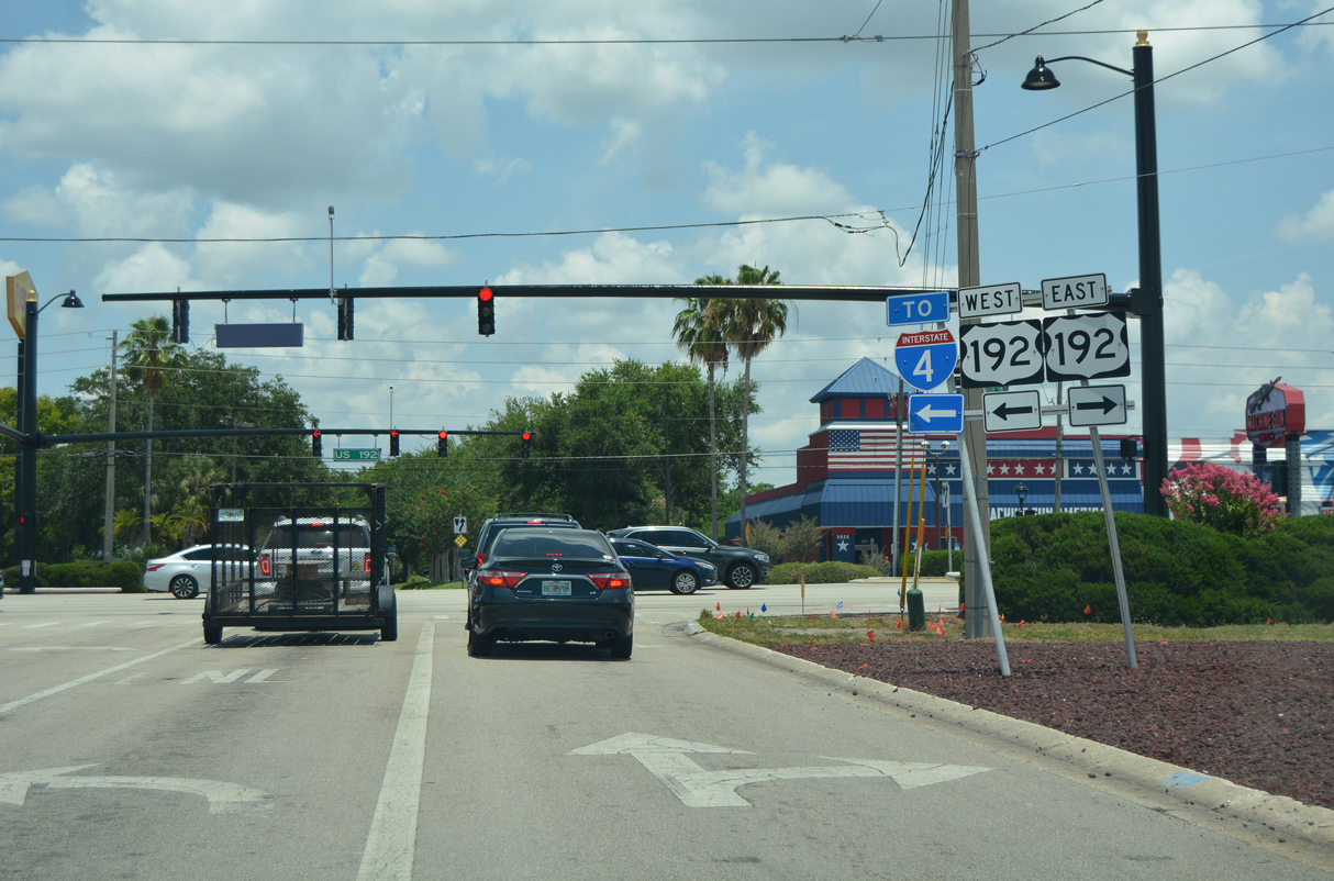
Continuing with six lanes, U.S. 192 angles southeast into northern Osceola County by a number of restaurants, hotels and vacation condos catering to tourists visiting the Disney World theme park. A brief rural reprieve ensues east of Old Lake Wilson Road (CR 545) across Reedy Creek. Interchanges join an expressway section of U.S. 192 with World Drive, the main access road to Disney World from the south, and Interstate 4. U.S. 192 transitions back into a slow moving commercial arterial east from there to the south end of International Drive and older retail development on the outskirts of Kissimmee.
State Road 535 (Vineland Road) ties into U.S. 192 (Irlo Bronson Memorial Highway) from resort areas east of Disney Springs and Interstate 4. U.S. 192 curves southward onto Vine Street in the city of Kissimmee, with six lanes separated by a narrow median east to U.S. 17/92 at John Young Parkway. U.S. 17/92 combine with U.S. 192 east for 0.7 miles to Main Street, where they turn north alongside U.S. 441 to Orange Blossom Trail in Orange County. U.S. 441 south combines with U.S. 192 east for 24.5 miles to Holopaw.
U.S. 192/441 lead southeast from Kissimmee by Osceola County Fair to intersect ramps with Florida's Turnpike (Exit 244) opposite Cross Prairie Parkway. The arterial previously reduced to four lanes east from there into St. Cloud, but separate projects added a lane per direction to CR 532 (Nova Road). Completed by late 2019, $37.7 million in road work expanded a 3.970 mile stretch of U.S. 192/441 between Aeronautical Drive and Budinger Avenue in the city of St. Cloud.
U.S. 192/441 run across St. Cloud along 13th Street with six overall lanes between Budinger Avenue and Eastern Avenue. The arterial reduced again to four lanes beyond Eastern Avenue, but a $16.2 million project completed in Summer 2017 expanded another 3.200 miles1 of U.S. 192/441 east to Narcoossee Road (CR 15).
Construction in 2006-08 widened U.S. 192/441 into a four lane, divided highway southeast from the outskirts of St. Cloud to Holopaw. This included building a new alignment between Alligator Lake and Lake Lizzie. The former two lane roadway was repurposed as service roads on the south side and renamed Alligator Lake Shore East and West.
U.S. 192/441 becomes rural southeast of Old Melbourne Highway (CR 500A) to Harmony, with new suburban development including Harmony West taking shape in 2019. Harmony was developed on rural land south of Buck Lake starting in 2003. The master planned community includes a golf course and high school. The school entrance represents the lone traffic light along U.S. 192 between Narcoossee Road and St. Johns Heritage Parkway at West Melbourne.
U.S. 441 turns south at Holopaw along a lightly traveled route 33.8 miles to Yeehaw Junction, where State Road 60 and the Turnpike meet. U.S. 192 east plies across wetland and conservation areas to West Melbourne and Interstate 95. The initial ten mile section between the Osceola County line and I-95 was expanded to four lanes starting in June 2002. The $24 million project was the first of a two phase, five year project designed to widen 35 miles of the corridor between CR 532 (Nova Road) and I-95. The subsequent 25 mile long section between CR 532 and the Brevard County line cost around $90 million and was underway in 2005.2 Construction of St. Johns Heritage Parkway, an arterial beltway built around Palm Bay, added a traffic signal just west of Interstare 95.
East of I-95, U.S. 192 transitions to New Haven Avenue, a 6.2 mile long urban arterial through June Park, Melbourne Village, West Melbourne and Melbourne. The US route shifts north one block onto Strawbridge Avenue to Downtown Melbourne and U.S. 1. Melbourne Causeway leads the route east across Indian River Lagoon and the Intracoastal Waterway to Indialantic. U.S. 192 ends at SR A1A a half block from the beach.
U.S. 192 Florida Guides
Originally U.S. 192 ended in Downtown Kissimmee from the east. U.S. 192 followed Neptune Road (CR 532) west from St. Cloud onto Drury Avenue in Downtown Kissimmee. U.S. 17/92 followed Broadway and Main Street at that time, with U.S. 192 concluding at their intersection with Drury Avenue. The route was extended west in 1972 to serve the Walt Disney World area.
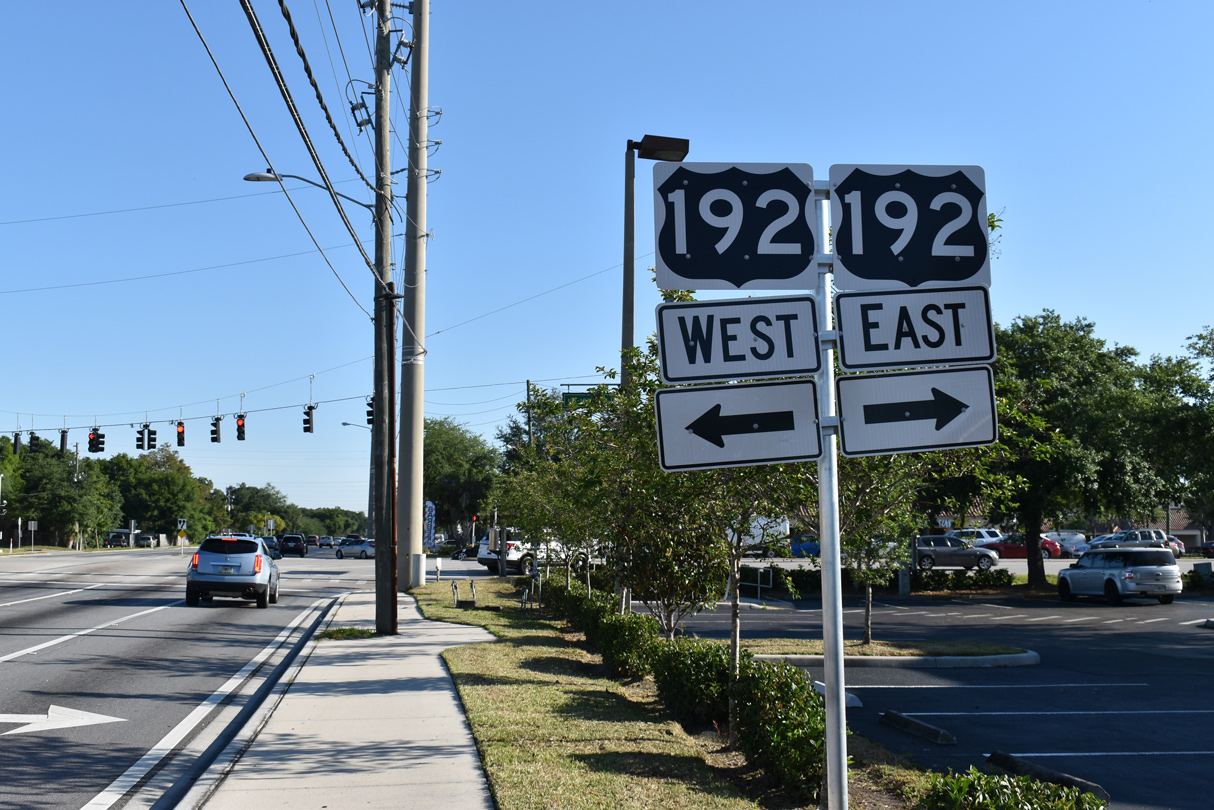
 | Holiday Trail north at the commercialized stretch of U.S. 192 (Irlo Bronson Memorial Highway) between Interstate 4 and SR 535 (Vineland Road). 06/05/19 |
 | Oak Street north at U.S. 192/441 and Michigan Avenue in Kissimmee. 04/24/19 |
 | The unique shields for U.S. 192 posted along Oak Street north at Irlo Bronson Memorial Highway in Kissimmee were installed in February 2017. 04/24/19 |
http://www.cflroads.com/project/ 239683-1/SR_500_US_192_FROM _EASTERN_AVENUE_TO_NOVA_ROAD- "Widening to Relieve U.S. 192 - Twenty-Six Deaths and more than 300 Accidents have Occurred Since 1995 on a 35-Mile Stretch of the Road." Orlando Sentinel, The (FL), June 7, 2002.
Photo Credits:
- 04/24/19 by AARoads and JP Nasiatka. 06/05/19 by AARoads.
Connect with:
Interstate 4
Interstate 95
U.S. 1
U.S. 17
U.S. 27
U.S. 92
U.S. 441
State Road A1A
State Road 429 - Western Beltway / Apopka Expwy / Wekiva Pkwy
State Road 535
Page Updated 12-14-2021.