|
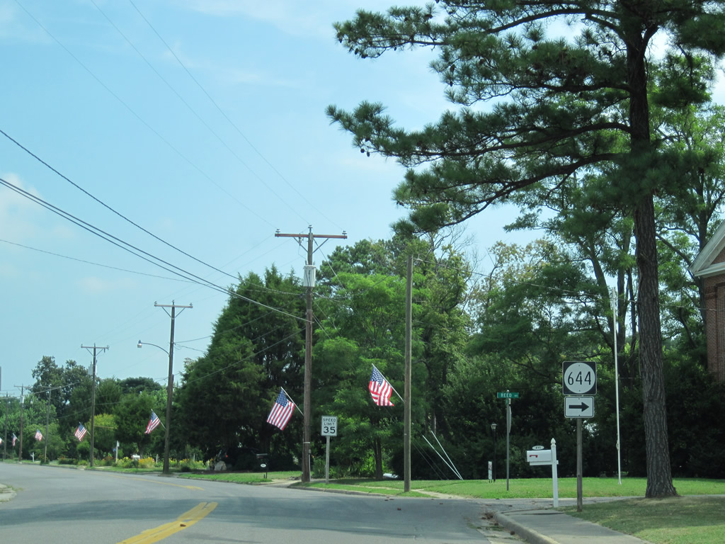
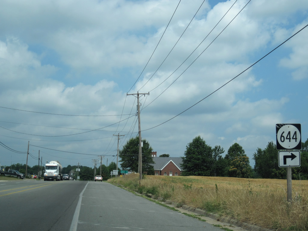
| U.S. 360 begins as the SR 644 turn off from Main Street onto Reed Avenue in Reedsville. 06/25/10 |
|
| There are no signs posted on Main Street northbound for U.S. 360 after the transition from SR 644 onto Reed Avenue. 06/25/10 |
|
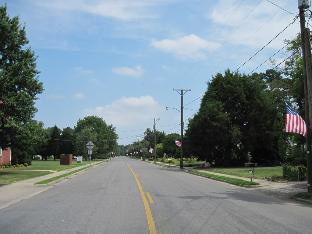
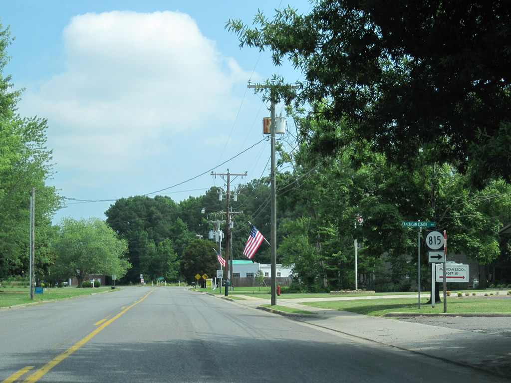
| U.S. 360 (Main Street) west at American Legion Way (SR 815). SR 815 is essentially just a driveway connecting Main Street with Reed Avenue (SR 644). 06/25/10 |
|
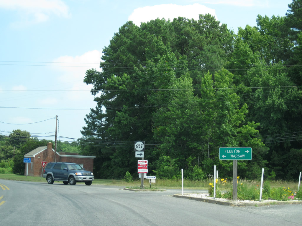
| U.S. 360 west merges with SR 657 (Fleeton Road) at the north end of Reedsville. Fleeton Road spurs southeast to Tibitha and Fleeton off Ingram Bay. 06/25/10 |
|
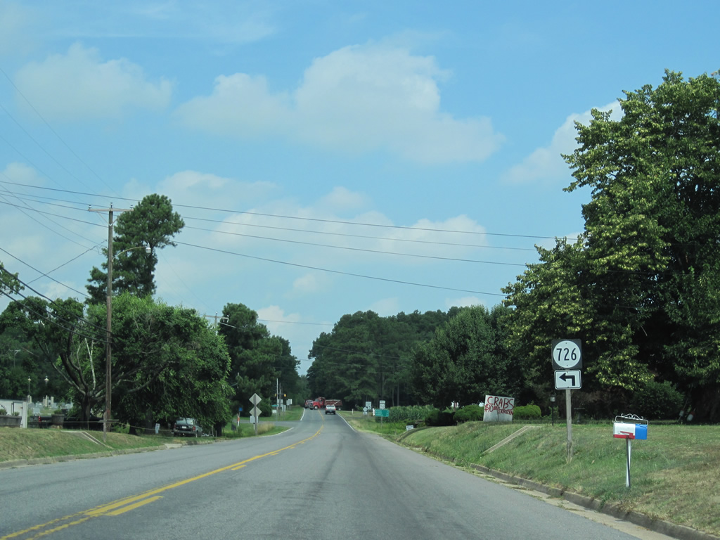
| U.S. 360 leaves Reedsville and follows Northumberland Highway. SR 726 next splits with the US highway for Liberty Street. 06/25/10 |
|
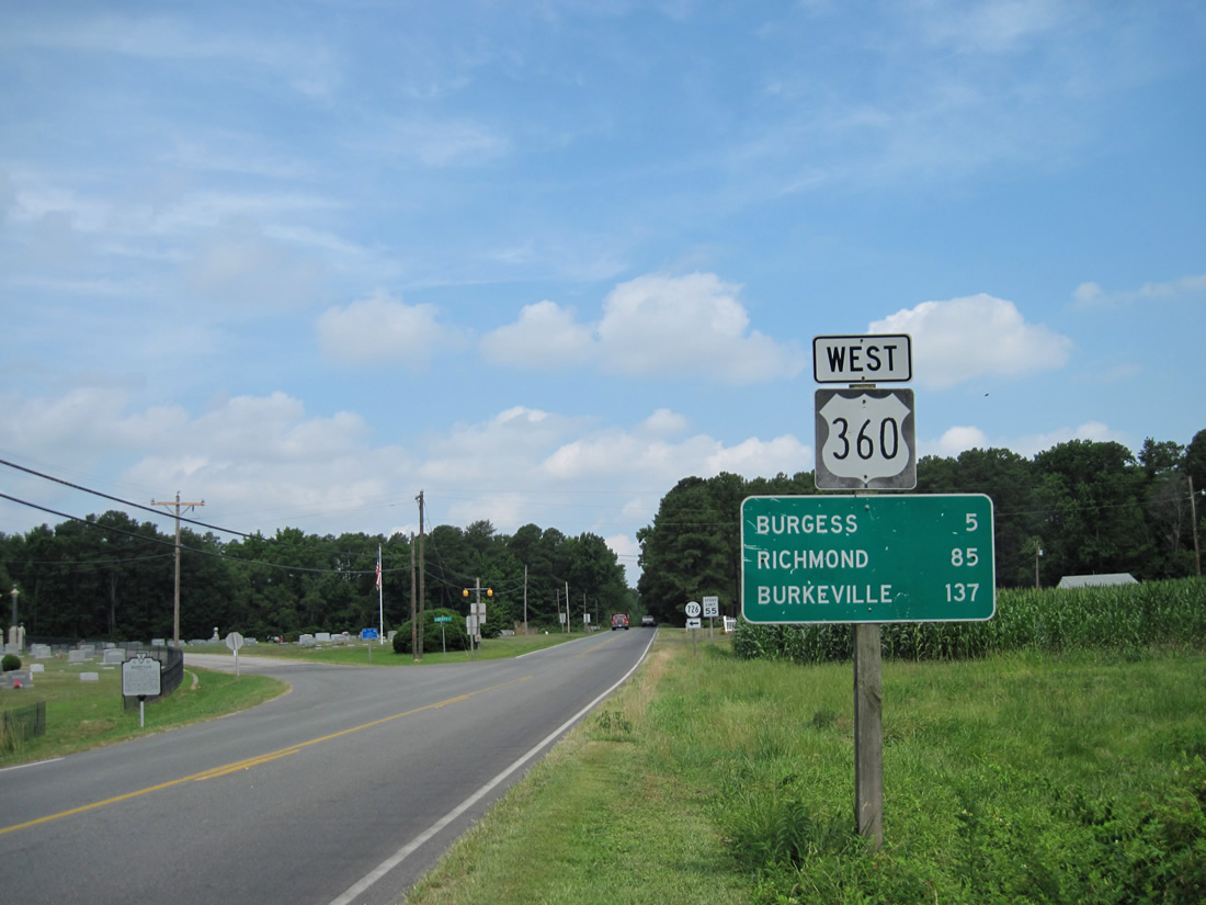
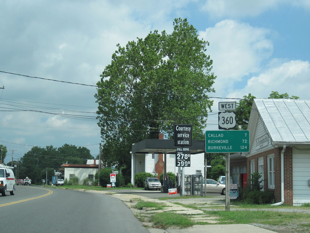
| The first shield assembly for the 225 mile route of U.S. 360 appears at Liberty Street outside Reedsville. Richmond is 85 miles to the southwest. Burkeville, where U.S. 360 overlaps with U.S. 460, is also highlighted on this distance sign at 137 miles out. 06/25/10 |
|
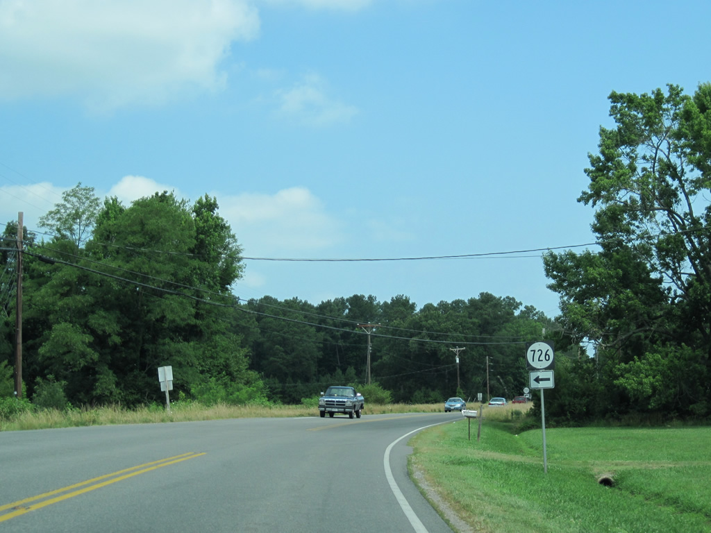
| Liberty Street (SR 726) returns to U.S. 360 from the south. SR 726 represents the first of several original alignments of U.S. 360. 06/25/10 |
|
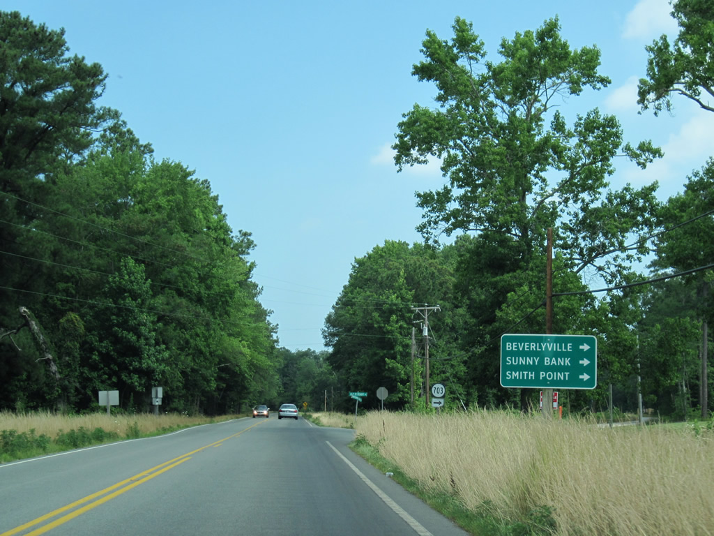
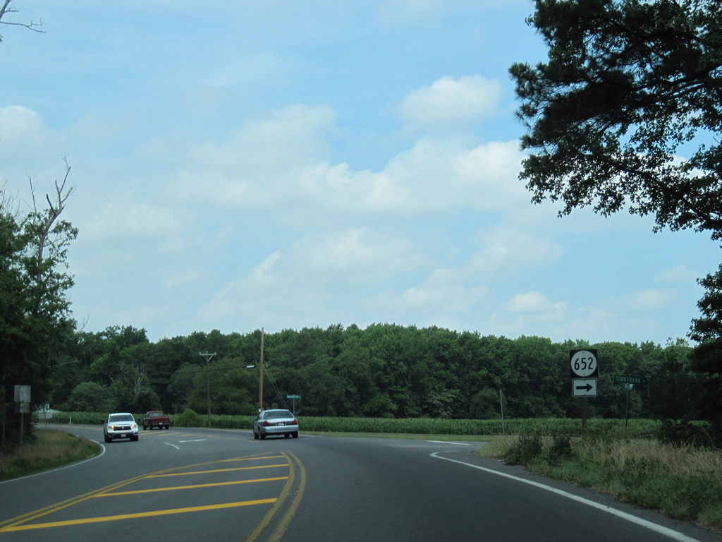
| Old Bethany Road connects U.S. 360 (Northumberland Road) west with SR 652 (Sunnybank Road) east to Sunny Bank and Smith Point. SR 703 is another former routing of U.S. 360. 06/25/10 |
|
| Sunnybank Road (SR 652) ties into U.S. 360 at the western turn from Beverlyville to Lilian. 06/25/10 |
|
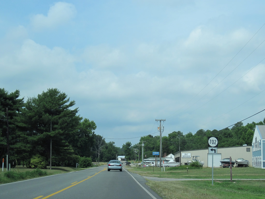
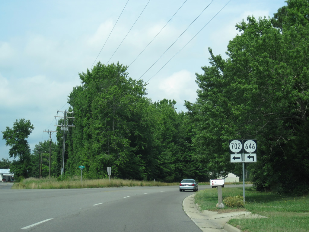
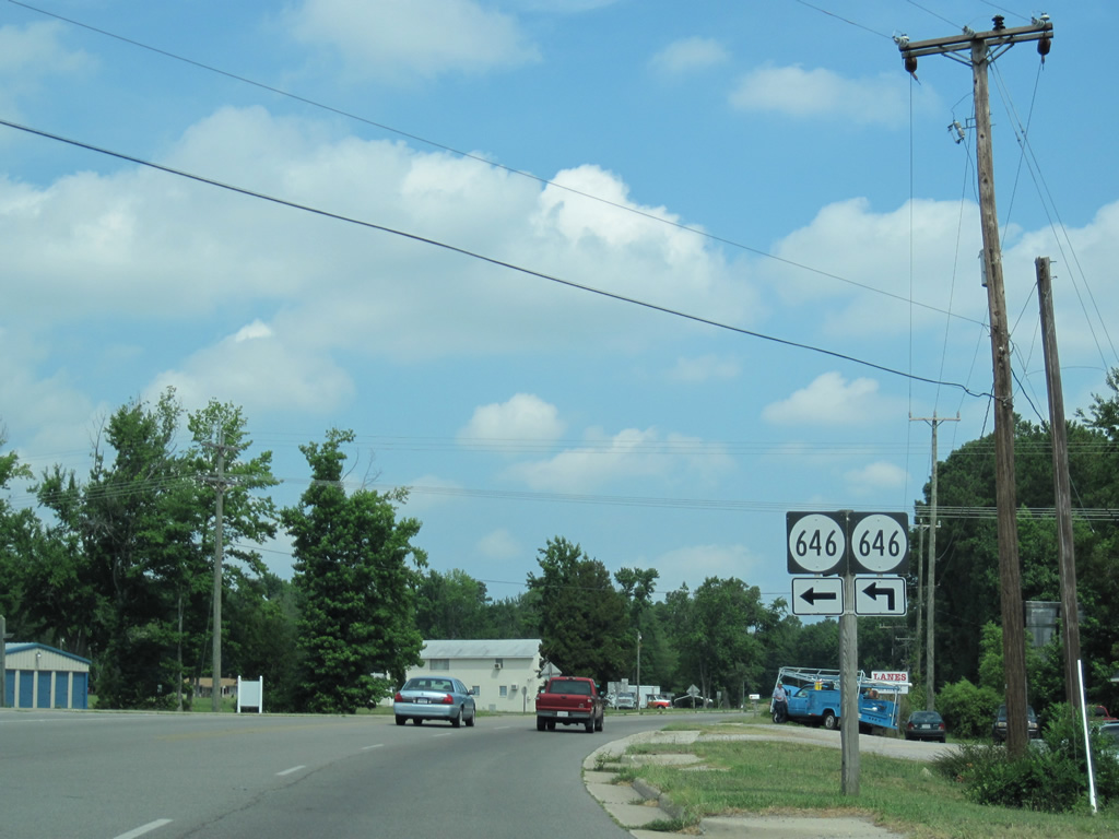
| SR 702 (Lillian Lane) provides a cut-off to SR 646 (Fairport Road) south from U.S. 360 west at Lilian. 06/25/10 |
|
| SR 702 west to SR 646 north lines the original U.S. 360 turn through Lilian. Fairport Road otherwise spurs south from Northumberland Highway to Fairport and Cockrell Point off the Great Wicomico River. 06/25/10 |
|
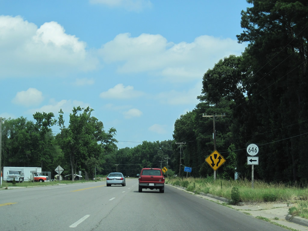
| Fairport Road is the southern branch of SR 646 from U.S. 360 west. Waverly Road spurs west from U.S. 360 as part of the SR 664 loop between Lilian and Walkers Store. 06/25/10 |
|
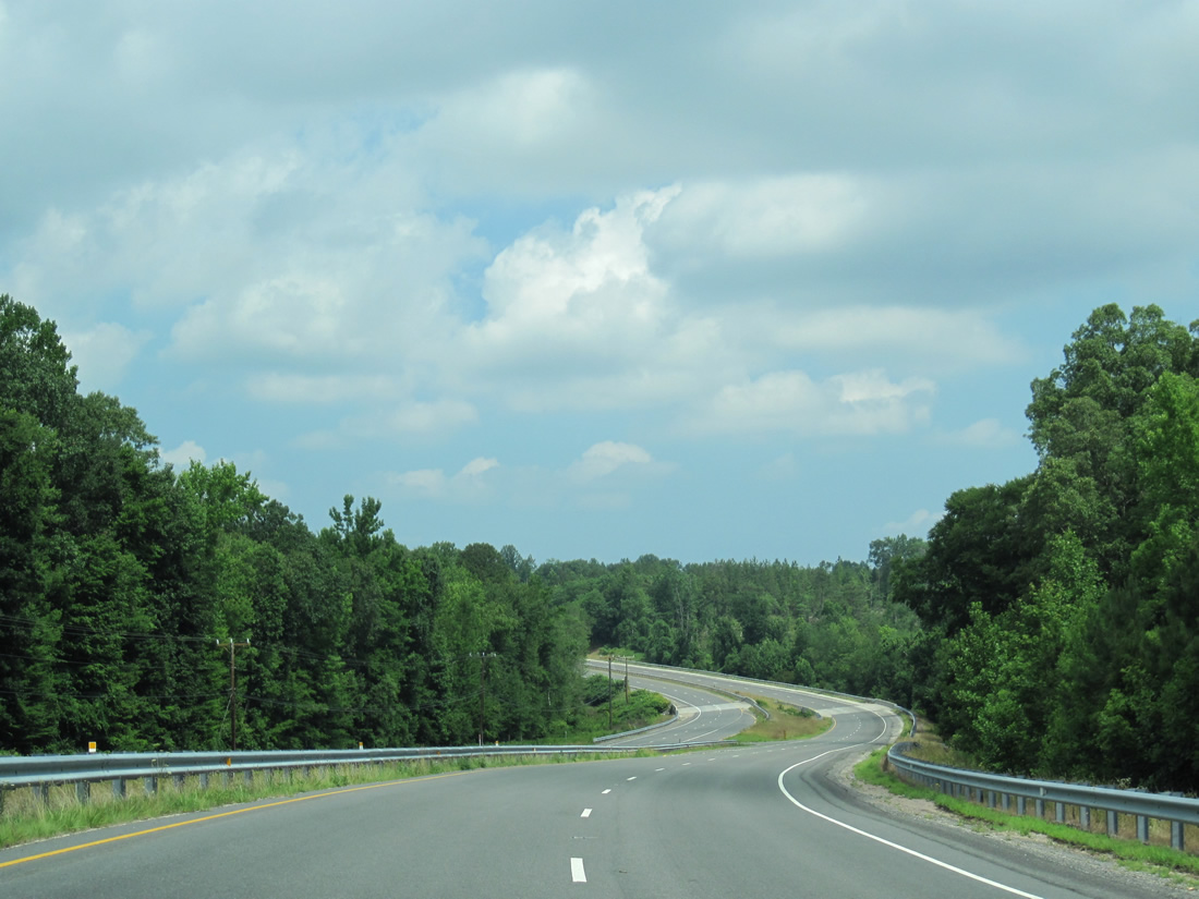
| U.S. 360 expands into a four lane divided highway north from Waverly Road (SR 646) west. 06/25/10 |
|
| SR 653 spurs south from U.S. 360 (Northumberland Highway) to Whays Creek opposite SR 1301 east to Bridge Creek Circle and Peachtree Point. 06/25/10 |
|
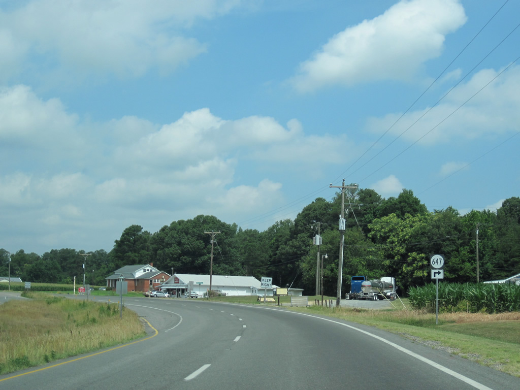
| U.S. 360 and SR 647 (Greenfield Road) west come together at Folly. 06/25/10 |
|
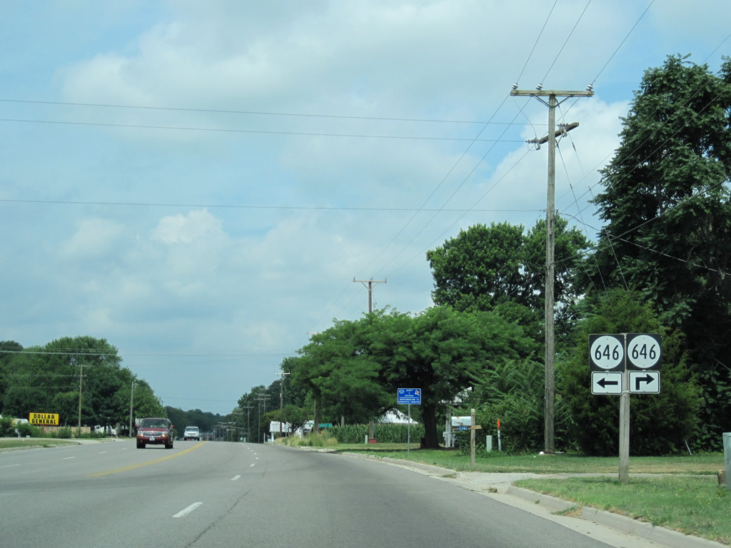
| Brickyard Road returns SR 646 north from Waverly Road to U.S. 360 at Walkers Store. A northern branch spurs from nearby along Folly Road to Gonyon. 06/25/10 |
|
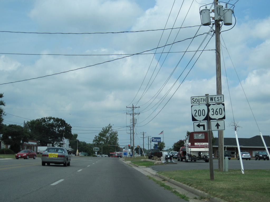
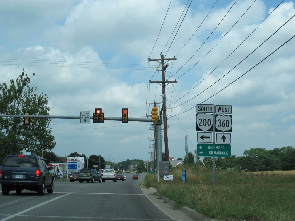
| SR 200 (Jessie Dupont Memorial Highway) begins from U.S. 360 (Northumberland Highway) at Burgess. 06/25/10 |
|
| The first traffic light along U.S. 360 lies six miles west of Reedsville at SR 200 south. SR 200 travels 19.23 miles south to SR 3 at Kilmarnock and a long a loop west from SR 3 to White Stone. 06/25/10 |
|
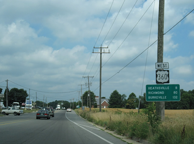
| Just the second shield assembly for U.S. 360 west coincides with this distance sign posted eight miles east of the Northumberland County seat of Heathsville. 06/25/10 |
|
| U.S. 360 (Northumberland Highway) reduces again to two lanes west of Burgess. 06/25/10 |
|
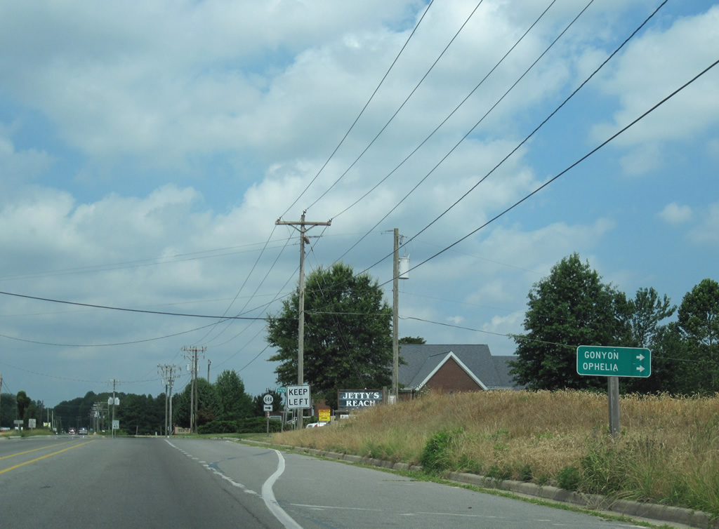
| Hacks Neck Road doubles as SR 644 north from U.S. 360 to Gonyon and Ophelia. SR 644 ends at Kayan on the Wicoming River. 06/25/10 |
|
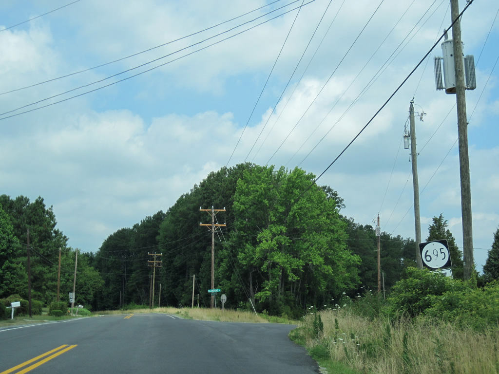
| Blundons Road (SR 695) provides a cut-off to Hull Neck Road (SR 640) north from U.S. 360 west. 06/25/10 |
|
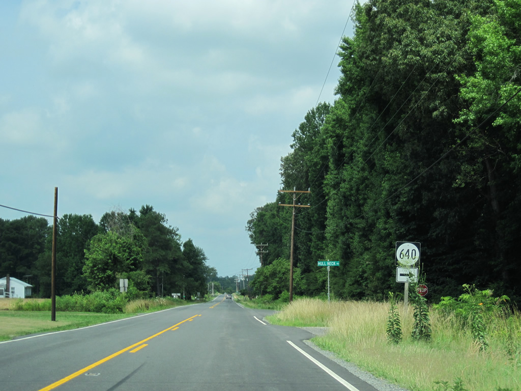
| SR 640 (Hull Neck Road) stems north from U.S. 360 at the next intersection to Blundons Corner, Edwardsville and Marshalls Beach on the Potomac River. 06/25/10 |
|
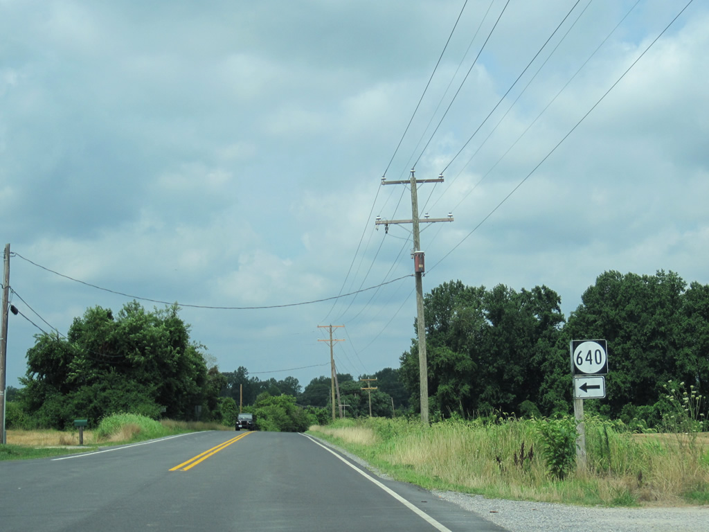
| A southern branch of SR 640 follows Pumpkin Hill Road from U.S. 360 to farms and residences ahead of Betts Mill Creek. 06/25/10 |
|
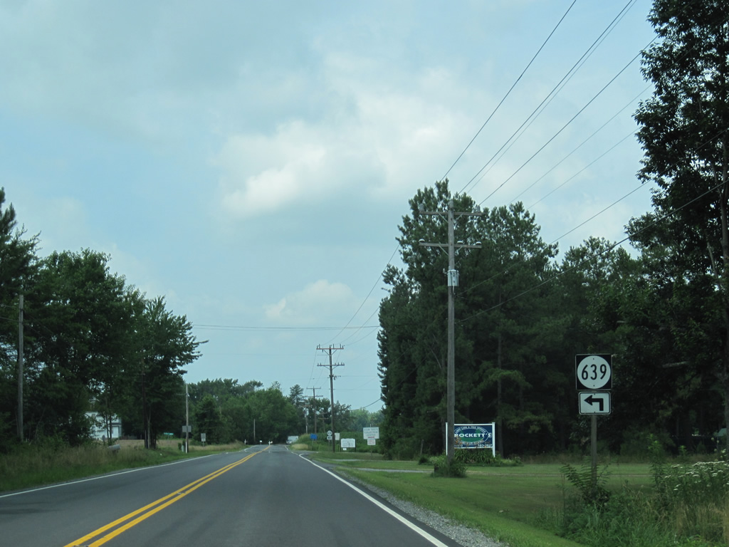
| West of Downings Corner, U.S. 360 approaches Cedar Point Road (SR 639) south. 06/25/10 |
|
| Horse Head Lane loops north from U.S. 360 (Northumberland Highway) at the community of Horsehead. 06/25/10 |
|
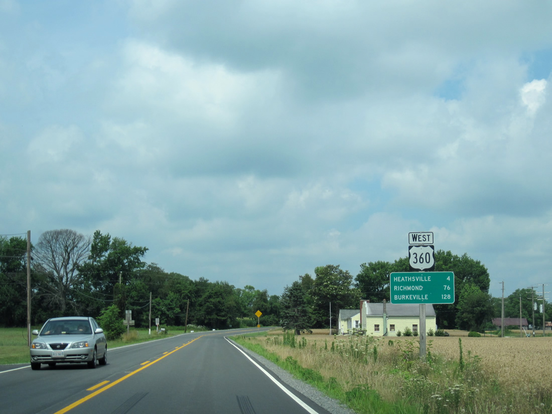
| U.S. 360 turns north from Horsehead four miles to Heathsville. Richmond is now 76 miles to the southwest. 06/25/10 |
|
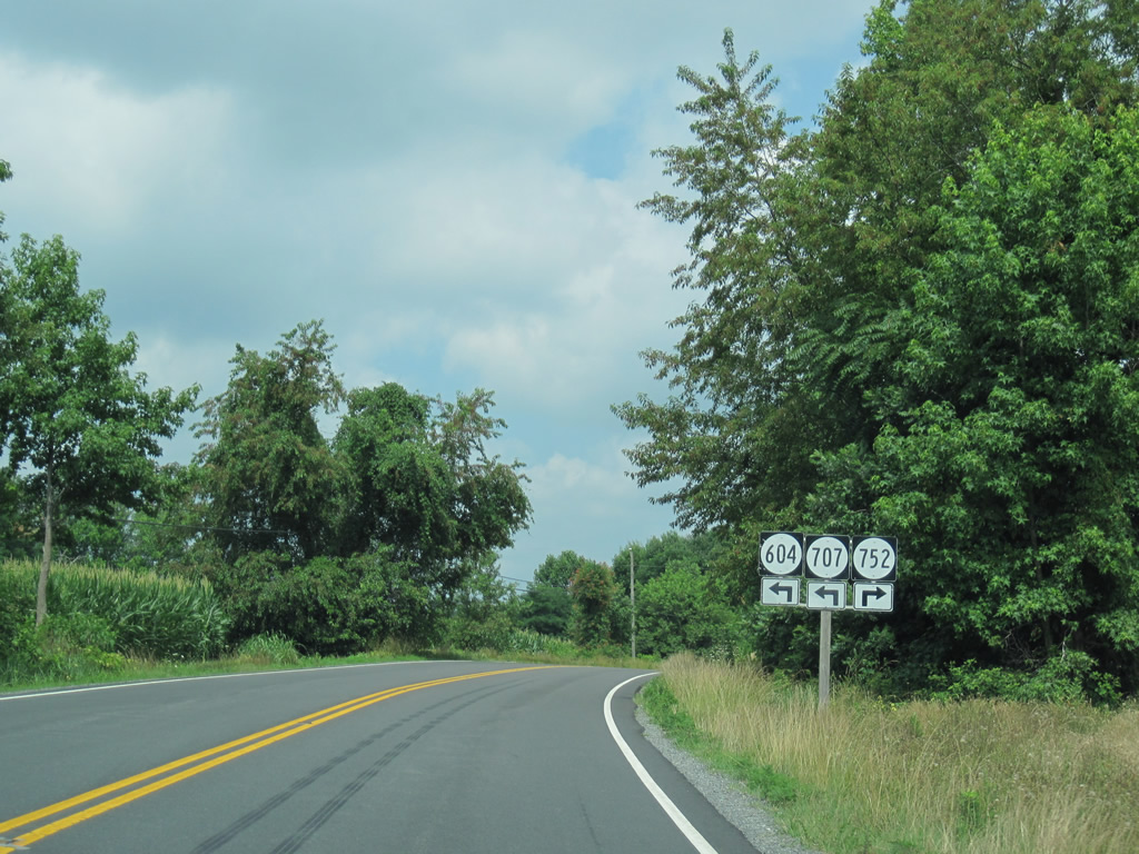
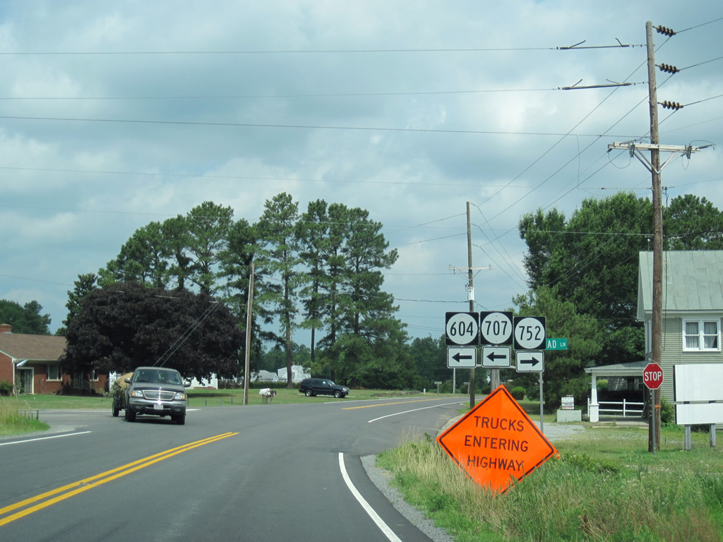
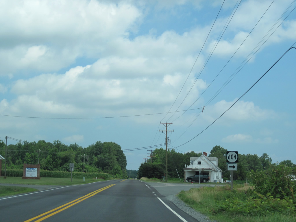
| A five-way intersection with rural farm roads joins U.S. 360 with SR 707 (Coopers Landing Road) south, SR 604 (Indian Valley Road) west and the return of Horse Head Lane. 06/25/10 |
|
| Indian valley Road west connects U.S. 360 with SR 201 at Bryant Corner. SR 707 spurs to Coopers Landing on the Great Wicomico River. 06/25/10 |
|
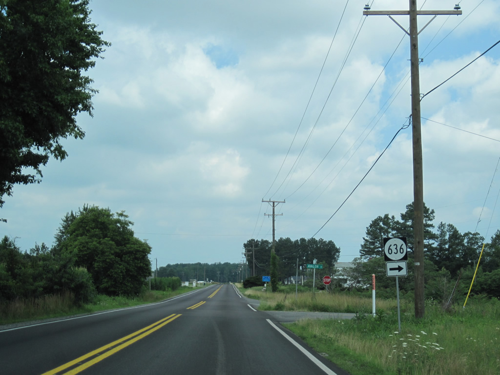
| SR 604 splits with U.S. 360 west for Avalon. Avalon Lane carries the route north to Sydnors Millpond Road east to Edwardsville. 06/25/10 |
|
| Avalon Lane turns west from Newmans Neck Road as SR 636 to U.S. 360. Avalon Lane is a likely original alignment of U.S. 360. 06/25/10 |
|
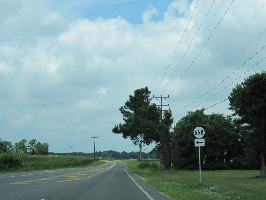
| SR 698 serves as the access road to a couple of schools from U.S. 360 near Claraville. 06/25/10 |
|
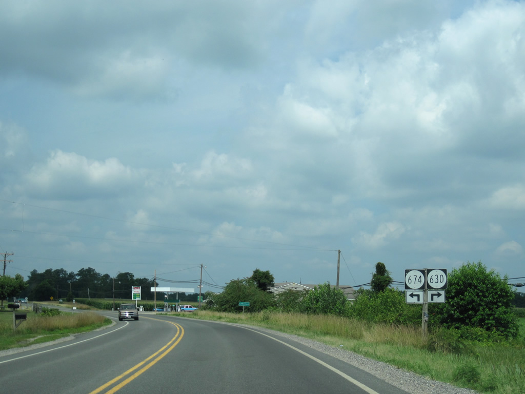
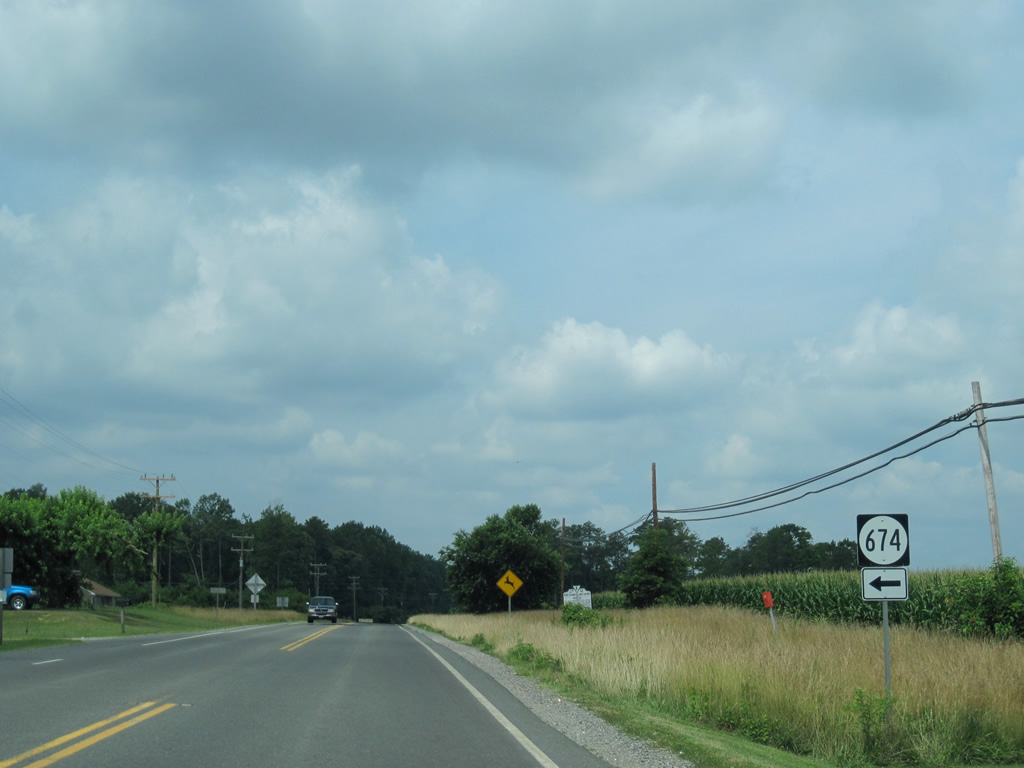
| Entering Claraville, U.S. 360 intersects SR 674 (Crabbetown Road) south and SR 630 (Walnut Point Road) north to Sissons and Middletons Corners. 06/25/10 |
|
| Crabbetown Road serves a handful of homes and a farm to the south of U.S. 360 at Claraville. 06/25/10 |
|
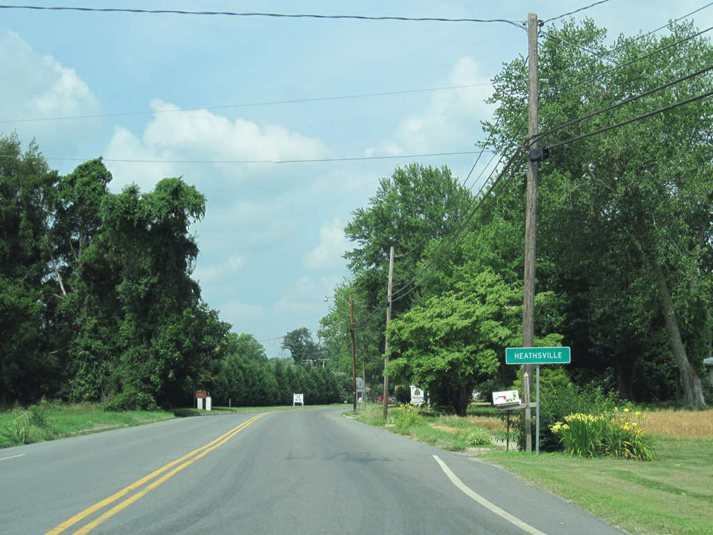
| U.S. 360 (Northumberland Highway) finally reaches Heathsville, an unincorporated community of around 150. 06/25/10 |
|
| SR 201 enters Heathsville from Lancaster County to the south. The route totals 16.17 miles between U.S. 360 and SR 354, southwest of Lively. 06/25/10 |
|
| Callao, the next junction with a state route, is seven miles to the west of Heathsville on U.S. 360. Richmond is 72 miles away. 06/25/10 |
|
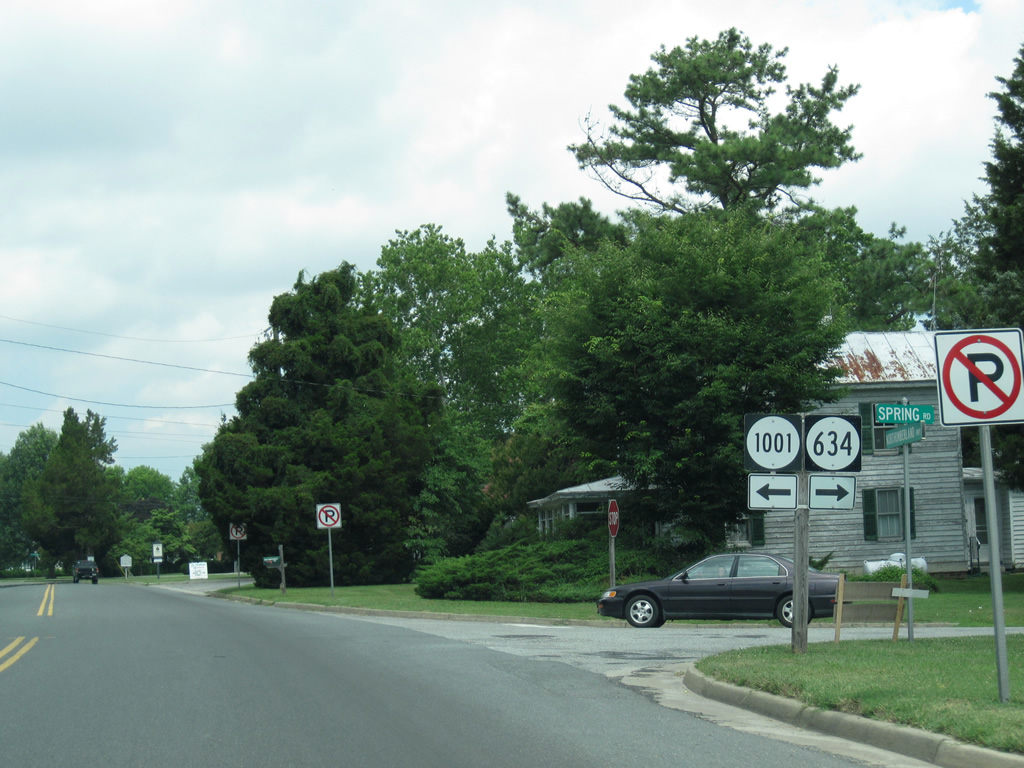
| Spring Road leads northeast from Heathsville as SR 634 to Hamlins Corner. SR 1001 follows Back Street to the Northumberland County Court building. 06/25/10 |
|
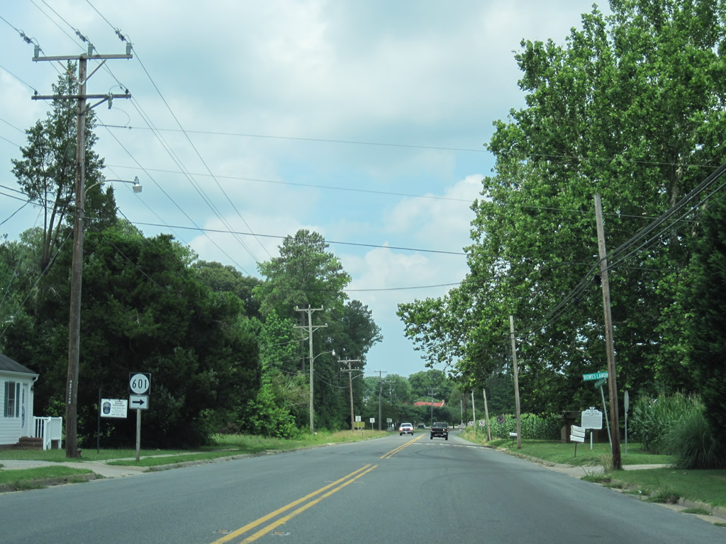
| SR 601 spurs north from U.S. 360 at Heathsville to Rowes Landing on the Coan River. 06/25/10 |
|
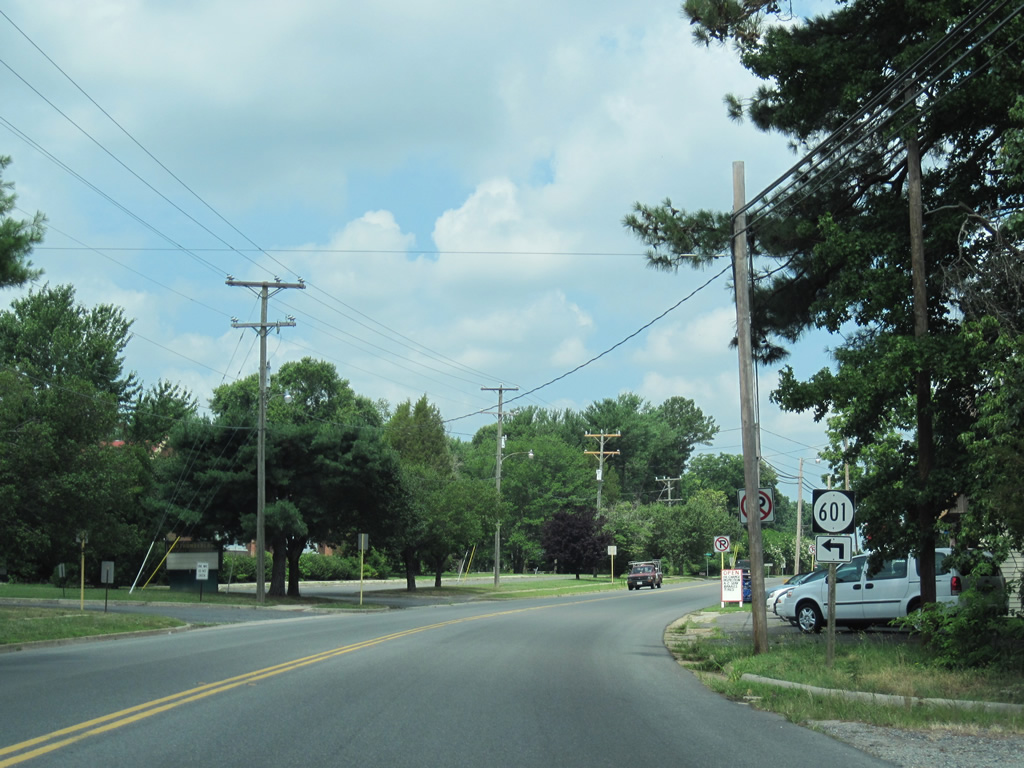
| Southbound SR 601 follows Dodlyt Road south to Gillick Corner and SR 604. 06/25/10 |
|
| U.S. 360 expands again into a four lane divided highway northwest from Heathsville. This scene looks at the open road ahead of Coan Mill Stream. 06/25/10 |
|
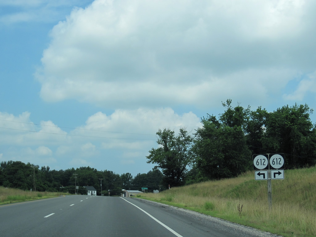
| U.S. 360 and SR 612 intersect at Coan Stage. SR 612 spurs east to Forest Landing on the Coan River and west to SR 600 (Ridge Road) at Rainswood. 06/25/10 |
|
| The scene along U.S. 360 (Northumberland Highway) at Fallins Millpond on Mill Creek. 06/25/10 |
|
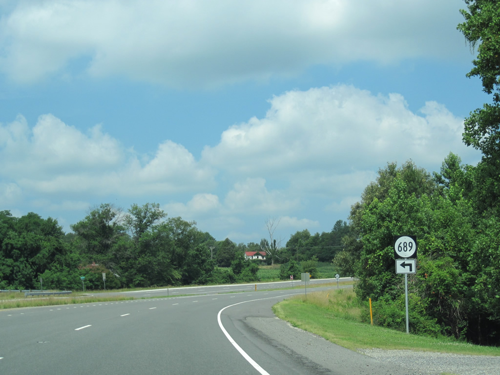
| Turning north again, U.S. 360 intersects SR 689 (Salem Road) west ahead of Lottsburg. 06/25/10 |
|
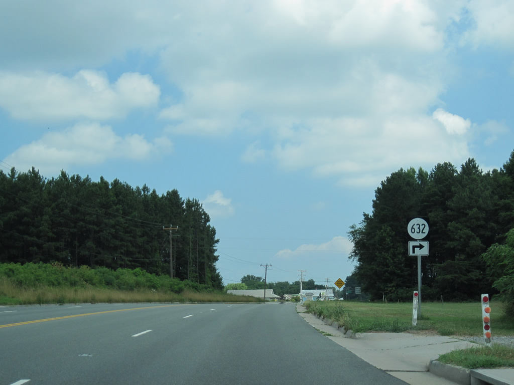
| Northumberland Highway narrows again to a two lane highway beyond Kingston Road (SR 632) into Lottsburg. 06/25/10 |
|
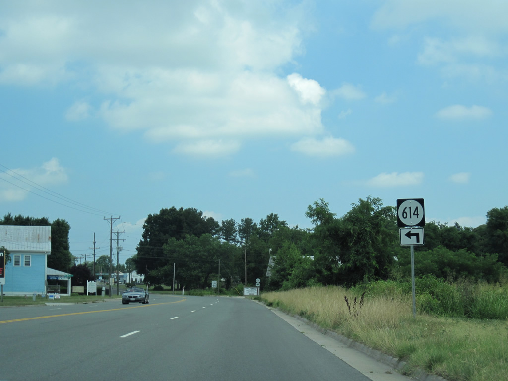
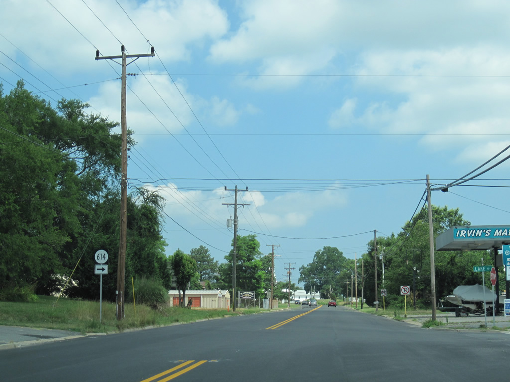
| Walmsley Road (SR 614) winds southwest from U.S. 360 at Lottsburg to Walmsley and Burtons Corner. 06/25/10 |
|
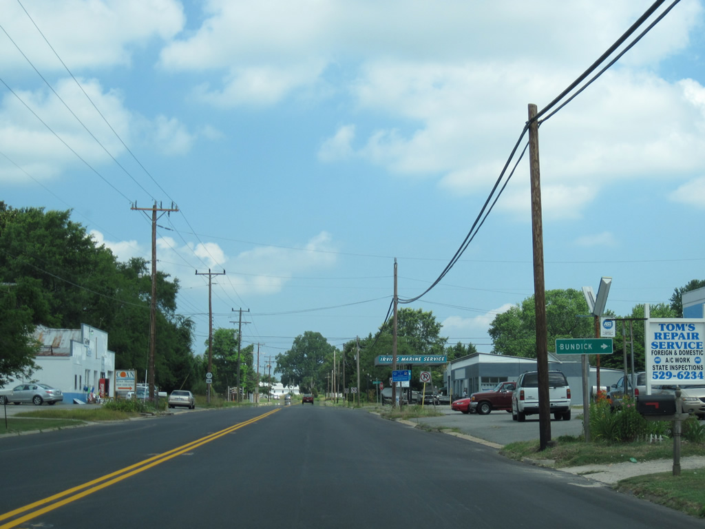
| Lake Road carries the eastern branch of SR 614 to Stevens Point. Bundick Road (SR 629) splits with the highway to Bundick off the Coan River. 06/25/10 |
|
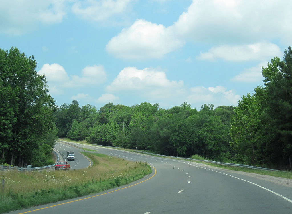
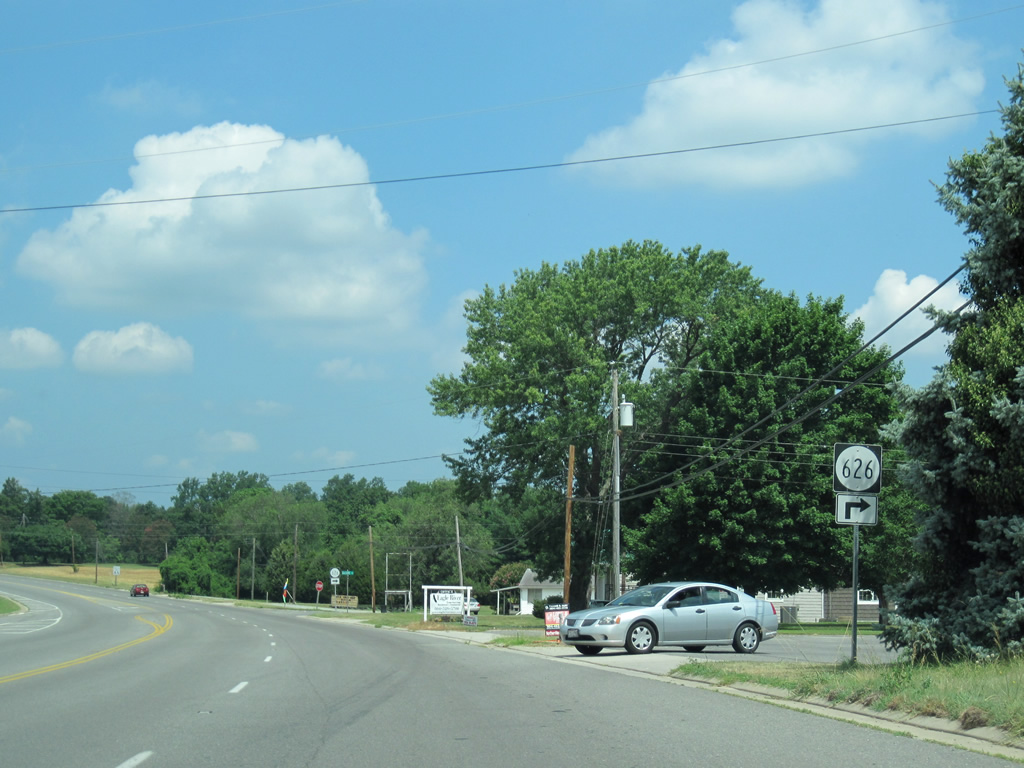
| Leaving Lottsburg, U.S. 360 expands back into a four lane highway as SR 626 (Glebe Road) spurs to the northeast. 06/25/10 |
|
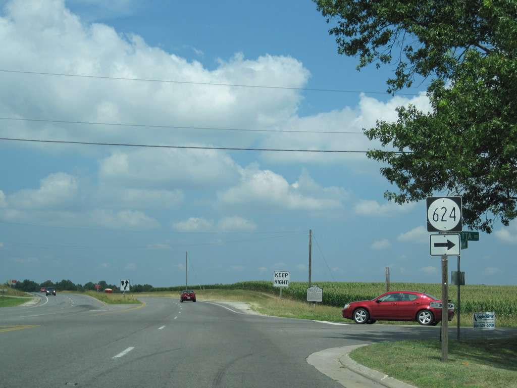
| U.S. 360 widens even more and again sees a grassy median from SR 624 westward. SR 624 ventures to Cherry Point Neck and Lewisetta off the Potomac River. 06/25/10 |
|
| U.S. 360 sinks toward a crossing of Lodge Creek at Headleys Millpond. 06/25/10 |
|
| Entering the eastern reaches of Callao at Cedar Lane (SR 729) south and Supply Lane (SR 750) north on U.S. 360 (Northumberland Highway) west. 06/25/10 |
|
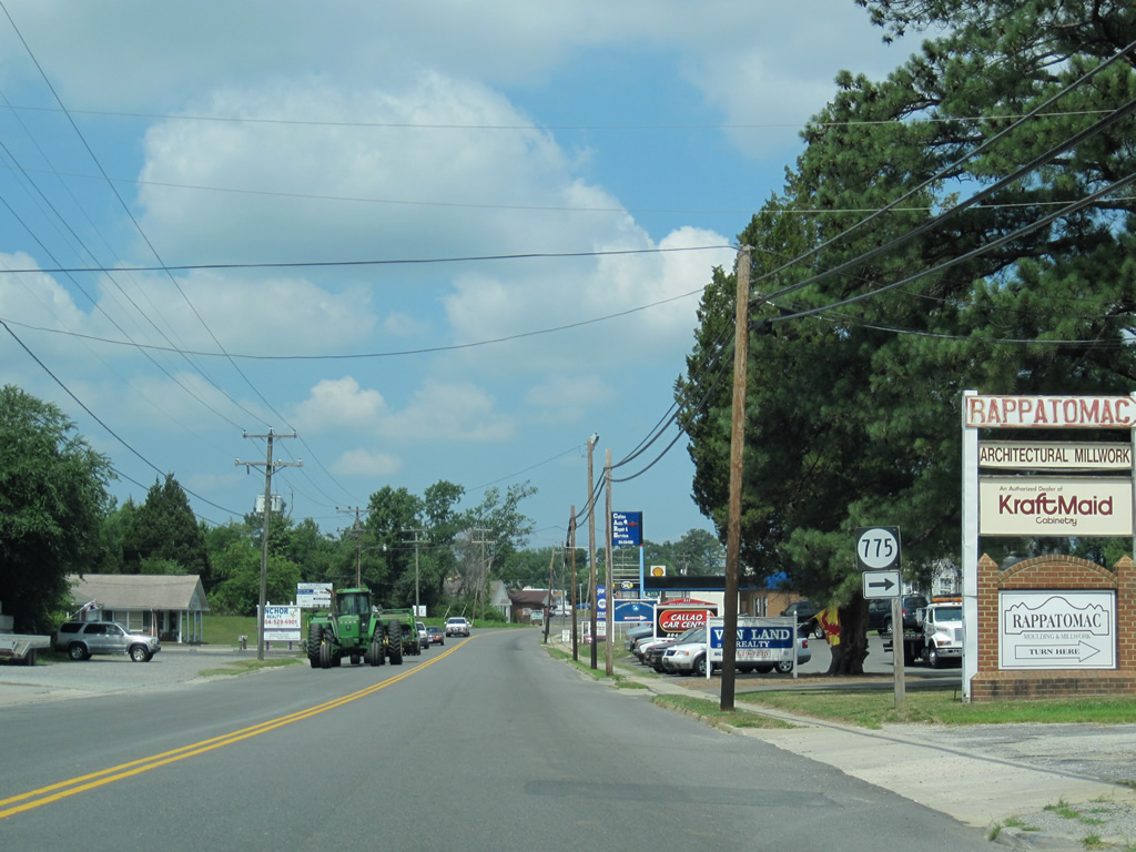
| U.S. 360 travels with just two lanes through Callao by a number of businesses at SR 775 (Factory Lane). 06/25/10 |
|
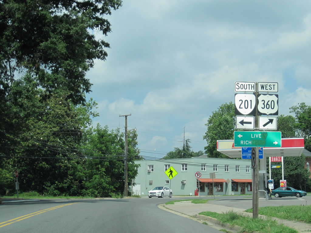
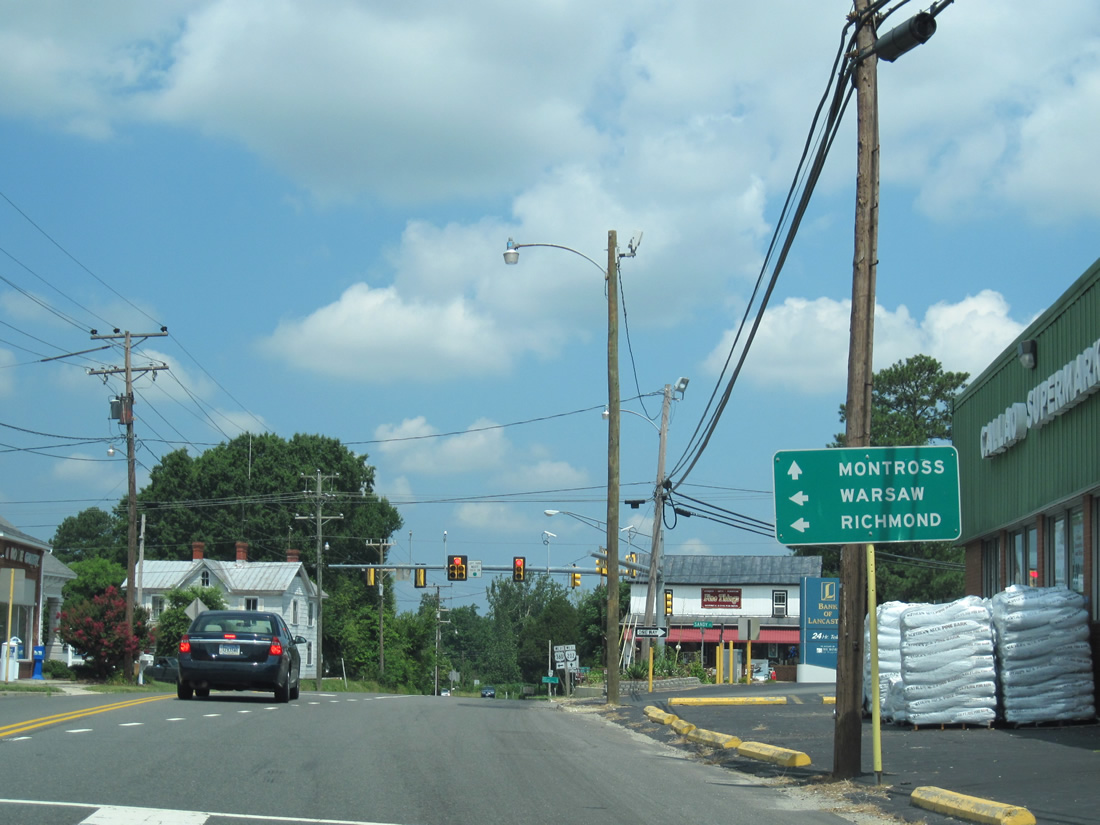
| U.S. 360 meets the east end of SR 202 (Hampton Hall Road) in Callao. The state route travels 17.91 miles northwest to Westmoreland County and junction SR 3, three miles south of Montross. 06/25/10 |
|
| Motorists continuing straight the traffic light with SR 202 continue along Hampton Hall Road north to Hauge, Mt. Holly and the Westmoreland County seat of Montross. U.S. 360 turns left at the intersection for Richmond Road west to Village, Haynesville and Warsaw. 06/25/10 |
|
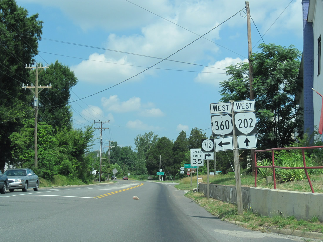
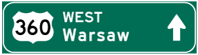
| Shield assembly posted just beyond the traffic light with U.S. 360 and SR 202. U.S. 360 travels 11 miles to the Richmond County seat of Warsaw while SR 202 immediately intersects SR 712 (Harryhogan Road) north to both Harryhogan and Lodge. 06/25/10 |
Page Updated 02-12-2013.