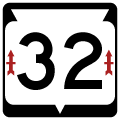
Traveling the height of Wisconsin, Wis 32 totals 325 miles from the Illinois state line at Pleasant Prairie to the Upper Peninsula of Michigan at Land O' Lakes. The state trunk highway doubles as the Red Arrow Highway, in commemoration of the 32nd Division of National Guard troops. The red arrow is the division's logo.
State Trunk Highway 32 Guides
- South - Pulaski to Pittsfield
- South - Pittsfield to Green Bay
- South - Green Bay, Ashwaubenon and De Pere
- South - Green Bay to De Pere
- North - De Pere, Ashwaubenon and Green Bay
- North - Green Bay to Shawano
Wis 32 connects the Lake Michigan cities of Kenosha and Racine as it heads north from Illinois Route 137. The trunk highway enters the Milwaukee area through the south suburbs of Oak Creek, Greenfield and Cudahy before reaching Downtown along a brief overlap with U.S. 18. The route remains along Lake Michigan through the Upper East Side of Milwaukee to Whitefish Bay and Fox Point before shifting west and combining with Interstate 43 at Bayside and Exit 82.
I-43/Wis 32 north add Wis 57 through south Ozaukee County. This is the first of two overlaps between Wis 32 /57. Wis 32 departs the freeway and acts as a business loop for Port Washington between Exits 93 and 100 while Wis 57 branches north via Exit 97 to Fredonia.
Leading north from Port Washington, Wis 32 and Interstate 43 again combine to Exit 113 near Cedar Grove. The trunk highway stays west of the freeway from this point onward as it takes a rural route north to Sheboygan Falls. Once at Howards Grove, Wis 2 turns northwest to reunite with Wis 57 along a 46 mile long overlap through Kiel, Chilton and De Pere.
Within the Green Bay area, Wis 32 parts ways with Wis 57 at Downtown De Pere to cross the Fox River. The trunk highway turns north along Ashland Avenue (former U.S. 41 Business) north through Ashwaubenon to the west end of the Mason Street freeway (Wis 54). Wis 32 shares a series of overlaps with Wis 54 west, I-41 north and Wis 29 west to leave Green Bay for Pulaski.
Beyond the Wis 29 expressway joining Green Bay with Shawano and Wausau, Wis 32 travels a rural route north to Nicolet National Forest and a 12 mile overlap with U.S. 8 between Laona and Crandon. The route angles northwest from there to combine with U.S. 45 at Three Lakes. The US route takes the remainder of Wis 32 north to Eagle River, Conover and the state line.
Connect with:
Interstate 41 / U.S. 41
Interstate 43
Interstate 794 / State Trunk Highway 794
State Trunk Highway 29
State Trunk Highway 57
State Trunk Highway 172
Page Updated 10-29-2019.
