|
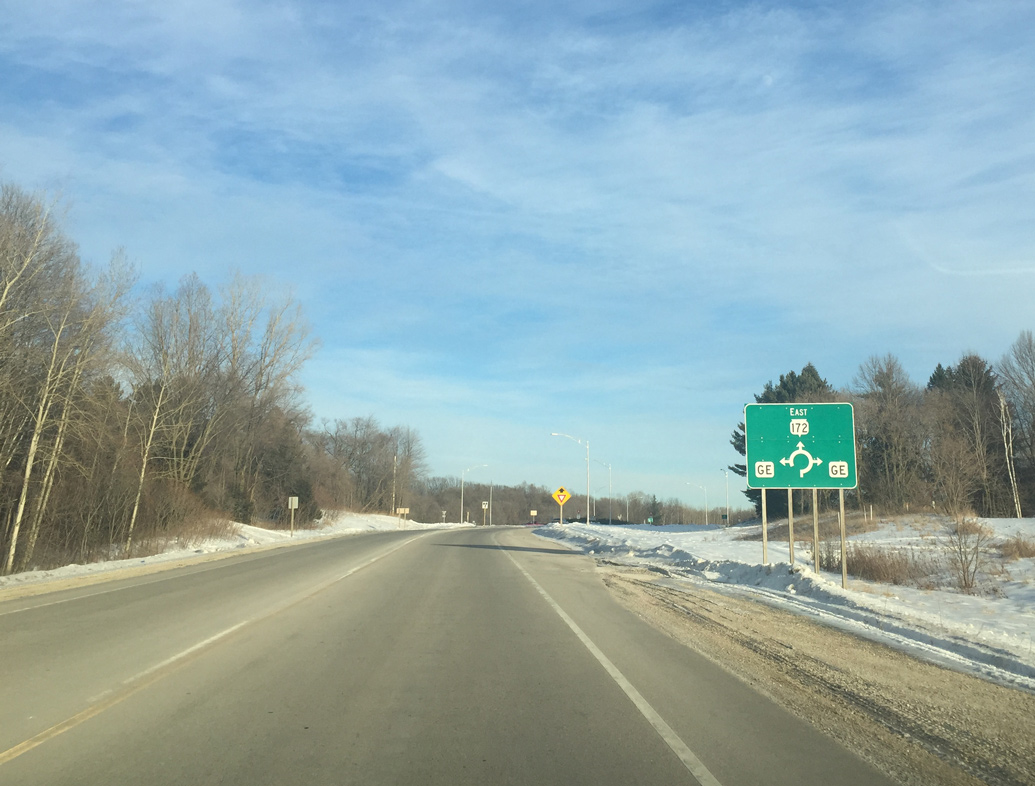
| Wis 54 (Mason Street) crosses Duck Creek and turns northward to approach the roundabout with both Wis 172 (Airport Drive) east and CTH E (Freedom Road) south at Oneida. 01/19/16 |
|
| The first reassurance marker for Wis 172 stands between the roundabout with STH 54 and Standing Stone Drive. The state trunk highway totals 11.63 miles. 01/19/16 |
|
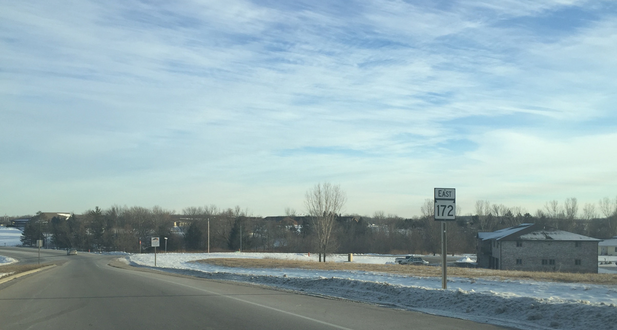
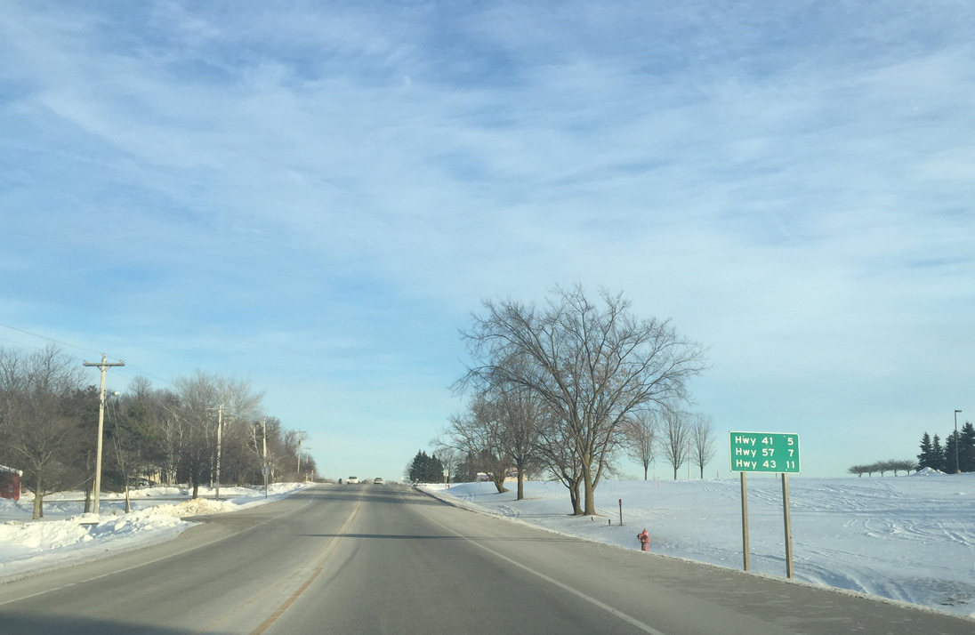
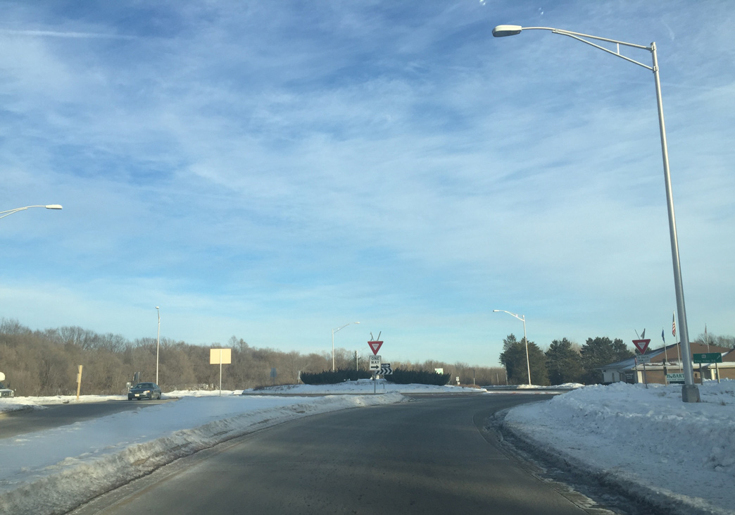
| Leading east from Oneida, STH 172 enters the village of Ashwaubenon and meets Interstate 41 [U.S. 41] in five miles and STH 57 in seven miles. 01/19/16 |
|
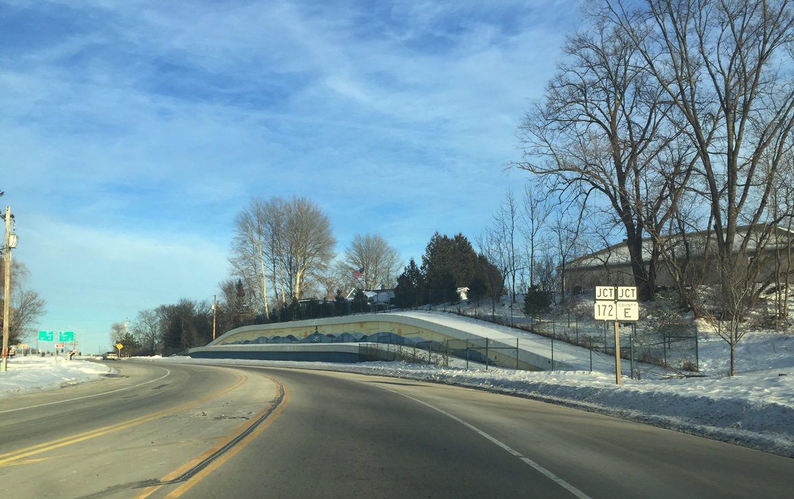
| A roundabout joins STH 172 (Airport Drive) with CTH GE (Pine Tree Road). 01/19/16 |
|
| CTH GE ends 0.9 miles to the north at STH 54 (Mason Street) and 3.8 miles to the south at CTH EE. 01/19/16 |
|
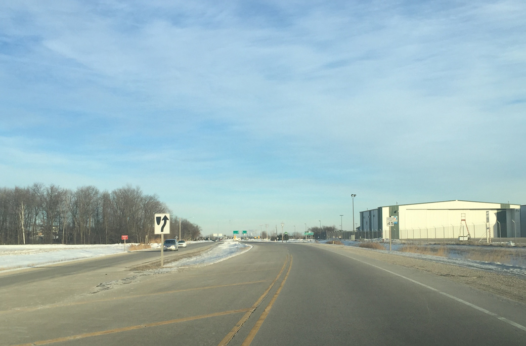
| Wis 172 (Airport Drive) expands into a four lane expressway along the north side of Austin Straubel International Airport (GRB). 01/19/16 |
|
| A multi-lane roundabout connects STH 172 with the airport passenger terminal and Entertainment Drive to adjacent Oneida Casino. 01/19/16 |
|
| South Point Road intersects STH 172 by the cargo facilities of Straubel International Airport (GRB). The road extends northward to west Green Bay. 01/19/16 |
|
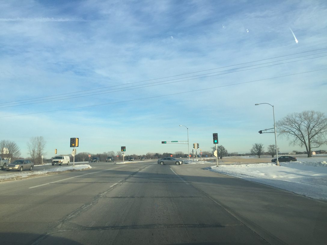
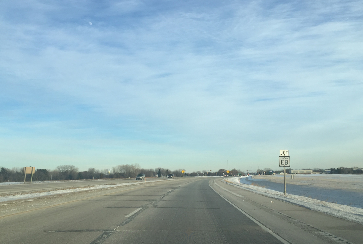
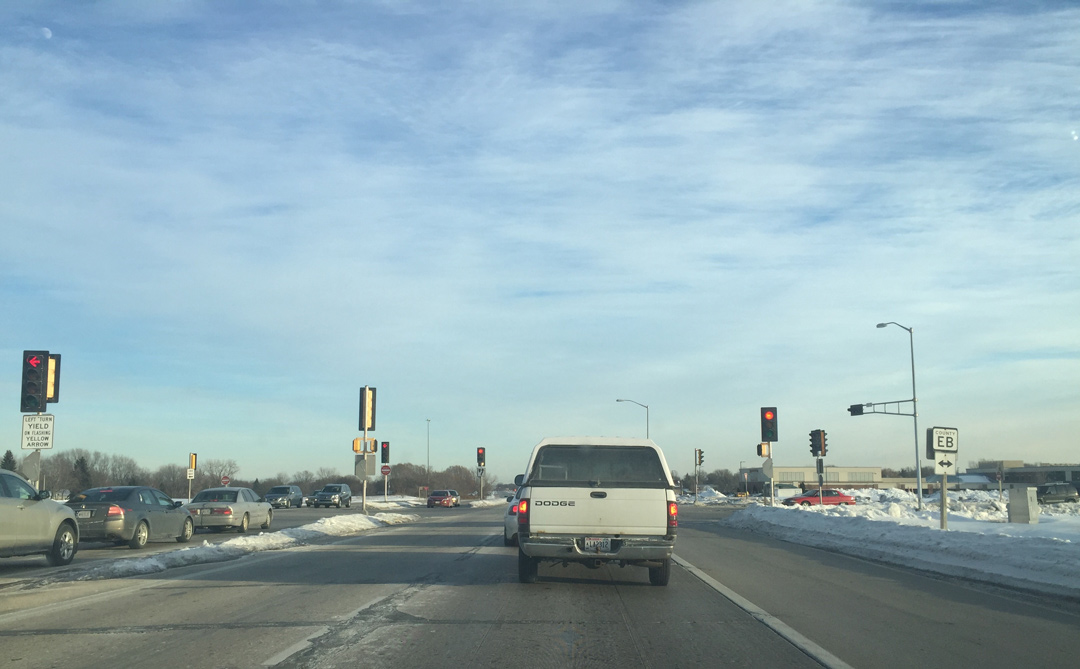
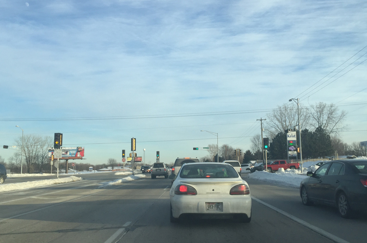
| Wis 172 (Airport Drive) passes through the runway approach area of GRB Airport leading into the signalized intersection with CTH EB (Packerland Road). 01/19/16 |
|
| CTH EB parallels Interstate 41 south to CTH F within the town of Lawrence and north to the village of Howard. Locally the highway comprises an arterial to commercial areas south of STH 172 and north through residential areas of Green Bay to STH 54. 01/19/16 |
|
| The Wis 172 expressway continues east to the traffic light with Babcock Road. Babcock Road provides the lone access point from the trunk highway to adjacent businesses and neighborhood areas. 01/19/16 |
|
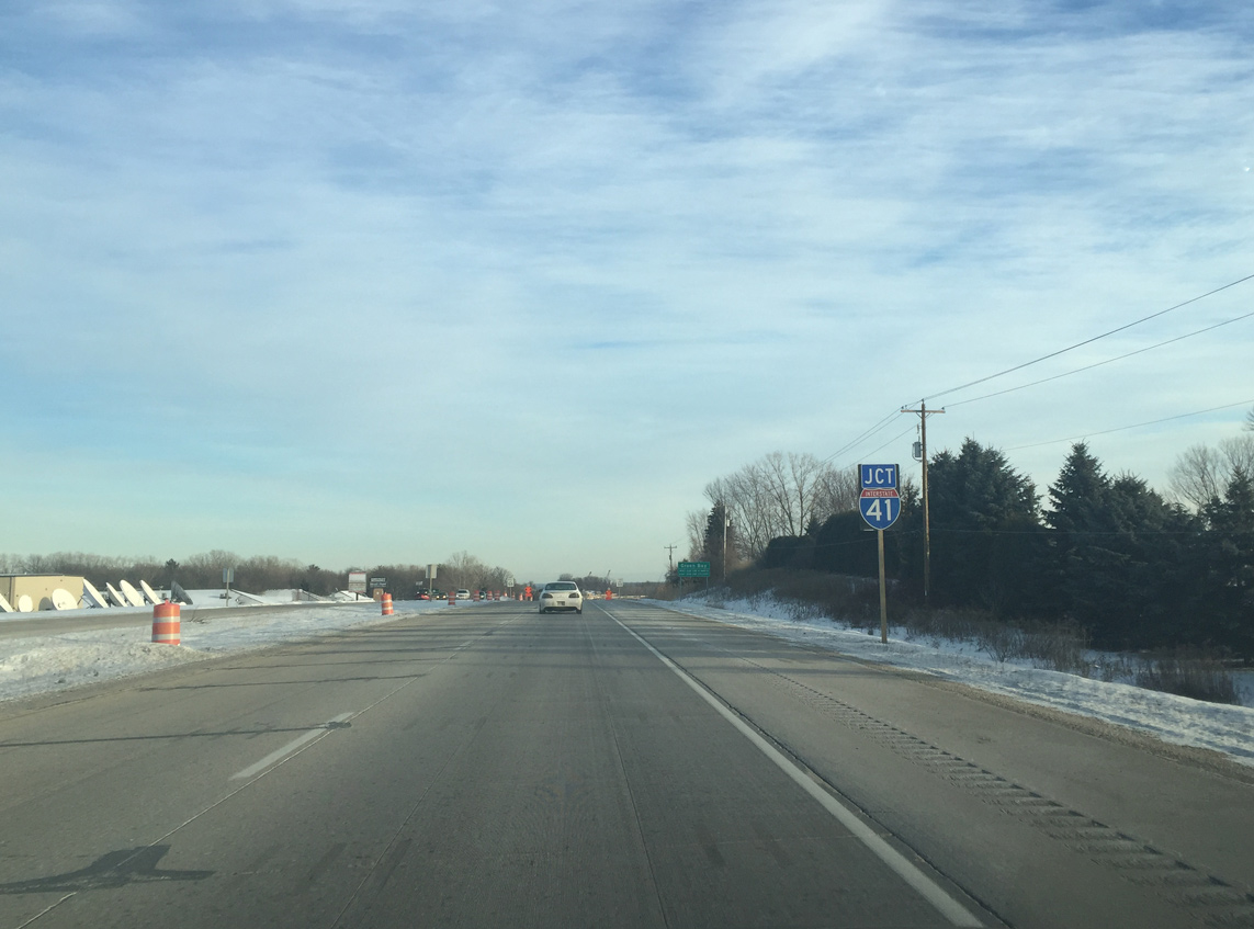
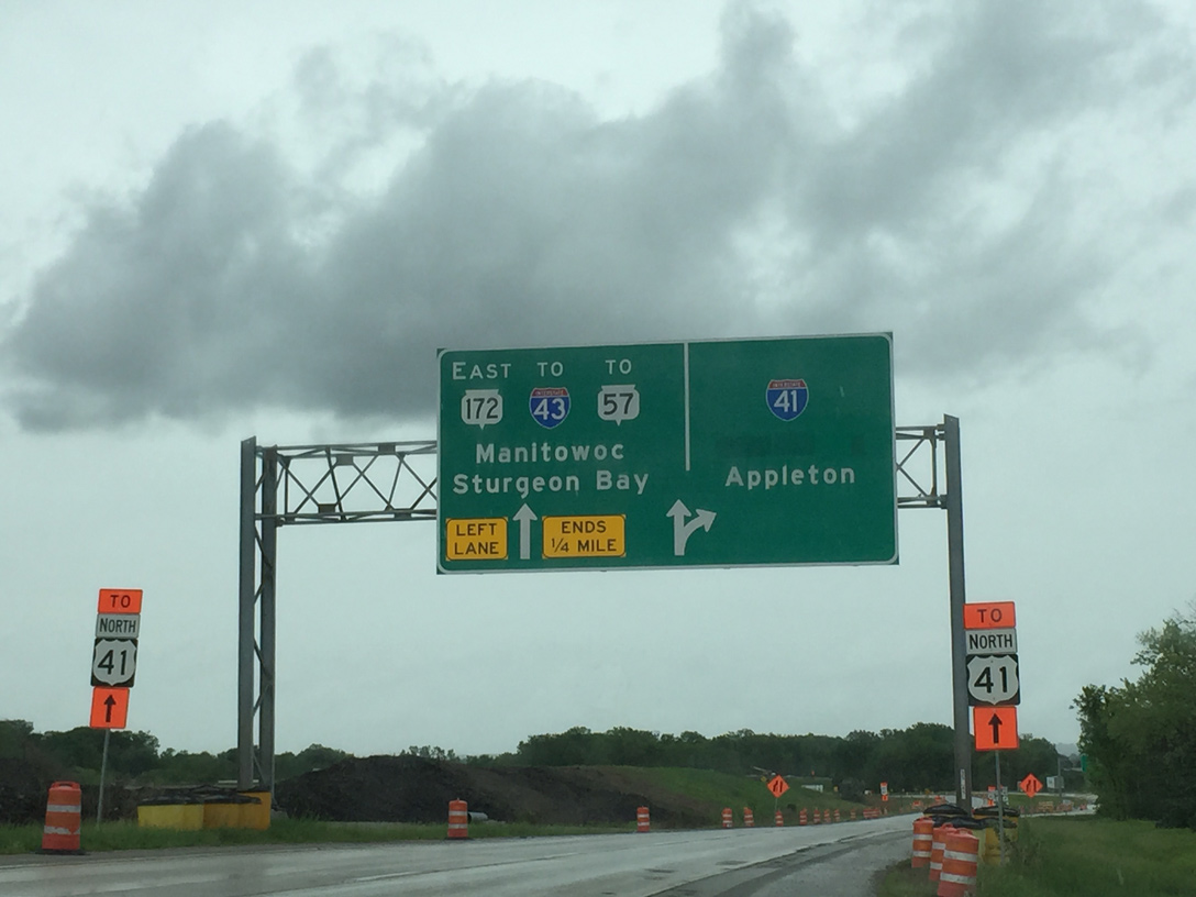
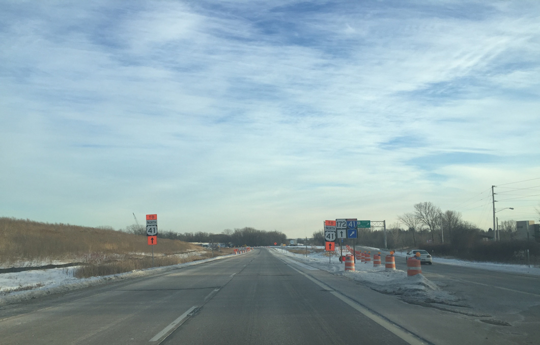
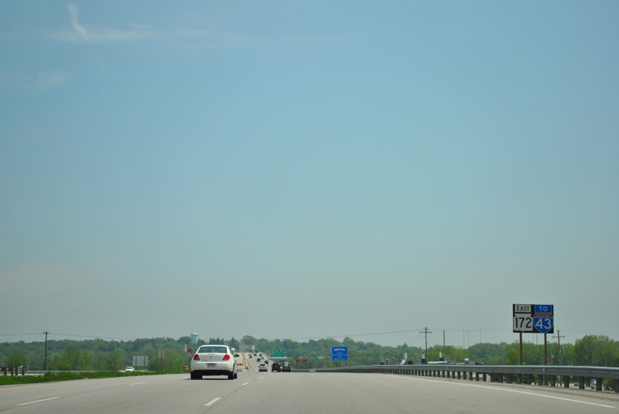
| East from Babcock Road, STH 172 travels 0.6 miles to the directional cloverleaf interchange with Interstate 41 [U.S. 41]. A pair of guide signs preceding the junction reference simply "41", which allows them to remain correct given that U.S. 41 became I-41 in 2015. 01/19/16 |
|
| Interstate 41 supplanted all of U.S. 41 from Howard southward to the Illinois state line at Pleasant Prairie. The designation, approved initially by AASHTO in 2012, followed a series of projects to upgrade U.S. 41 to Interstate standards. 01/19/16 |
|
| Together with Interstate 41 here and Interstate 43 north from Bellevue, STH 172 forms a beltway encircling Green Bay. 01/19/16 |
|
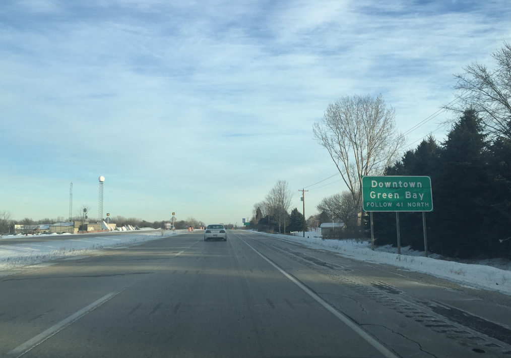
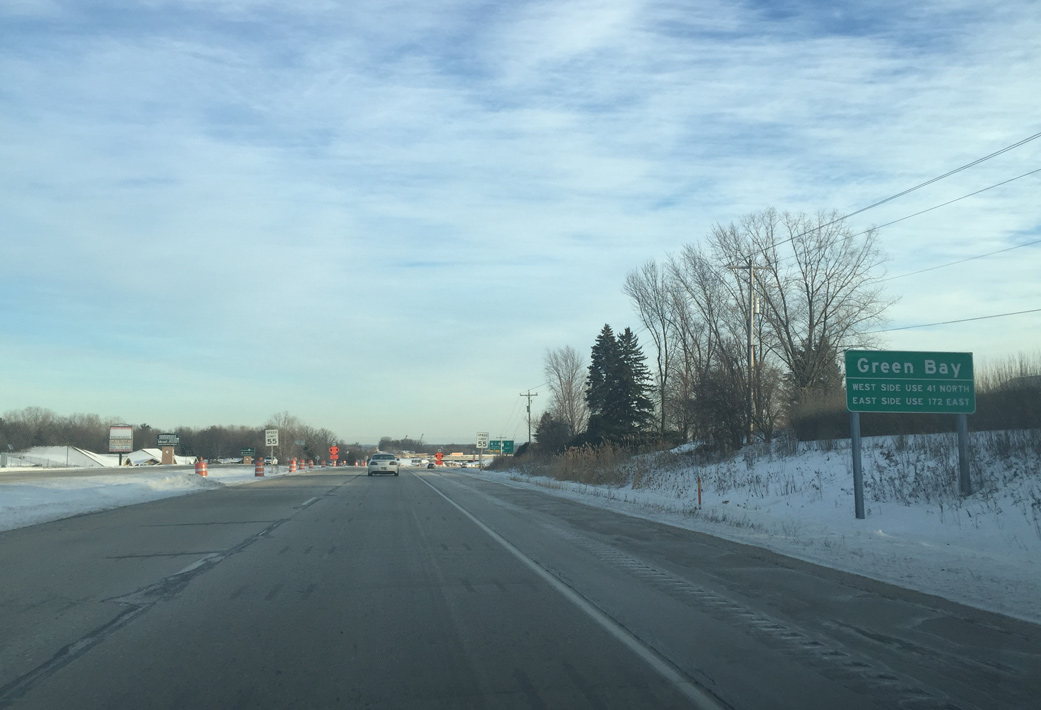
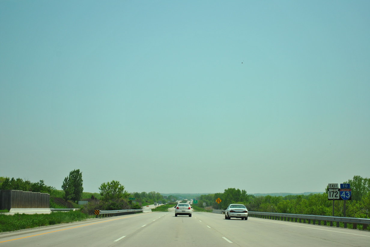
| Sign changes made along STH 172 east in May 2015 were some of the first to reflect the upgrade of U.S. 41 to I-41. Interstate 41 serves the west side of Green Bay, including Lambeau Field, northward to Howard and south from Ashwaubenon to De Pere. 05/30/15 |
|
| All traffic bound for Interstate 41 north to Green Bay and Marinette and south to Appleton and Oshkosh departs STH 172 east in unison. 01/19/16 |
|
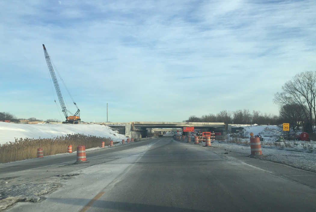
| Construction underway between 2013 and 2016 expands Interstate 41 above Wis 172 with the addition of collector distributor roadways. The loop ramp from STH 172 east to I-41 north was reconfigured as part of the project. 01/19/16 |
|
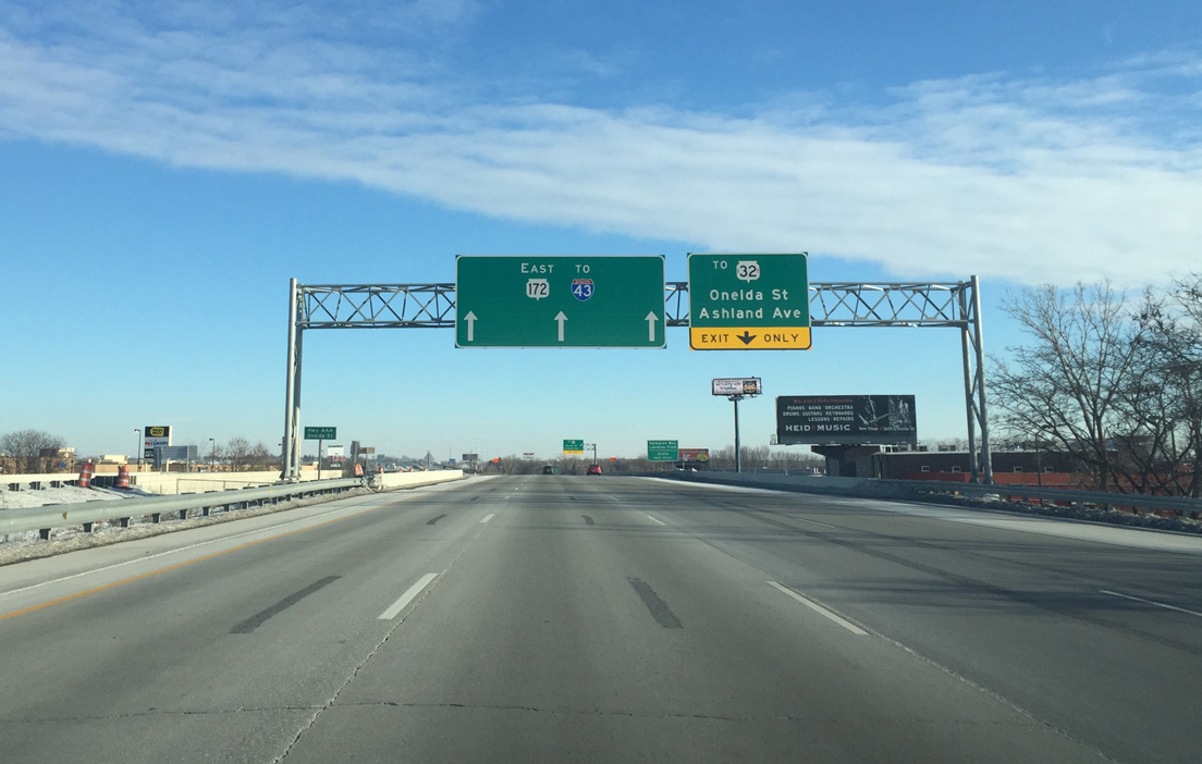
| Crossing over Oneida Street, Wis 172 leaves I-41 [U.S. 41] and approaches a folded diamond interchange with Van Der Perren Way and Pilgrim Way, local roads connecting the freeway with Wis 32 (Ashland Avenue). STH 32 was historically a part of U.S. 41 Business through Ashwaubenon. 01/20/16 |
|
| Van Der Perren Way leads motorists west from the Wis 172 off-ramp to Oneida Street north to Lambeau Field (home of the NFL Green Bay Packers) and the Resch Center, a concert and sports arena. Wis 32, the Red Arrow Highway, otherwise runs south to De Pere and north to Green Bay along Ashland Avenue parallel to the Fox River. 05/30/11 |
|
| Dutchman Creek winds between the ramps joining STH 172 and parallel Pilgrim Way and Van Der Perren Way by this reassurance assembly. 05/30/11 |
|
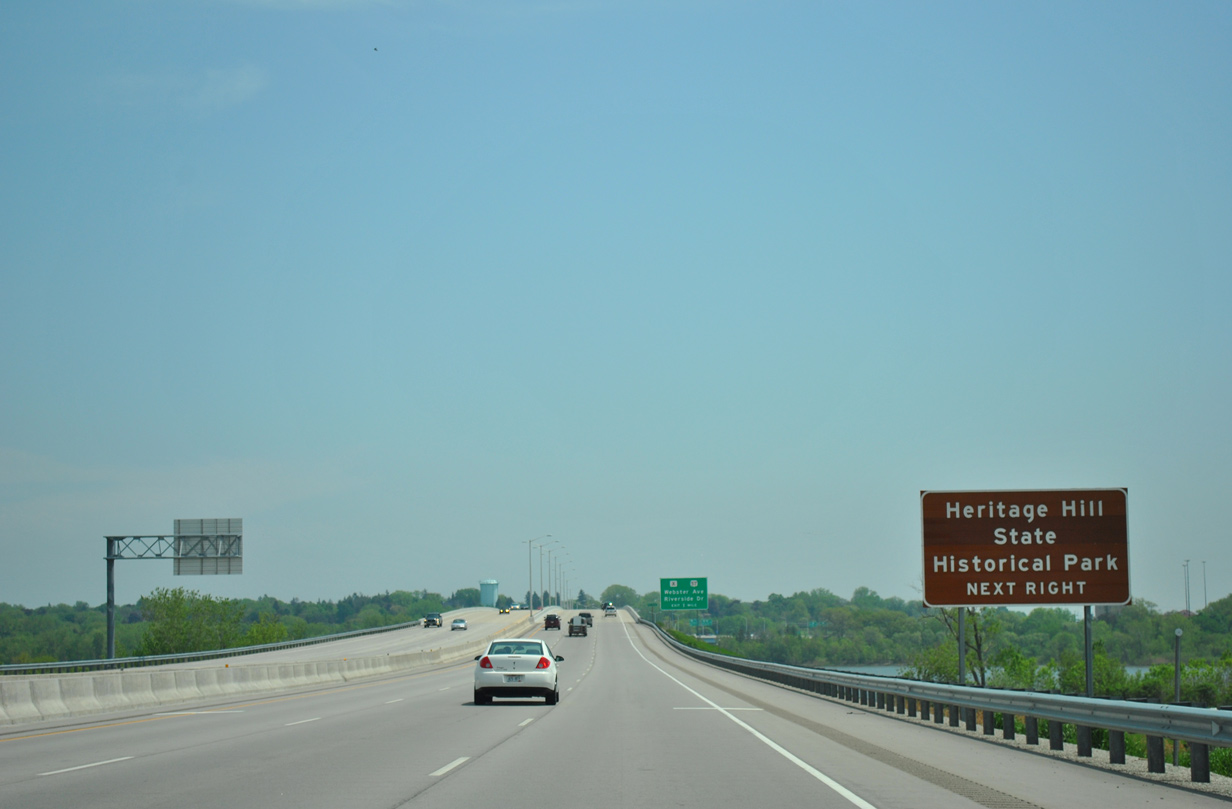
| The Fox River comes into view as STH 172 passes by an industrial area along the east side of STH 32 (Red Arrow Highway). Heritage Hill State Historical Park resides north of the freeway in the forthcoming village of Allouez. 05/30/11 |
|
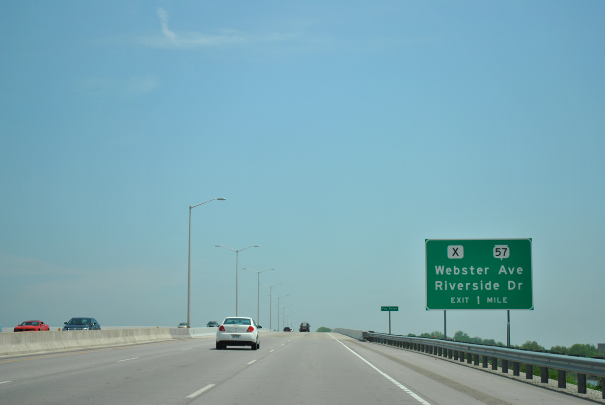
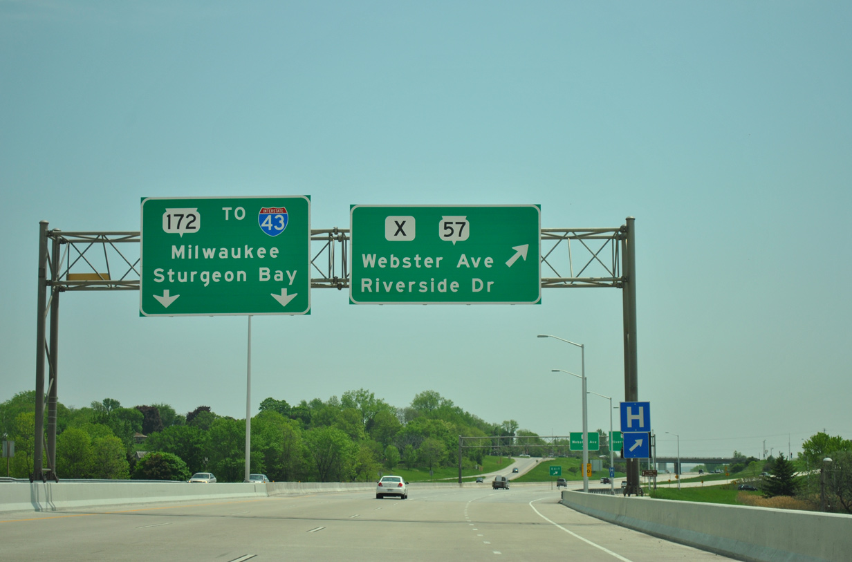
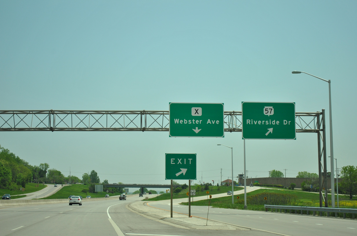
| Back to back interchanges join the Wis 172 freeway with STH 57 (Riverside Drive) and CTH X (Webster Avenue) at the east end of the Fox River bridge. 05/30/11 |
|
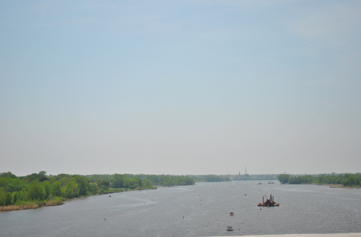
| Looking southward at the Fox River toward De Pere from the STH 172 freeway. The Lower Fox River flows north from Lake Winnebago into Green Bay. 05/30/11 |
|
| The six lane Fox River bridge and a 5.5 mile stretch of STH 172 was reconstructed as part of a $38 million project between September 2008 and September 2010. This included redecking of the span and replacement of bridges over Oneida Street.1 05/30/11 |
|
| Traffic to both STH 57 (Riverside Drive) and CTH X (Webster Avenue) departs in unison from the Wis 172 freeway into Allouez. STH 57 parallels the Fox River north to Monroe Avenue and Downtown Green Bay and south along Broadway through De Pere. 05/30/11 |
|
| Wis 57 runs nearly 192 miles from Milwaukee north to Sister Bay on the Door County peninsula. CTH X parallels STH 57 to the east along Webster Avenue between George Street (CTH G) and the Green Bay city line at Grignon Street. 05/30/11 |
|
| Continuing east, Wis 172 reduces to a four lane freeway ahead of the Libal Street underpass in Allouez. 05/30/11 |
|
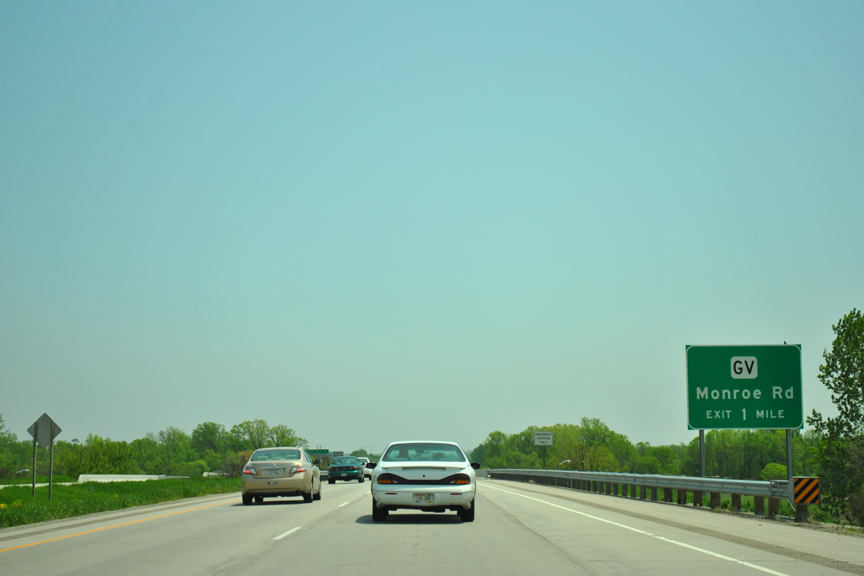
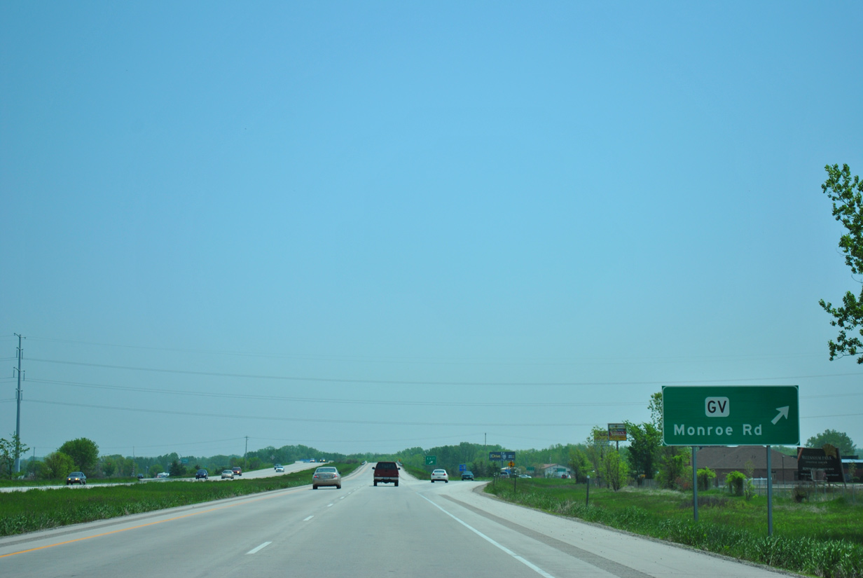
| A diamond interchange joins STH 172 with CTH GV (Monroe Road) in the city of Bellevue. 05/30/11 |
|
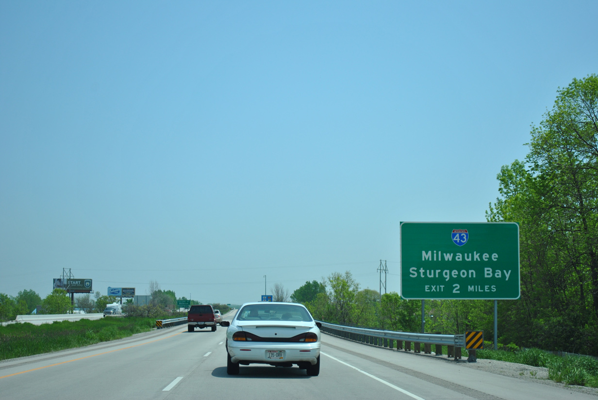
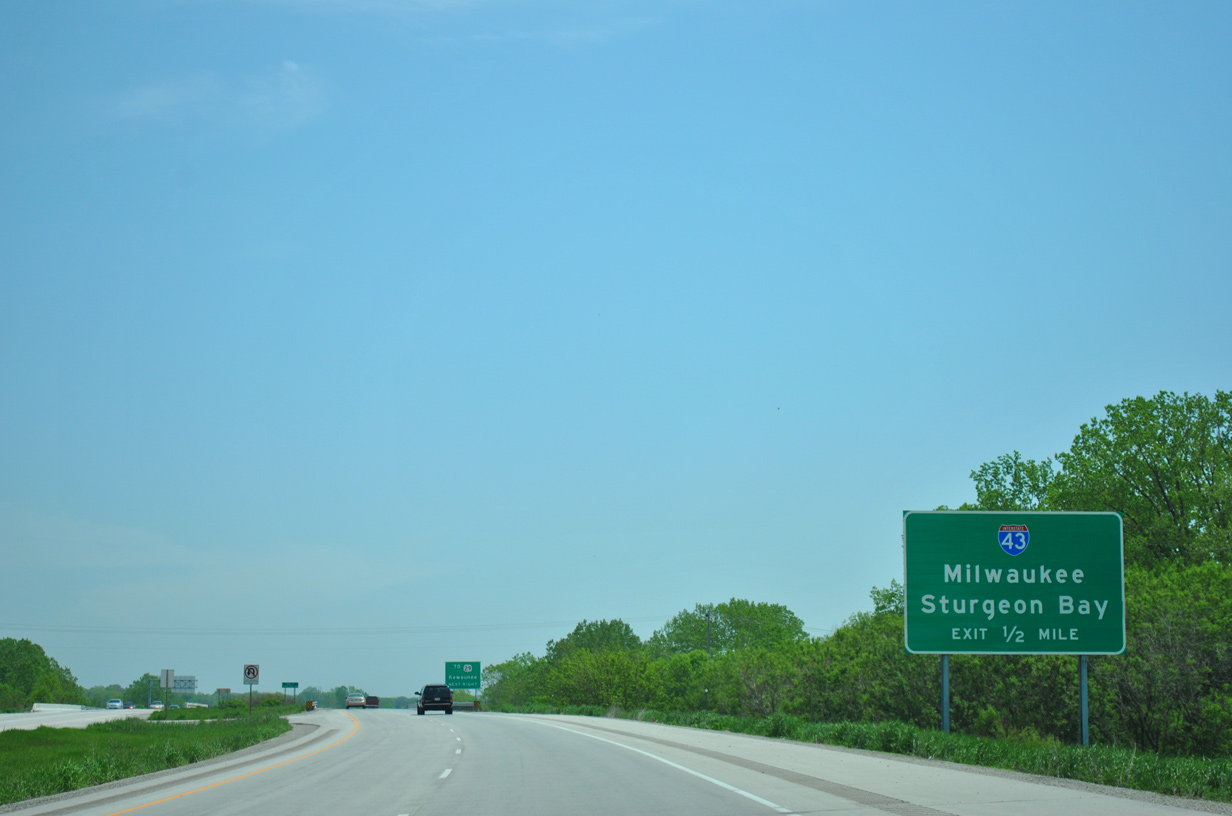
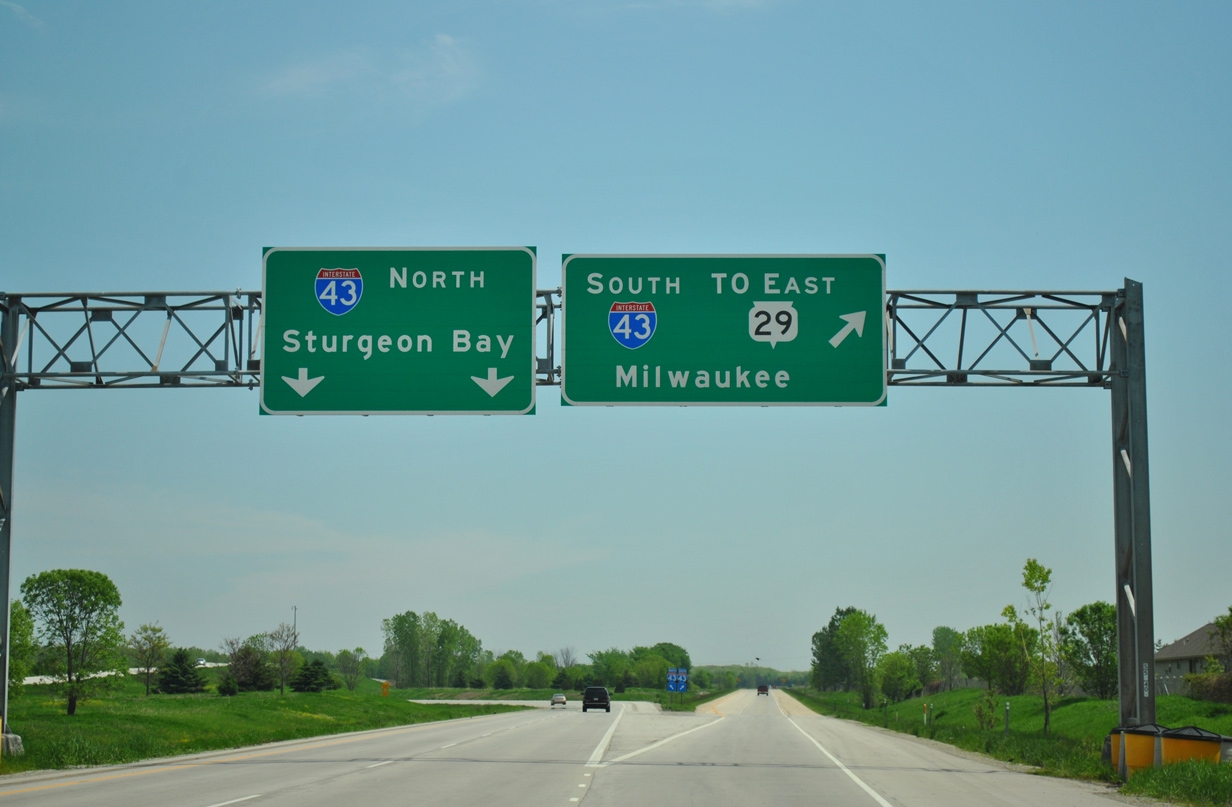
| Wis 172 ends at Interstate 43 in two miles. I-43 connects Green Bay with Milwaukee to the south while providing a local bypass to Sturgeon Bay for STH 57 north. 05/30/11 |
|
| Commercial development along CTH GV transitioned the previously rural junction at STH 172. As such, CTH GV was expanded into an arterial style road leading south to CTH G (Chicago Street) and north to Lime Kiln Road. Lime Kiln Road extends CTH GV north into Green Bay. 05/30/11 |
|
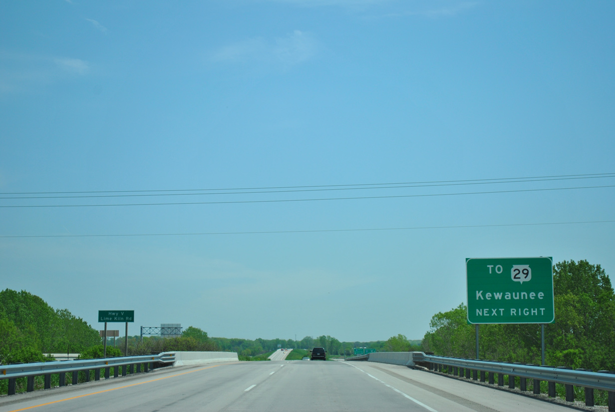
| The final eastbound reassurance marker for Wis 172 stands ahead of the CTH V (Lime Kiln Road) underpass. 05/30/11 |
|
| Traffic separates in one half mile for Interstate 43 at an expansive three wye interchange. 05/30/11 |
|
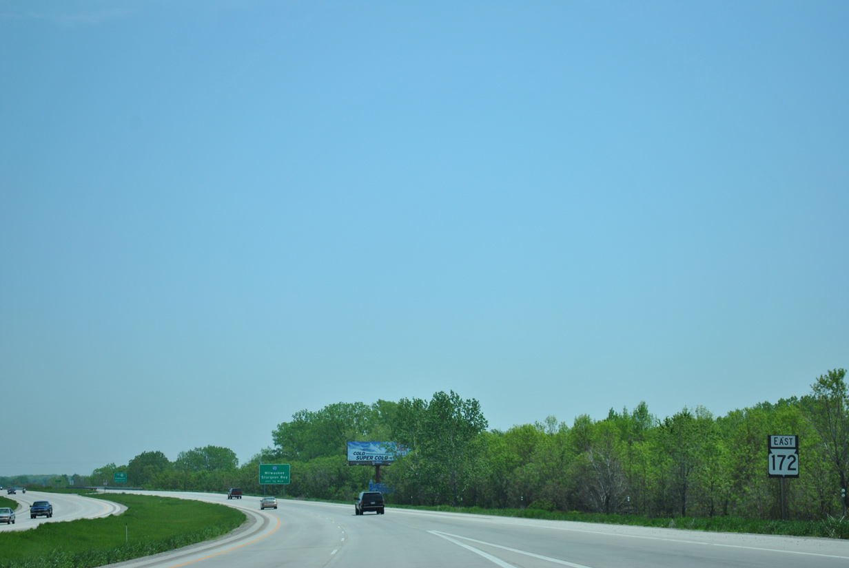
| The subsequent southbound exit along I-43 connects the freeway with U.S. 141 to STH 29. STH 29 leads east from Bellevue to Poland, Henryville and ultimately the Kewaunee County seat of Kewaunee. 05/30/11 |
|
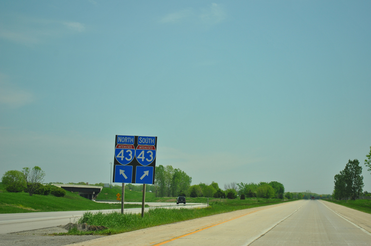
| STH 172 east defaults onto Interstate 43 north into Green Bay. I-43 connects with STH 57 north to the Door County seat of Sturgeon Bay in 5.5 miles. 05/30/11 |
|
| Interstate 43 ends at Interstate 41 [U.S. 41] in 11 miles. The freeway encircles Green Bay to the high level Leo Frigo Bridge across the Fox River. Southward I-43 travels a rural route 30 miles to Manitowoc. 05/30/11 |
Page Updated 01-21-2016.