|
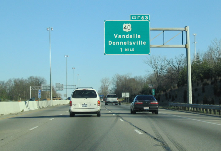
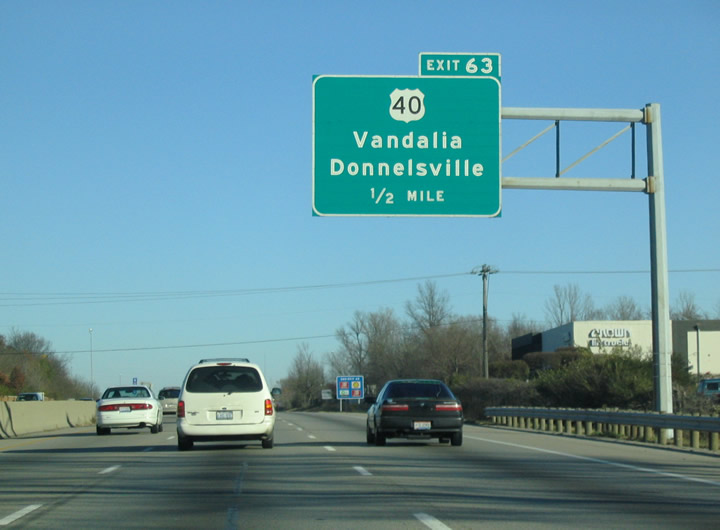
| Interstate 75 reenters the city of Vandalia north from I-70 and ahead of the diamond interchange (Exit 63) with U.S. 40 (National Road). 11/13/04 |
|
| U.S. 40 follows the National Road west Interstate 75, 2.5 miles to Dayton International Airport Access Road to DAY Airport and 5.2 miles to Englewood MetroPark. 11/13/04 |
|
| East from I-75, U.S. 40 turns south in 0.4 miles from National Road onto Browns School Road as part of a circuitous route across the Great Miami River at Taylorsville Dam and Taylorsville MetroPark. 11/13/04 |
|
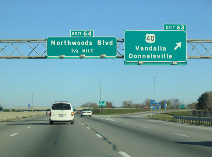
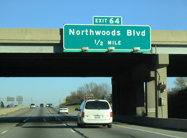
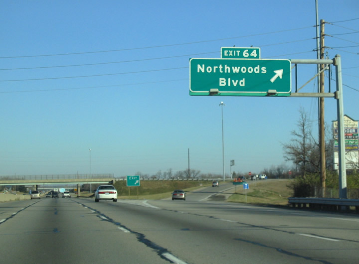
| Northwoods Boulevard stems a half east from N Dixie Drive (old U.S. 25) by DAY Airport to the diamond interchange at Exit 64. 11/13/04 |
|
| Northwoods Boulevard spurs east from Exit 64 to a business park. 11/13/04 |
|
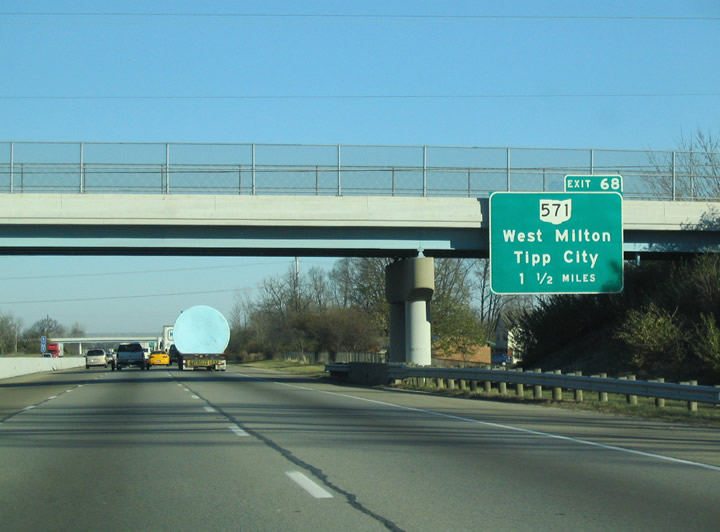
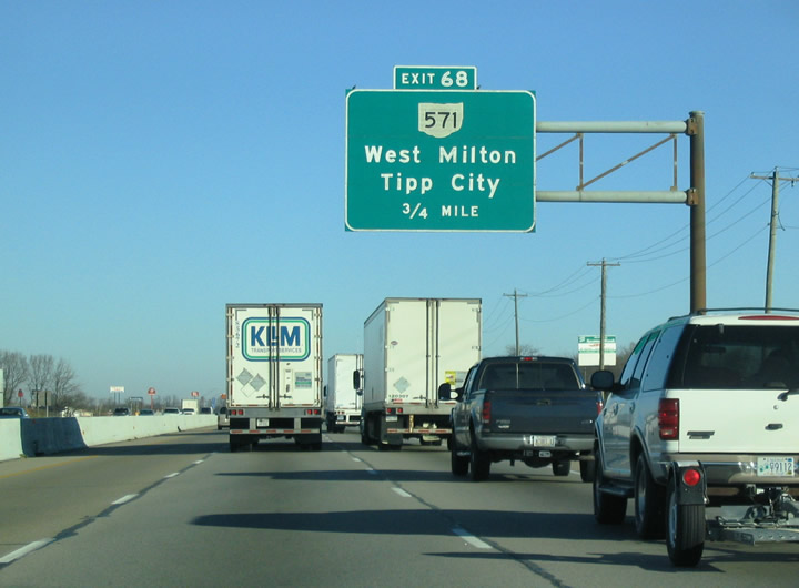
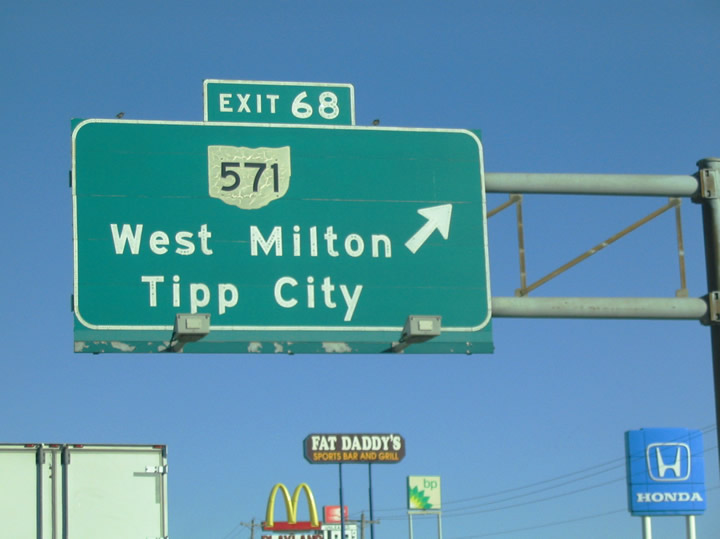
| Continuing north, Interstate 75 enters Miami County in Monroe Township. The succeeding exit is for SR 571 (W Main Street) in Tipp City. 11/13/04 |
|
| SR 571 leads west from Tipp City to the village of West Milton and east to the city of New Carlisle in Clark County. 11/13/04 |
|
| The diamond interchange with SR 571 (W Main Street) is within a mile of Downtown Tipp City to the west. Overall SR 571 measures 50.51 miles in length from Indiana State Road 28 in Union City to U.S. 40 southeast of New Carlisle.1 11/13/04 |
|
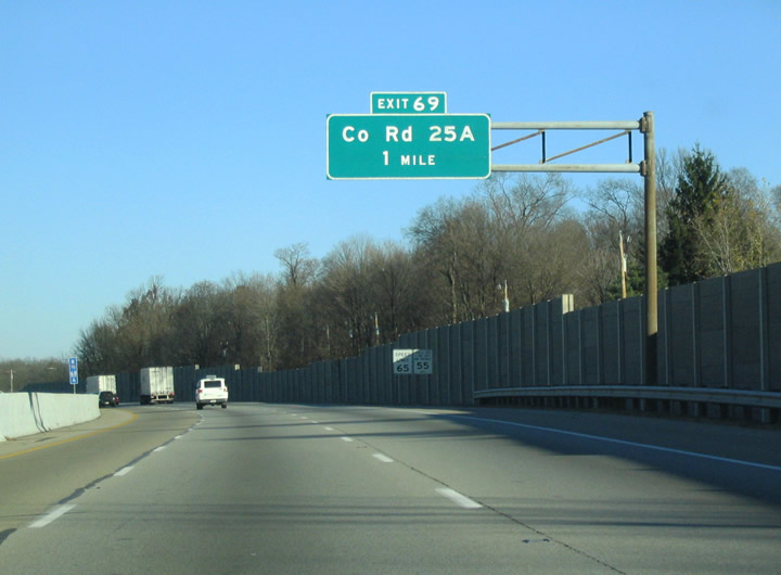
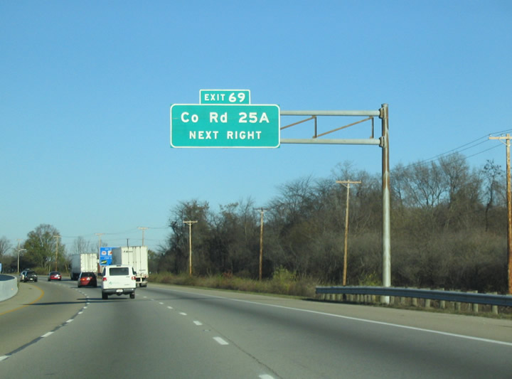
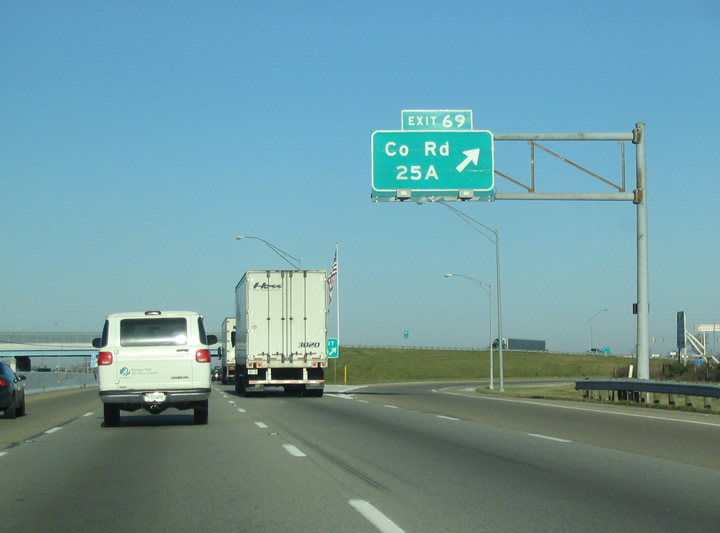
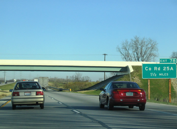
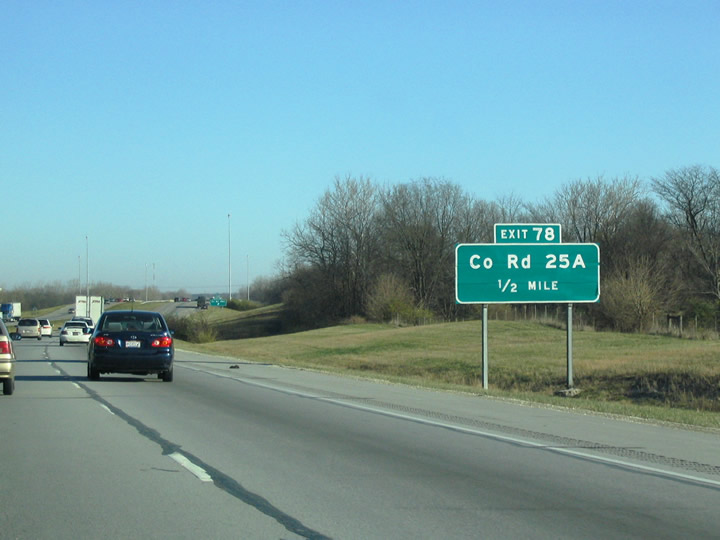
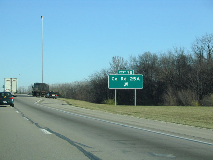
| County Road 25A, the historic alignment of U.S. 25, converges with Interstate 75 at Exit 69 at the north end of Tipp City. 11/13/04 |
|
| CR 25A north onto Market Street was formerly part of Business Loop I-75 to the city of Troy. The business route returned to I-75 at Exit 78. 11/13/04 |
|
| The parclo interchange at Exit 69 was converted to a diamond interchange by 2015. CR 25A heads north to a number of subdivisions in Miami and Concord Townships and south to the Meijer Distribution Center across west Tipp City. 11/13/04 |
|
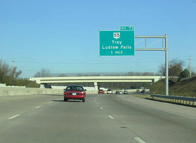
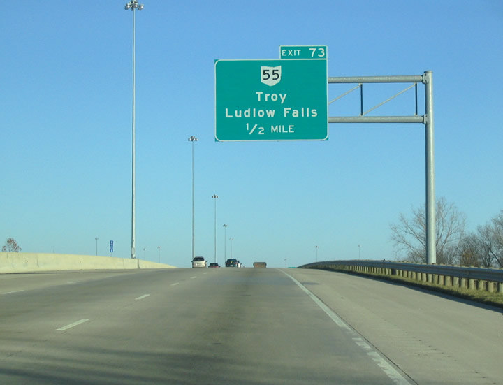
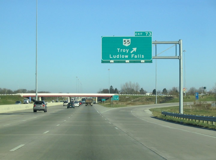
| SR 55 branches six miles east from SR 48 outside Ludlow Falls to the first of two exits along Interstate 75 in the city of Troy. 11/13/04 |
|
| SR 55 follows W Market Street east to old U.S. 25/Business Loop I-75 along S Market Street en route to Downtown Troy. Beyond Troy, SR 55 continues to Casstown and Christiansburg. 11/13/04 |
|
| The diamond interchange (Exit 73) with SR 55 (W Market Street) lies just south of SR 718 (Arthur Road) west to Pleasant Hill. 37.87 miles in length, SR 55 runs west to SR 571 near Laura and east to U.S. 68 in Urbana.2 11/13/04 |
|
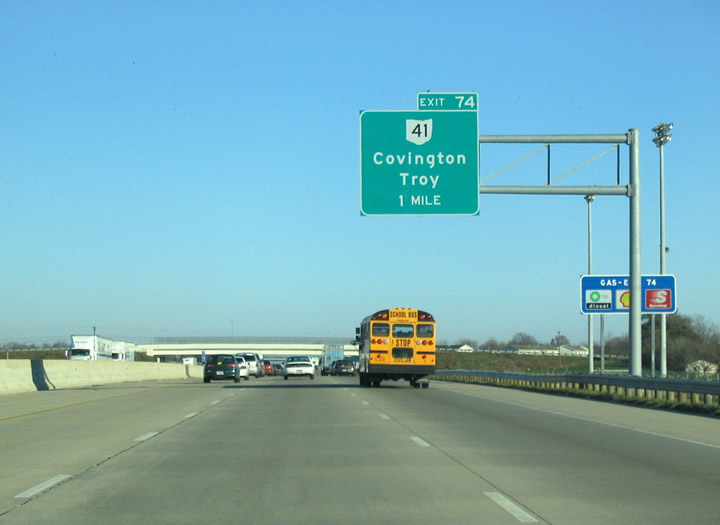
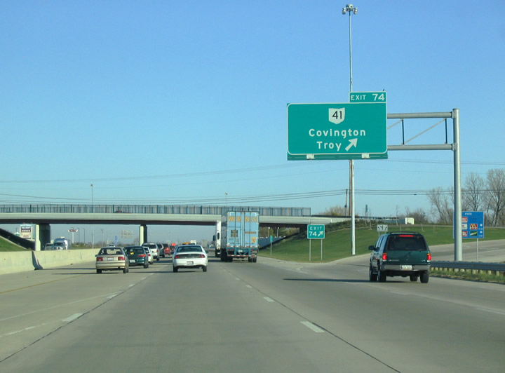
| McKaig Avenue (CR 133) spans Interstate 75 one mile south of the diamond interchange (Exit 74) with SR 41 (W Main Street). 11/13/04 |
|
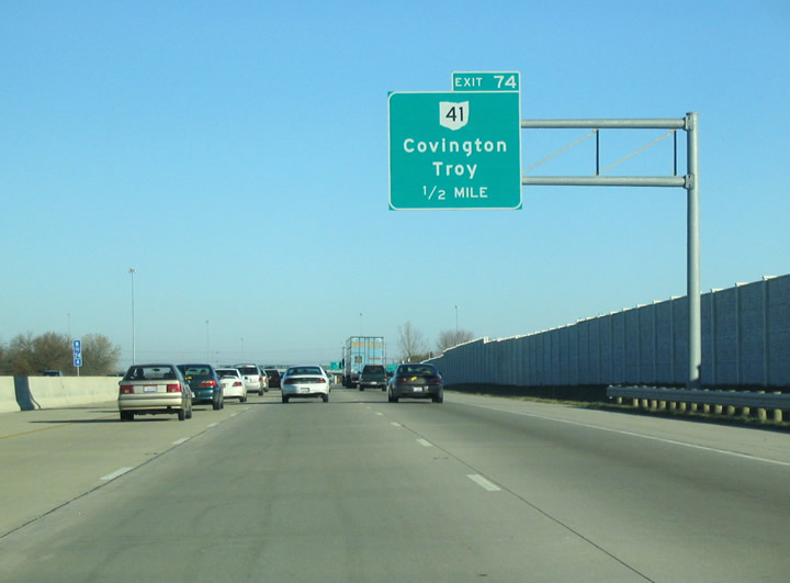
| A subdivision line the east side of I-75 ahead of the exchange (Exit 74) with SR 41 (W Main Street). SR 41 angles 7.8 miles northwest to SR 48 (High Street) in the village of Covington. 11/13/04 |
|
| 1.8 miles southeast from Exit 74, SR 41 enters the traffic circle with SR 55 (Market Street) beyond the Miami County Courthouse in Downtown Troy. A loop ramp joining I-75 south with SR 41 south was eliminated at Exit 74. 11/13/04 |
|
| Interstate 75 narrows from six to four lanes a mile north of SR 41 in Troy. 11/13/04 |
|
| County Road 25A (old U.S. 25) extends north from Elm Street in Troy to Eldean and Interstate 75 at Exit 78. 11/13/04 |
|
| CR 25A parallels the Great Miami River north from Troy into the city of Piqua. 11/13/04 |
|
| A folded diamond interchange joins I-75 with CR 25A (old U.S. 25) adjacent to the Great Miami River at Farrington in Washington Township. 11/13/04 |
|
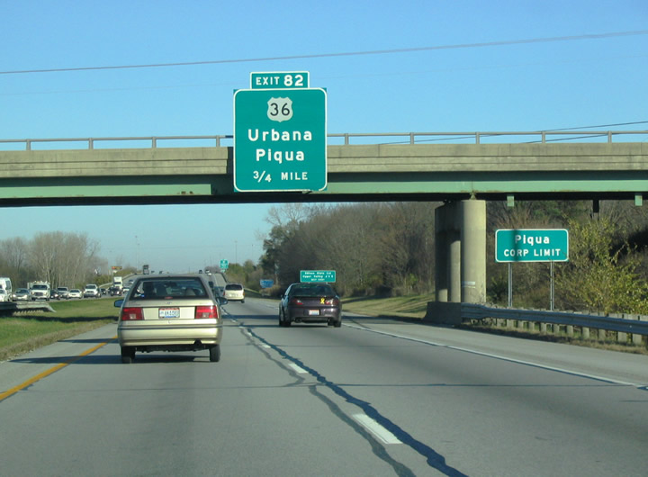
| Rest areas line both roadways of Interstate 75 south fo the Statler Road overpass and Piqua city line in Springcreek Township. The succeeding exit is the diamond interchange with U.S. 36 (Ash Street) by Miami Valley Centre Mall. 11/13/04 |
|
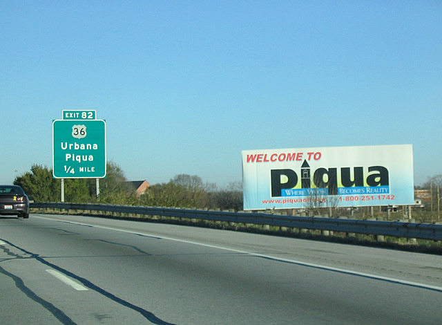
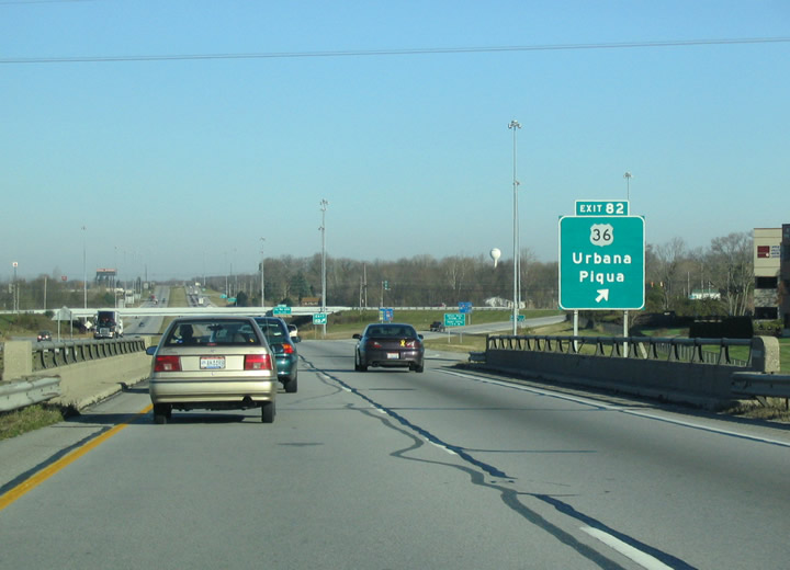
| Ash Street takes U.S. 36 west across the Great Miami River to Spring Street and Downtown Piqua. U.S. 36 travels 25 miles east from Exit 82 to U.S. 68 in the Champaign County seat of Urbana. 11/13/04 |
|
| Interstate 75 crosses Garby Road ahead of Exit 82. U.S. 36 runs 5.6 miles east to the village of Fletcher and west from Piqua to Covington and Greenville. 11/13/04 |
|
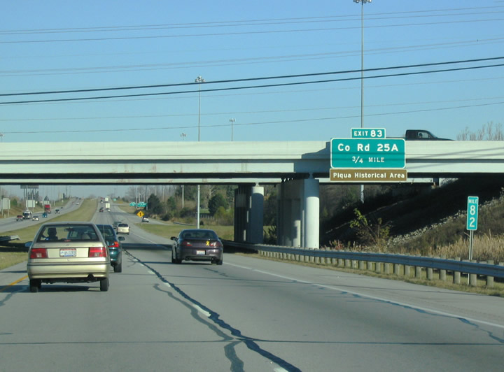
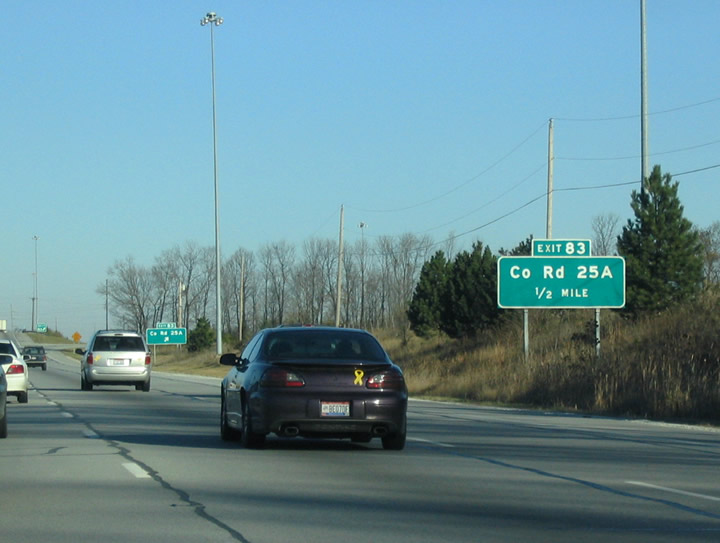
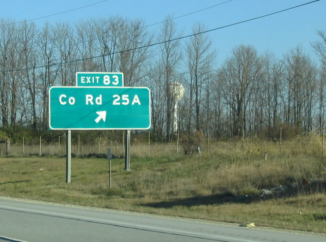
| N Main Street becomes County Road 25A across the Great Miami River. The former alignment of U.S. 25 meets I-75 at a split wye and half diamond interchange (Exit 83) adjacent to a CSX Railroad line. 11/13/04 |
|
| CR 25A south from Exit 83 to Main Street and SR 66 (Riverside Drive) were formerly part of Business Loop I-75 through Piqua. 11/13/04 |
|
| Old U.S. 25 shifts east of Interstate 75 to Miami Shelby Road before turning north to Sidney. 11/13/04 |
Page Updated 11-09-2007.