
Interstate 480 constitutes a 43.07 mile long suburban loop north from I-80/Ohio Turnpike to Cleveland. The Outerbelt South Freeway branches northeast from I-80 at the city of North Ridgeville, overtaking SR 10 along an expressway that originates at U.S. 20 south of Elyria. Entering Cuyahoga County, I-480 runs through the cities of North Olmsted and Fairview Park into southwest Cleveland by Cleveland Hopkins International Airport (CLE).
Heading east from the Riverside neighborhood in Cleveland, I-480 straddles the city line between the Puritas-Longmead community and the city of Brook Park. The Berea Freeway and Interstate 71 tie into the Outerbelt South Freeway along this stretch. I-480 shifts northward across the city of Brooklyn and reenters Cleveland at the Old Brooklyn Neighborhood, north of Parma.
Continuing east from SR 176 (Jennings Freeway), I-480 passes through the village of Brooklyn Heights to a four level interchange with Interstate 77 in Independence. A high viaduct leads I-480 east across both the Cuyahoga River and Ohio Canal into the cit of Garfield Heights. The Outer Belt South Freeway again shifts northward, switching sides with parallel SR 17 (Granger Road) between Maple Heights and the Lee-Miles neighborhood in Cleveland.
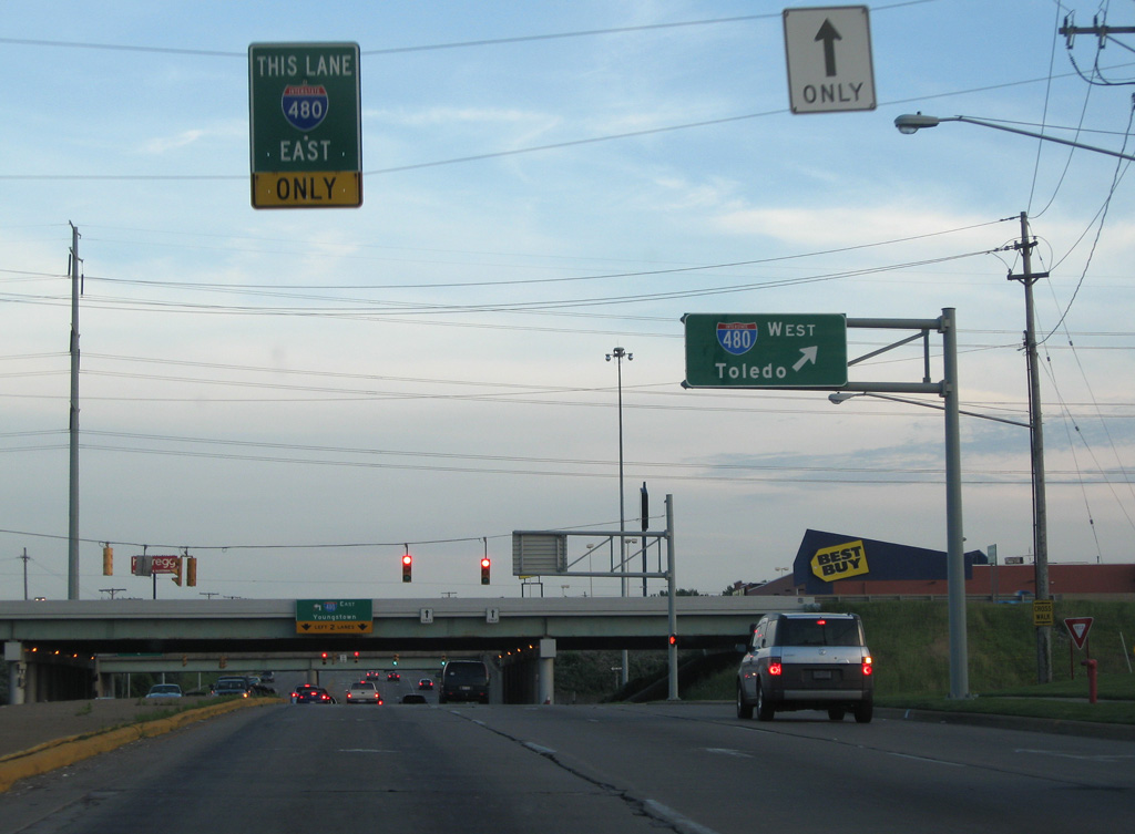
A northern branch of Interstate 480 (I-480N) splits with I-480 between Warrensville Heights and Bedford Heights. I-480N is a 2.44 mile long connector joining with I-271 north to Beachwood and Pepper Pike and the freeway along U.S. 422 east to Solon and Auburn Corners in Geauga County.
Interstate 480 turns south from I-480N through Bedford Heights, combining with I-271 for 3.37 miles to Bedford and Oakwood. SR 14 also joins I-271/480 south from Broadway Avenue. The I-271/480 concurrency is one of two instances in the Interstate System were branch routes overlap. The other is I-785/840 at Greensboro, North Carolina.
Beyond the separation with I-271, I-480/SR 14 angle southeast through Macedonia and Twinsburg in Summit County. Crossing into Portage County, I-480 concludes at the Ohio Turnpike while SR 14 transitions into a commercial arterial into the city of Streetsboro.
Interstate 480 Ohio Guides
 | SR 83C links the freeway along SR 10 with Chestnut Ridge Road and SR 83 via Butternut Ridge Road. SR 10 heads northeast to I-480 in North Ridgeville. 05/25/02 |
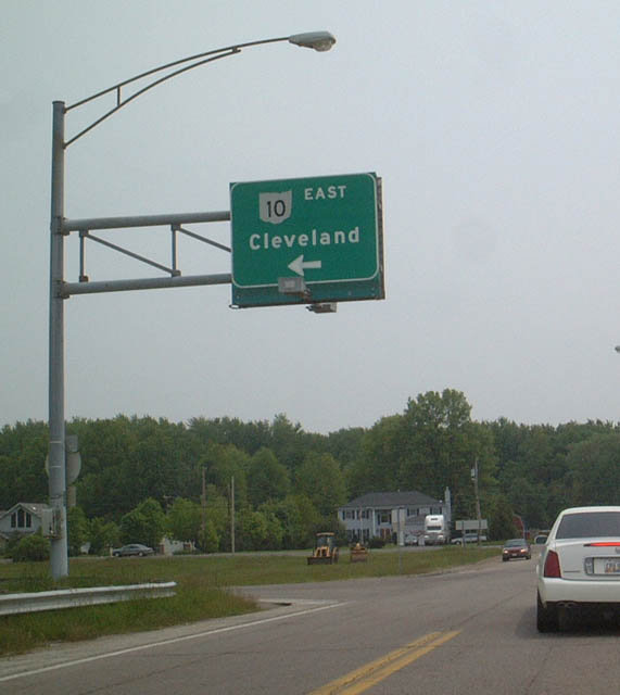
 | SR 10 continues 2.96 miles northeast from SR 83C in southern North Ridgeville to Interstate 480. 05/25/02 |
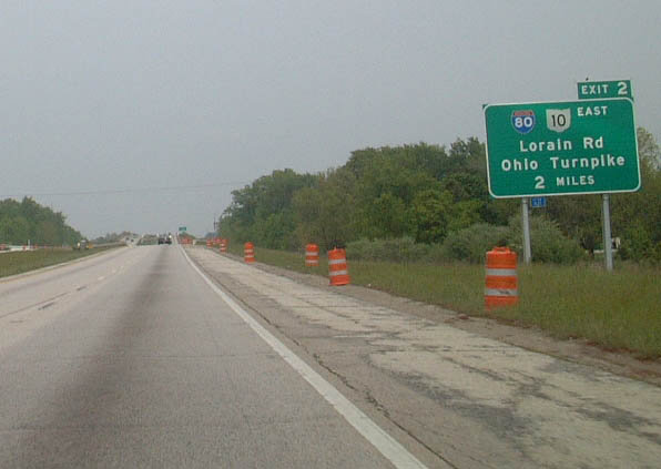 | SR 10 crosses over the Ohio Turnpike before converging with Interstate 480 at a wye interchange. A parclo interchange (Exit 2) follows for SR 10C (Lorain Road) west to I-80. 05/25/02 |
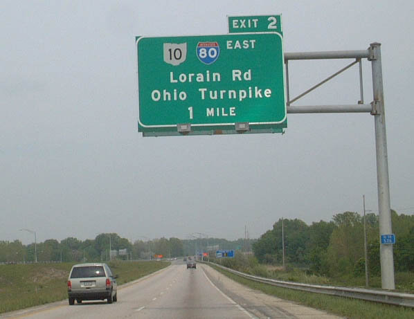 | SR 10 overlaps with I-480 east for 0.76 miles to Lorain Road at Exit 2. SR 10C lines Lorain Road southwest 0.76 miles to the exchange with the Ohio Turnpike. 05/25/02 |
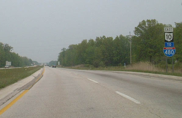
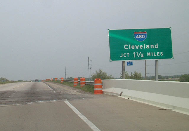 | Interstate 480 branches 1.33 miles east from a wye interchange along I-80 (Ohio Turnpike) to combine with SR 10. 05/25/02 |
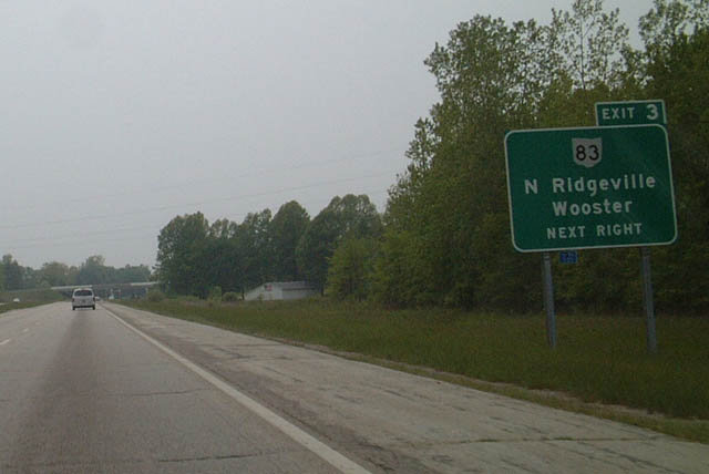 | SR 10 extends southwest along a freeway from I-480 to a diamond interchange with SR 83C. Continuing the sequence from I-480, this exchange was formerly signed as Exit 3. 05/25/02 |
 scenes scenes |
 | Ridge Road heads south from the city of Brooklyn to meet Interstate 480 along the Cleveland city line. 06/14/10 |
 | I-480 heads west from Ridge Road through Brooklyn to reenter the city of Cleveland at the Puritas-Longmead neighborhood. 06/14/10 |
 | I-480 (Outerbelt South Freeway) parallels the Parma city line east from Ridge Road to SR 176 (Jennings Freeway). 06/14/10 |
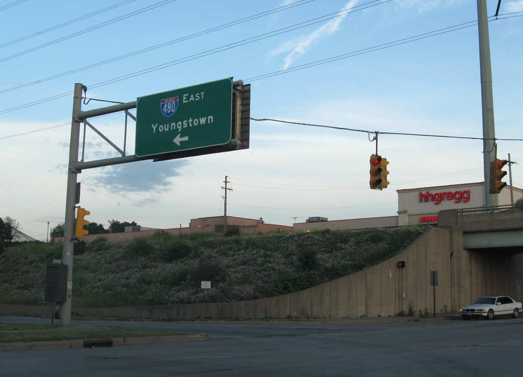
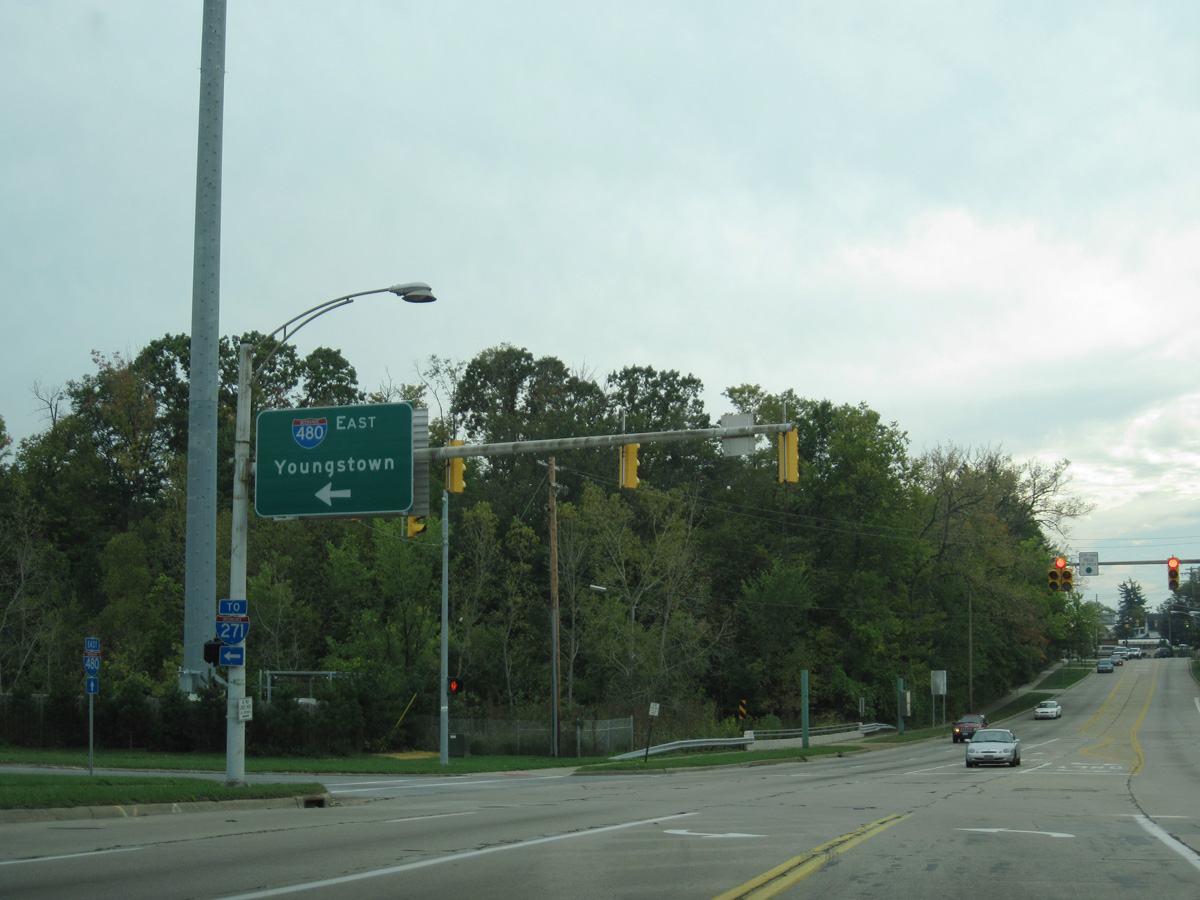 | Lee Road meets I-480 (Outerbelt South Freeway) south from the Lee-Miles neighborhood in Cleveland at the Maple Heights city line. 09/30/10 |
Photo Credits:
05/25/02, 06/14/10, 09/30/10 by AARoads
Connect with:
Interstate 80
Interstate 71
Interstate 77
Interstate 271
Page Updated 08-02-2021.