|
| The Outer Loop freeway continues east along Interstate 590 through the directional T interchange with I-390 south. 05/10/05 |
|
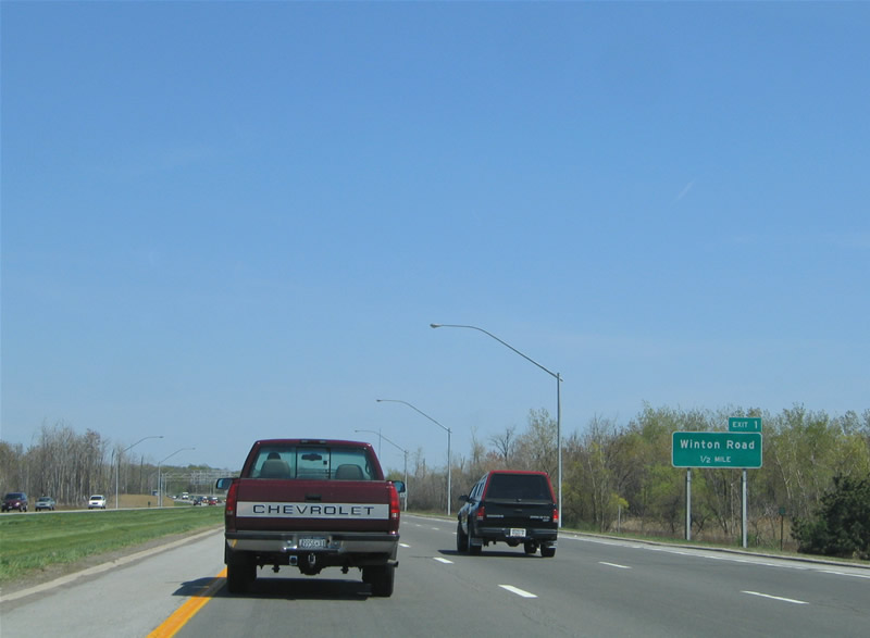
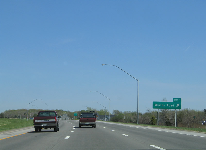
| Winton Road meets Interstate 590 at a diverging diamond interchange (Exit 1) in a half mile. Construction from March 2011 to Summer 2012 converted the diamond interchange with Winton Road into a DDI.1 05/10/05 |
|
| The first northbound Interstate 590 confirming marker. 05/10/05 |
|
| Winton Road heads south from I-590 at Brighton into the town of Henrietta. Northward, Winton Road continues into east Rochester and NY 404 (Empire Boulevard) near Irondequoit Bay. 05/10/05 |
|
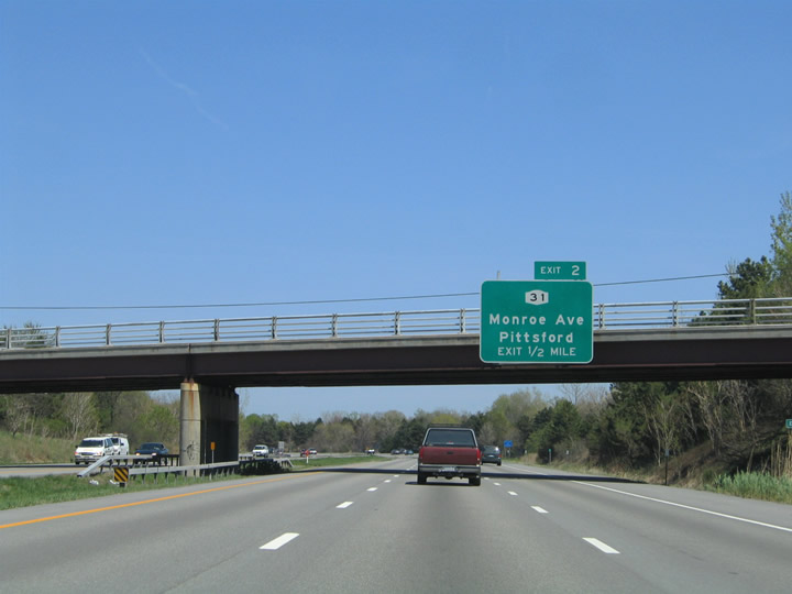
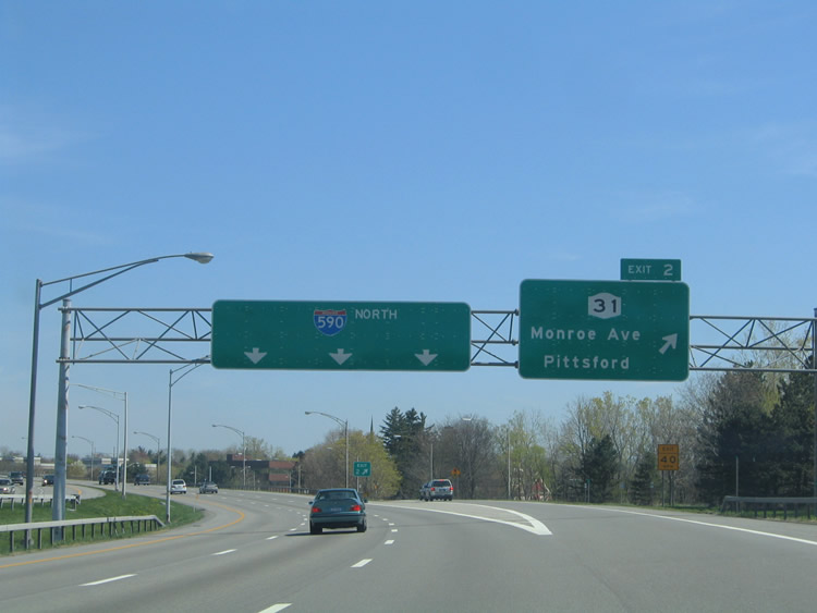
| Interstate 590 curves northward to a six-ramp parclo interchange (Exit 2) with NY 31 (Monroe Avenue). 05/10/05 |
|
| NY 31 constitutes a lengthy highway from Buffalo east to Syracuse. Locally the state route follows Monroe Avenue from Downtown Rochester to the village of Pittsford. 05/10/05 |
|
| I-590 kinks northwest at the Allen Creek Road under crossing at Exit 2. Sound walls accompany the freeway northward to the Can of Worms interchange. 05/10/05 |
|
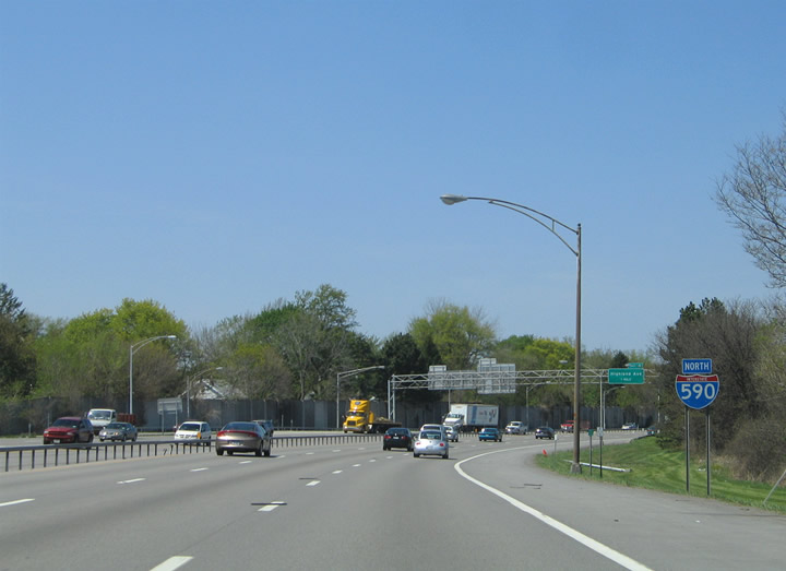
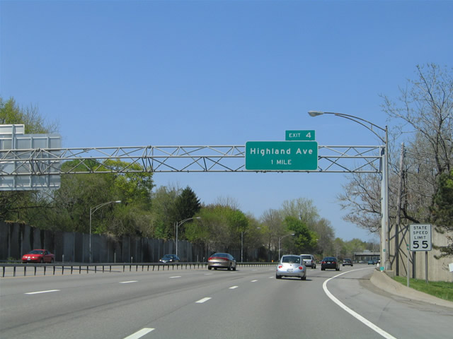
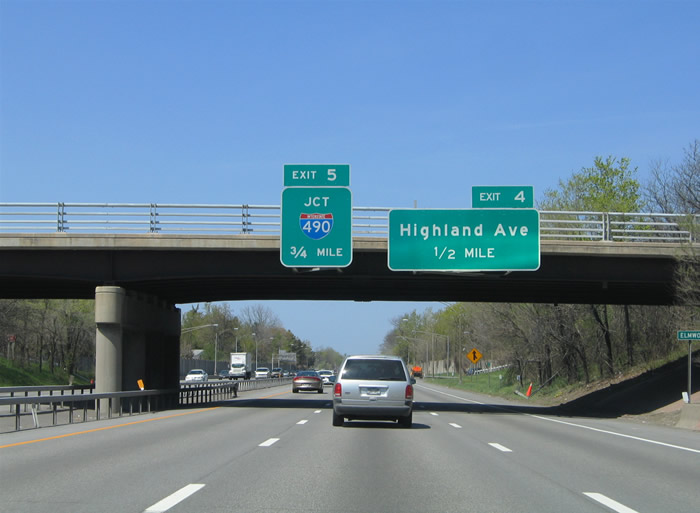
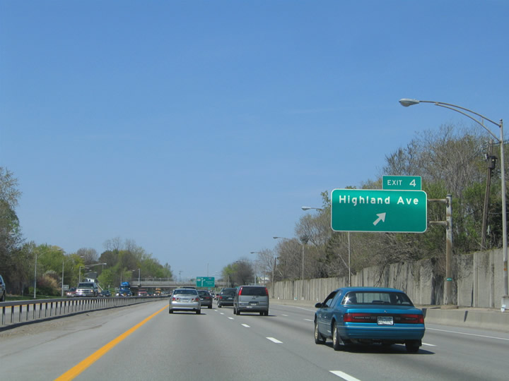
| Interstate 590 proceeds north through residential areas of Brighton one mile to a half diamond interchange (Exit 4) with Highland Avenue. 05/10/05 |
|
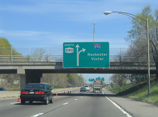
| A half diamond interchange (Exit 3 from I-590 south) joins Elmwood Avenue with the freeway north a half mile from Highland Avenue. Exit 5 to Interstate 490 follows. 05/10/05 |
|
| Highland Avenue leads west from Exit 4 to Cobbs Hill Park in Rochester and east to NY 65 (Clover Street) adjacent to NY 96 (East Avenue). NY 96 runs through the Can of Worms Interchange, but without access to I-590/NY 590. 05/10/05 |
|
| A two lane flyover separates from Interstate 590 north for both directions of I-490. 05/10/05 |
|
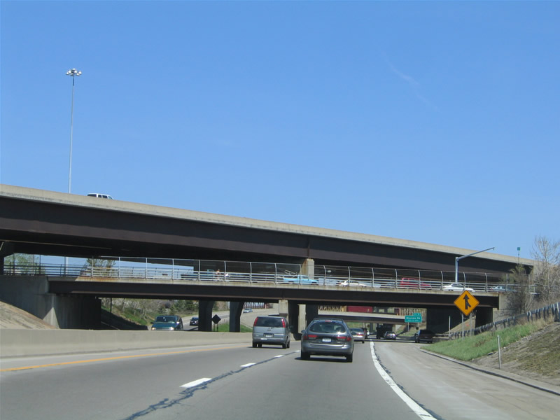
| The Can of Worms Interchange consists of two overlapping directional T interchanges. Transitioning to NY 590 north, I-590 travels at grade level through the exchange. 05/10/05 |
|
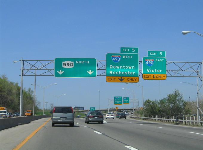
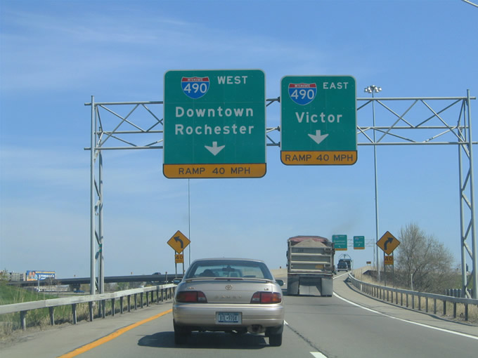
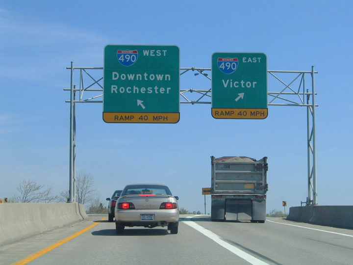
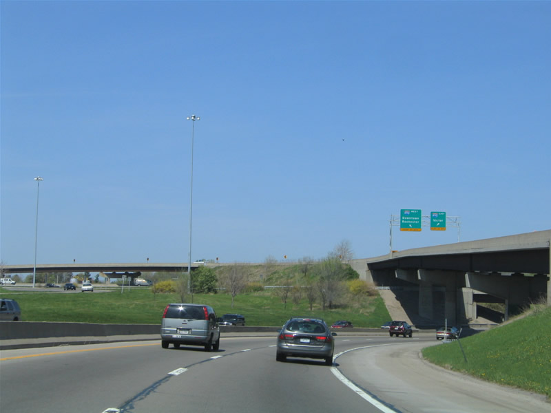
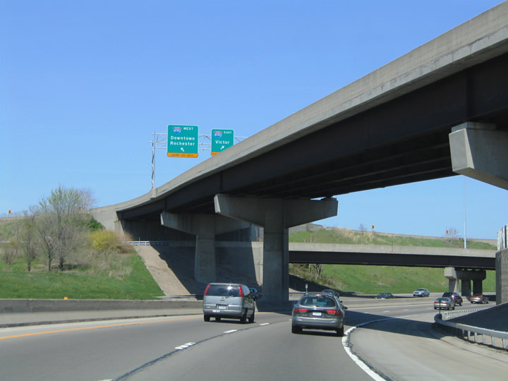
| Exit 5 partitions into ramps for I-490 west to Downtown Rochester and I-490 east to East Rochester, Victor and the New York Thruway east to Syracuse. 05/10/05 |
|
| Interstate 490 reaches Downtown Rochester three miles to the west. Victor lies 13 miles to the southeast. 05/10/05 |
|
| NY 590 extends north along the east side of Rochester toward Irondequoit Bay and Sea Breeze. 05/10/05 |
|
| NY 590 extends north from the Can of Worms interchange to NY 104 east (Exit 11) to Webster. 05/10/05 |
|
| Heading out of the Can of Worms Interchange, NY 590 (Sea Breeze Expressway) meets Blossom Road in a half mile. 05/10/05 |
|
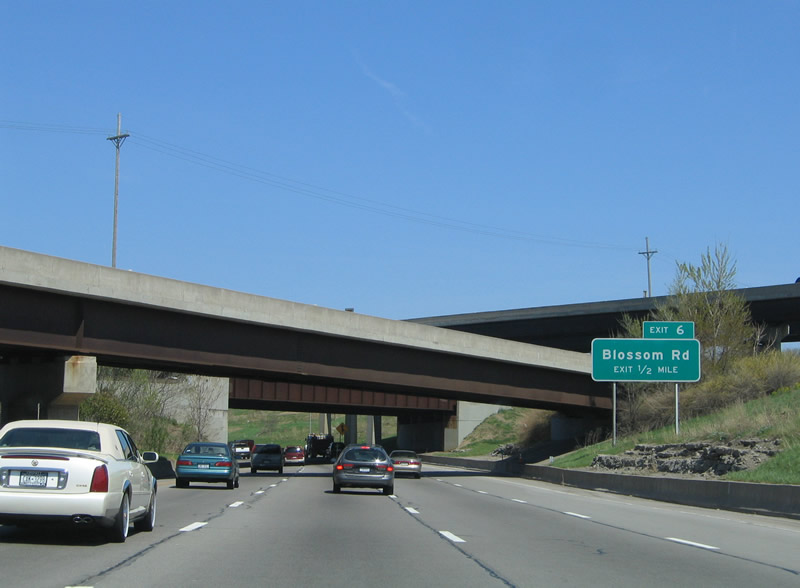
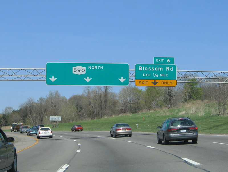
| A lane drop occurs along NY 590 northbound for the off-ramp (Exit 6) to Blossom Road. Blossom Road heads west to University Avenue in Rochester and east to Ellison Park and NY 286. 05/10/05 |
|
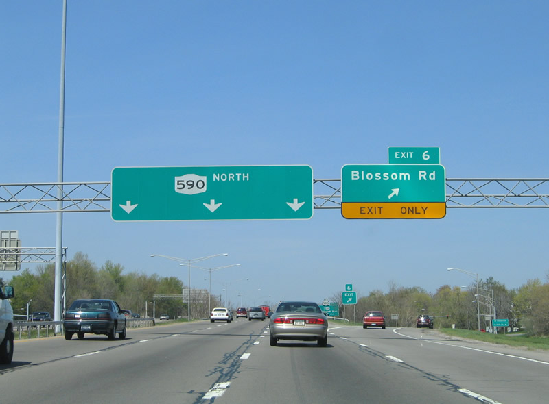
| Entering the diamond interchange (Exit 6) with Blossom Road on NY 590 (Sea Breeze Expressway) northbound. 05/10/05 |
|
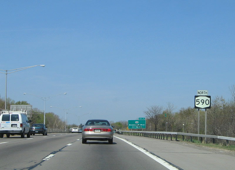
| NY 590 reassurance shield posted by the Blossom Road underpass. 05/10/05 |
|
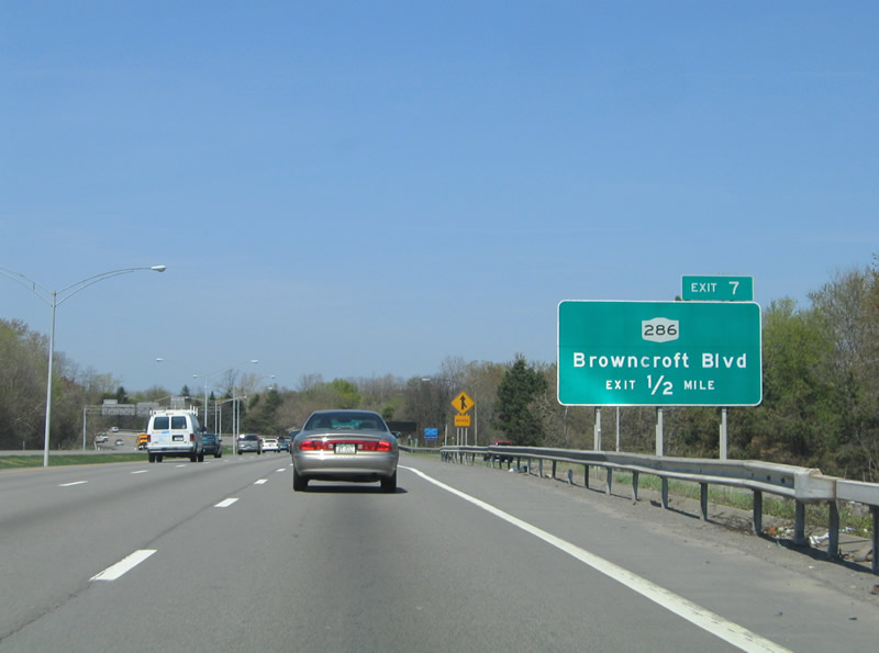
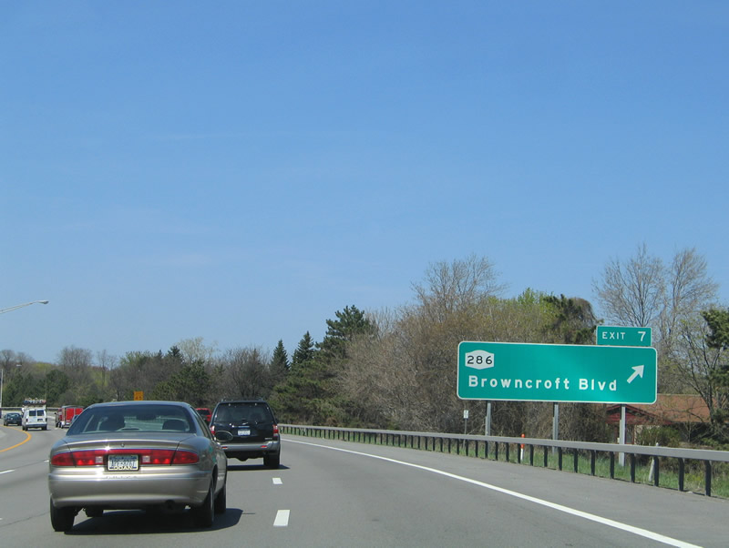
| NY 286 follows Browncroft Boulevard east from NY 590 (Seabreeze Expressway) to Atlantic Avenue in Monroe County. The state route runs 13.06 miles to NY 350 in Walworth. 05/10/05 |
|
| Browncroft Boulevard becomes Atlantic Avenue west of Winton and the Browncroft neighborhood in east Rochester. 05/10/05 |
|
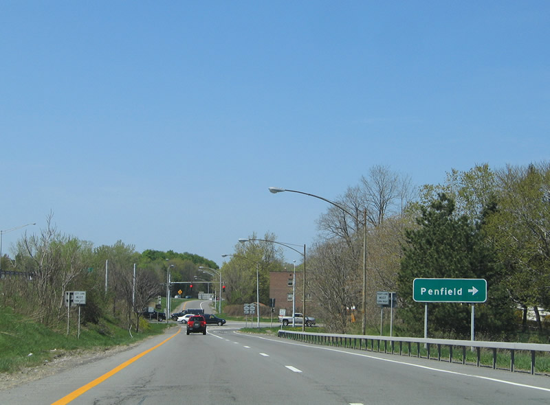
| NY 286 joins the city of Rochester with the town of Penfield east of Ellison Park. 05/10/05 |
|
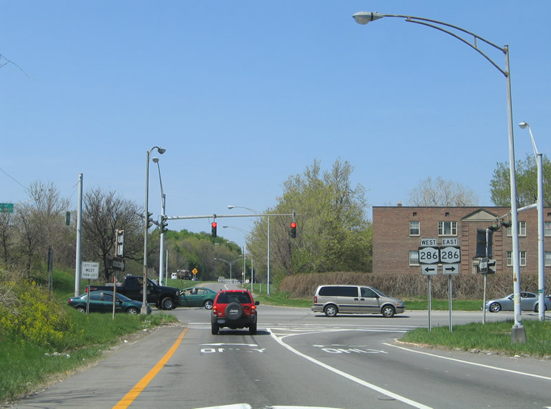
| NY 286 concludes at the west side of the parclo interchange with NY 590. 05/10/05 |
Page Updated 03-11-2020.

 North
North