|
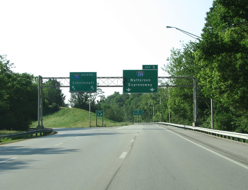
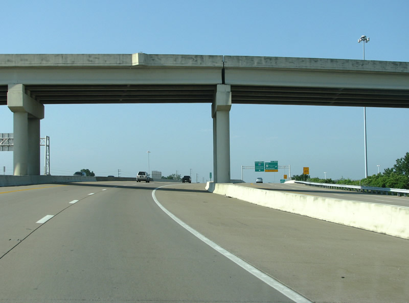
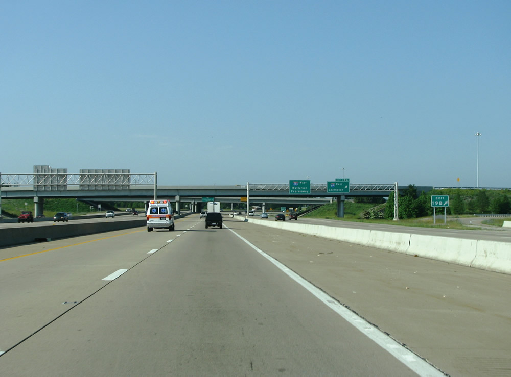
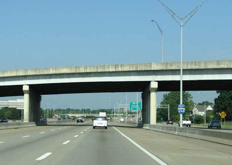
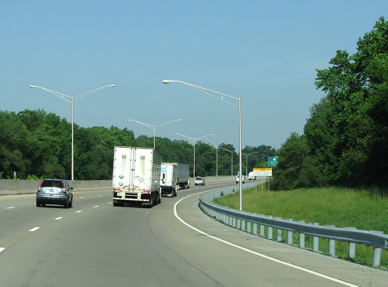
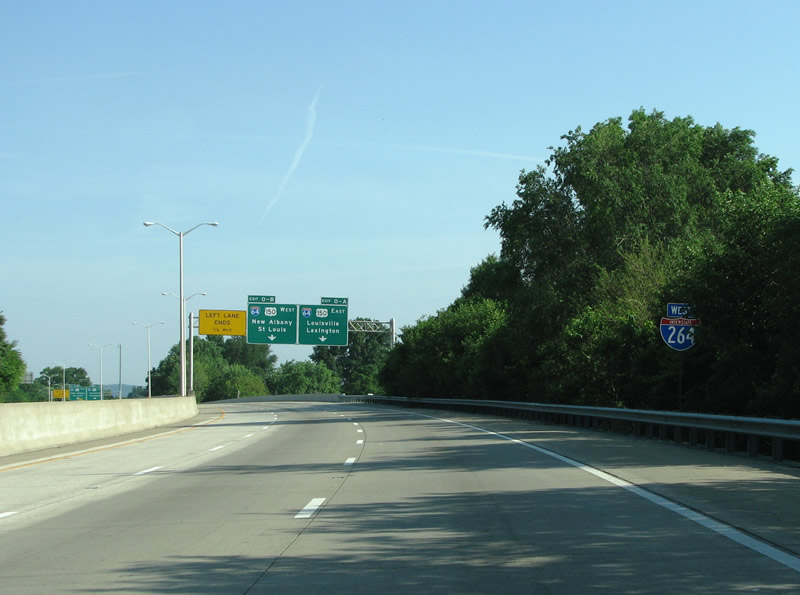
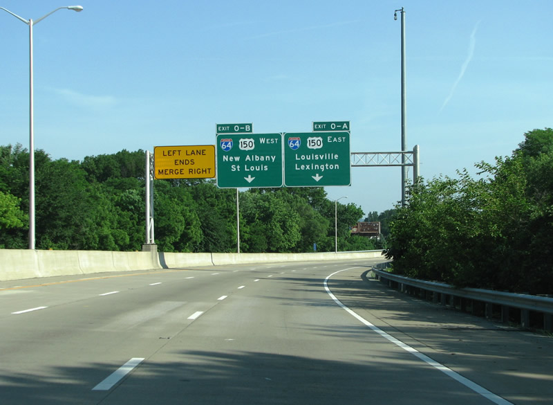
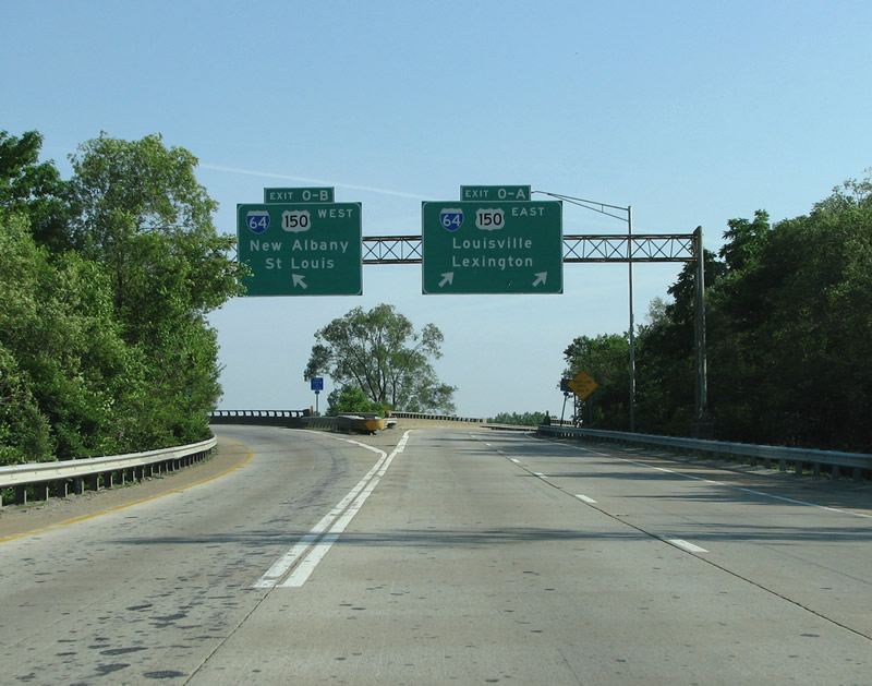
| I-71 eastbound at the eastern beginning of I-264. This view looks towards the south and east. 06/05/08 |
|
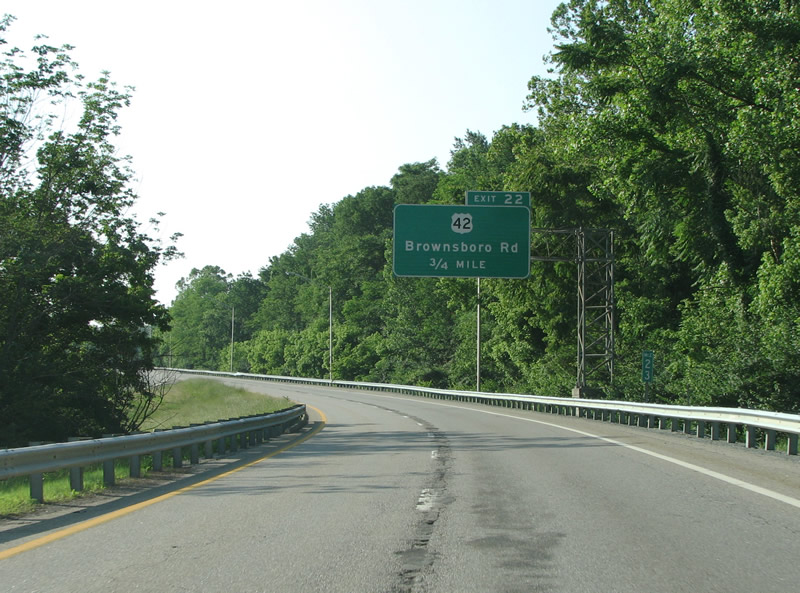
| The first exit along the Watterson Expressway is at US 42, Brownsboro Road. The US route runs from Louisville to Cleveland, and is closely shadowed by I-71 for its entire length. Through Louisville, US 42 only has one freeway junction, and is a two lane road. Although burdened with traffic, widening efforts along the route normally meet opposition from the wealthy landowners that live along it. This stretch of road opened in 1968, and was the final leg of the Watterson Expressway to be completed (although not the final portion of I-264 to be completed). 06/05/08 |
|
| Immediately to the west of this exit sits the Zachary Taylor Memorial Cemetery. The remains of the 19th century President and his wife rest there. KY 22 ends just to the east of here, and all around are large houses surrounded by deep forests and gardens. 06/05/08 |
|
| Through here, there are few views of the buildings beyond. I-264 runs over Westport Road here, which is slated to get a new interchange in the next few years. Westport goes east and meets I-265. 06/05/08 |
|
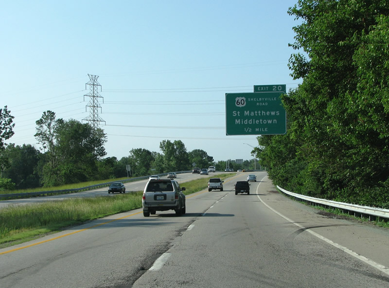
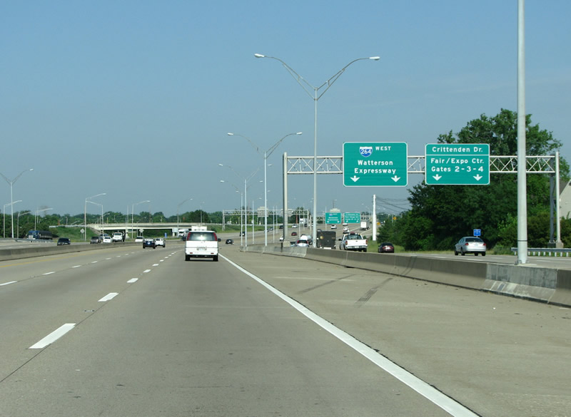
| The next exit is the new single point urban interchange with Kentuckky 1447 (Westport Road), built between fall of 2008 and April 2010. Following that is US 60, the most important east/west US highway in town. The Watterson Expressway has a unique name (instead of "freeway," like most of the others) because it was first built in the 1940s, before the term Freeway came into general use. The name has stuck to this day, so it is never referred to as the "Watterson Freeway." 06/05/08 |
|
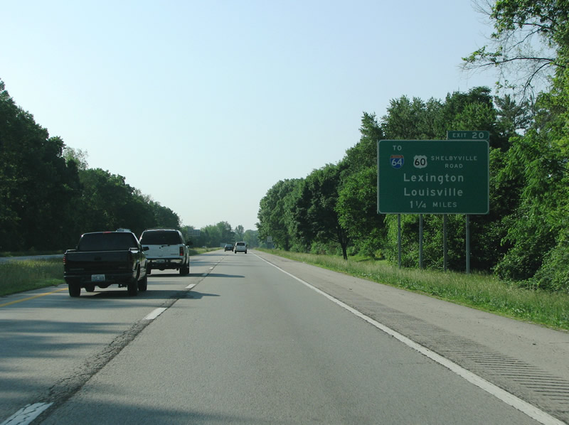
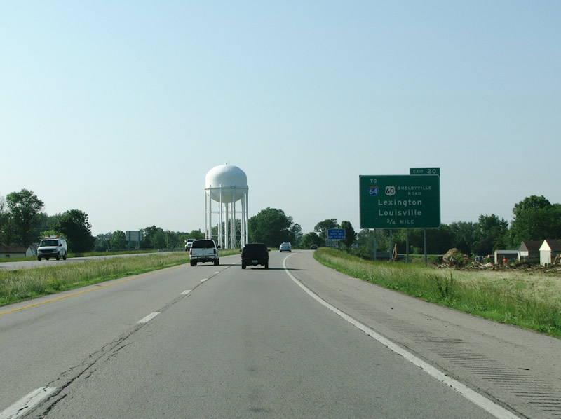
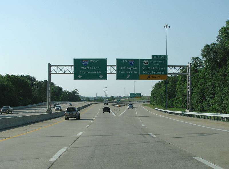
| The US 60 / I-64 interchange is connected with collector distributor lanes, hence the I-64 sign here.
Beginning work was visible for the new SPUI completed in April 2010 with Westport Road (KY-1447). Westport Road connects I-264 with Windy Hills to the west and Graymoor and Devondale to the east. 06/05/08 |
|
| The expressway opened starting in 1949 as a US 60 bypass route, but it was not open to this point until the 1950s. The original cloverleaf was rebuilt in the late 80s and early 90s and collector distributor lanes were added. The northwest cloverleaf ramp was replaced by a flyover, but there are still two exits here at US 60. There are two large shopping malls at this exit, Mall St. Matthews to the west and Oxmoor Center to the east. Mall St. Matthews opened in 1962 and was Kentucky’s first enclosed suburban mall. 06/05/08 |
|
| The suburb of St. Matthews is at this exit as well. The town was named for a local church in 1851, and incorporated in 1950. Today its an important community separate from Louisville, and has about 16,000 residents. 06/05/08 |
|
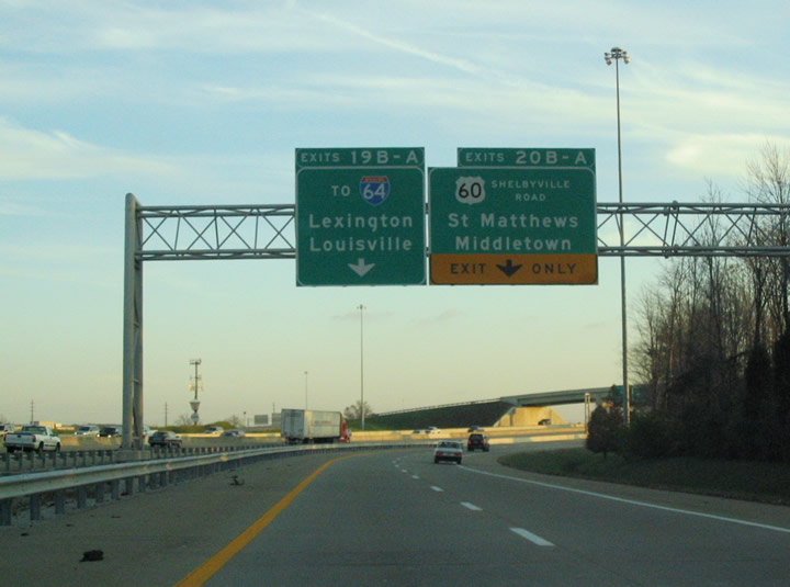
| U.S. 60 shadows Interstate 64 often along their respective journeys east to Charleston and Hampton Roads, Virginia. A pair of cloverleaves, joined by long collector distributor roadways, tie I-64 and U.S. 60's interchanges with Interstate 295 east of Richmond, Virginia, very similar to the configuration at St. Mathews. 11/12/04 |
|
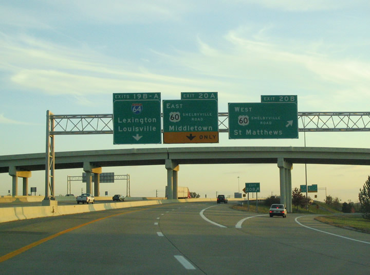
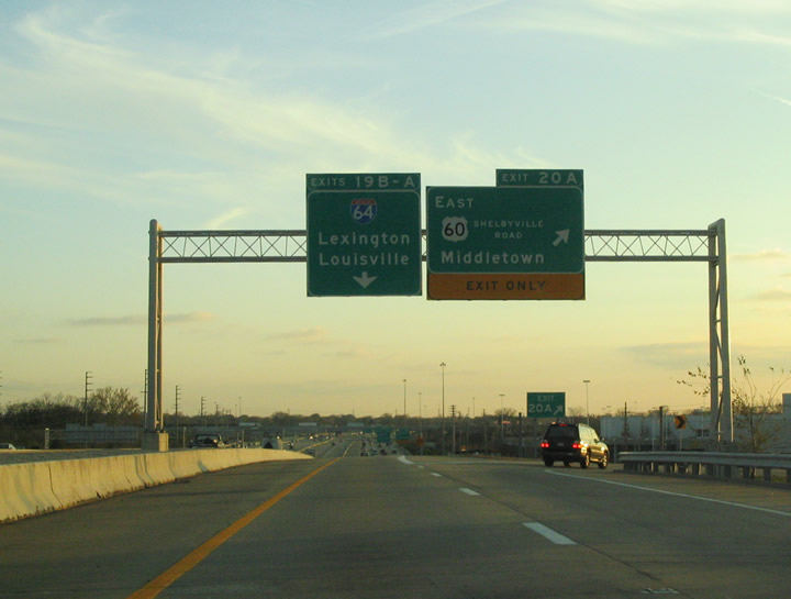
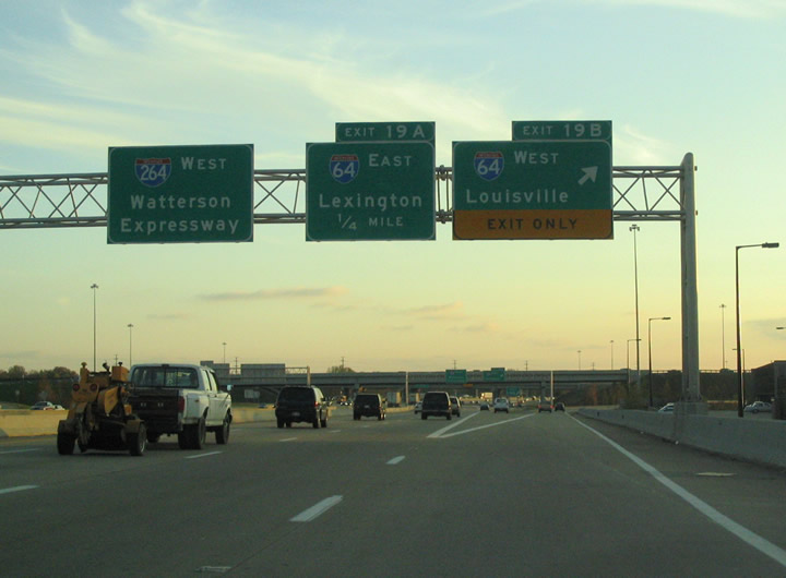
| I-264 meets its parent I-64 here with another cloverleaf interchange. I-64 runs east/west through Kentucky from here in Louisville all the way to Ashland on the Ohio River. The interchange here was rebuilt in 1991 and features a westbound-to-southbound flyover ramp just like US 60. Collector/distributor lanes keep all of the merging traffic away from the freeway through here. 06/05/08, 11/12/04 |
|
| Louisville's eastern suburban hospital area is near here, with the Norton Suburban Hospital and Baptist Hospital East adjacent to the freeway. 06/05/08 |
|
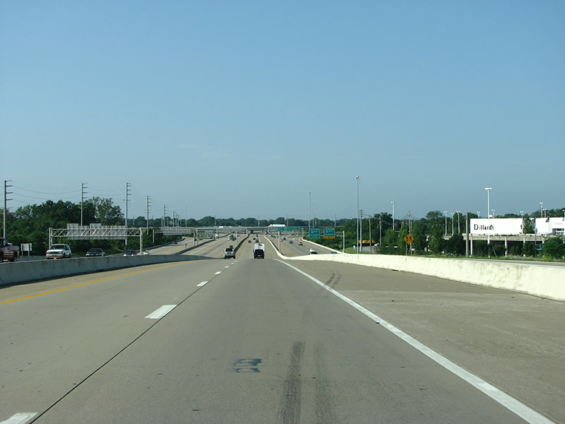
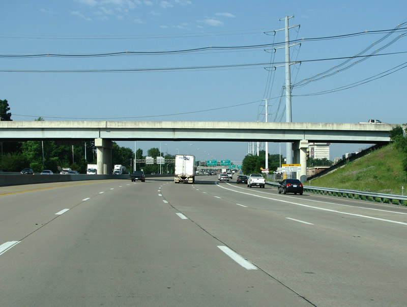
| The freeway is a wide band of concrete through here, as I-64 traffic runs into the road and it becomes more of an urban freeway. 06/05/08 |
|
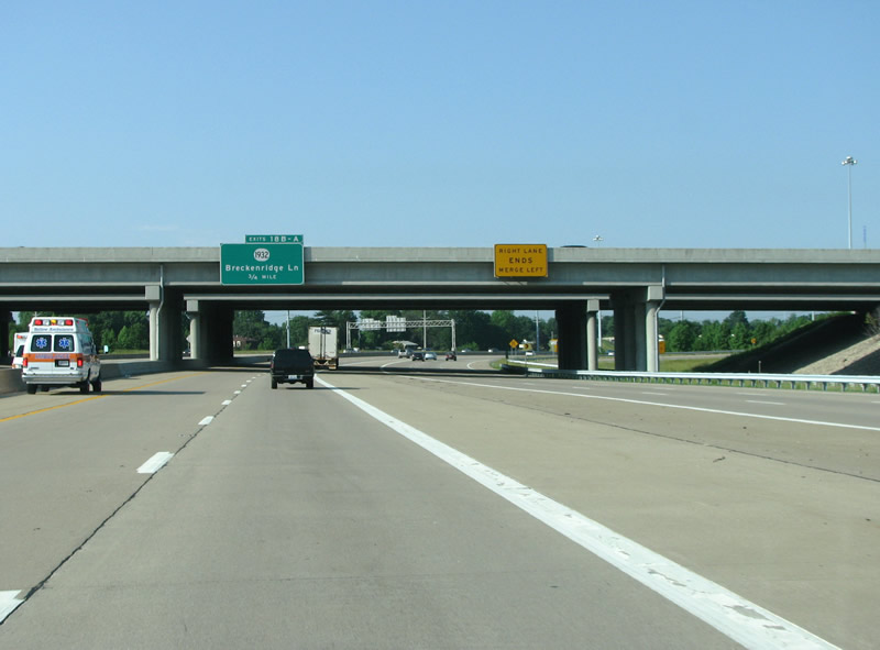
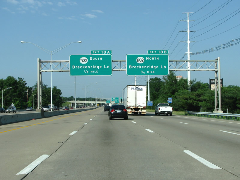
| Breckenridge Lane is the next exit and is a three-leafed cloverleaf, with no loop ramp on the northeast side. The road is named for the family of James Breckenridge Speed, who was an early railroad and cement magnate active in Louisville's civic affairs. The road is alternately spelled Breckinridge on some signs, its unclear as to which one is official. 06/05/08 |
|
| Louisville's famous Kaden Tower sits at this exit, and was one of the city's first suburban office developments. 06/05/08 |
|
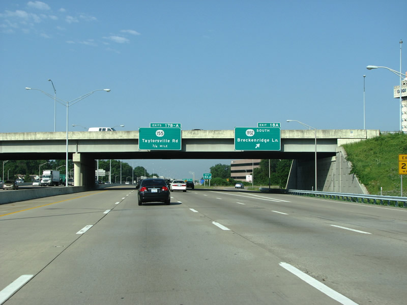
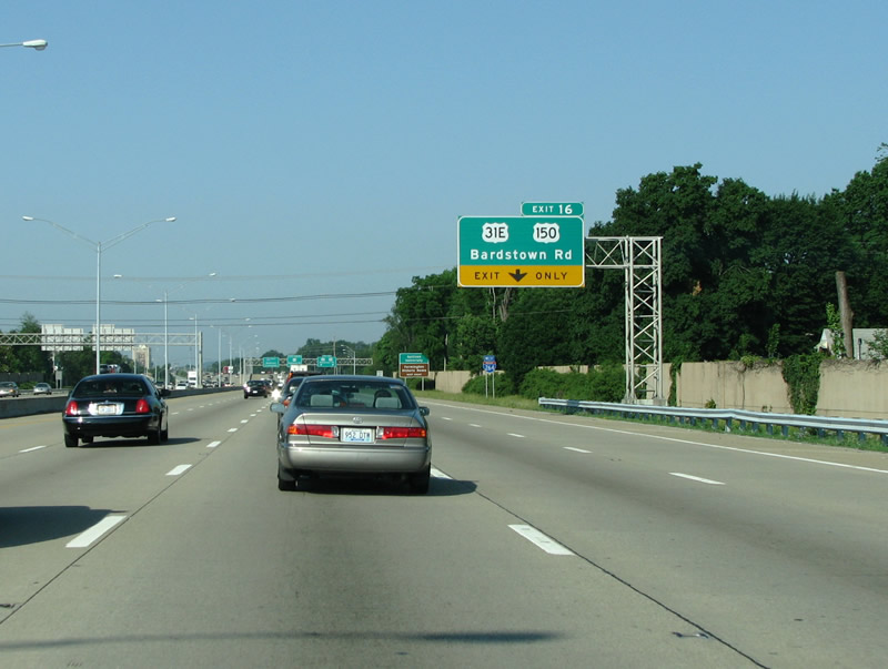
| KY 1932 runs north to St. Matthews' downtown and US 42. It continues southbound to US 150/31E, Bardstown Road. It's an arterial through here, and connects mostly suburban destinations with the freeway. 06/05/08 |
|
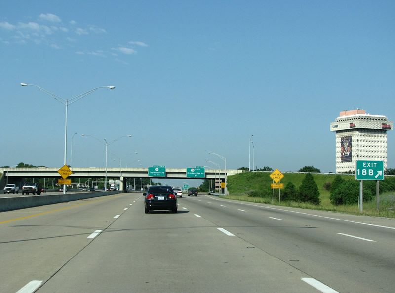
| Taylorsville is an important road out of town to the southeast, and connects Louisville with the county seat of Spencer County about 30 miles away – although through here it runs almost due east/west. The road is important through here as it connects the freeway to Bowman Field and central Jeffersontown. Bowman Field is one of the oldest public airports in the country, and still functions today as Louisville's secondary airport. 06/05/08 |
|
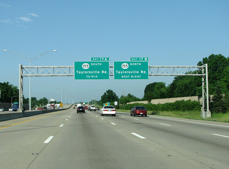
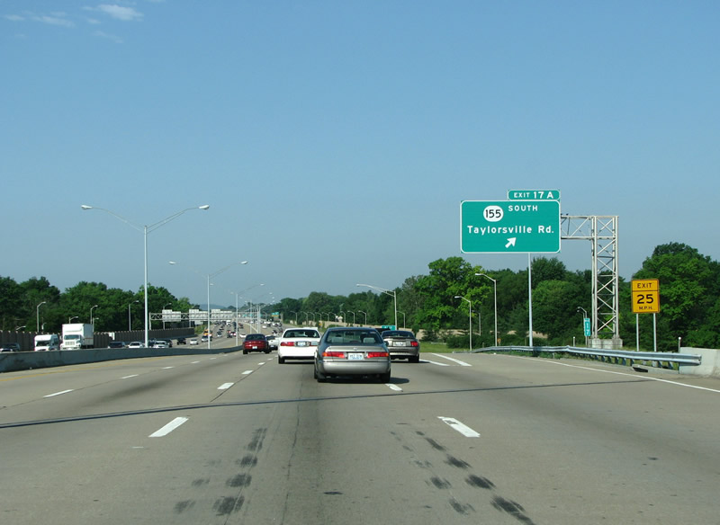
| KY 155 begins at US 150/31E just to the west of here, and begins in some of the nicer parts of the city. It continues east through the city's largest suburb, Jeffersontown, and finally reaches I-265. At I-265 it is undergoing great strains with too much traffic congestion and is currently being studied for an upgrade. After that, it runs out into Spencer County which forms one of the fastest sprawling areas in the state. 06/05/08 |
|
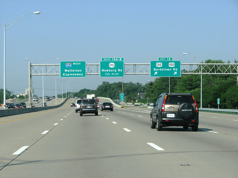
| US 31E/150 is the next exit at Bardstown Road. The exit was upgraded to a SPUI in the mid 90s, and was Kentucky's first. This was also one of the first two freeway exits to open in Kentucky. This first section of the Watterson Expressway from Bardstown Road back to Breckenridge Lane opened in 1949. It was not a true freeway when it opened, because it was only two lanes and still had at-grade crossings. The road was put into the interstate system in 1958 and soon upgraded and extended. 06/05/08 |
|
| Bardstown Road was originally tolled and called the Bardstown Turnpike, serving traffic from Bardstown to the wharves at the river. 06/05/08 |
|
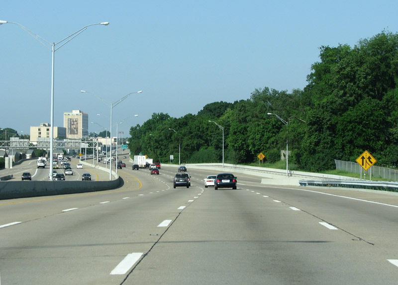
| A view of I-264 west of Bardstown Road. 06/05/08 |
|
| I-264's control point on this pull-through sign does not mention the west side of the city, only the freeway's name. 06/05/08 |
|
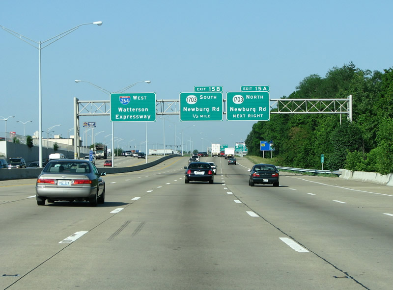
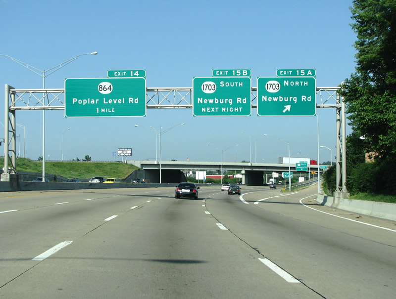
| Newburg Road runs through some of the nicest suburbs in the city. It was named because it ran out to the community of Newburg. The town was founded by German immigrants and originally spelled Newburgh. 06/05/08 |
|
| I-264 westbound at southbound Newburg Road. 06/05/08 |
|
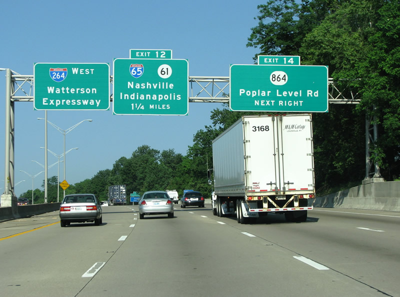
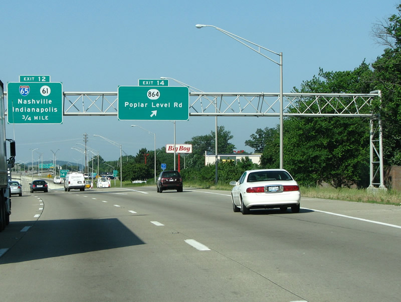
| The first exit east of I-65 is at Poplar Level Road. Poplar Level Road used to continue further out, but today it's been carved up by suburbia and ends before I-265. Poplar Level is a neighborhood in Louisville that was named for the road, which was named for its original paving material of poplar tree boards. The Poplar Level interchange is a SPUI, and was rebuilt along with the freeway in 2003. 06/05/08 |
|
| I-264 westbound at Poplar Level Road. 06/05/08 |
|
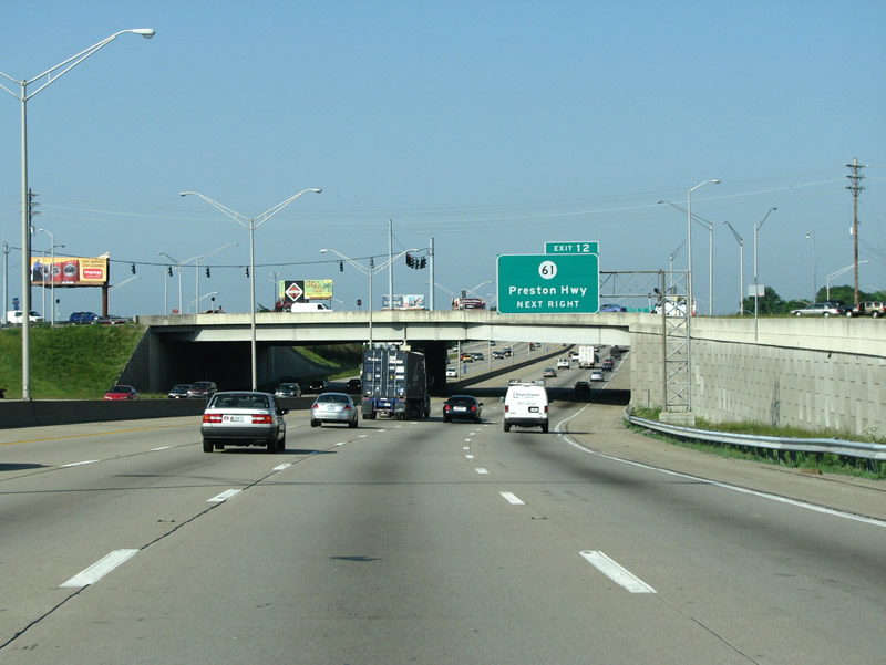
| KY 61, at the next exit, is the Preston Highway. Preston Highway was named for General William Preston, who got a 1,000 acre land grant from the British government for services rendered in the French and Indian war. Much of Louisville is built on the old Preston grant, and the highway runs down the middle of it. 06/05/08 |
|
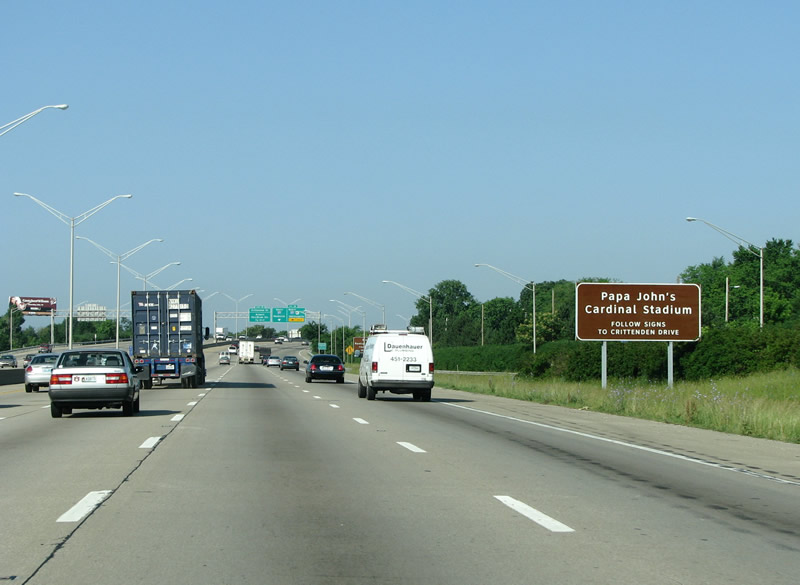
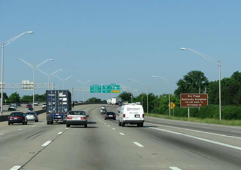
| Kentucky's local Six Flags and the University of Louisville's Papa John's Stadium are POIs noted at the I-65 interchange. 06/05/08 |
|
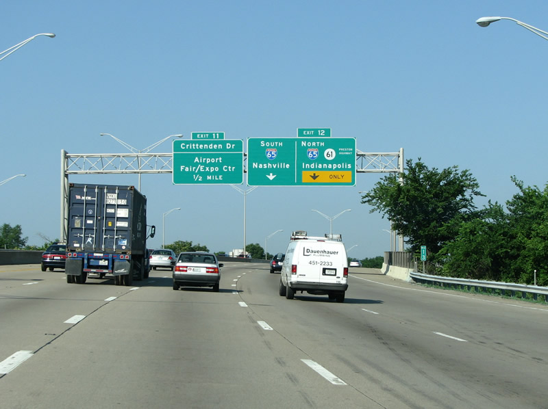
| In 1999, this interchange was rated as Kentucky's worst road bottleneck, ranked 92nd worst in the nation. It normally stays in the top 100 of worst traffic bottlenecks in the country. In 1974, just after the interchange opened, the area was notably wiped out by a tornado. 06/05/08 |
|
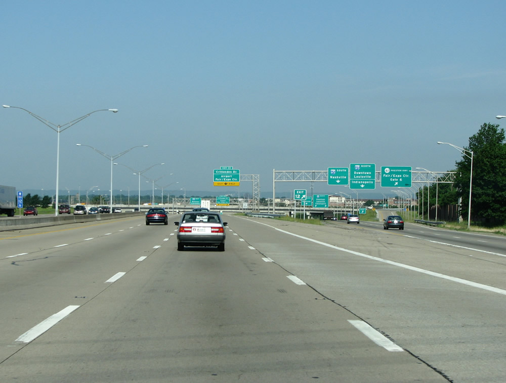
| Originally, the airport and I-65 interchanges were two tightly spaced cloverleafs, but they've since been redone. 06/05/08 |
|
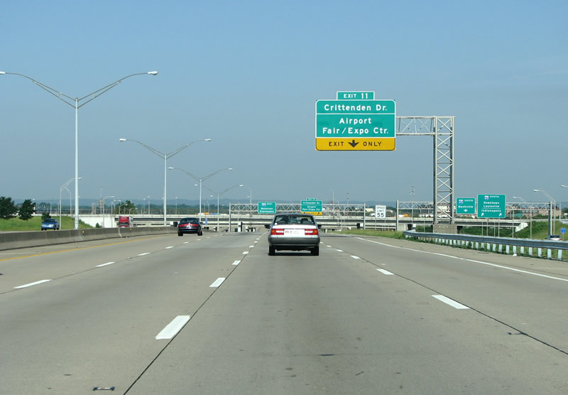
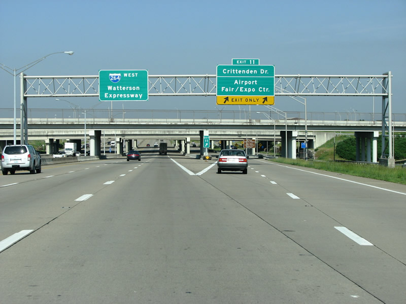
| This exit connects I-264 with Crittenden Dr and the city's airport. South of the expressway, in 1997, the road was closed for the airport's runway expansion. In 2003, Crittenden was reopened as it was extended southward past the airport to Fern Valley Road. 06/05/08 |
|
| I-264 westbound at Crittenden/Airport. This overhead sign also features an older pull-through sign. 06/05/08 |
|
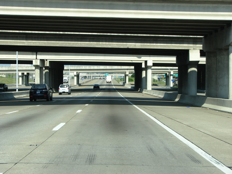
| A view of the bridges at the sprawling, but not very big, I-65/I-264 interchange. 06/05/08 |
|
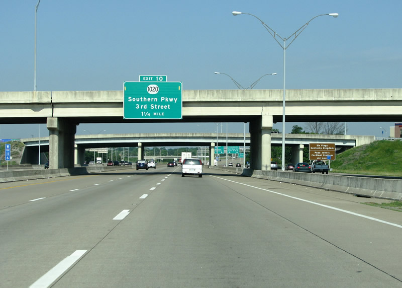
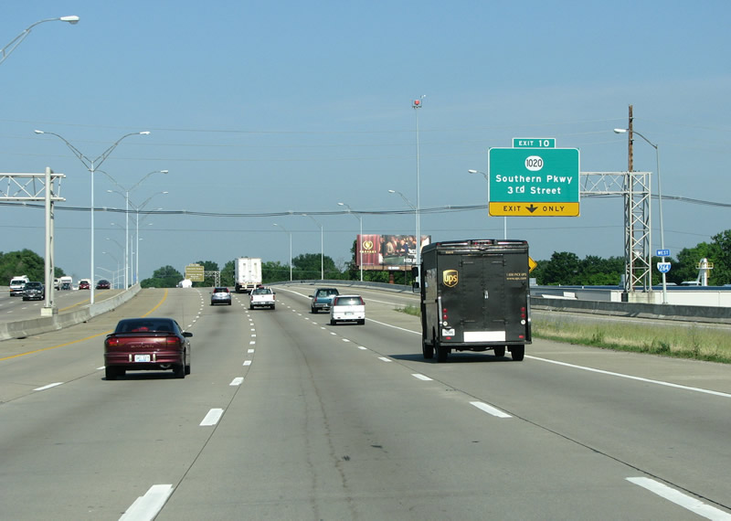
| KY 1020 runs south for about 13 miles from US 31W along various routes, including National Turnpike, to the Shepherdsville area - and is the next exit. 06/05/08 |
|
| An I-264 reassurance marker at the airport. 06/05/08 |
|
| These signs to the north are present at the airport interchange. 06/05/08 |
|
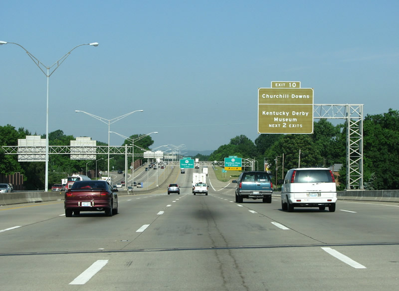
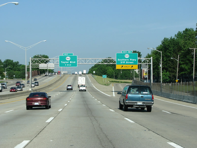
| Kentucky's most famous tourist attraction, Churchill Downs, is the POI mentioned on this overhead sign. Southern Parkway runs north to it. 06/05/08 |
|
| Southern Parkway is an important route running south from downtown Louisville to Iroquois Park, which has beautiful views of the entire city from the top of a hill. The parkway is well known for its large homes and canopies of trees. Northbound, the route connects the expressway to the famous Churchill Downs. The route was built as part of Frederick Law Olmstead's famous parks plan for the city. 06/05/08 |
|
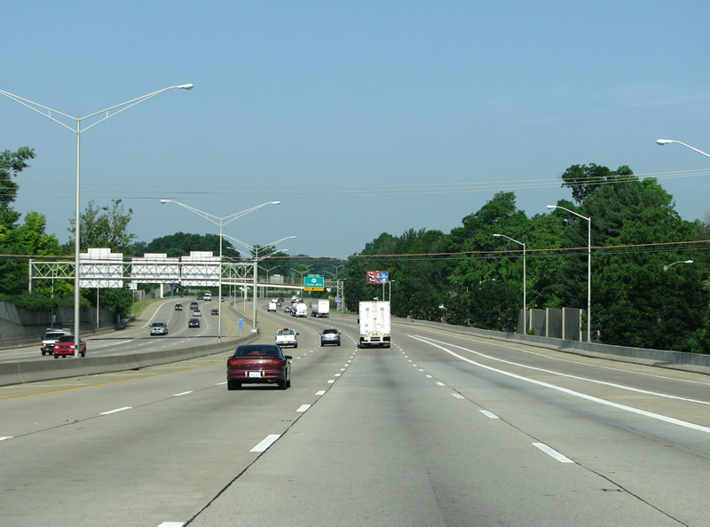
| A view of the Watterson Expressway west of Southern Parkway. The road enters the poorer part of the city here. 06/05/08 |
|
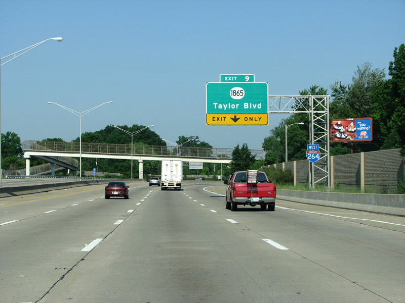
| Taylor Blvd meets I-264 in a parclo on the southwest side of Louisville. Taylor Blvd was built in the 1920s to connect to the Jacobs Addition subdivision, then on the edge of town. 06/05/08 |
|
| I-264 westbound at Taylor Blvd. 06/05/08 |
|
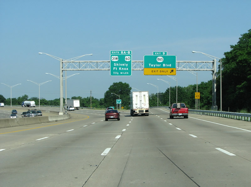
| I-264's next exit is at the Dixie Highway, although the road's name is not mentioned on this sign. The Dixie Highway is the main route out of Louisville to the southwest. It runs through the poorer side of the city and its sides are full of industrial areas and dead retail. 06/05/08 |
|
| More advance signage for the Dixie Highway. The Dixie Highway was started in 1915, and really makes up a series of highways that total about 5700 miles. This interchange was the original 1940s ending of the expressway, and when it was extended in 1970 it was built in such a way so the original ramps could stay intact. So today, the ramps feature left exits and odd sharp turns. 06/05/08 |
|
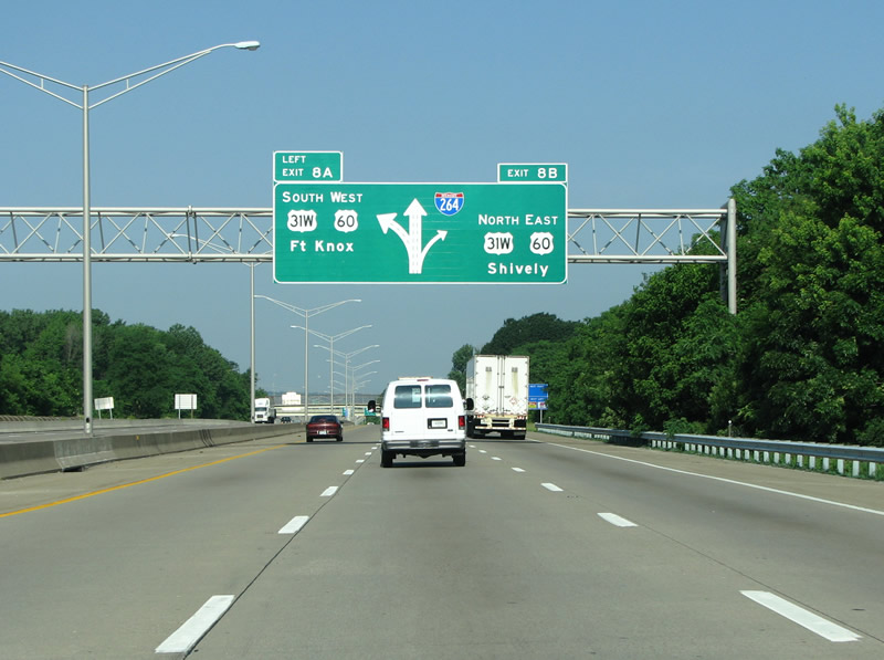
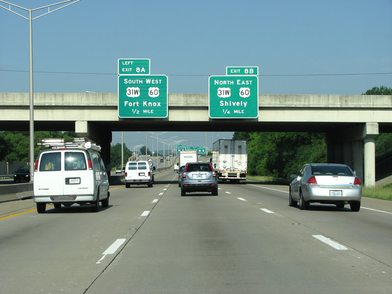
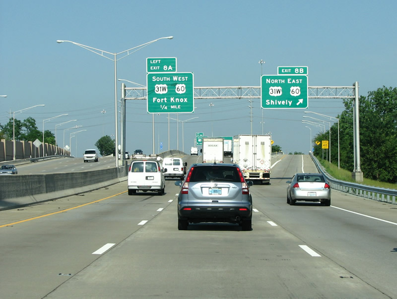
| This marks the end of the Watterson Expressway and the beginning of the Shawnee Expressway. Famous Fort Knox is just a short drive south along the highway to the south. 06/05/08 |
|
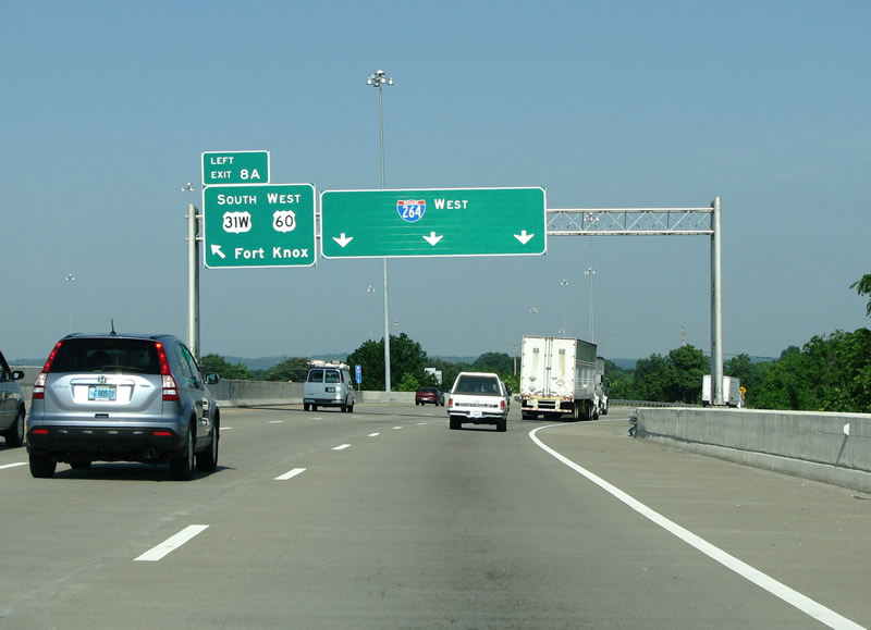
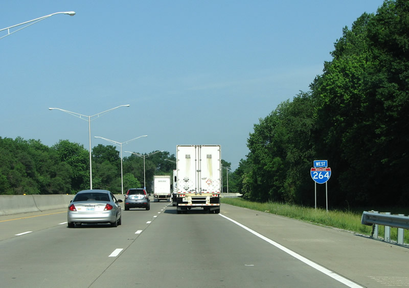
| Although still signed as west, I-264 makes its turn from west/east to north/south here. 06/05/08 |
|
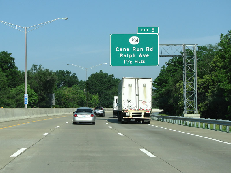
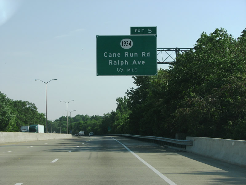
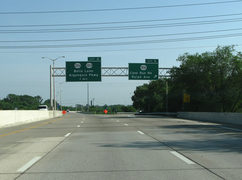
| Cane Run Road runs southwest from the Dixie Highway near the river. The road was named for the Cane Run creek, which runs west from North Lexington to the Ohio River. A neighborhood called Cane Run also sits along the route further out. 06/05/08 |
|
| More advance signage for Cane Run Rd. 06/05/08 |
|
| KY 1934 is 11.5 miles long and runs from US 31W in Louisville south to KY 2054. There is very little traffic on this stretch of roadway today. 06/05/08 |
|
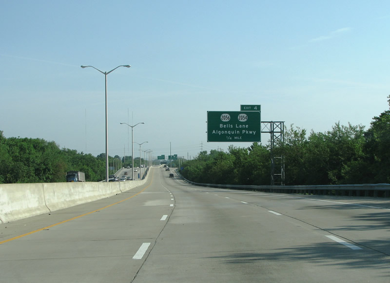
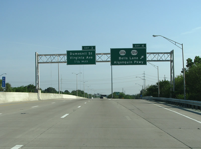
| Bells Lane forms the main route into the aptly named neighborhood of Rubbertown. The area was built up during World War II because of the many industrial plants constructed there. Standard Oil built an oil refinery there in 1918, and today it houses 11 chemical plants. Today, the area is known for pumping out almost half of the air pollution in Jefferson County. 06/05/08 |
|
| KY 2056 is about 1.5 miles long and connects the Ohio River shoreline with Cane Run Road, KY 1934. 06/05/08 |
|
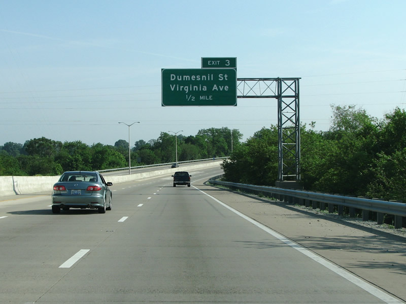
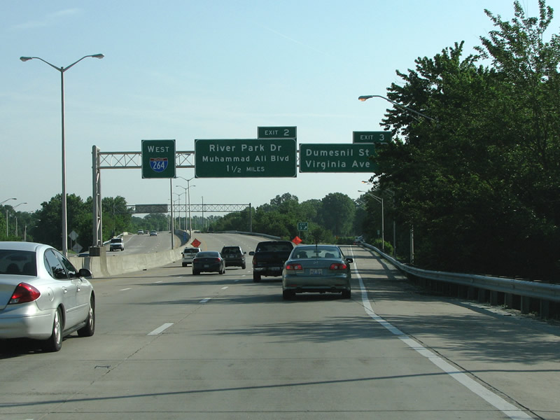
| Exit 3 connects the Shawnee Expressway with the one way street couplet of Virginia/Dumesnil, which continues to the west as Hale Avenue. Chickasaw Park on the Ohio River sits just down Hale to the west. 06/05/08 |
|
| I-264 northbound at Virginia/Dumesneil. I-264 has lost its pull-through name designation, and now has no control point. 06/05/08 |
|
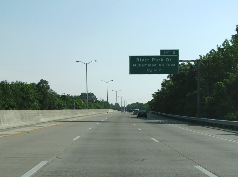
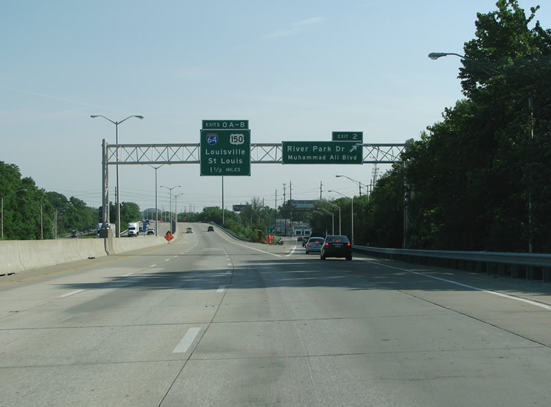
| Exit 2 is an extended diamond interchange that connects the expressway to the one way couplet of Muhammad Ali Blvd and River Park Dr. These streets run west to the river to Shawnee Park, which gives this expressway its name. Walnut Street was renamed after Ali in the 70s to honor the Louisville native. These streets run through some of the poorest areas of town which also have the largest percentage of African Americans in Kentucky. 06/05/08 |
|
| I-64 makes its entrance here at the Muhammad Ali exit. 06/05/08 |
|
| I-64 marks the western end of I-264 and the last exit for the parent route before it runs west into Kentucky. 06/05/08 |
|
| A view of the final I-264 westbound reassurance marker. 06/05/08 |
|
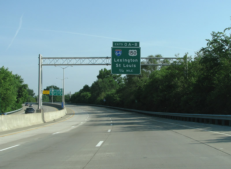
| Unlike many states, downtown Louisville is not mentioned as the control point for I-64 although that is the destination of many cars along this stretch of highway - instead Lexington, about an hour to the east, plays that part. 06/05/08 |
|
| U.S. 150 combines with Interstate 64 between 22nd Street (Exit 3) in Louisville and Exit 119 near Floyds Knobs, Indiana. 06/05/08 |
|
| I-264 ends here on the far west side of Louisville. Motorists can head west and immediately cross into Indiana. 06/05/08 |
Page Updated 09-23-2008.

 / Watterson Expressway - West