|
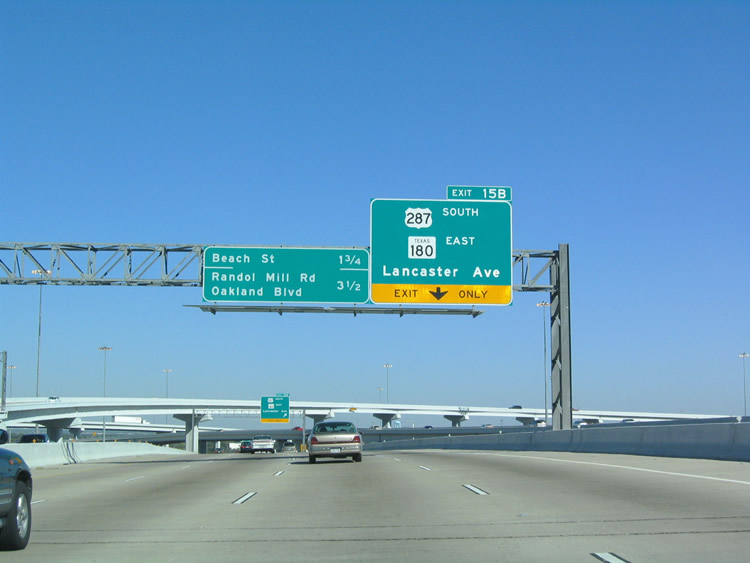
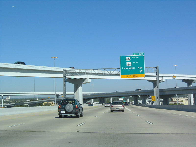
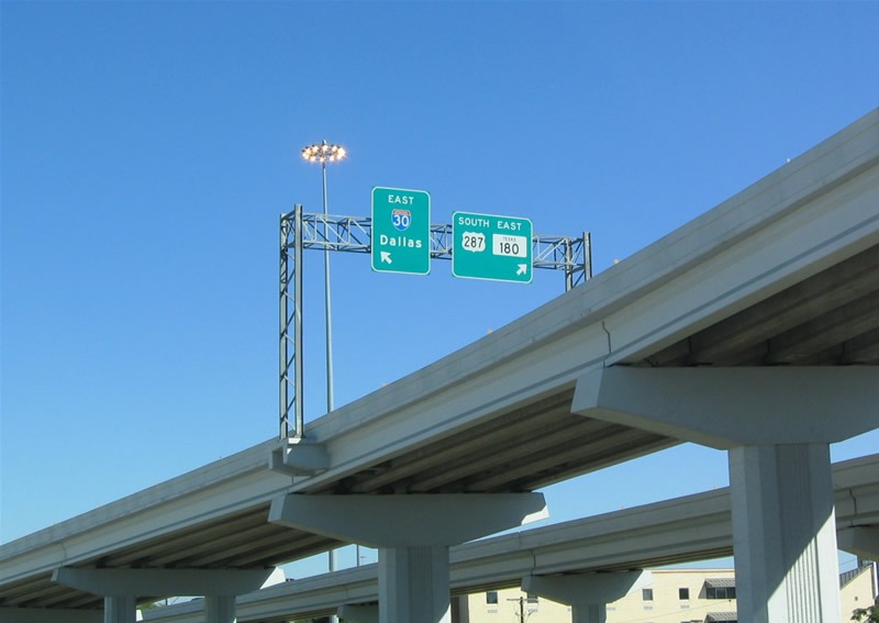
| Continuing east from the stack interchange with IH 35W, IH 30 next approaches Exit 15B for U.S. 287 (Martin Luther King, Jr. Freeway) south and SH 180 (Lancaster Avenue) east. 10/19/03 |
|
| U.S. 287 angles 6.5 miles southeast from IH 35W/U.S. 377 along the MLK, Jr. Freeway between Downtown and IH 820 at Lake Arlington. U.S. 287 joins Fort Worth with Kennedale, south Arlington and Mansfield. SH 180 (former U.S. 80) leaves Downtown along Lancaster Avenue en route to IH 820 and the Arlington city line. 10/19/03 |
|
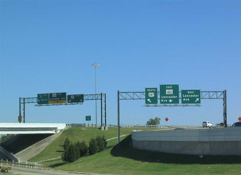
| Passing through the multi level interchange with U.S. 287 (Martin Luther King, Jr. Freeway) on IH 30 eastbound. 10/19/03 |
|
| Ramps along Exit 15B separate for Martin Luther King, Jr. Freeway south and Lancaster Avenue. SH 180 originates along Lancaster Avenue below the exchange joining IH 30/35W. The state highway parallels IH 30 east 24.07 miles to SL 12 in west Dallas. 10/19/03 |
|
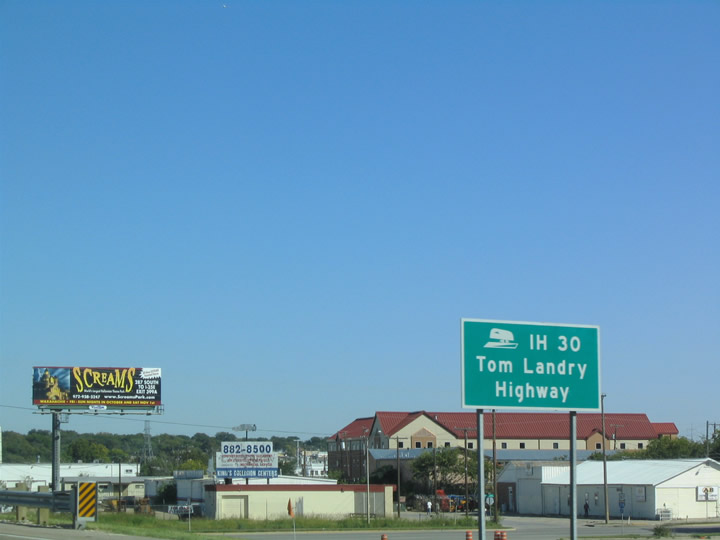
| Interstate 30 along the former Dallas Fort Worth Turnpike is the Tom Landry Highway. 10/19/03 |
|
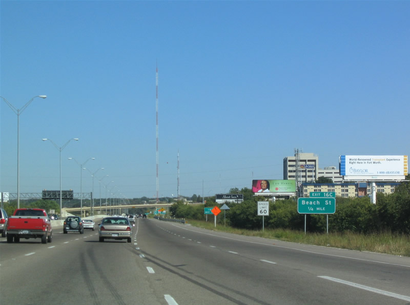
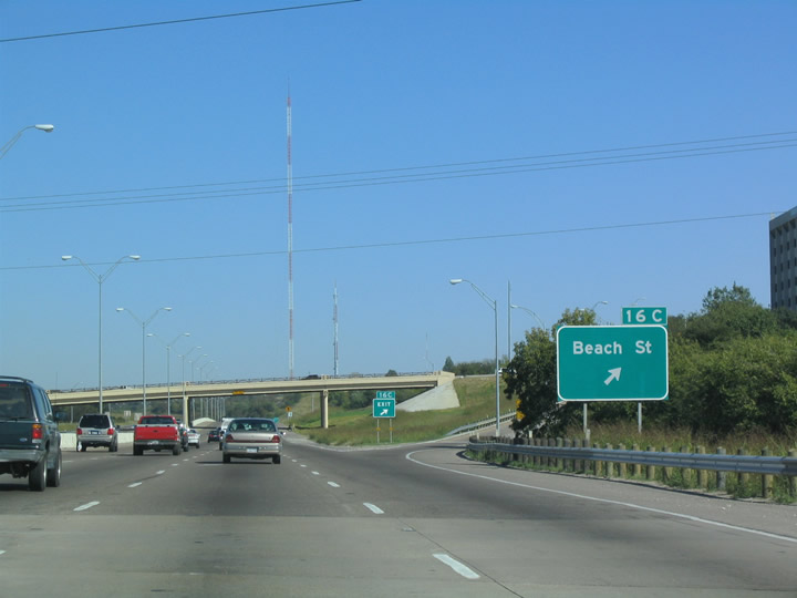
| IH 30 proceeds east across Sycamore Creek to a diamond interchange (Exit 16C) with Beech Street. 10/19/03 |
|
| Beach Street connects Interstate 30 with SH 180 (Lancaster Avenue) via a SPUI to the south and Gateway Park to the north of the Trinity River West Fork. There is no Exit 16A or 16B on IH 30 east, as those ramps connect westbound with Riverside Drive. 10/19/03 |
|
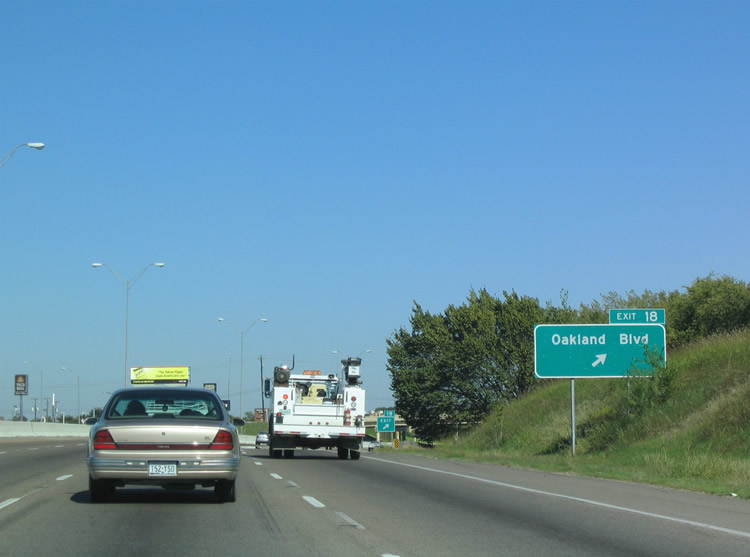
| Interstate 30 shifts northward across undeveloped areas by the West Fork Trinity River to a half diamond interchange (Exit 18) with Oakland Avenue south to Meadowbrook in Fort Worth. 10/19/03 |
|
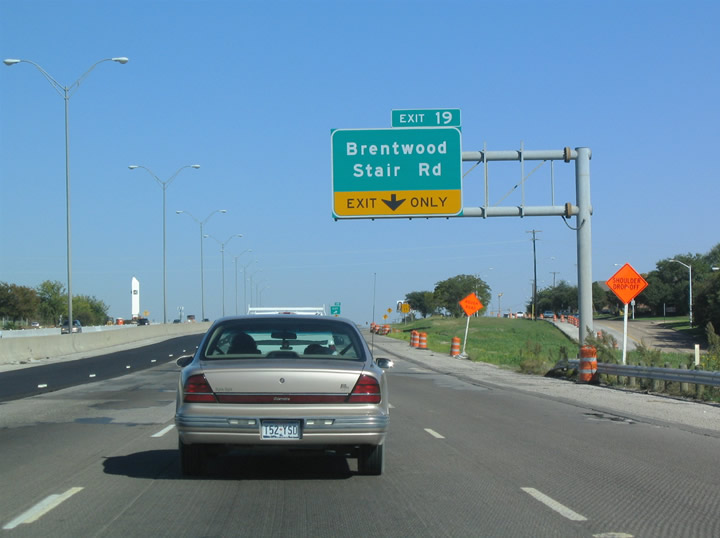
| Exit 19 constitutes a folded diamond interchange with the frontage roads (Brentwood Stair Road / Bridge Street) at Holt Street. 10/19/03 |
|
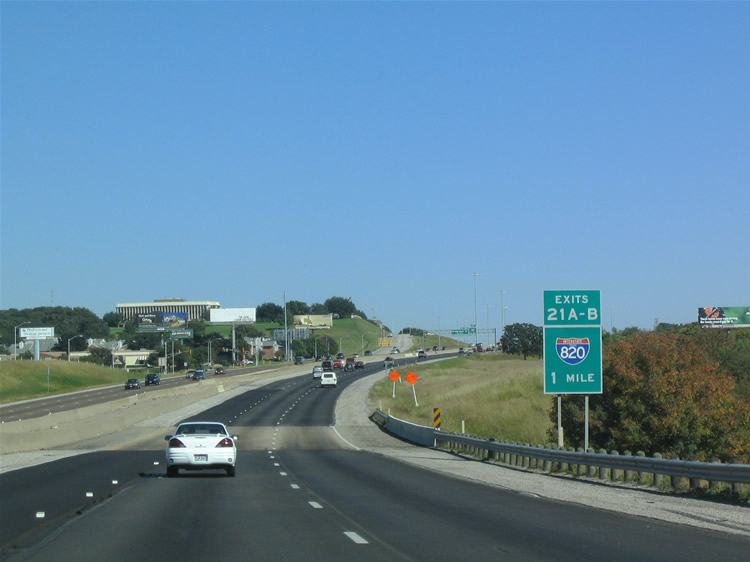
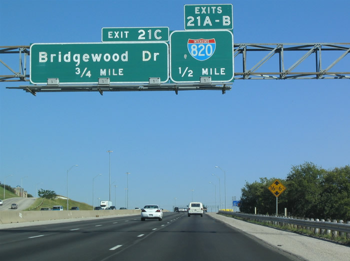
| IH 30 passes over Woodhaven Boulevard one mile west of Interstate 820 (Exits 21A/B). IH 30 previously met IH 820 at Exit 5. 10/19/03 |
|
| IH 820 serves the northeastern suburbs of Haltom City, North Richland Hills at SH 121/183 (Airport Freeway), and Hurst among others. Southward, IH 820 leads to IH 20 at Forest Hill. 10/19/03 |
|
| Originally a trumpet interchange joined the Dallas-Fort Worth Turnpike with Brentwood Stair Road at Exit 21. That exchange was removed during construction of the systems interchange with IH 820. 10/19/03 |
|
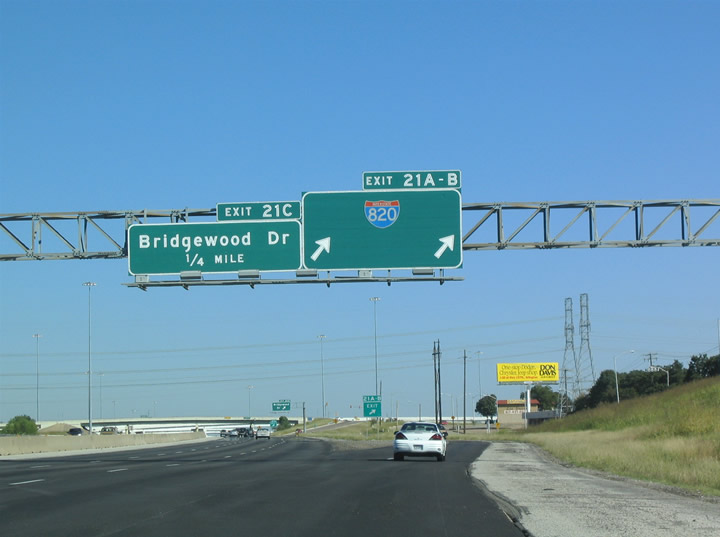
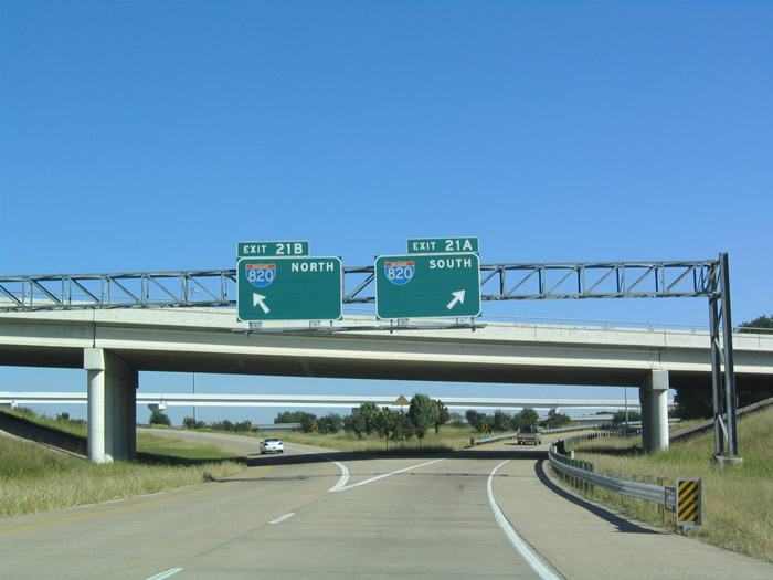
| Exits 21A/B separate for Interstate 820 south 6.5 miles to IH 20 & U.S. 287 (MLK Freeway) and north 3.2 miles to the merge with SH 121 (Airport Freeway). 10/19/03 |
|
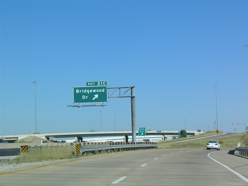
| Bridgewood Drive stems north from Brentwood Stair Road to a parclo interchange (Exit 21C) with IH 30 and an adjacent retail area at Bridge Street. 10/19/03 |
|
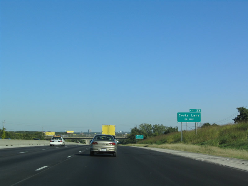
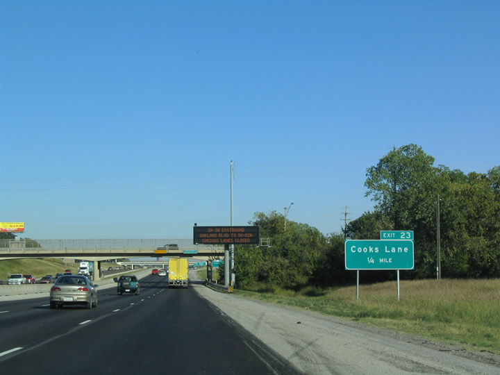
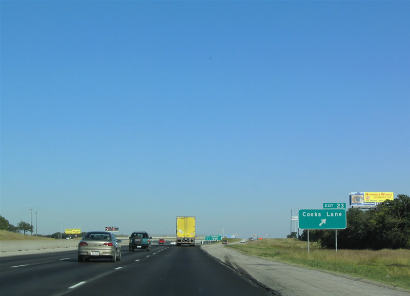
| IH 30 advances 0.75 miles east below overpasses for Sandy Lane and Morrison Drive to a diamond interchange (Exit 23) with Cooks Lane. 10/19/03 |
|
| Exit 23 leaves IH 30 eastbound for Cooks Lane south to SH 180 (Lancaster Avenue) along the Arlington city line and north to Randol Mill Road in Fort Worth. 10/19/03 |
|
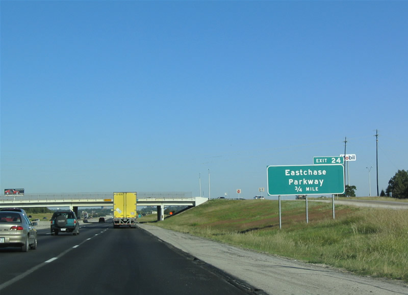
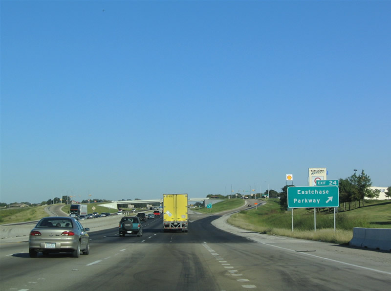
| Exit 24 represents the last interchange within Fort Worth along IH 30 eastbound. Joining the freeway in 0.75 miles is Eastchase Parkway, a commercial arterial south from Randol Mill Road. 10/19/03 |
|
| Interstate 30 crosses Cottonwood Creek ahead of the diamond interchange (Exit 24) with Eastchase Parkway. Eastchase Parkway south transitions into Dottie Lynn Parkway en route to SH 180 (Lancaster Avenue) and Green Oaks Boulevard in Arlington. 10/19/03 |
|
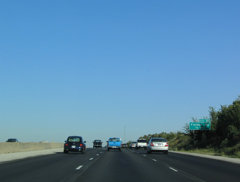
| Interstate 30 enters Arlington across Village Creek. Upcoming Fielder Road is the first of three exits along IH 30 eastbound within the city. 10/19/03 |
|
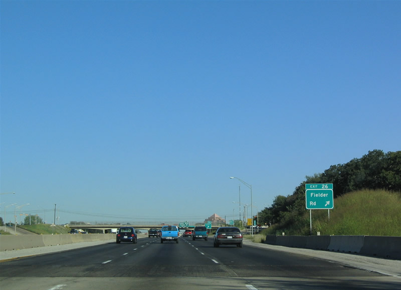
| Fielder Road travels 6.6 miles north from Arbrook Boulevard to Green Oaks Boulevard. A diamond interchange (Exit 26) joins Fielder Road with Interstate 30. 10/19/03 |
|
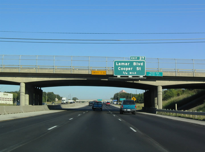
| A parclo interchange (Exit 27) joins Interstate 30 with Cooper Street in 0.75 miles. 10/19/03 |
|
| Cooper Street serves Downtown Arlington from the west in addition to the University of Texas at Arlington (UTA) campus. Parallel Lamar Boulevard ties into the exchange at Exit 27 from the north. 10/19/03 |
|
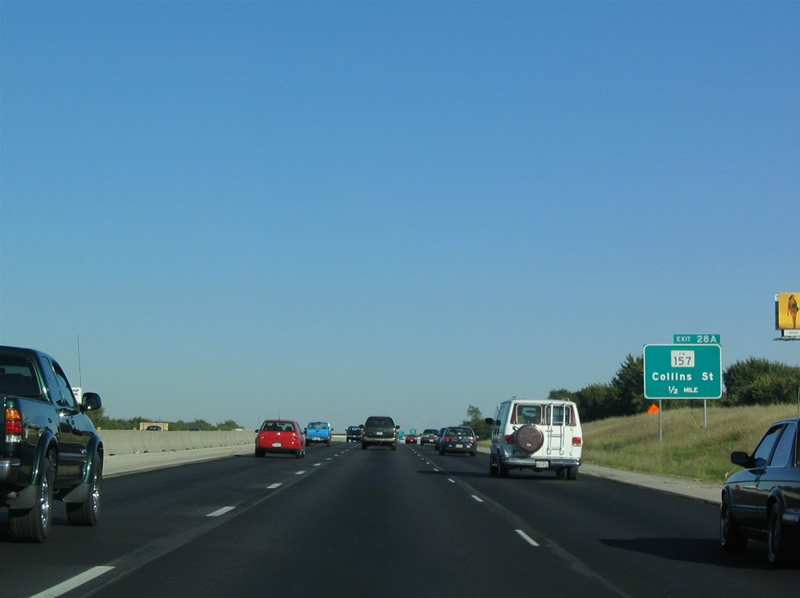
| FM 157 follows Collin Street northward 8.94 miles from SH 180 in Arlington to SH 121 at Bedford and Euless. 10/19/03 |
|
| Reconstruction of IH 30 through Arlington replaced the original trumpet interchange with FM 193 (Collins Street). Collins Street leads south to AT&T Stadium, home of the NFL Dallas Cowboys. 10/19/03 |
|
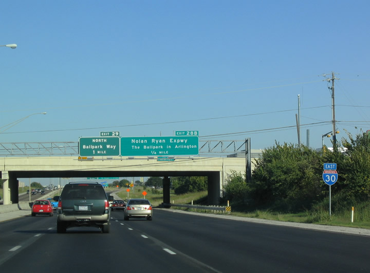
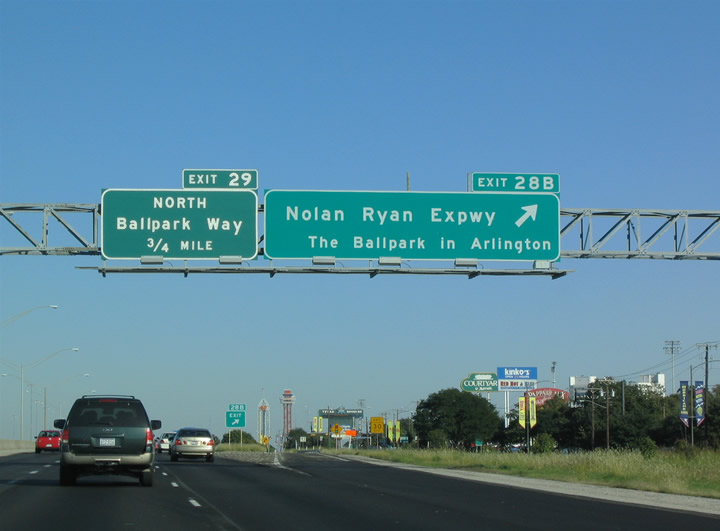
| Nolan Ryan Expressway is a local arterial south from IH 30 to Road to Six Flags Street. The roadway formerly ran along the west side of Arlington Stadium, the former home of the MLB Texas Rangers. Arlington Stadium was demolished following completion of the Ballpark at Arlington in 1994. 10/19/03 |
|
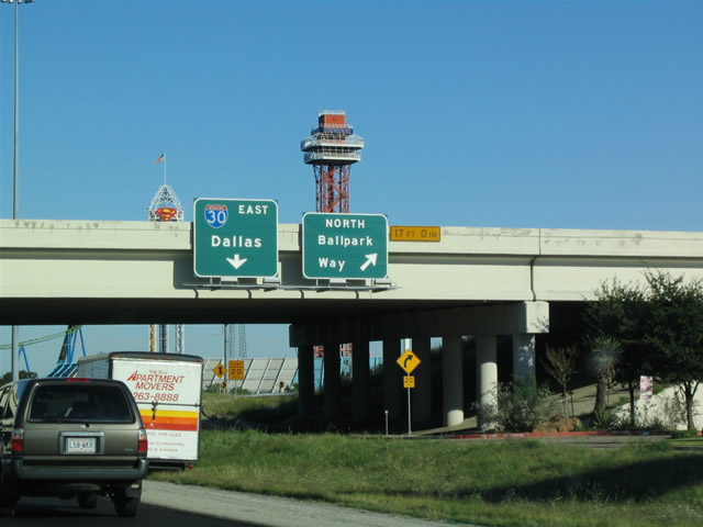
| Ballpark Way, previously named Stadium Drive, leads north from Abram Street and SH 180 (Division Street) to a parclo interchange (Exit 29) with IH 30 and Green Oaks Boulevard. 10/19/03 |
|
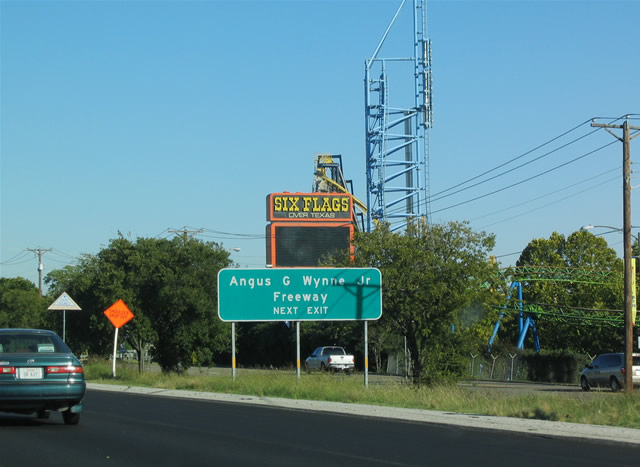
| The exchange with Ballpark Way is located next to the Six Flags over Texas theme park. 10/19/03 |
|
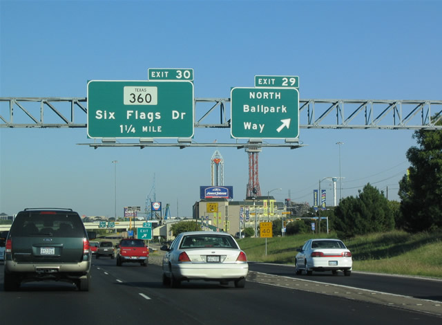
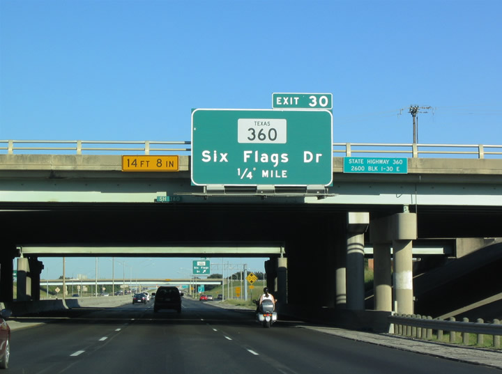
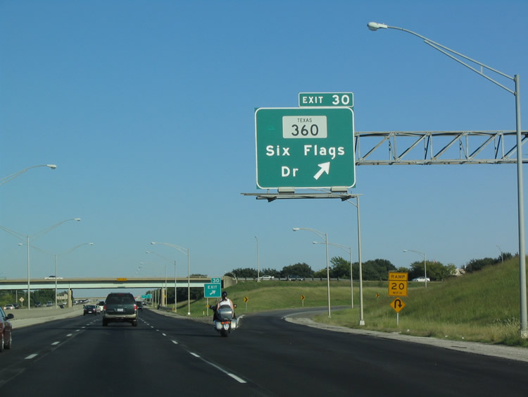
| IH 30 proceeds east alongside Six Flags Over Texas to a trumpet interchange and access road linking with SH 360 (Angus G. Wynne, Jr. Freeway). The Interstate 30/State Highway 360 interchange project underway from Spring 2016 to 2021 replaces the outdated exchange with a systems interchange. 10/19/03 |
|
| The Interstate 30/State Highway 360 extends Six Flags Way north to Avenue H and reconfigures the exchange into a diamond interchange. Six Flags Way arcs southwest from SH 360 to the theme park and SH 180 (Division Street). 10/19/03 |
|
| SH 360 constitutes a freeway south to IH 20 and north to SH 121/183 (Airport Freeway) along the Arlington / Grand Prairie City line. 10/19/03 |
Page Updated 07-05-2019.

 East
East