|
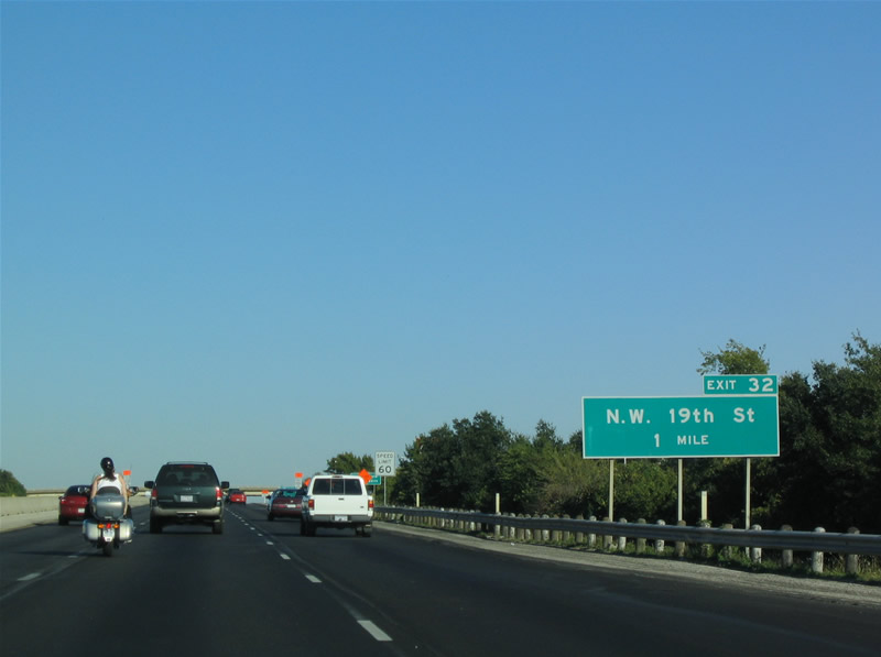
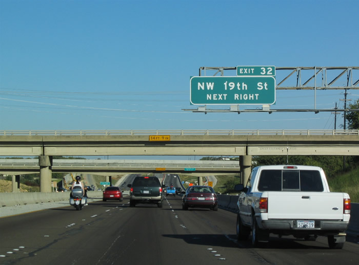
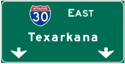
| Interstate 30 (Tom Landry Freeway) progresses to a systems interchange with SH 161 at Northwest 19th Street in Grand Prairie. 10/19/03 |
|
| President George Bush Turnpike (PGBT) was completed south from Irving to IH 30 in Grand Prairie in 2007. 10/19/03 |
|
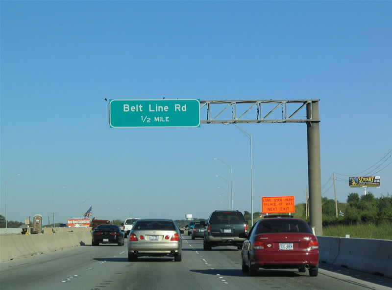
| Belt Line Road represents a series of surface roads that encircles the city of Dallas. The road travels between Grand Prairie and Irving in west Dallas County. 10/19/03 |
|
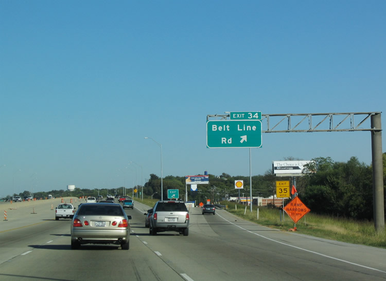
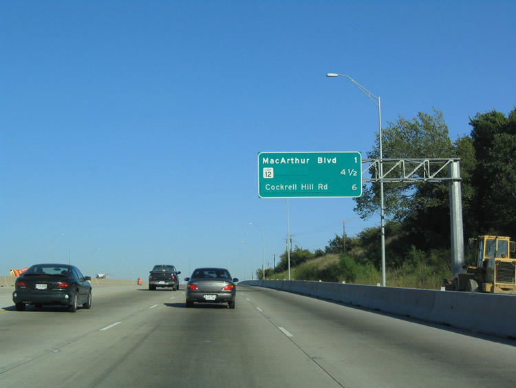
| Exit 34 departs IH 30 east 0.9 miles ahead of Belt Line Road. The ramp configuration and frontage road system replaced an original Dallas Fort Worth Turnpike trumpet interchange. South of SH 180, Belt Line Road is a part of FM 1382. FM 1382 measures 18.87 miles southeast to Cedar Hill and IH 35E at DeSoto. 10/19/03 |
|
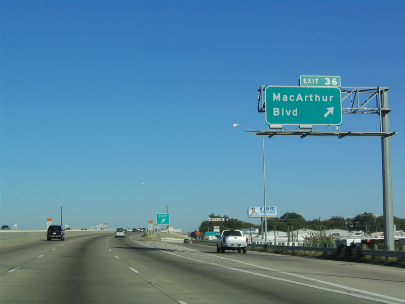
| IH 30 continues toward the Express Lane ingress point and Exit 36 with MacArthur Boulevard (Exit 36) in east Grand Prairie. 10/19/03 |
|
| Macarthur Boulevard heads north into Irving at Vilbig Lake and south through a residential area to SH 180 (Main Street). 10/19/03 |
|
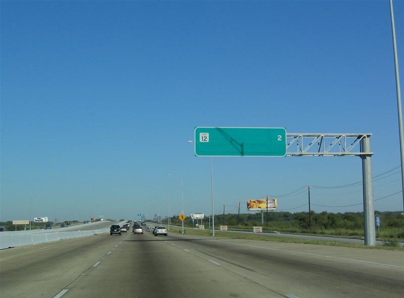
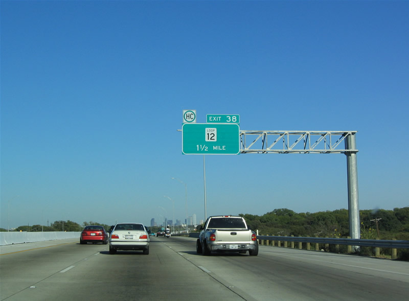
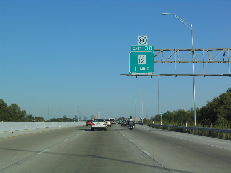
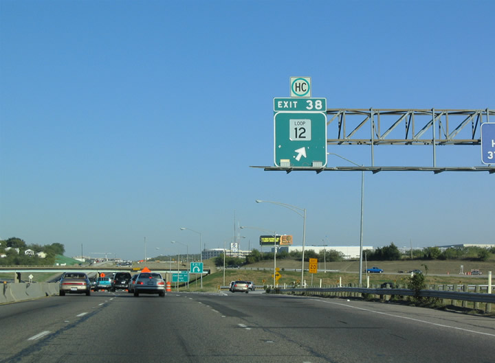
| Passing south of the Grand Prairie Landfill, IH 30 advances two miles to a trumpet interchange (Exit 38) and access road with SL 12 (Walton Walker Boulevard). 10/19/03 |
|
| SL 12, like Belt Line Road, also encircles Dallas. The western alignment of SL 12 constitutes a full freeway linking IH 35W to the north with SS 408 (Patriot Parkway) and IH 20 to the south. 10/19/03 |
|
| Loop 12 connects IH30 with SH 180 (Davis Street) at Arcadia Park in west Dallas and Trinity Oaks in Irving to the north. Loop 12 meets IH 30 again at Exit 53A along Buckner Boulevard in east Dallas. 10/19/03 |
|
| Interstate 30 crosses over Loop 12 (Walton Walker Boulevard) and a UP Railroad line ahead of Exit 38. Loop 12 travels south to Ledbetter Drive and Dallas Executive Airport (RBD) and north to the University of Dallas in Irving. 10/19/03 |
|
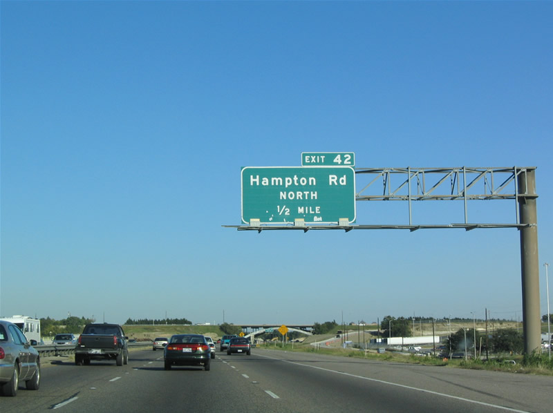
| Exit 42A departs IH 30 eastbound beyond Westmoreland Road for the adjacent frontage road leading to Hampton Road south. 10/19/03 |
|
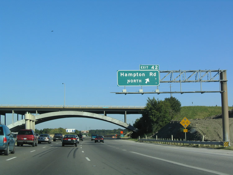
| Exit 42 directly links IH 30 east with Hampton Road north to West Dallas at a directional cloverleaf interchange. 10/19/03 |
|
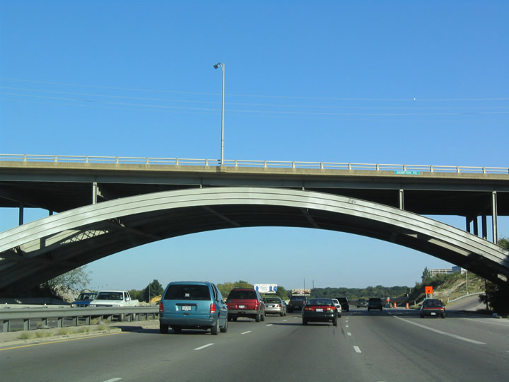
| The 267.1 foot long steel arch bridge taking Hampton Road over IH 30 in Dallas was built in 1957.1 10/19/03 |
|
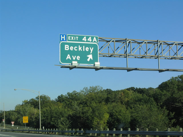
| Exit 44 parts ways with IH 30 east of Sylvan Avenue for Beckley Avenue north to Trinity Groves and south to the Kessler neighborhood and Bishop Arts District. 10/19/03 |
|
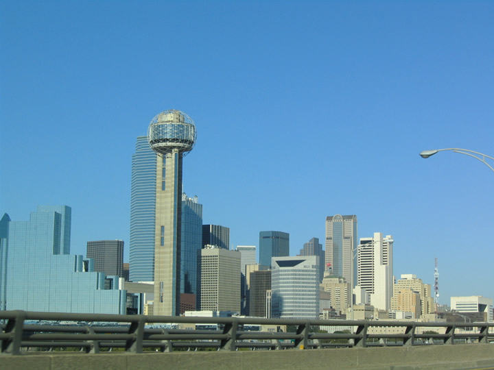
| The Downtown Dallas skyline appears as IH 30 approaches the Margaret McDermott Bridge across the Trinity River. 10/19/03 |
|
| A distributor roadway system was constructed from Sylvan Avenue east across the Margaret McDermott Bridge to Riverfront Boulevard (formerly Industrial Boulevard). The previous ramp was part of a Breezewood style connection from IH 30 east to IH 35W south. 10/19/03 |
|
| IH 30 spans Trinity River Greenbelt Park, an area of green space between the Trinity River levee system east across the Margaret McDermott Bridge to a systems interchange with IH 35E (Stemmons Freeway). 10/19/03 |
|
| Reunion Tower rises next to the exchange joining IH 30 and IH 35E (Stemmons Freeway) at Downtown Dallas. 10/19/03 |
|
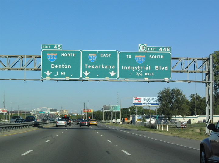
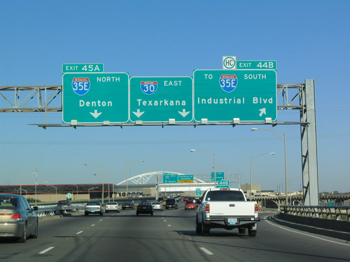
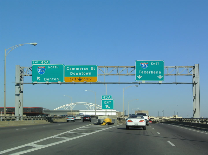
| Reconstruction of the exchange with IH 35E (Stemmons Freeway) shifted ramps for both IH 35E north to Denton and south to Waco and Commerce Street to Downtown to the right side of IH 30 eastbound. 10/19/03 |
|
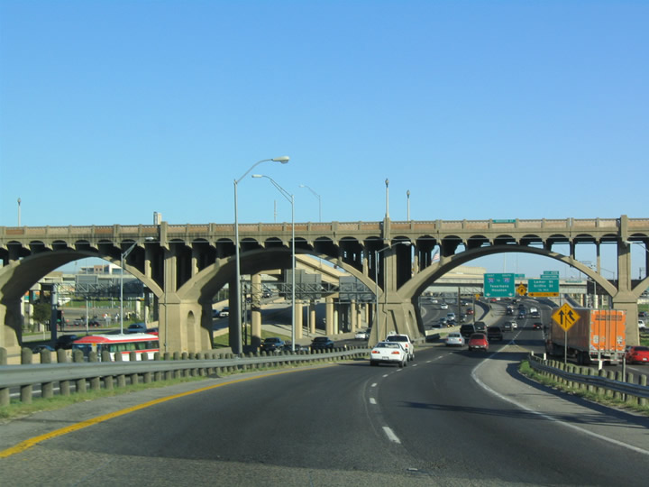
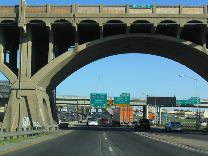
| Houston Street Viaduct (historic U.S. 80) crosses IH 30 and IH 35E northeast to Kay Bailey Hutchison Convention Center Dallas. Together with the Jefferson Boulevard Viaduct, the bridge system represents historic U.S. 77/80 between Zang Boulevard and Downtown Dallas. 10/19/03 |
|
| The roadways of IH 30 and IH 35E parallel one another below the Houston Street and Jefferson Boulevard Viaducts. Although unmarked, IH 35E overlaps with U.S. 77 through Dallas and U.S. 67 north from the Martin D. Love Freeway north to IH 30 east. 10/19/03 |
|
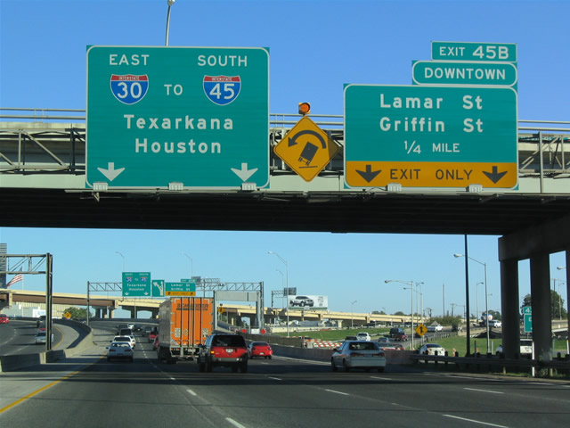
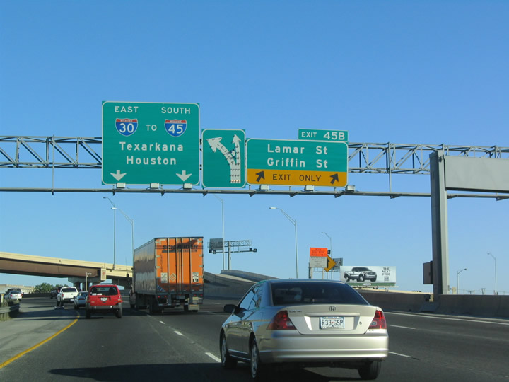
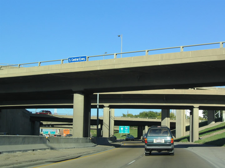
| A collector distributor roadway system accompanies IH 30 east from IH 35E (Stemmons Freeway) to Lamar, Griffin and Cadiz Streets to Cesar Chavez Boulevard. 10/19/03 |
|
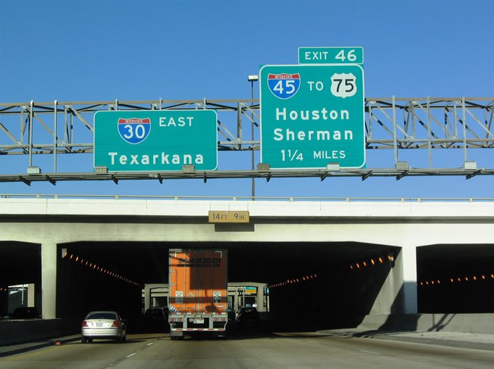
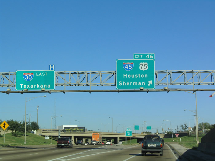
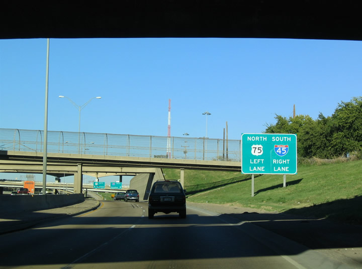
| IH 30 passes through a tunnel below Hotel Street and Dallas Area Rapid Transit (DART) lines to Kay Bailey Hutchison Convention Center Dallas. The freeway proceeds 0.8 miles east to a distributor roadway (Exit 46) for IH 45 south and U.S. 75/IH 345 north. 10/19/03 |
|
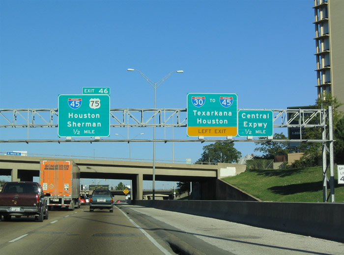
| A three level interchange connects the IH 30 c/d roadway system with Cesar Chavez Boulevard (formerly Central Expressway) just west of the systems interchange with IH 45 (Julius Schepps Freeway) south and U.S. 75 (Central Expressway) north. 10/19/03 |
|
| Exit 46 separates from IH 30 east for IH 45 and U.S. 75. IH 45 replaced U.S. 75 south from Dallas to Houston and Galveston. U.S. 75 remains northward along the Central Expressway to Richardson, Plano, McKinney and Sherman. 10/19/03 |
|
| Cesar Chavez Boulevard branches west from IH 45 and U.S. 175 along an at-grade portion of the old Central Expressway to IH 30 and eastern reaches of Downtown Dallas. 10/19/03 |
|
| Exit 46 separates into ramps for IH 45 south to Hutchins, Ennis and Houston and U.S. 75/IH 345 north below the Good Latimer Expressway overpass. IH 345 is a hidden route accompanying U.S. 75 (Central Expressway) 1.43 miles north to Spur 366 (Woodall Rogers Freeway) near Uptown. 10/19/03 |
|
| Signs for U.S. 75 throughout the Dallas area were amended to display McKinney in place of Sherman in 2007. U.S. 75 extends north from Texas to Durant, Henryetta and Tulsa, Oklahoma. 10/19/03 |
Page Updated 07-05-2019.

 East
East