Texas State Highway 48 (SH 48) provides a 22.3 mile connection between Brownsville and South Parde Island. Beginning at U.S. 77 Business and U.S. 281 in Brownsville, SH 48 overlays Boca Chica Boulevard before angling northeast along Brownsville-Port Isabel Highway to end at Port Isabel, just shy of South Padre Island. The state highway also connects Brownsville with its deep water port.
|
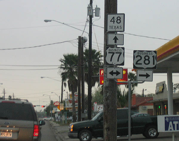
| Eastbound beginning for SH 48 at the intersection of U.S. 77 Business (BU 77-Z) and Boca Chica Boulevard) in central Brownsville. SH 48 takes over for U.S. 281 along Boca Chica Boulevard across Brownsville before turning northeast along South Padre Island Highway to Port Isabel. 02/19/06 |
|
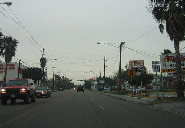
| First confirming marker posted for SH 48 east beyond U.S. 77 Business (Central Boulevard) and U.S. 281. 02/19/06 |
|
| SH 48 is part of the Texas Tropical Trail, a series of four byways that encompass the southern Texas region, extending north to Corpus Christi and west to Laredo. The Border Byway runs nearly 200 miles between Laredo and Boca Chica Beach, and includes U.S. 83, U.S. 281, and SH 48 as a part of its routing. 02/19/06 |
|
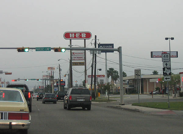
| Immediately following IH 69E, Boca Chica Boulevard (SH 48) meets FM 1847 (Paredes Line Road) north to Cameron Park and Los Fresnos. 02/19/06 |
|
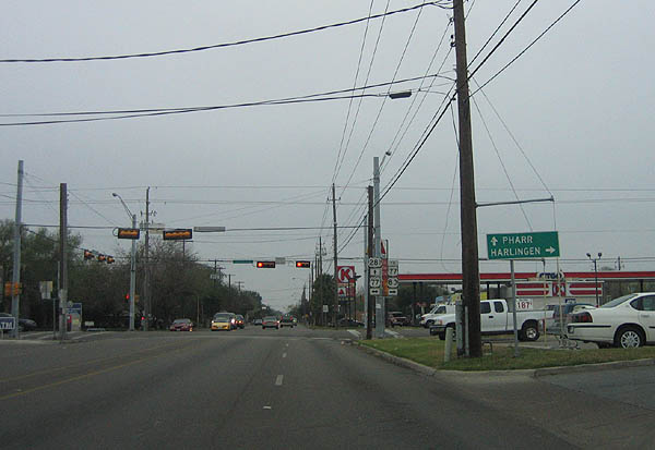
| Scene of SH 48 (Boca Chica Boulevard) west on the approach to U.S. 77 Business (Central Boulevard) and U.S. 281 north. U.S. 77 Business (BU 77-Z) connects SH 48 with downtown Brownsville and Harlingen (via IH 69E and U.S. 77-83) while U.S. 281 connects motorists with Pharr deeper within the Rio Grande Valley. 02/19/06 |
|
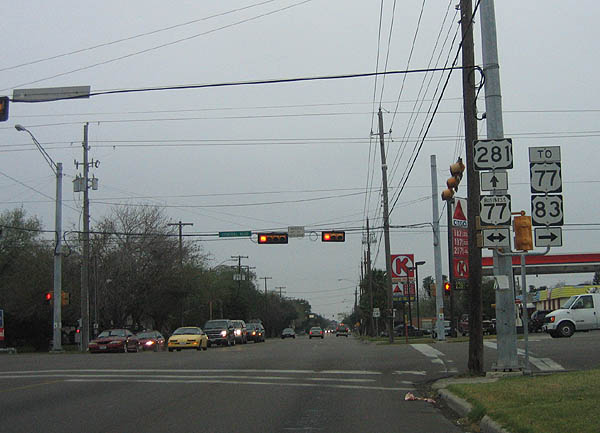
| SH 48 west officially ends here while U.S. 281 begins its 1,872 mile course through the central United States. Use U.S. 77 Business north to otherwise reach IH 69E and company. 02/19/06 |
Page Updated 01-23-2018.