|
| After exiting IH 37 southbound, motorists pass the first reassurance marker on the ramp to SH 358. 07/11/05 |
|
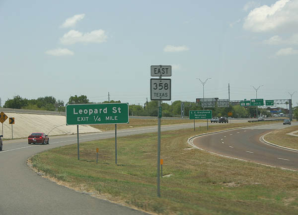
| The first exit from SH 358 is Leopard Street, hidden SS 407 (former SH 9 before construction of IH 37). 07/11/05 |
|
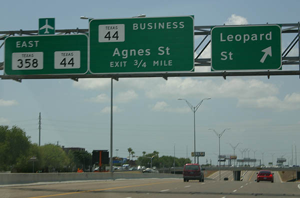
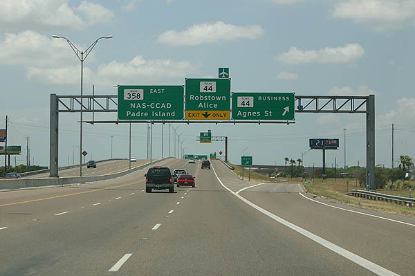
| Agnes Street is the Cesar Chavez Memorial Parkway. 07/11/05 |
|
| SH 358 east at Agnes Street. While signed as Business (BS) 44, the road is actually known as SS 544 and only signed as Business SH 44 between SH 358 and SH 44. 07/11/05 |
|
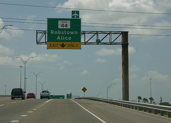
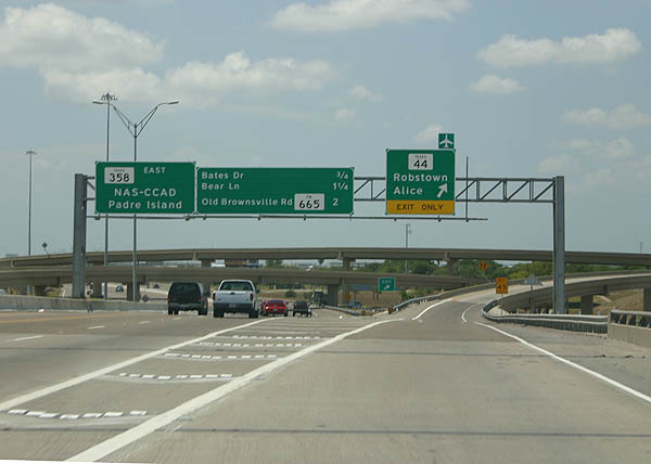
| SH 358 east approaches SH 44 to Robstown and Alice. 07/11/05 |
|
| The ramp to SH 44 splits from SH 358 east, 0.75 miles ahead of Bates Drive. 07/11/05 |
|
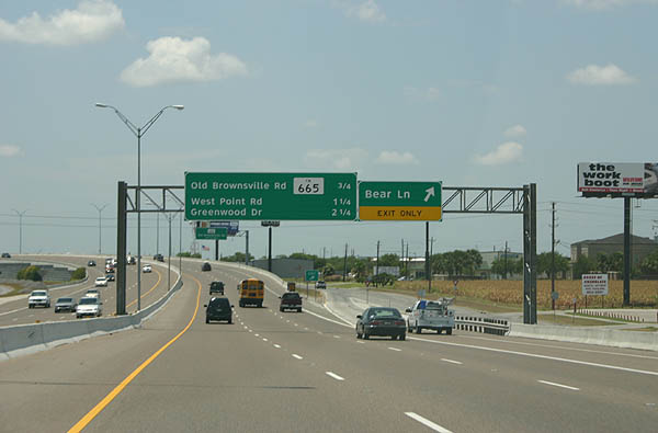
| SH 358 eastbound at Bear Lane. 07/11/05 |
|
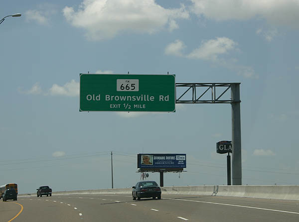
| One half mile north of FM 665 (Old Brownsville Road). 07/11/05 |
|
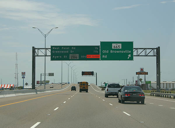
| FM 665 (Old Brownsville Road) angles southwest across SH 358 (South Padre Island Drive) to SH 357 along the Corpus Christi city line. The state highway travels 46.05 miles westward to Petronila, Driscoll and Alice. 07/11/05 |
|
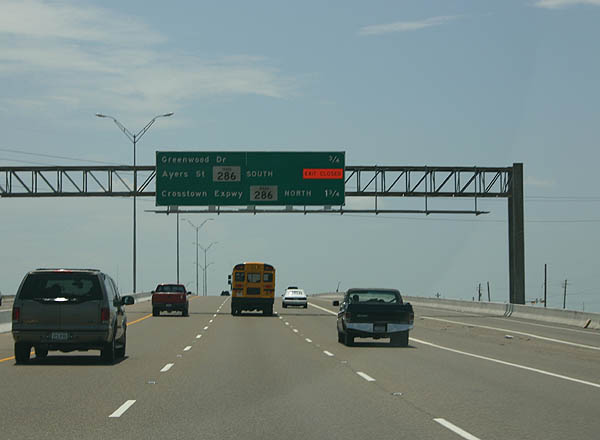
| The succeeding exits along SH 358 east are with Greenwood Drive and SH 286 (Crosstown Expressway). 07/11/05 |
|
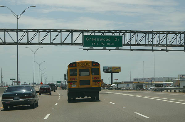
| One quarter mile ahead of Greenwood Drive. 07/11/05 |
|
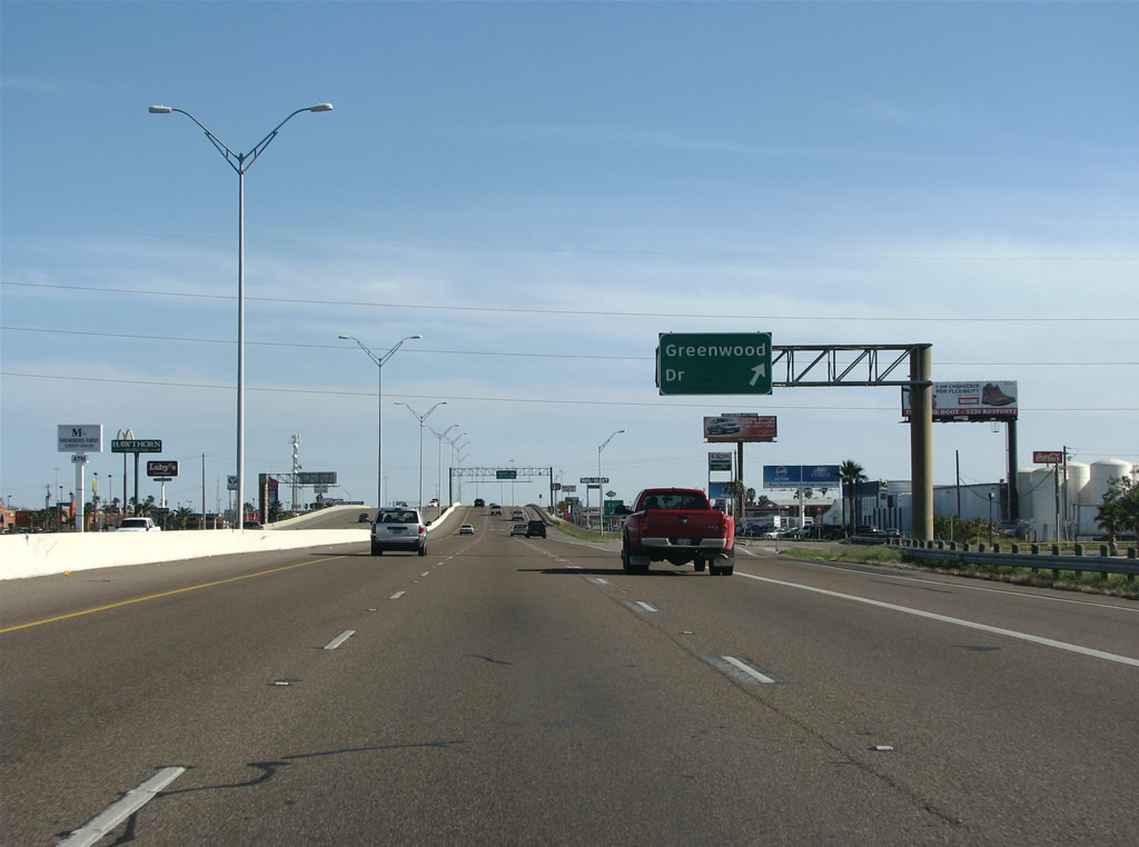
| Greenwood Drive comprises a commercial arterial within the vicinity of the diamond interchange with South Padre Island Drive. 12/29/08 |
|
| The ensuing off-ramp joins SH 358 with the S Padre Island frontage road with connections to the SH 286 frontage road and parallel Ayers Street (SH 286 Business). 12/29/08 |
|
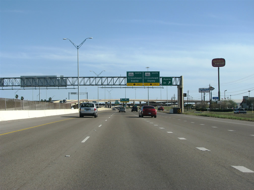
| Commercialized frontage lines both sides of South Padre Island Drive on the approach to the cloverstack interchange with SH 286 (Crosstown Expressway). 12/29/08 |
|
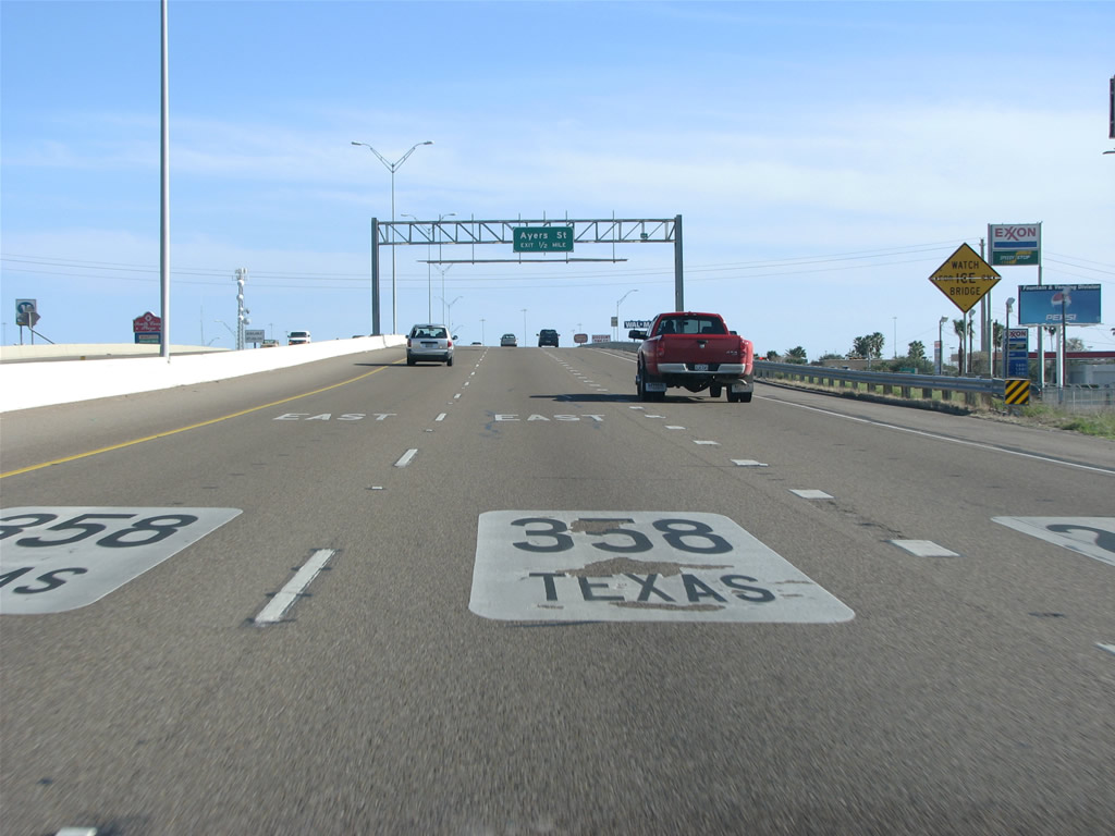
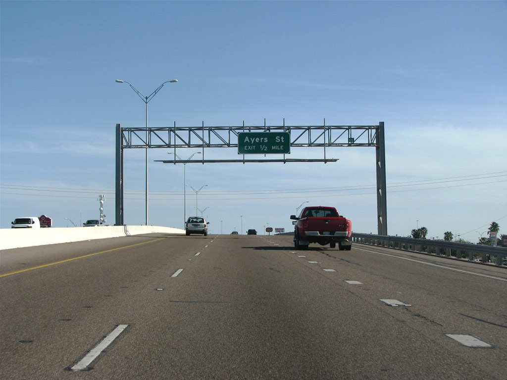
| The exit for Ayers Street precedes the multi level interchange with SH 286 (Crosstown Expressway). 12/29/08 |
|
| SH 286 extends as a suburban freeway south across Oso Creek before transitioning into a rural two lane road en route to Chapman Ranch and FM 70. 12/29/08 |
|
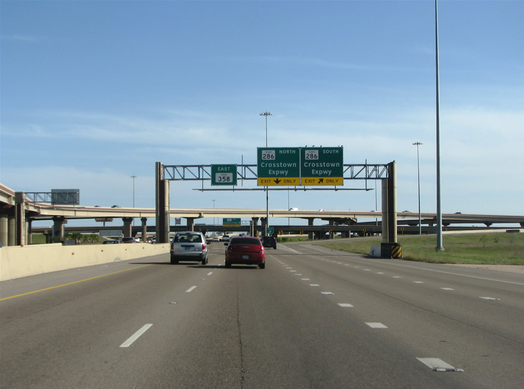
| Painted shields aid in motorist navigation ahead of the loop ramp for SH 286 (Crosstown Expressway) northbound to Downtown Corpus Christi. 12/29/08 |
|
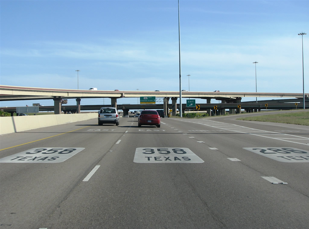
| SH 286 travels 4.55 miles north to the south ends of IH 37 and U.S. 181. 12/29/08 |
|
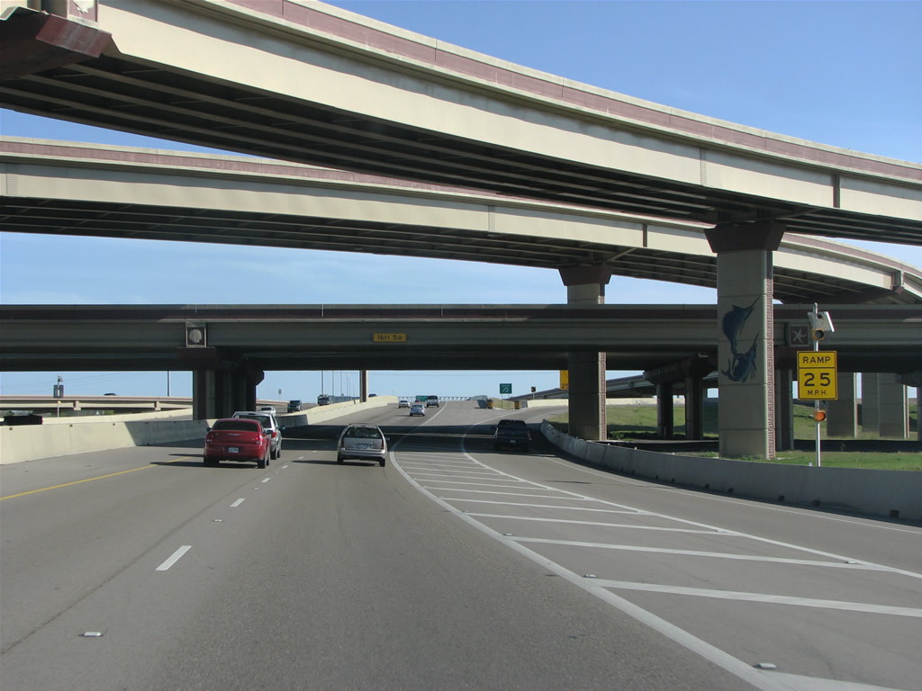
| The stack interchange between the Crosstown Expressay and Padre Island Drive features a aquatic motif for the SH 358 connection to Padre and Mustang Islands. 12/29/08 |
|
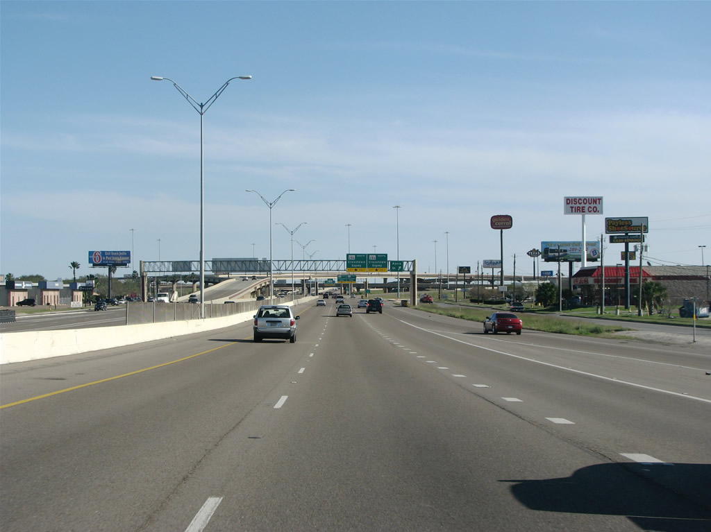
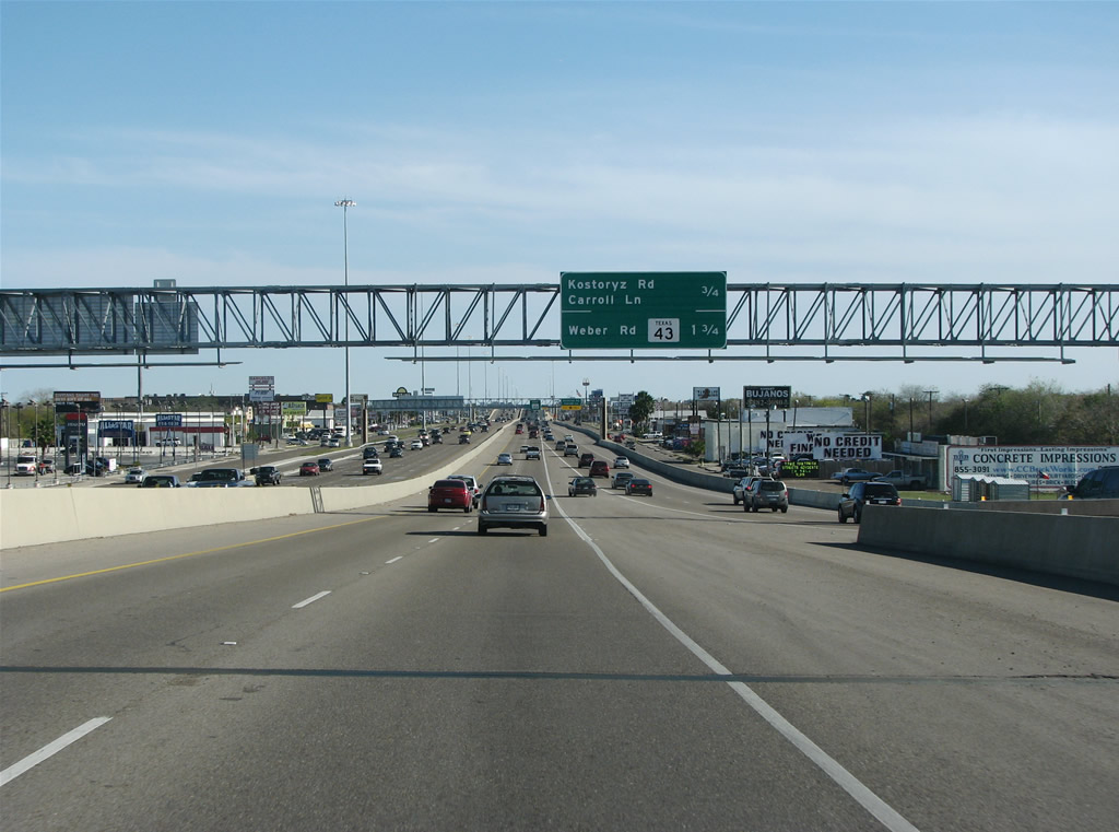
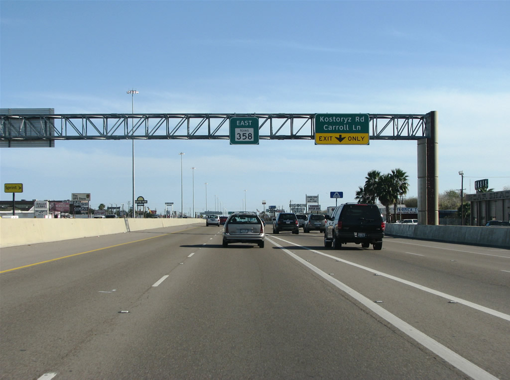
| Continuing east, SH 358 (Padre Island Drive) straddles the Corpus Christi street grid, next meeting Kostoryz Road. 12/29/08 |
|
| The diamond interchange with Kostoryz Road represents the beginning of the 1972 section of SH 358 freeway, which is the most congested freeway in Corpus Christi. 12/29/08 |
|
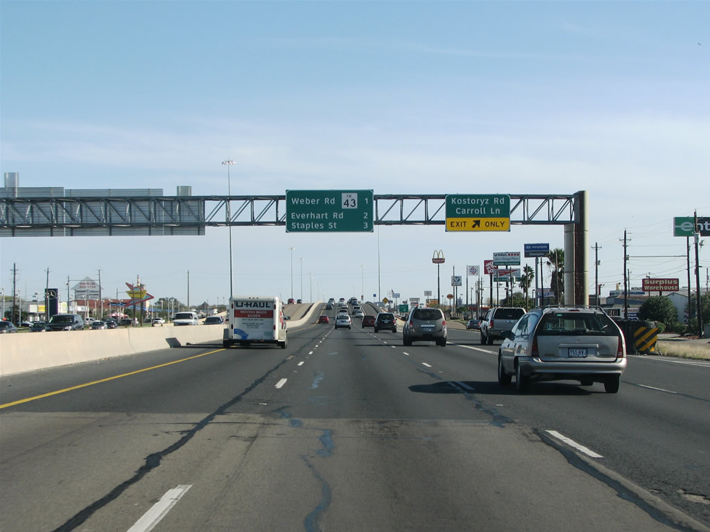
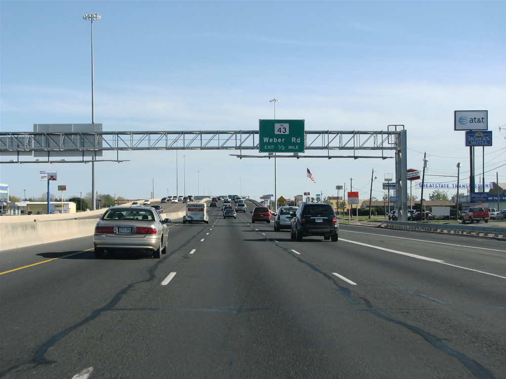
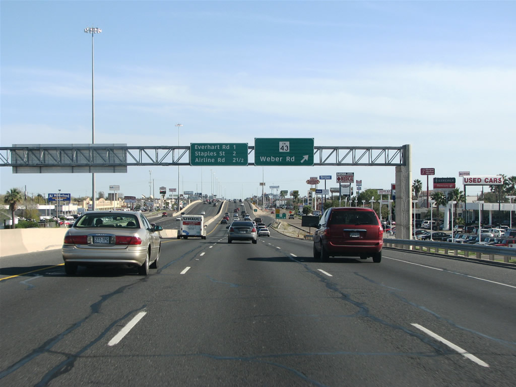
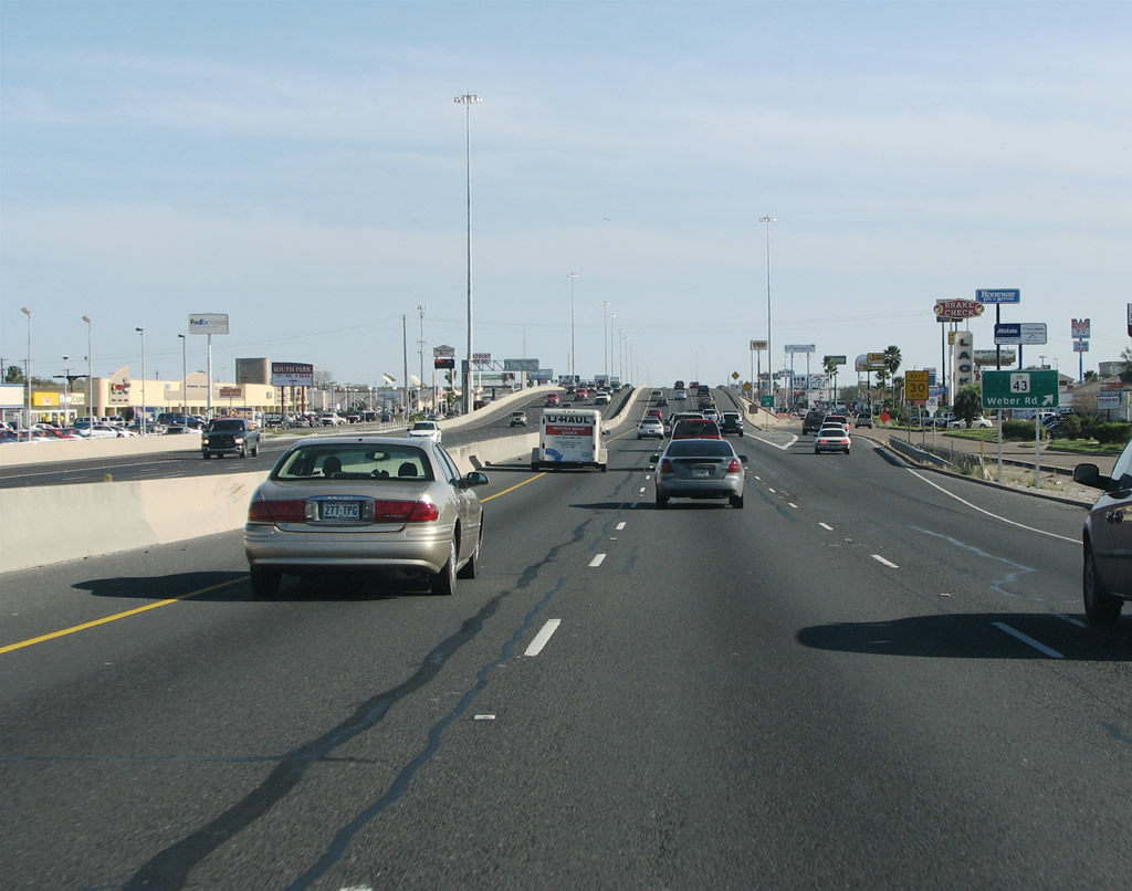
| SH 358 (South Padre Island Drive) meets FM 43 (Weber Road) in one half mile. 12/29/08 |
|
| FM 43 stems southwest from SH 358 along Weber Road to cross Oso Creek into unincorporated Nueces County. The state highway runs 10.77 miles west to the intersection of FM 665 and FM 2444. 12/29/08 |
|
| FM 43 (Weber Road) west to FM 665 joins Corpus Christi with Petronila and U.S. 77. 12/29/08 |
|
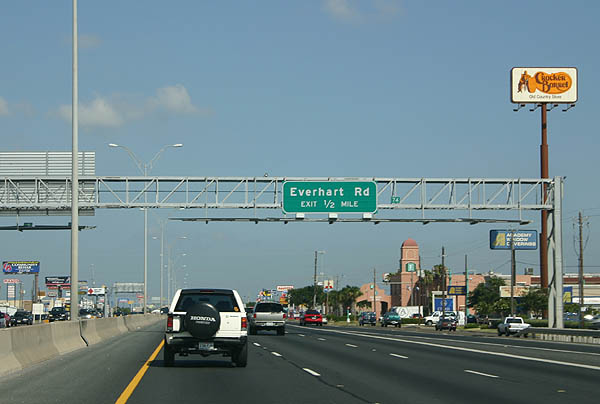
| Advancing east to Everhart Road on SH 358 (South Padre Island Drive). Beyond Everhart Road is the largest concentration of shopping centers in Corpus Christi. 07/11/05, 12/29/08 |
|
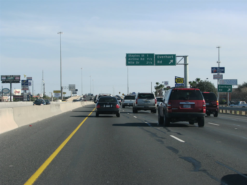
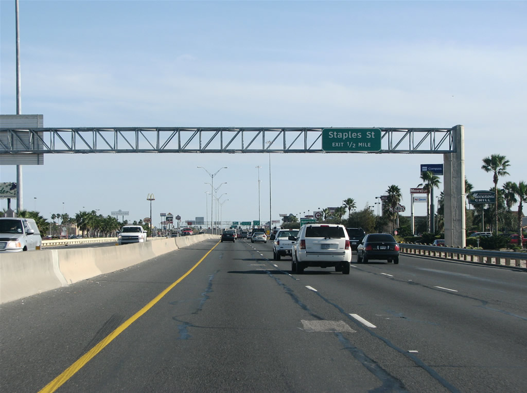
| Staples Street and SH 358 converge by La Palmera and Sunrise Malls in one half mile. 12/29/08 |
|
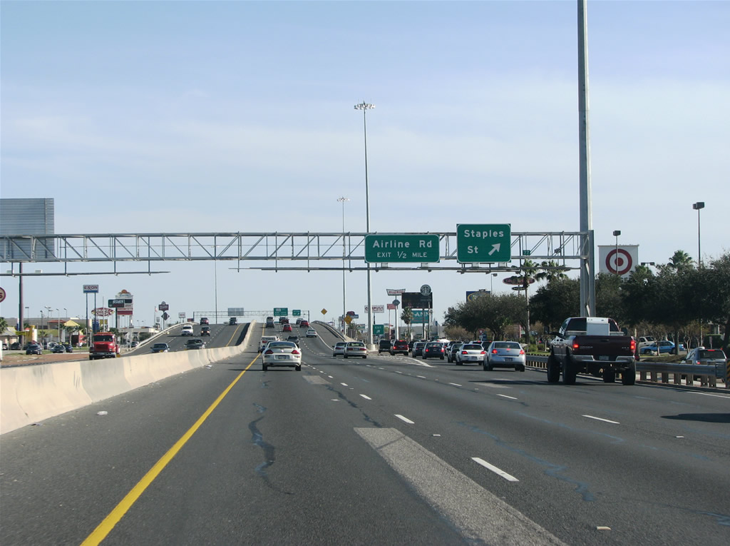
| Staples Street heads toward Downtown Corpus Christi and southwest from SH 358 to FM 2444 and the Kings Crossing Golf Course community. The crossroads of Staples Street and South Padre Island Drive (SPID) is the busiest in Corpus Christi. 12/29/08 |
|
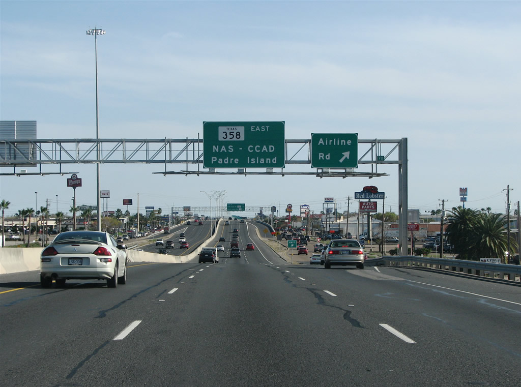
| Airline Road runs along the east side of Sunrise Mall by Gulfway Shopping Center and other retail. Traffic along SH 358 decreases considerably following this exit. 12/29/08 |
|
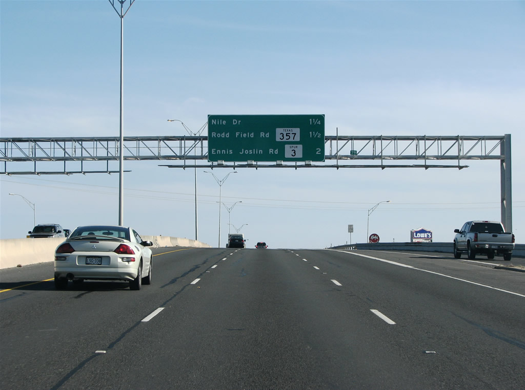
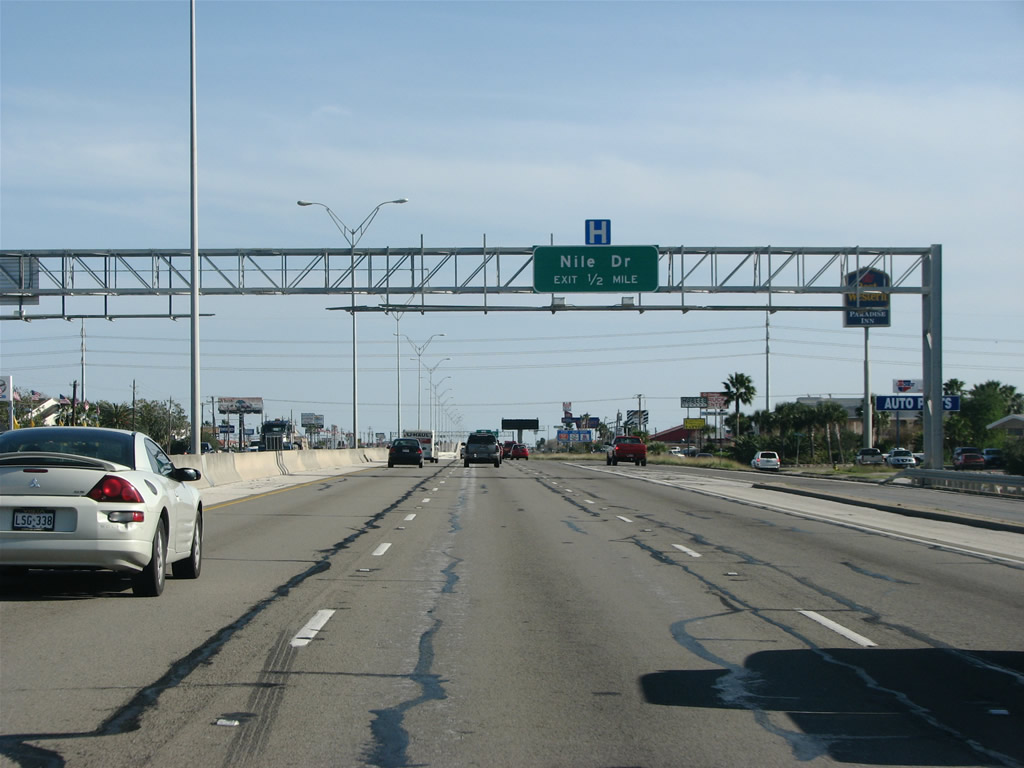
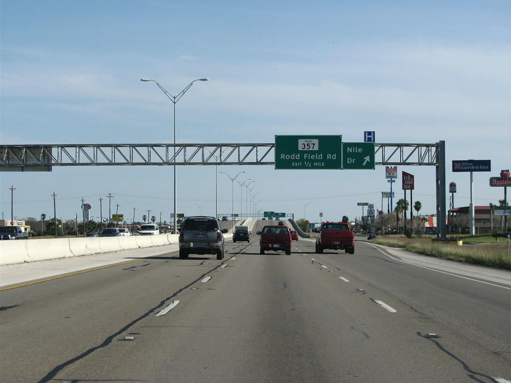
| SH 358 east to Nile Drive, SH 357 and Spur 3 opened in 1988. 12/29/08 |
|
| Preceding the exit to Niles Drive, an auto mall lines the north side of S Padre Island Drive while hotels and apartments front the south service road. 12/29/08 |
|
| Nile Drive heads north from SH 358 to Ennis Joslin Road through the Pharaoh Valley subdivision. The community formerly included a golf course, which ceased operations in 2010. Barisi Village, a $300 million mixed use development, was proposed at the site by 2014, but lawsuits filed by three area residents in 2015 prevented the project from moving forward.1 12/29/08 |
|
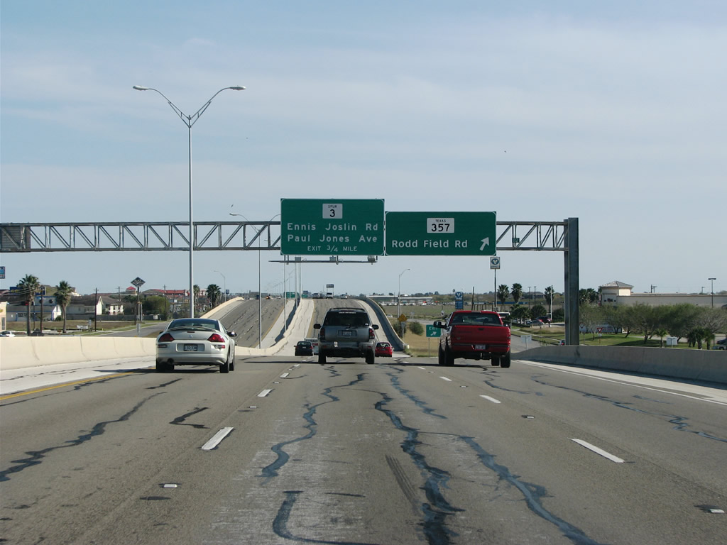
| SH 357 follows Rodd Field Road southwest from SH 358 and Corpus Christi Medical Center to Saratoga Boulevard. Saratoga Boulevard leads the state highway northwest to FM 665. 12/29/08 |
|
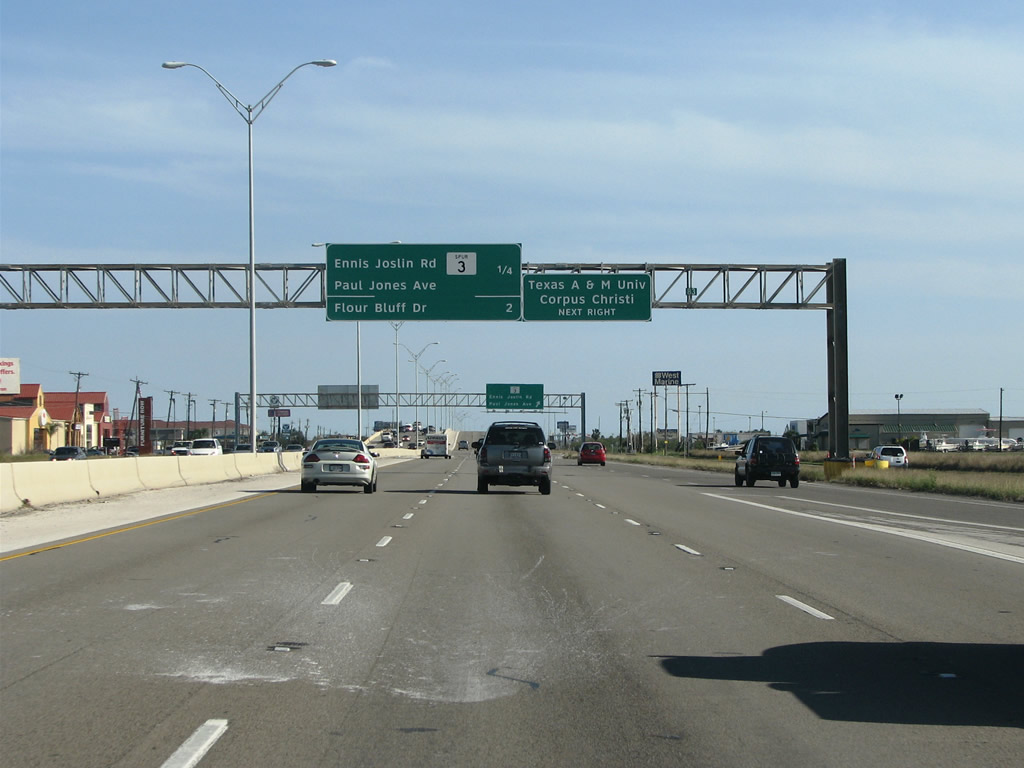
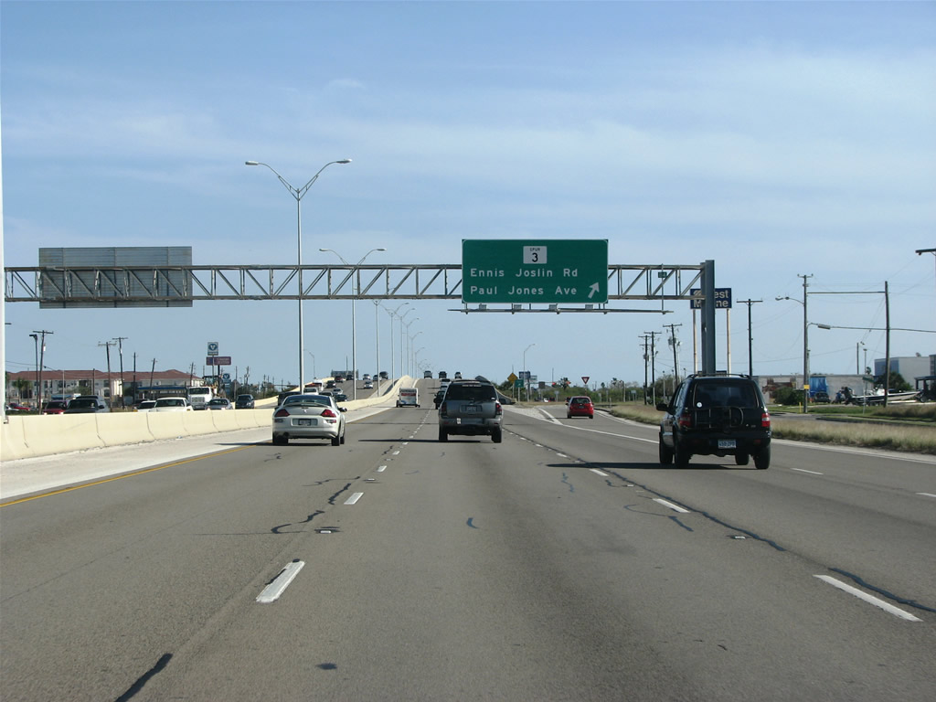
| Spur 3 (Ennis Joslin Road) ties into SH 358 off Oso Bay ahead of Paul Jones Avenue. 12/29/08 |
|
| Spur 3 follows Ennis Joslin Road north along Oso Bay to Ocean Drive. The 3.36 mile route takes Ocean Drive to Texas A&M - Corpus Christi. 12/29/08 |
|
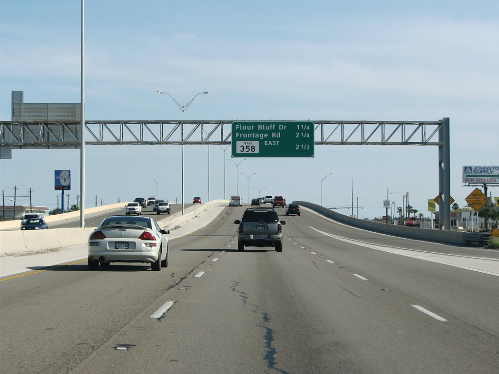
| SH 358 (Padre Island Drive) progresses southeast across Oso Bay to Corpus Christi N.A.S. & Army Depot, and the Flour Bluff community. 12/29/08 |
|
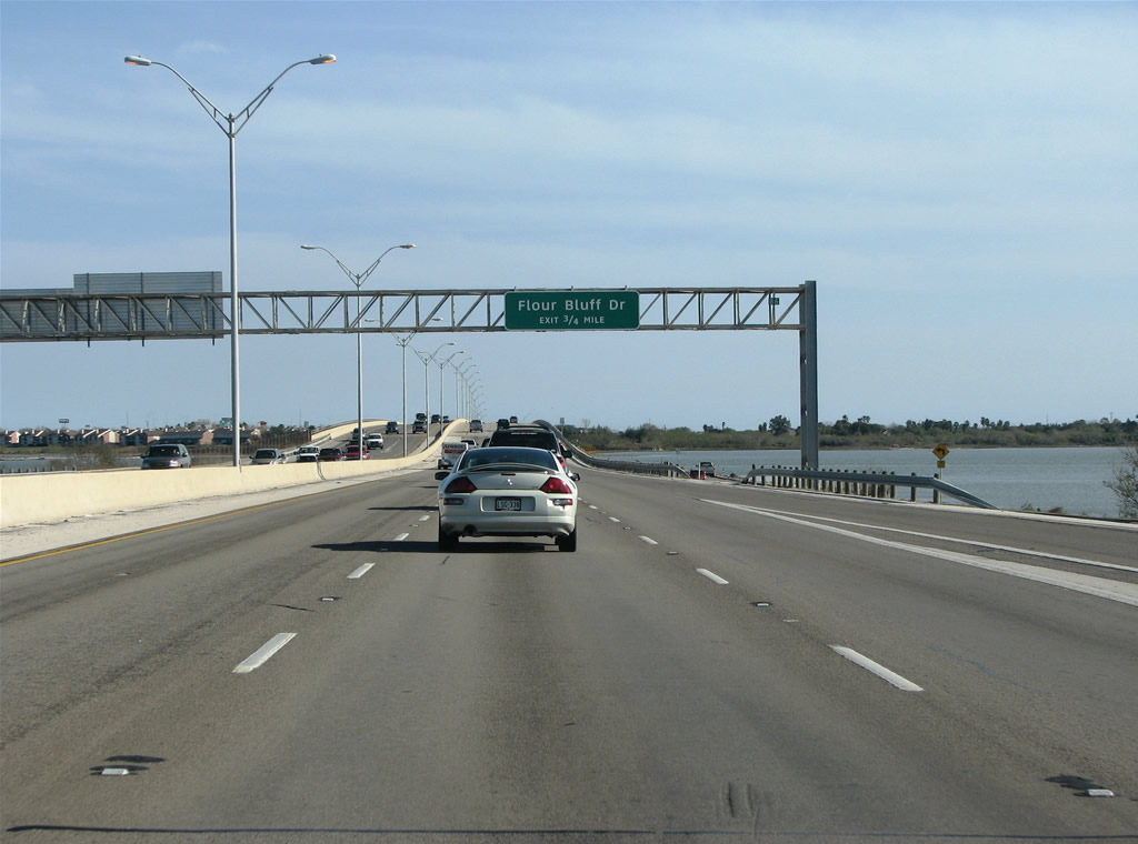
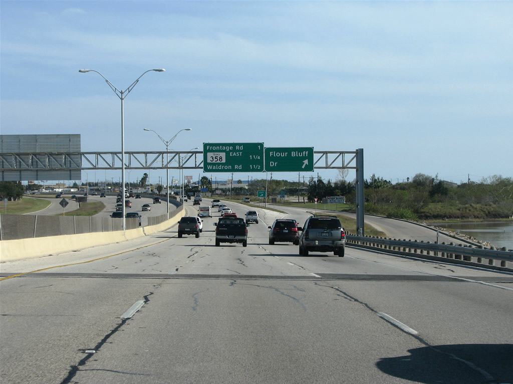
| Crossing Cayo Del Oso, SH 358 reaches the off-ramp to Flour Bluff Drive in 0.75 miles. 12/29/08 |
|
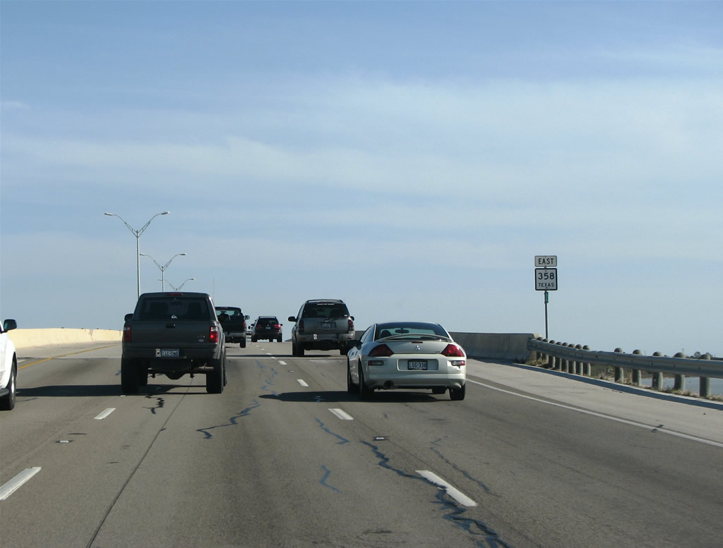
| A fixed span carries SH 358 over the waterway beyond this reassurance shield. 12/29/08 |
|
| Flour Bluff Drive spurs north to residential areas alongside NAS Corpus Christi and southwest along Encinal Peninsula to Waldron Field NOLF. 12/29/08 |
|
| An exit for the South Padre Island frontage road departs just before SH 358 separates with the freeway for NAS Drive. 12/29/08 |
|
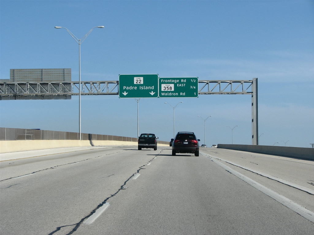
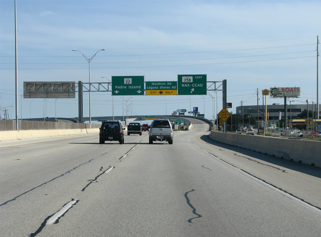
| The frontage road off-ramp leaves SH 358 for adjacent big box retail along Park Road 22 east. PR 22 continues South Padre Island Drive onto John F. Kennedy Memorial Causeway across Laguna Madre. 12/29/08 |
|
| SH 358 turns north along a flyover from PR 22 onto NAS Drive, a surface arterial leading to NAS Corpus Christi and Corpus Christ Army Depot. PR 22 spurs 15.59 miles south onto Padre Island, ending at the entrance to Padre Island National Seashore. 12/29/08 |
Page Updated 07-25-2019.