|
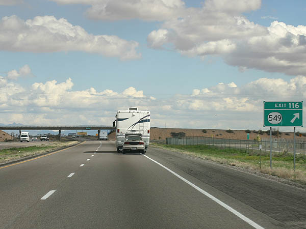
| NM 549 parallels Interstate 10 along an old alignment of U.S. 70/80 east from Deming to the first exit in Dona Ana County. 02/27/05 |
|
| The 31.43 mile long route of NM 549 concludes at the diamond interchange (Exit 116) joining I-10 with County Road C001 (FR 1026). 02/27/05 |
|
| Interstate 10 directly followed old U.S. 70/80 east from Exit 116 to Corralitos Road. Portions of the old alignment remain as frontage roads. 02/27/05 |
|
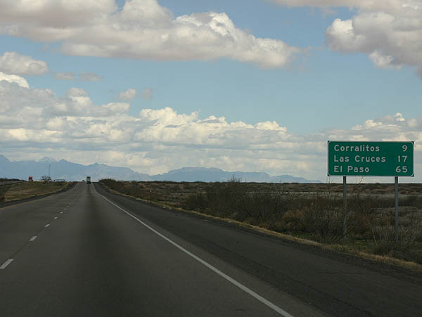
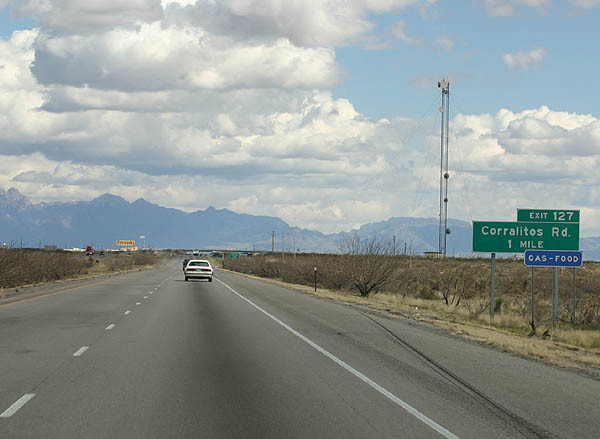
| Corralitos Road (FR 1030) is a ranch exit lying midway between the US Border Patrol Checkpoint and Las Cruces International Airport (LRU). Robert Larson Boulevard (FR 1030) runs along the south side of I-10 from Exit 127 to the Southern New Mexico State Fair and Rodeo complex. 02/27/05 |
|
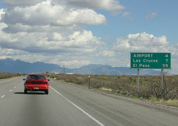
| U.S. 70 splits with Interstate 10 east in seven miles for Las Cruces. The city center lie another seven miles further via either route. 02/27/05 |
|
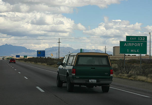
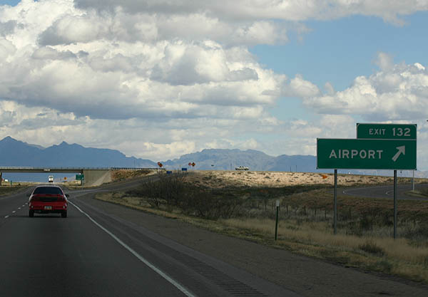
| One mile west of the diamond interchange (Exit 132) with Crawford Road (FL 5606) to Las Cruces International Airport (LRU) and an industrial park. 02/27/05 |
|
| Exit 132 departs I-10 east for Crawford Road. Las Cruces International Airport (LRU) is on the mesa west of Las Cruces, around 500 feet higher than the Mesilla Valley. 02/27/05 |
|
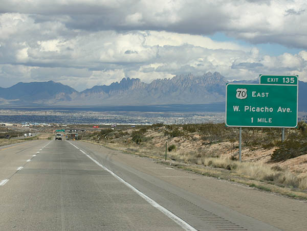
| Gradually descending into Mesilla Valley, the ensuing exit is where U.S. 70 branches northward from I-10 & U.S. 180 along Picacho Avenue into Las Cruces. 02/27/05 |
|
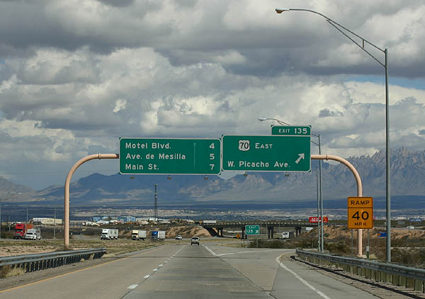
| Entering the trumpet interchange with U.S. 70 (Picacho Avenue) east to the community of Fairacres and central Las Cruces. U.S. 80 also followed U.S. 70 until I-10 was constructed to the south. 02/27/05 |
|
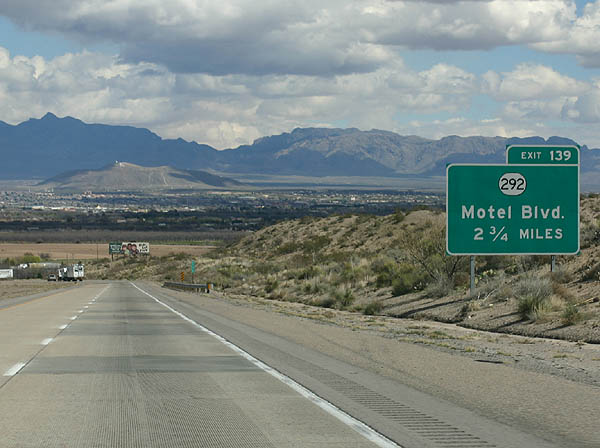
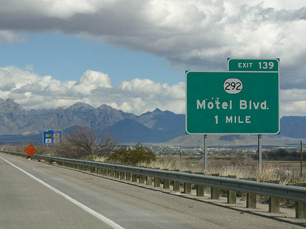
| Dropping below 3,900 feet above sea level, I-10 crosses the Rio Grande ahead of the diamond interchange (Exit 139) with NM 292 (Motel Boulevard). 02/27/05 |
|
| NM 292 follows Motel Boulevard and Calle de El Paso 1.45 miles south from Exit 139 to NM 28 (Avenida de Mesilla) at the town of Mesilla. 02/27/05 |
|
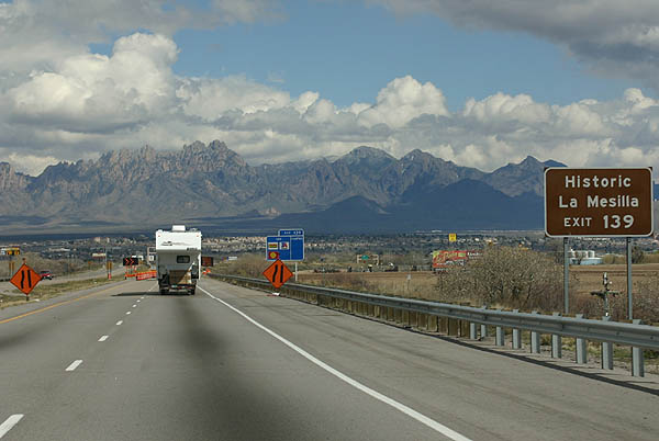
| Exit 139 serves La Mesilla, the original 1848 town site. Mesilla was settled after the Mexican War, and was the primary supply and market point for the region via the Butterfield Stage Line, until the railroad went through Las Cruces rather than Mesilla. 02/27/05 |
|
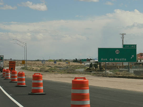
| NM 28 (Avenida de Mesilla) arcs northeast from NM 359 and NM 292 at Mesilla to a diamond interchange (Exit 140) with I-10 and NM 478 (Main Street) south of Downtown Las Cruces. 02/27/05 |
|
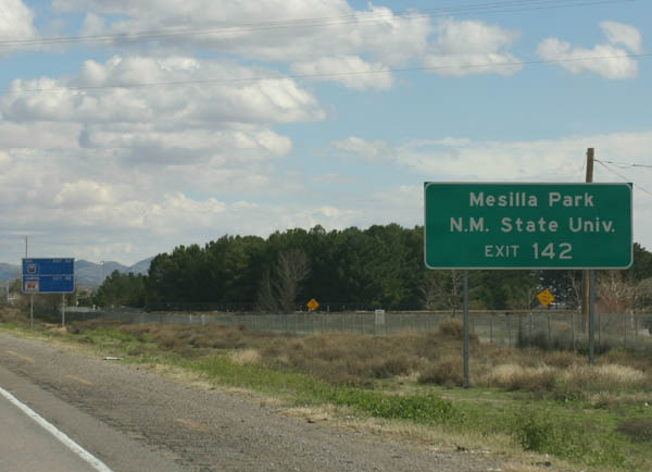
| NM 478 (Main Street) heads south from the Las Cruces city center to converge with Interstate 10 at NM 188 (Valley Drive) and University Avenue west of New Mexico State University. 02/27/05 |
|
| NM 478 (Main Street) is the pre-1955 alignment of U.S. 80 from Downtown south to Mesquite and Anthony. The state highway offers an alternate route to El Paso south of Exit 142. 02/27/05 |
|
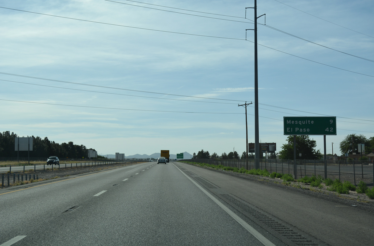
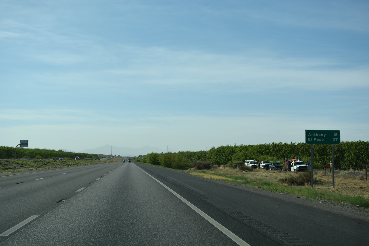
| Unincorporated Mesquite lies nine miles to the southeast from I-10 in Las Cruces. El Paso, Texas follows in 42 miles. 04/25/17 |
|
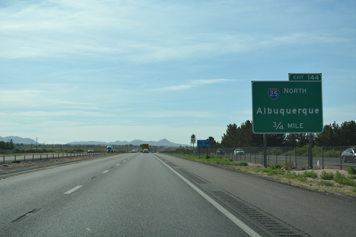
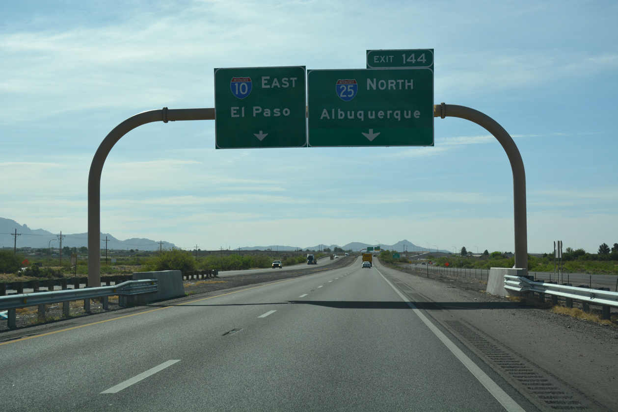
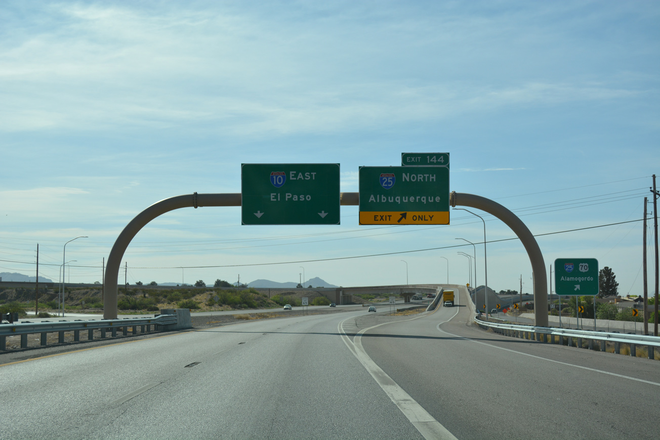
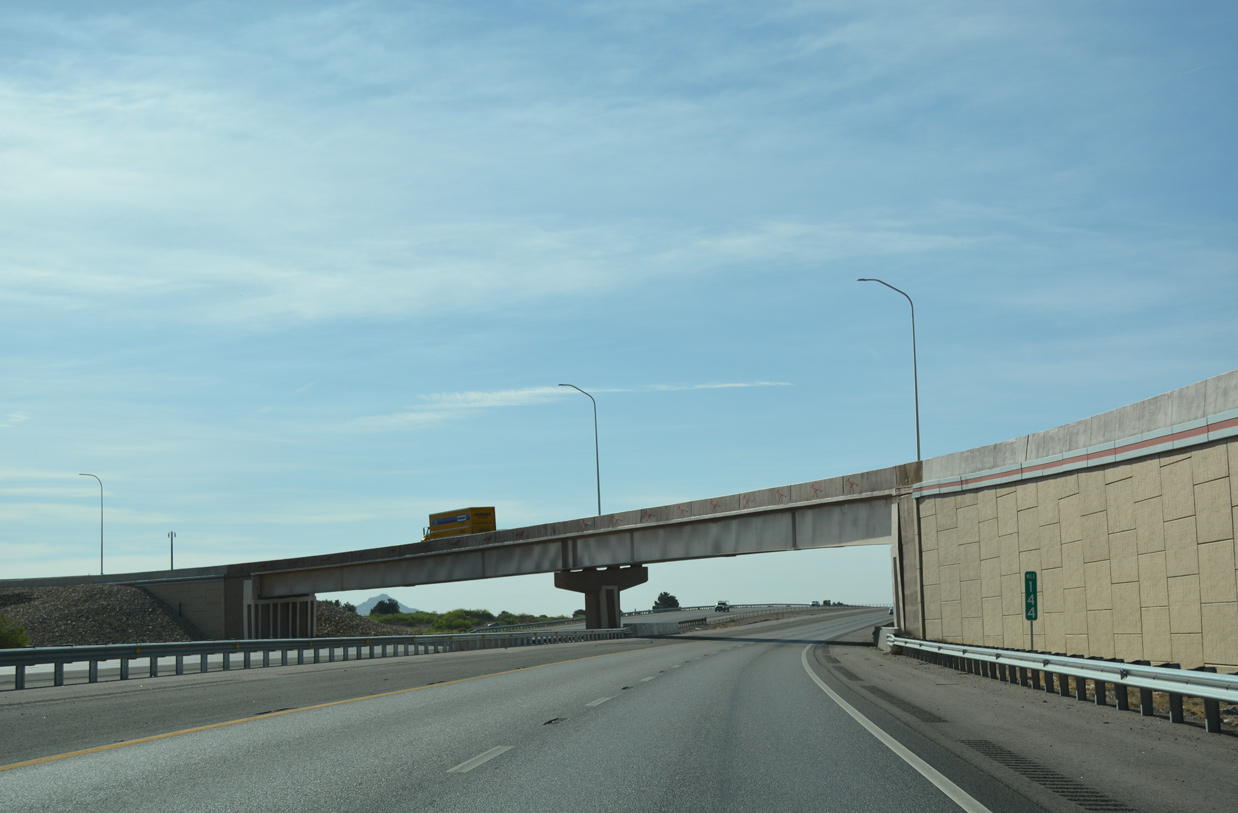
| I-10 & U.S. 180 merge with the south end of Interstate 25 at a two wye interchange (Exit 144) in three quarters of a mile. 04/25/17 |
|
| The I-10/I-25 Interchange Reconstruction Project rebuilt the exchange from April 26, 2012 to April 9, 2013. Costing $37 million, work included constructing a new flyover from I-10 east to I-25 north, replacing the I-10 overpasses above the southbound on-ramp from I-25, and removing the sharp loop ramp at old Exit 144.1 04/25/17 |
|
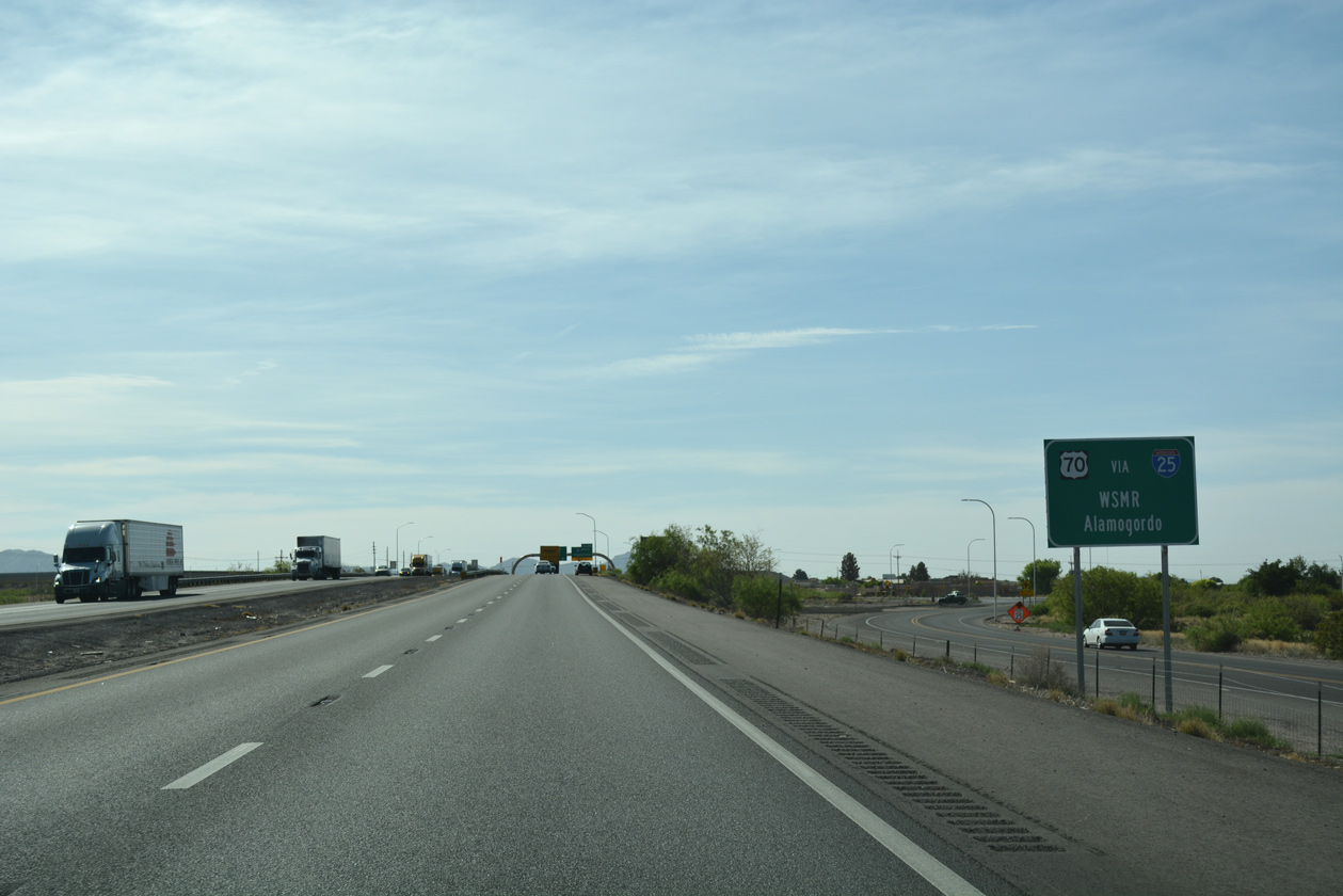
| Interstate 25 north connects with U.S. 70 east for White Sands Missile Range and Alamogordo in six miles. 04/25/17 |
|
| Traveling north from Las Cruces to Truth of Consequences, Socorro, Albuquerque, and Santa Fe, Interstate 25 wholly replaced U.S. 85. U.S. 85 retains a short segment in El Paso, and an alignment from Denver northwards, but in New Mexico the route is not acknowledged officially. 04/25/17 |
|
| A ribbon cutting ceremony took place on April 23, 2013, marking the formal completion of the I-10/I-25 Interchange Reconstruction Project. Work finished 60 days ahead of schedule, netting the contractor a $2.25 million bonus. The previous trumpet interchange between the two freeways was constructed in 1950.2 04/25/17 |
|
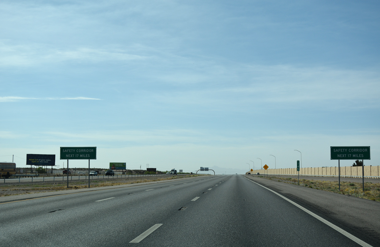
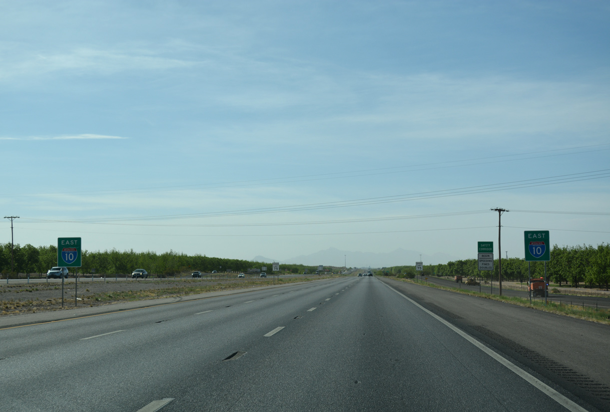
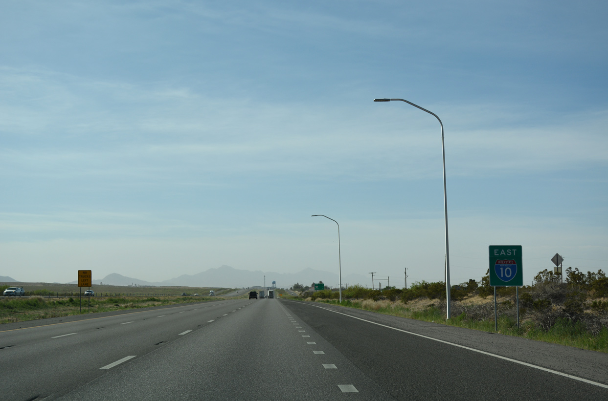
| South from I-25, Interstate 10 a safety corridor. Under a 2002 state law, speeding fines can be doubled along the 17 mile stretch between Las Cruces and Anthony.3 04/25/17 |
|
| The remainder of Interstate 10 east in New Mexico was expanded from four to six lanes during a $39 million 18 month project. Substantial work on the 18 mile long project was completed by the end of July 2011.3 04/25/17 |
|
| Meeting Interstate 10 next is NM 228 via Frontage Route 1035 (Stern Drive). FR 1053 follows I-10 southward from Union Avenue in Las Cruces 21.65 miles to Acosta Road at Anthony. 04/25/17 |
|
| NM 228 (Mesquite Drive) travels 1.81 miles between FR 1053 and NM 478 (former U.S. 80/85) in Mesquite. Mesquite represents one of the many farming towns and railway sidings between Las Cruces and El Paso. 04/25/17 |
|
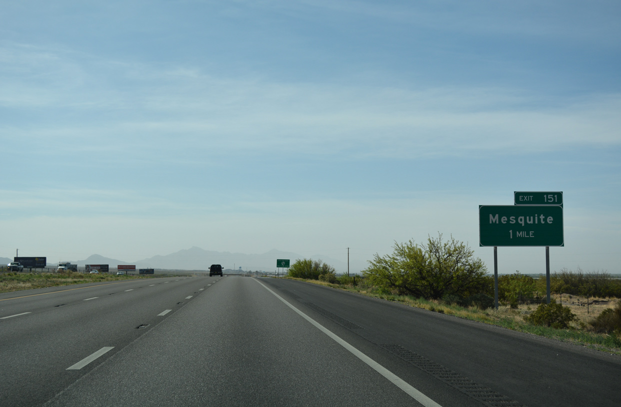
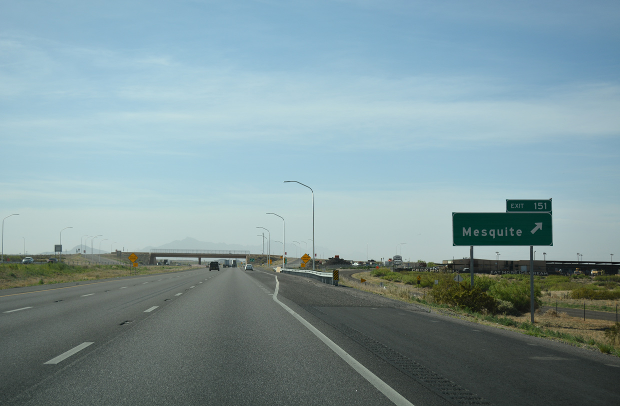
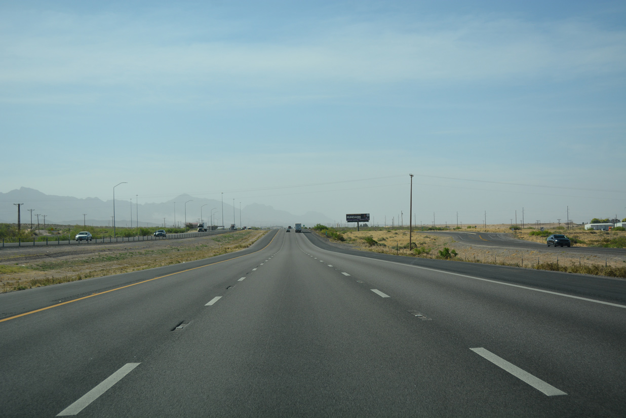
| Interstate 10 passes by a number of dairy operations south from Exit 151 at Mesquite. 04/25/17 |
|
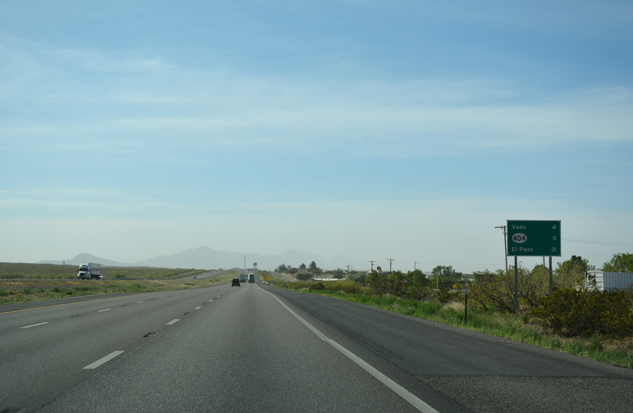
| Distance sign for Vado, NM 404 serving Chaparral, and El Paso posted along Interstate 10 east. 04/25/17 |
|
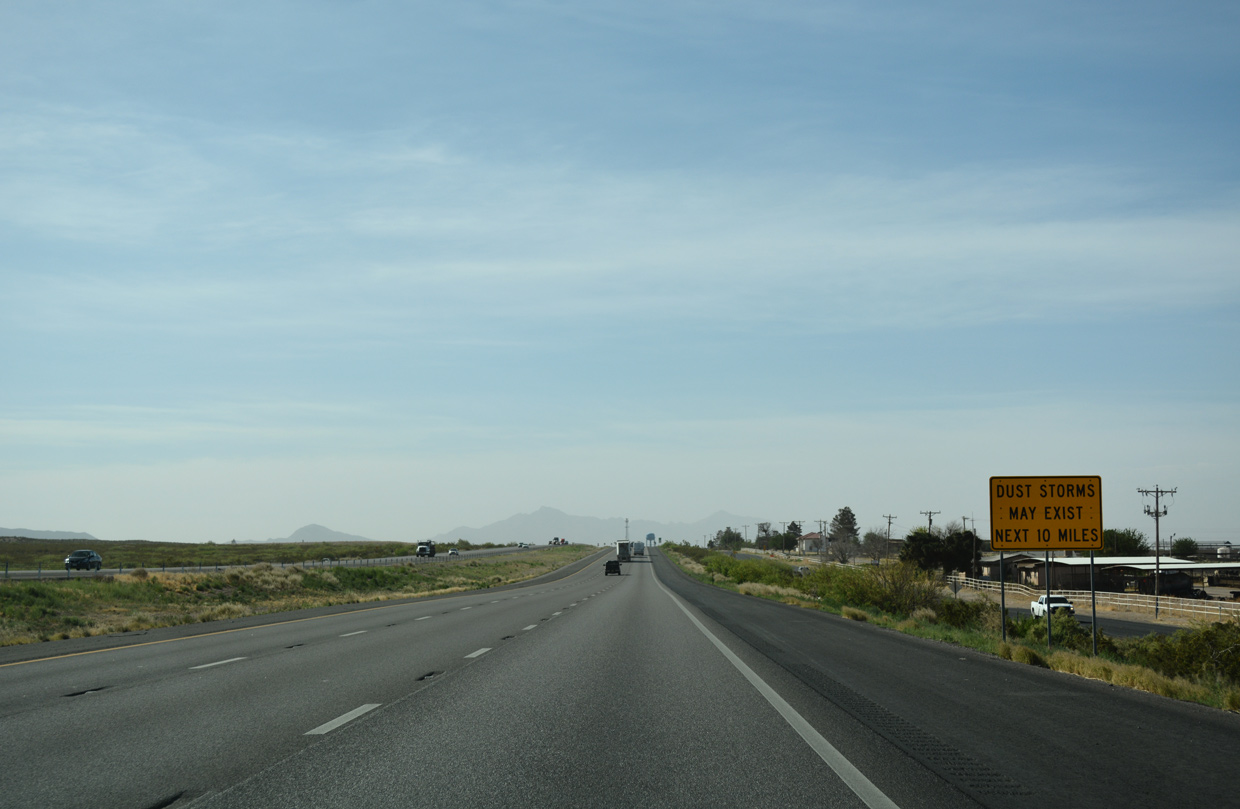
| Interstate 10 through the southern Mesilla Valley is also prone to dust storms. 04/25/17 |
|
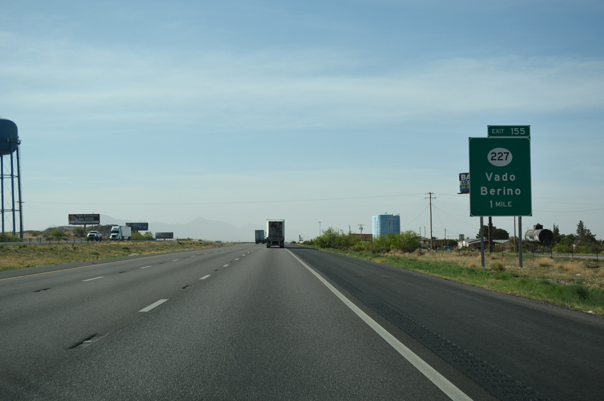
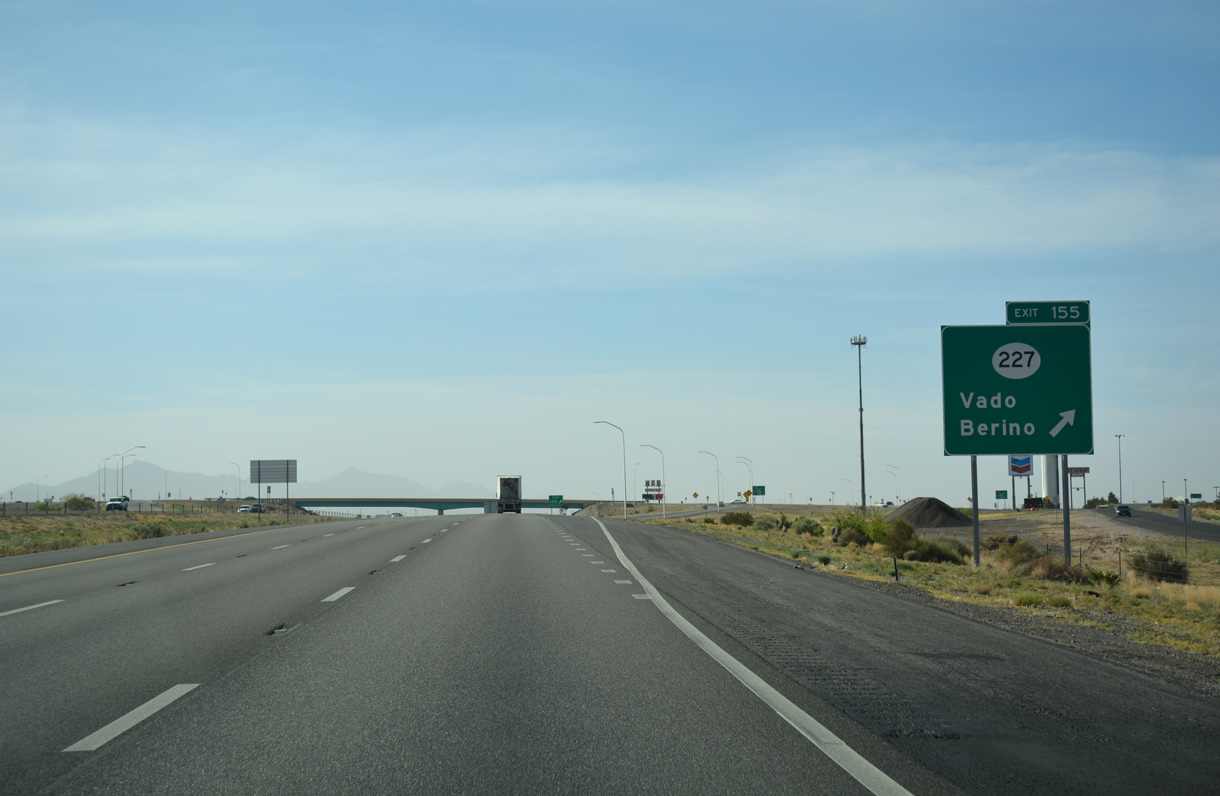
| Advance signage for NM 227 (Vado Drive), serving Vado. NM 227 constitutes a 1.98 mile route between Exit 155 and NM 478 (former U.S. 80/85). 04/25/17 |
|
| NM 227 (Vado Drive) stems west from I-10, the 1955 alignment of U.S. 80, to NM 478 at Vado. NM 227 originally linked U.S. 80-85 with NM 28, but that segment was renumbered to NM 189 in 1988 to eliminate the short overlap on NM 478.4 04/25/17 |
|
| Continuing south from the dumbbell interchange with NM 227 at Exit 155, Interstate 10 bee lines between Berino and the Franklin Mountains. The speed limit along a nearly 14 mile section of I-10 between Exit 151 and the Texas state line was increased to 75 miles per hour on October 29, 2012.5 04/25/17 |
|
| A trumpet interchange (Exit 160) previously connected I-10 with NM 460 (Anthony Drive) south into Anthony. The exchange was removed after Exit 162 at O'Hara Road opened to traffic around 2000. NM 460 represents a former alignment of U.S. 80/85 and later U.S. 80 Alternate. The state route remains along Anthony Drive, 3.81 miles south from FR 1035 to the Texas line. 01/14/06 |
|
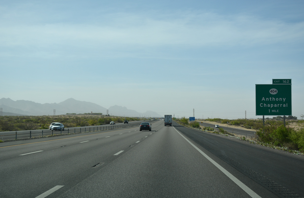
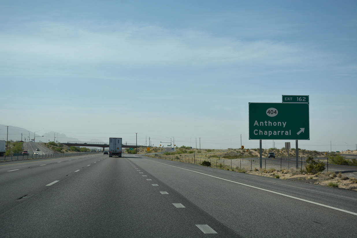
| Exit 162 departs Interstate 10 eastbound in one mile for NM 404 (O'Hara Drive) west to the town of Anthony and east to unincorporated Chaparral. 04/25/17 |
|
| A 9.70 mile long route, NM 404 (O'Hara Drive) leads west to NM 460 (Anthony Drive) and east across the Franklin Mountains to NM 213. O'Hara Drive extends 1.96 miles west from NM 460 to NM 168 across the Rio Grande. 04/25/17 |
|
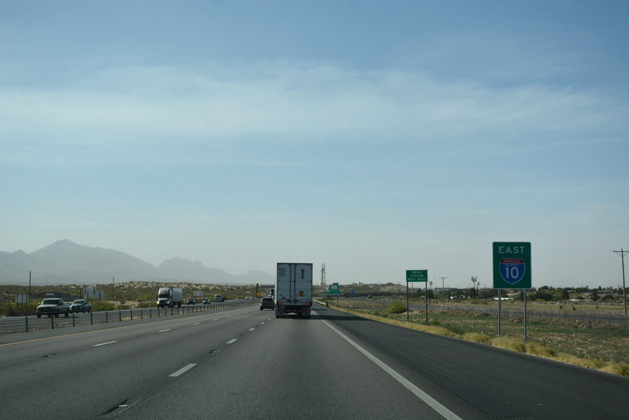
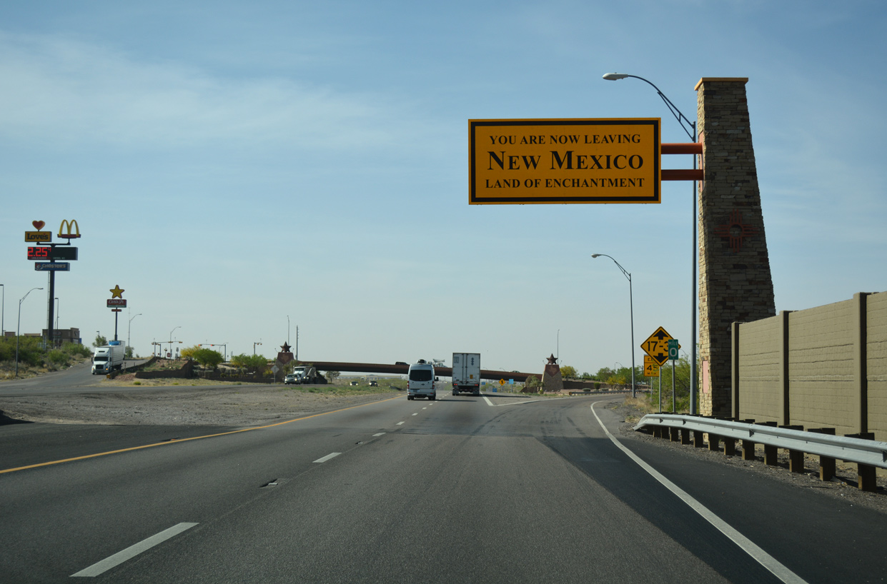
| The final reassurance shield for Interstate 10 in New Mexico stands along the freeway at Anthony. 04/25/17 |
|
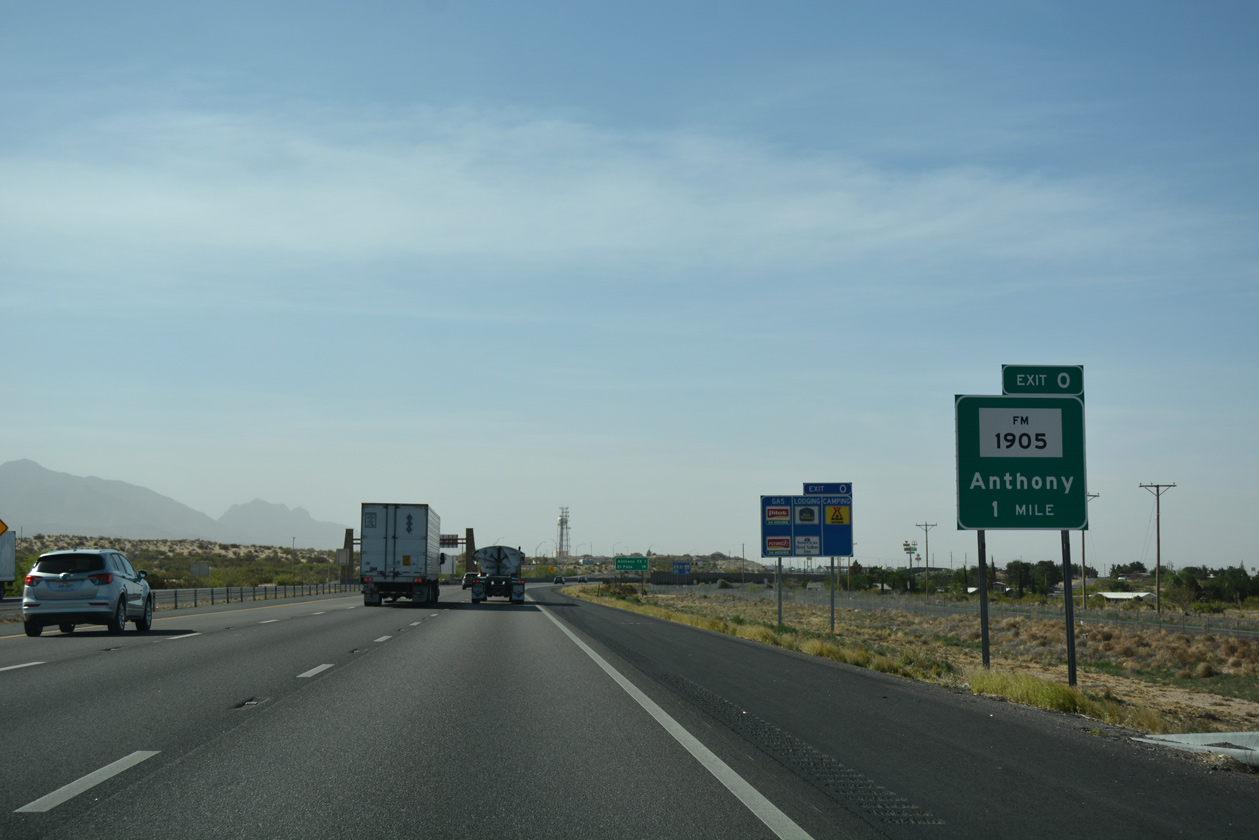
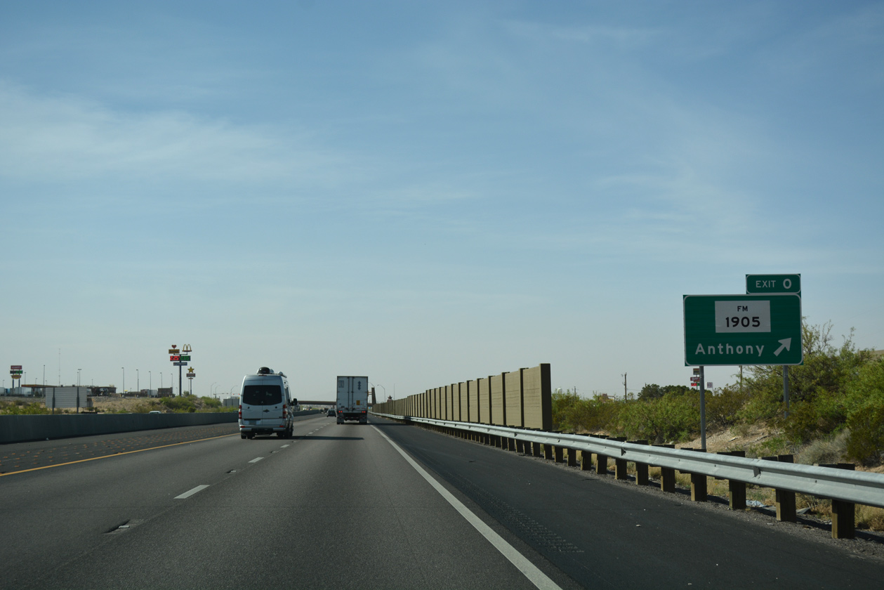
| Exit 0 follows just across the state line with FM 1905 (Antonio Street) west to Franklin Street and SH 20 (Main Street) in Anthony, Texas. 04/25/17 |
|
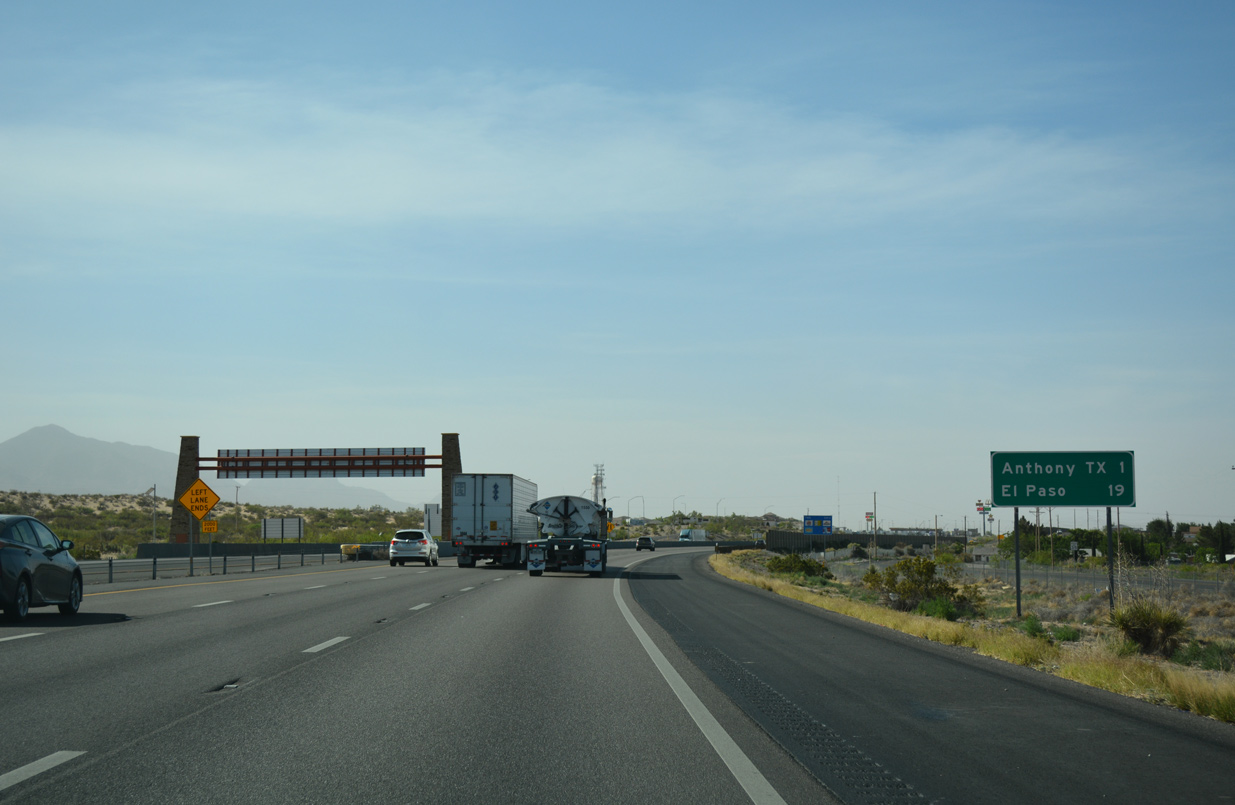
| Split between towns in both New Mexico and Texas, Anthony lies just west of I-10 along NM 470 and SH 20, the former route of U.S. 80/85 south to El Paso. 04/25/17 |
|
| Entering the diamond interchange (Exit 0) with FM 1905 (Antonio Street) west and Mountain Pass Boulevard east on Interstate 10. FM 1905 stems west 2.11 miles from IH 10 to become NM 225. State Spur 6 (Wildcat Drive) loops south from FM 1905 nearby, providing a 1.49 mile long bypass of Anthony west to SH 20. 04/25/17 |
|
| Interstate 10 crosses into Hudspeth County, Texas at the departure of Exit 0. U.S. 85 south & 180 east appear on subsequent shield assemblies along the freeway south into El Paso. 04/25/17 |
Page Updated 04-03-2019.


 East
East