|
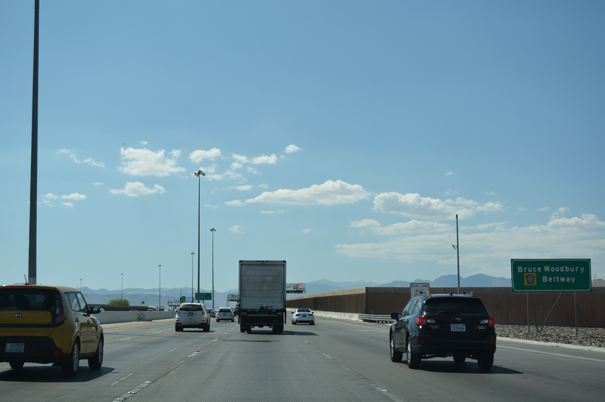
| Clark County 215 (CC-215) continues along the remaining 39 miles of the Bruce Woodbury Beltway from the Fish Bowl Interchange with I-15. 07/21/17 |
|
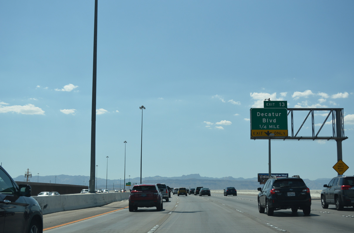
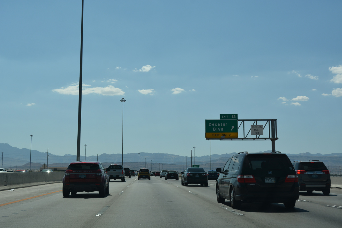
| CC-215 bends around Arville Street ahead of Exit 13 for Decatur Boulevard. 07/21/17 |
|
| Meeting CC-215 (Bruce Woodbury Beltway) in one quarter mile, Decatur Boulevard originates from Southern Heights Parkway in south Enterprise. 07/21/17 |
|
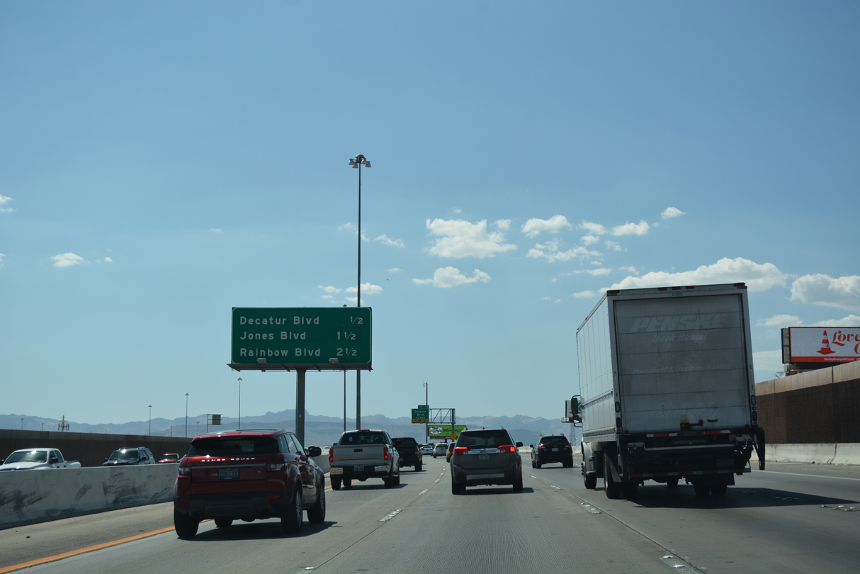
| Exit 13 leaves CC-215 west for Decatur Boulevard. Decatur Boulevard extends 9.8 miles north through Spring Valley and western Las Vegas to North Las Vegas Airport (VGT) at SR 599 (Rancho Drive). 07/21/17 |
|
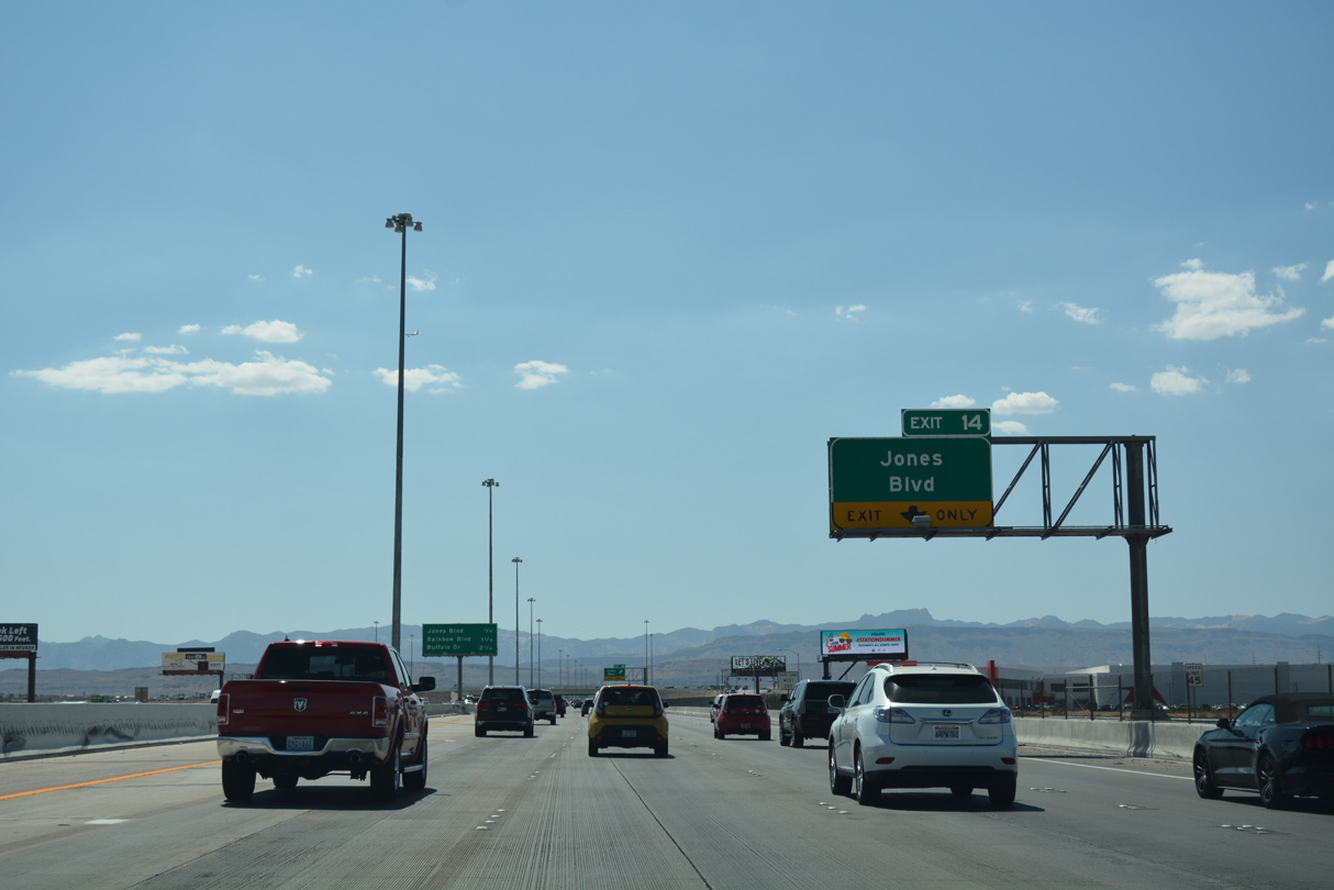
| Exit 14 to Jones Boulevard (Exit 14) follows in quick secession from CC-215 west of Decatur Boulevard. 07/21/17 |
|
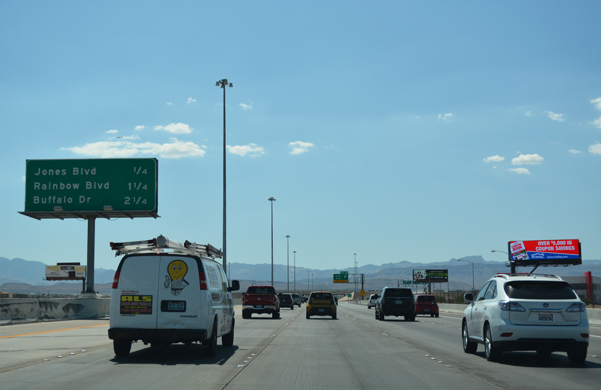
| Interchange sequence sign posted on 2.25 miles ahead of Exit 10 to Buffalo Drive. Jones Boulevard travels north from Exit 14 to Tropicana Boulevard where SR 596 overlays the arterial for 7.16 miles. 07/21/17 |
|
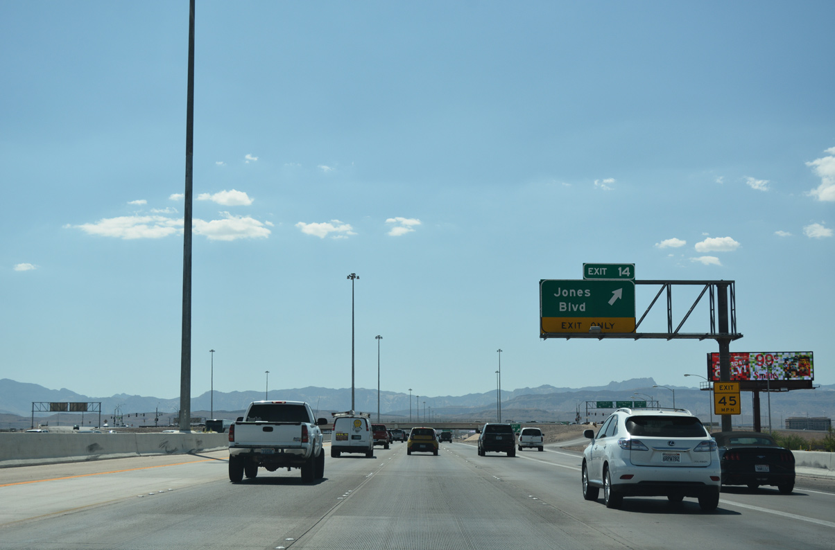
| A slip ramp (Exit 14) joins Rafael Rivera Way west to Jones Boulevard. Rafael Rivera Way is part of a frontage road system for CC-215 (Bruce Woodbury Beltway) between Decatur Boulevard (Exit 13) and Tropicana Avenue (Exit 20). Jones Boulevard continues 2.6 miles south to Torino Avenue. 07/21/17 |
|
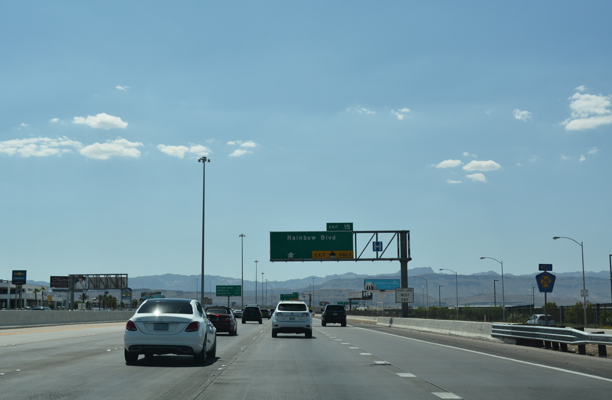
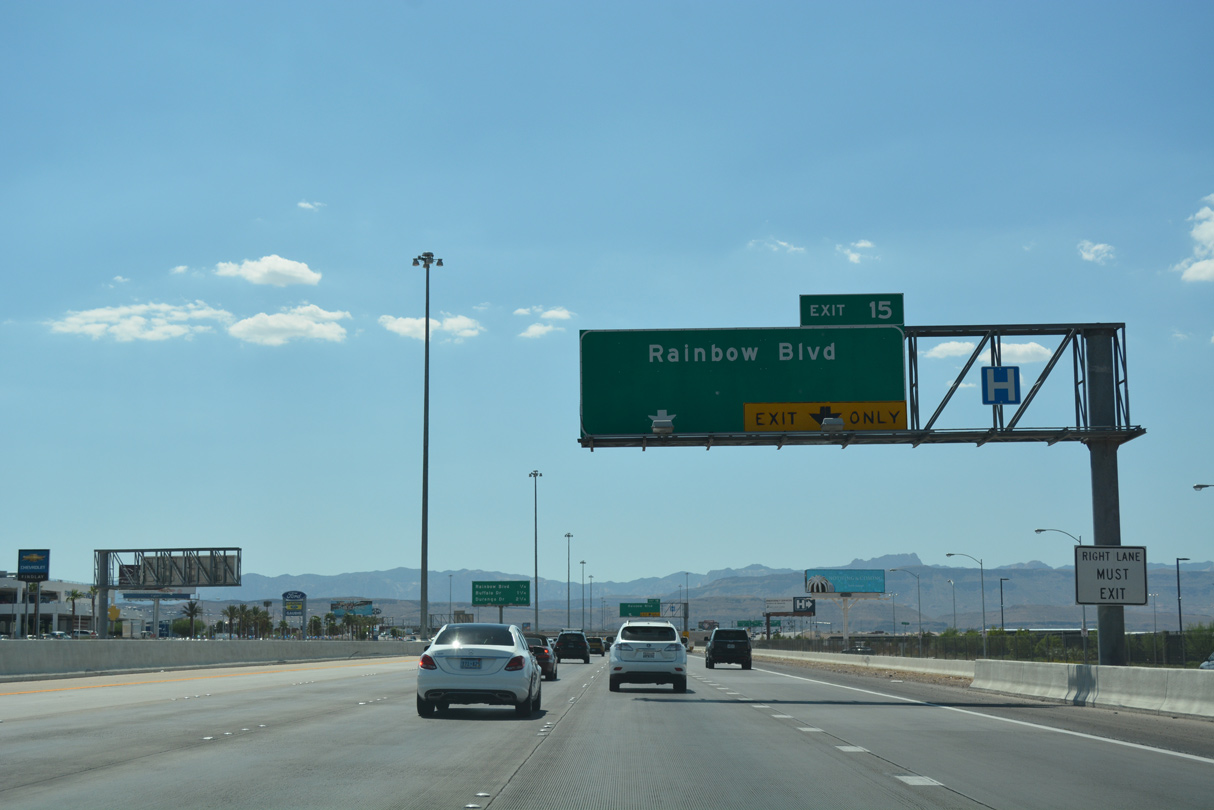
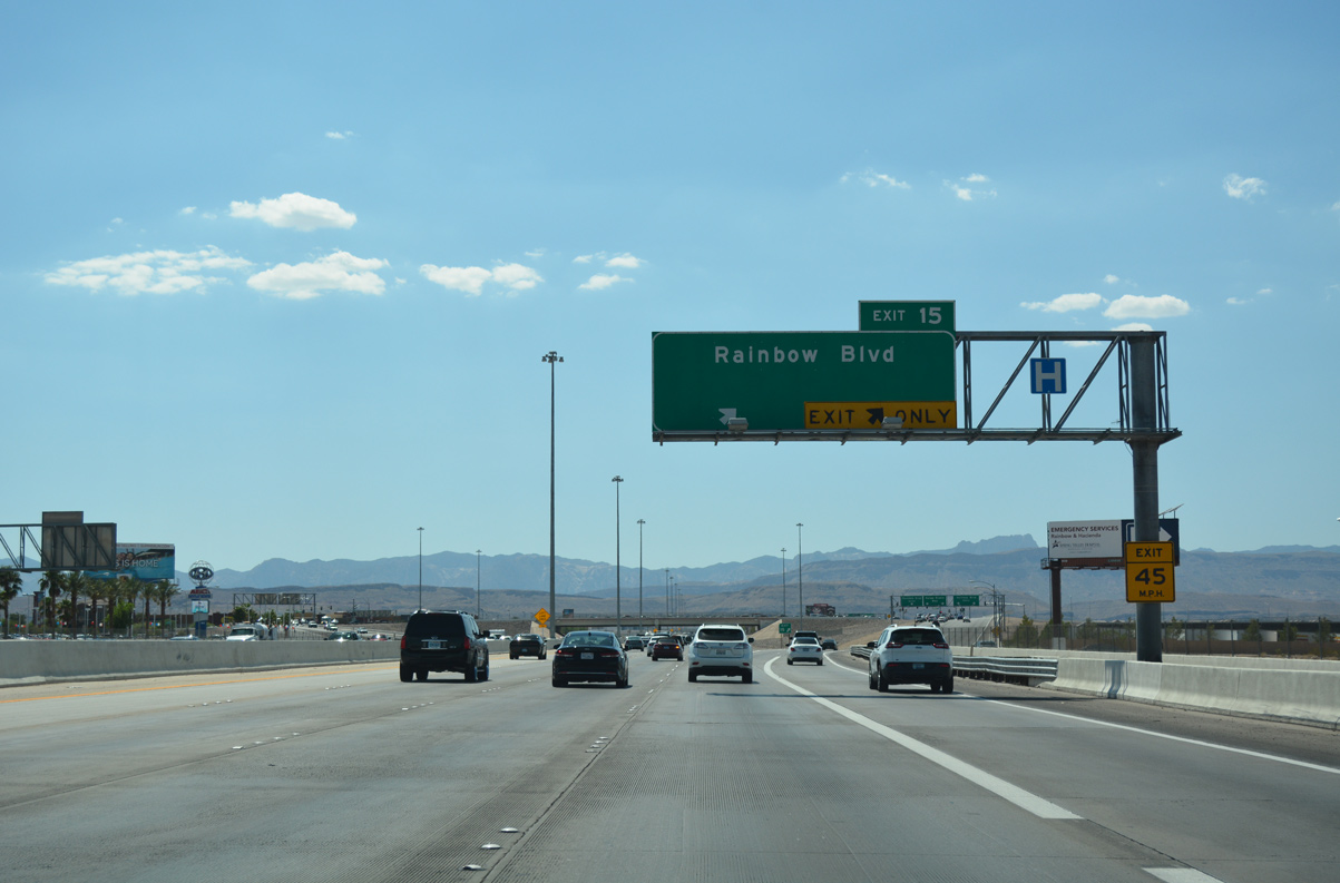
| Westbound CC-215 briefly expands to five lanes with the inclusion of an auxiliary lane between the on ramp from Jones Boulevard and Exit 15 for Rainbow Boulevard. 07/21/17 |
|
| Rainbow Boulevard is a major arterial that connects the Bruce Woodbury Beltway with Spring Valley in a half mile. 07/21/17 |
|
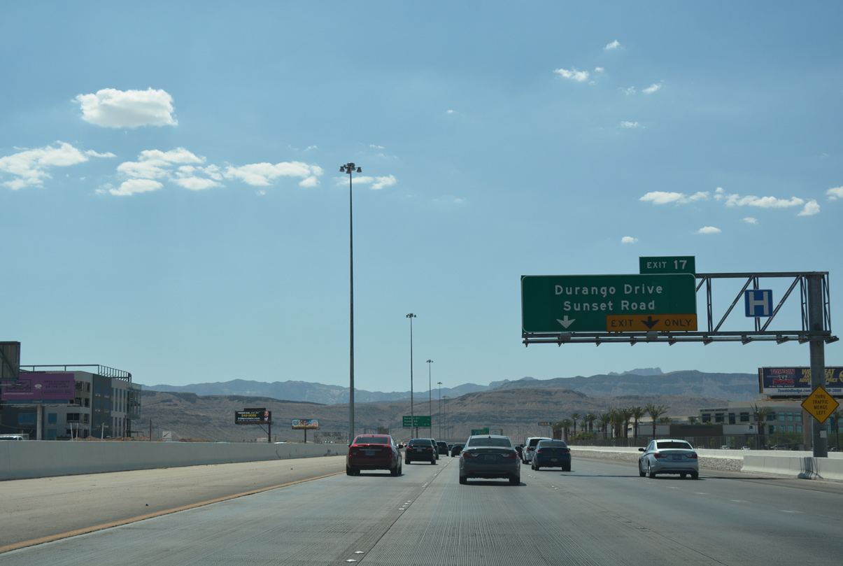
| CC-215 makes its northward turn 2.25 miles ahead at Durango Drive (Exit 17). 07/21/17 |
|
| Exit 15 leaves CC-215 west for Rainbow Boulevard. Rainbow Boulevard heads north through central Spring Valley into western suburbs of Las Vegas. Southward, Rainbow Boulevard extends to SR 160 and south Enterprise.
SR 595 follows Rainbow Boulevard between Tropicana Avenue and the Rainbow Curve interchange (U.S. 95). 07/21/17 |
|
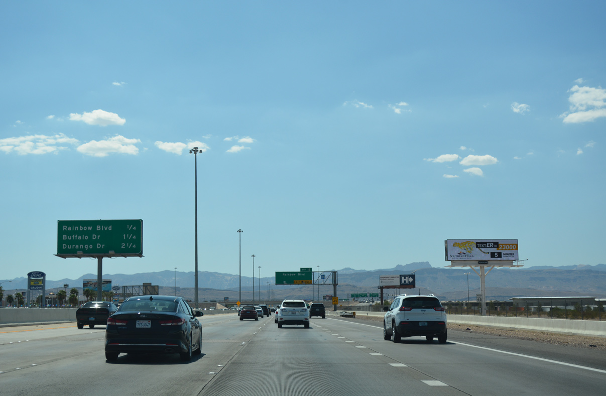
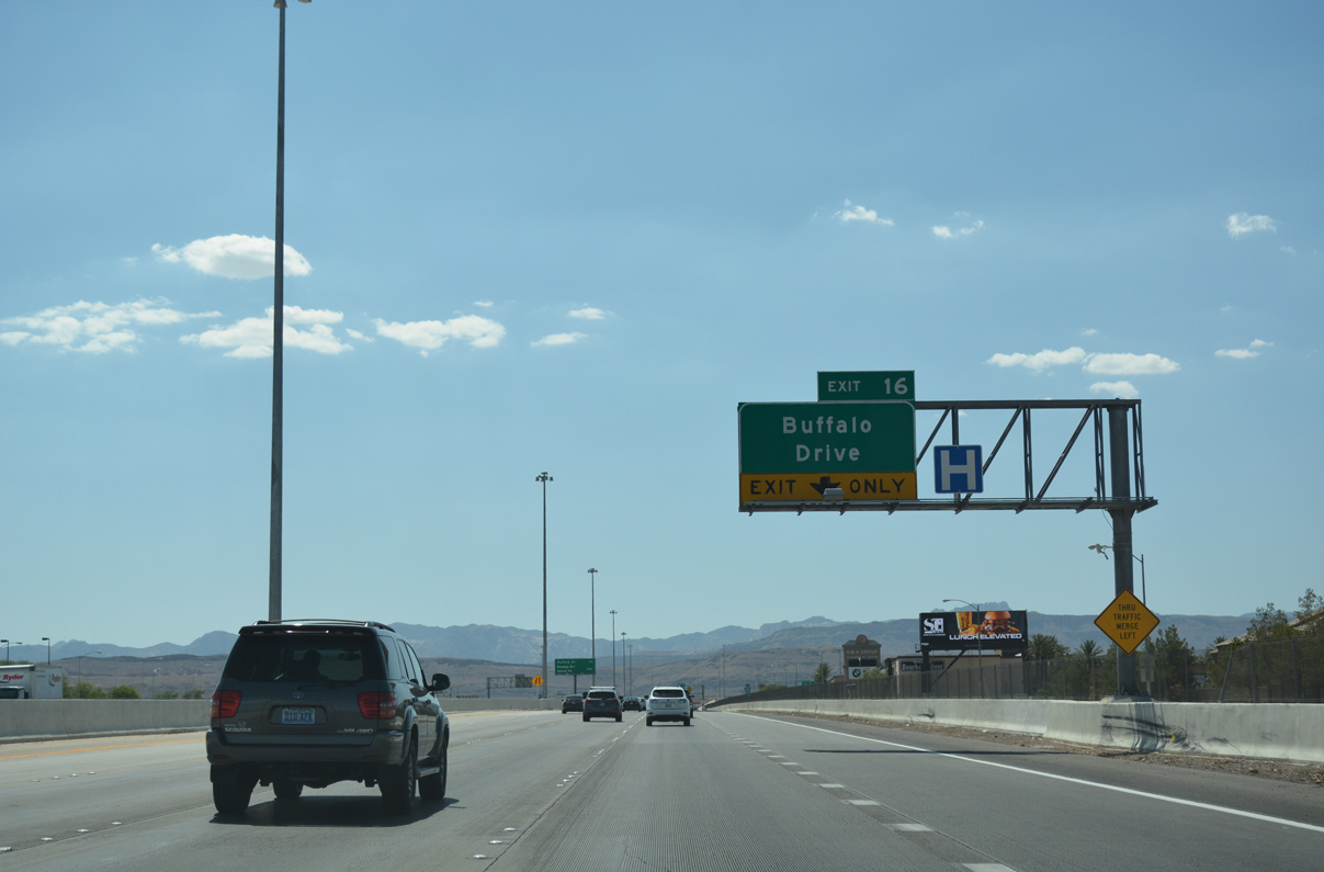
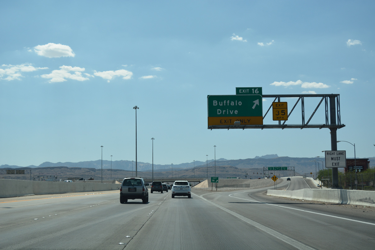
| Buffalo Drive meets the Bruce Woodbury Beltway one mile west of Rainbow Boulevard at Exit 16. 07/21/17 |
|
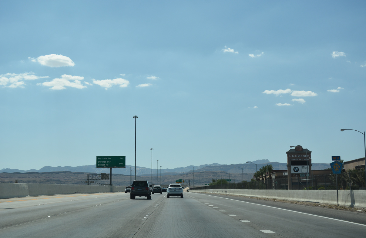
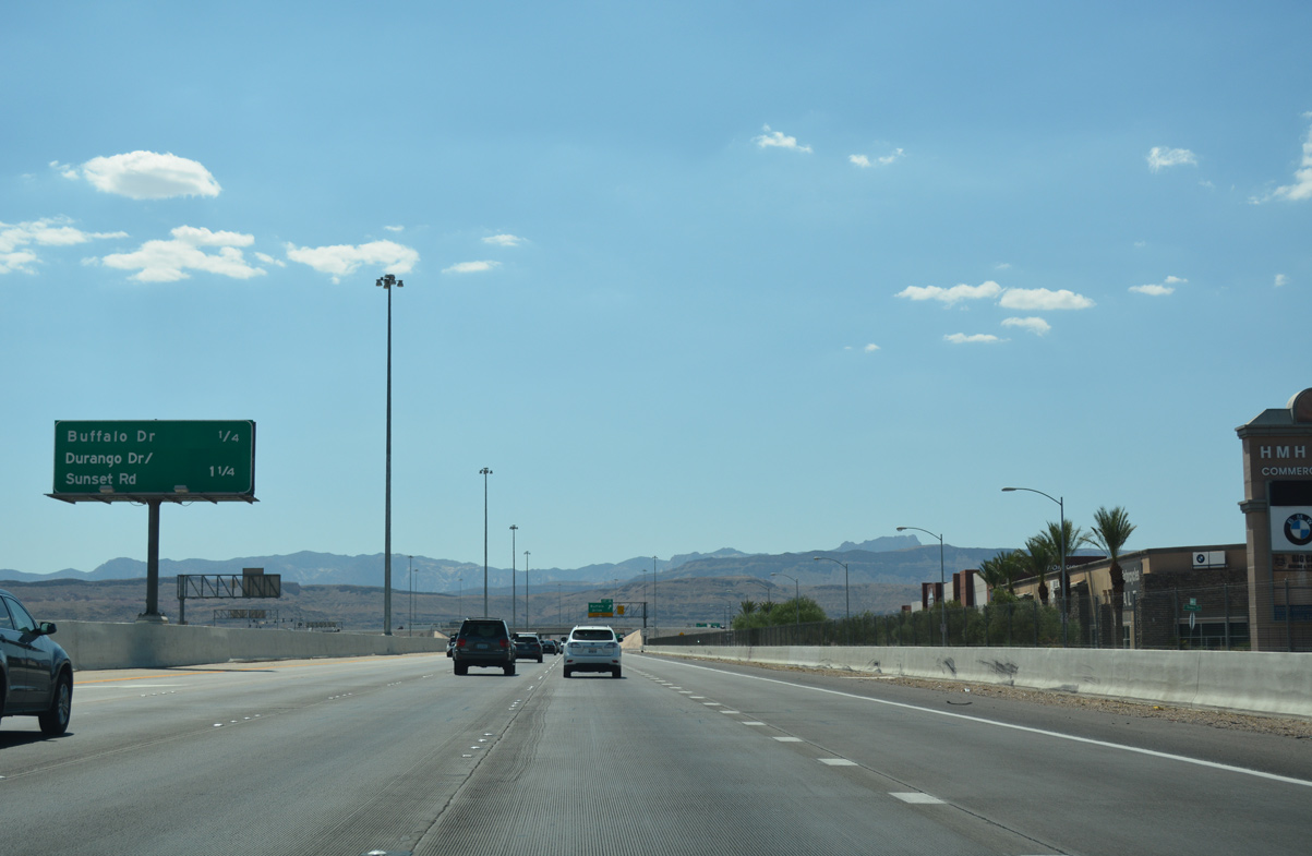
| A split diamond interchange joins CC-215 with Durango Drive and Sunset Road 1.25 miles ahead. 07/21/17 |
|
| CC-215 westbound reduces to three lanes at the off-ramp (Exit 16) to Buffalo Drive. Locally, Buffalo Drive extends south to SR 160 (Blue Diamond Highway) and north to Hacienda Avenue. 07/21/17 |
|
| The southern end of Blue Diamond Hill (el. 4,956 feet) and the Sandstone Bluffs appear in the distance on the half mile drive to Exit 17 (Durango Drive / Sunset Road). 07/21/17 |
|
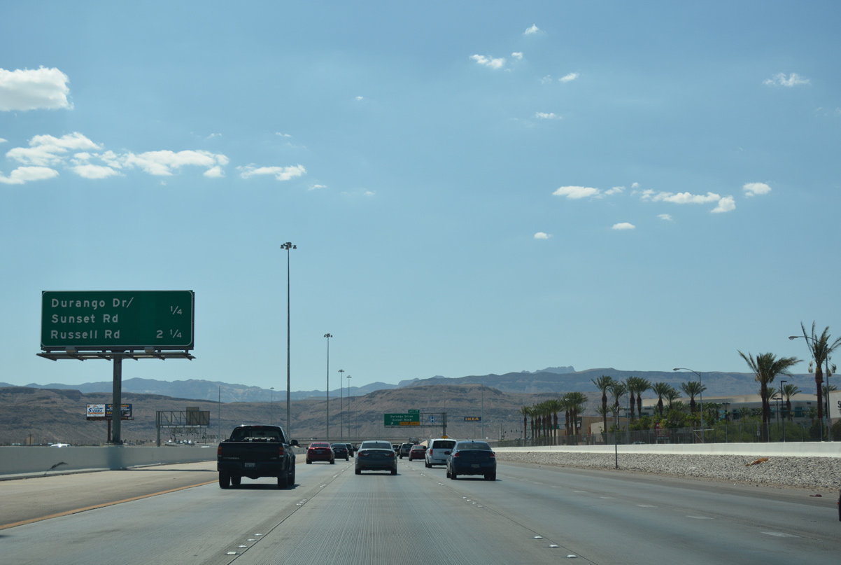
| Sunset Road runs 18.3 miles overall east across the lower valley between Spring Valley and Henderson as Durango Road leads 13.2 miles north from Enterprise to Summerlin. 07/21/17 |
|
| Motorists enter the split diamond (Exit 17) interchange with Durango Drive and Sunset Road. Durango Road heads 1.3 miles north to meet Russell Road and south 0.7 miles to Warm Springs Road. 07/21/17 |
|
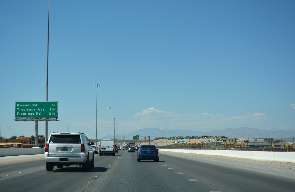
| The next interchange along CC-215 (Las Vegas/Bruce Woodbury Beltway) occurs 0.50 miles ahead at Russell Road (Exit 19). 07/21/17 |
|
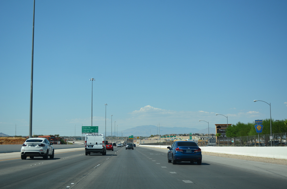
| This confirming marker near milepost 19 indicates the cardinal direction change along Clark County Route 215. 07/21/17 |
|
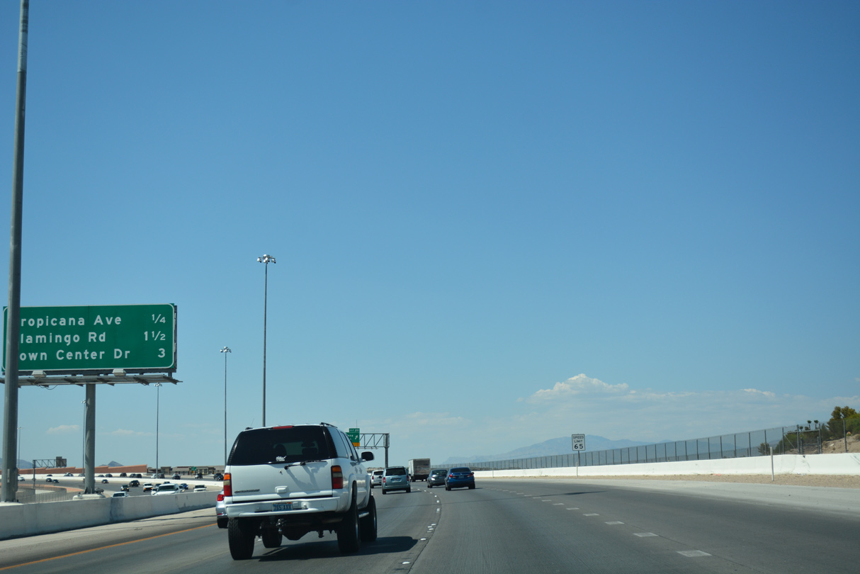
| Both Tropicana Avenue (Exit 20) and Flamingo Road (Exit 21) stretch across Spring Valley to the southern half of the Las Vegas Strip. 07/21/17 |
|
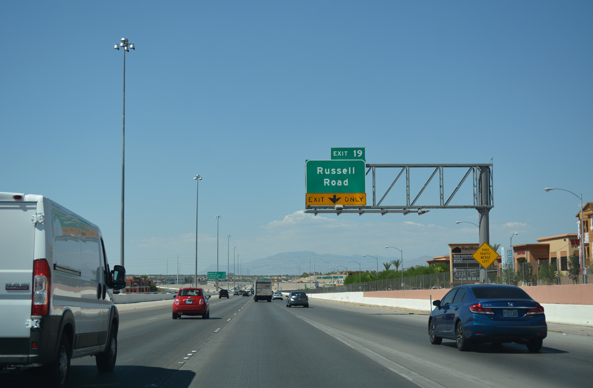
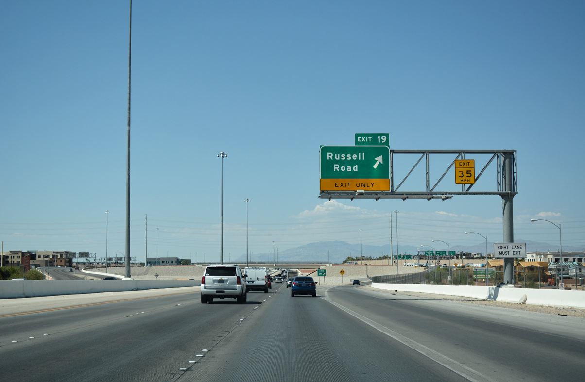
| Exit 19 joins CC-215 (Bruce Woodbury Beltway) to Russell Road. Locally Russell Road extends west to Fort Apache Road and east to Durango Road. 07/21/17 |
|
| Clark County 215 advances from Exit 19 (Russell Road) to meet Tropicana Avenue next. 07/21/17 |
|
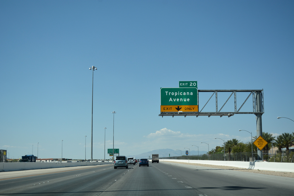
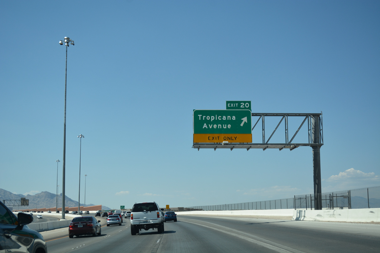
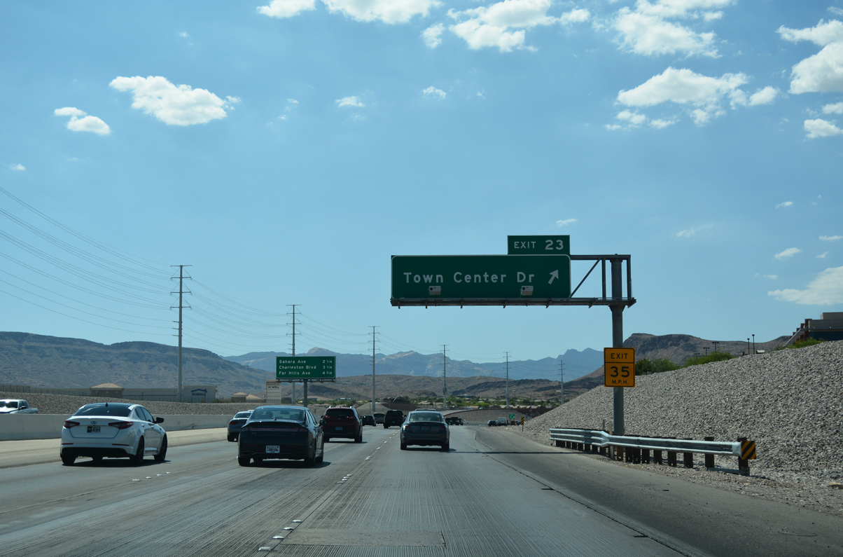
| The Las Vegas/Bruce Woodbury Beltway kinks northwesterly on the final approach to Tropicana Avenue (Exit 20). A single point urban interchange (SPUI) joins the freeway with Town Center Drive in three miles. 07/21/17 |
|
| A slip ramp departs CC-215 north for Brent Thurman Way to Tropicana Avenue (Exit 20). In addition to the Strip, Tropicana Avenue connects the western suburbs with McCarran International Airport (LAS) and University of Nevada at Las Vegas (UNLV). 07/21/17 |
|
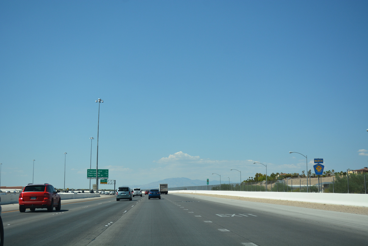
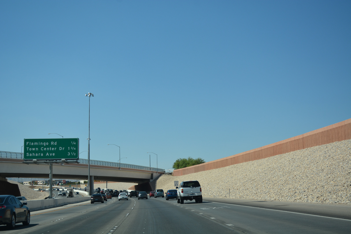
| Embanked sound walls divide the Bruce Woodbury Beltway from residential neighborhoods on the drive to Flamingo Road (Exit 21). 07/21/17 |
|
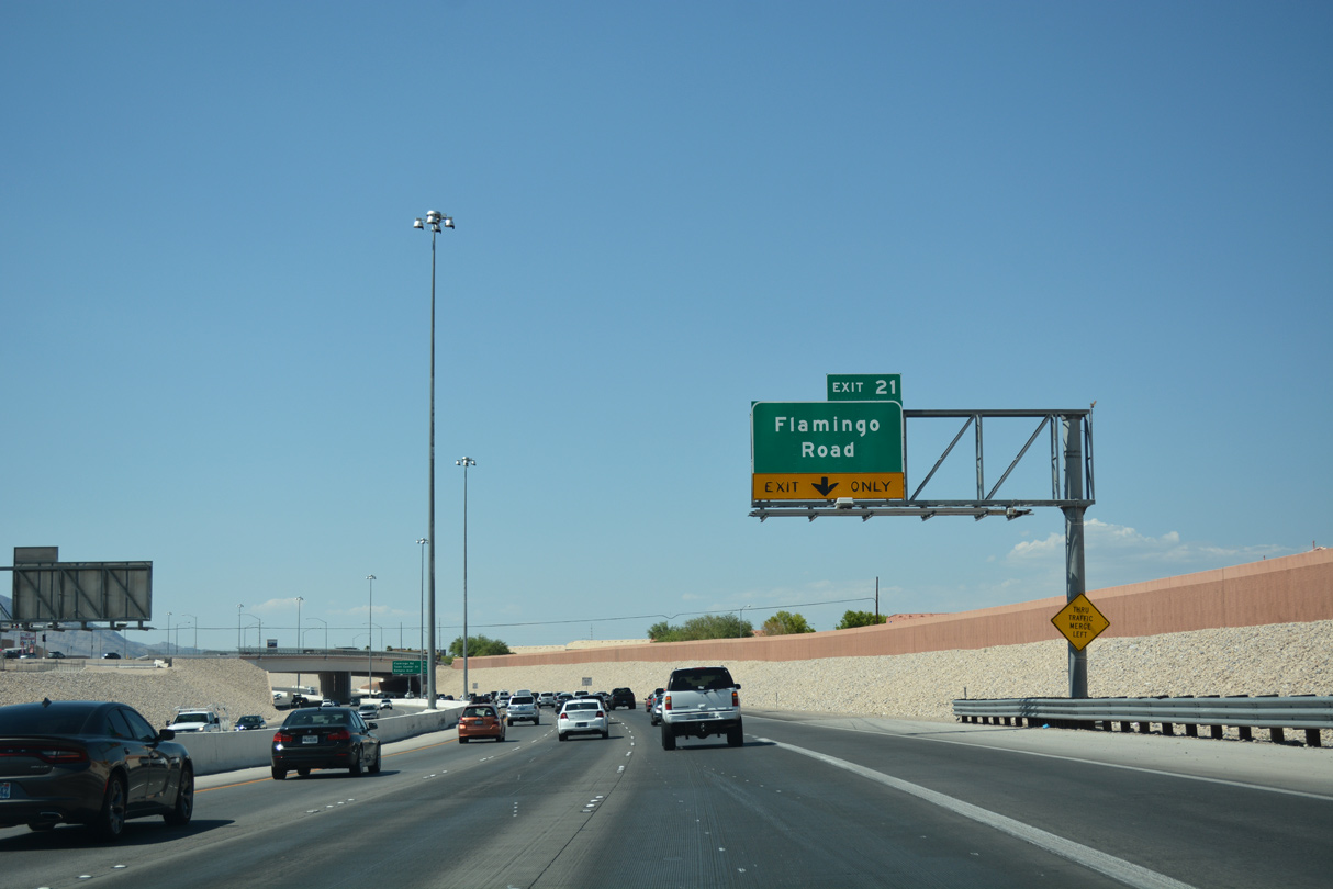
| Fort Apache Road spans CC-215 on the 0.25 mile approach to Flamingo Road. 3.5 miles separate motorists from Sahara Avenue (Exit 25). 07/21/17 |
|
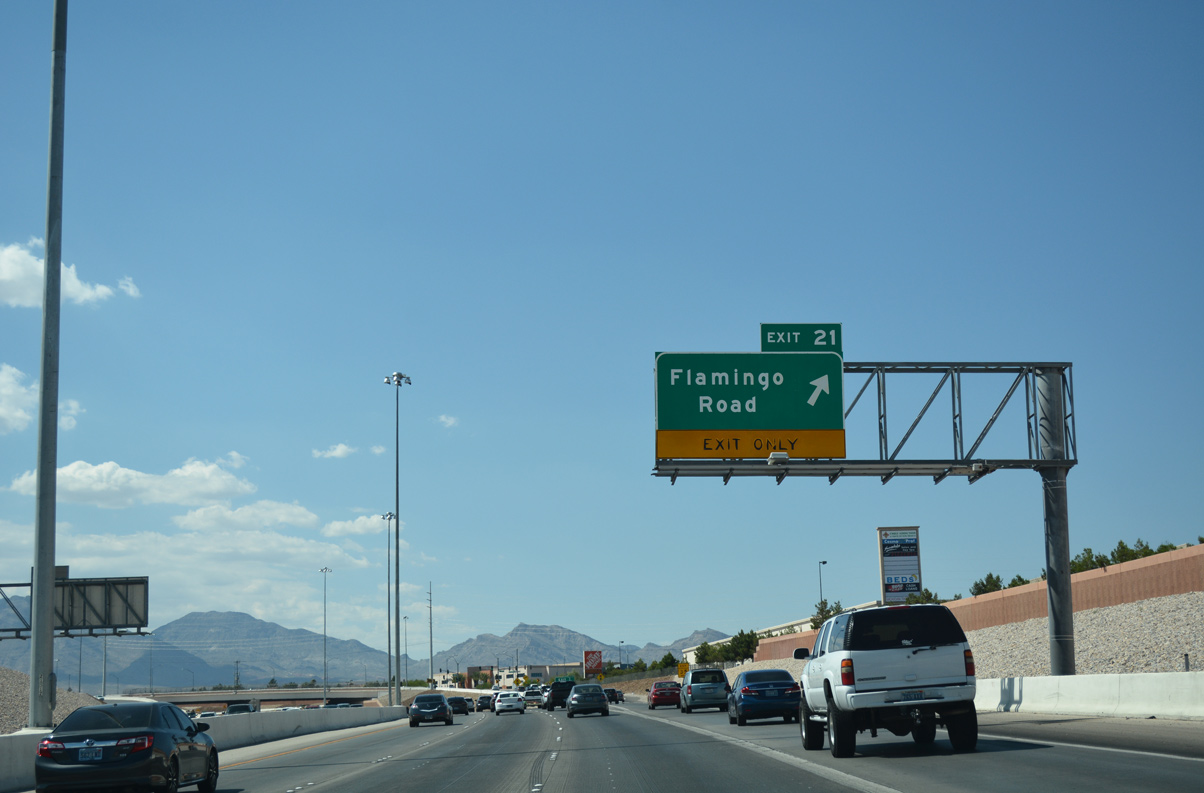
| Traffic departs for the diamond interchange (Exit 21) with Flamingo Road. Flamingo Road arcs northwest from the Bruce Woodbury Beltway to meet Desert Inn Road opposite Red Rock Ranch Road. Heading east, Flamingo Road enters central Spring Valley en route to I-15 and the Strip. 07/21/17 |
|
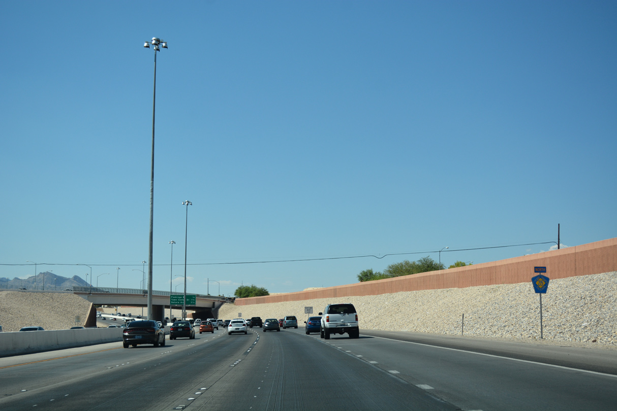
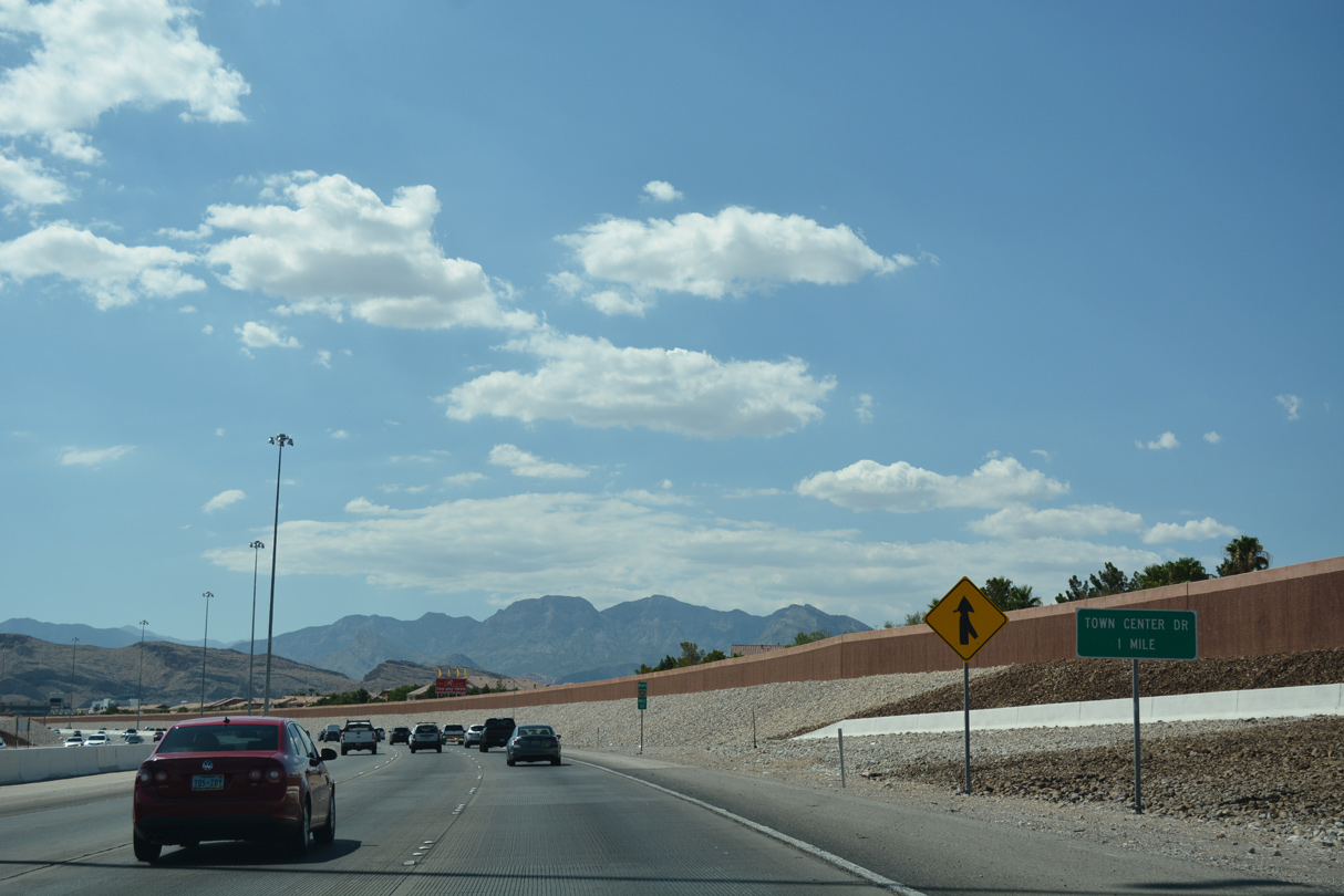
| This mini guide sign for upcoming Town Center Drive (Exit 23) is a remnant from when the freeway section temporarily ended beyond Flamingo Road. 07/21/17 |
|
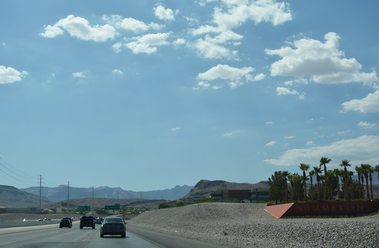
| Summerlin, a master planned community, houses over 100,000 residents over 22,500 acres of the western valley region.1 The Las Vegas/Bruce Woodbury Beltway travels the next eight miles through the community. 07/21/17 |
|
| CC-215 begins a northward turn as the freeway reaches Exit 23 (Town Center Drive). The Gardens neighborhood lines Town Center Drive to the north while Ridgebrook lies to the south near Flamingo Road. 07/21/17 |
|
| Traffic along CC-215 north lowers through the single point urban interchange (SPUI) with Town Center Drive (Exit 23). Sahara Avenue follows in 2.25 miles and is the first of two access points for the Downtown Summerlin commercial and entertainment complex. 07/21/17 |
|
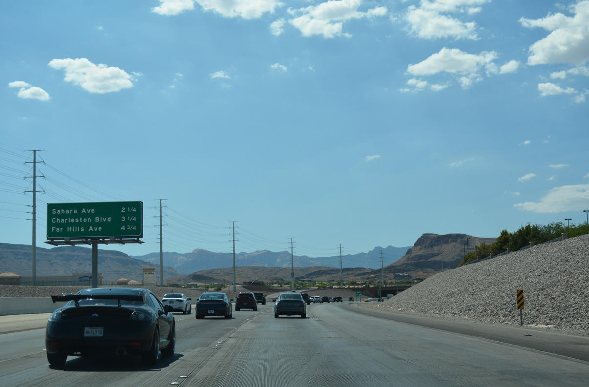
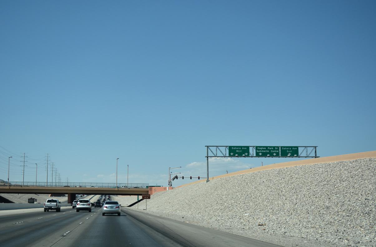
| The Bruce Woodbury Beltway splits the Gardens and Ridgebrook neighborhoods on the one mile drive to Sahara Drive (Exit 25). Hughes Park Drive forms a frontage road along northbound and connects Sahara Avenue with Charleston Boulevard (SR 159). 07/21/17 |
|
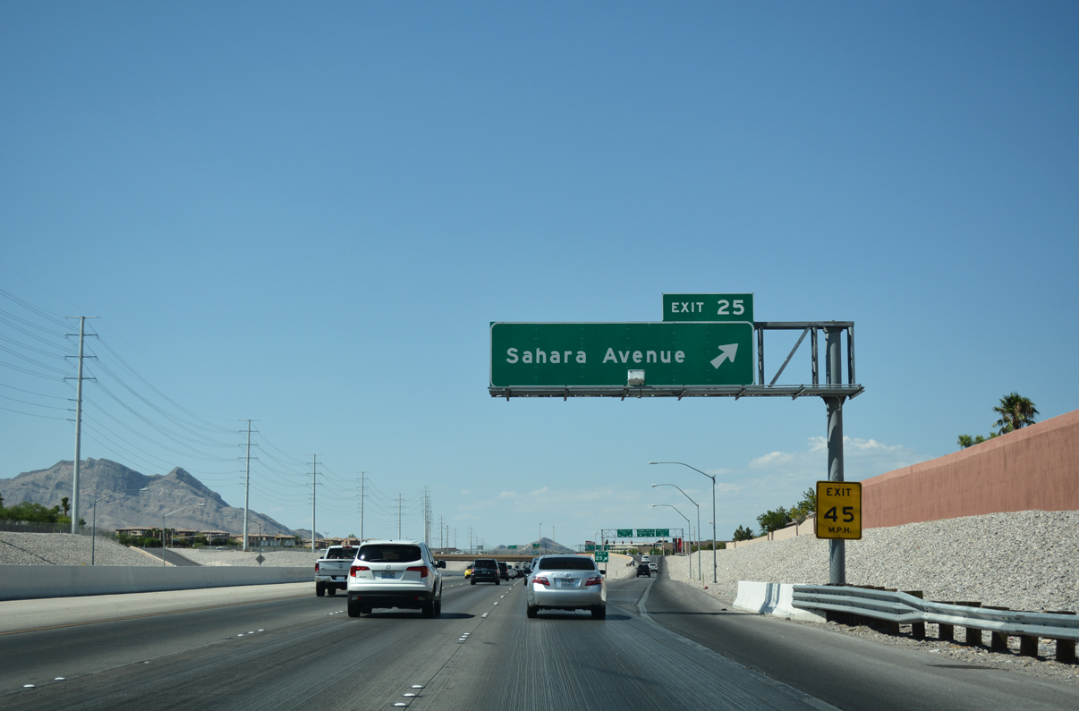
| Sahara Avenue joins CC-215 with Downtown Summerlin at Exit 25. Downtown Summerlin opened October 9, 2014 and offers shopping, dining, and entertainment options.2
07/21/17 |
|
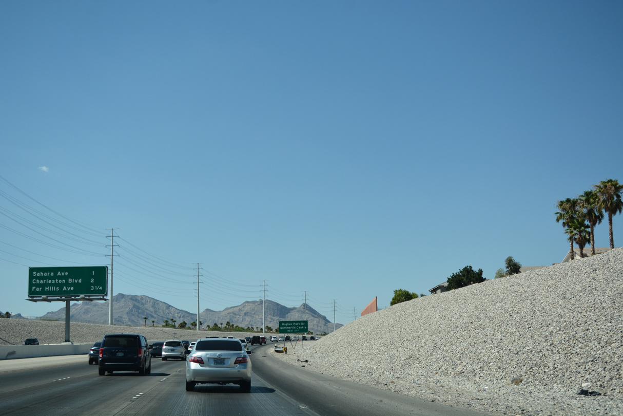
| Sahara Avenue borders Downtown Summerlin as it leads east from CC-215 (Bruce Woodbury Beltway) through the Willows neighborhood. Beyond Summerlin, Sahara Avenue continues through Spring Valley to I-15 and the north end of the Las Vegas Strip.
Hughes Park Drive otherwise continues ahead for Downtown Summerlin and Summerlin Centre Drive. 07/21/17 |
|
| Red Rock Canyon National Conservation Area borders Summerlin to the west along SR 159 (Charleston Boulevard). Sahara Avenue continues west to Red Rock Ranch Road beyond the diamond interchange. 07/21/17 |
|
| Hughes Park Drive straddles between CC-215 north and the Downtown Summerlin complex as a frontage road connecting Sahara Avenue with Charleston Boulevard (SR 159). 07/22/17 |
|
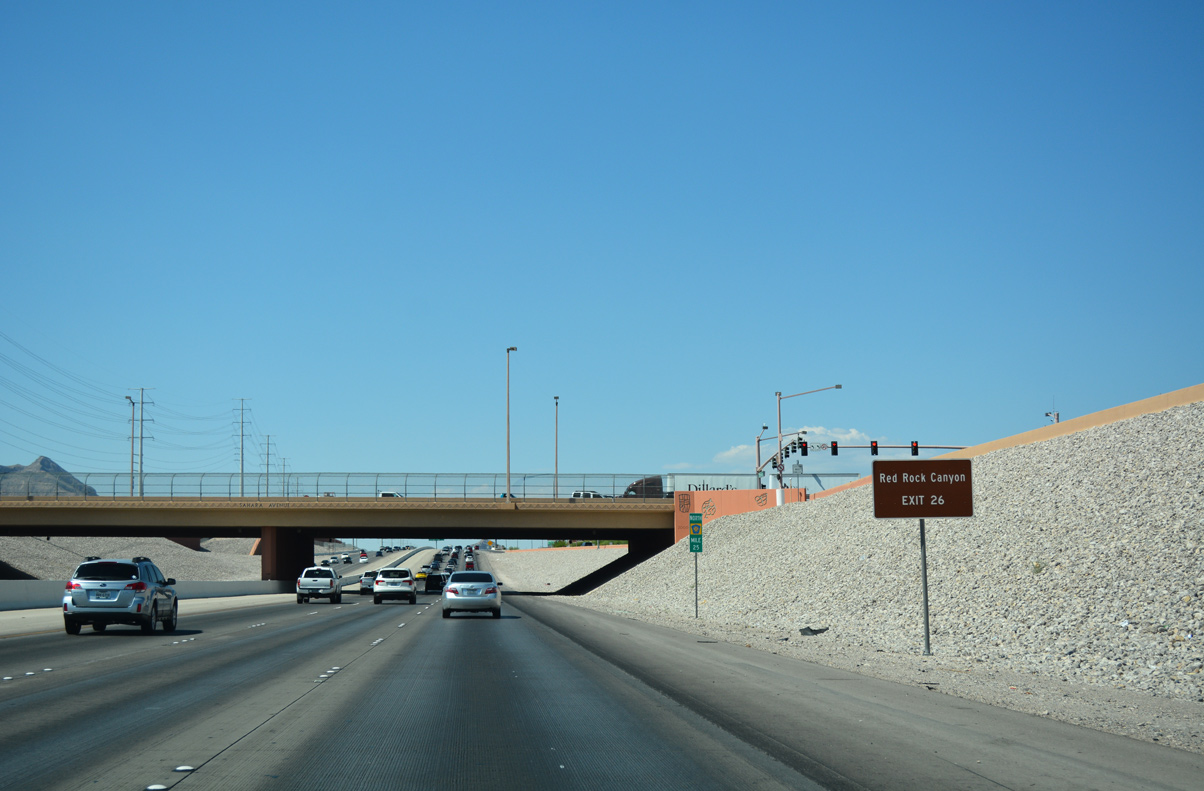
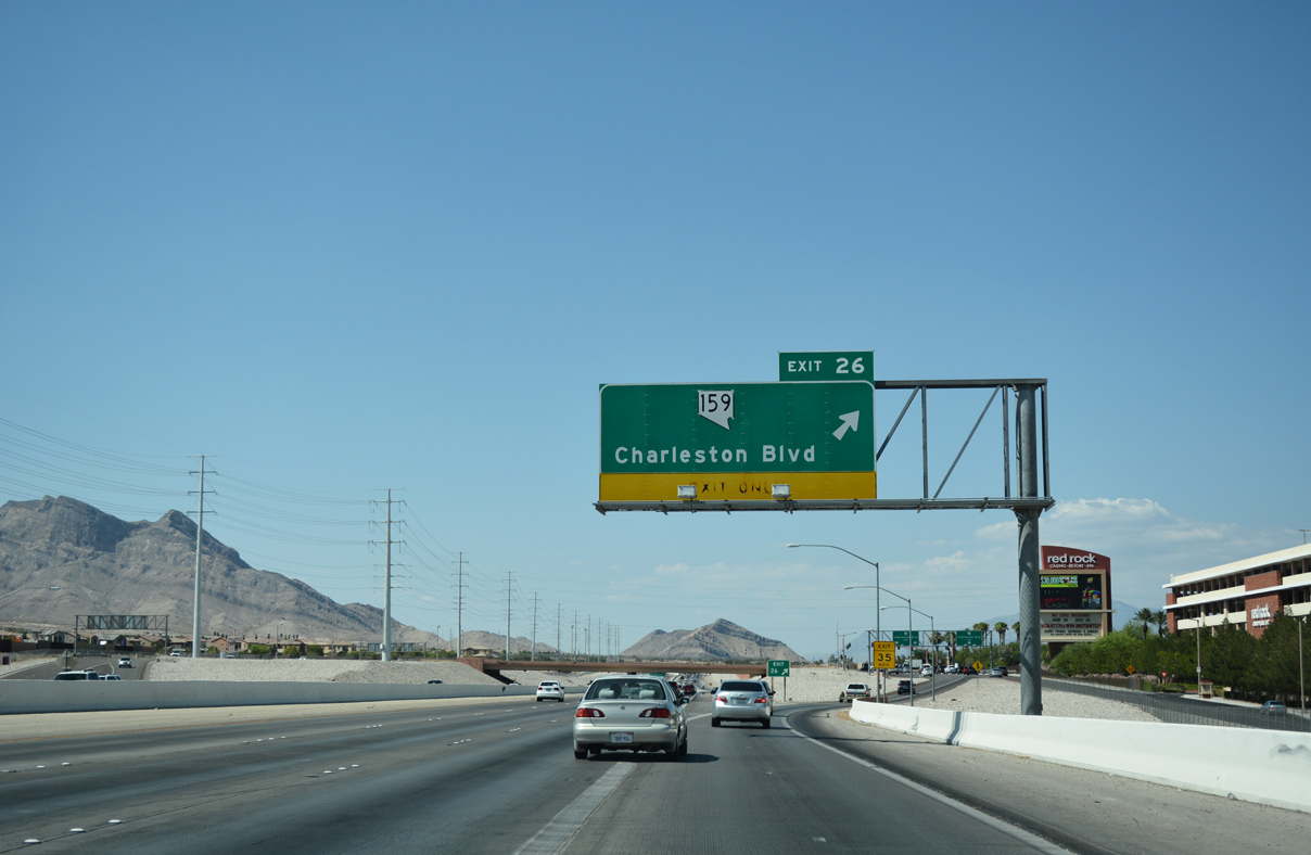
| CC-215 passes next to the Downtown Summerlin complex as the freeway advances north to meet SR 159 (Exit 26) in one half mile. SR 159 forms a 31.2 mile loop joining the Las Vegas/Bruce Woodbury Beltway with Red Rock Canyon and Las Vegas. 07/21/17 |
|
| Summerlin Parkway (Exit 28) joins the Bruce Woodbury Beltway (CC-215) with the U.S. 95 (Oran K. Gragson) freeway to Downtown Las Vegas in 2.50 miles. 07/22/17 |
|
| Motorists depart for SR 159 (Charleston Boulevard) to Red Rock Canyon National Conservation Area. The park is operated by the Bureau of Land Management (BLM) and is a well known destination for hikers and sightseers.
The Red Rock Casino Resort and Spa occupies the southeast quadrant of Exit 26 and forms the northern extent of Downtown Summerlin. 07/21/17 |
|
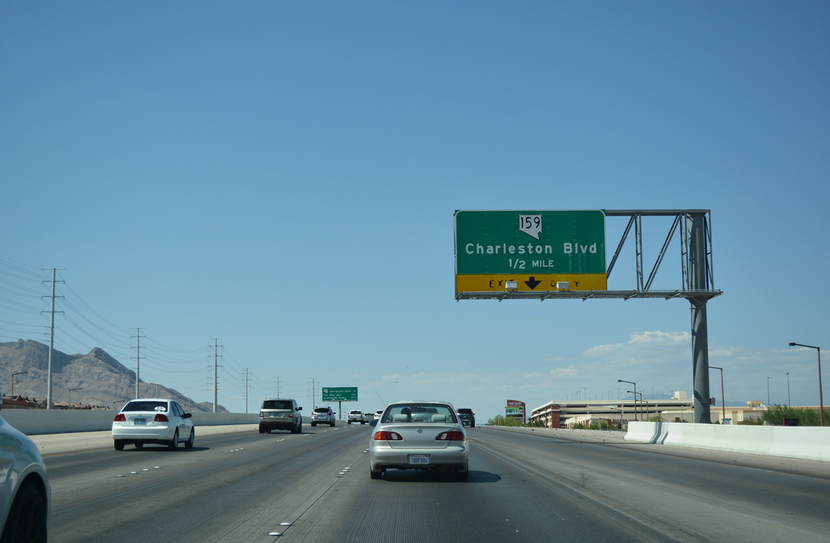
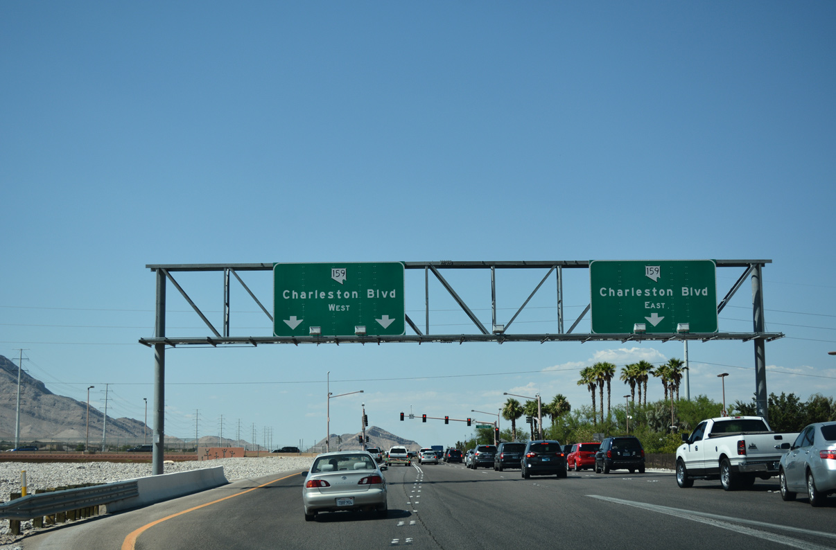
| Charleston Boulevard represents a major east-west thoroughfare across the Las Vegas region, connecting CC-215 with Downtown Las Vegas. SR 159 overlays Charleston Boulevard from the limits of Red Rock Canyon to SR 612 (Nellis Boulevard) in eastern reaches of Las Vegas.
SR 159 continues southwest through Red Rock Canyon before looping back east to meet SR 160 near Blue Diamond. 07/21/17 |
|
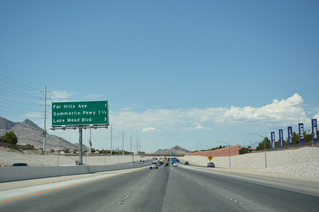
| Interchange sequence gantry posted along CC-215 (Bruce Woodbury Beltway) near the ingress point from SR 159 (Charleston Boulevard). Lake Mead Boulevard (Exit 29) represents the penultimate exit for Summerlin. 07/22/17 |
|
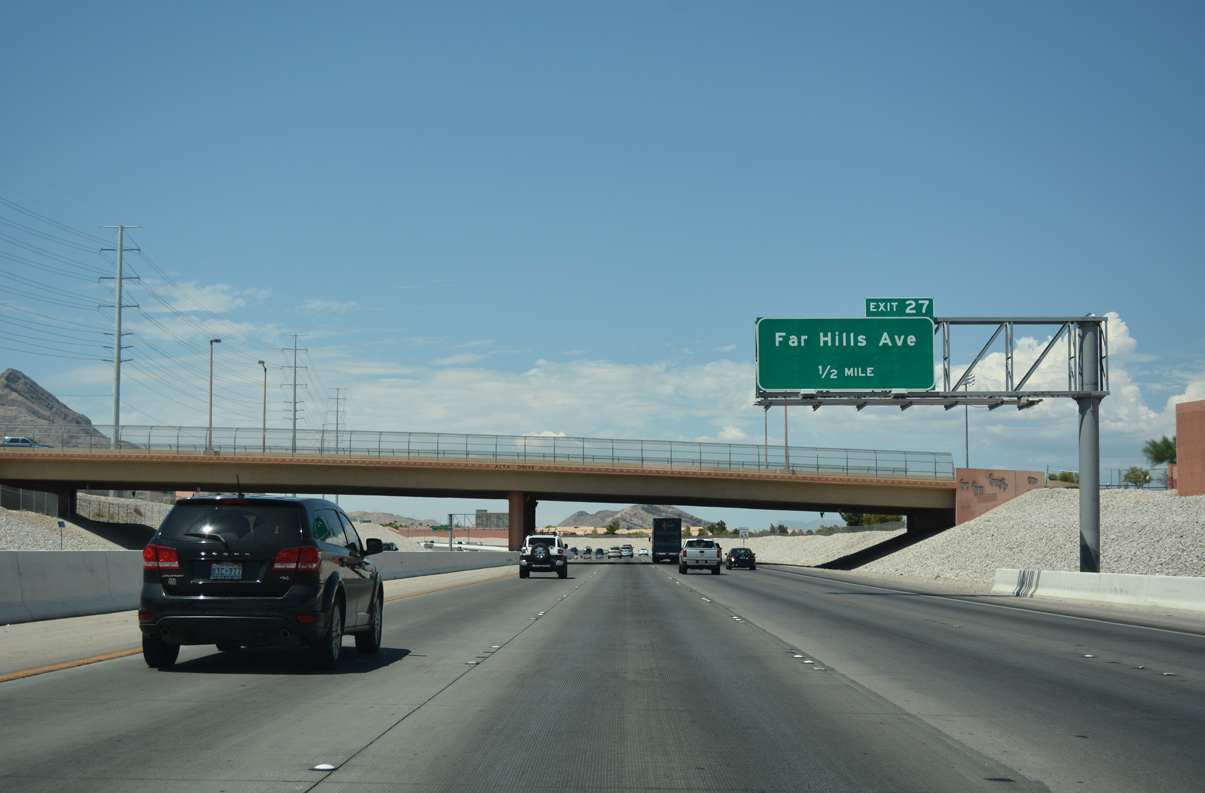
| Alta Drive spans the Bruce Woodbury Beltway on the half mile drive to a SPUI with Exit 27 (Far Hills Avenue). Far Hills Avenue joins the freeway with the Arbors neighborhood. 07/22/17 |
|
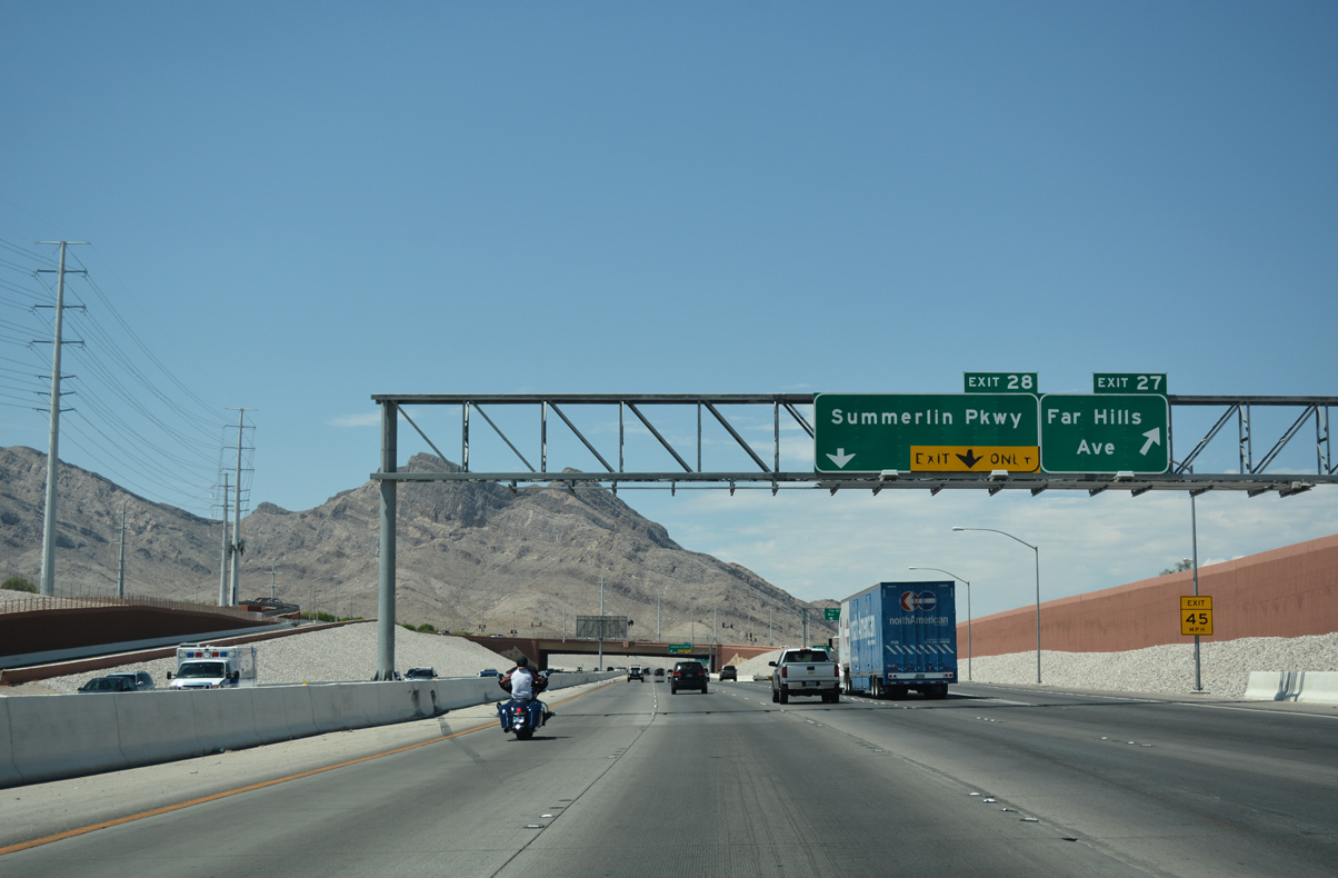
| CC-215 north briefly widens to five travel lanes on the final approach to Far Hills Avenue (Exit 27). Far Hills Avenue bends southeast along a residential corridor to Town Center Drive and west to the Talaverde neighborhood. 07/22/17 |
|
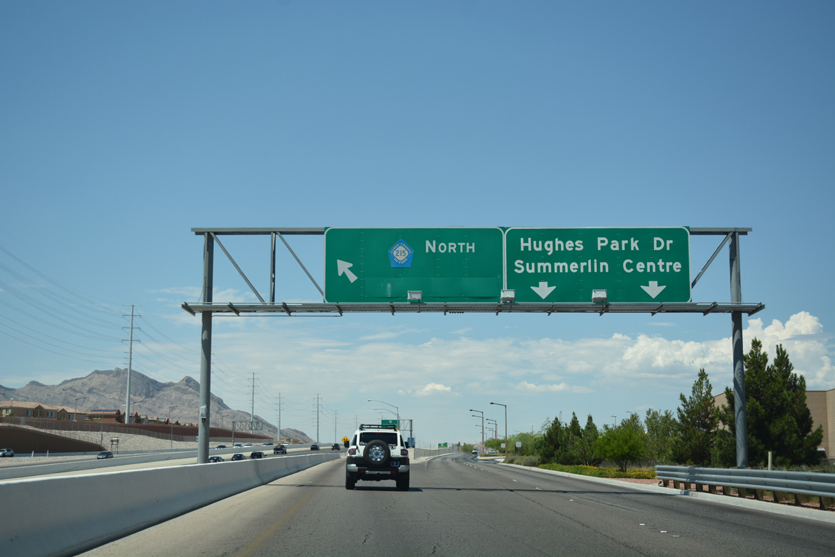
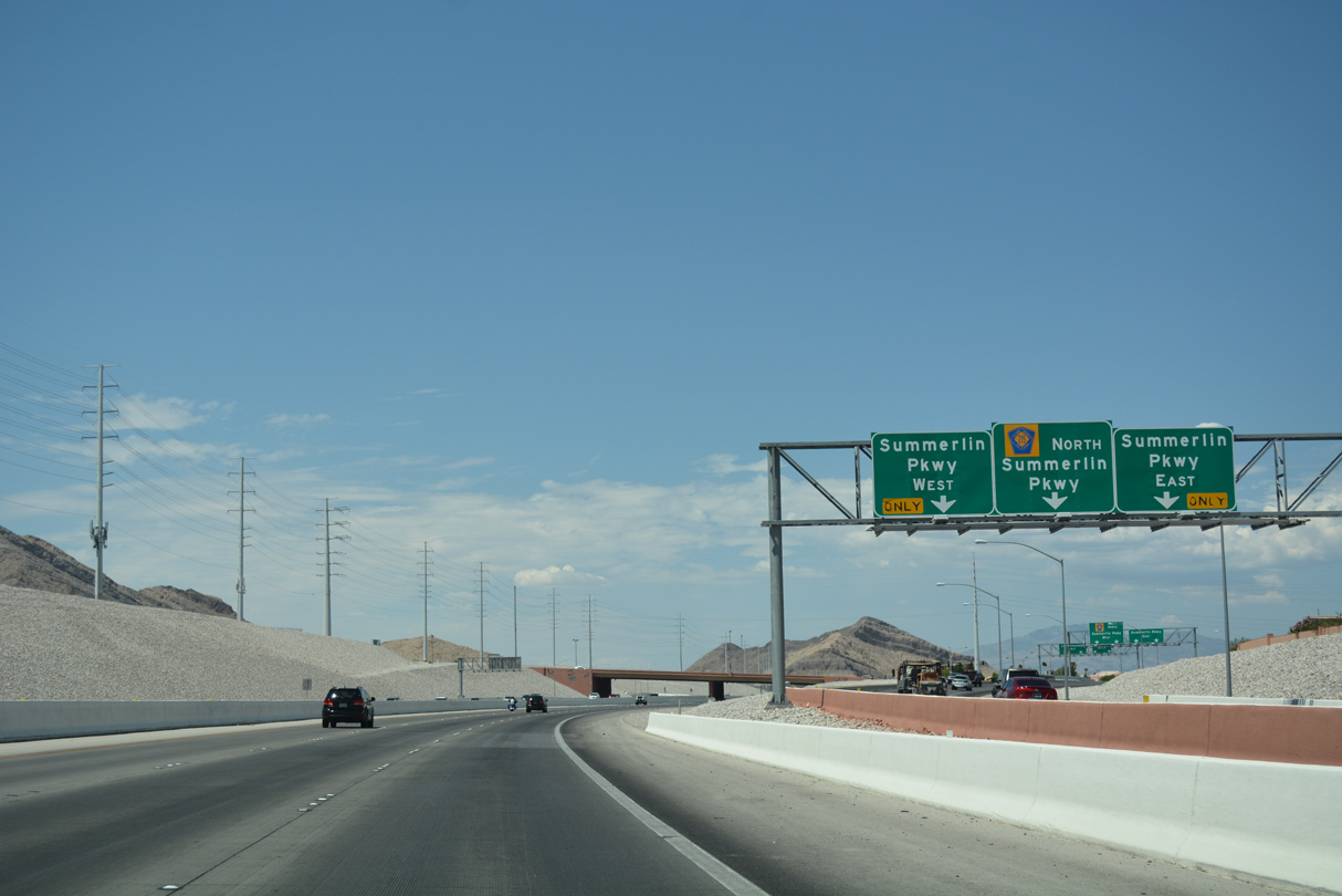
| A ramp to Summerlin Parkway (Exit 28) follows in quick succession from Exit 27. Summerlin Parkway is a 6.3 mile commuter freeway linking Clark County 215 with Downtown Las Vegas. An initial four mile segment opened between U.S. 95 (Oran K. Gragson Freeway) and Town Center Drive by 1990.1 07/22/17 |
|
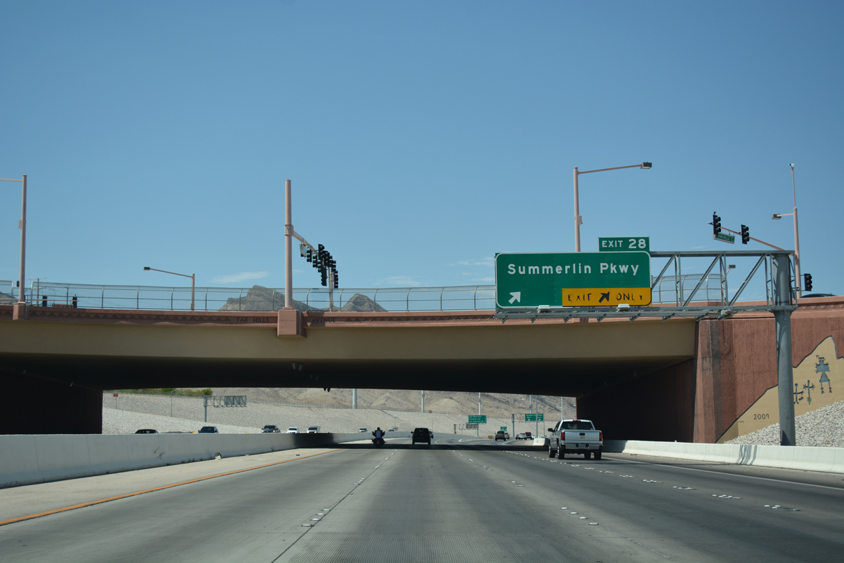
| Lanes partition for east and westbound Summerlin Parkway ahead of the parclo interchange (Exit 28). Summerlin Parkway currently ends at the Las Vegas/Bruce Woodbury Beltway with stubs for a future extension into undeveloped Summerlin. 07/22/17 |
|
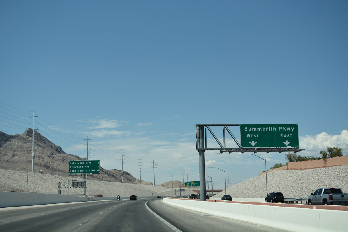
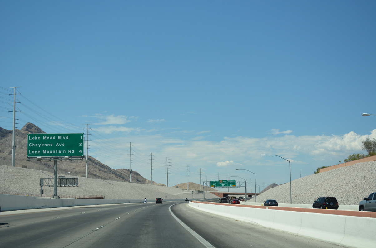
| One mile separates Lake Mead Boulevard (Exit 29) with Cheyenne Avenue (Exit 30) ahead along CC-215 north. 07/22/17 |
|
| Traffic from Far Hills Avenue (Exit 27) joins the ramp ahead of its split to Summerlin Parkway east and west. The freeway portion of Summerlin Parkway begins immediately east of the interchange (Exit 28) with Clark County 215. A return ramp otherwise follows the signalized intersection for Summerlin Parkway west. 07/22/17 |
Page Updated 06-18-2018.