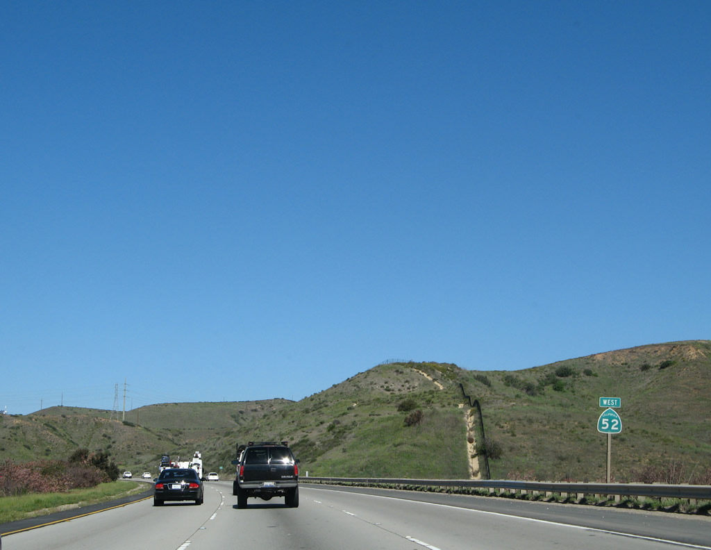
| California 52 (Soledad Freeway) west |
|
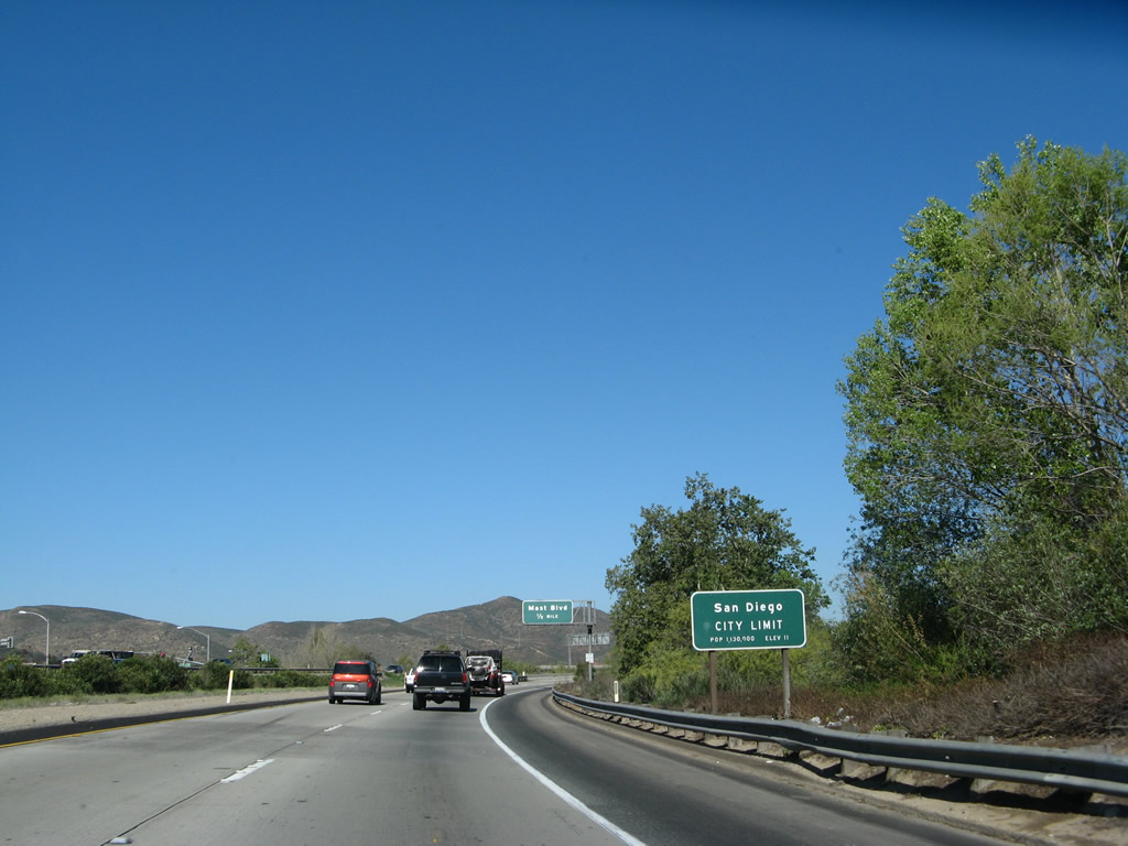
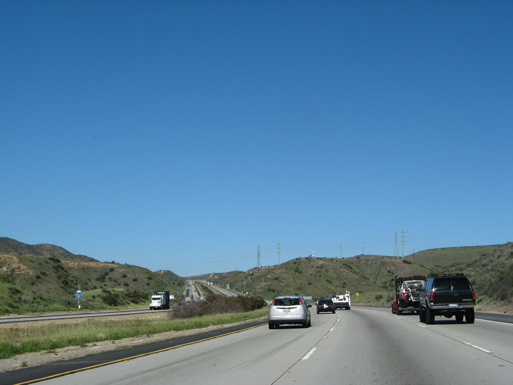
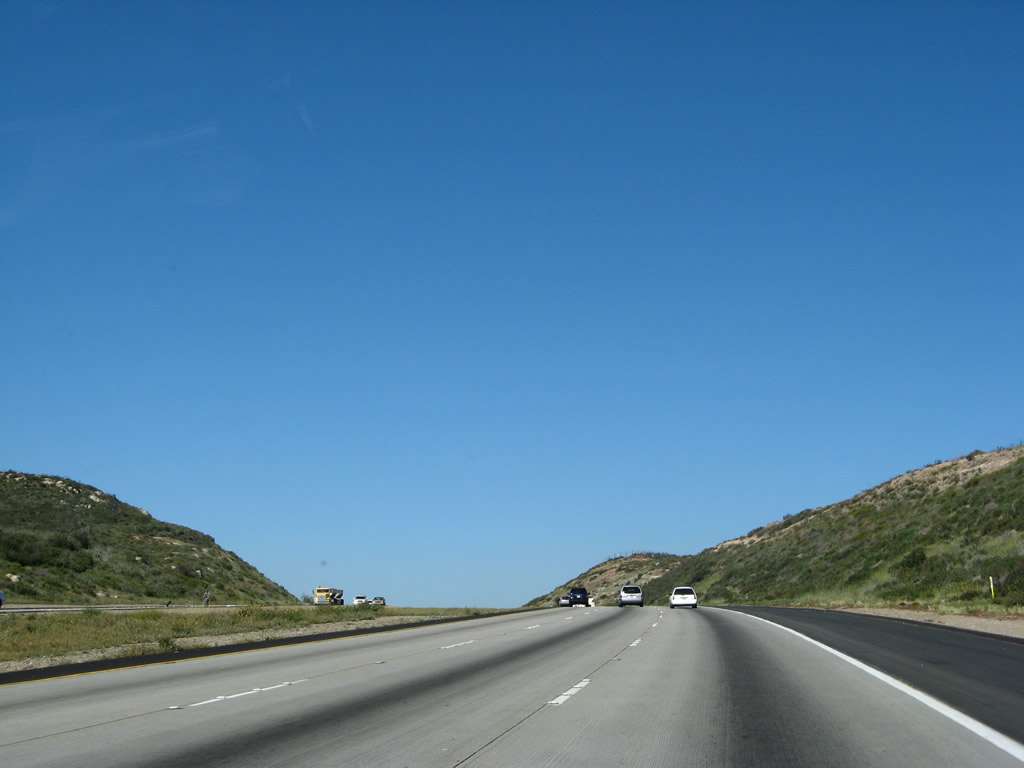
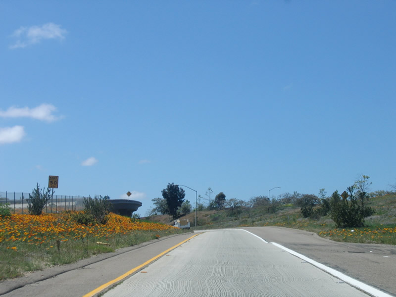
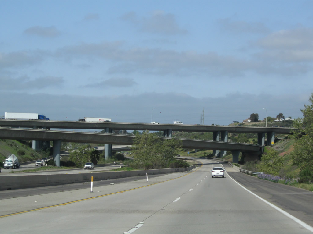
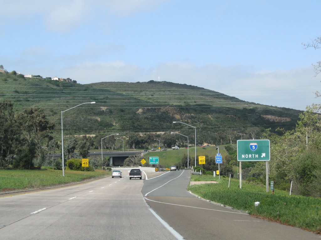
California 52 commences with three westbound lanes after the ramps from California 67 north and south converge in the city of Santee. Incorporated on December 1, 1980, Santee consists of 16.56 square miles, sits at an elevation of 350 feet, and had a population of 52,975 as of the 2000 Census. Continuing construction of new homes has brought rapid growth to this city, which lies northeast of the city of San Diego. A portion of Mission Trails Regional Park lies within the city limits of Santee, while the majority of the park is within the city of San Diego. Photo taken 03/19/11. |
|
|
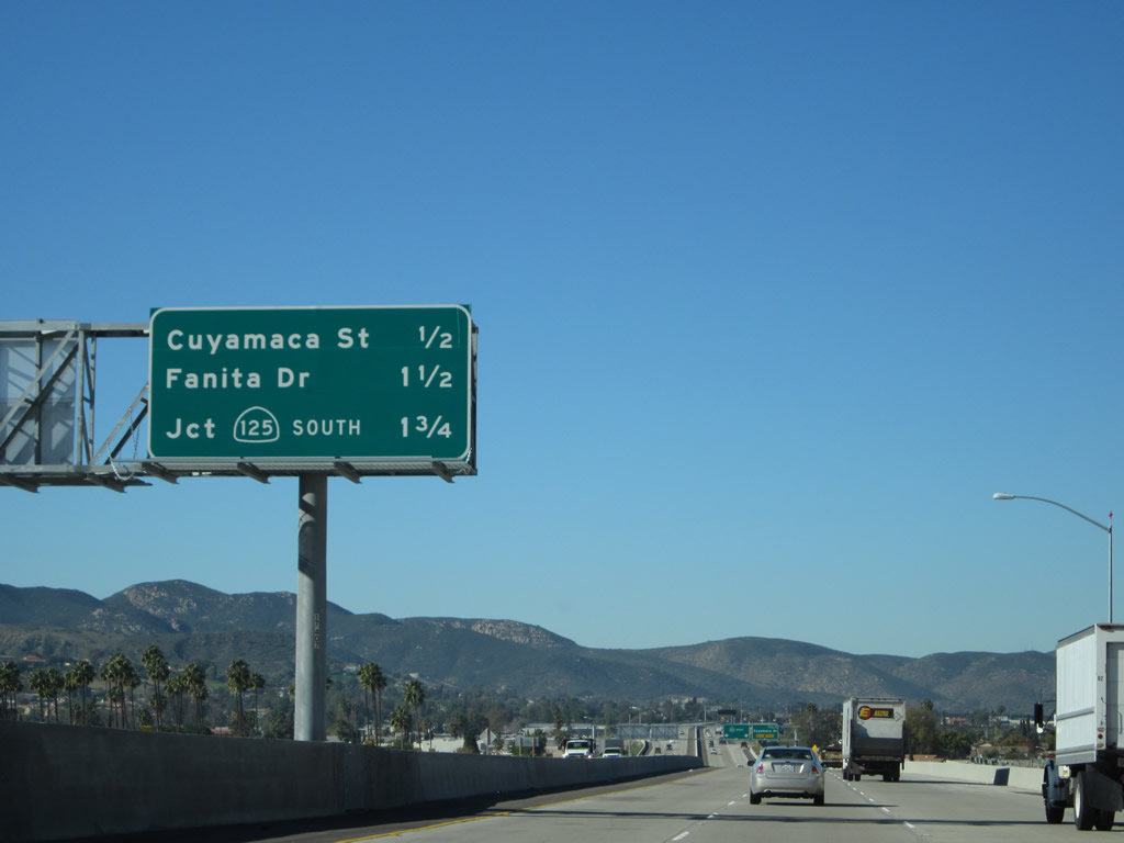
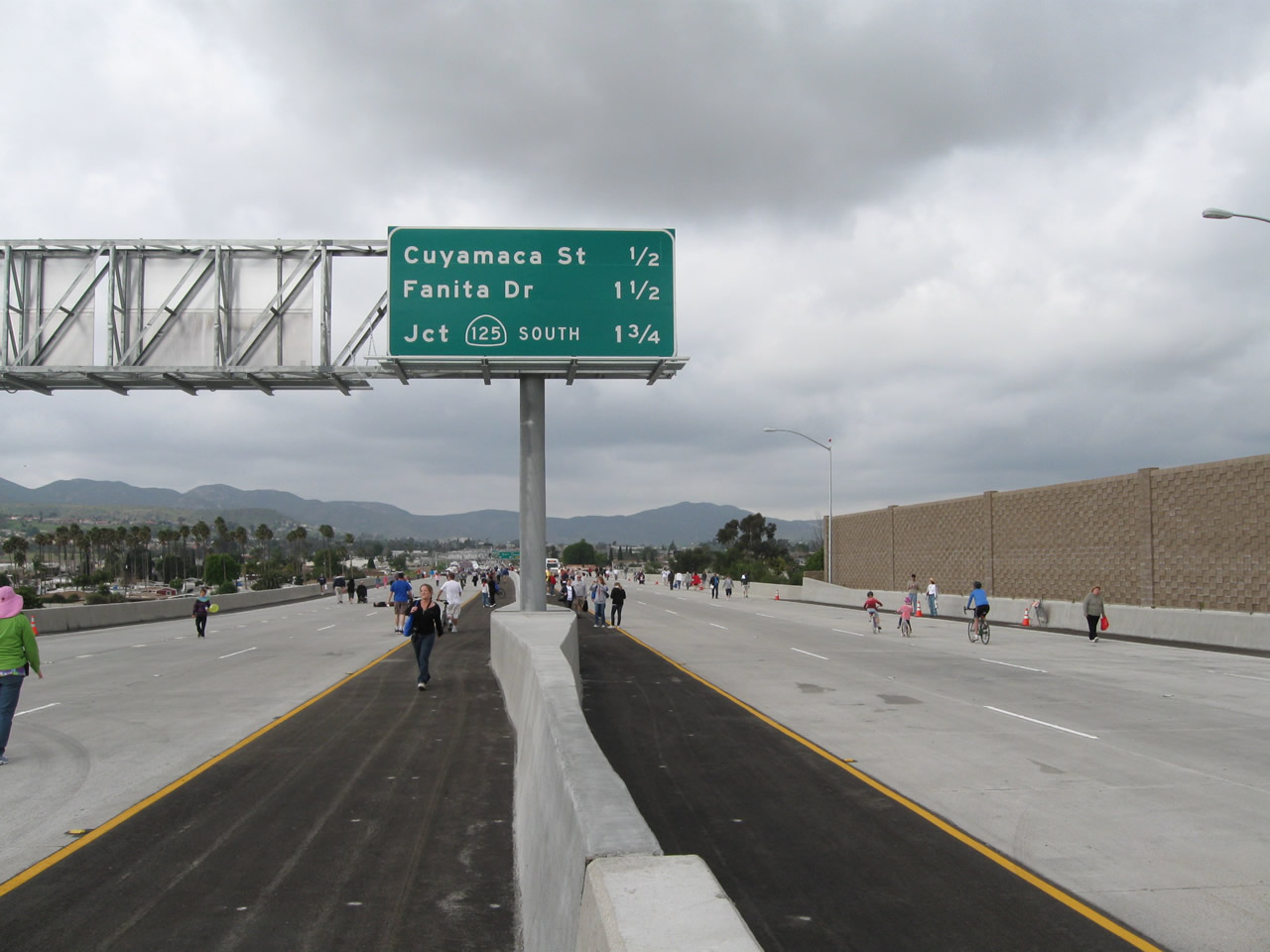
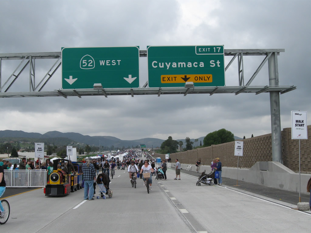
This interchange sequence sign along California 52 (Soledad Freeway) west provides the distance to the next three exits: Exit 17, Cuyamaca Street; Exit 15B, Fanita Drive; and Exit 15A, California 125 south. Photos taken 12/28/11 and 03/19/11. |
|
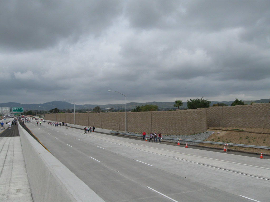
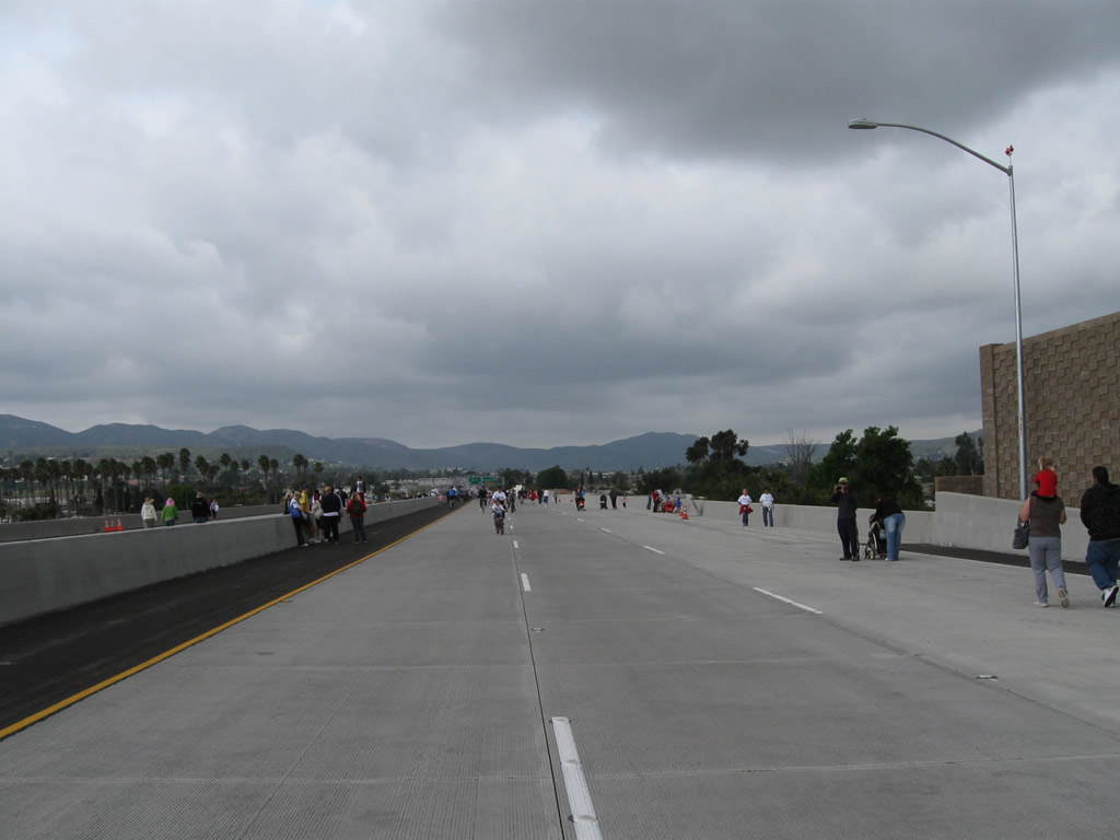
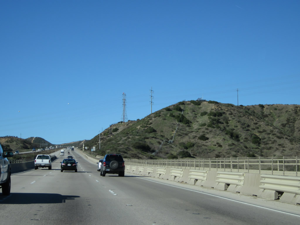
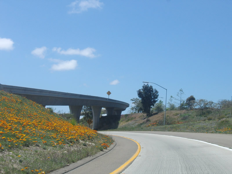
This view of California 52 was taken on March 19, 2011, when the freeway was open to the public for a free tour before it opened ten days later (on March 29, 2011). The celebration included a variety of food tents, bicycle race, public address, and ribbon cutting. Photo taken 03/19/11. |
|
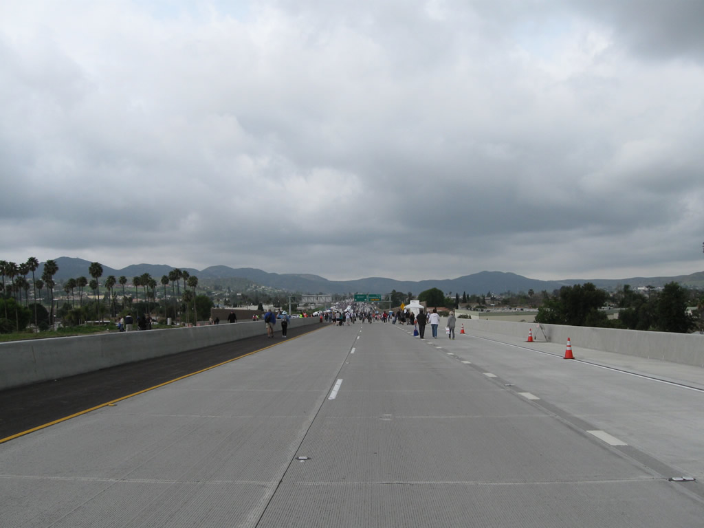
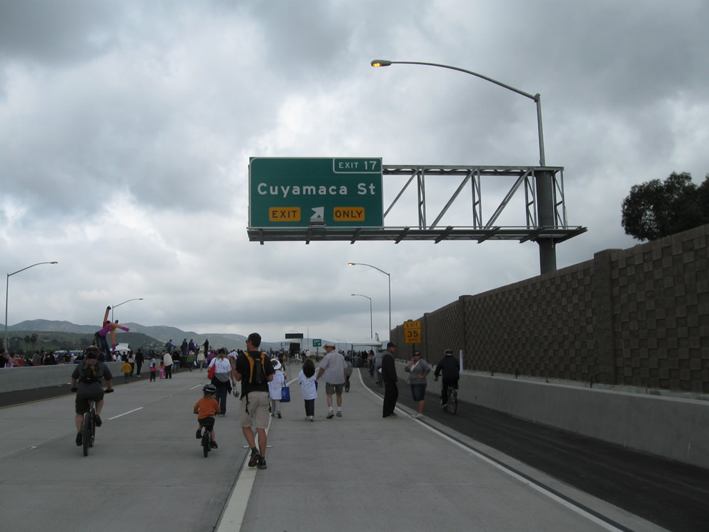
The right lane of California 52 west becomes exit only for Exit 17, Cuyamaca Street. Photo taken 03/19/11. |
|
|
Use Cuyamaca Street south into downtown Santee. Most motorist services (gas, food, shopping) are available along Cuyamaca Street and Mission Gorge Road (which parallels California 52 to the north). Photos taken 12/28/11 and 03/19/11. |
|
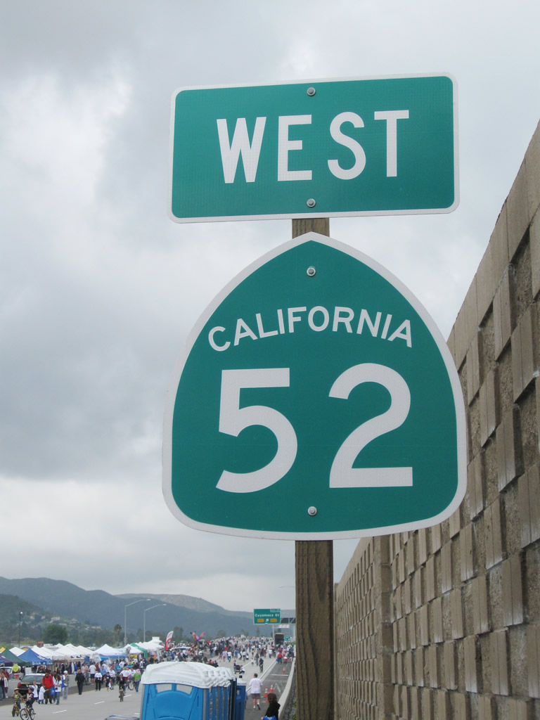
A California 52 west reassurance shield is posted shortly thereafter. Photo taken 03/19/11. |
|
|
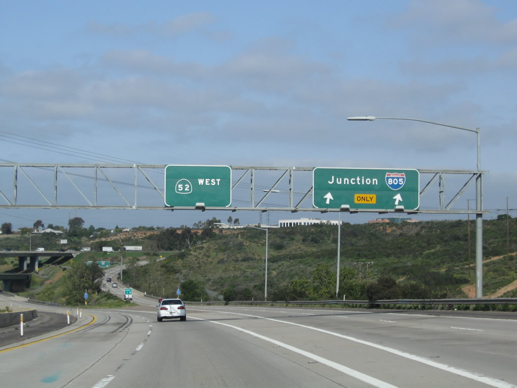
Westbound California 52 (Soledad Freeway) reaches Exit 17, Cuyamaca Street. The next two exits along westbound are Exit 15B, Fanita Drive and Exit 15A, California 125 south to La Mesa, Spring Valley, Chula Vista, and Otay Mesa. Photos taken 12/28/11 and 03/19/11. |
|
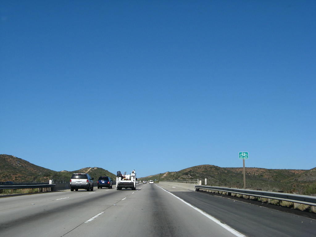
On the day of the grand opening celebration, bicyclists lined up early on Saturday, March 19, 2011, to bicycle the new segment of California 52 freeway at the Exit 17 gore point (exit to Cuyamaca Street). Photo taken 03/19/11. |
|
This view looks west on California 52 (Soledad Freeway) after the Exit 17 gore point. Photo taken 03/19/11. |
|
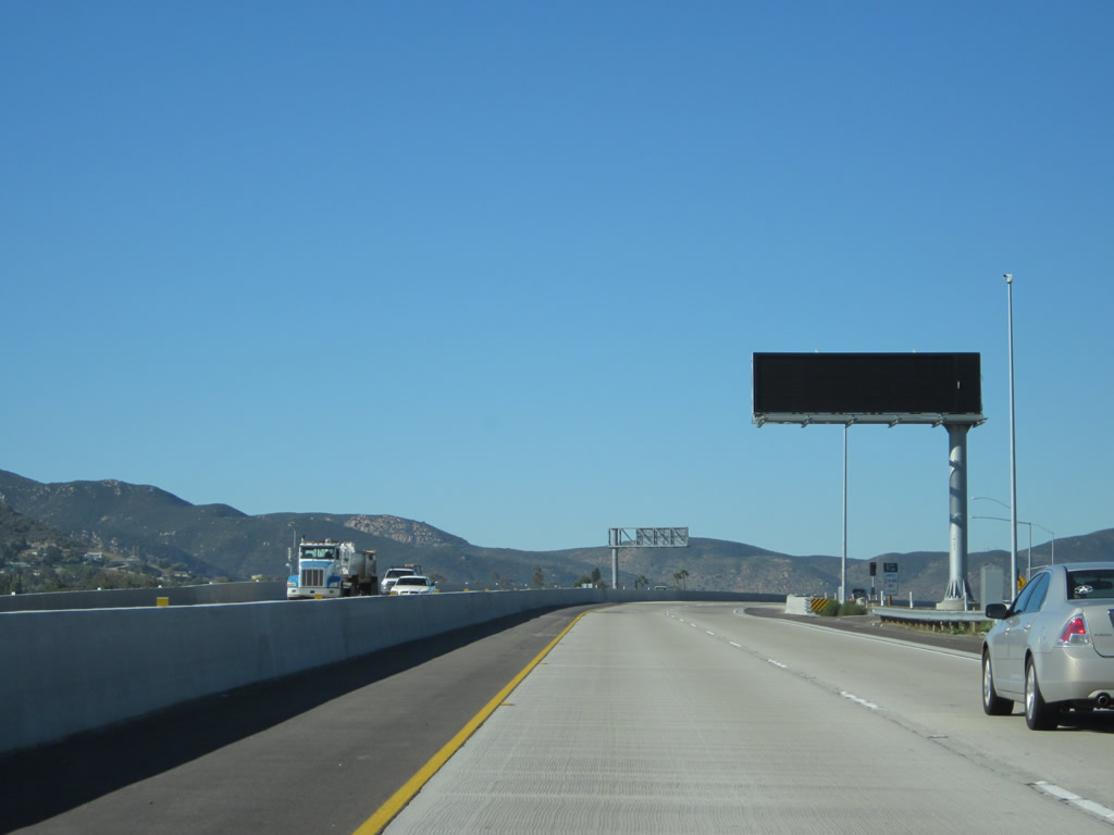
A dynamic message sign is posted on the Cuyamaca Street overpass. Photo taken 12/28/11. |
|
The next two exits along California 52 (Soledad Freeway) west are Exit 15B, Fanita Drive and Exit 15A, California 125 south to La Mesa, Spring Valley, Chula Vista, and Otay Mesa. It seems like a Caltrans District 11 standard for situations when two exits are closely spaced is for the first guide sign include both two exits on one sign (like this) and ignore exit numbers. (Another example is on California 67 north approaching California 52 and Prospect Avenue and also on Interstate 5 near the Oceanside Harbor and Camp Pendleton exits.) In this case, it would be nice to see a tab stating Exits 15B-A on this guide sign. Photo taken 12/28/11. |
|
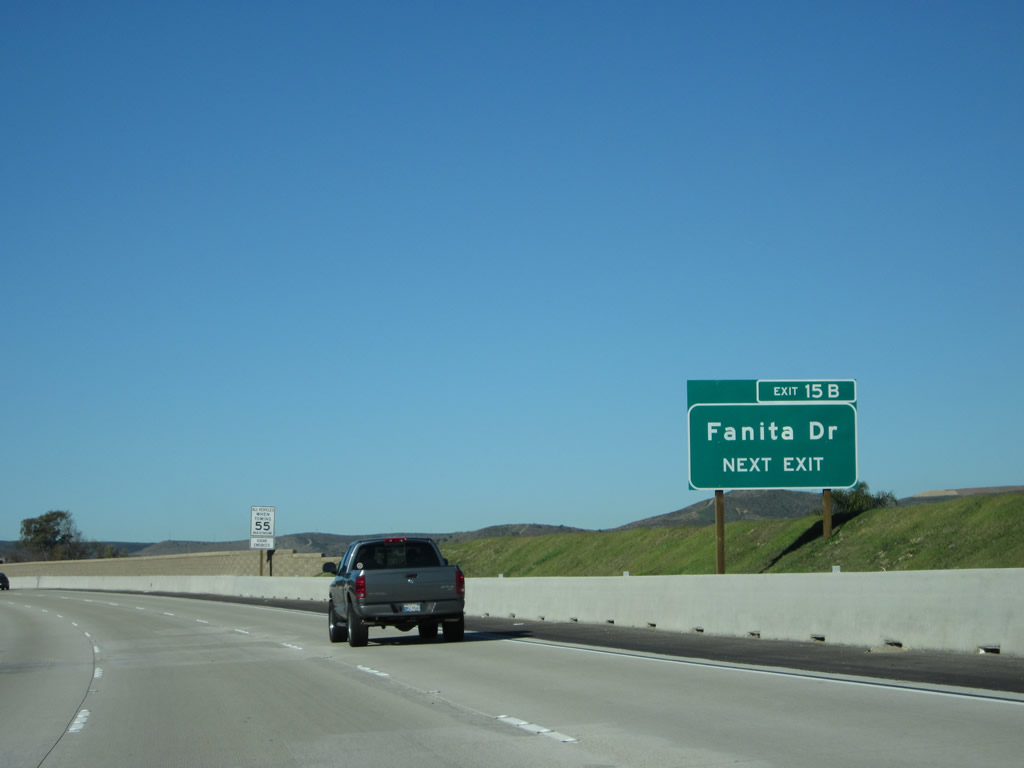
Instead, a roadside guide sign for Exit 15B, Fanita Drive is posted shortly after the overhead sign, and this sign includes the exit number. Photo taken 12/28/11. |
|
|
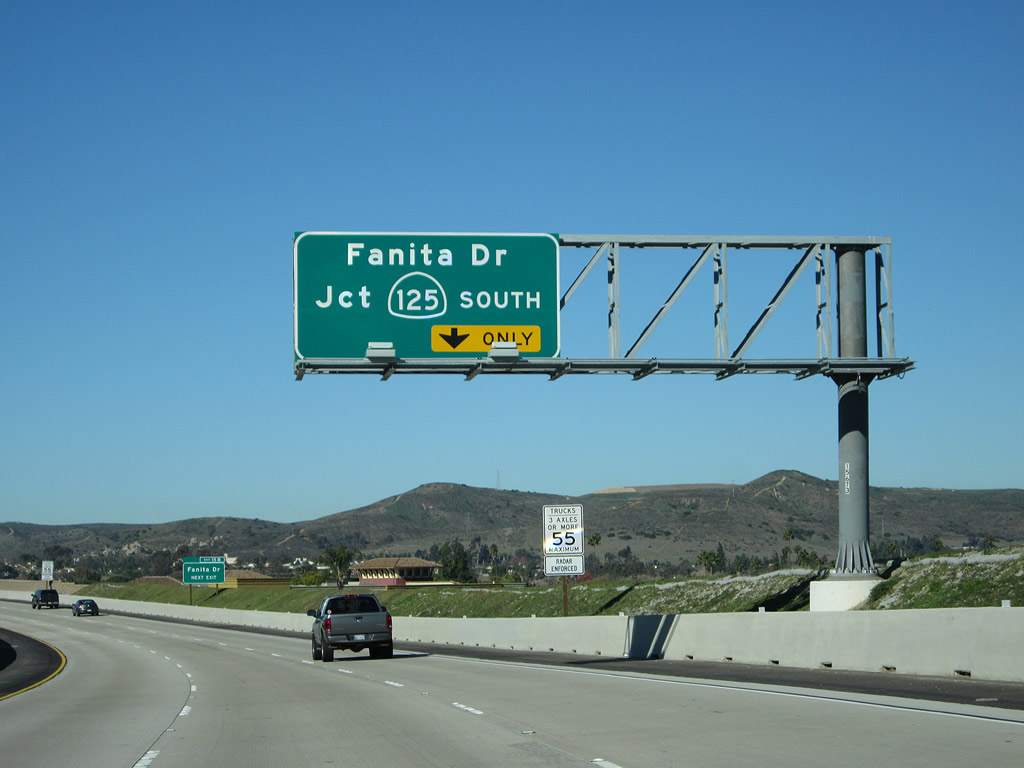
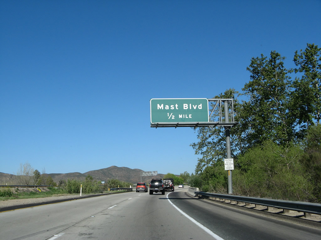
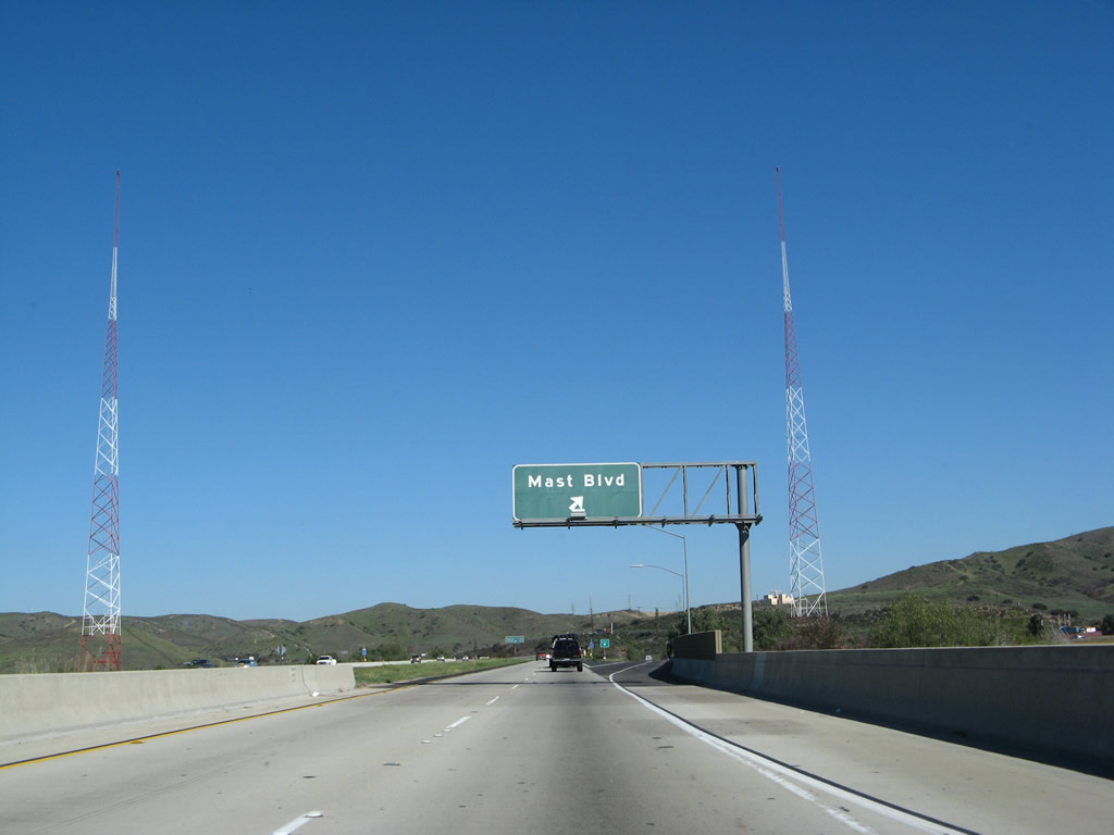
Westbound California 52 (Soledad Freeway) reaches Exit 15B, Fanita Drive. The next two exits are Exit 15A, California 125 south to La Mesa, Spring Valley, Chula Vista, and Otay Mesa and Exit 13, Mast Boulevard. Photos taken 12/28/11 and 04/09/11. |
|
|
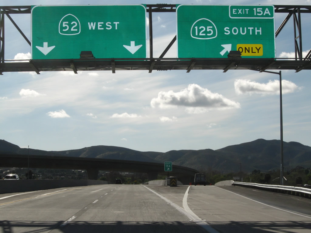
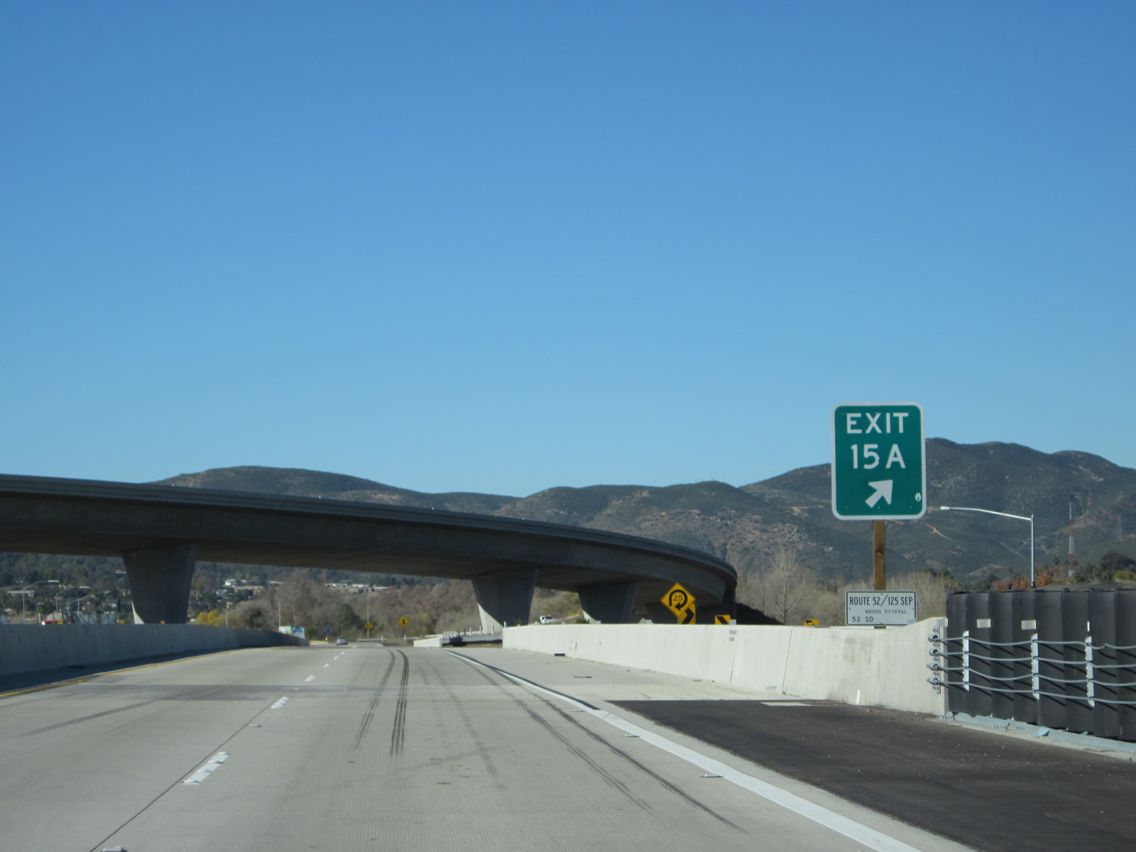
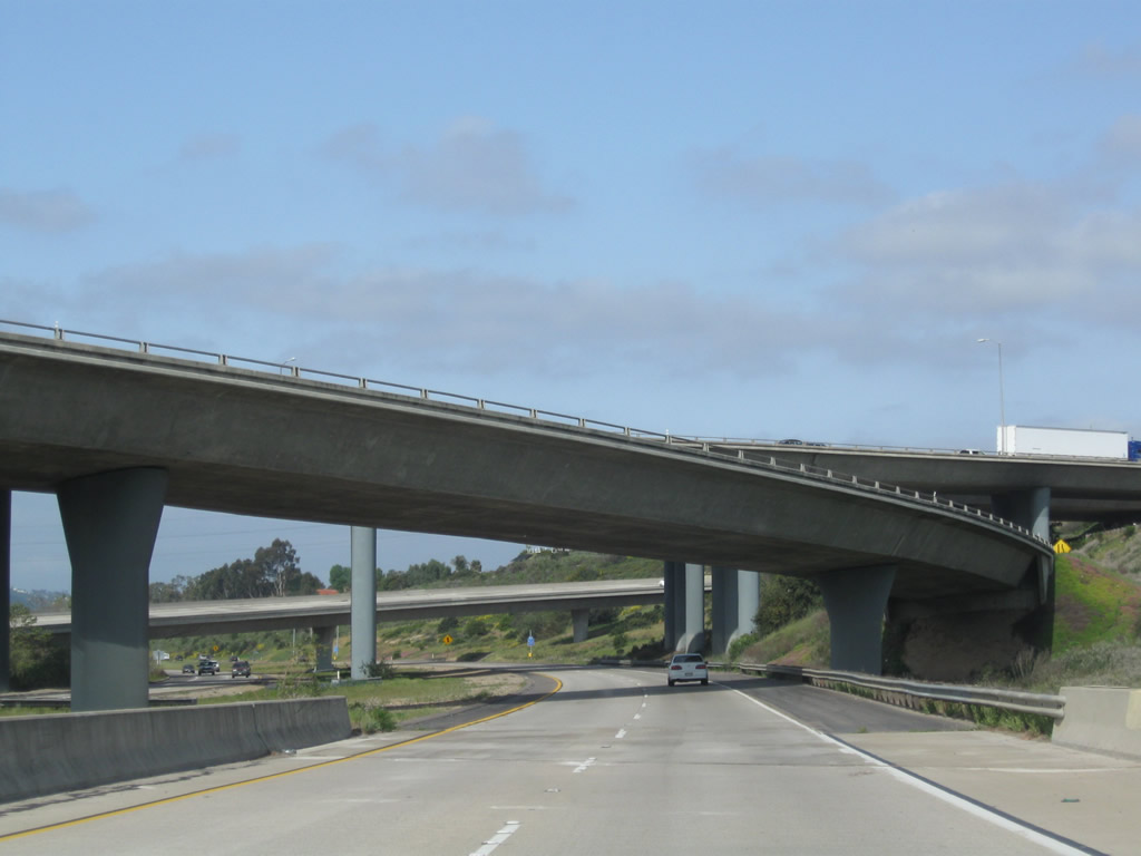
Immediately thereafter, westbound California 52 (Soledad Freeway) meets Exit 15A, California 125 south. This loop ramp requires motorists to slow down before exiting. Photos taken 12/28/11 and 04/09/11. |
|
A bridge identification sign (52/125 Separation) is posted below the Exit 15A gore point. Photo taken 12/28/11. |
|
Westbound California 52 (Soledad Freeway) passes under the transition ramp from California 125 north to California 52 west. Photo taken 12/28/11. |
|
|
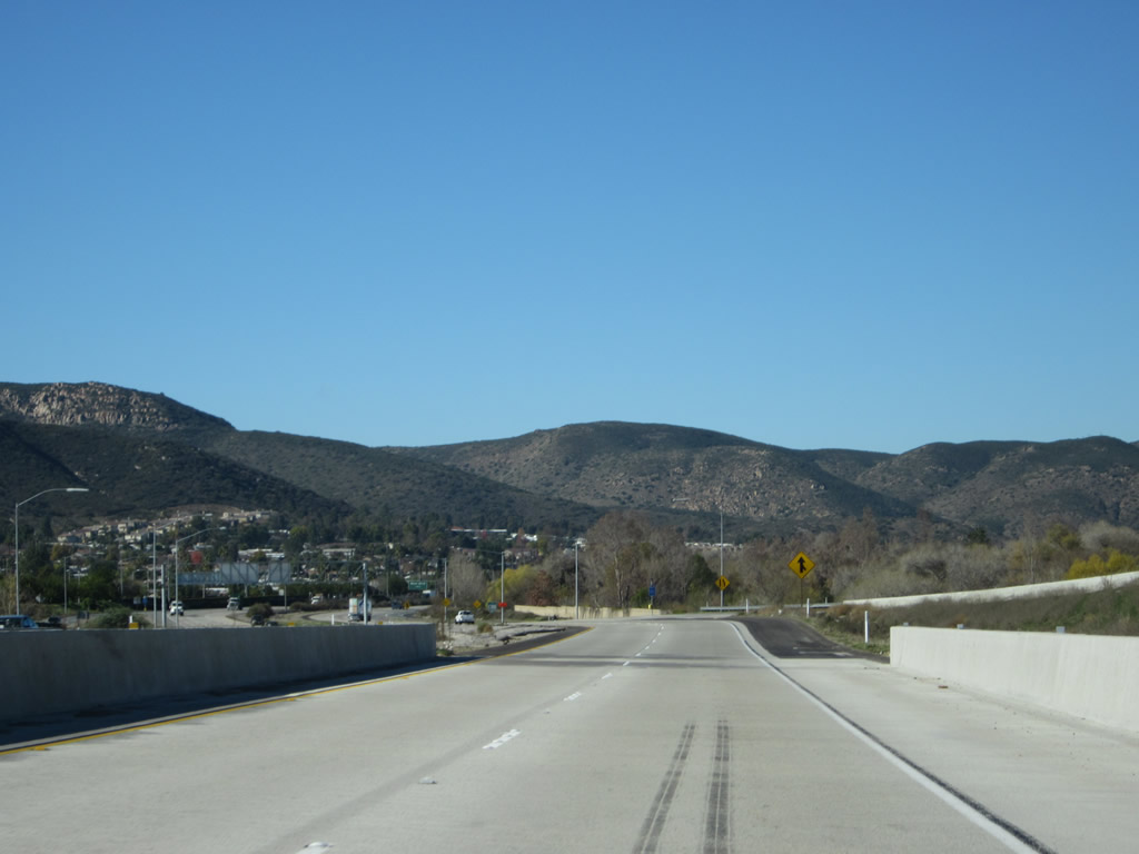
The peaks of Mission Trails Regional Park come into view as California 52 passes under the transition ramp between California 125 north and California 52 west. Here, California 52 passes over Mission Gorge Road. Photos taken 04/09/11 and 12/28/11. |
|
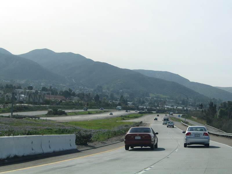
Traffic from California 125 north and Mission Gorge Road merges onto California 52 west. Photo taken 12/28/11. |
|
This view, taken from the transition ramp from California 125 north to California 52 west, shows the unbuilt California 52 extension as was the case in 2005. Note the stub ramps for the easterly extension of California 52, which has since been built. Photo taken 02/16/05. |
|
The first exit along westbound California 52 is Exit 13, Mast Boulevard. Photo taken 03/30/07. |
|
Use Mast Boulevard east to West Hills Parkway south to Mission Gorge Road west to Mission Trails Regional Park. Hiking, bicycling, camping, and a museum are among the many offerings at the sprawling open space park. In addition, Mast Bouelvard east connects to Santee Lakes, which offer additional recreational opportunities. Photo taken 03/30/07. |
|
Leaving Santee, California 52 enters the city of San Diego. Home to 1,223,400 people as of the 2000 Census, San Diego was the sixth largest city at that time, but it has since slipped to eighth largest (moving behind Phoenix and San Antonio). Annual precipitation at San Diego International Airport (Lindbergh Field) amounts to 10.77 inches annually, which makes San Diego an arid place. However, the agreeable climate allows for plant growth with sufficient irrigation. Being at the southern end of the state, water is a major concern here, as the vast majority of water is imported from the Colorado River or from Northern California via the State Water Project (California Aqueduct). Growth is expected to continue, despite the fact that San Diego has one of the highest costs of living in the country. Photo taken 03/30/07. |
|
A half-mile advance sign for Exit 13, Mast Boulevard is posted shortly therefater. Photo taken 03/30/07. |
|
|
California 52 crosses the San Diego River between the Mission Gorge Road and Mast Boulevard exits. This bridge more or less marks the city limits between Santee and San Diego, although technically the city of San Diego owns the San Diego River channel between this bridge and the California 52/125 interchange. Photos taken 03/30/07. |
|
After the bridge, westbound California 52 reaches Exit 13, Mast Boulevard, the first San Diego exit along westbound. Photo taken 03/30/07. |
|
|
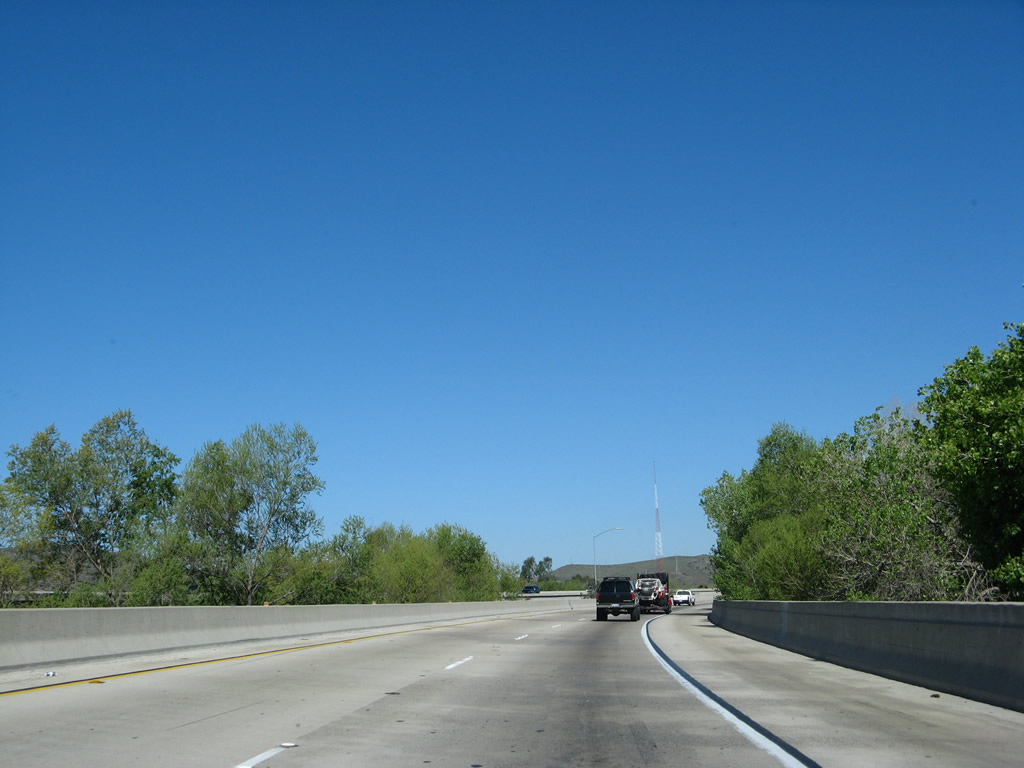
Westbound California 52 enters Mission Trails Regional Park after the Mast Boulevard interchange. The next exit is in four and a half miles at Exit 8, Santo Road. Photos taken 12/28/11 and 03/30/07. |
|
A California 52 west reassurance shield is posted after the on-ramp from Mast Boulevard. Photo taken 03/30/07. |
|
|
|
|
| California 52 west ascends to Mission Trails Summit (el. 821 feet) in Mission Trails Regional Park. This grade is located between the Mast Boulevard and Santo Road interchanges. While there are three lanes along westbound at this point, the climbing lane used to end at the top of the grade but has been extended to Santo Road. This results in traffic delays for morning commuters who use California 52 to reach Interstate 15. Watch for bicycles, as they are permitted for use on this section of California 52. A bike lane was added between 2007 and 2011, making a dedicated route for bike traffic over Mission Trails Summit. Photos taken 03/30/07 and 12/28/11. |
|
|
|
|
|
|
|
After crossing the summit, the populated areas of the city of San Diego spread out from Mission Trails Summit on westbound California 52. This an incredibly beautiful view most mornings. Photos taken 03/30/07. |
|
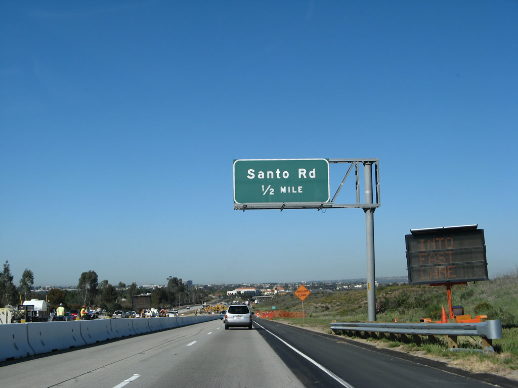
The next exit along westbound California 52 is Exit 8, Santo Road south to Tierrasanta. Photo taken 03/30/07. |
|
|
Santo Road is a north-south arterial that passes through Tierrasanta. Construction was underway in 2007 to add a lane and create a dedicated bike path; work was done by 2011. Photos taken 12/28/11 and 03/30/07. |
|
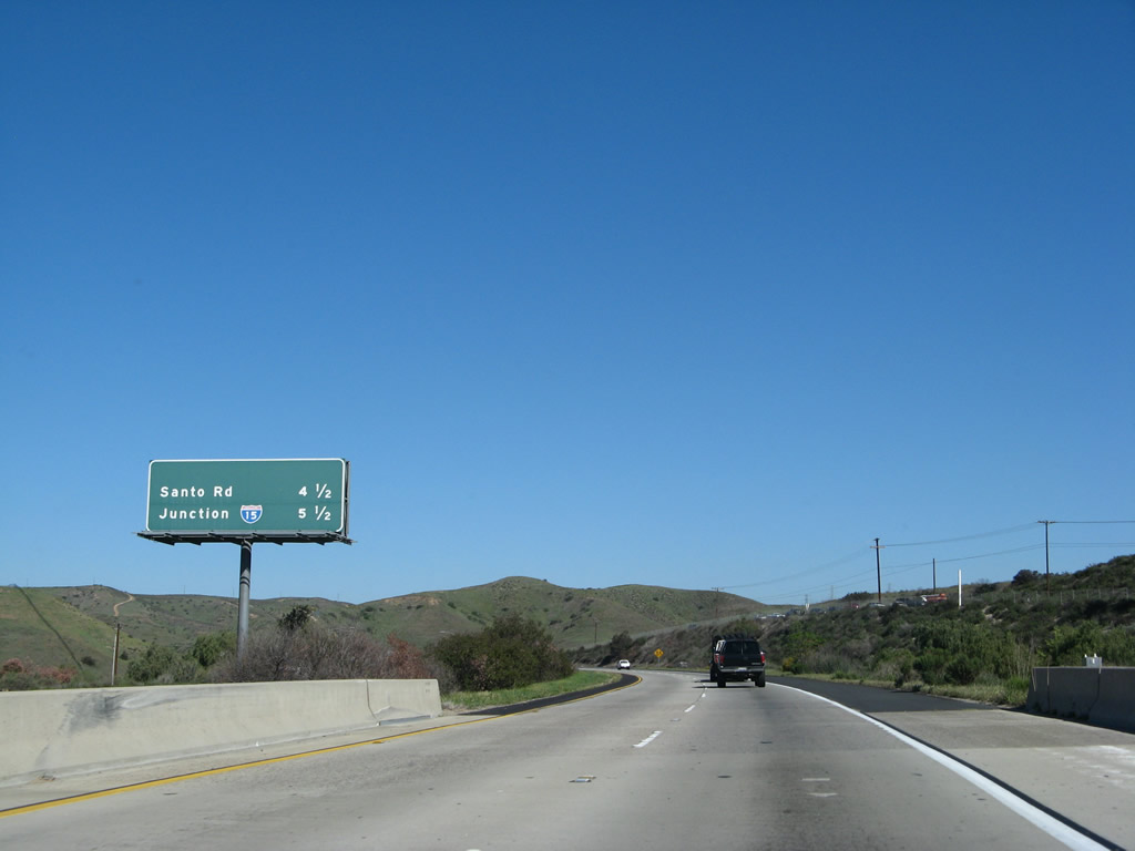
Prior to the Santo Road interchange, a dynamic message sign provides travel times to Interstate 805 and Interstate 5. Photo taken 03/30/07. |
|
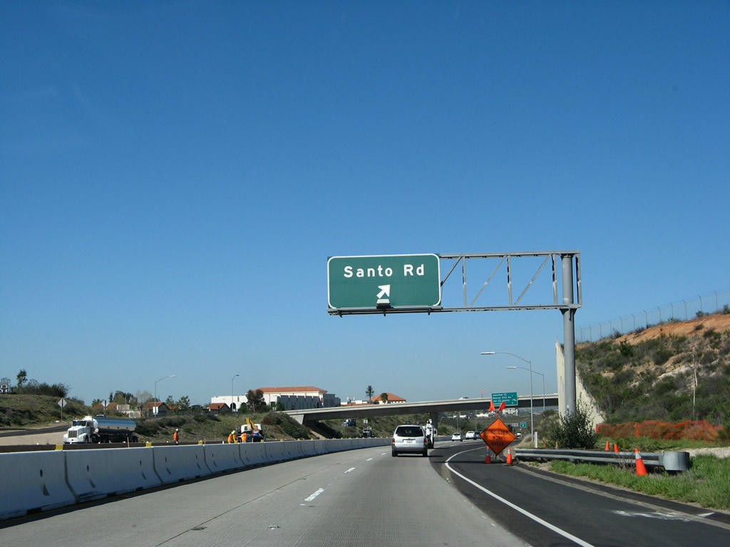
Westbound California 52 reaches Exit 8, Santo Road. Photo taken 03/30/07. |
|
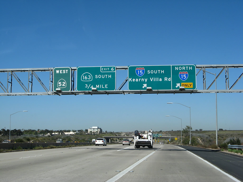
The next three exits along westbound are Exit 7, Interstate 15 and Kearny Villa Road; Exit 6, California 163; and Exit 5, Convoy Street. Photo taken 03/30/07. |
|
The right two lanes connect to Interstate 15. Use Interstate 15 north to Scripps Ranch, Mira Mesa, Sabre Springs, and Rancho Bernardo. To the south, Interstate 15 passes through Murphy Canyon en route to Mission Valley and City Heights. California 163 is another freeway that travels southwest toward downtown San Diego. Photo taken 03/30/07. |
|
A reassurance shield for California 52 west is posted after the on-ramp from Santo Road. The "elephant tracks" pavement marking indicates that the right lane becomes exit only. Photo taken 03/30/07. |
|
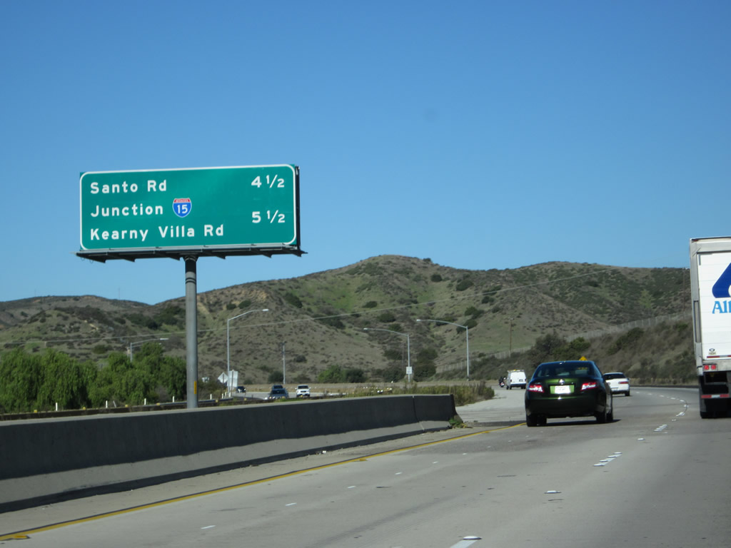
Another mileage sign for California 52 west provides the distance to Exit 7, Interstate 15 (Escondido Freeway) and Kearny Villa Road and Exit 6, California 163 (Cabrillo Freeway). Photo taken 03/30/07. |
|
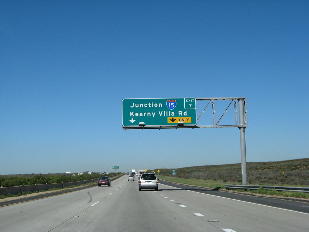
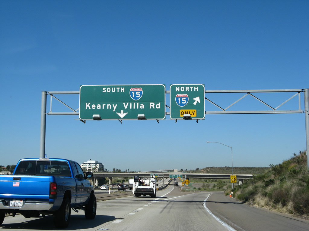
Westbound California 52 (Soledad Freeway) reaches Exit 7, Interstate 15 (Escondido Freeway) and Kearny Villa Road. Use this exit for all destinations north of here; there is no access to California 163 north. Even though this exit guide sign was placed in 2006, there is no exit number posted on the overhead sign for Interstate 15. There is an exit number on the guide sign for Exit 6, California 163 (Cabrillo Freeway) south to downtown. Photo taken 03/30/07. |
|
|
Now on the collector distributor lanes, the first ramp connects to northbound Interstate 15 (Escondido Freeway) to Escondido, Riverside, and San Bernardino. The next ramp on the c-d lanes connects to Interstate 15 south and then Kearny Villa Road. Photos taken 12/28/11 and 03/30/07. |
|
|
Back on the main lanes, westbound California 52 (Soledad Freeway) approaches the off-ramp to Exit 6, California 163 (Cabrillo Freeway) south to downtown San Diego. Photos taken 03/25/10 and 02/16/05. |
|
|
Again returning to the collector distributor lanes for Exit 7, the second ramp in this interchange connects to Interstate 15 southbound. The next ramp serves Kearny Villa Road (old U.S. 395). Photos taken 12/28/11 and 04/09/06. |
|
|
The collector distributor lanes split, with the right lane transitioning onto southbound Interstate 15 and the left lane continuing onto westbound California 52. Photos taken 12218/11 and 04/09/06. |
|
|
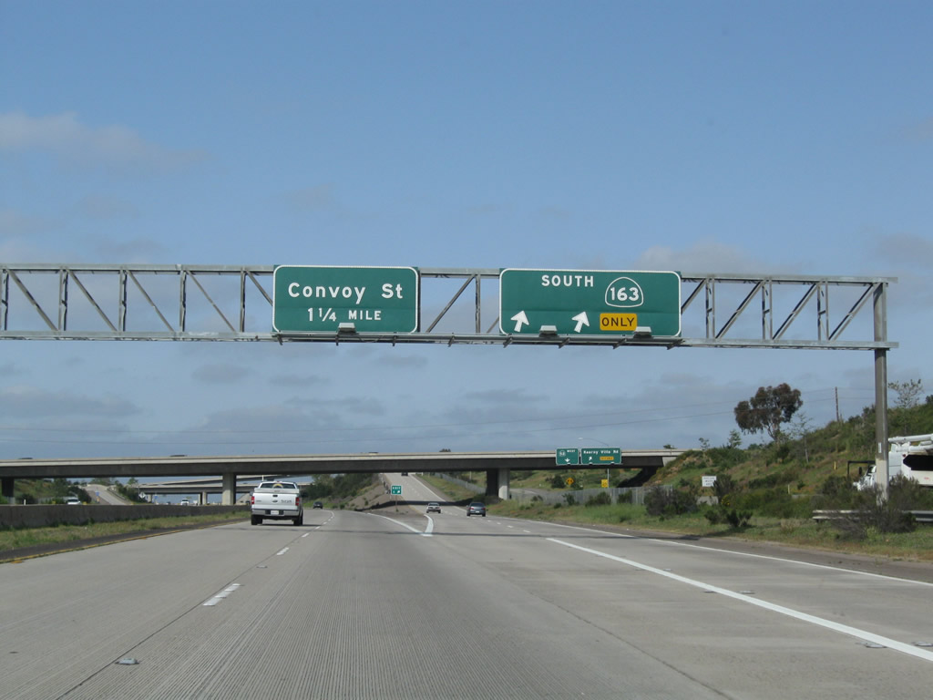
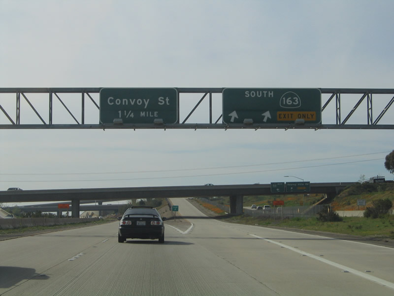
Meanwhile, on the main lanes, westbound California 52 (Soledad Freeway) reaches Exit 6, California 163 (Cabrillo Freeway) south to downtown San Diego. The next exit on the mainline is Exit 5, Convoy Street. Photos taken 03/25/10 and 02/16/05. |
|
|
A two-lane, high-speed transition ramp carries traffic from California 52 west to California 163 south. Photos taken 12/28/11. |
|
Back on the collector distributor lanes, the right lane departs onto Kearny Villa Road, while the left lane continues toward westbound California 52. Photo taken 04/09/06. |
|
|
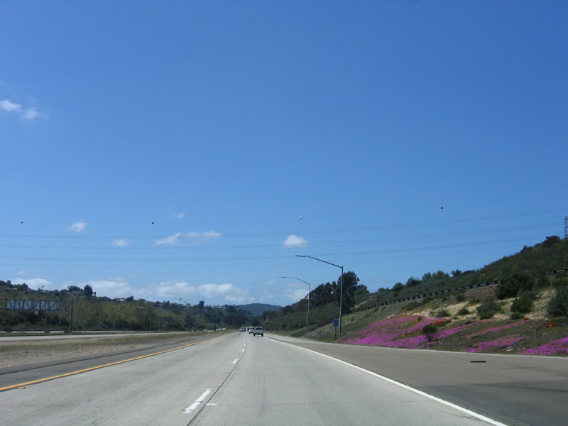
Blooming flowers are a common sight along this section of California 52 in March and April, and this year was no exception. The occasional orange poppy (state flower) blends well with the other colorful wildflowers. Photos taken 04/09/06. |
|
|
After traffic joins the collector distributor lanes from northbound California 163, the auxiliary lanes prepare to merge back onto the main lanes. Photos taken 03/25/10 and 04/09/06. |
|
Decorative artwork graces the retaining wall that separates westbound California 52 from the transition ramp that connects southbound California 163 with westbound California 52. Photo taken 04/09/06. |
|
Additional lanes join westbound California 52 after the California 163 interchange, and the freeway briefly has four westbound lanes. The right lane becomes exit only for the next off-ramp: Exit 5, Convoy Street. Photo taken 03/25/10. |
|
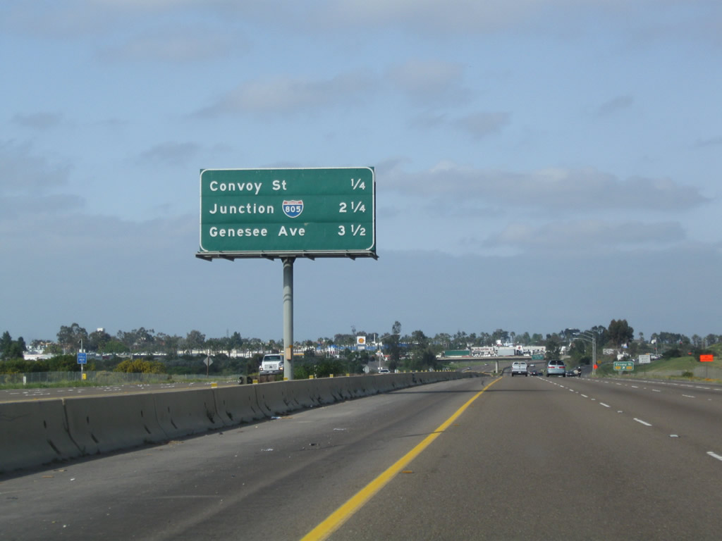
This interchange sequence sign along California 52 west provides the distance to the next three exits: Exit 5, Convoy Street; Exit 3, Interstate 805 (Jacob Dekema Freeway), and Exit 2, Genesee Avenue. Watch this stretch of California 52 for dips in the freeway, because this particular section of freeway was constructed on top of an old landfill that was topped off in the middle of the 20th century. Note the pavement change from concrete in the previous photobox to asphalt here. This portion of California 52 is regularly repaved due to the constantly changing and undulating surface. Photo taken 03/25/10. |
|
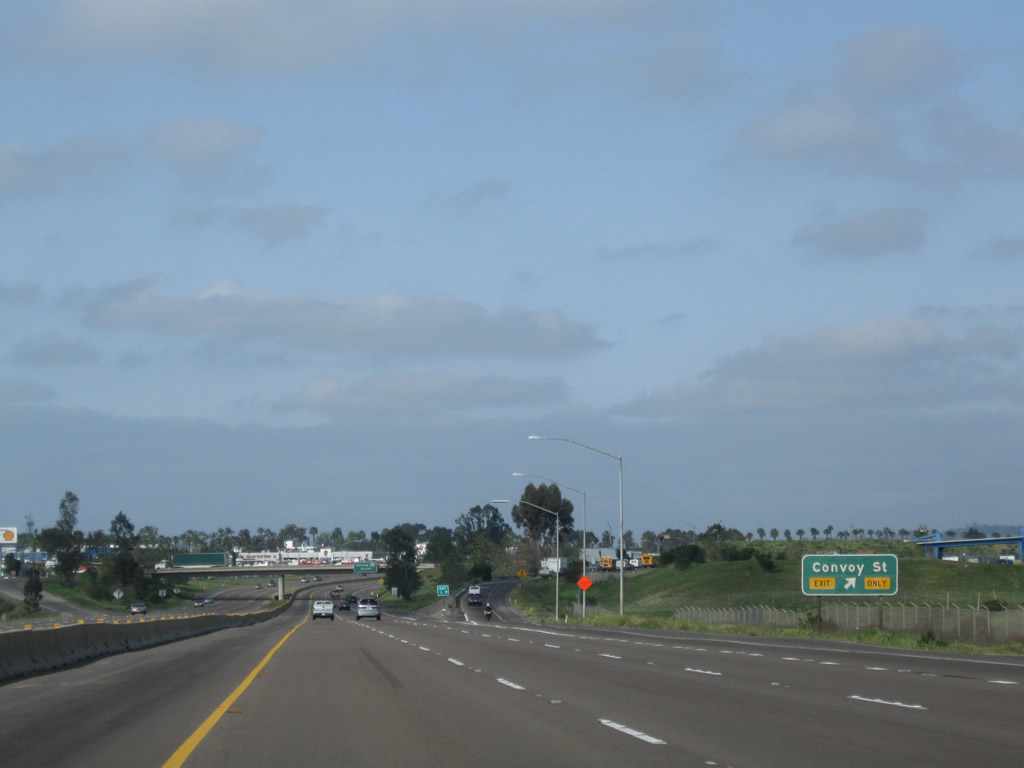
Westbound California 52 (Soledad Freeway) reaches Exit 5, Convoy Street. To the north of the freeway, California 52 skirts the southern edge of the Miramar Marine Corps Air Station and the city of San Diego's landfill. For waste disposal, use Exit 5 and follow Convoy Street north to the entrance to the landfill. To the south, Convoy Street passes through several business parks before emerging along one of the most diverse restaurant corridors in San Diego. A wide variety of ethnic restaurants, especially Asian restaurants, line Convoy Street south of Clairemont Mesa Boulevard. Photo taken 03/25/10. |
|
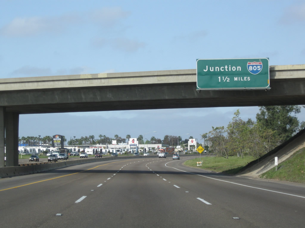
The next exit along westbound California 52 (Soledad Freeway) is Exit 3, Interstate 805 (Dekema Freeway). This major interchange connects California 52 with a major north-south corridor that provides a more direct connection to Interstate 5 north toward Los Angeles. Photo taken 03/25/10. |
|
This interchange sequence sign along California 52 west provides the distance to the next three exits: Exit 3, Interstate 805 (Jacob Dekema Freeway), Exit 2, Genesee Avenue; and Exit 1B, Clairemont Mesa Boulevard and Regents Road. Photo taken 03/25/10. |
|
The right lane of California 52 (Soledad Freeway) becomes exit only for Interstate 805. Use the two left lanes to continue west on California 52. Photo taken 04/09/06. |
|
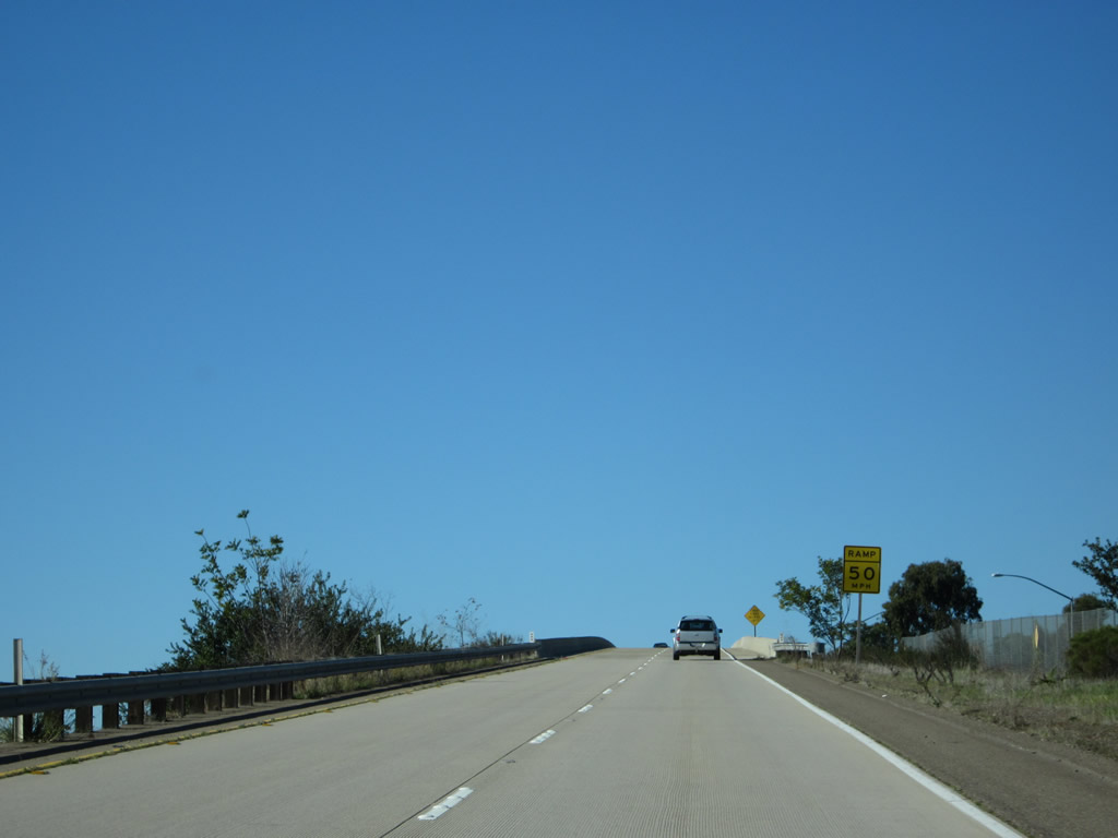
California 52 descends from Kearny Mesa into San Clemente Canyon. The freeway will follow this canyon west to Interstate 5, where San Clemente Canyon merges with Rose Canyon. Photo taken 04/09/06. |
|
Use the two left lanes to continue west along California 52; use the right two lanes to exit onto Interstate 805. The characteristics of California 52 change after Interstate 805, as it has only four lanes total (two in each direction) and features a landscaped median. Photo taken 03/25/10. |
|
|
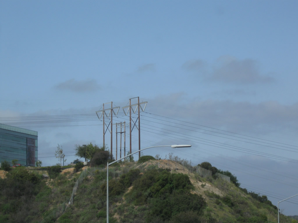
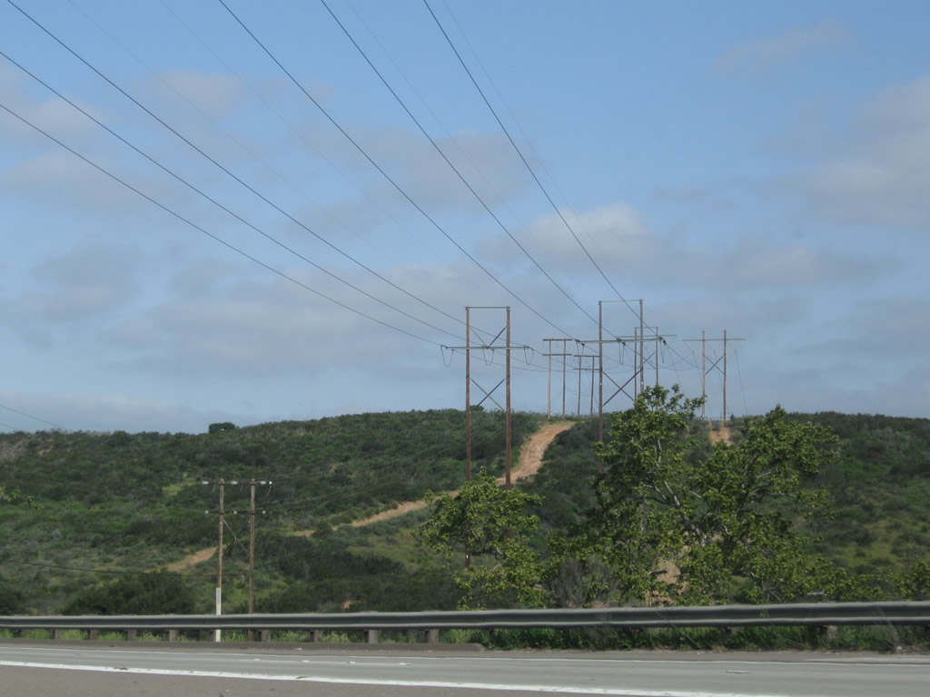
A set of San Diego Gas & Electric 230kV power lines cross over the California 52 freeway near the Interstate 805 interchange. Photos taken 03/25/10. |
|
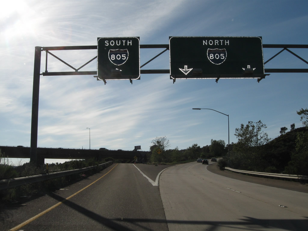
Now on the transition ramp from California 52 west to Interstate 805, the right two lanes connect to Interstate 805 north, while the left lane connects to Interstate 805 south (a loop ramp). Photo taken 04/09/11. |
|
|
|
|
Back on the mainline, we see that the interchange between Interstate 805 and California 52 is a stack. California 52 forms the lowest level, while Interstate 805 forms the top deck. Photos taken 03/25/10. |
|
More spring flowers adorn the right of way of California 52 as the freeway continues west through San Clemente Canyon. To the north lies the University City community of San Diego, while the Clairemont community is to the south of the freeway. Photo taken 04/09/06. |
|
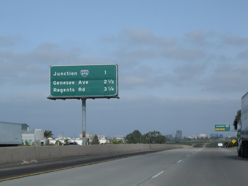
This interchange sequence sign along California 52 east provides the distance to the next three exits: Exit 2, Genesee Avenue; Exit 1B, Regents Road and Clairemont Mesa Boulevard; and Exit 1A, Interstate 5 (San Diego Freeway) and La Jolla Parkway west. Photo taken 03/25/10. |
|
This reassurance shield for California 52 west is posted after the Interstate 805 interchange and prior to the Genesee Avenue interchange. Photo taken 03/25/10. |
|
Use Genesee Avenue north to University City and south to Clairemont Mesa. Both of these are communities of the city of San Diego. Photo taken 03/25/10. |
|
|
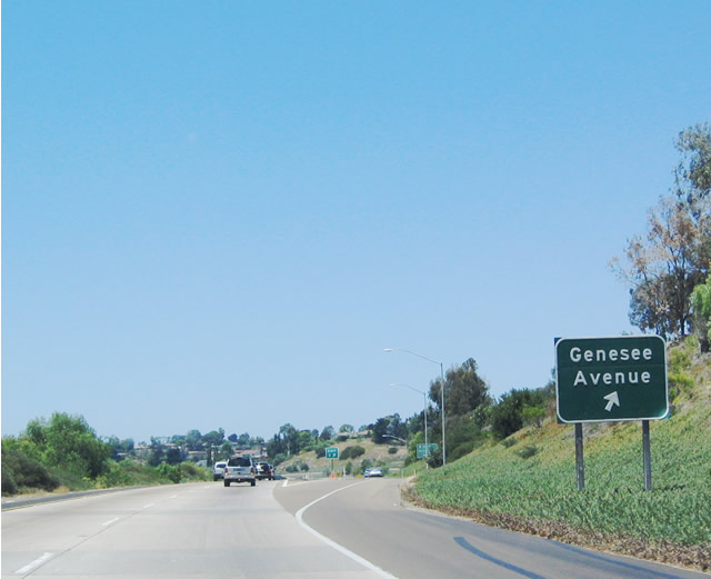
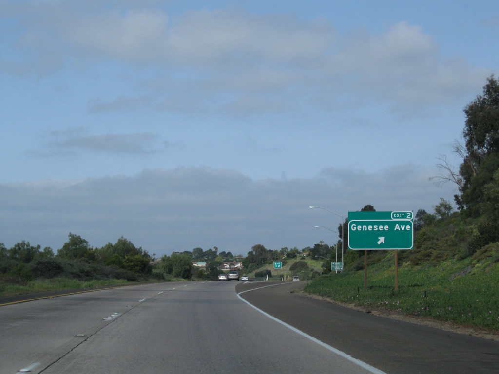
Westbound California 52 (Soledad Freeway) reaches Exit 2, Genesee Avenue. The original sign was replaced with an exit number sign in 2005. Photos taken 05/22/04 and 03/25/10. |
|
Upon exiting, the first ramp connects to Genesee Avenue north, or stay left on the off-ramp to loop onto Genesee Avenue south to Clairemont Mesa. Genesee Avenue may be also designated as San Diego County S-21, although we've not seen any route markers with that designation southeast of Interstate 5. Photo taken 03/25/10. |
|
The interchange with Genesee Avenue is a bit more complicated than a typical diamond interchange due to the contours of the landscape and the narrowness of the canyon. Photo taken 04/09/06. |
|
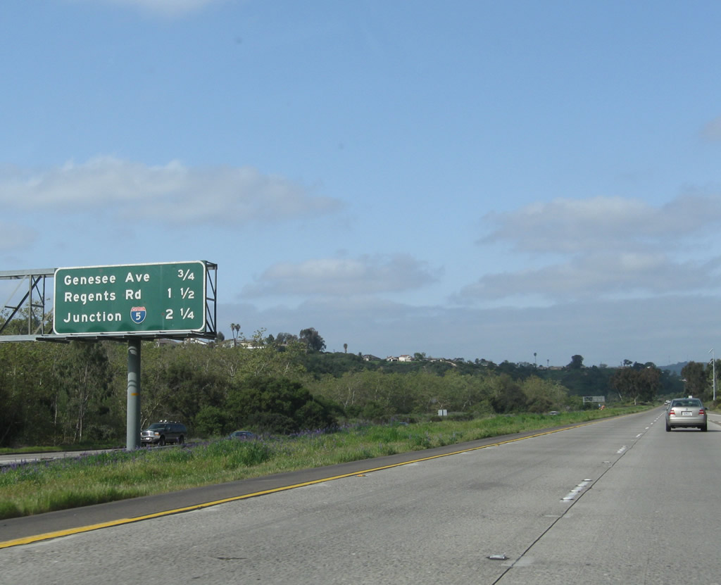
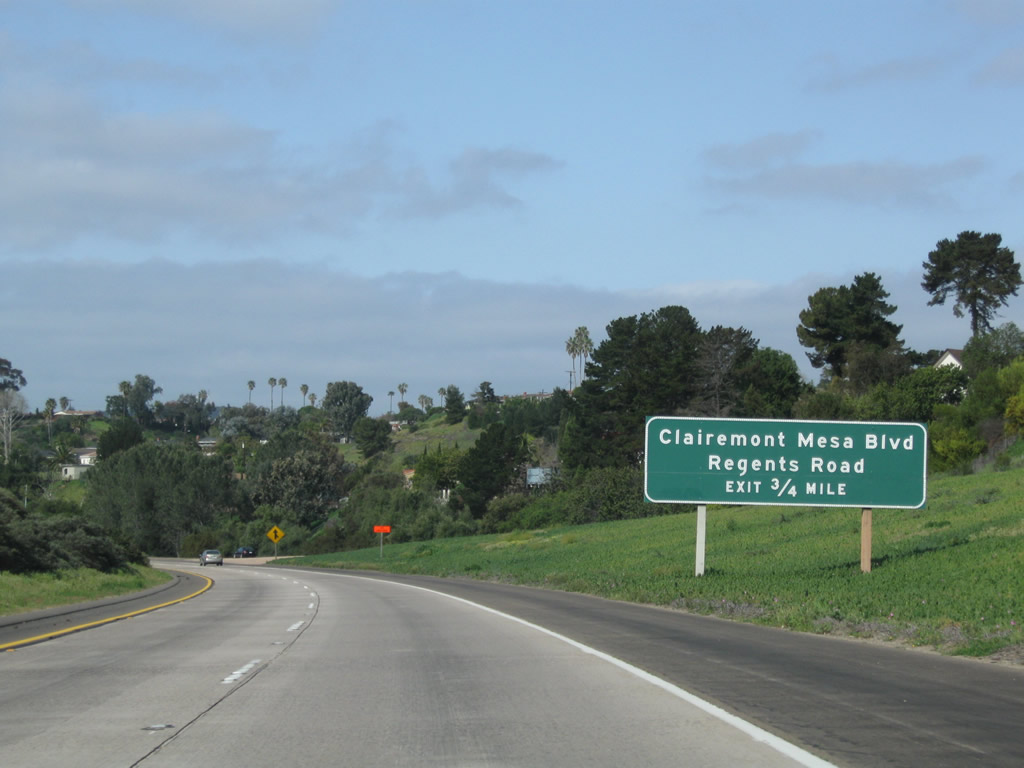
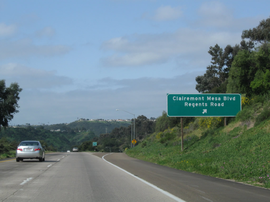
The next exit along westbound California 52 is Exit 1B, Clairemont Mesa Boulevard and Regents Road. Clairemont Mesa Boulevard turns southeast toward the community of Clairemont, while Regents Road enters South University City. Regents Road ends just north of Governor Drive. There are proposals to construct a bridge over Rose Canyon, but the project has become extremely controversial. As of April 2006, it is not clear if the bridge will ever be built. Photo taken 03/25/10. |
|
A California 52 west reassurance shield is posted after the on-ramp from Genesee Avenue. Photo taken 03/25/10. |
|
Westbound California 52 reaches Exit 1B, Clairemont Mesa Boulevard southeast and Regents Road north. Photo taken 03/25/10. |
|
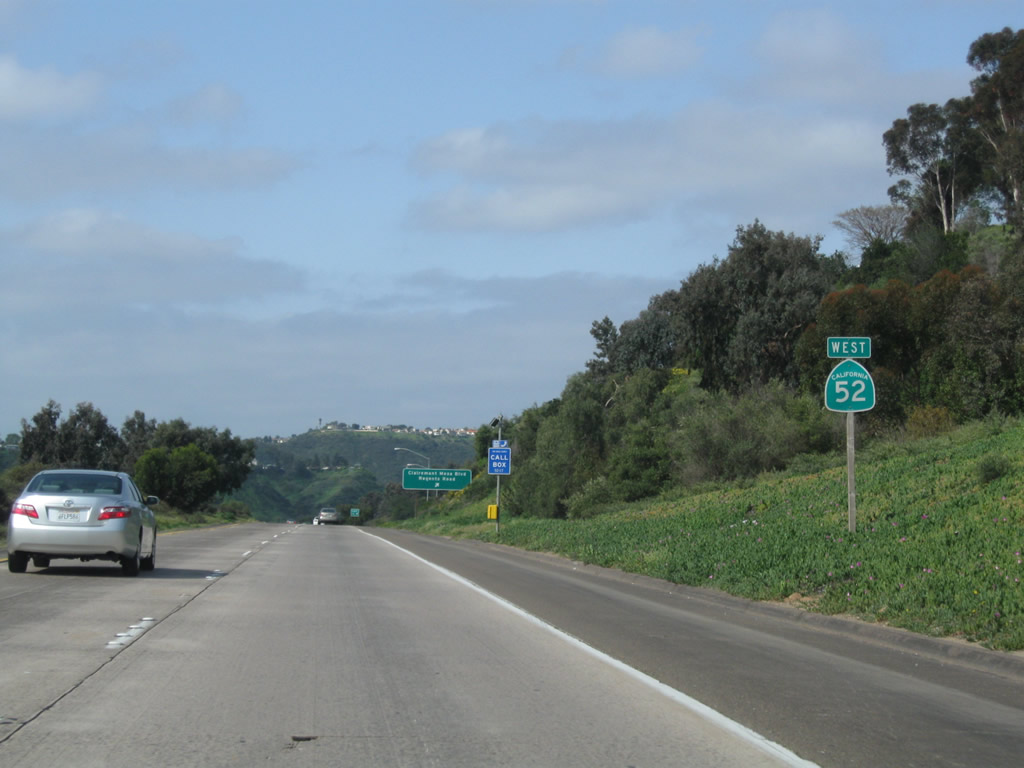
This is the last reassurance shield for California 52 along westbound. Photo taken 03/25/10. |
|
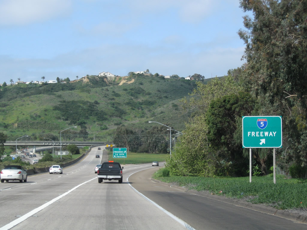
The final exit along westbound is Exit 1A, Interstate 5 (San Diego Freeway); the right two lanes will exit onto the freeway. Photo taken 03/25/10. |
|
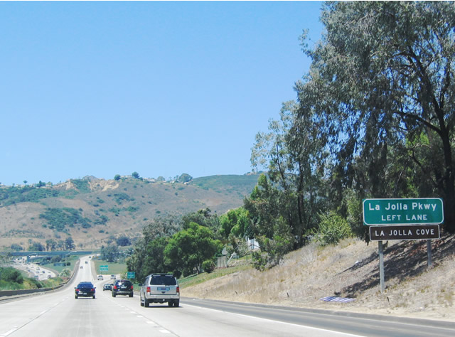
To continue west into La Jolla, use the left two lanes to follow La Jolla Parkway. Photo taken 05/22/04. |
|
The Interstate 5 and California 52 junction is known as the Rose Canyon Interchange due to its location within Rose Canyon. California 52 passes over the Rose Canyon Fault here. Both right lanes exit onto Interstate 5 north/south. Photo taken 03/25/10. |
|
|
Westbound California 52 reaches Exit 1A, Interstate 5 north to Carmel Valley and south to Downtown. Photos taken 05/22/04 and 03/25/10. |
|
|
|
Now on the transition ramp to Interstate 5, the left two lanes transition onto southbound Interstate 5, while the right lane has an exit to northbound Interstate 5. This marks the end of the northern Inner Belt created by the combination of California 125 and California 52. Photos taken 03/25/10. |
|
Meanwhile, back on the mainline, California 52 serves as the top deck in the Rose Canyon Interchange; Interstate 5 is the bottom deck. Photo taken 05/22/04. |
|
|
An increasing rarity, the end of California 52 is signed with an end shield. La Jolla Parkway, a city street that was formerly known as Ardath Road, continues from here into the community of La Jolla. Photo taken 01/18/09 and 01/24/07. |
| La Jolla Parkway west |
|
After the end shield, the highway continues as a city-maintained street: La Jolla Parkway. There is one partial interchange on this route, which is shown here for La Jolla Scenic Drive North. There is no access to La Jolla Scenic Drive South because the bridge across the highway was never built due to resident opposition. Photo taken 02/16/05. |
|
Westbound La Jolla Parkway reaches the off-ramp to La Jolla Scenic Drive North. To downtown La Jolla, continue straight ahead on La Jolla Parkway. Photo taken 02/16/05. |
|
La Jolla Parkway is narrow and has a jersey barrier that acts as a separation between the two directions of traffic. Photo taken 01/24/07. |
|
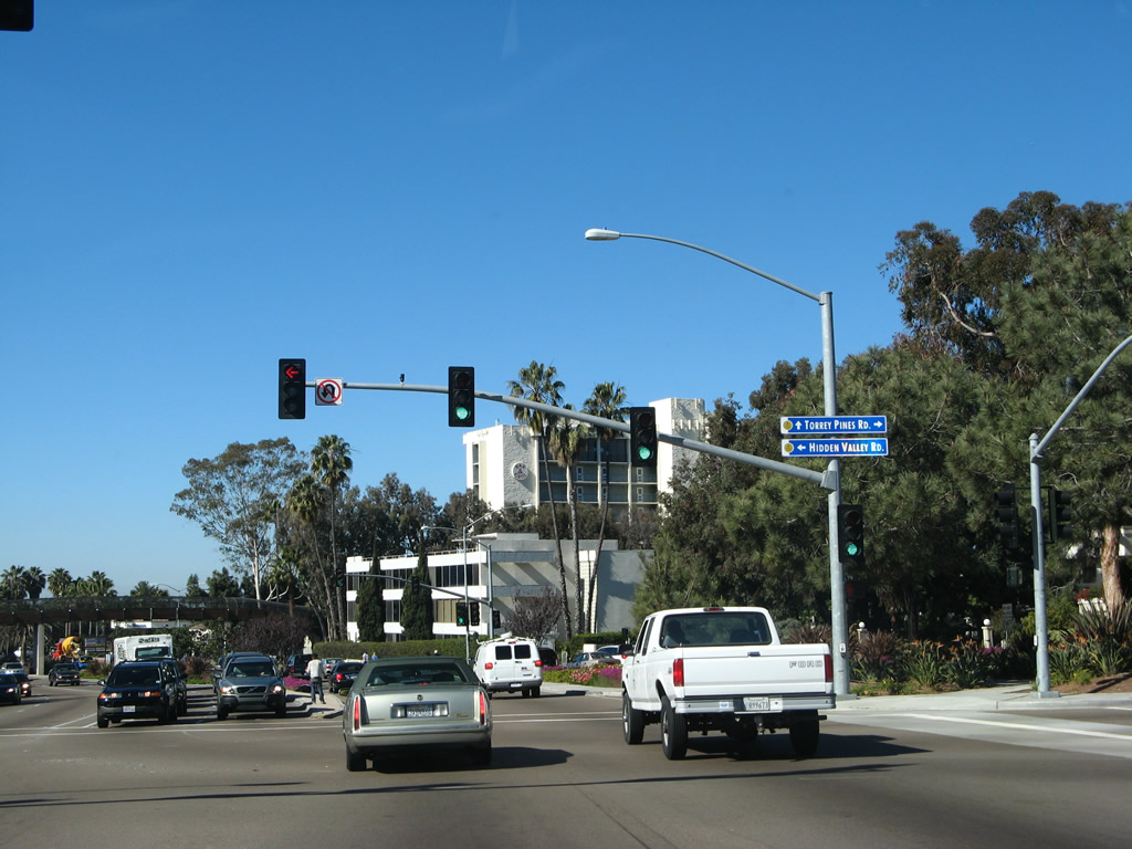
At the bottom of the hill, all traffic should prepare to stop for the upcoming traffic signals with Torrey Pines Road. To downtown La Jolla, continue straight. La Jolla Parkway will become Torrey Pines Road (historic U.S. 101W) south. Photo taken 01/24/07. |
|
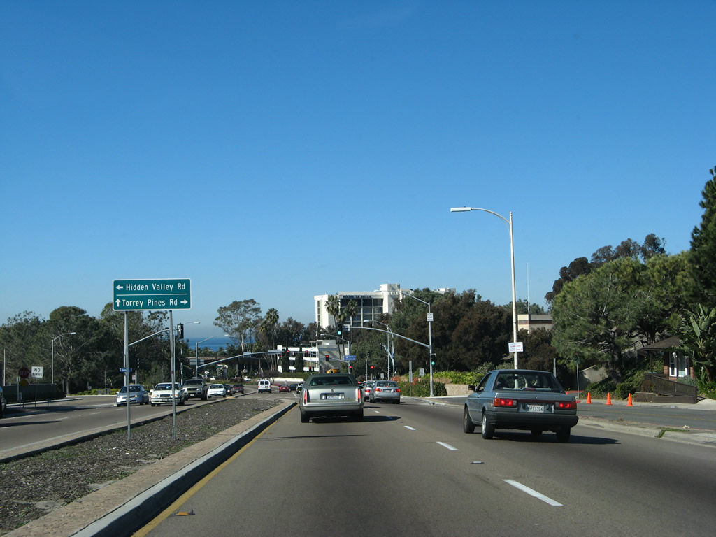
Turn right at the first trafic signal to Torrey Pines Road north to the University of California at San Diego. Photo taken 01/24/07. |
|
The limited access La Jolla Parkway comes to an end at this traffic signal, where it meets Hidden Valley Drive and Torrey Pines Road. Follow Torrey Pines Road south to downtown La Jolla. Photo taken 01/24/07. |
|
Westbound La Jolla Parkway meets Hidden Valley Drive and Torrey Pines Road at this intersection. Photo taken 01/24/07. |
| Torrey Pines Road south |
|
Now on southbound Torrey Pines Road, a colorful median and pedestrian bridge dominate the view. The next traffic signal is with La Jolla Shores Drive. Photo taken 01/24/07. |
Page Updated September 12, 2012.