
Nevada Road & Highway Photo Guides

Sitemap to all pages covering the state of Nevada.
Route Categories
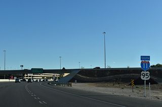
Interstates
6 routes, 1,391 photos
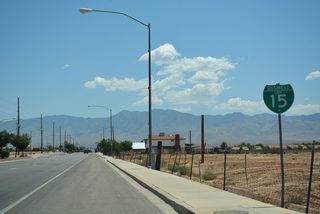
Business Routes
10 routes, 383 photos
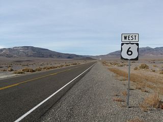
U.S. Highways
15 routes, 1,368 photos
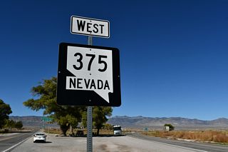
State Routes
76 routes, 2,419 photos
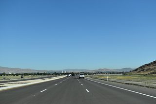
Other Roads
1 routes, 27 photos
Photo Coverage of Roads and Highways in Nevada
AARoads documents highways and roads across Nevada with route-by-route photo guides organized by direction of travel. Coverage includes Interstate Highways, U.S. Routes, Nevada State Routes, and select named roads.
Photo guides focus on highway signage, interchanges, route markers, city limit signs, county lines, and notable points of interest along each route. Urban guides feature major freeways and arterials in the Las Vegas and Reno areas. Rural highway coverage emphasizes wide open corridors with documentation of reassurance markers, route junctions and mileposts.
New and updated photos for Nevada routes are added periodically and cataloged on the updates page.
City/Area Guides

Las Vegas
10 Photos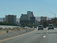
Reno-Sparks
38 PhotosNevada Route Logs

Routes 1-99
Routes 100-199

Routes 200-299

Routes 300-399
Routes 400-499

Routes 500-599
Routes 600-699
Routes 700-799
Routes 800-900
Nevada State Routes
The original Nevada State Route system was renumbered in 1976 to its current system. This system clusters primary, secondary (urban), and secondary (rural) routes by county. The following chart shows the numbers assigned to each county, including any routes added and/or removed from the state route system since 1976:
| County | Primary | Secondary-Urban | Secondary-Rural |
|---|---|---|---|
| Carson City | 509-531 | 705 | |
| Churchill | 115-121 | 715-727 | |
| Clark (Las Vegas) | 142-171 | 562-612 | 738-745 |
| Douglas | 28, 88, 206-208 | 756-760 | |
| Elko | 221-223 | 535 | 766-767 |
| Esmeralda | 264-267 | 773-774 | |
| Eureka | 278 | 780-781 | |
| Humboldt | 140, 289-294 | 786-794 | |
| Lander | 304-306 | 806 | |
| Lincoln | 317-322 | 816 | |
| Lyon | 338-342 | 822-829 | |
| Mineral | 359-362 | 839 | |
| Nye | 372-379 | 844 | |
| Pershing | 396-401 | 854-860 | |
| Washoe (Reno) | 425-447 | 646-686 | 877-880 |
| White Pine | 487-490 | 892-895 |
Nevada Highways in the National Highway System
In addition to the Nevada Interstate Highways, Nevada has several other arterials that are designated as part of the National Highway System. This includes as of 2016:
- Interstate 15
- Interstate 80
- Interstate 215
- Interstate 515
- Interstate 580
- U.S. 6 - between the California State Line and SR 360; the concurrent section with U.S. 95; and from SR 318 east to the Utah State Line
- U.S. 50
- U.S. 50 Alternate - Main Street roundabout in Fernley to U.S. 50
- U.S. 93 - excepting the portion between SR 318 and U.S. 50
- U.S. 95
- U.S. 95 Alternate - Main Street roundabout to I-80 in Fernley
- U.S. 395
- U.S. 395 Alternate - Mt. Rose Highway to Patriot Boulevard
- SR 88 - Woodfords Road
- SR 146 - St. Rose Parkway
- SR 147 - East Lake Mead Boulevard
- SR 159 - Charleston Boulevard
- SR 160 - Blue Diamond / Pahrump Road
- SR 163 - Laughlin Highway
- SR 225 - Mountain City Highway
- SR 289 - East Winnemucca Boulevard
- SR 318 - Sunnyside Road
- SR 360 - Mina / Basalt Cutoff
- SR 376 - Tonopah - Austin Highway
- SR 439 - USA Parkway
- SR 430 - North Virginia Street
- SR 445 - Pyramid Way
- SR 535 - Idaho Street
- SR 564 - Lake Mead Parkway
- SR 573 - Craig Road
- SR 582 - Boulder Highway
- SR 589 - Sahara Avenue
- SR 593 - Tropicana Avenue
- SR 595 - Rainbow Boulevard
- SR 599 - Rancho Road
- SR 612 - Nellis Boulevard
- SR 647 - Prater Road
- SR 648 - Glendale Boulevard
- SR 659 - McCarran Boulevard
- SR 667 - Kietzke Lane
- SR 673 - Stread Boulevard
- SR 720 - Union Lane
Mileposting
Nevada uses the white, California-style milepost in place of the green on white signs found throughout the rest of the country. These markers indicate the county name, the route number, and the type of route. The markers are used on interstate highways in Nevada in addition to the typical Interstate green-and-white mileposts. The numbers for the white markers are reset at each county line. Although California refers to these as "postmile markers," Nevada refers to their version as "mileposts."
Each Nevada milepost has an abbreviation indicating the class of the route: "IR" for Interstate, "US" for U.S. routes, and "SR" for all state routes. Occasionally these markers are the only indication that a road is maintained by the Nevada Department of Transportation (NDOT).
Nevada uses two-letter abbreviations while California uses three letters. The following is a list of all two-digit county codes for Nevada Mileposts. These abbreviations are also used in the State Route Lists.:
- CC - Carson City
- CH - Churchill County
- CL - Clark County
- DO - Douglas County
- EL - Elko County
- ES - Esmeralda County
- EU - Eureka County
- HU - Humboldt County
- LA - Lander County
- LN - Lincoln County
- LY - Lyon County
- MI - Mineral County
- NY - Nye County
- PE - Pershing County
- ST - Storey County
- WA - Washoe County
- WP - White Pine County
Photographic Contributors
Photography by Alex Nitzman, Andy Field, Brent Ivy and others. Special thanks to Michael Ballard, Nick Christensen, Casey Cooper, Steve Hanudel, Dominic Ielati, L.J. Johnson, Jim Magin, Erik Slotboom, Kevin Trinkle, Joel Windmiller and Mark Yoshinaka for their efforts in supporting these pages. Mark was very helpful in creating various sign graphics found throughout the Nevada Highway pages.
About Nevada
- Capital:
 Carson City
 - Nickname: Silver State
- Area: 110,622 square miles or 286,367 square kilometers, 7th largest
- Statehood: 36th state; admitted October 31, 1864
- Total Interstate Mileage: 623.79 miles
- Highest Point: Boundary Peak (southwest of Coaldale) 13,147 feet above sea level
- Mining: gold, diatomite, oil, gas, silver
- Agriculture: cattle, milk, hay, potatoes, barley
The Nevada Highways pages are in no way related to the state of Nevada or the Nevada Department of Transportation (NDOT).
Last updated: Monday February 9, 2026