05/08/05, 05/11/05, 07/02/05, 07/03/05 & 07/04/05 photos taken by Alex Nitzman.
| Interstate 390 South |
|
The first southbound reassurance shield of Interstate 390 posted within Livingston County. Photo taken 07/02/05. |
|
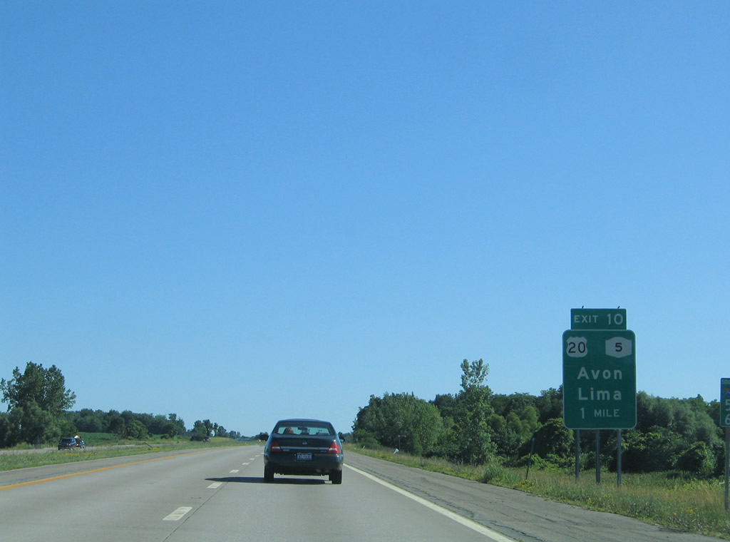
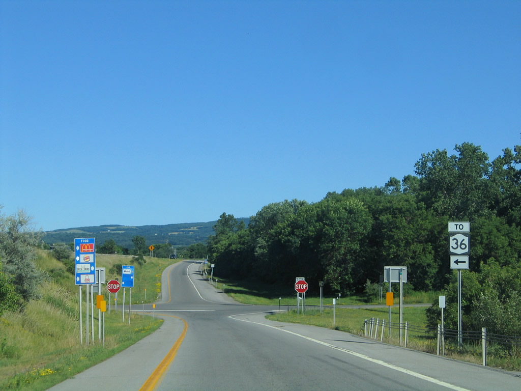
U.S. 20 & New York 5 (Avon-Lima Road) cross paths with Interstate 390 at the Exit 10 parclo interchange at East Avon. Photo taken 07/02/05. |
|
U.S. 20 & New York 5 travels a short distance west to their partition in Avon and east through to the city of Auburn. The two routes represent the third and fourth longest touring routes in the state respectively. Photo taken 07/02/05. |
|
|
Continuing southward on the ten-mile drive to Geneseo along Interstate 390. Photos taken 07/02/05. |
|
New York 15 (Lakeville Road) heads south from U.S. 20 & New York 5 (Avon-Lima Road) and meets Interstate 390 at the Exit 9 diamond interchange. Photo taken 07/02/05. |
|
New York 15, the pre-1974 alignment of U.S. 15, leaves the Interstate 390 corridor for Lakeville, Conesus Lake, and Livonia. The state route returns to Interstate 390 for an overlap at Exit 3. Photo taken 07/02/05. |
|
|
A short distance south of Exit 9 is U.S. 20A (Lakeville Road). U.S. 20A heads west from an overlap with New York 15 at Lakeville and Conesus Lake to the Livingston County seat of Geneseo. Photos taken 05/08/05 & 07/02/05. |
|
U.S. 20A continues west from Geneseo to Warsaw on its 83.59 mile-route between Bloomfield and Orchard Park. Use Exit 9 for SUNY Geneseo. Photo taken 07/02/05. |
|
|
Interstate 390 bypasses Geneseo to the southeast and does not see another interchange with the town. Instead the freeway travels an uninterrupted path to the Mt. Morris vicinity. Photos taken 05/08/05. |
|
The southbound drive affords sweeping curves such as this located along Interstate 390 north of the Reservoir Road overpass. North Road parallels the freeway briefly in this scene as well. Photo taken 05/08/05. |
|
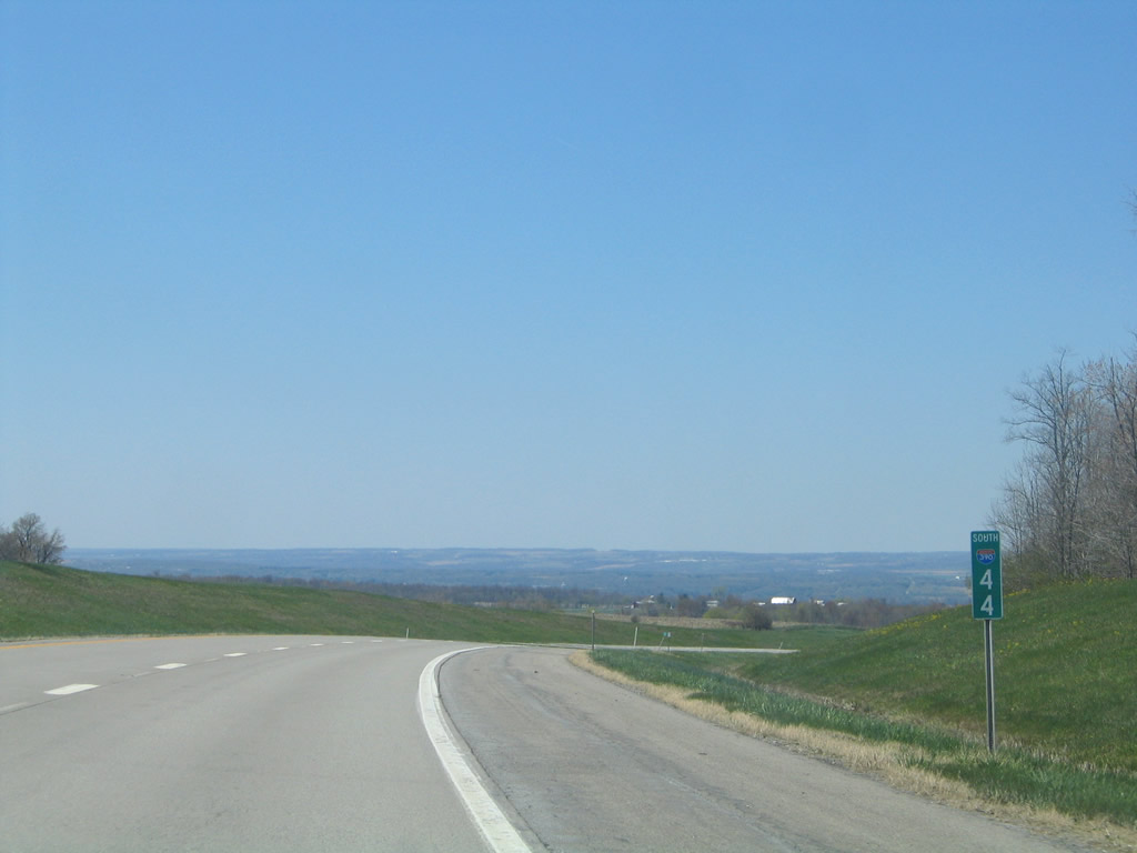
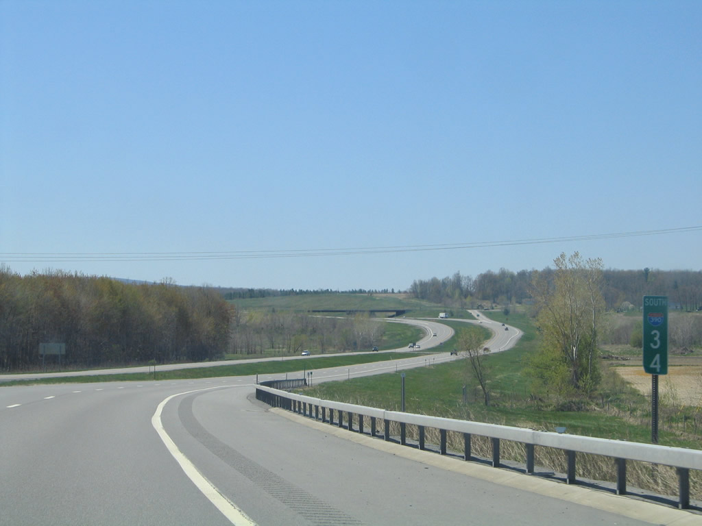
Many mileposts for Interstate 390 feature a small interstate shield such as this example at the carriageway split at mile 44. Photo taken 05/08/05. |
|
|
|
Interstate 390 passes under Crossett Road and New York 63 (Mt. Morris Road) in these three scenes. Photos taken 05/08/05. |
|
Just south of Exit 7 are a pair of rest areas along Interstate 390. Photo taken 05/08/05. |
|
Meeting the freeway just east of Mt. Morris is New York 408 (Mt. Morris Geneseo Road). New York 408 begins at parallel New York 63 and travels southwest 15.95 miles to New York 70 at Dalton. Photo taken 07/02/05. |
|
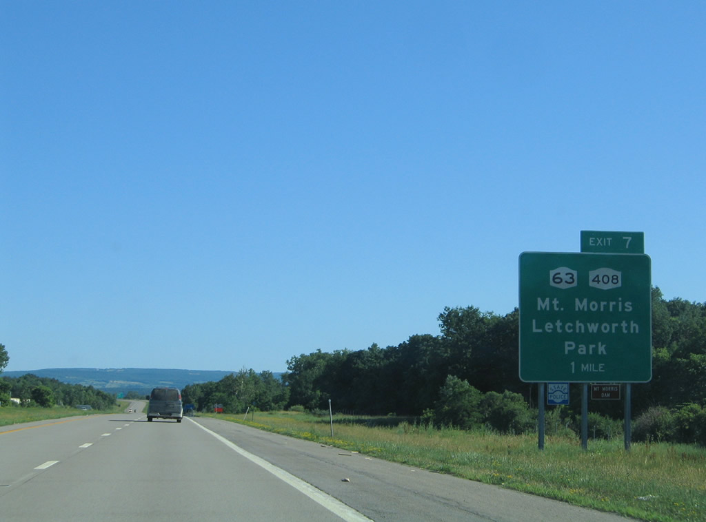
Drivers bound for New York 408 south to Mt. Morris and Letchworth State Park depart Interstate 390 south. New York 63 heads south from Geneseo and kisses Interstate 390 at New York 408. The state route continues along the Canaseraga Creek to Groveland and Dansville. Photo taken 07/02/05. |
|
A folded-diamond interchange joins New York 408 with Interstate 390. New York 408 follows State Street to a brief overlap with New York 36 (Main Street) in Mt. Morris. Both state routes provide connections to adjacent Letchworth State Park. Photo taken 07/02/05. |
|
Southbound at the aforementioned rest area. Canaseraga Creek flows near the southbound ramp. Photo taken 07/02/05. |
|
|
Five miles separates the Mt. Morris area with Sonyea via Interstate 390 south. Photos taken 05/08/05 & 07/02/05. |
|
New York 36 ventures south from Mt. Morris to the community of Sonyea just north of the Exit 8 diamond interchange with Interstate 390. Photo taken 07/02/05. |
|
|
Southbound at the Exit 8 off-ramp to New York 36 (Sonyea Road). New York 36 parallels Interstate 390 closely between here and Dansville. Photos taken 05/08/05 & 07/02/05. |
|
|
|
|
|
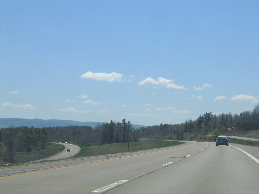
An eight-mile exit less stretch carries Interstate 390 travelers southward along the hills west of the Canaseraga Creek. Photos taken 05/08/05 & 07/02/05. |
|
|
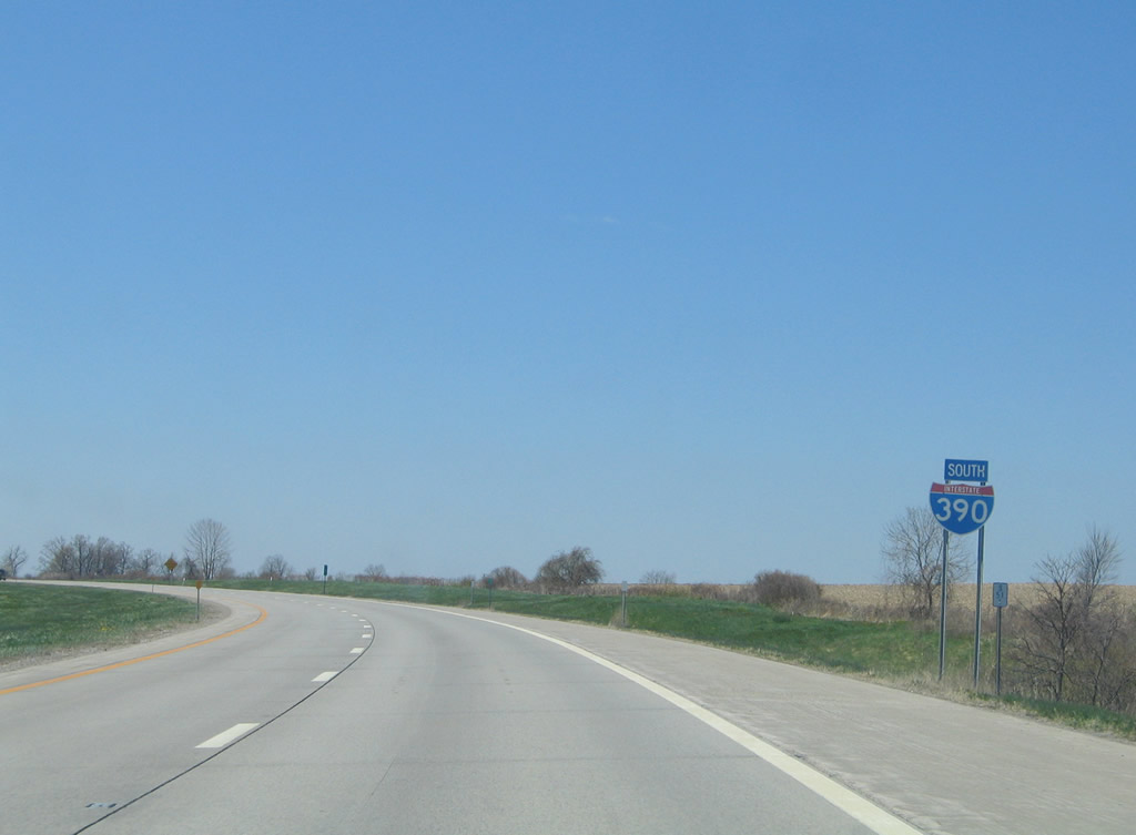
A seemingly random reassurance shield for Interstate 390 south posted midway between Exits 6 and 5. Photos taken 05/08/05 & 07/02/05. |
|
|
Descending toward the village of Dansville and junction New York 36 on Interstate 390 south. The state route provides a direct route into downtown via Franklin, Depot, and Ossian Streets. Connections with New York 436 lead drivers west to Nunda and New York 63 (Main Street) south toward Wayland. Photos taken 07/02/05 & 07/03/05. |
|
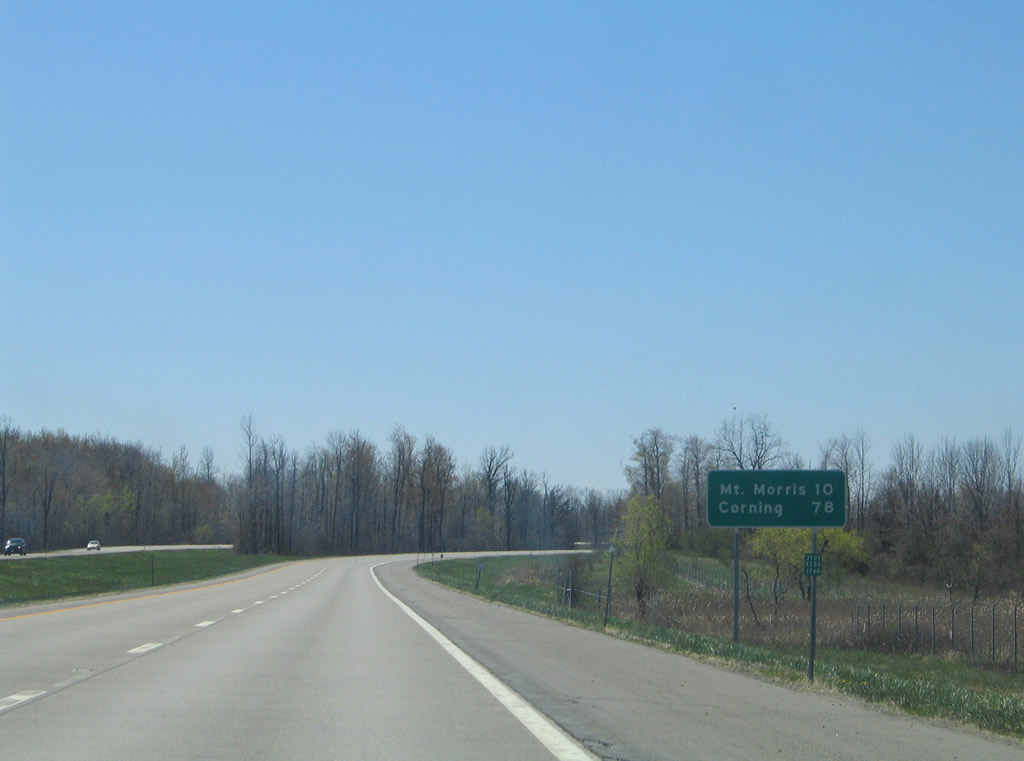
New York 36 sees two interchanges for Dansville, thus through travelers destined for Hornell are advised to use the second exit. The state route totals 95.17 miles between New York 31 at Adams Basin and the Pennsylvania state line at Troupsburg. Photo taken 07/02/05. |
|
|
Interstate 390 spans the Canaseraga Creek ahead of the diamond interchange with McWhorter Road. McWhorter Road constitutes a short access road between the freeway and adjacent New York 36 (Airport Road). Photos taken 07/02/05. |
|
Dropping down to McWhorter Road via Exit 5 of Interstate 390 south. A truck stop lies to the west via McWhorter Road; to the east is a signalized intersection with New York 36 opposite Dansville Municipal Airport. Photo taken 07/02/05. |
|
Interstate 390 straddles the western boundary of Dansville between the two New York 36 interchanges. New York 36 leaves a brief overlap with New York 63 via Clara Barton Street to Noyes Memorial Hospital and a parclo interchange at Exit 4. Photo taken 07/04/05. |
|
New York 36 continues south from Interstate 390, Exit 4 to Stony Brook State Park, Arkport, and Interstate 86 & New York 17 at North Hornell. Photo taken 07/04/05. |
|
|
Southbound shields for Interstate 390 posted within and after Exit 4. Photos taken 07/04/05 & 05/11/05. |
|
|
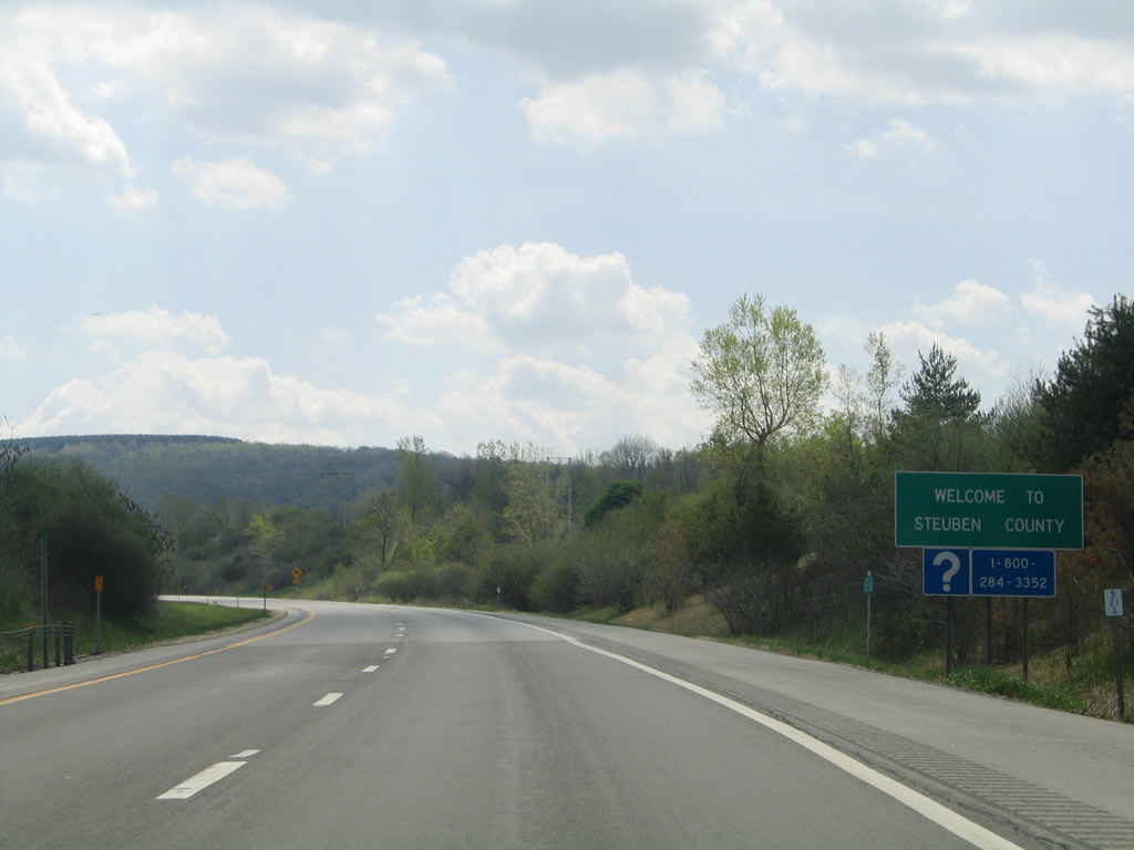
Drivers continue through the town of North Dansville to the Steuben County line and the town of Wayland. Photos taken 07/04/05 & 05/11/05. |
|
|
Stone Falls Road passes over Interstate 390 ahead of this scene. A third reassurance shield follows. Photos taken 07/04/05. |
|
|
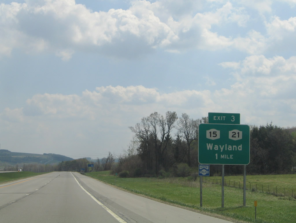
New York 15 travels south with New York 21 from Wayland 1.7 miles to its end at Interstate 390 at Exit 3. New York 21 continues from the split to Haskinville. Photos taken 05/11/05. |
|
Exit 3 departs Interstate 390 south for New York 15 & 21 north to Wayland and New York 21 south. Michigan Road ties into the state route from Perkinsville as New York 415 (old U.S. 15) begins at Michigan Road and travels southeast to Cohocton. Photo taken 05/11/05. |
|
New York 15 used to join Interstate 390 south for the remainder of the freeway to Interstate 86 & New York 17 east. The state route overlap provided continuity for through travelers bound for U.S. 15 south at Painted Post once U.S. 15 was decommissioned. Signage for the overlap was to come down in 2009. Photo taken 07/04/05. |
|
|
Curving south from Hemmer Hill along a scenic path between Potter Hill and Cohocton. Photos taken 05/11/05. |
|
|
Nearing the village of Cohocton, Interstate 390 sees a diamond interchange (Exit 2) with Loon Lake Road (Steuben County 121) for New York 415 (Maple Avenue). Photos taken 05/11/05. |
|
New York 415 enters Cohocton from North Dansville Road parallel to the freeway. Following Maple Avenue, the state route travels east to New York 371's southern terminus and its southward turn onto Main Street. New York 371 joins Cohocton with North Cohocton and New York 21 south of Canandaigua Lake. Photo taken 05/11/05. |
|
|
Interstate 390 enters a ten mile exit less stretch between Cohocton and Avoca. Elmira appears as the second control city for Interstate 86 & New York 17 east of Corning. Photos taken 07/04/05. |
|
|
|
Curving southeast again parallel to the Cohocton River east of Potter Hill on Interstate 390 south. Wentworth Road passes over the freeway as Waterbury Hill rises to the southwest. Photos taken 05/11/05. |
|
Interstate 390 spans a railroad line and New York 415 near the community of Wallace and this reassurance shield assembly. Photo taken 05/11/05. |
|
The freeway kinks southeast again near Wallace and its crossings of the Cohocton River. Wagner Hill lies to the east. Photo taken 05/11/05. |
|
|
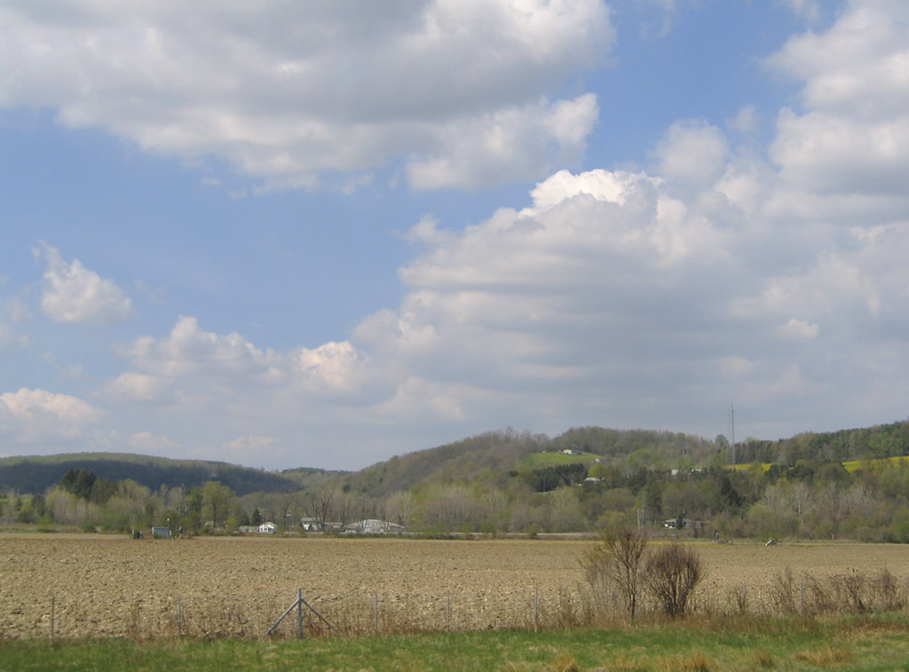
Looking west at the farm fields between Interstate 390 and New York 415 at Bloomerville. Photos taken 05/11/05. |
|
|
Approaching Avoca, the freeway turns east onto Wagner Hill to bypass the village. Michigan Hollow Road connects Interstate 390 with the parallel state route to the west. Photos taken 05/11/05. |
|
Southbound at the Exit 1 ramp departure to Michigan Hollow Road for New York 415. New York 415 travels just west of Avoca along the Cohocton River nearby. Photo taken 07/04/05. |
|
A diamond interchange joins Interstate 390 with Michigan Hollow Road. Michigan Hollow Road spurs northeast from New York 415 into Michigan Hollow. New York 415 south otherwise continues to Kanona. Photo taken 05/11/05. |
|
The final reassurance shield for Interstate 390 south, posted with New York 15 after the Michigan Hollow Road on-ramp. New York 15 was officially removed by Interstate 390 by 2004. Photo taken 05/11/05. |
|
Drivers quickly encounter the inverted trumpet interchange with Interstate 86 south of Avoca. Interstate 390 defaults onto Interstate 86 & New York 17 east to Bath and Corning. The final exit ramp connects Interstate 86 & New York 17 west to Hornell and Jamestown. Photo taken 05/11/05. |
|
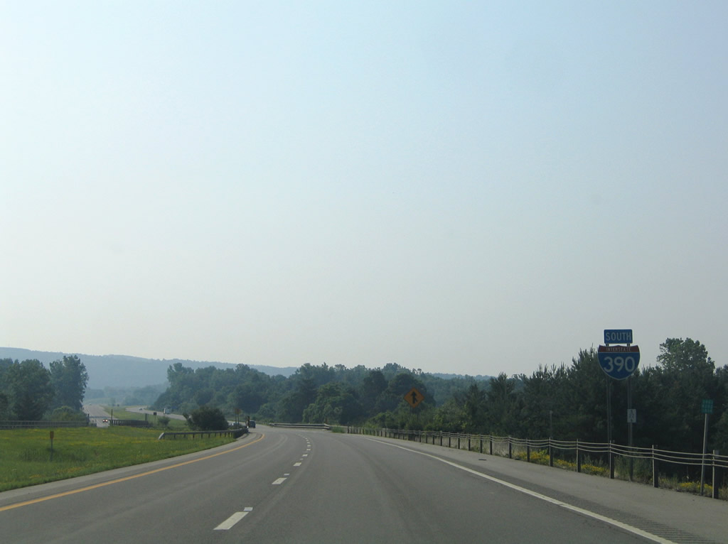
I-86/NY 17 (Southern Tier Expressway) overlap west to the Pennsylvania state line at Findley Lake. Interstate 86 replaced PA 17 from there to I-90 east of Erie. Photo taken 05/11/05. |
|
This shield assembly mentions the I-86/NY 17 designation as the Southern Tier Expressway. The Southern Tier is generally the area of New York north of Pennsylvania and west of Binghamton. Photo taken 05/11/05. |
|
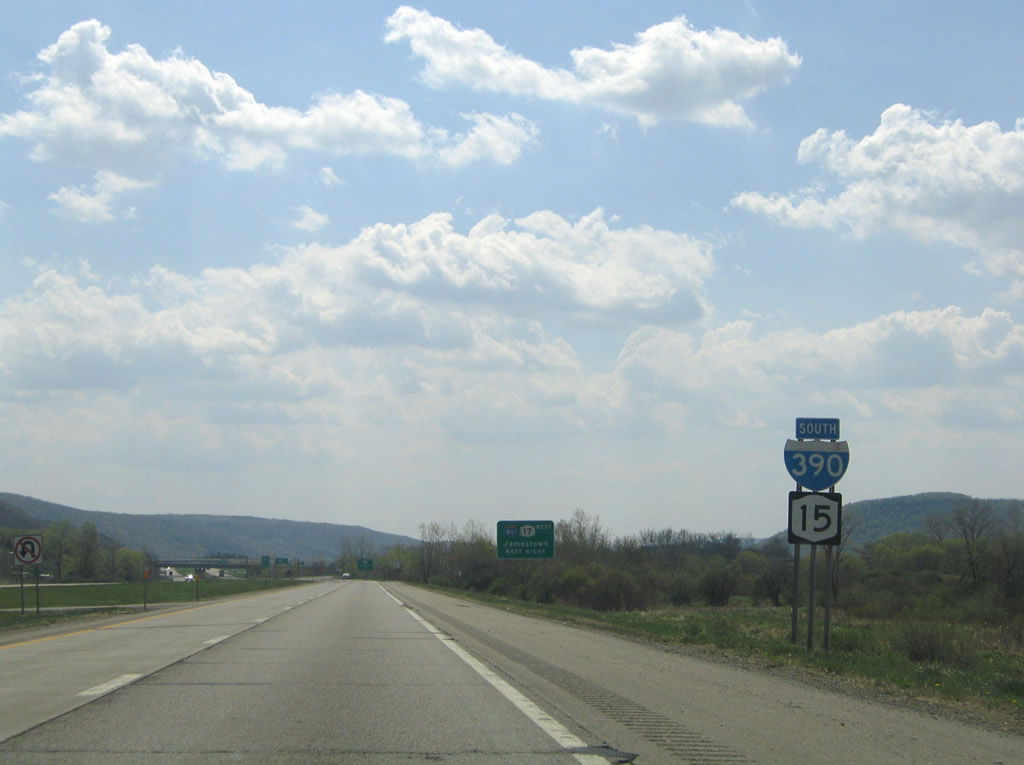
Travelers bound for I-86/NY 17 west depart Interstate 390 south. The Southern Tier Expressway serves Olean and Salamanca in addition to its control city of Jamestown. Photo taken 05/11/05. |
|
New York 15 used to continue onto I-86/NY 17 east through to the U.S. 15 southbound beginning at Painted Post. New York 415 remains parallel to the Southern Tier Expressway through such towns as Kanona, Bath, Savona, and Coopers Plain. Photo taken 05/11/05. |
|
A look at the I-86/NY 17 carriageway from the ending Interstate 390 south. A loop ramp carries drivers onto Interstate 390 north to Avoca. Photo taken 05/11/05. |
Page Updated October 23, 2009.