Regional Navigation
Vermont Miscellaneous Statewide Photos
| White River Junction | |||||||||
|---|---|---|---|---|---|---|---|---|---|

Eastbound U.S. 4 at U.S. 5 at White River Junction. The two highways duplex for a short stretch creating an unique consective number multiplex. Photo taken 07/24/00.
| 
U.S. 4 shield just to the east of Interstate 89 Exit 1. The bridge depicted behind the sign actually overpasses another roadway. There is a small access road that links to U.S. 4 and this roadway (behind and to the right of the camera). Photo taken 07/24/00.
| Montpelier
| 
End U.S. 302 shield assembly approaching the terminus with U.S. 2 at Montpelier. Photo taken 07/23/00.
| 
View of the state capital dome overlooking the Winooski River. Photo taken 07/23/00.
| | ||||
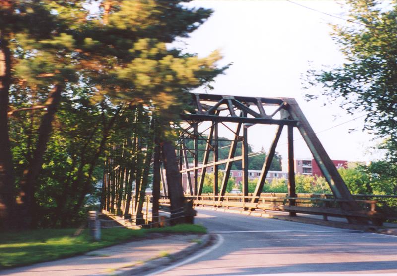


Winooski River truss bridges (Bailey Avenue and Granite Street) in Montpelier as seen from U.S. 2/Memorial Drive. Photos taken 07/23/00.
| |
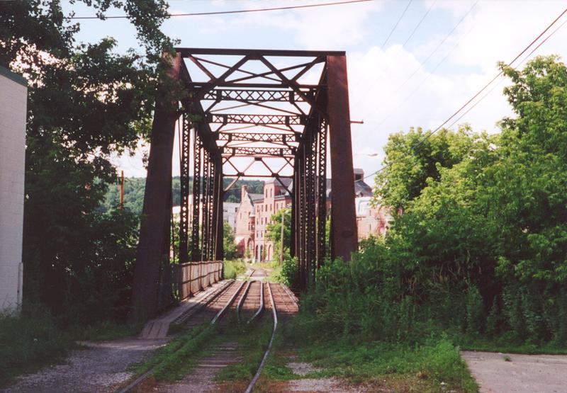
Montpelier railroad truss bridge over the Winooski River, just to the west of the Business U.S. 2. Photo taken 07/23/00.
| 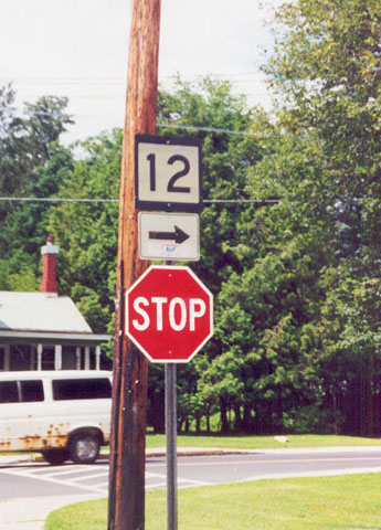
Old Vermont Route 12 shield in Montpelier. One can find three eras of state route shields in Vermont: the new green shield, the old circular shield, and the very old square shield. Photo taken 07/23/00.
| State Routes |

U.S. 5 and Vermont Route 9 shields at the Brattleboro
traffic circle, near Interstate 91 Exit 3. Photo taken 07/24/00.
| | |||

Eastbound Vermont 78 at the northern terminus of Vermont 36 in Swanton. Since this signage is maintained locally, examples of the two predecessors of the current green shield are in place. Photo taken 07/22/00.
| 
Vermont Route 15 and 100 shields near Morrisville. The two routes duplex westward for two miles to the town of Hyde Park. Photo taken 07/23/00.
| 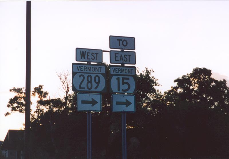
Vermont 289 to Vermont Route 15 shields. These signs are located on Vermont 117 north, at the stub end of defunct Interstate 289. Vermont 289 heads north of this interchange to Vermont 2A near Colchester. Exit signage along the route is mileage based, and follows the numbering of the never completed I-289. Photo taken 07/23/00.
| 
One of two state routes serving the islands of Lake Champlain. This route serves Alburg Dunes State Park and Isle Lamotte. Photo looks at end signage at the eastern terminus with U.S. 2. Photo taken 07/22/00.
| 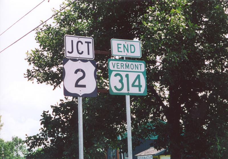
The other route on the islands themselves is Vermont 314. This is end signage for the southern terminus of Vermont 314. This route loops to the west of U.S. 2 between South Hero and Grand Isle, serving traffic bound for the Plattsburgh, New York bound ferry. Also of note, that this route was originally signed as Vermont F-6, of the Ferry Route series. The renumbering to Vermont 314 came about when with the phasing out (of the F series ferry routes, only Vermont F-5 still exists) to coincide with New York 314, which ends at the western ferry dock. Photo taken 07/22/00.
| 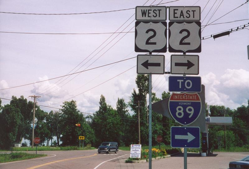
U.S. 2 to Interstate 89 shields located at the southern terminus of Vermont 314. Photo taken 07/22/00.
| |
Page Updated March 4, 2002.
|
About Contact Glossary |
In The News Interstate Guide |
Social Media:
 |
|
© 2000-25 AARoads.com | All Rights Reserved | Privacy Policy / Terms of Use
|
||