

U.S. Highway 11 North
07/22/00 photo taken by AARoads. 05/09/05, 05/11/05 & 07/20/05 photos taken by Alex Nitzman. 08/01/07 photos taken by Andy Field.
| U.S. 11 North | |
|---|---|
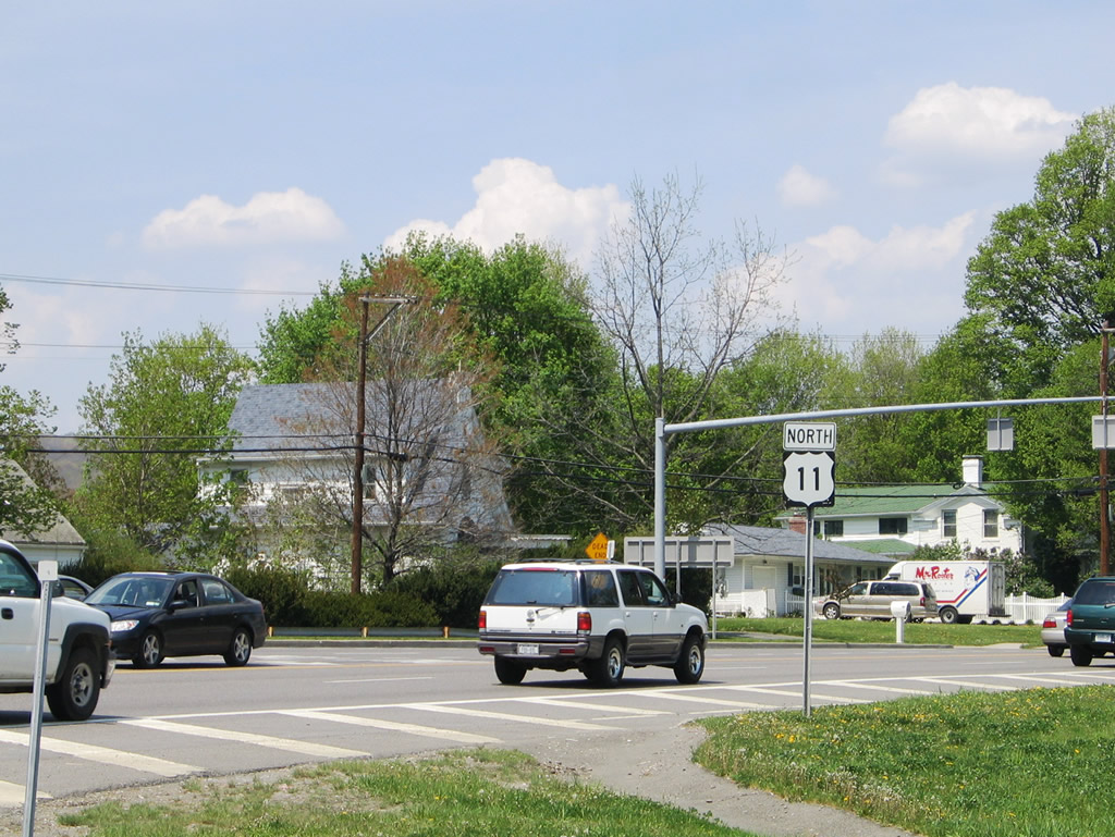 |
Northbound reassurance shield for U.S. 11 north posted after the Exit 5 folded-diamond interchange with Interstate 81 in Binghamton. Photo taken 05/11/05. |
 |
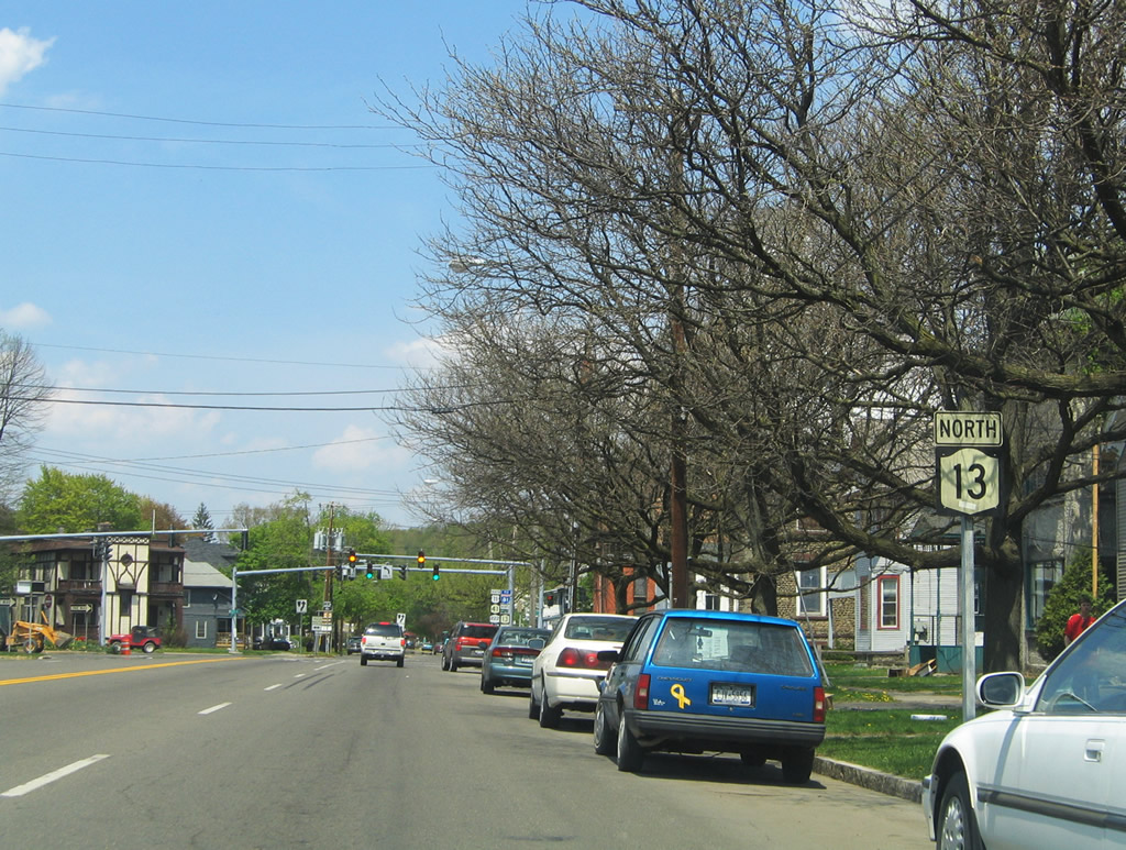
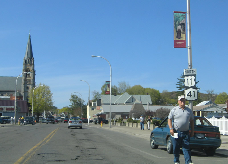
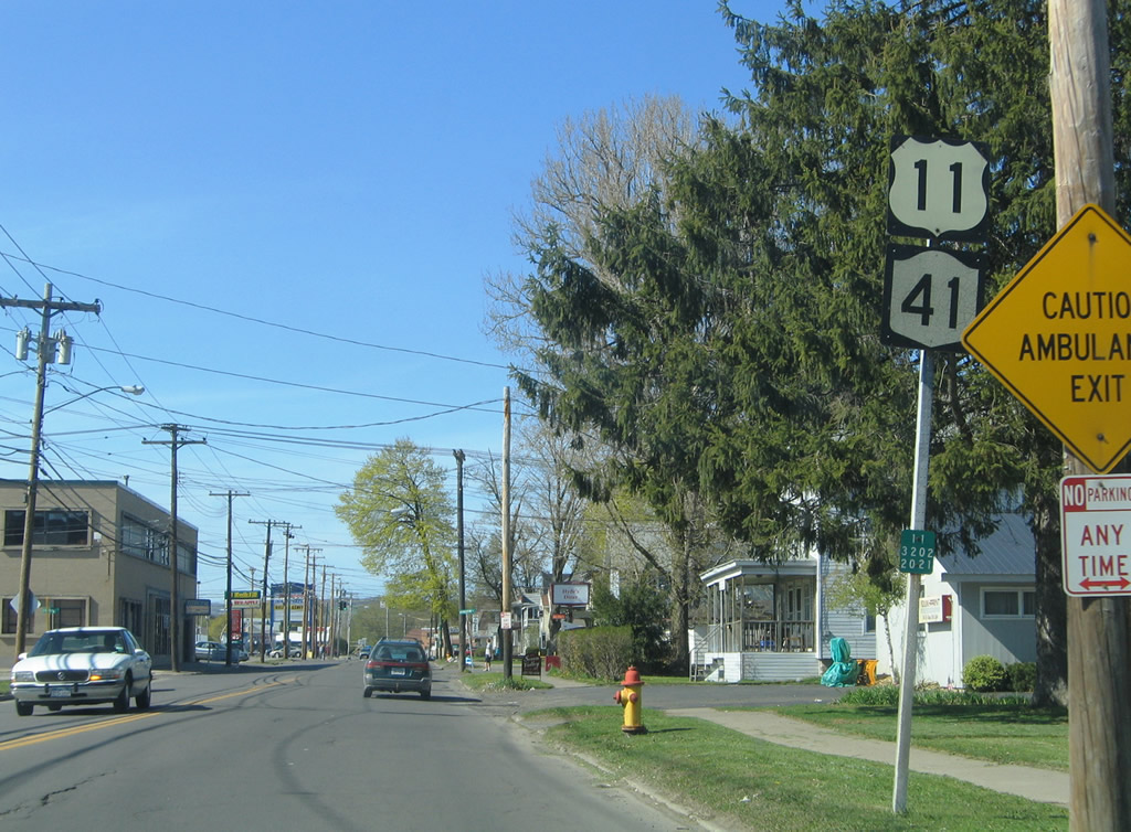
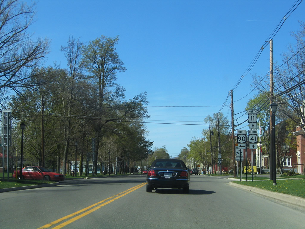
U.S. 11 & New York 41 combine for 5.56-miles through the Cortland and Homer vicinity in central Cortland County. Within downtown Cortland, the tandem follows Port Watson Street west to Church Street north and a merge with New York 13. Photo taken 05/11/05. |
 |
Approaching the intersection with Court Street west on Church Street north. U.S. 11 & New York 41 combine with New York 13 north for 0.31 miles along Church Street in Cortland. Photo taken 05/11/05. |
 |
Central Avenue flows east from Main Street south and crosses U.S. 11 & New York 13-41 north (Church Street) at the next traffic light. Central Avenue continues east to Pendleton Street south. Photo taken 05/11/05. |
 |
Next in line for northbound motorists is the eastern terminus of New York 222 (Clinton Avenue). Photo taken 05/11/05. |
 |
New York 13 turns onto Clinton Avenue north toward Interstate 81 (Exit 11). Photo taken 05/11/05. |
 |
Elm Street splits with New York 222 (Clinton Avenue) east just west of the intersection with U.S. 11 & New York 13-41 (Church Street). The first traffic light provides access to Clinton Avenue west via Elm Street west. Photo taken 05/11/05. |
 |
 |
U.S. 11 & New York 41 splits into separate couplets at New York 222: northbound follows Clinton Avenue west to North Main Street; southbound follows Grant Street east to North Church Street south. Photos taken 05/11/05. |
 |
Turning west from New York 13, U.S. 11 & New York 41 north join New York 222 along Clinton Avenue two blocks (0.14 miles) to the intersection of Groton Avenue and Main Street. Photo taken 05/09/05. |
 |
U.S. 11 & New York 41 turn onto Main street north at the split with New York 222 west. Main Street used to also carry New York 90 northward to Homer as well. Photo taken 05/09/05. |
 |
New York 222 travels Groton Avenue west to SUNY Cortland on its 10.57-mile drive to Groton. Main Street leads south to New York 13 (Tompkins Street / Port Watson Street). Photo taken 05/09/05. |
 |
North Main Street carries U.S. 11 & New York 41 north to Homer Avenue. Photo taken 05/09/05. |
 |
Traffic lights govern the staggered intersection with Arthur Avenue west and Grant Street east on U.S. 11 & New York 41 (Main Street) north. Grant Street east to Church Street south carries the southbound couplet of U.S. 11 & New York 41 to New York 13 and 222. Photo taken 05/09/05. |
 |
A set of flashers hang above the U.S. 11 & New York 41 (North Main Street) intersection with Miller Street north. Photo taken 05/09/05. |
 |
One block west of Miller Street sees the U.S. 11 & New York 41 turn onto Homer Avenue north. Photo taken 05/09/05. |
 |
West Main Street continues from North Main and Homer Avenue to New York 281 (West Road). Homer Avenue continues south to New York 222 (Groton Avenue). Photo taken 05/09/05. |
 |
U.S. 11 & New York 41 follow Homer Avenue north to the city line. Photo taken 05/09/05. |
 |
Northbound Homer Avenue at Wheeler Avenue west; Wheeler Avenue connects U.S. 11 & New York 41 with New York 222 (West Road). Photo taken 05/09/05. |
 |
Entering the Village of Homer, U.S. 11 & New York 41 follow Main Street. Just out of view is the West Branch of the Tioughnioga River. Photo taken 05/09/05. |
 |
Nearing the parclo interchange with the Interstate access road between New York 281 (West Street) and Exit 12 of Interstate 81. Photo taken 05/09/05. |
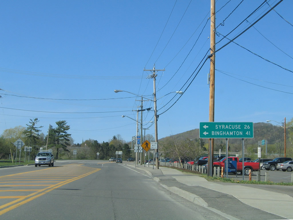 |
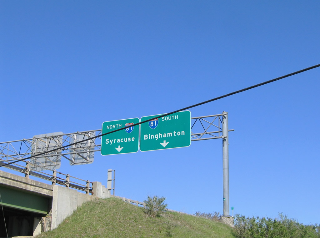
Interstate 81 heads north from Cortland 26 miles to Syracuse and south 41 miles to Binghamton. Photo taken 05/09/05. |
 |
A loop ramp carries drivers onto the Main Street Connector east to a trumpet interchange with Interstate 81. Photo taken 05/09/05. |
 |
Peering upward at the sign bridge for Interstate 81 posted on the Main Street Connector east. Photo taken 05/09/05. |
 |
U.S. 11 & New York 41 (South Main Street) continue into downtown Homer. Photo taken 05/09/05. |
 |
Approaching the southern terminus of New york 90 on U.S. 11 & New York 41 (South Main Street) northbound in Homer. New York 90 constitutes a 52.95-mile route to New York 31 at Montezuma. Photo taken 05/09/05. |
 |
New York 90 begins and follows Cayuga Street west onto Cosmos Hill on the 13.5-mile drive to New York 38 at Locke. The state route originally continued south of Homer along with U.S. 11 & New York 41 to New York 13 in Cortland and the current alignments of New York 215 south to Virgil and 392 east to U.S. 11.1 Photo taken 05/09/05. |
 |
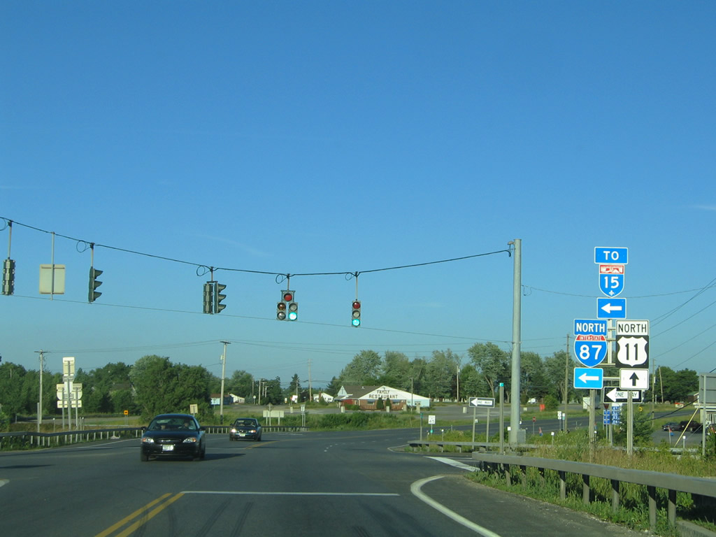
U.S. 11 travels east into a diamond interchange with Interstate 87 (Exit 42) at the town of Champlain. Photo taken 08/01/07. |
 |
 |
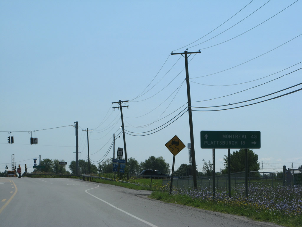
Interstate 87 leads travelers north to Quebec Autoroute 15 on the 43-mile drive to Montreal. The final interchange connects with U.S. 9's northern terminus. Photos taken 07/20/05. |
 |
U.S. 11 connects with U.S. 9 on the southside of Champlain at Main Street. Photo taken 07/20/05. |
 |
Ridge Road (Clinton County 19) leads south from Church Street and U.S. 11 to Clinton County 21 (Lavalley Road). Photo taken 07/20/05. |
 |
Approaching U.S. 9 near the village of Champlain. U.S. 9 follows Main street north to a folded-diamond interchange with Interstate 87 (Exit 43). Photo taken 07/20/05. |
 |
U.S. 9 used to end at the Canadian border, but its crossing was removed when Interstate 87 opened. Southward the U.S. route continues along the Interstate 87 corridor to Plattsburgh. Interests to U.S. 2 east to Vermont should remain on U.S. 11 north to Rouses Point. Photo taken 07/20/05. |
 |
U.S. 11 originally followed U.S. 9 (Main Street) north to Elm Street east in Champlain. The highway now bypasses the village along Champlain Street east. Photo taken 07/20/05. |
 |
U.S. 11 continues east along Champlain Street by a shopping center east of Main Street. Photo taken 07/20/05. |
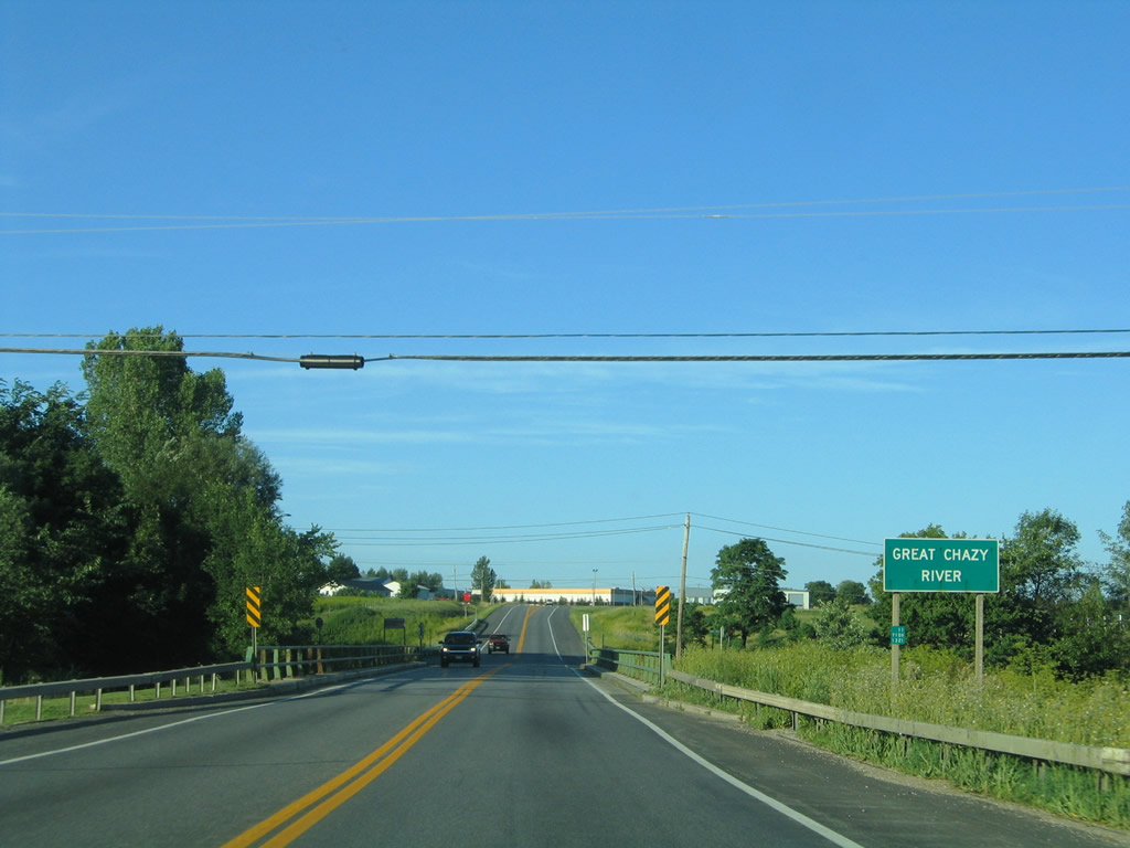 |
Spanning the Great Chazy River on U.S. 11 (Champlain Street) east. The river flows east from the Adirondack Mountains into Lake Champlain at King Bay. Photo taken 07/20/05. |
 |
Elm Street (former U.S. 11) merges with U.S. 11 east of Champlain. Photo taken 07/20/05. |
 |
Nearing the western terminus of New York 276, a 4.69-mile loop north to the Canadian border and east to Rouses Point. Photo taken 07/20/05. |
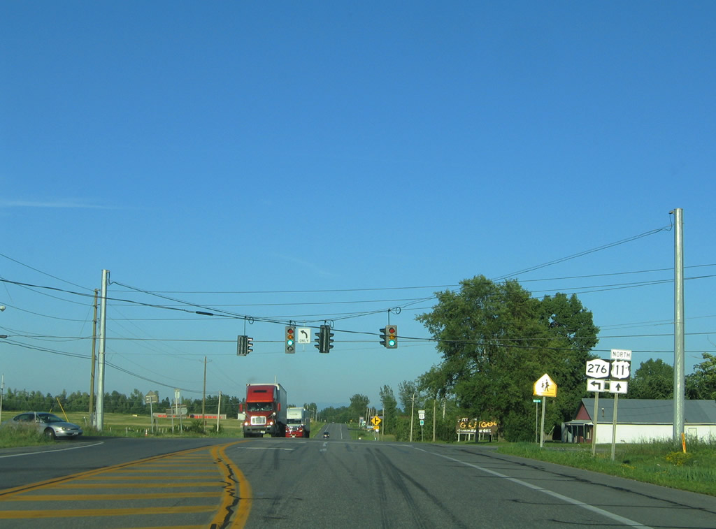 |
Northbound U.S. 11 at the eastbound beginning of New York 276. New York 276 to Quebec 221 leads drivers seven miles to Lacolle. New York 276 otherwise straddles the international border eastward to a southerly turn onto Church Street in Rouses Point. Photo taken 07/20/05. |
 |
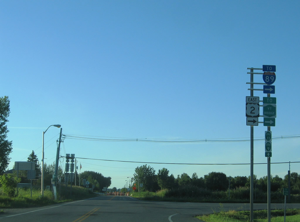
U.S. 2 trailblazer posted along Lake Street north of its intersection with New York 276 (Pratt Street). Photo taken 07/20/05. |
 |
The final U.S. 11 shield resides along Lake Street near Beverly Drive in Rouses Point. Signage for the route north of U.S. 2 was removed between 2000 and 2005. Photo taken 07/20/05. |
 |
U.S. 2 begins at U.S. 11 (Lake Street) on the north side of Rouses Point. The east-west highway follows the Rouses Point Bridge east across the Richelieu River to Grand Isle County, Vermont. Turning south at Alburg, U.S. 2 straddles the Lake Champlain islands through to Milton. Connections with Vermont 78 lead drivers east to Interstate 89 at Swanton. Photo taken 07/20/05. |
 |
U.S. 11 ends at the U.S. 2 eastbound beginning; those continuing north enter a customs station immediately on the 0.78-mile drive to Quebec 223. U.S. 2 (Bridge Road) meanwhile totals just 0.88 miles east into Vermont. Photo taken 07/20/05. |
 |
A look at the previous shield assembly installed at U.S. 2 (Bridge Street) east. Note the U.S. 11 shield directing traffic northward to the international border. Photo taken 07/22/00. |
Sources:
Page Updated August 26, 2009.
|
About Contact Glossary |
In The News Testimonials Interstate Guide |
Social Media:
 |
|
© 2000-23 AARoads.com | All Rights Reserved | Privacy Policy / Terms of Use
|
||