
Sam Rayburn Tollway - Collin County
| Sam Rayburn Tollway north | |
|---|---|
 |
Spring Creek Parkway is the first exit in Plano. The road runs south and east to form an arterial route on the north side of Plano. Photo taken 01/20/09. |
 |
A 121 Toll reassurance marker sits here before Spring Creek. Photo taken 01/20/09. |
 |
SH 121 northbound at Spring Creek Parkway. Photo taken 01/20/09. |
 |
Legacy Drive approaches as the next exit with office blocks appearing on the horizon. Photo taken 01/20/09. |
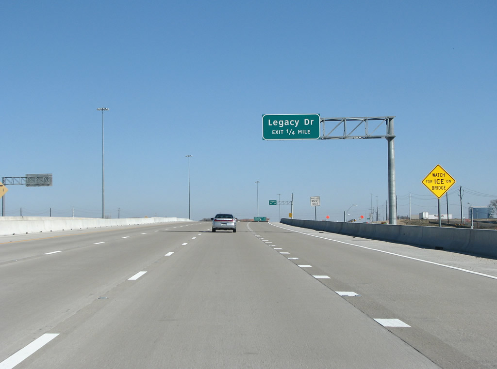 |
SH 121 northbound before Legacy. Photo taken 01/20/09. |
 |
Legacy Drive runs east into Plano and forms the main road through the Legacy Office Park area. This office park sees the corporate headquarters for companies like Frito-Lay, JC Penney, EDS, and Dr Pepper-Seven Up. Photo taken 01/20/09. |
 |
The DNT is the next exit, a major road coming north from downtown Dallas. The DNT was the first road built by the NTTA, and does not have a number. Photo taken 01/20/09. |
 |
SH 121 northbound before the Dallas North Tollway (DNT) at the border of Plano and Frisco. Photo taken 01/20/09. |
 |
SH 121 northbound at the DNT. The tollway runs south with junctions at the PGB Turnpike and Interstate 635 before ending near downtown Dallas at IH 35E. It continues north from here to end at US 380. Plans are in place to extend the road into Grayson County and to the Oklahoma border. Photo taken 01/20/09. |
 |
The right-of-way here is wide, as the two toll roads meet. This junction is very substandard, especially for such a busy area. Traffic from westbound 121 onto southbound DNT has to sit through 5 lights, for example. Plans are in place but are not funded to build a stack here. Photo taken 01/20/09. |
 |
Granite Park, the tallest building in Collin County is here on the right - while the regional Ikea store sits to the left. Photo taken 01/20/09. |
 |
121 forms a focal point for the suburbs as it passes under the DNT here. Plano was named the most affluent city in the US by the census bureau in 2008, and almost always ranks in the top 10 of "best places to live in the US" lists. Photo taken 01/20/09. |
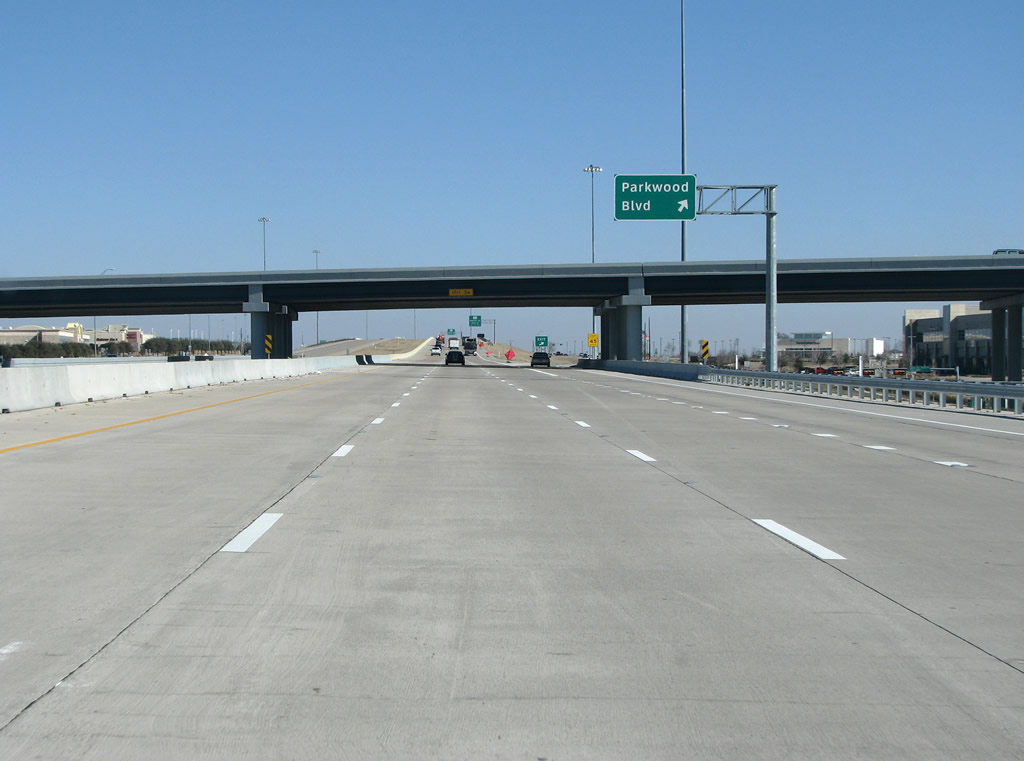 |
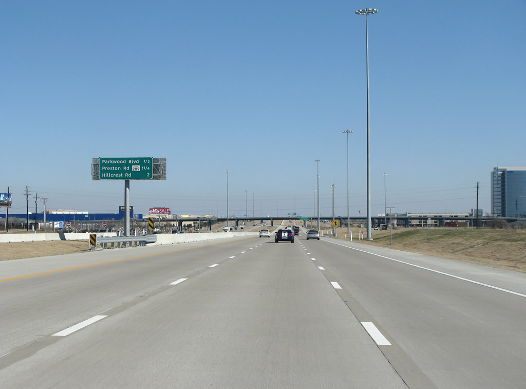
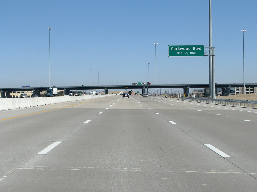
121 meets Parkwood Boulevard here, which is a minor arterial that runs north and south on the east side of the DNT. Photo taken 01/20/09. |
 |
A more standard route marker is seen here for the Preston Road exit, which follows Parkwood. Photo taken 01/20/09. |
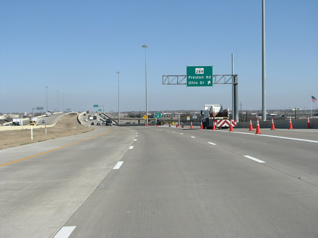 |
Preston Road is the oldest road in the Dallas area, and started out as an Indian Trail before the 1840s. Dallas was founded because it sat where Preston Road crossed the Trinity River, and early entrepreneurs set up a ferry crossing which became the city. It also forms the main street through Frisco, the suburb to the north of here. Photo taken 01/20/09. |
 |
121 passes past Preston and runs through Plano/Frisco here. Frisco almost always ranks in the top 10 fastest growing municipalities in the country. The population rose to 100,000 in 2008 from 1,000 in 1987. Photo taken 01/20/09. |
 |
Hillcrest/Robinson, a set of north/south arterials, is the next exit here. Photo taken 01/20/09. |
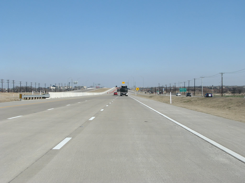 |
The open portion of 121 (when these photos were taken) ends here east of Hillcrest. Photo taken 01/20/09. |
 |
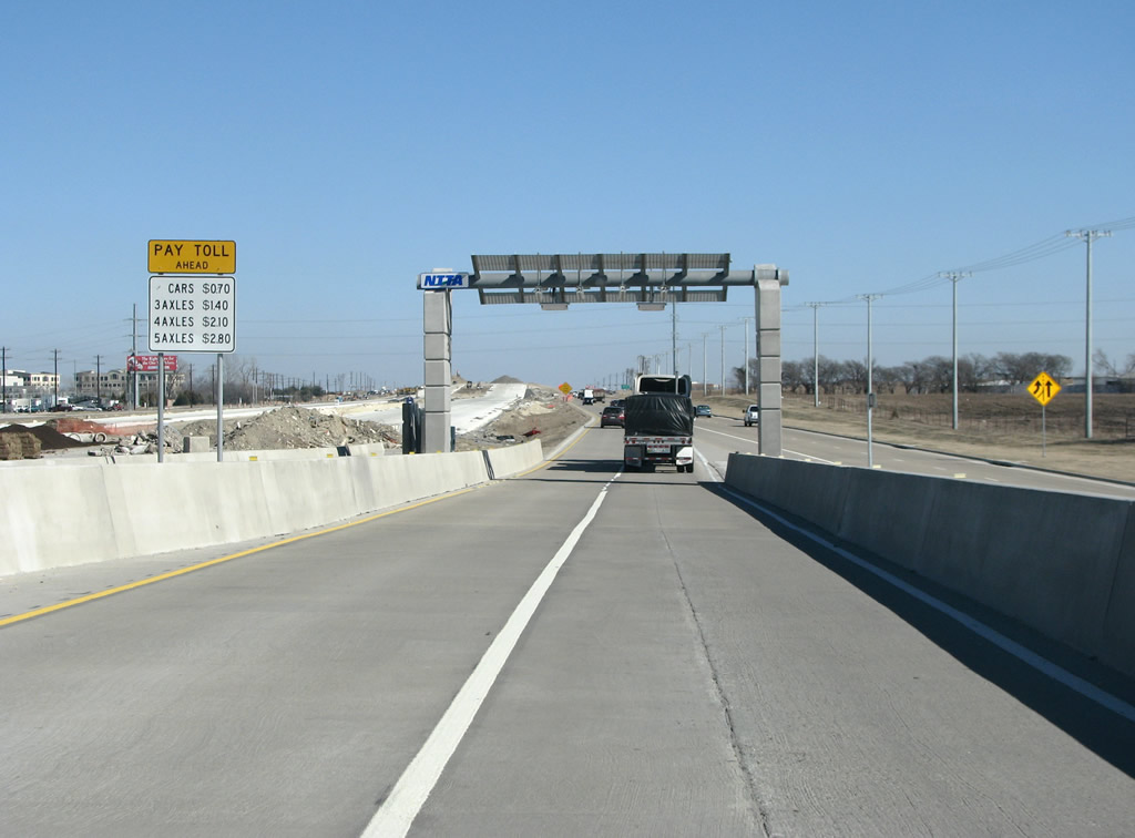
A sign east of Hillcrest indicates that the Tollway ends ahead. The left lane ends and all traffic must exit. A sign of the times - this sign used to say "Freeway Ends". Photo taken 01/20/09. |
 |
The open portion of 121 ends here east of Hillcrest. Like most other things with this road, the NTTA has seen fit to place their logo directly on the toll gantry. Photo taken 01/20/09. |
 |
121 becomes an at-grade, signalized route here with a light here at Coit Road in northern Plano. 121 continues north to US 75 and beyond. Photo taken 01/20/09. |
Page Updated February 4, 2009.
|
About Contact FAQ |
Spotlights Testimonials Interstate Guide |
Social Media:
 |
|
© 2000-23 AARoads.com | All Rights Reserved | Privacy Policy / Terms of Use
|
||