
California State Route 905

California 905 was upgraded to a freeway and realigned from Otay Mesa Road leading east from I-805 to the Otay Mesa Port of Entry (POE) in south San Diego. The final segment opened to traffic in July 2012. This suite of photos shows portions of Otay Mesa Road when it was still a part of the state route, construction to build the Otay Mesa Freeway, and temporary configurations during road work.

California 905 extended east from I-805 onto Otay Mesa. The state route continued seven miles to the Otay Mesa Port of Entry and truck crossing. 12/03/06

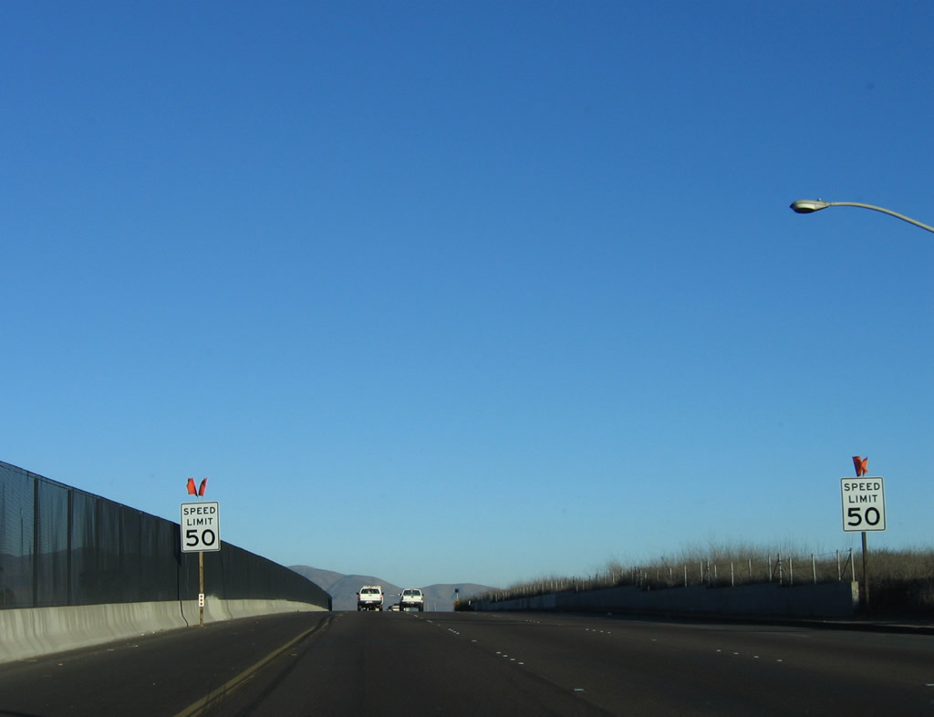
Prior to 2012, the Otay Mesa Freeway ended a half mile east of Interstate 805. 12/03/06

The speed limit on California 905 east reduced to 50 miles per hour as the freeway transitioned into Otay Mesa Road. The ensuing traffic signal operated at Otay Mesa Road, which travels southwest toward San Ysidro. 12/03/06
Continuing east after the Otay Mesa Road intersection, California 905 widened to three lanes in each direction with a chain link fence lining the median. 12/03/06
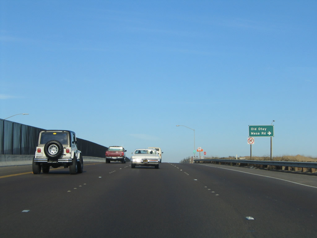
California 905 east at the turnoff for Old Otay Mesa Road, which travels south and then west to the Princess Park and Remington Hills subdivisions. The new freeway parallels this section of Otay Mesa Road on an alignment about a quarter mile south. 08/21/04
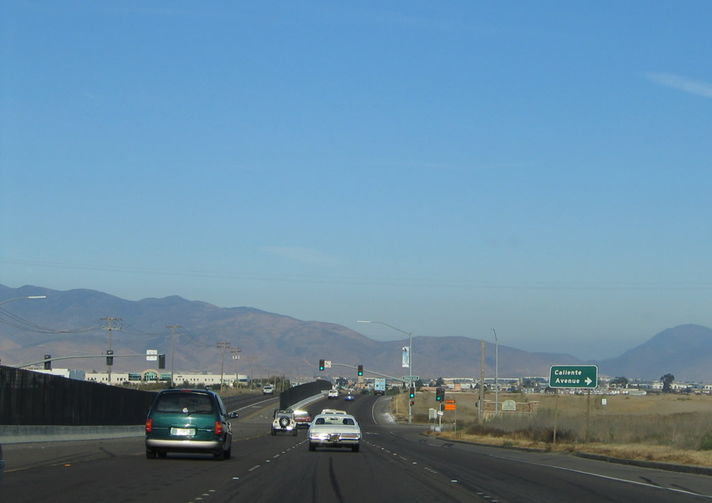
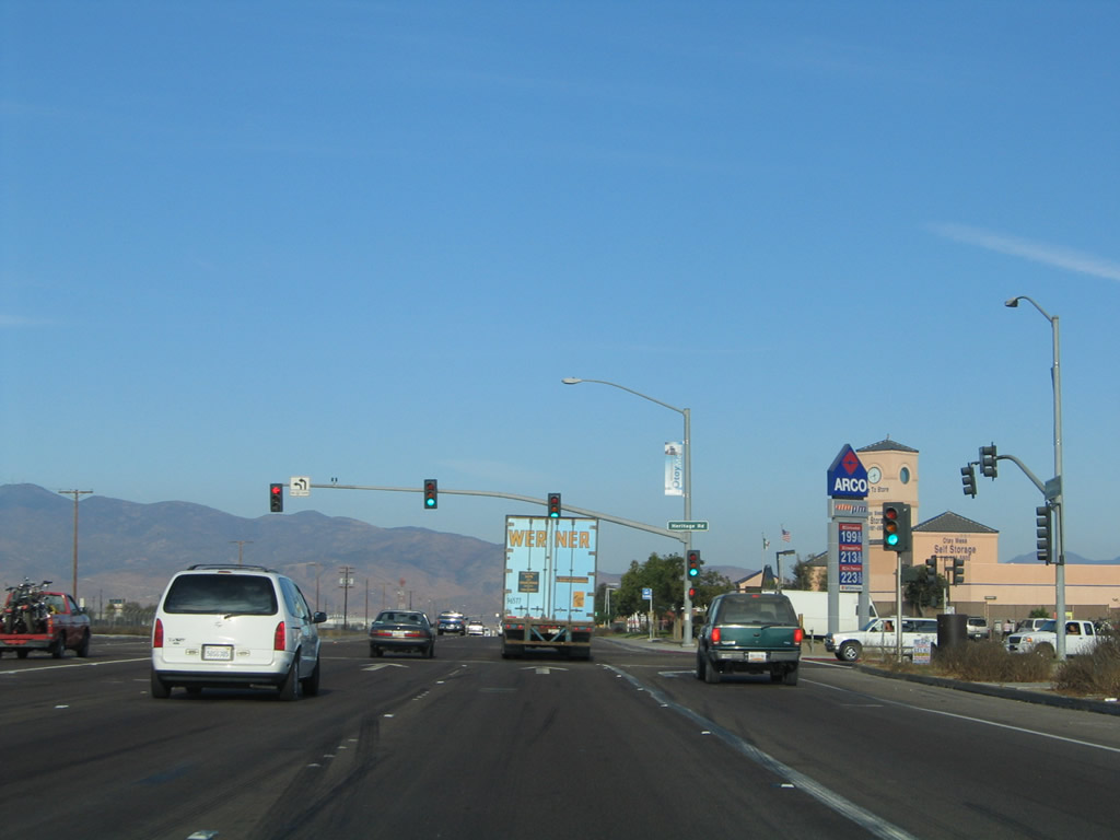
The first traffic signal on California 905 (Otay Mesa Road) east was with Caliente Avenue south and Ocean View Hills Parkway north. At the time this picture was taken, there was no access onto Ocean View Hills Parkway. 08/21/04

Otay Mesa Road east at Caliente Avenue south and Ocean View Hills Parkway north. 08/21/04

Otay Mesa Road east at Caliente Avenue south and Ocean View Hills Parkway north. 02/21/11
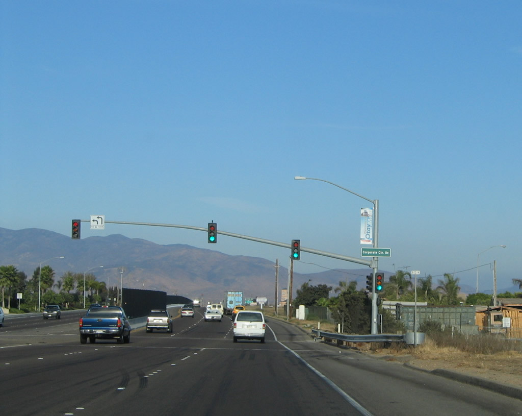
The next traffic signal on Otay Mesa Road east is with Corporate Center Drive, which serves several business parks north of the highway. 08/21/04

Otay Mesa Road east approaches Heritage Road south to business park areas and north to Otay Valley Road en route to the city of Chula Vista and Otay Valley Regional Park, amphitheater, and water slide park. 08/21/04
Otay Mesa Road (old California 905) east at Heritage Road. 08/21/04
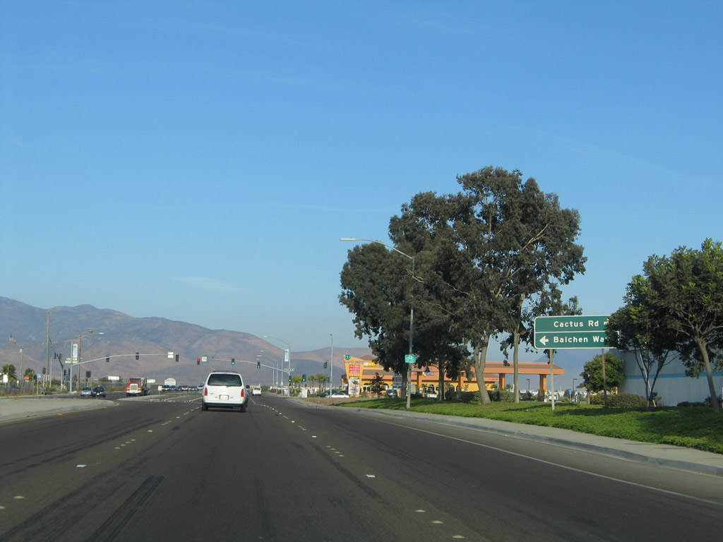
The next traffic signal on Otay Mesa Road east is with Cactus Road south and Balchen Way north. Cactus Road, like other nearby business parks, serves the maquiladora facilities that have ties to manufacturing operations in Mexico. 08/21/04
California 905 (Otay Mesa Road) east at the signalized intersection with Cactus Road. Brown Field and its sprawling runway comes into view on the north side of Otay Mesa Road. 08/21/04

With the completion of the California 905 freeway between Airway Road and Brittania Boulevard, a sign was added at Cactus Road to advise motorists to turn south on Brittania Boulevard to continue east along the state route. 02/21/11

A south bannered California 905 shield was once posted along Otay Mesa Road east of Cactus Road. It was later corrected to east. 08/21/04

The succeeding traffic signal on Otay Mesa Road east is with Britannia Boulevard. California 905 temporarily turned south on Brittania Boulevard to join the then-new freeway alignment. 02/21/11

Prior to November 2010, SR 905 remained east along Otay Mesa Road beyond Britannia Boulevard. 08/21/04

California 905 south reassurance shield that was posted on eastbound Otay Mesa Road after Britannia Boulevard. 08/21/04

Otay Mesa Road (old SR 905) east at Gailes Boulevard. 08/21/04

With Otay Mountain rising along the eastern horizon, Otay Mesa Road approached Aisla Court. 08/21/04

After passing by Ocean View Hills and Brown Field Municipal Airport, then-California 905 east approached Otay Mesa Center Road. 12/03/06

All trucks with cargo entering Mexican were directed along Otay Mesa Road (California 905) east to La Media Road south. This restriction remained after California 905 shifted southward onto a freeway. 08/21/04

Otay Mesa Road east at La Media Road south to the truck port of entry into Mexico. 12/03/06

A guide sign advised of the pending junction between California 905 and the tolled South Bay Expressway (California 125). California 125 forms an outer beltway of the San Diego region by traveling from the Otay Mesa area north through Chula Vista, Bonita, Spring Valley, La Mesa, El Cajon, and Santee, ending at California 52. 07/12/09

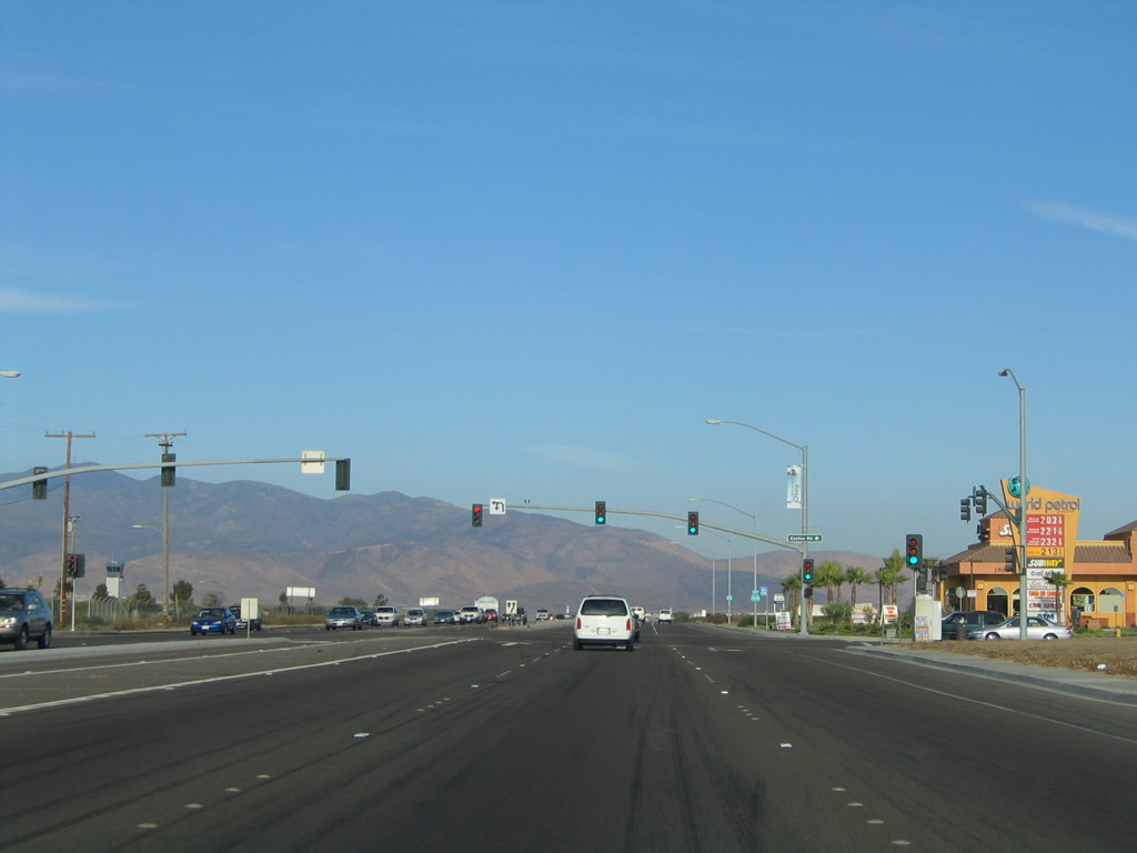
The succeeding traffic light along Otay Mesa Road is located at Piper Ranch Road. Piper Ranch Road stems north to an industrial park. 12/03/06

Otay Mesa Road east at the temporary south end of the South Bay Expressway. A half diamond interchange joins SR 125 with Otay Mesa Road here now. 07/12/09

Otay Mesa Road east at the temporary south end of the South Bay Expressway. A half diamond interchange joins SR 125 with Otay Mesa Road here now. 07/12/09

With the completion of the South Bay Expressway, California 905 was realigned to turn southeast. 07/12/09

The temporary intersection between California 905 and California 125 under construction. This was completed by December 2007. 12/03/06

The former intersection between California 905 east and California 125 north. A portion of the California 905 roadway hosts the direct connection from the Otay Mesa Freeway to the South Bay Expressway. 07/12/09

Harvard Road provided a second connection for California 905 east after the turn off for California 125 north. 07/12/09

Harvard Road provided a second connection for California 905 east after the turn off for California 125 north. 07/12/09

Prior to completion of the South Bay Expressway toll road, California 905 continued east to split with Otay Mesa Road. 08/21/04

Prior to completion of the South Bay Expressway toll road, California 905 continued east to split with Otay Mesa Road. 12/03/06

California 905 temporarily turned south at Harvest Road from Otay Mesa Road to Siempre Viva Road and the Otay Mesa Port of Entry. 08/21/04

Between California 125 and the international border with Mexico, California 905 is known as Paseo Internacional and travels due south toward the port of entry. This sign advising of construction was posted south of the Otay Mesa Road intersection. The freeway segment through the Otay International development was completed in 2004-2005. 08/21/04

Reassurance marker for SR 905 east posted during construction of Segment 4 ahead of Airway Road. This stretch of freeway was completed in November 2010. 07/12/09

An erroneous south reassurance marker for California 905 was posted ahead of Siempre Viva Road. 08/21/04

California 905 east at the former intersection with Airway Road. Freeway construction closed this at-grade intersection in 2009. 08/21/04

South of Airway Road, the California 905 freeway directly overlays the old alignment of Paseo Internacional through to the Siempre Viva Road interchange completed by 2005. 08/21/04
Photos by AARoads
Page Updated Saturday January 18, 2025.