
Interstate 10 Florida – West
Interstate 10 angles southwest from SR 87 to meet CR 89 (Ward Basin Road) ahead of Blackwater Bay. 05/31/04
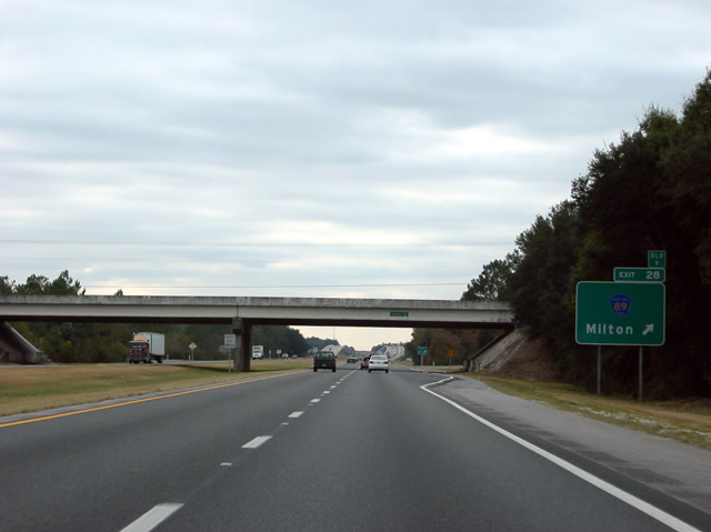
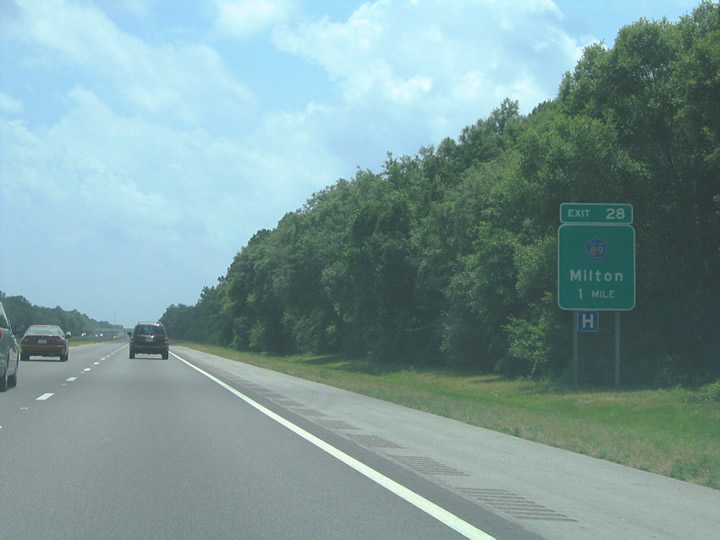
County Road 89 stems south from U.S. 90/SR 87 at East Milton to a dead south south of Exit 28 and Wards Basin. 12/06/03
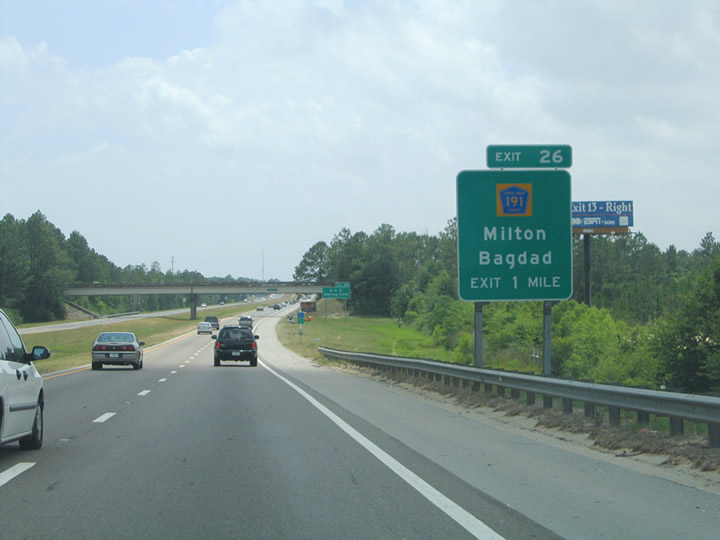
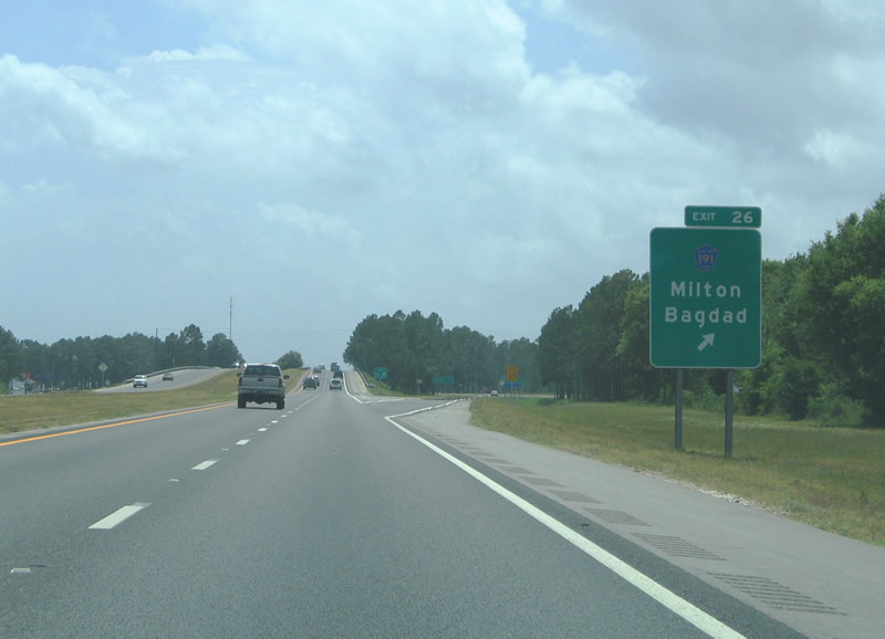
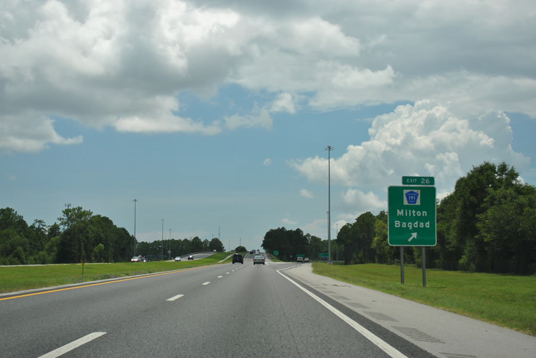
Spanning the Blackwater River, I-10 west next meets CR 191 in one mile at Exit 26. This sign was replaced by 2011. 05/31/04
Two sign replacements were made by 2011 and 2013 for Exit 26 on I-10 west. 05/31/04
CR 191 meanders south to SR 281 near Garcon Point and north through Bagdad to Downtown Milton. 07/24/11

Carbon copying of this sign assembly retained the road name of Avalon Boulevard in place of SR 281, which was included on new signage for Exit 22 when the Garcon Point Bridge opened in 1999. 12/06/03

Replaced guide sign posted one mile ahead of Exit 22 to SR 281. SR 281 travels south to U.S. 98 at Midway and north to U.S. 90 at Pea Ridge. 12/06/03
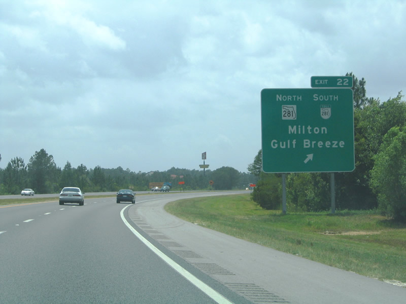
Additional sign replacements were made along I-10 west at the diamond interchange (Exit 22) with SR281 (Avalon Boulevard). 05/31/04
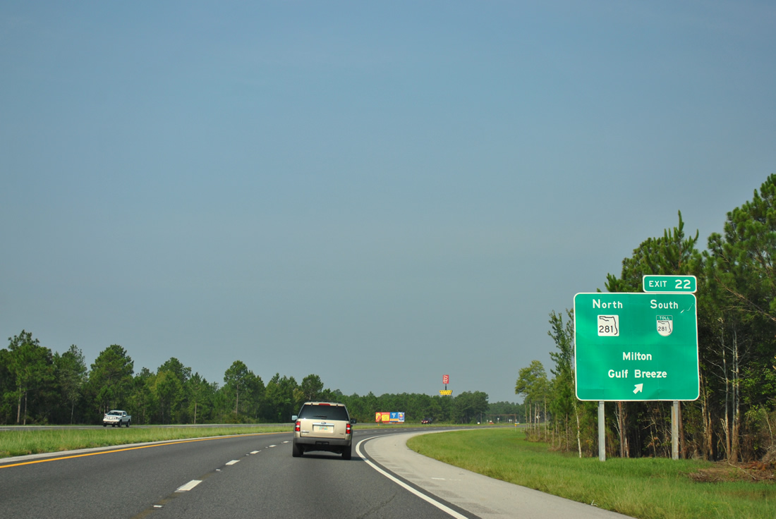
While toll SR 281 shields are displayed, the route is free until just south of the turn off to Garcon Point Road. 08/03/11
Interstate 10 crossing the 1969-built bridge across Escambia Bay. 12/06/03
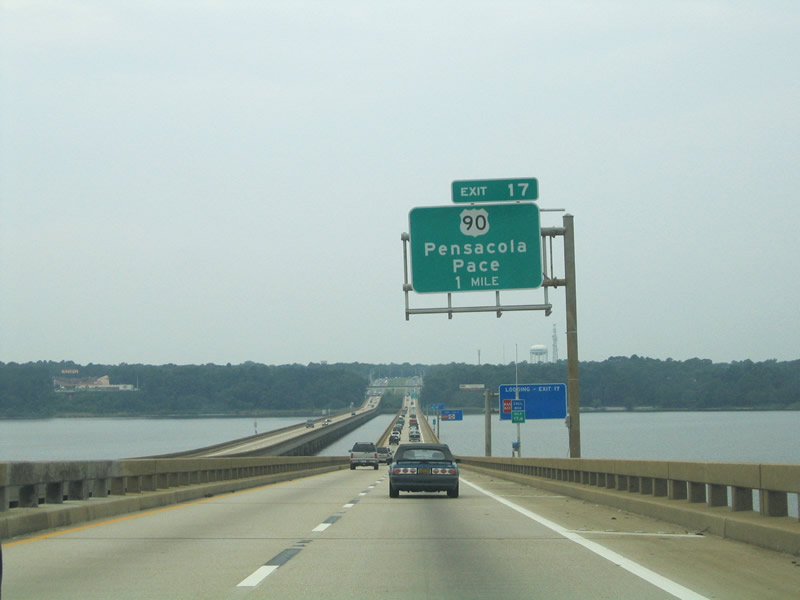
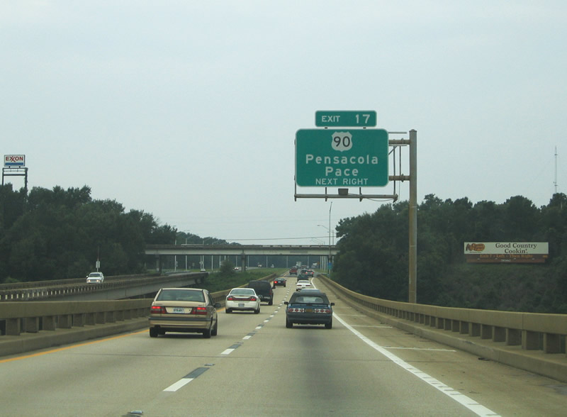
Overheads for Exit 17 were updated to add Pace to Pensacola for U.S. 90 east. 07/17/04

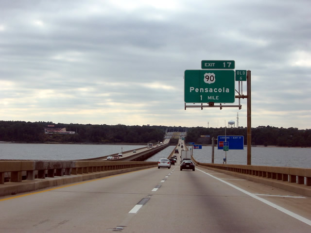
A vintage overhead for Exit 17 at the west end of Escambia Bay. 12/06/03
The folded diamond interchange at Exit 17 was unchanged following the completion of the new Escambia Bay bridges in 2006/07. 07/17/04
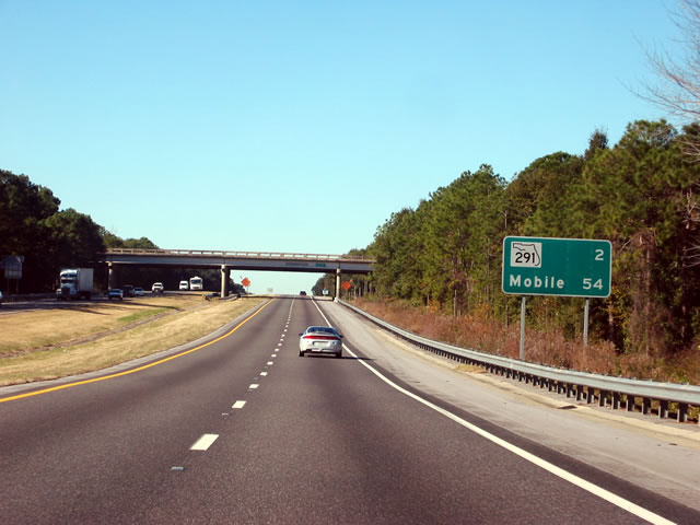
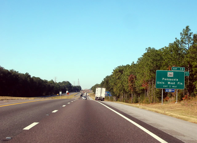
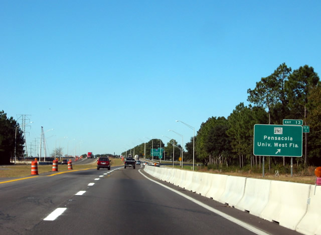
Removed mileage sign that was posted two miles from Exit 13 (SR 291) and 54 miles from Mobile, Alabama. 12/21/03
Former ground level sign for Exit 12 and SR 291 (Davis Highway). 12/21/03
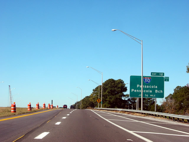
Exit 12 departed I-10 west at the eastern extent of the I-10/I-110 construction zone. Work ran from 2003 to 2008. 12/21/03
Ground level sign at SR 291 for the trumpet interchange (Exit 12) with I-110 south. 12/21/03

A replacement of the half mile sign for I-110 south was made during I-10/110 Interchange construction. 05/23/05
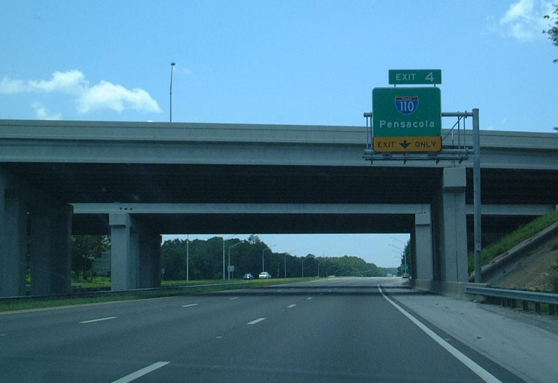
This overhead was erected in 1999 at I-110 south. Work in 2002 added a retention pond within the loop ramp at Exit 12 in place of a stand of pine trees. 06/23/01
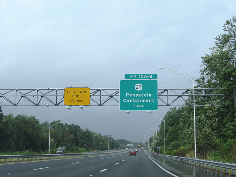
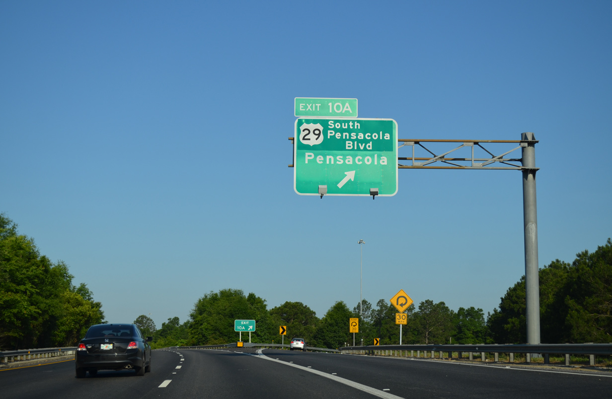
Sign changes made to Exit 10 in April of 2010 add Pensacola Boulevard, the name of U.S. 29 between Ensley and Brent. 09/01/08
Construction expanded I-10 west from I-110 to U.S. 29 to 2007. 12/21/03
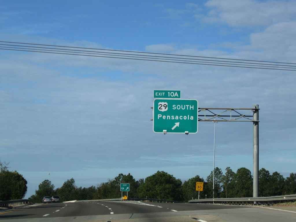
This ground level sign for U.S. 29 (Pensacola Boulevard was replaced with a sign bridge during widening of I-10. 05/25/05
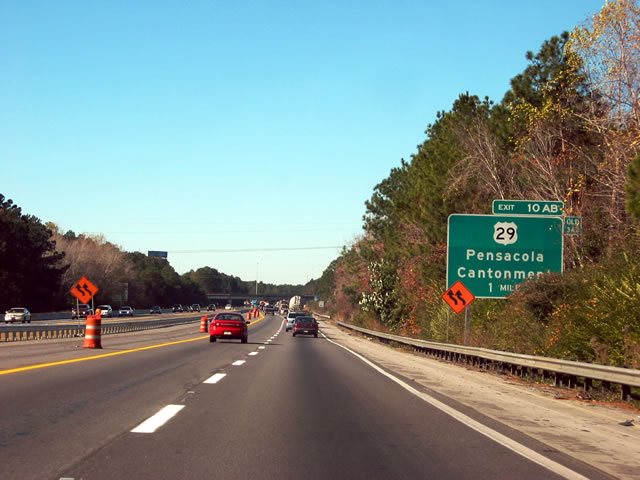
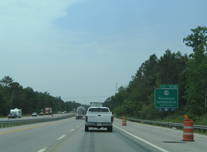
Entering the directional cloverleaf interchange (Exits 10B/A) with U.S. 29 on I-10 west. 08/03/08
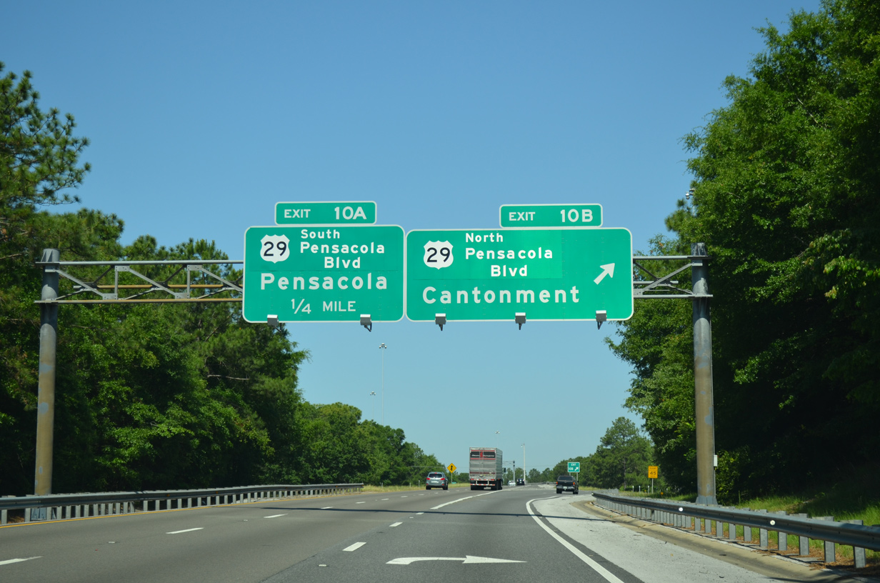
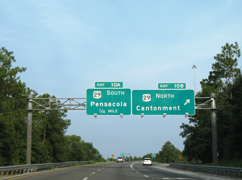
Exit 10B was expanded to a two-lane ramp by 2014. This resulted in a new overhead for U.S. 29 north, replacing the one pictured here. 05/18/14
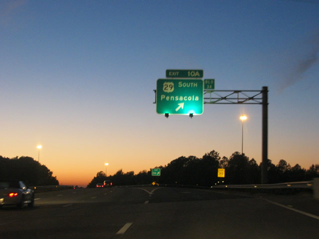
A previous overhead for Exit 10A. U.S. 29 ends 6.2 miles to the south at U.S. 90/98 (Cerventes Street) in Pensacola. 12/21/03
The overhead for Exit 10A before the Pensacola Boulevard greenout was added over SOUTH. 11/23/08
The loop ramp for U.S. 29 south permanently closed in 2018. 05/09/15
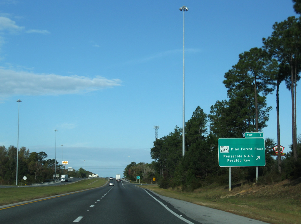
New signs for Exit 7 including Pine Forest Road were installed in 2002. Signs previously changed in 1999 to display Perdido Key in place of Pine Forest Road. This assembly was knocked down in Fall 2010 and subsequently replaced. 11/23/08
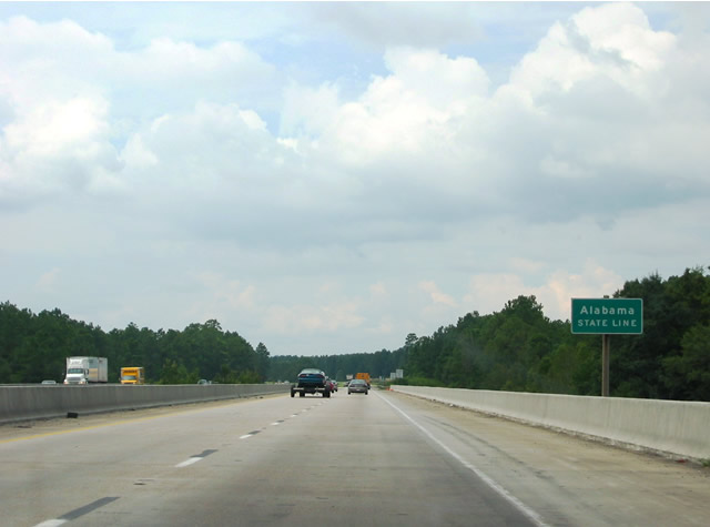
Interstate 10 enters Baldwin County, Alabama at the Perdido River northwest of Bealuh. 08/21/03
Photos by AARoads
Page Updated Friday January 24, 2025.