
Interstate 40 North Carolina - East
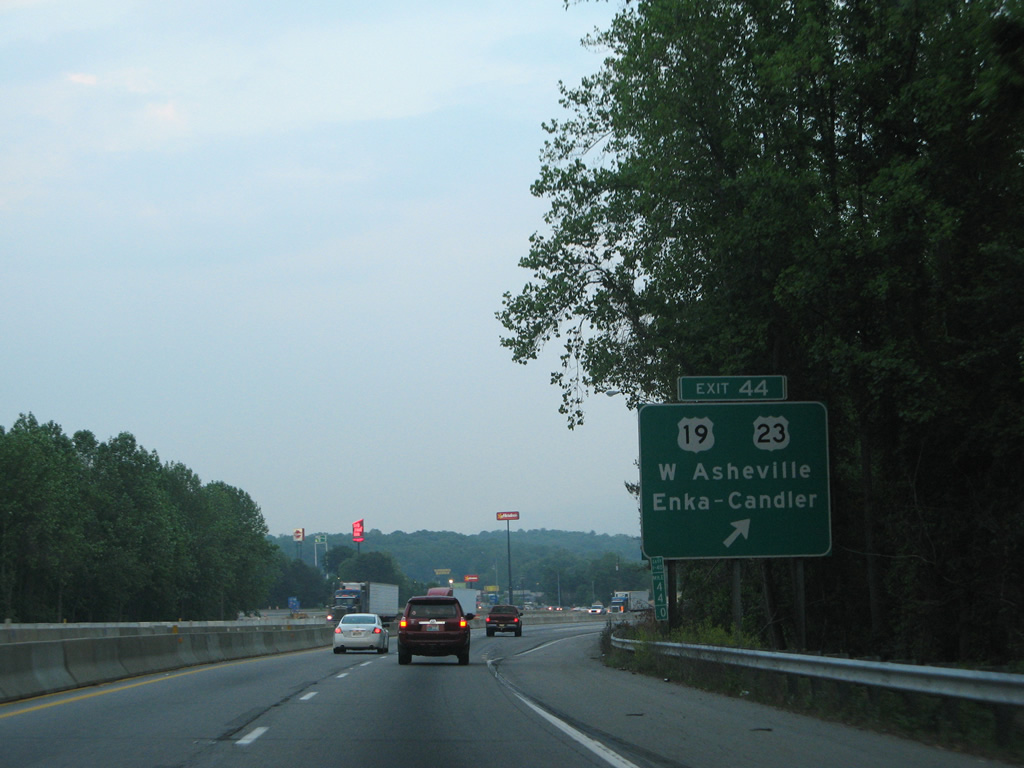
I-40 eastbound at the parclo interchange (Exit 44) with U.S. 19/23 near Enka from before the 2005-08 widening of the freeway east to Exit 46. 05/31/07
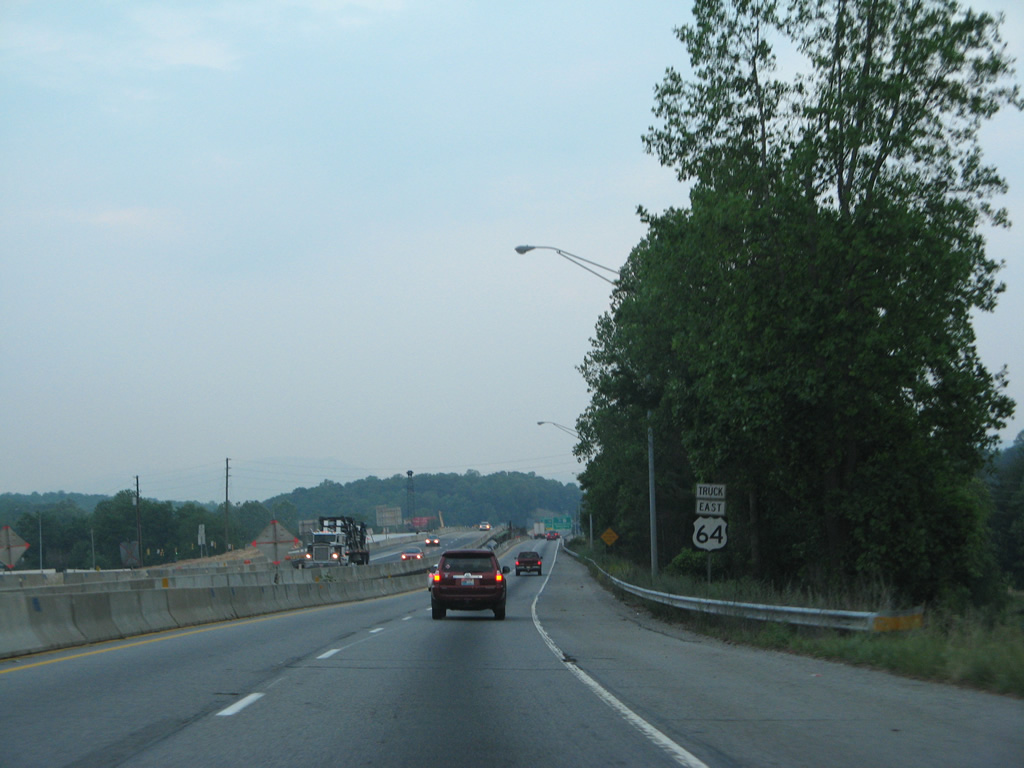
Crossing over U.S. 19/23 (Patton Avenue) along I-40/U.S. 74 east during reconstruction to expand the freeway. This Truck U.S. 64 shield assembly was not replaced when work was completed. 05/31/07
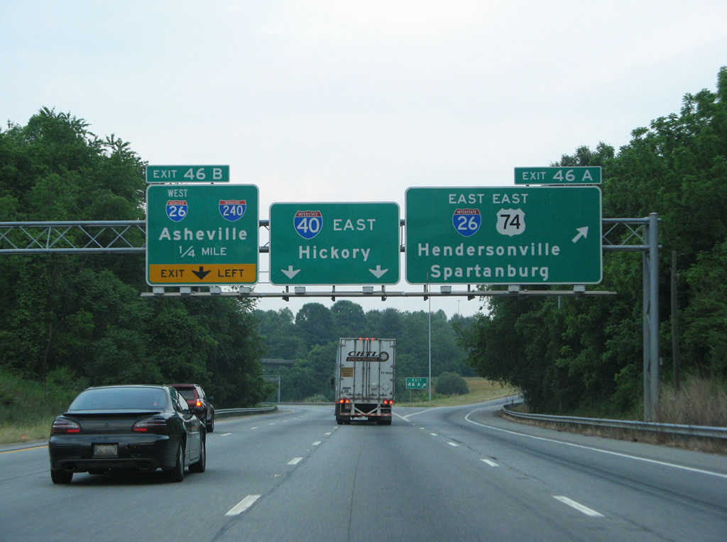
Until August 2003, Interstate 26 ended at Exit 46 with I-40. The northward extension took the route initially to I-81 in eastern Tennessee. This view looks at the previous signage for the end point. 05/31/07
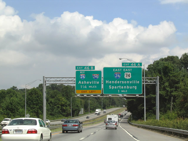
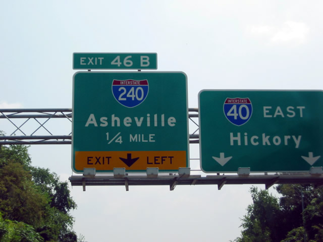
A greenout added I-26 west to the Exit 46 B panel, reflecting the then new overlap with I-240 east to Downtown Asheville. This sign bridge was later replaced during 2005-08 widening of Interstate 40 to eight lanes. 08/15/04
Interstate 40 travels between Lake Ashnoca and Sand Hill leading into the exchange with the former west end of Interstate 26. 08/23/03
The older Exit 46 B sign was retained and augmented with a greenout for Interstate 26 west prior to the reconstruction of I-40 in 2005. 08/15/04
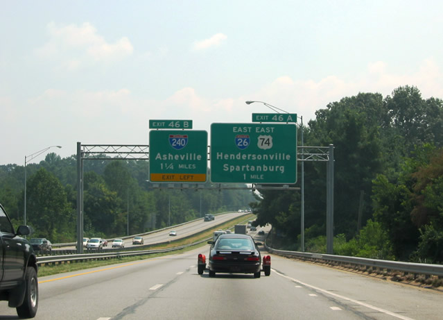
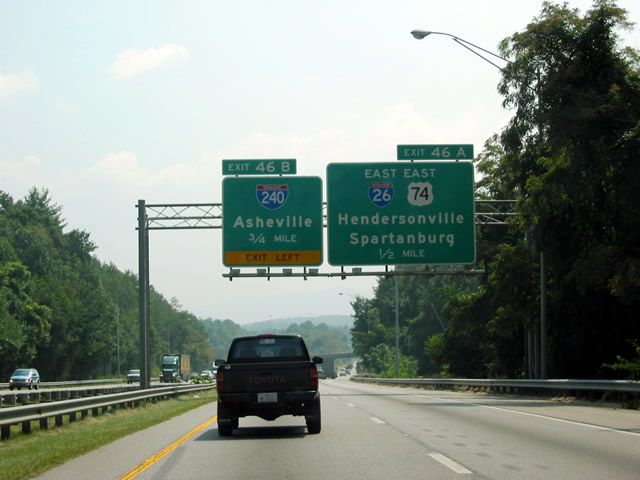
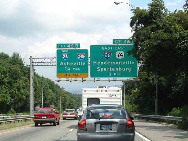
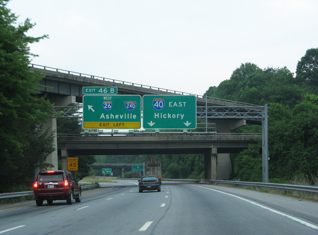
Interstate 40 and U.S. 74 part ways at Exit 46 A. Sign changes made here added Johnson City and Downtown for Exit 46 B while including Biltmore Estate for I-40 east. 05/31/07
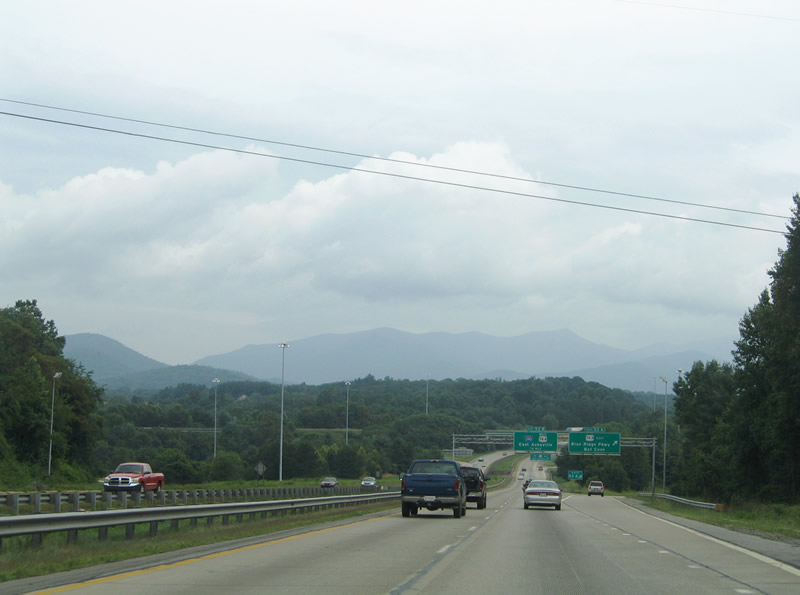
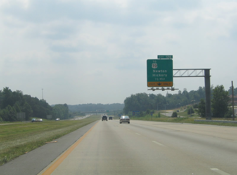
The control city for I-40 is Hickory east through to the exchange with I-240 and the former west end of I-26. Statesville becomes the primary reference point from there onward. 08/23/03
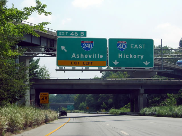
Replaced signs that were posted along Interstate 40 east at the beginning of Interstate 240 leading into Asheville. 08/23/03
I- 40 east at the left exit for I-26 west / I-240 east. 05/31/07
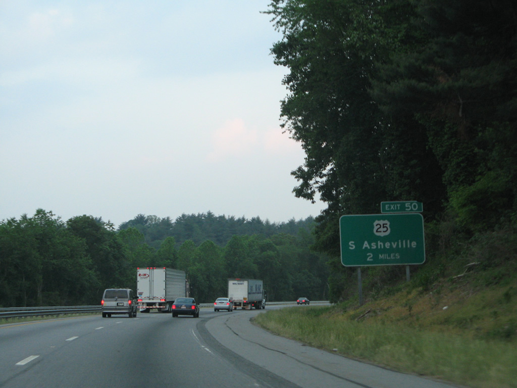
Interstate 40 guide signs for U.S. 25 and Exit 50 were amended to include Biltmore Estate. 05/31/07
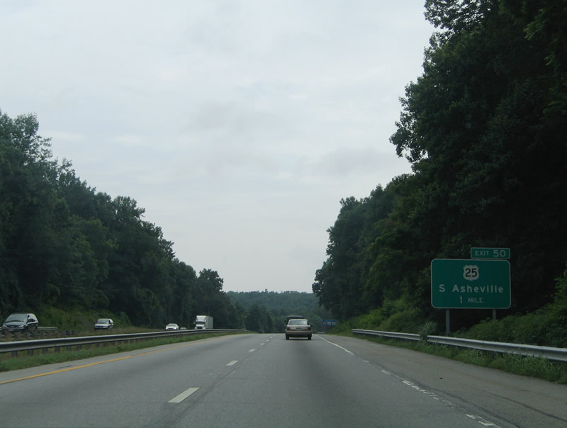
I-40 winds across hills to the south of the Swannanoa River one mile from to Exit 50 for U.S. 25. 07/16/05
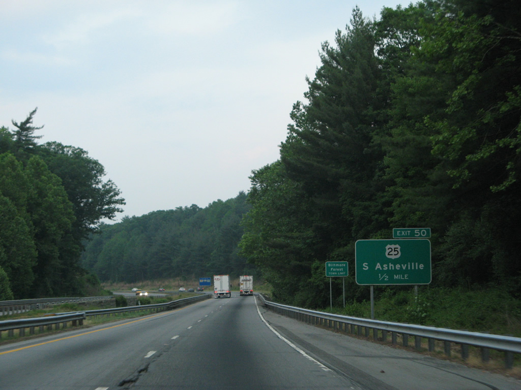
The replaced half mile sign for U.S. 25 on I-40 east at Biltmore Forest. 05/31/07
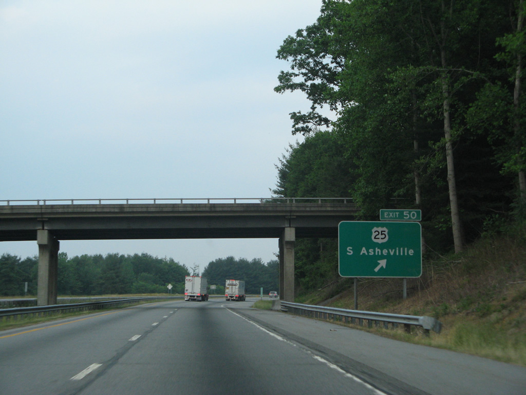
I-40 east at Exit 50, U.S. 25 (Hendersonville Road) to the northwest of Shiloh. 05/31/07
Original concrete was still in place along Interstate 40 in this scene east of U.S. 25. 07/16/05
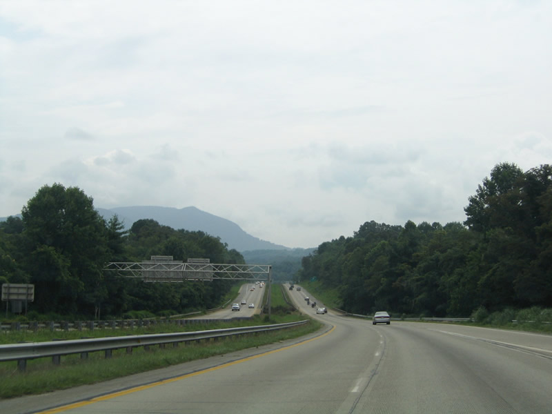
Interstate 40 east ahead of Exits 53 A/B with U.S. 74A and I-240 west ahead of the Great Craggy Mountains. The concrete roadway was paved over with asphalt by 2007. 07/16/05
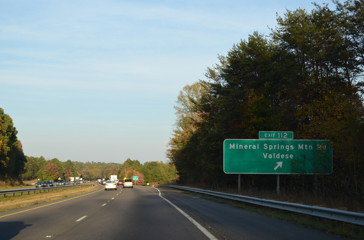
10/23/15
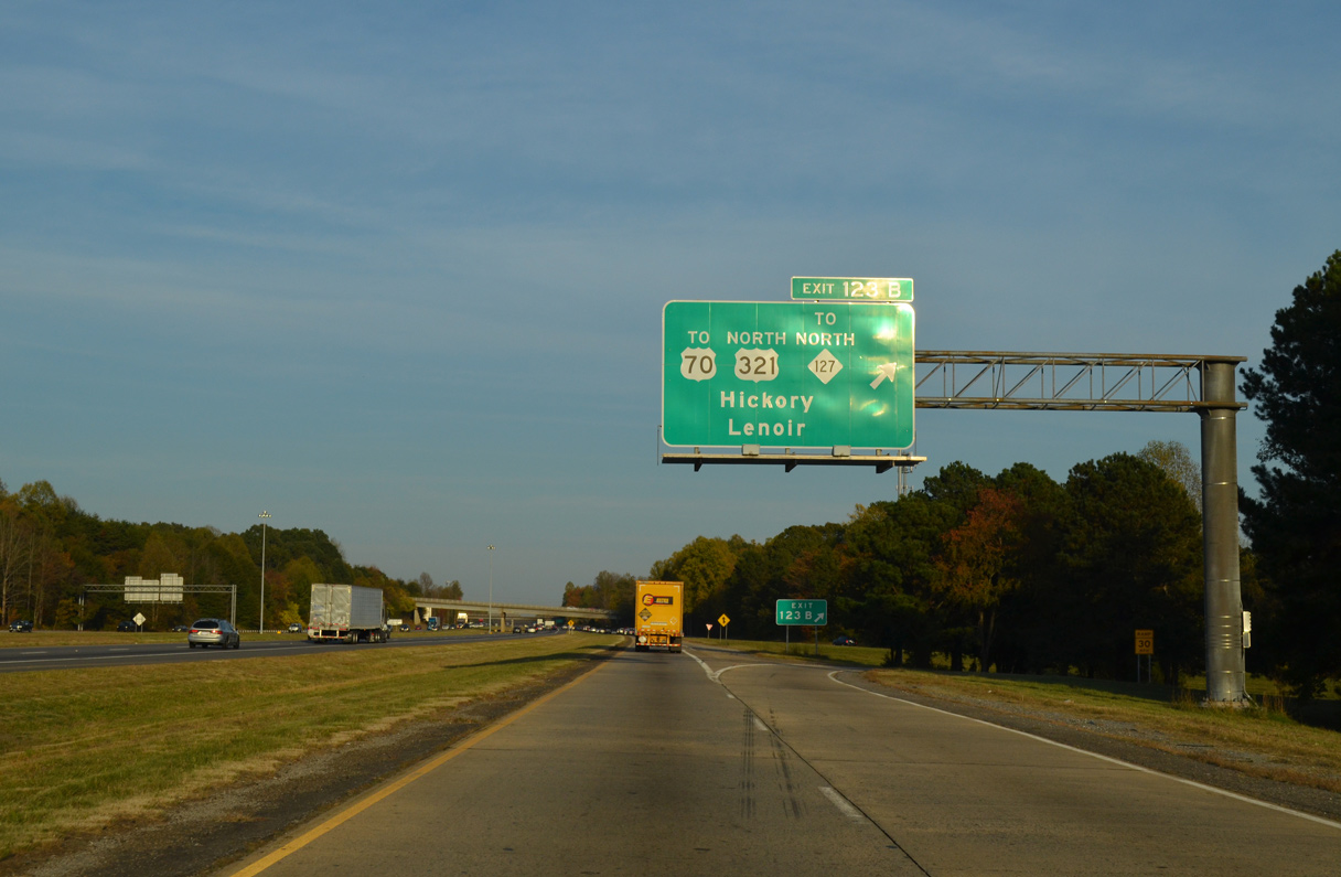
A replacement for the overhead at Exit 123 B removed NC 127. 10/23/15
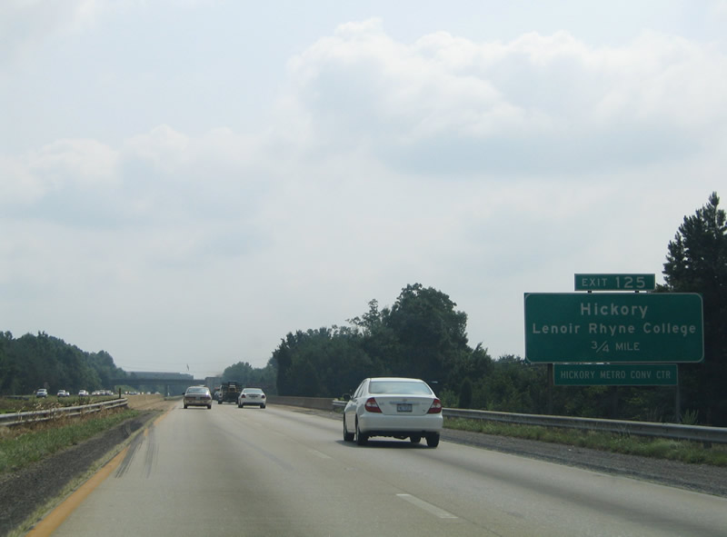
Replacements for signs at Exit 125 dropped Lenoir Rhyne College. 07/24/04
07/24/04
Photos by AARoads, Carter Buchanan (12/31/03, 08/15/04), Jamie Dzencelowcz (02/23/08)
Page Updated Friday January 24, 2025.