
Interstate 85 Georgia – North

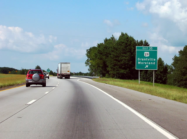
A historical look at I-85 north at Exit 35 with U.S. 29 near Grantville. The freeway now expands to six lanes here. 08/22/03
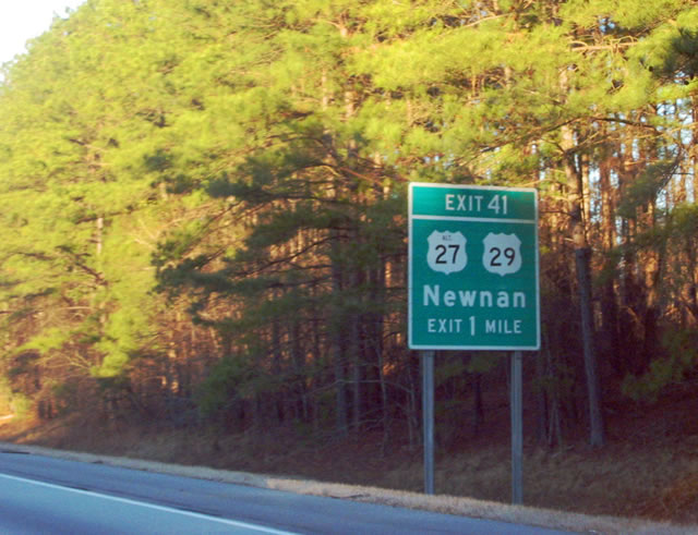
Former ground level sign posted one mile ahead of the diamond interchange (Exit 41) with U.S. 29/27 Alternate outside Newnan. Overheads are now used here as the freeway is six lanes wide with a barrier median. 01/16/04
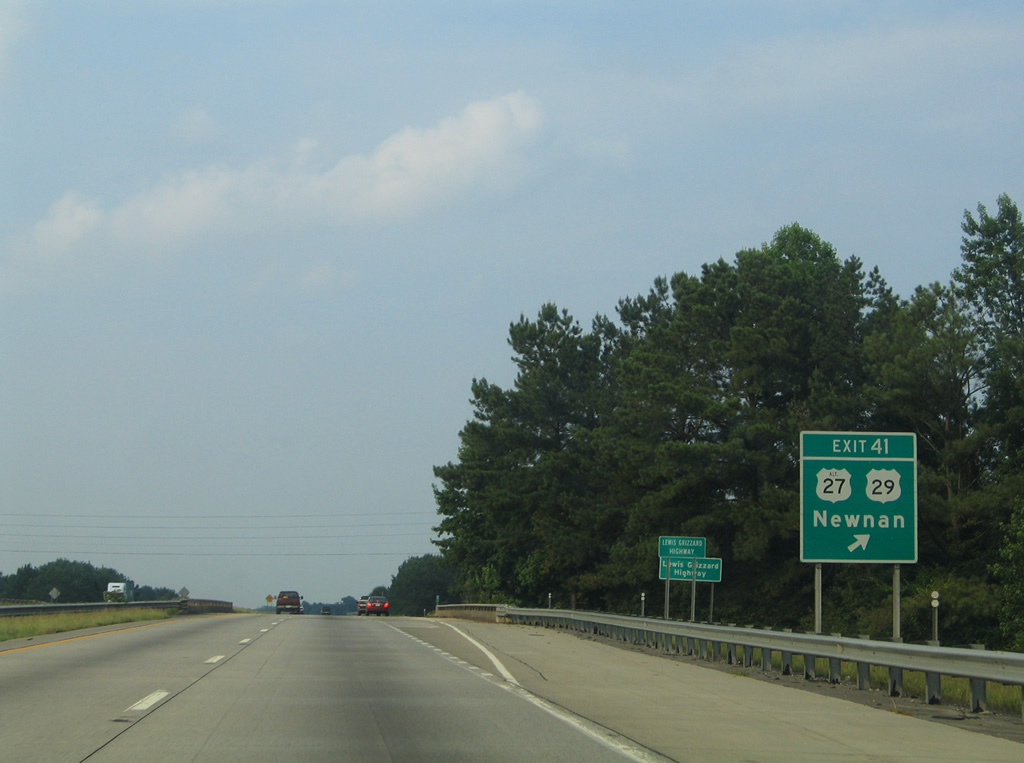
A look at the original ramp departure of Exit 41 to U.S. 29/27 Alternate from when I-85 was still a four-lane freeway with a rural design. 06/21/05
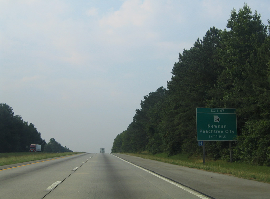
Interstate 85 northbound one mile ahead of Exit 47 to SR 34. 06/21/05
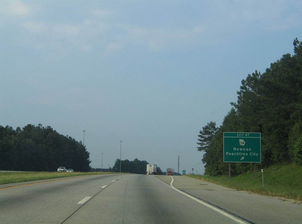
Entering the parclo interchange (Exit 47) with SR 34 along I-85 north from when the freeway was still just four lanes. 06/21/05
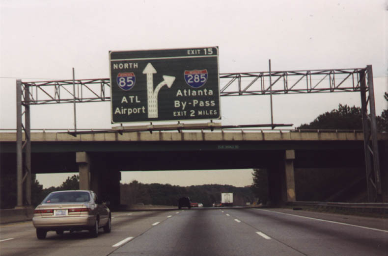
I-85/285 diagrammatic overhead for Exit 15 at the Flat Schoals Road overpass. All Georgia Interstate exits were renumbered from a sequential based system to a mileage based system during 1999 and 2000. Coinciding with this statewide project was the replacement of all non-reflective mainline guide signs with reflective panels and the removal of sign lighting fixtures. 12/07/99
A reassurance marker was posted near the hidden crossing over Morning Creek. It was removed by 2012. 09/28/10
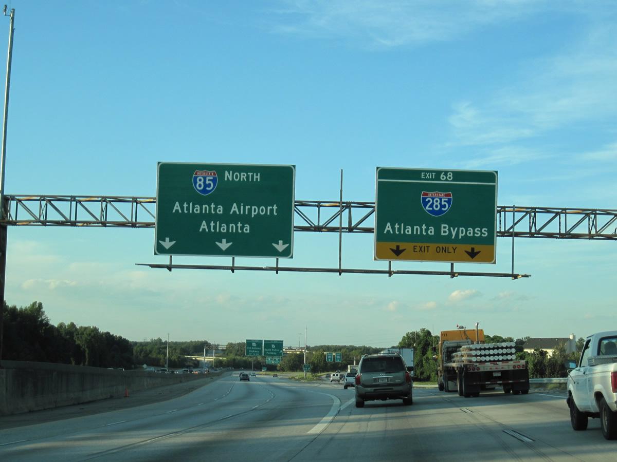
Sign changes were made at Exit 68 in 2012 to partition motorists to ATL Airport between the domestic and international terminals. 09/28/10
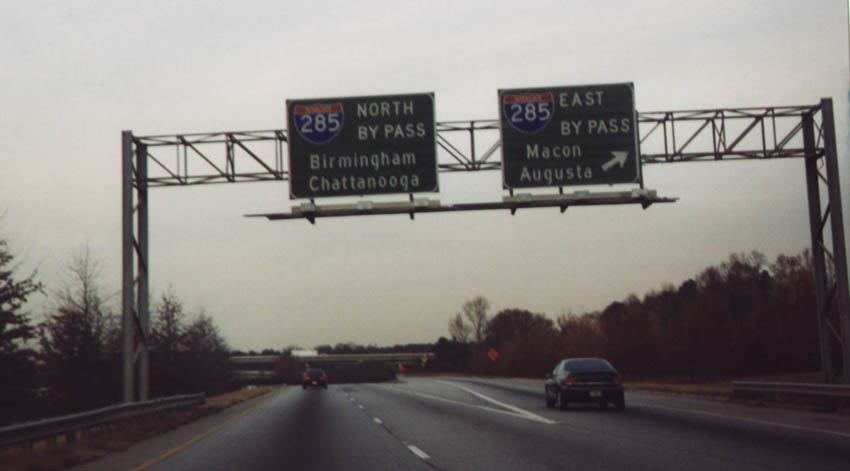
Previous I-285 overheads and sign lighting fixtures that were posted at the Exit 68 ramp split. I-285 eastbound parallels I-85 from SR 14 Spur eastward for two miles while the Atlanta Beltway travels seven miles to I-75 and 18 miles to I-20. 12/07/99
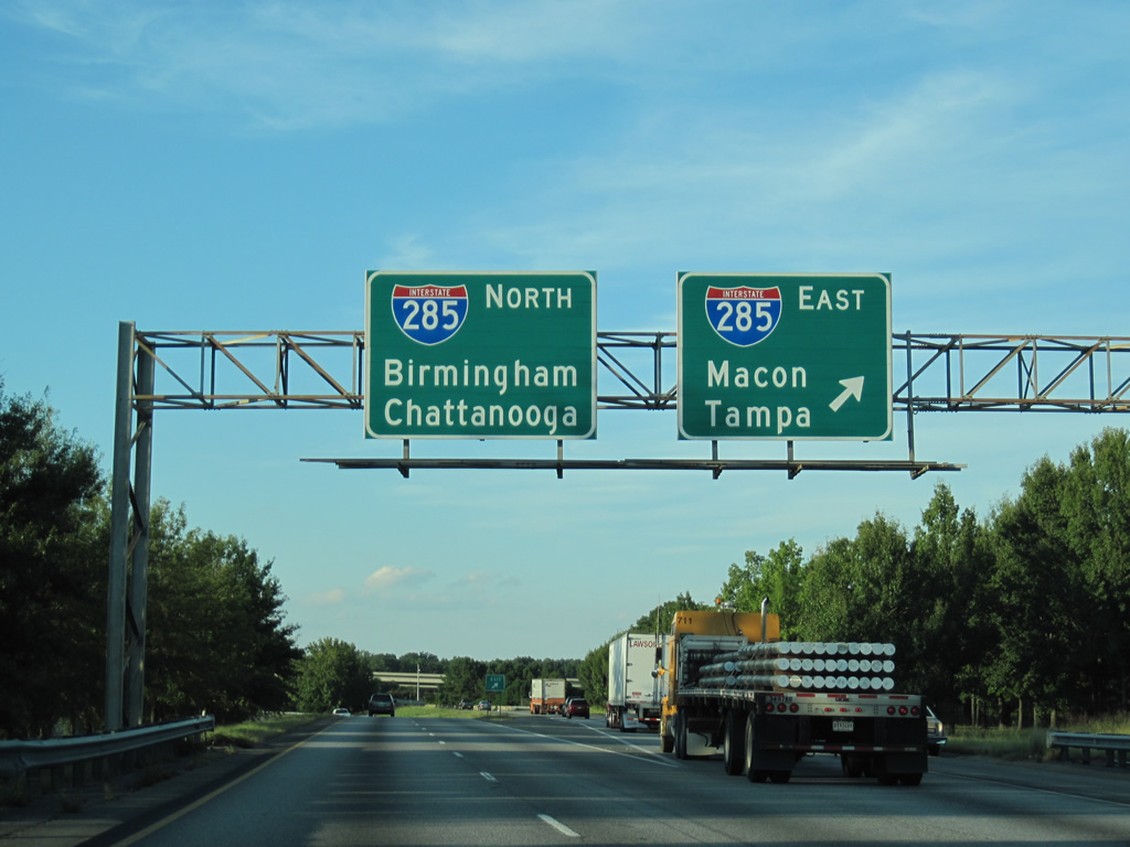
Augusta was replaced with Tampa in a 2000 sign replacement while sign changes made at the Exit 68 separation by 2012 reflected the new International terminal of ATL Airport. The airport replaced Tampa (via I-75 south) as a destination for I-285 east. 09/28/10
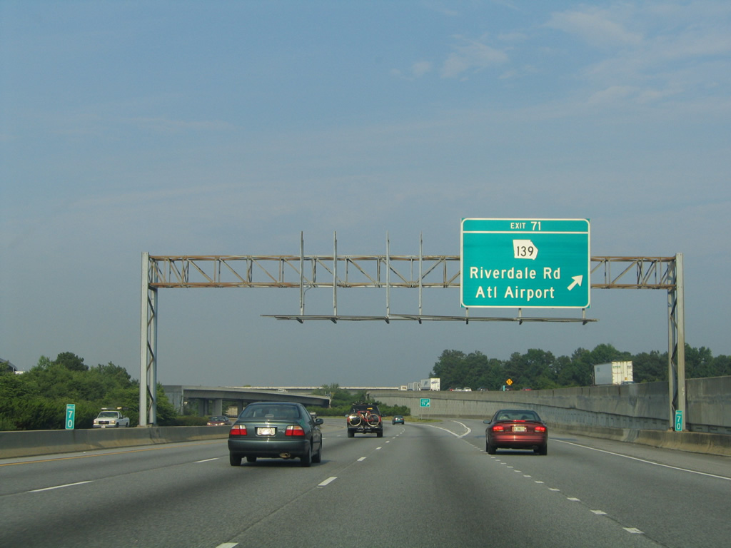
Signs for the Riverdale Road exit were replaced in 2012 to reflect the transition of the original ATL Airport terminal to domestic flights only. 06/21/05

Entering the parclo interchange (Exit 101) with Indian Trail-Lilburn Road on I-85 north along the Norcross city line. The northbound off-ramp was expanded in 2015, resulting in a sign change here. 07/02/14

The shield for SR 378 on this guide sign for Exit 102 fell off sometime after October 2011. This sign bridge was eventually updated to include signs for the I-85 Express lanes ingress/egress point a half mile ahead. 05/28/05
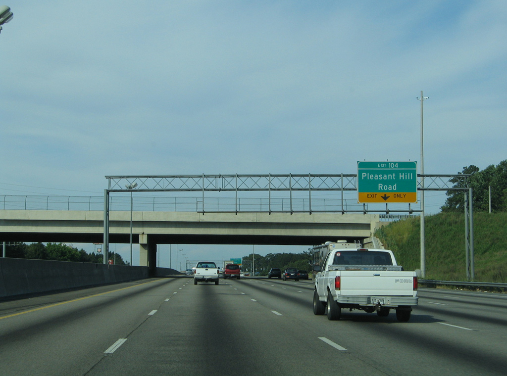
Interstate 85 north carried six lanes through to a lane drop at Exit 104 with Pleasant Hill Road. The freeway retains six lanes north to Georgia 316 now. 05/28/05

Two lanes parted ways with Interstate 85 north for Pleasant Hill Road to Gwinnett Place Commercial Center and Duluth. The diamond interchange here was converted to a DDI by 2013. 05/28/05
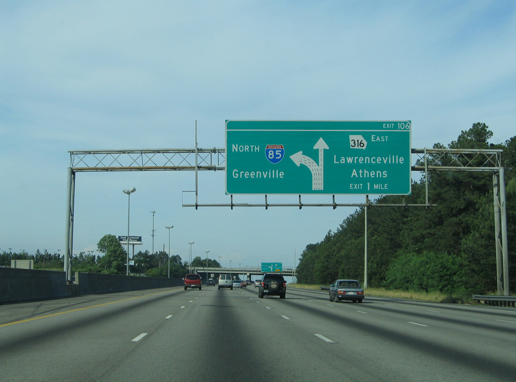
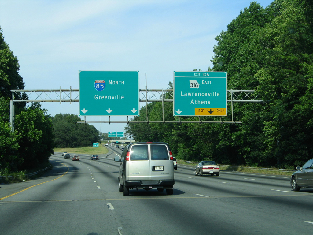
Work to overhaul Interstate 85 north at the split with SR 316 (University Parkway) drastically changed the previous simple wye interchange at Exit 106. 05/28/05
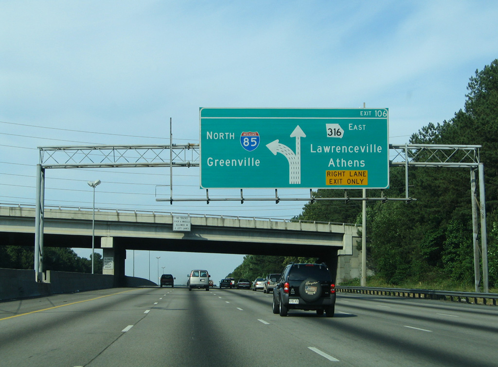
The forthcoming split with SR 316 allocated five lanes for I-85 north with the addition of the HOT lane on the left side. 05/28/05
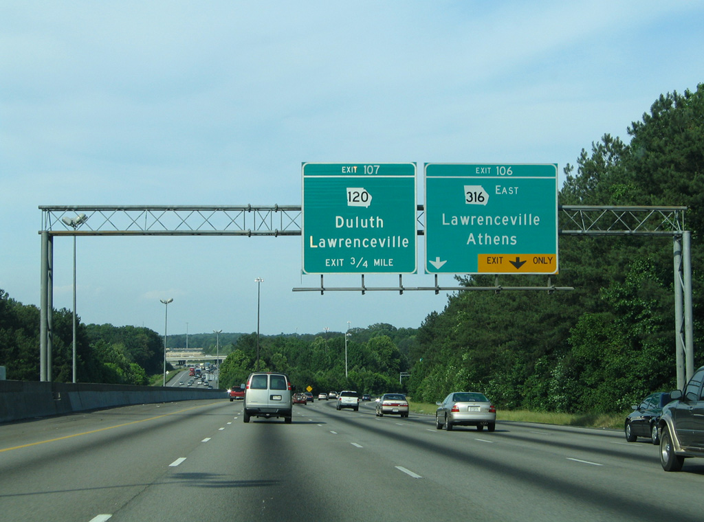
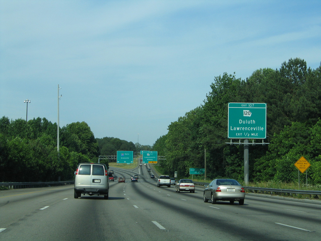
A series of c/d roadways were carved out of the adjacent forest stands to serve local movements to Boggs Road, SE 120 and previous Pleasant Hill Road. This shifted the off-ramp for SR 120 a mile west of the split with SR 316. 05/28/05
A c/d roadway originally ran north from the Boggs Road on-ramp to the parclo interchange (then-Exit 107) with SR 120. This roadway was incorporated into the SR 316 interchange redesign. 05/28/05
SR 16 begins from Exit 106 as a freeway running east to Lawrenceville. The adjacent Boggs Avenue off-ramp pictured here was shifted to the new c/d roadway for Exit 105 during 2006-08 road work. 05/28/05
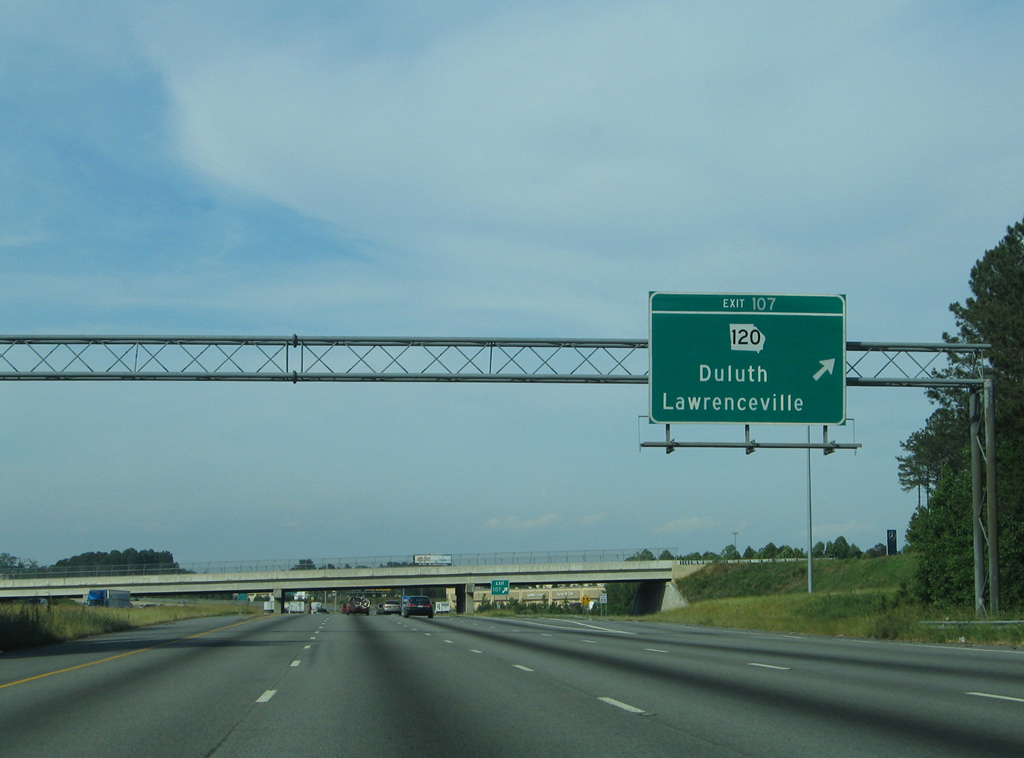
Northbound at the former ramp departure (Exit 107) for SR 120 (Duluth Highway). 05/28/05

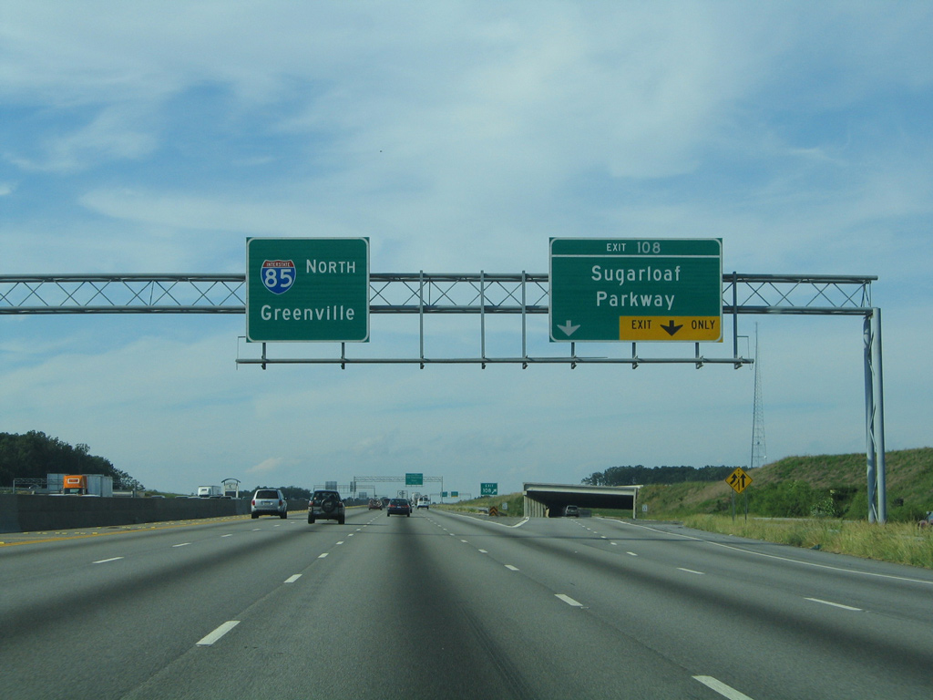
Extension of the HOV-2 roadway in 2008 added a lane to the right on the approach to Sugarloaf Parkway (Exit 108). A concrete barrier now separates the mainline and c/d roadway here. 05/28/05

Expansion of I-85 north sees five through lanes here and two departing lanes for Sugarloaf Parkway. 05/28/05
Another look at Interstate 85 north prior to the completion of the HOV-2 lane beyond Sugarloaf Parkway. 05/28/05
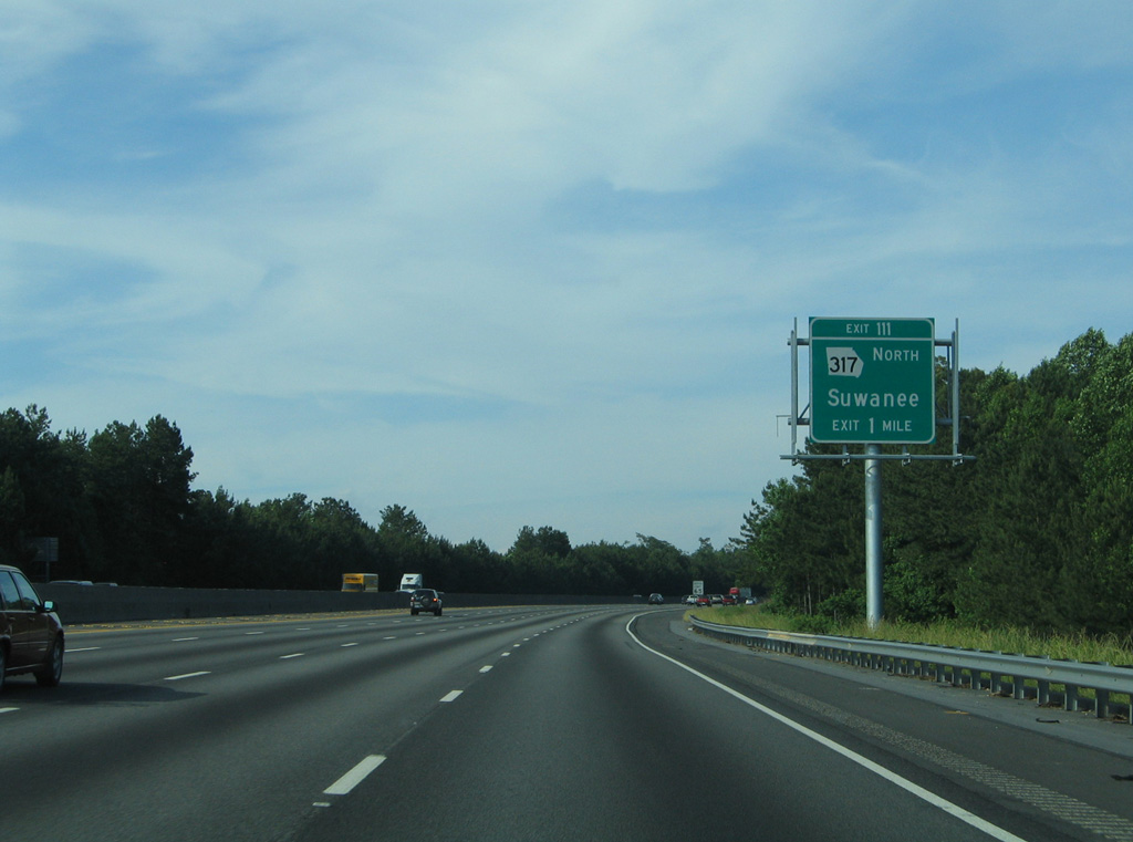
Replaced guide sign for Exit 111 and SR 317. I-85 north carries five lanes here now. 05/28/05
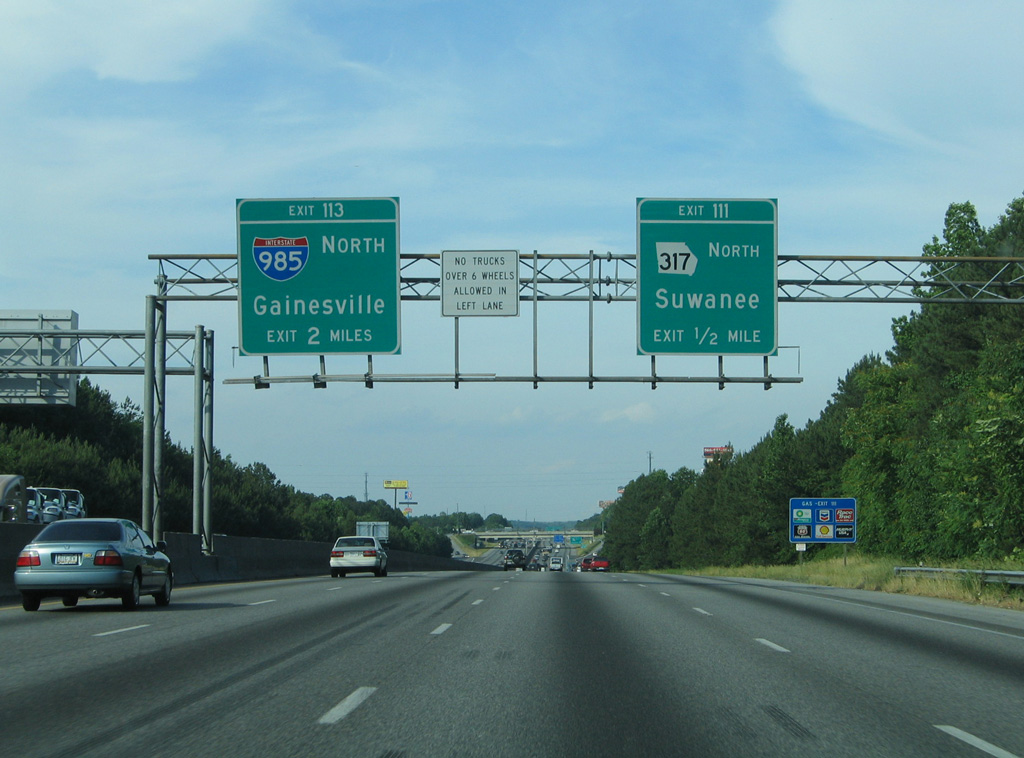
This sign bridge for I-985 and SR 317 was removed and replaced by a new one further north by the McGinnis Ferry Road overpass. 05/28/05

Exit 111 departed I-85 north one mile south of a now-shuttered rest area preceding I-985. 05/28/05
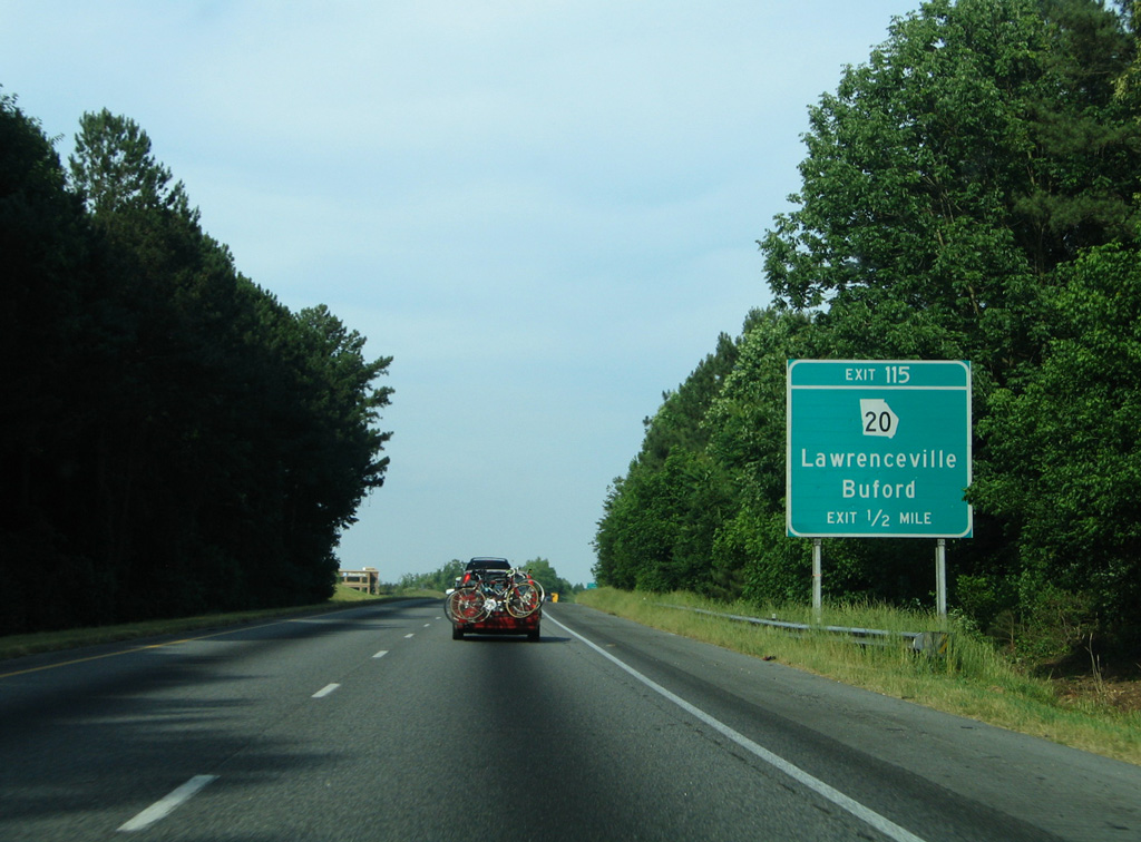
Ground level signs for Exit 115 and SR 20 were replaced by sign bridges during widening of I-85 north completed in 2008. 05/28/05
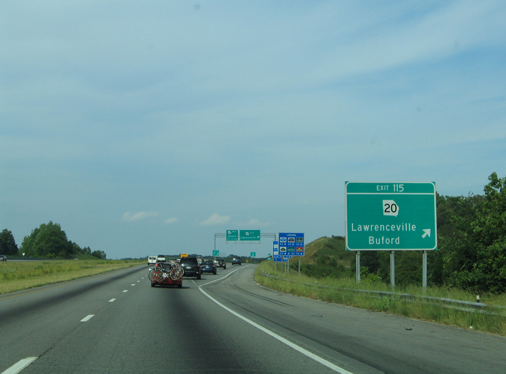
A lane drop occurs at the c/d roadway for SR 20 at Exit 115 now. Work between 2016 and 2018 further expands I-85 with an extension of the HOT lanes north to Exit 120. 05/28/05

Exit 115 was redesigned in the early 2000s from a diamond interchange. Signs on the c/d roadway were replaced after 2011. 05/28/05
Exit 115 was redesigned in the early 2000s from a diamond interchange. Signs on the c/d roadway were replaced after 2011. 05/28/05
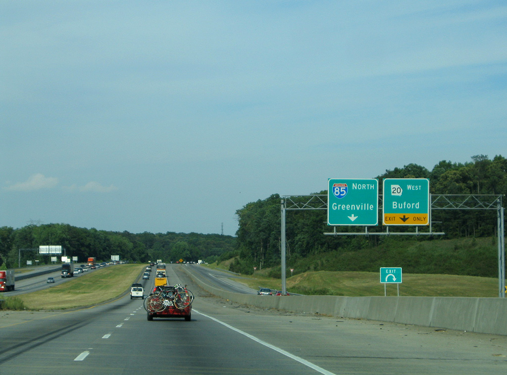
All signs with the narrow width Highway Gothic font for Interstate 85 north from Exit 115 to the South Carolina state line were replaced by 2013 or 2014. 05/28/05
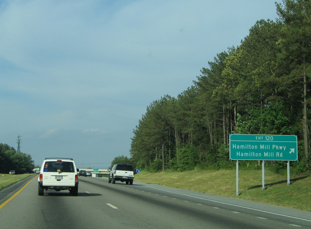
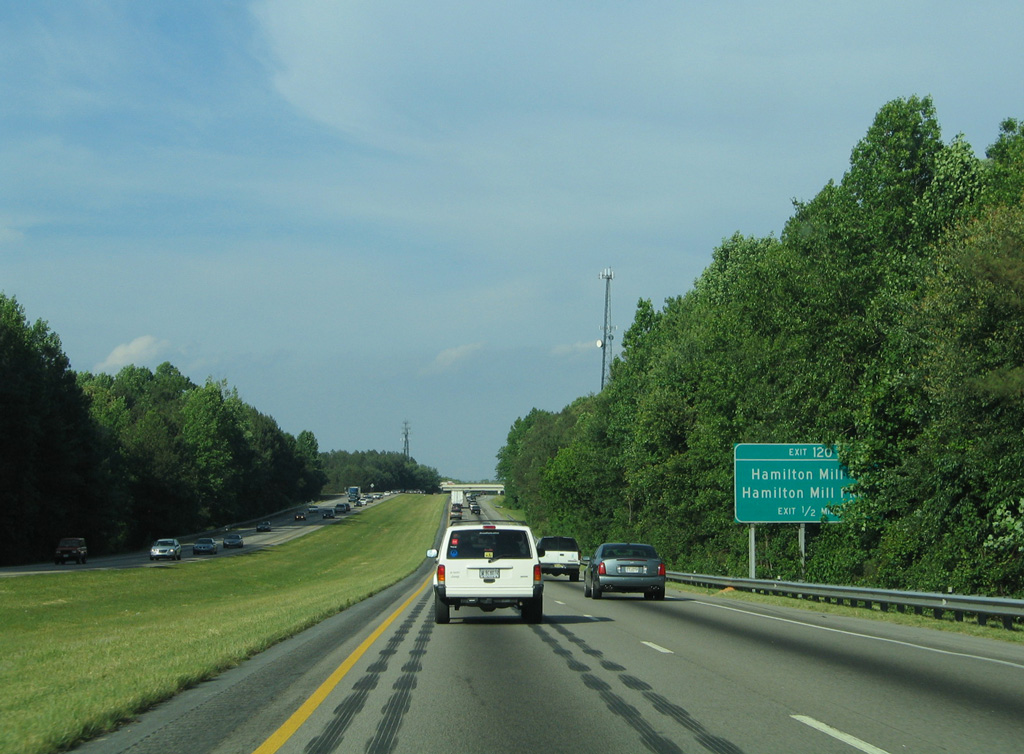
Northbound I-85 at the off-ramp (Exit 120) to Hamilton Mill Road. Big box retail lies both north and south of this formerly rural interchange. 05/28/05
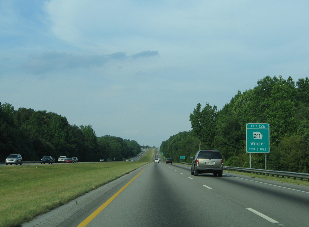
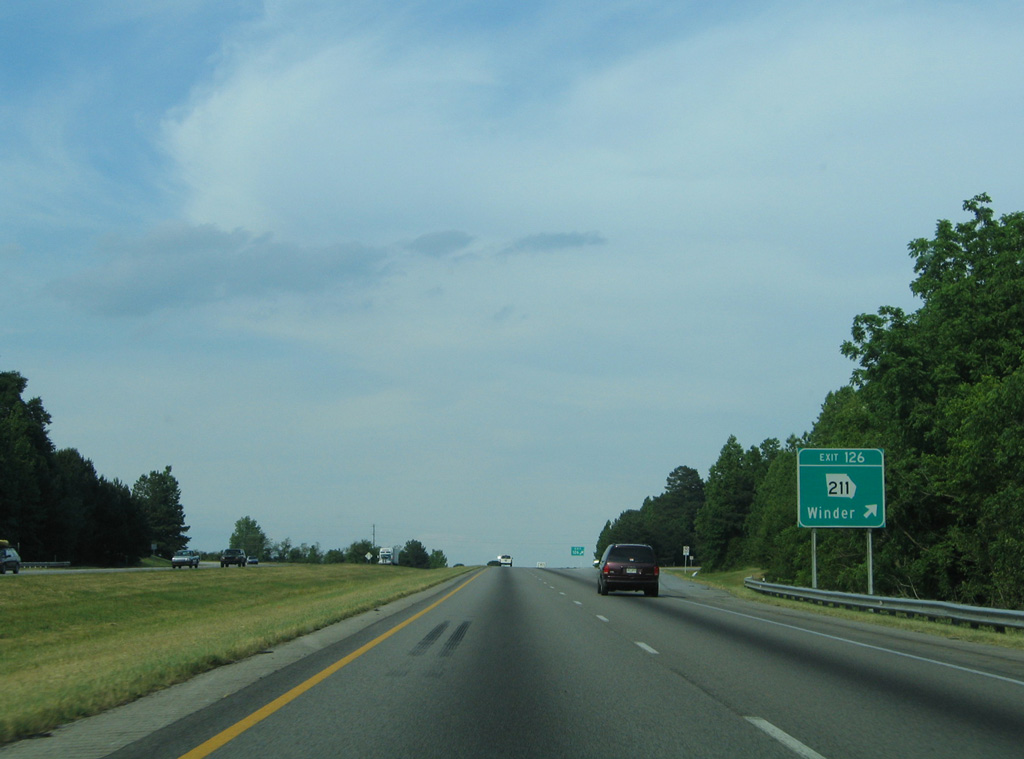
All guide signs for Exit 126 and SR 211 were replaced by April 2012. 05/28/05
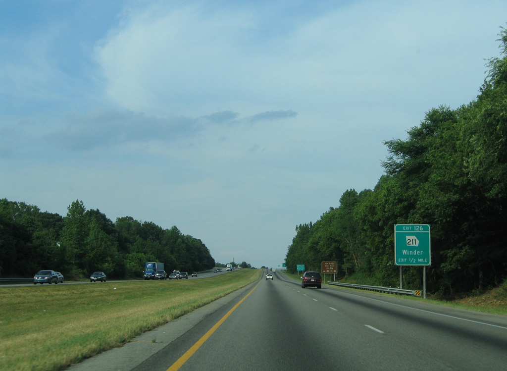
One half mile west of the diamond interchange (Exit 126) with SR 211 on I-85 north. 05/28/05
SR 211 forms an S-shaped route stretching 33 miles from U.S. 29/SR 316 at Statham to SR 60/322 south of Gainesville. 05/28/05
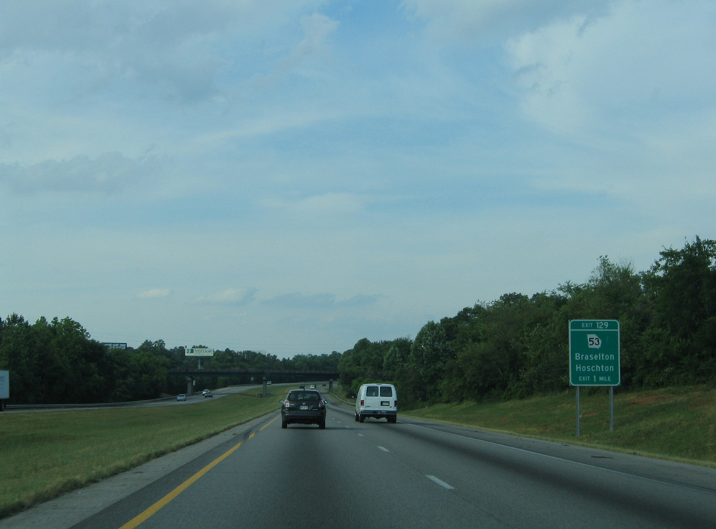
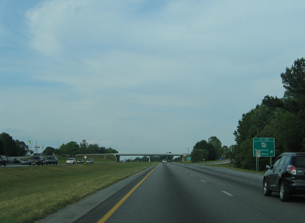
The first of four Jackson County exits along I-85 north joins the freeway with SR 53 at Braselton. 05/28/05
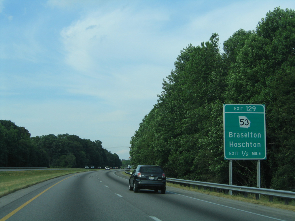
Signs for Exit 129 were replaced by April 2012. The replacements use external exit tabs. 05/28/05
Entering the diamond interchange (Exit 129) with SR 53 (Green Street) on I-85 north. 05/28/05
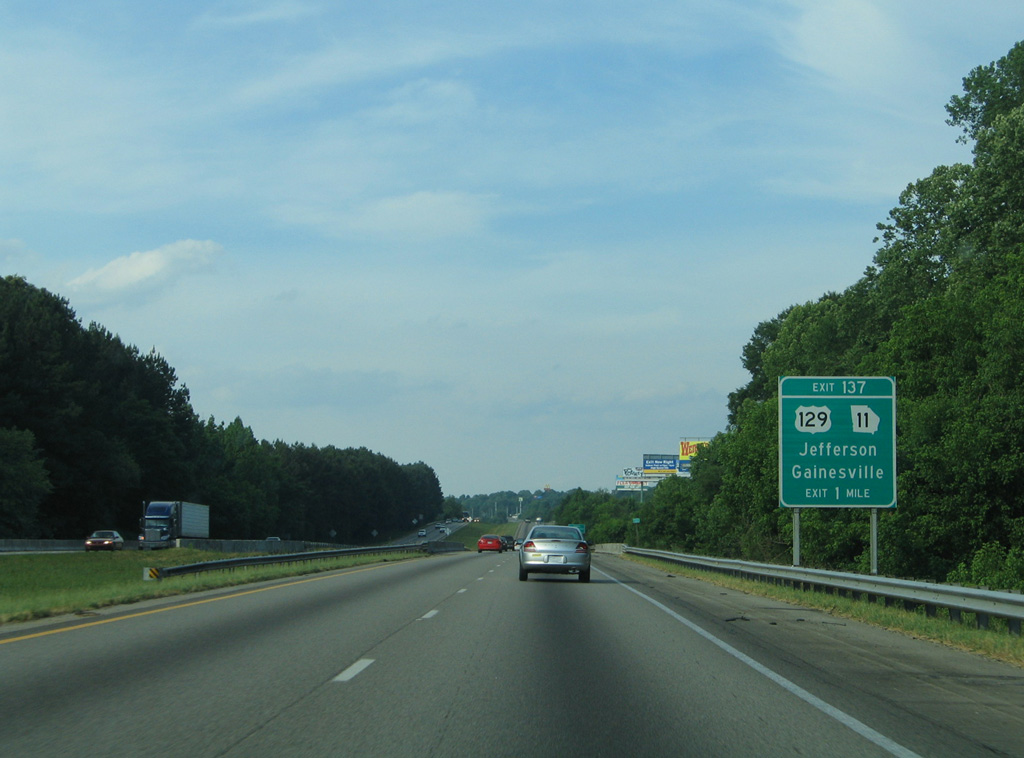
Spanning Walnut Creek, Interstate 85 approached U.S. 129/SR 11 by this guide sign. 05/28/05
Photos by AARoads
Page Updated Friday January 24, 2025.