
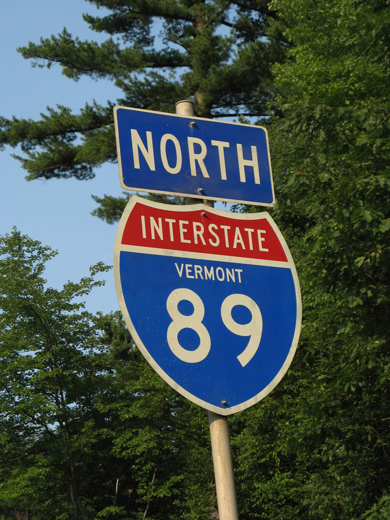
Interstate 89 Vermont – North
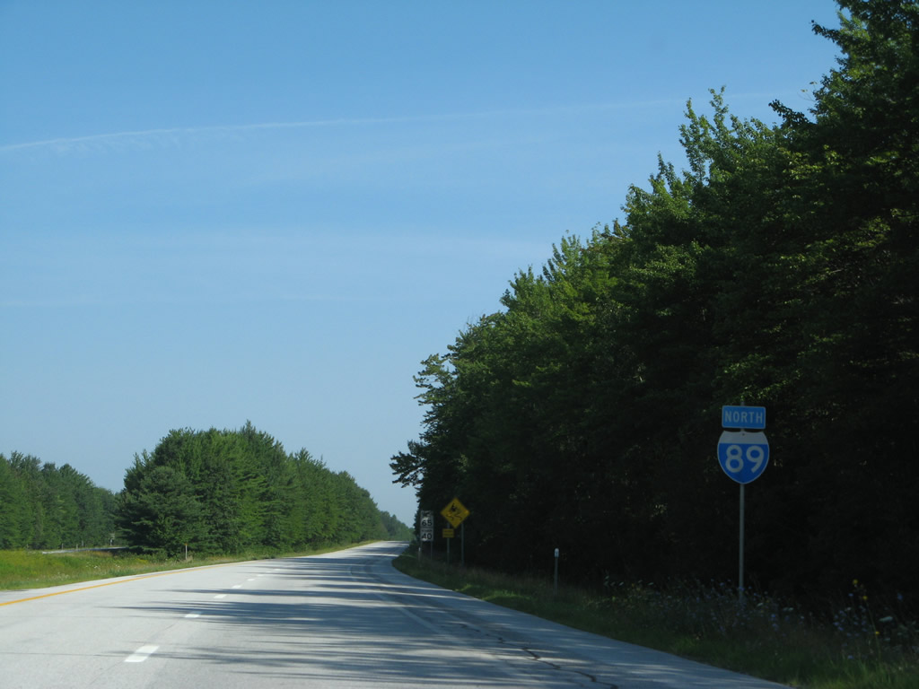
Replaced shield assembly for I-89 north posted after the on-ramp from I-189 east. 07/22/05
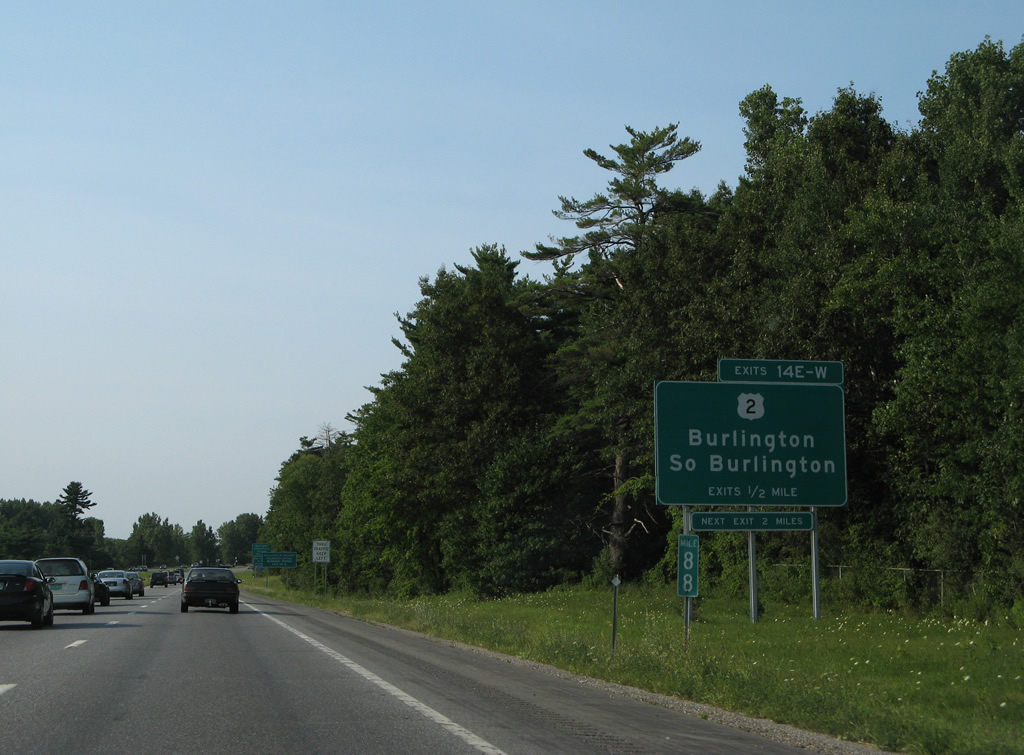
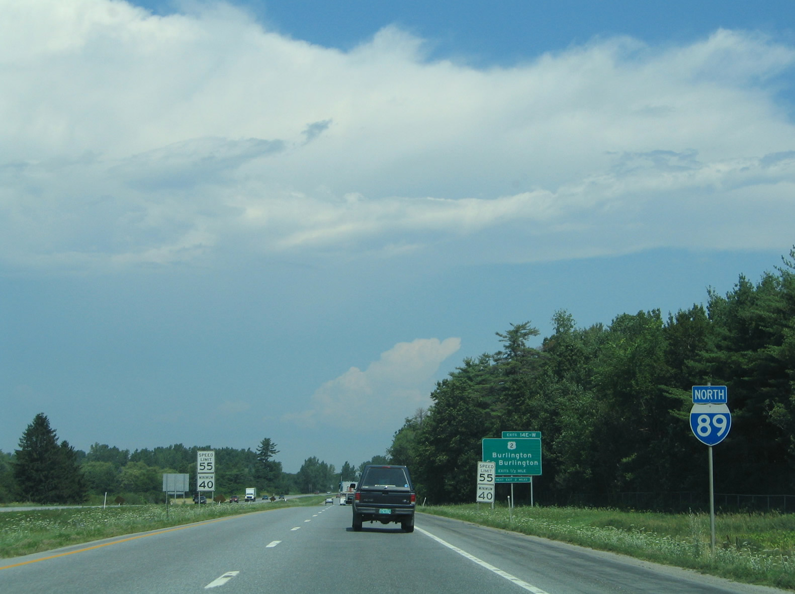
A full cloverleaf interchange joins Interstate 89 with U.S. 2 (Williston Road) just east of the Burlington city line. The next exit two miles placard here was removed with a sign replacement. 08/01/07
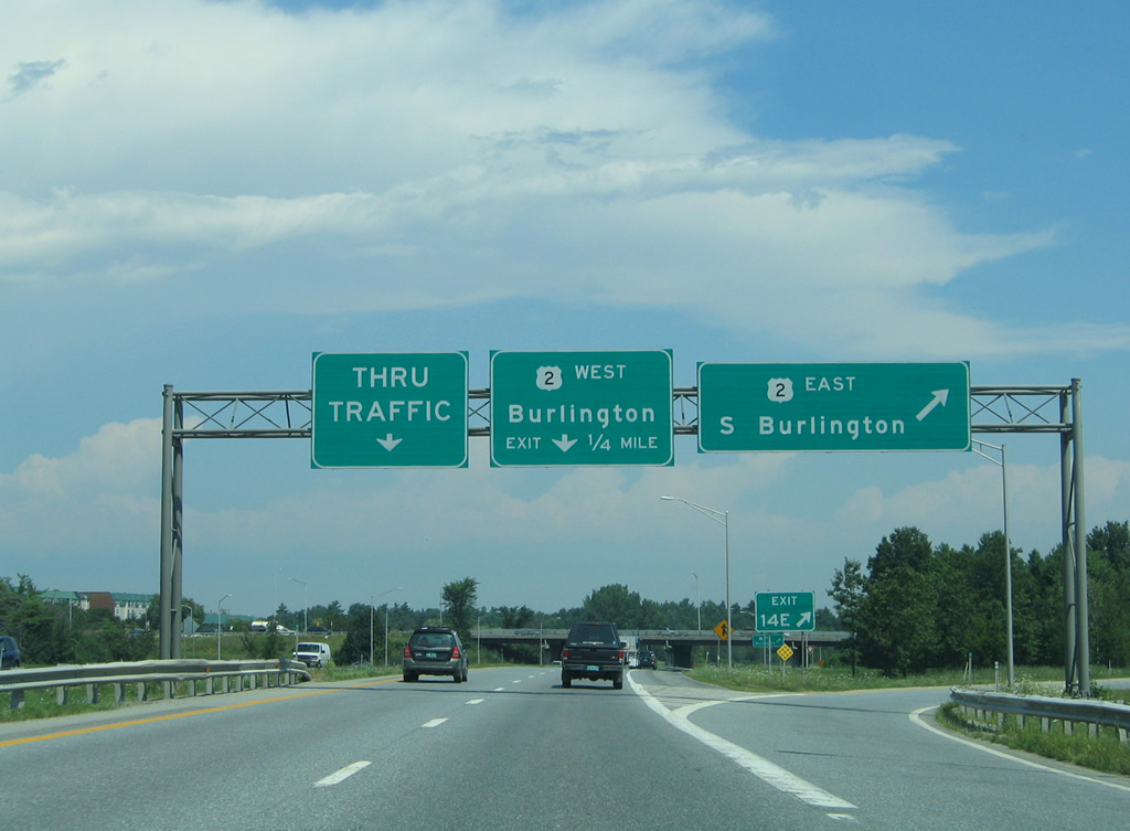
This sign bridge posted at the departure of Exit 14E for U.S. 2 east was replaced with a new assembly. The pull-through panel now reads I-89 north St. Albans instead of the nondescript Thru Traffic. 07/22/05
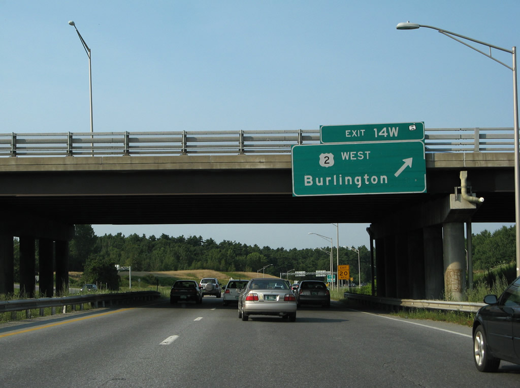
Exit 14W provides a direct, albeit slow, route to Downtown Burlington via U.S. 2 and Main Street west. 08/01/07
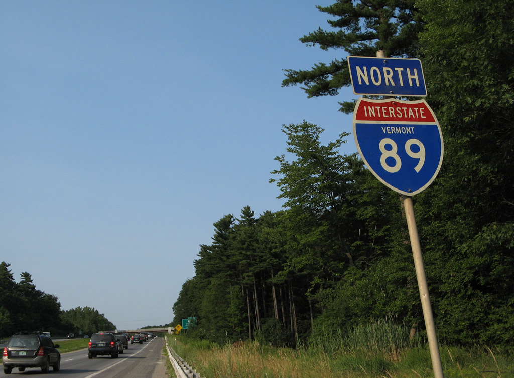
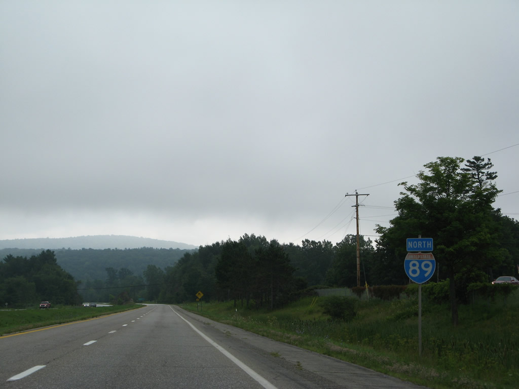
All state-named shields posted along the Interstate 89 mainline were replaced. This assembly preceded the Patchen Road overpass in South Burlington. 07/31/07
All state-named shields posted along the Interstate 89 mainline were replaced. This assembly preceded the Patchen Road overpass in South Burlington. 07/31/07
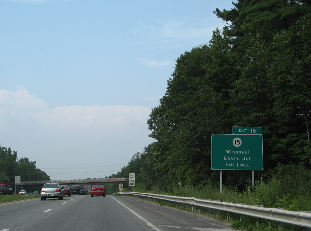
Exit 15 lies one mile ahead with Vermont 15 (Allen Street) west to Downtown Winooski. 08/03/07
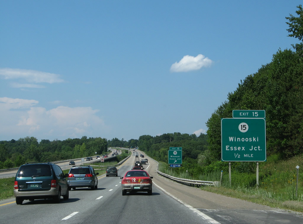
Drivers along Interstate 89 north reach the Winooski River one half mile out from Exit 15 with Vermont 15. A pair of replaced signs directed traffic into an auxiliary lane across the river to the state route. 07/31/07
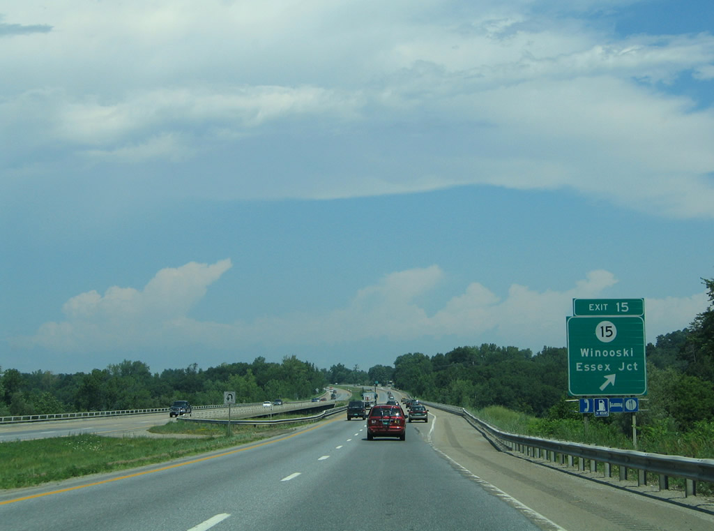
Vermont 15 connects Downtown Winooski with St. Michaels College and the village of Essex Junction to the east of Exit 15. 07/22/05
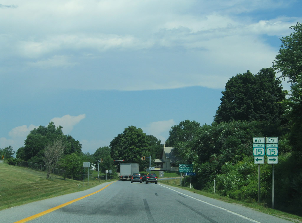
This set of shields for Vermont 15 posted along the Exit 15 off-ramp was removed when a new sign bridge was installed by 2011. 07/22/05
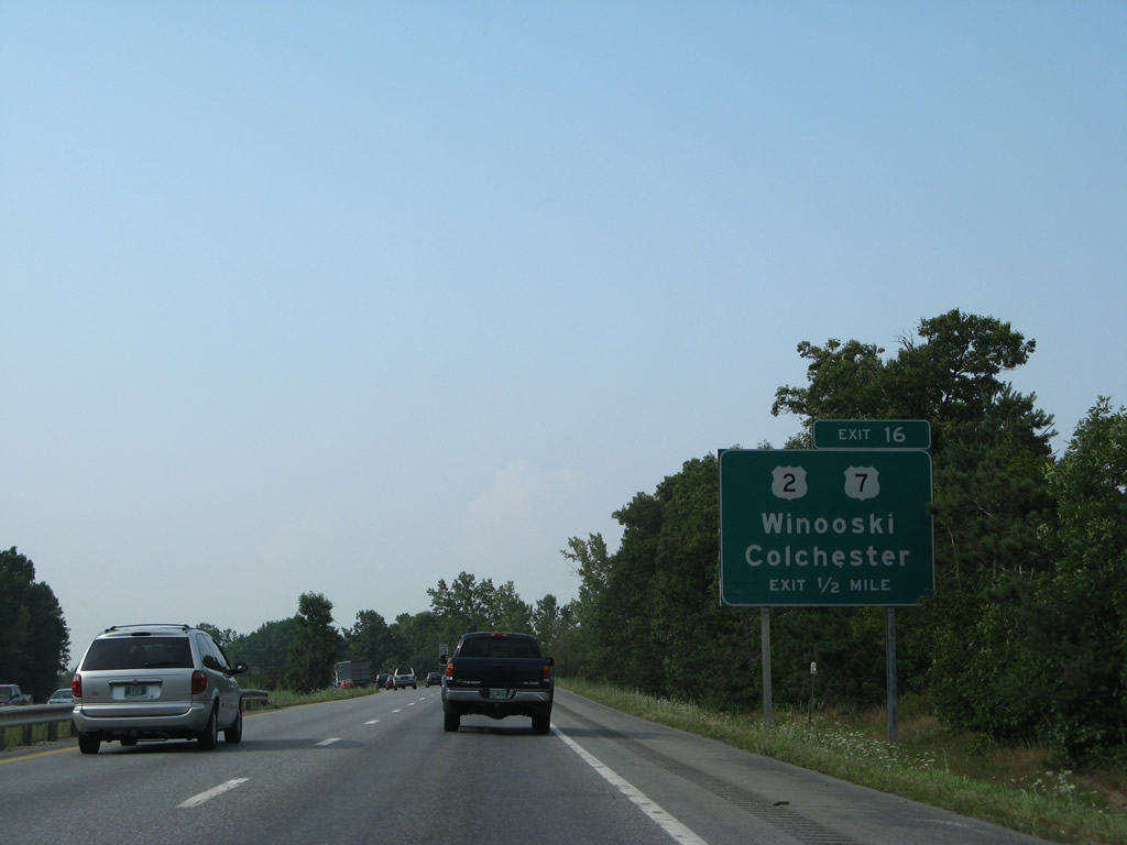
U.S. 2 & 7 follow Main Street north from Downtown Winooski to cross the Colchester town line ahead of Exit 16 with I-89. 08/03/07
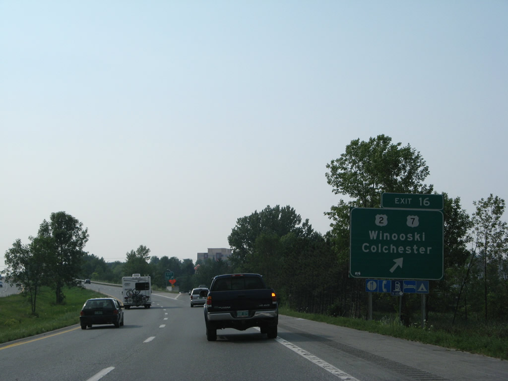
Exit 16 leaves I-89 north for U.S. 2 & 7 north into Colchester just ahead of milepost 92. 08/03/07
Highway Gothic font adorned this mileage sign posted ahead of Sunderland Brook on I-89 north. 08/03/07
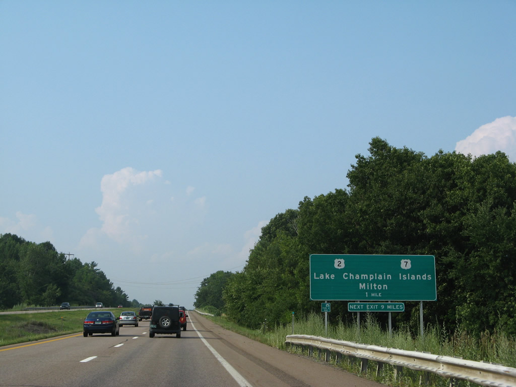
Older guide signs for Exit 17 on I-89 north were devoid of exit tabs for U.S. 2 west to the Lake Champlain Islands and U.S. 7 north into Milton. 08/03/07
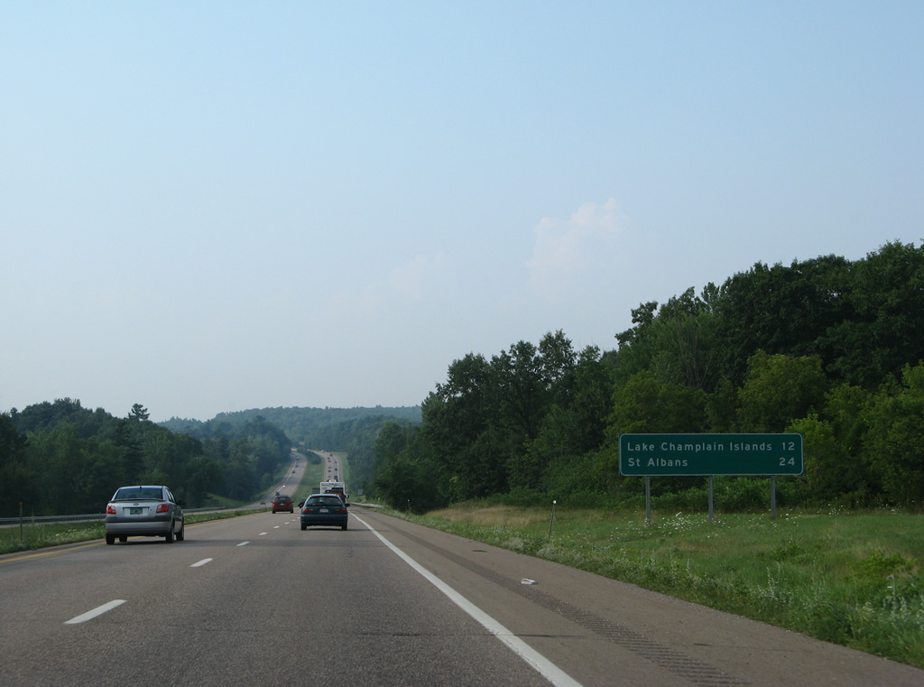
U.S. 2 provides connections to New York state via Vermont 314 to the Grand Isle, VT - Plattsburgh, NY Ferry or the Rouses Point Bridge. 08/03/07
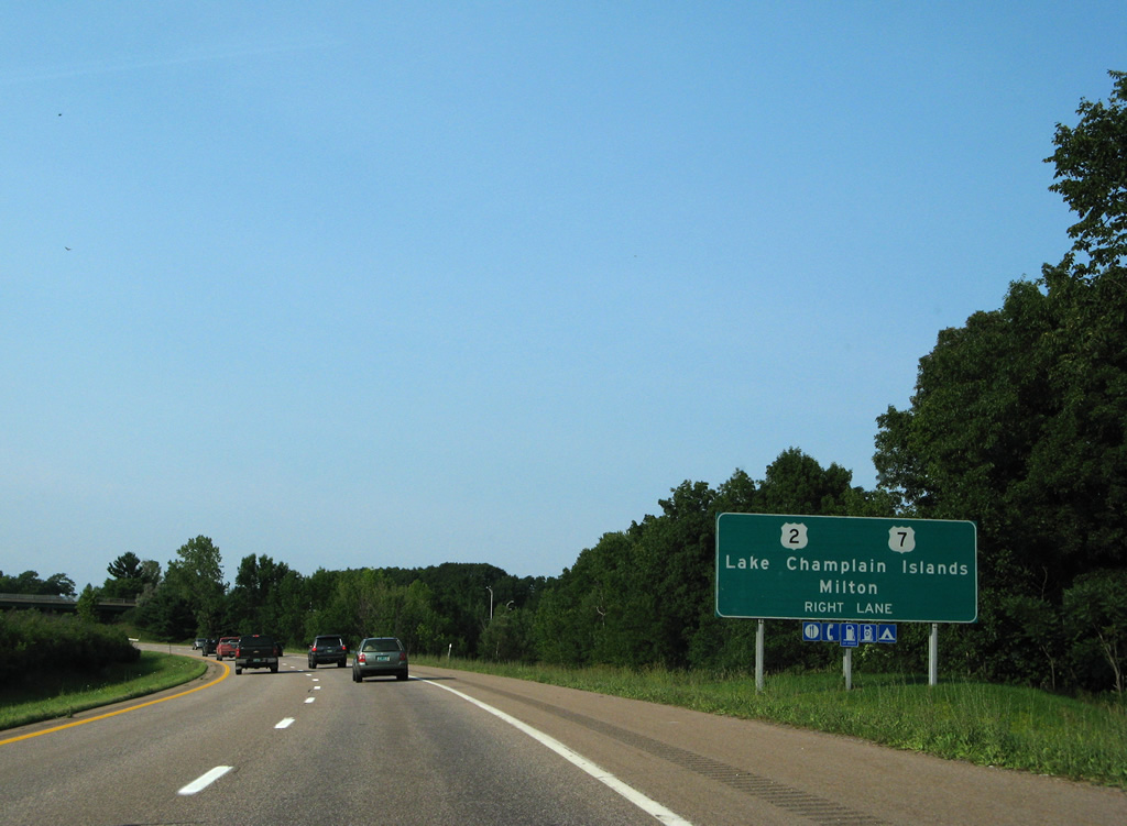
A new sign placed closer to the off-ramp (Exit 17) for U.S. 2 replaced this sign indicating Right Lane. U.S. 2 & 7 part ways with one another just east of the parclo interchange with I-89 at Chimney Corner. 08/01/07
A forested median appears along Interstate 89 through south Milton by this replaced mileage sign. 08/01/07
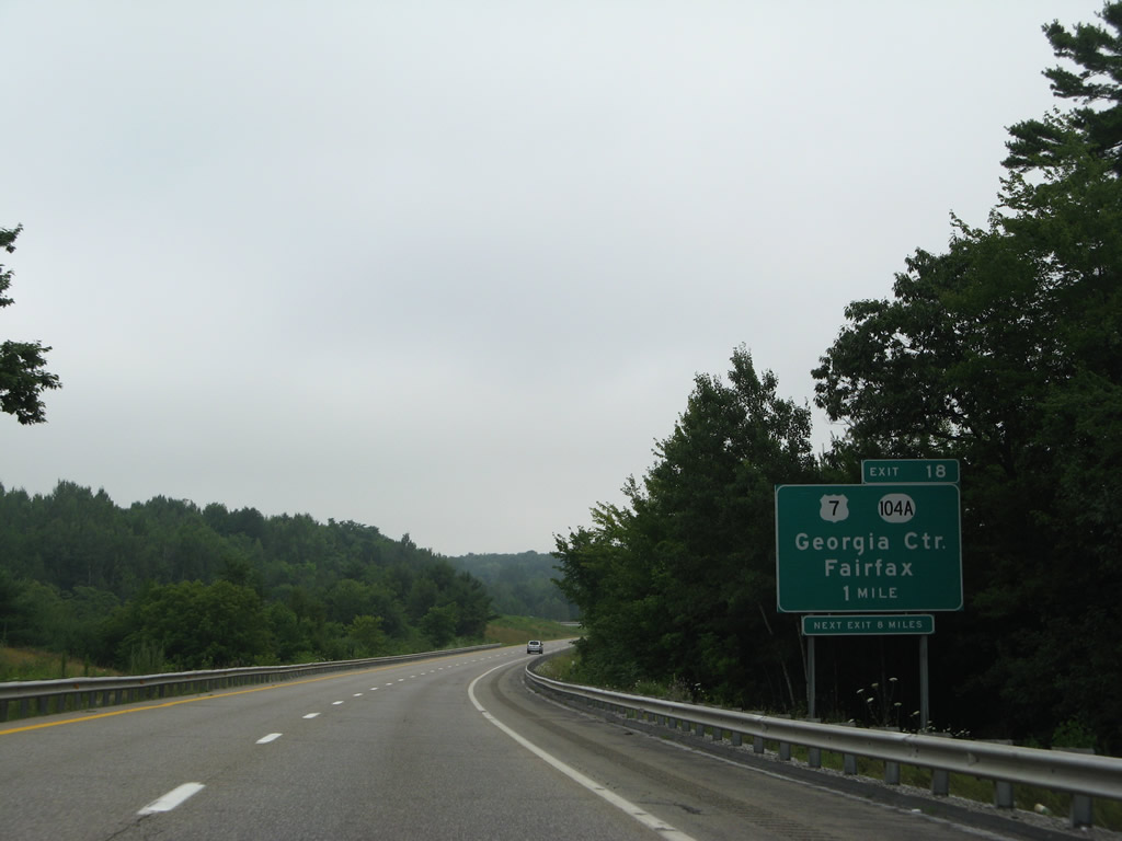
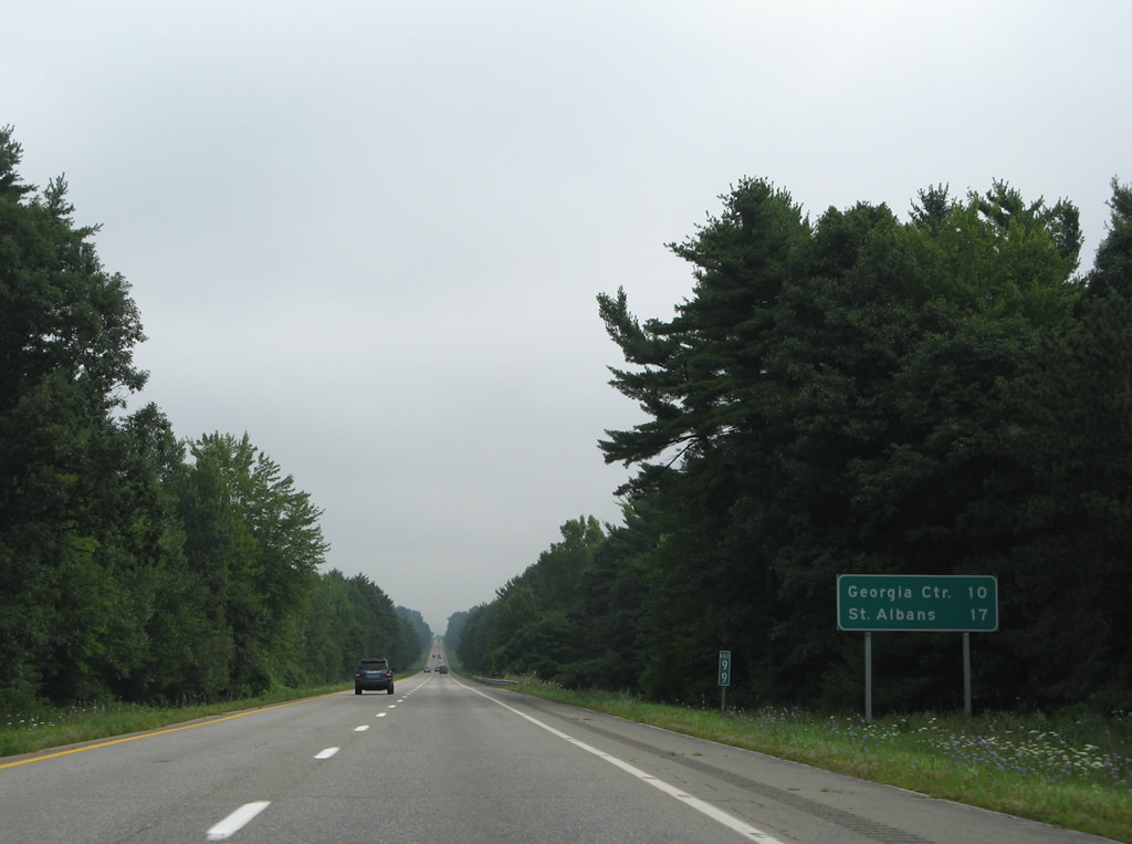
U.S. 7 crosses paths with Interstate 89 for the second time at Exit 18 in the town of Georgia. 08/01/07
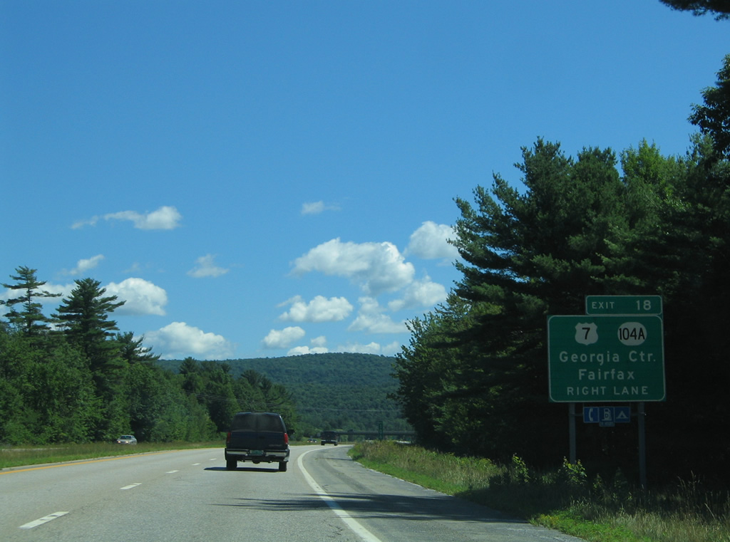
Approaching the off-ramp (Exit 18) for U.S. 7 and adjacent Vermont 104 east, on I-89 north. 07/24/05
Skunk Hill Road appears along side this replaced shield for I-89 at Georgia Regional Dairy Industrial Park. 08/01/07
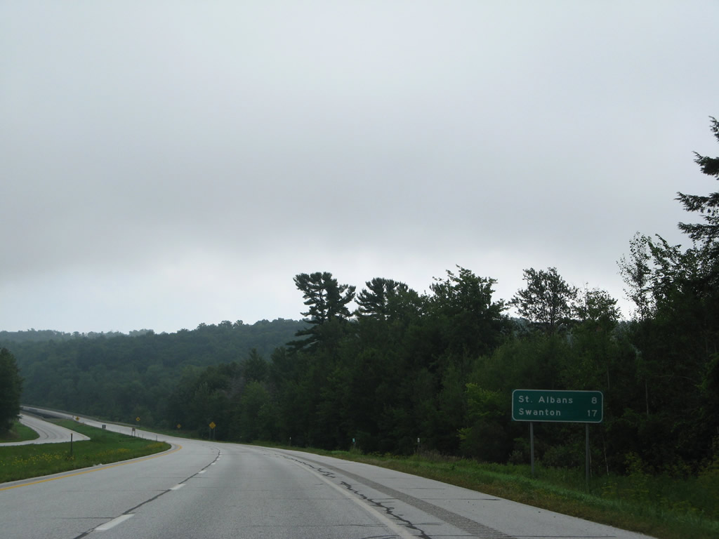
Interstate 89 continues north eight miles to the city of St. Albans. The freeway spans a New England Central Railroad line beyond this former mileage sign. 08/01/07
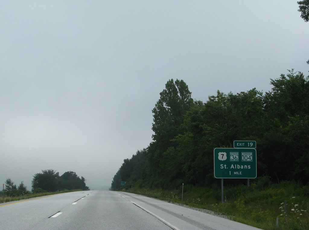
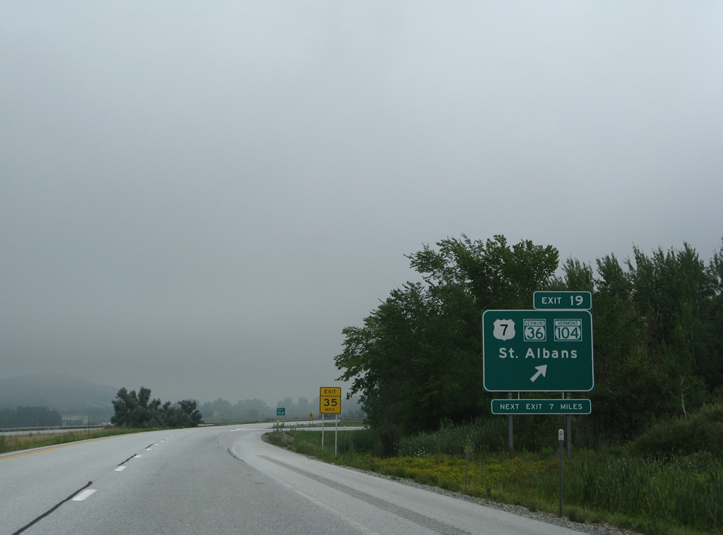
All guide signs for Exit 19 to St. Albans were replaced by 2011. 08/01/07
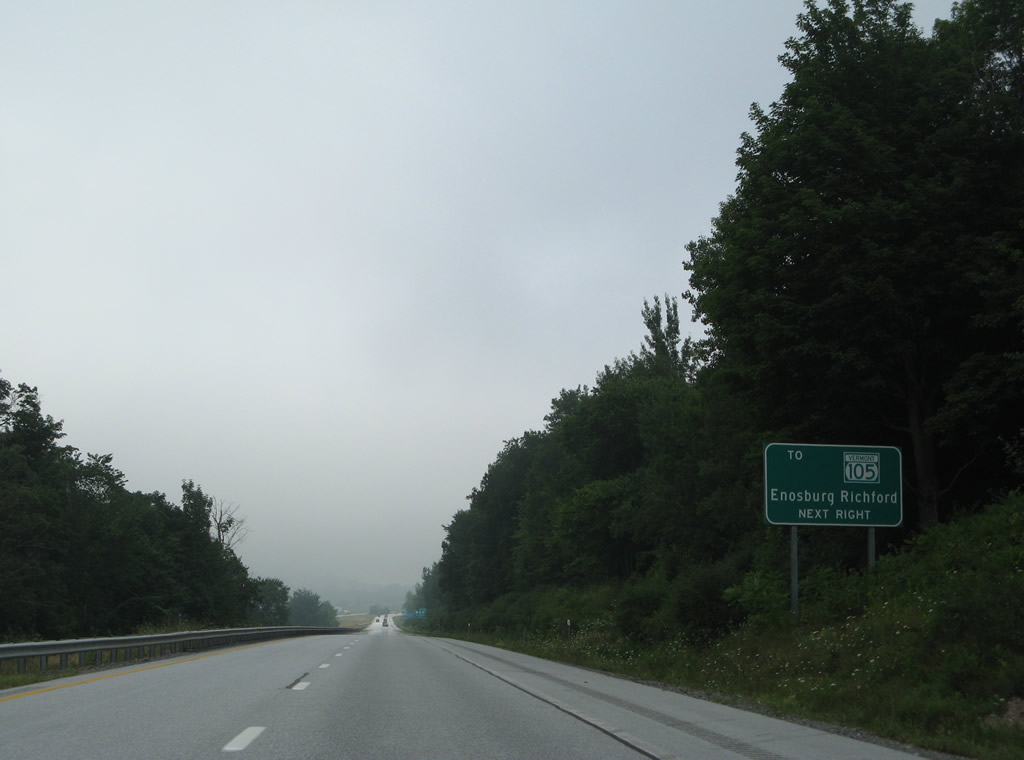
An auxiliary sign touts the connections of Vermont 104 north to Vermont 105 for points east including Enosburg and Richford. The new sign includes a shield for VT 104. 08/01/07
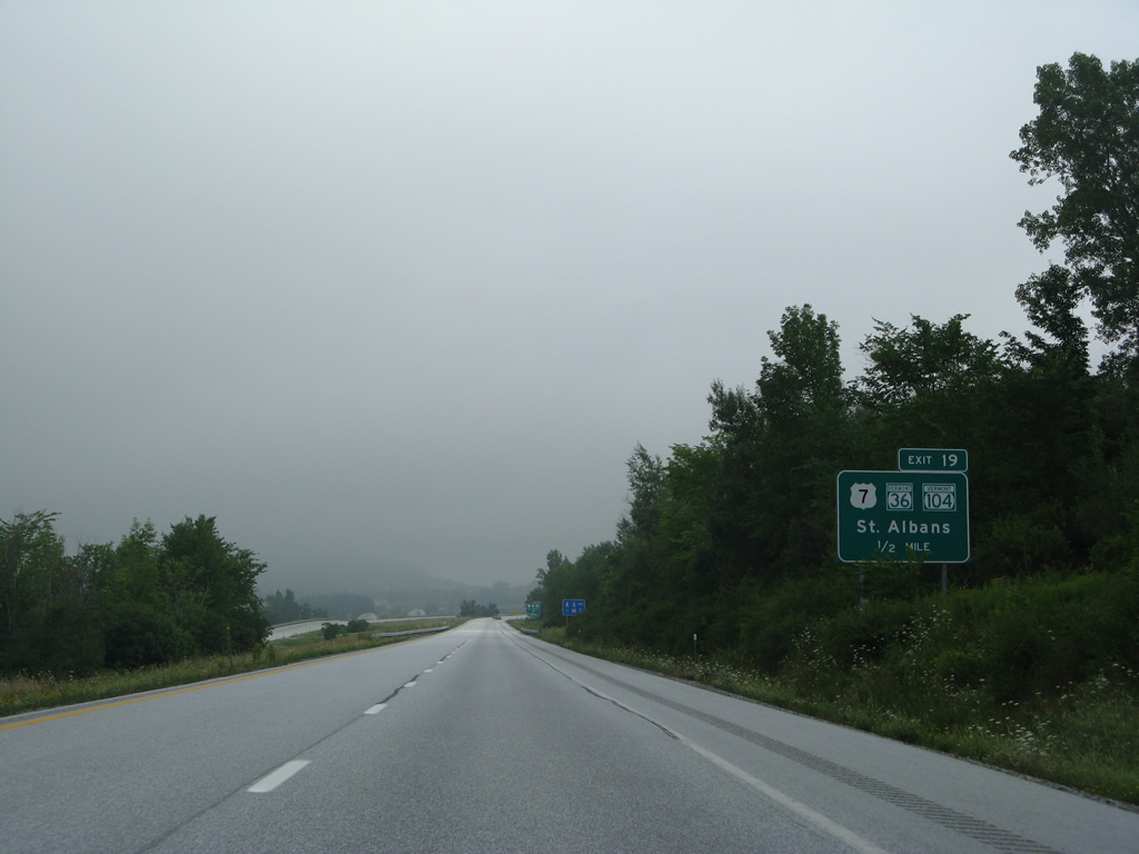
Exit 19 departs one half mile ahead as Interstate 89 passes by milepost 113. 08/01/07
nterstate Access Road stems 1.3 miles west from Exit 19 to adjacent Vermont 104 (Fairfax Road) and U.S. 7 (Main Street). 08/01/07
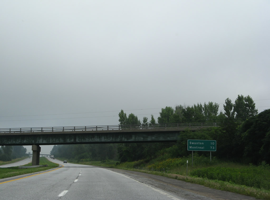
Mileage sign posted ten miles south of Swanton at the VT 36 overpass. 08/01/07
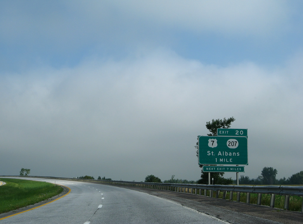
Approaching the diamond interchange (Exit 20) with Vermont 207 on I-89 north. 08/01/07
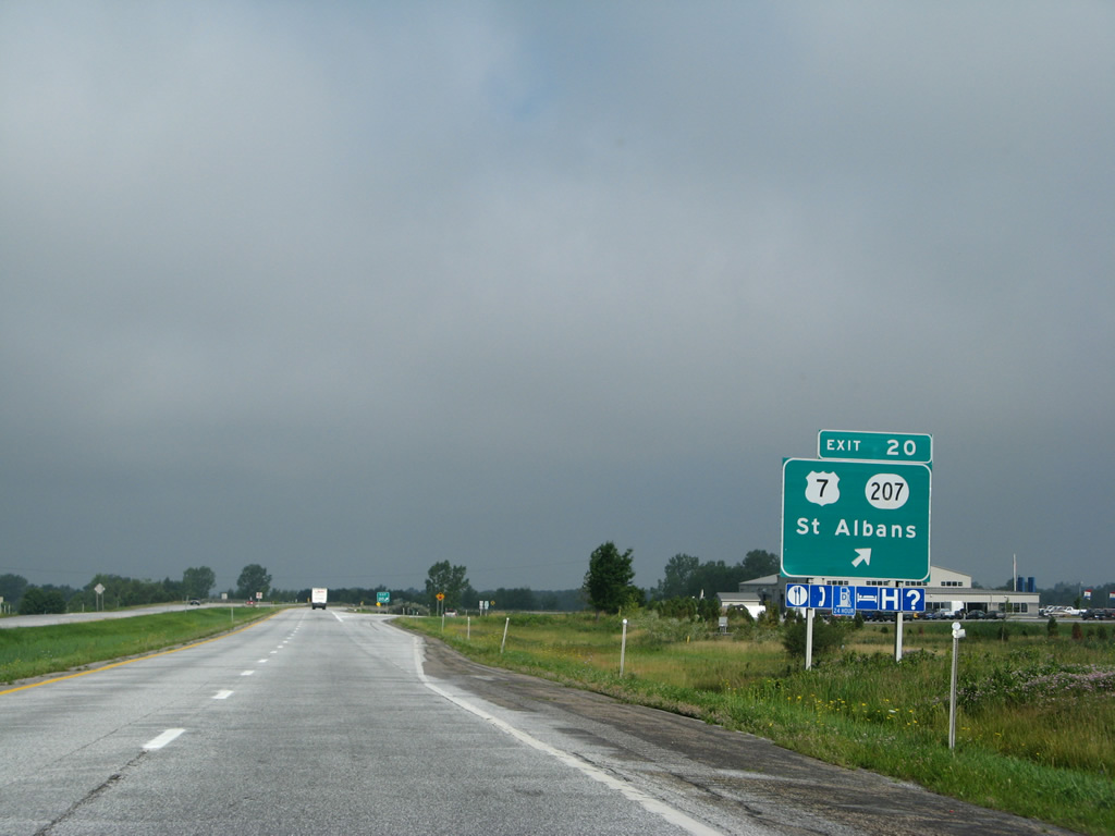
Exit 20 leaves I-89 north after milepost 117 for VT 207 north to Highgate Center and south to adjacent U.S. 7 in St. Albans. 08/01/07

A wide forested median separates the roadways of Interstate 89 through south Swanton. 08/01/07
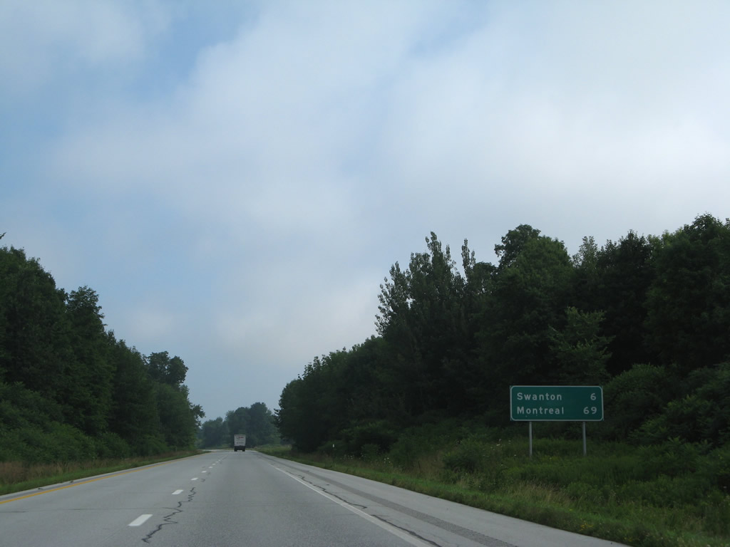
Interstate 89 extends north through Swanton six miles to the village center. 08/01/07
Vermont 78 (1st Street) joins Interstate 89 with U.S. 7 in the village of Swanton to the west at Grand Avenue. 08/01/07
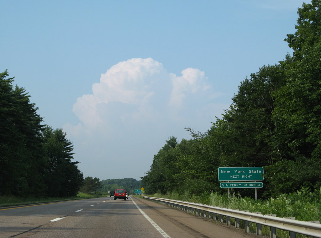
A 17-mile drive takes motorists to New York state via VT 78 and U.S. 2 across the Rouses Point Bridge. 08/01/07
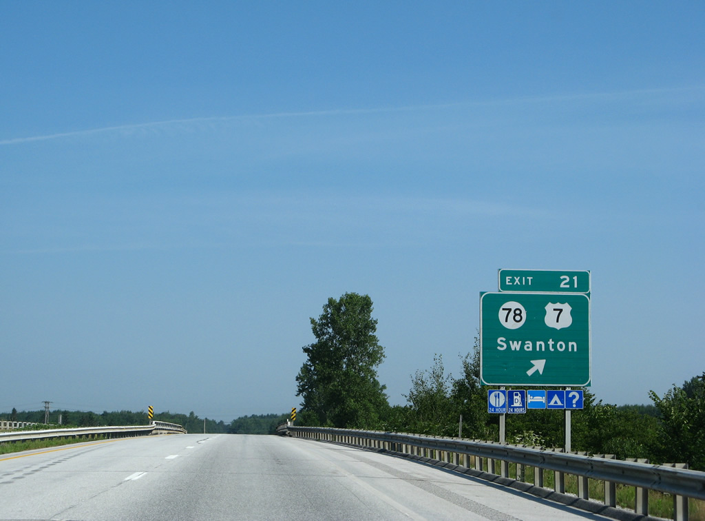
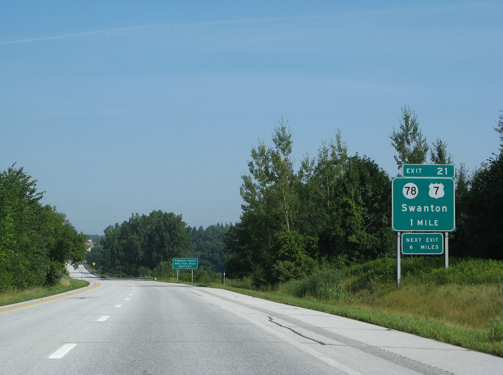
Replaced guide sign posted at the off-ramp (Exit 21) to Vermont 78 (1st Street). VT 78 heads east to Franklin County State Airport (FSO) and Highgate Center. 08/01/07
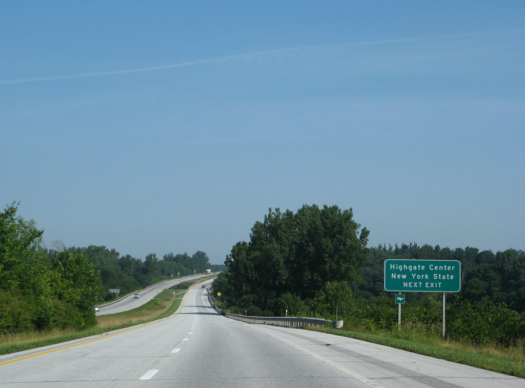
Progressing northward to the Highgate town line along I-89. 08/01/07
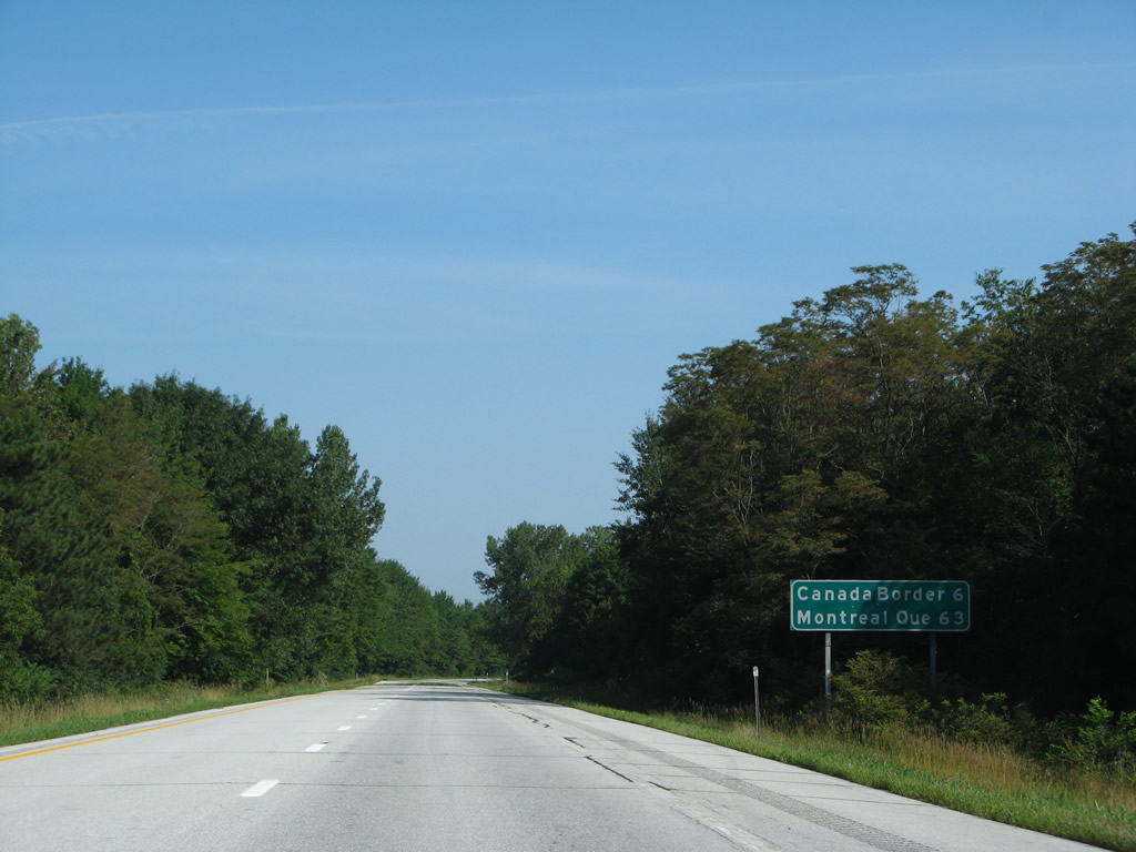
The replacement of this mileage sign dropped Quebec from the distance to Montreal. 08/01/07
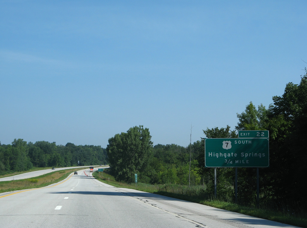
U.S. 7 and I-89 come together for a final time at Exit 22 just south of the international border. 08/01/07
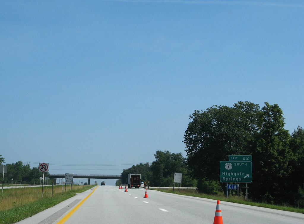
Exit 22 departs I-89 north for U.S. 7 south to Highgate Springs. Noticeably absent are signs referencing this as the last U.S. exit. 08/01/07
Photos by AARoads
Page Updated Friday January 24, 2025.