
Interstate 94 North Dakota - East

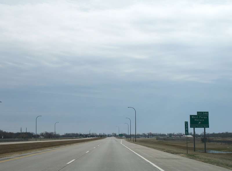
Annexations of West Fargo to areas of farm land to the south of Interstate 94 resulted in sign changes reflecting Sheyenne Street in place of Horace. County Road 17 runs south to the rural city from Exit 346. 04/22/07
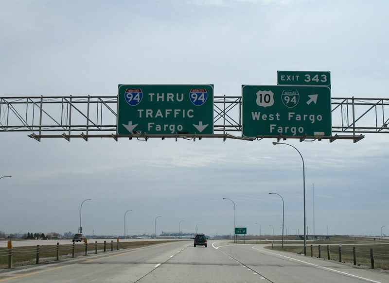
Changes made at Exit 343 by 2015 replaced West Fargo and Fargo with Main Avenue and eliminated Thru Traffic and Fargo for the pull through panel. 04/22/07
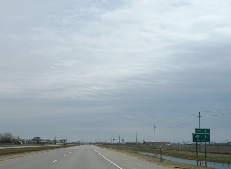
This rural scene 1.5 miles ahead of 45th Street is now home to an interchange with Veterans Boulevard (Exit 347) and Sanford Medical Center Fargo. 04/22/07
The final four North Dakota interchanges along I-94 & U.S. 52 east serve the state's largest city. An on-ramp joins the freeway east from Veterans Boulevard in place of this ground level sign. 04/22/07
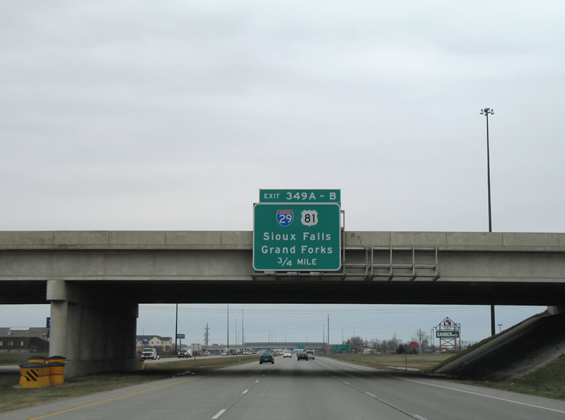
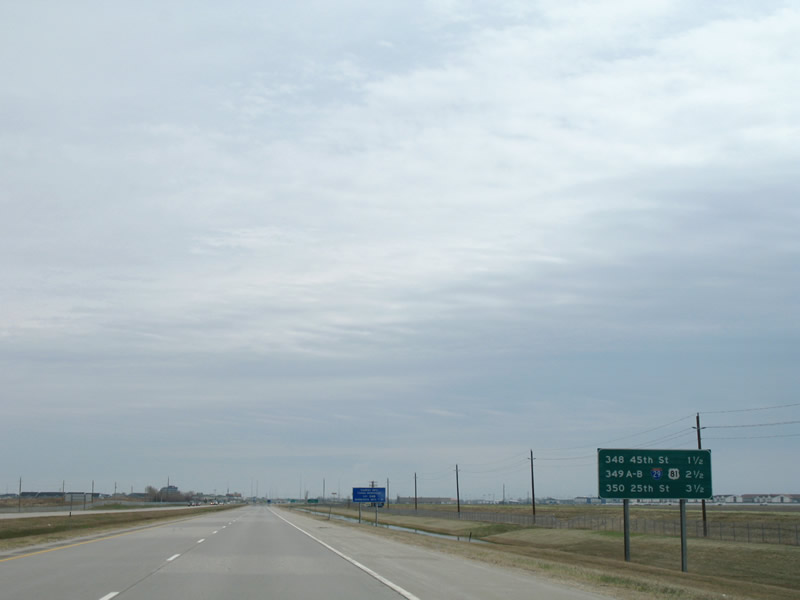
All signs for Interstate 29 & U.S. 81 were replaced by 2015 to reflect the extension of the third eastbound lane from the 45th Street South on-ramp to Exits 349A/B. 04/22/07
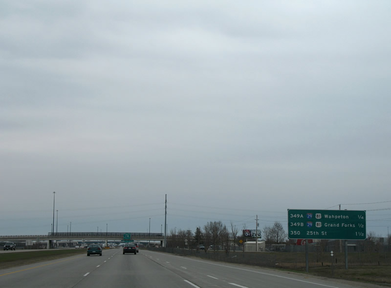
Wahpeton was the previous control city highlighted on this interchange sequence sign posted ahead of I-29 & U.S. 81 south. It was replaced by 2015 to display Sioux Falls. 04/22/07
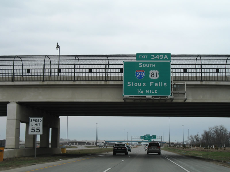
A lane drop occurs now at Interstate 29 & U.S. 81. 04/22/07
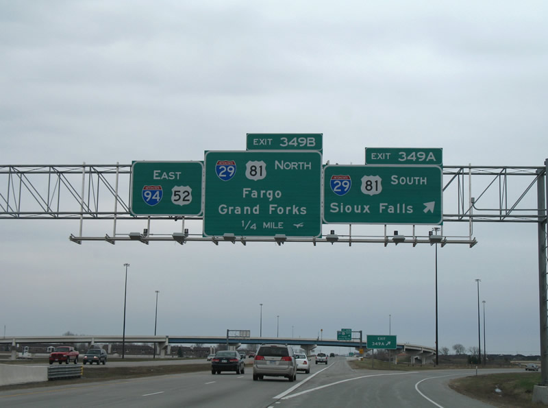
Fargo was dropped as a control point for Interstate 29 & U.S. 81 north while Minneapolis was added to the pull through panel for I-94 in 2015. 04/22/07
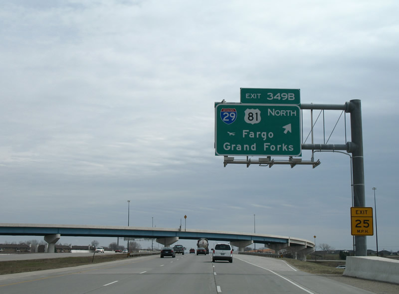
This overhead for Exit 349B was replaced to included an Exit Only placard. 04/22/07
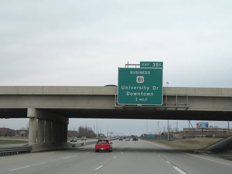
A Clearview font based sign replaced this overhead for U.S. 81 Business by 2015. 04/22/07
Removed by 2013, this interchange sequence sign referenced the first three Minnesota interchange. Clay County 52 (Exit 2) represents the original U.S. 52 alignment and return of Business Loop Interstate 94 from Fargo. 04/22/07
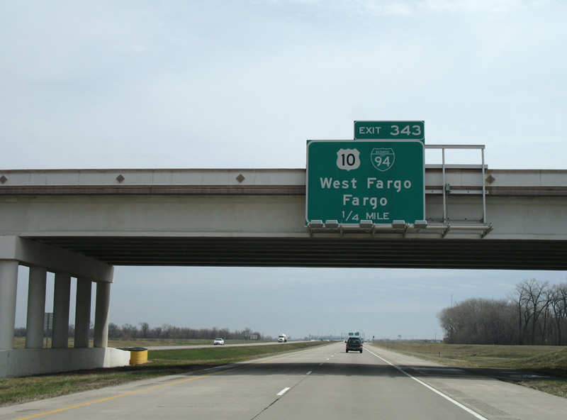
Guide signs for Exit 343 to U.S. 10 & Business Loop I-94 were replaced by 2015 to use Clearview font. 04/22/07
Photos by AARoads
Page Updated Friday January 24, 2025.