
I-95 Rhode Island – North

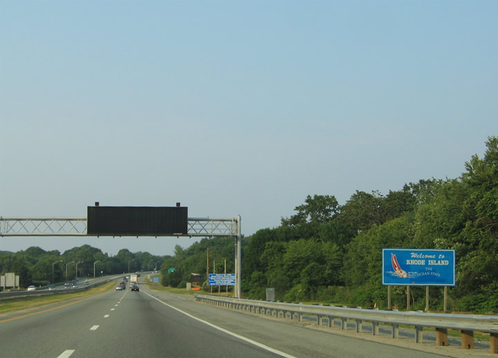
This style of welcome sign for Rhode Island was phased out by 2007. 06/25/05
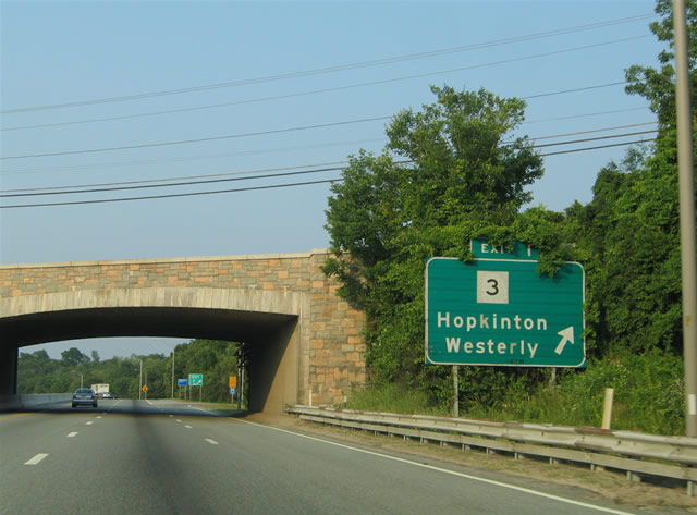
An older ground level guide sign directed motorists from I-95 north onto the loop ramp (Exit 1) for Rhode Island 3. This sign was replaced with a new overhead assembly by 2007. 06/26/05
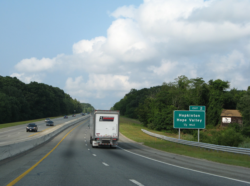
Sign changes made for Exit 2 along I-95 north by 2007 replaced Alton with Hopkinton. 06/26/05
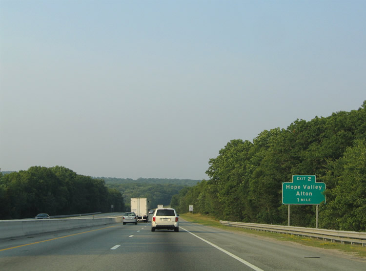
The quarter mile sign for the diamond interchange (Exit 2) with Woodville Alton Road was removed and a new sign added at a half mile out. 07/28/07
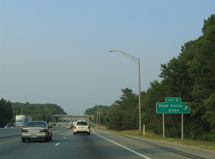
Interstate 95 north at Exit 2. This ground level sign was replaced with a new overhead assembly by 2007. 06/26/05
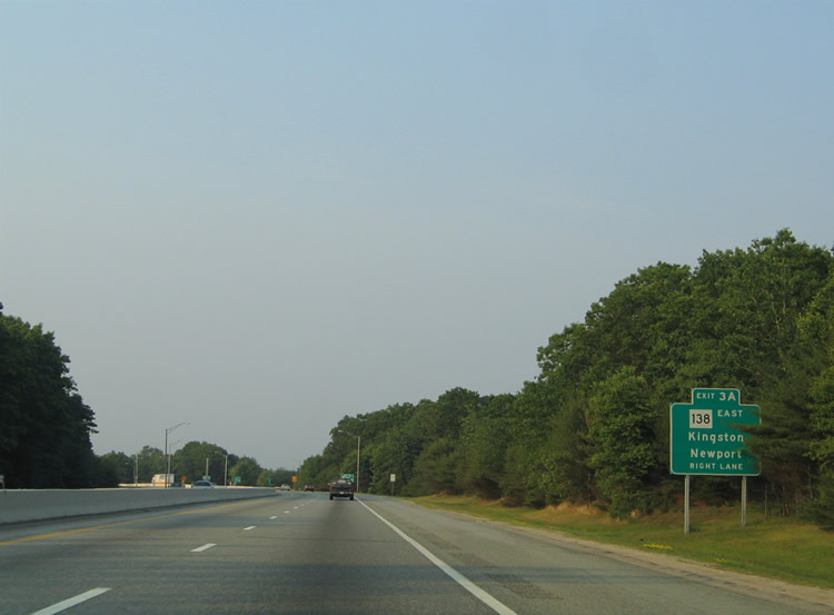
Sign changes made for Exit 3A and Rhode Island 138 east on I-95 north replaced Newport and Kingston with South Kingstown and Wyoming. Kingston and Newport are highlighted on auxiliary signage now. 06/26/05
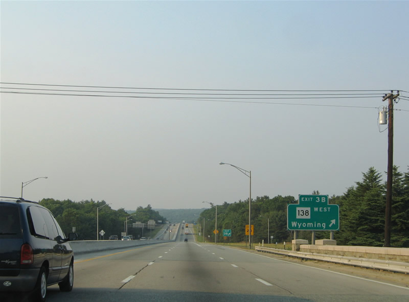
Within the cloverleaf interchange at Rhode Island 138, this ground level sign directed motorists onto Exit 3B for Wyoming. It was replaced with a new overhead by 2007. 06/26/05
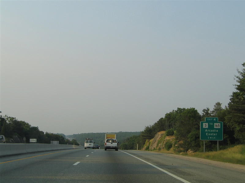
Interstate 95 lowers toward Moonshine Swamp on the one mile approach to Exit 4. Signs for Rhode Island 3 to Rhode Island 165 were replaced by 2007. 06/26/05
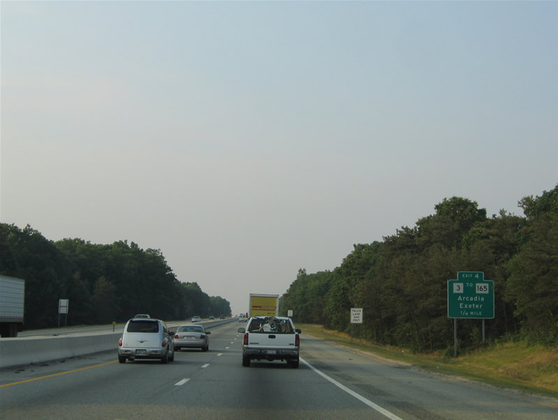
This sign was posted one quarter mile ahead of the half diamond interchange (Exit 4) with Rhode Island 3 in the town of Richmond. A new sign for Exit 4 was erected at a half mile distance from the off-ramp by 2007. 06/26/05
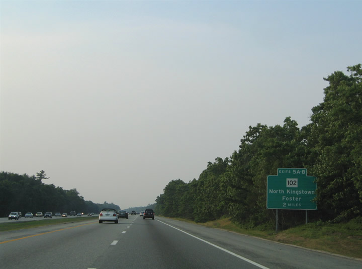
The two mile sign on I-95 north for Exit 5 and Rhode Island 102 was no longer posted as of 2007. 06/25/05
One mile south of the full cloverleaf interchange (Exits 5A/B) with R.I. 102 on I-95 north. Sign changes made by 2007 switched out Foster for West Greenwich for the state route north. 06/26/05
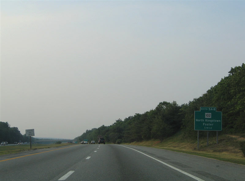
The quarter mile sign for Exit 5A and R.I. 102 east at the Austin Farm Road overpass was replaced with a half mile sign listing both Exits 5A/B by 2007. 06/26/05
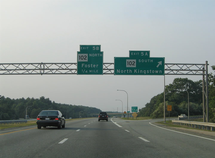
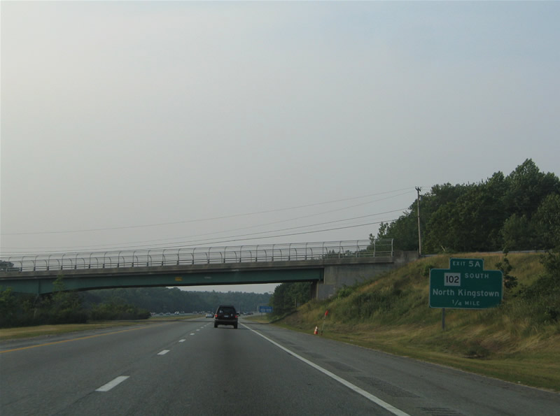
This sign bridge directed traffic to Exit 5A and North Kingstown via Rhode Island 102 east and Foster for Rhode Island 102 west. It was replaced with a new assembly in 2007. 06/26/05
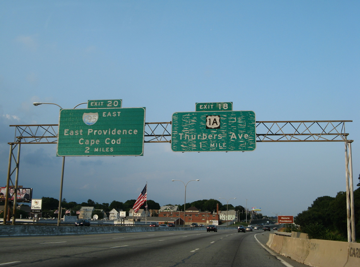
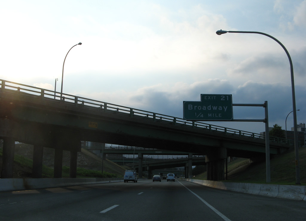
Interstate 95 northbound skips to Exit 18 (Exit 17 serves U.S. 1 from southbound) for Thurbers Avenue and U.S. 1A (Allens Avenue). Featured in this photograph was the one-mile overhead for Exit 18 and the first sign for Interstate 195 & U.S. 6 east to East Providence and Cape Cod. 07/28/07
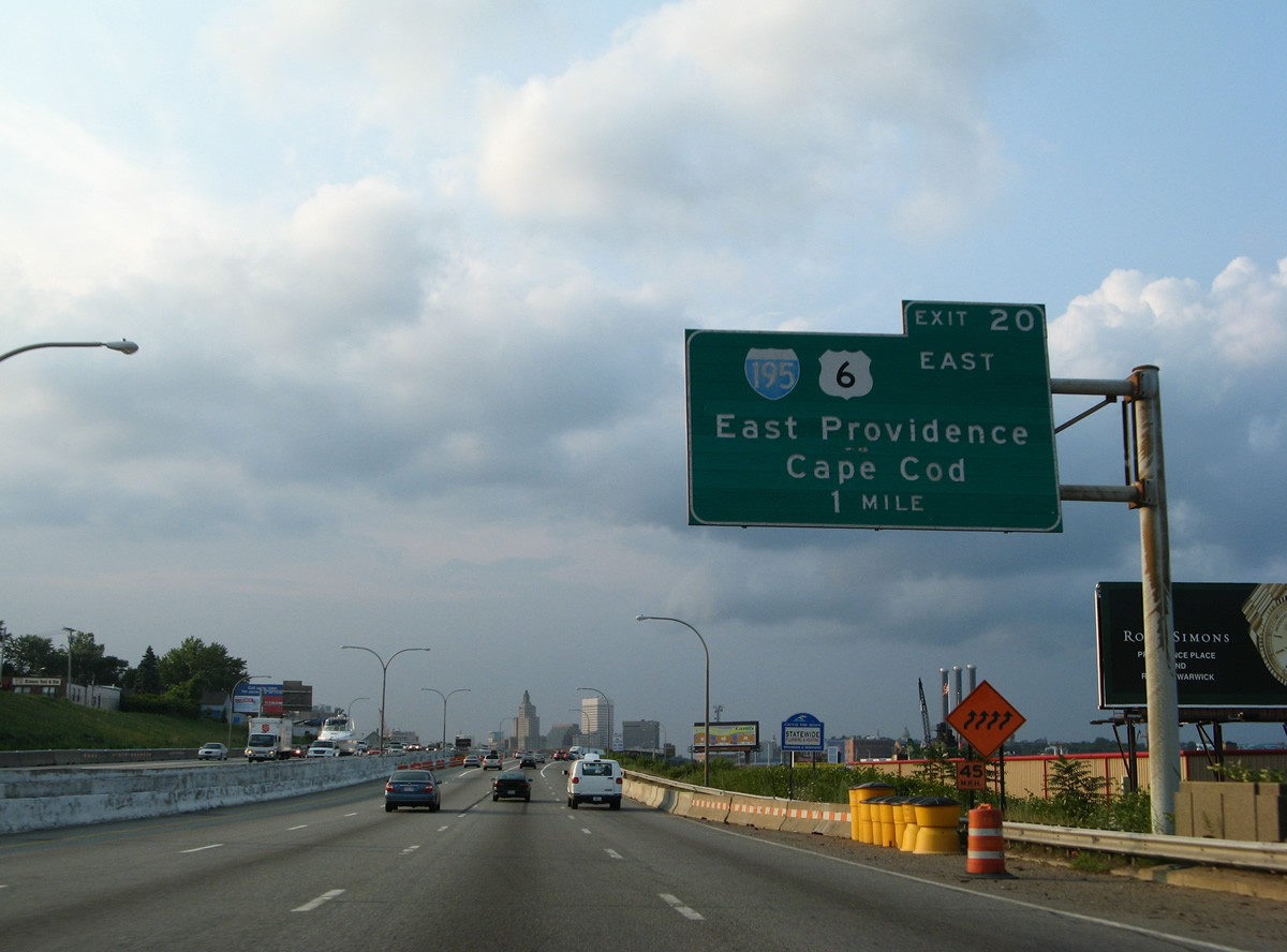
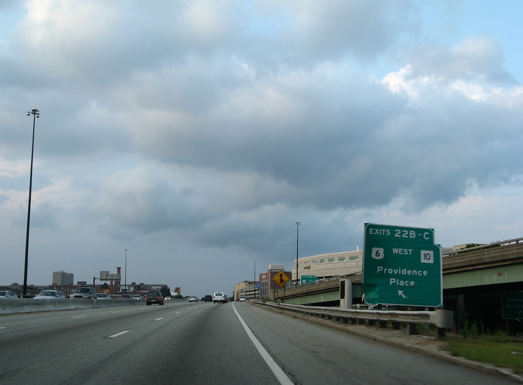
What was the original one-mile guide sign for Interstate 195 & U.S. 6 east before the Iway project relocated the freeway southward. The old Interstate 195 to the north was demolished by 2012. 07/28/07
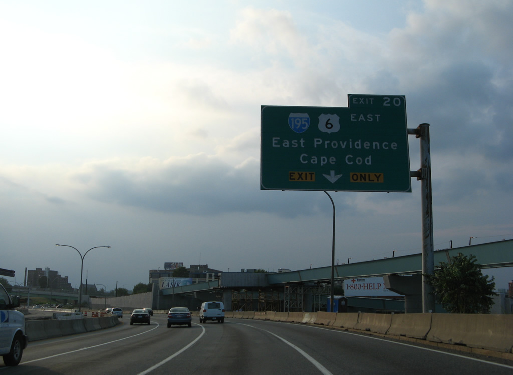
Exit 20 originally served the eastbound beginning of Interstate 195 at a directional interchange north of Point Street. The interchange was removed and a new Exit 20 now connects Interstate 95 north with Point Street. 07/28/07
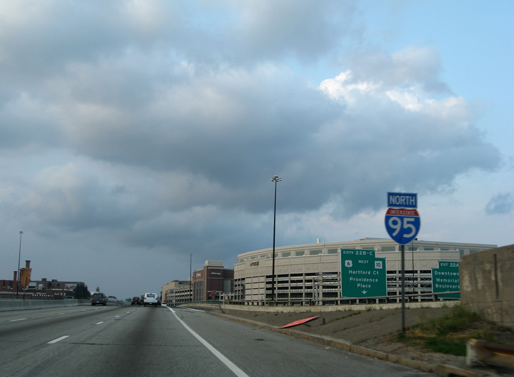
A look at the original directional interchange between Interstates 95-195 and U.S. 6. New ramps here now connect I-95 south with Rhode Island Hospital and Franklin Street north with I-95 north. All remnants of the former Interstate 195 were demolished by 2012. 07/28/07
Removed guide sign posted along Exit 22 ahead of the split of ramps for Memorial Boulevard east and the Huntington Expressway west. An on-ramp dropped onto Interstate 95 north from Franklin Street above. 07/28/07
Reassurance shield for Interstate 95 formerly posted ahead of the Exchange Street underpass at the 1964-built Providence Viaduct. 07/28/07
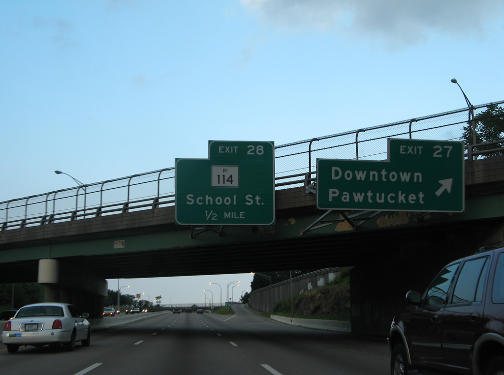
Exit 28 originally departed east of the Seekonk River on I-95 north. The 2010-13 Pawtucket River Bridge construction project added a new collector distributor roadway for R.I. 114 and School Street. The c/d roadway departs just beyond the Pine Street overpass instead of a half mile east of Exit 27. 07/28/07
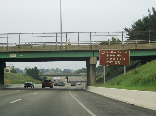
Northbound at the Pine Street overpass at downtown Pawtucket. Exit 28 departs here now for the Old Slater Mill historic site via Rhode Island 114 (School Street) north across the Seekonk River. 06/26/05
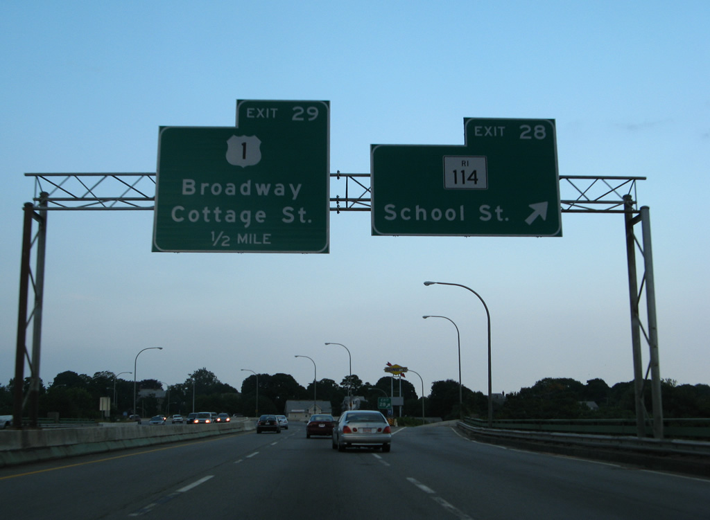
Interstate 95 originally spanned the Seekonk River across bridges built in 1958 through to the off-ramp (Exit 28) to Rhode Island 114 (School Street). The new c/d roadway separates traffic to the School Street exit and on-ramp from George Street (U.S. 1 north) from the freeway mainline now. 07/28/07
Photos by AARoads
Page Updated Friday January 24, 2025.