
I-95 South Carolina – North
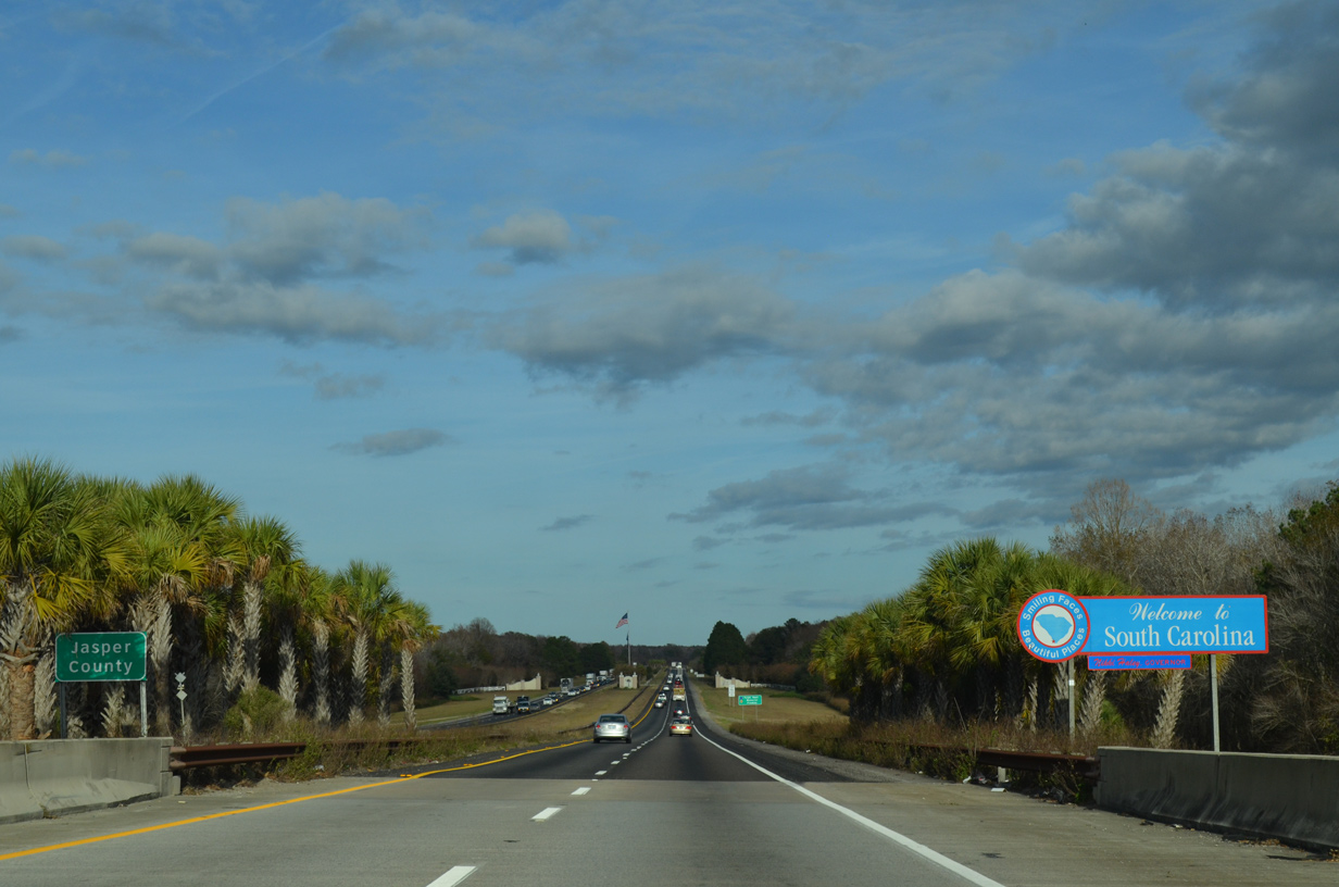
Older style welcome sign at the Savannah River. 12/19/13
All Highway Gothic font based guide signs posted along Interstate 95 from the Georgia state line northward to the Orangeburg County line (just ahead of I-26) were replaced with Clearview font based signs in 2010. 03/14/10
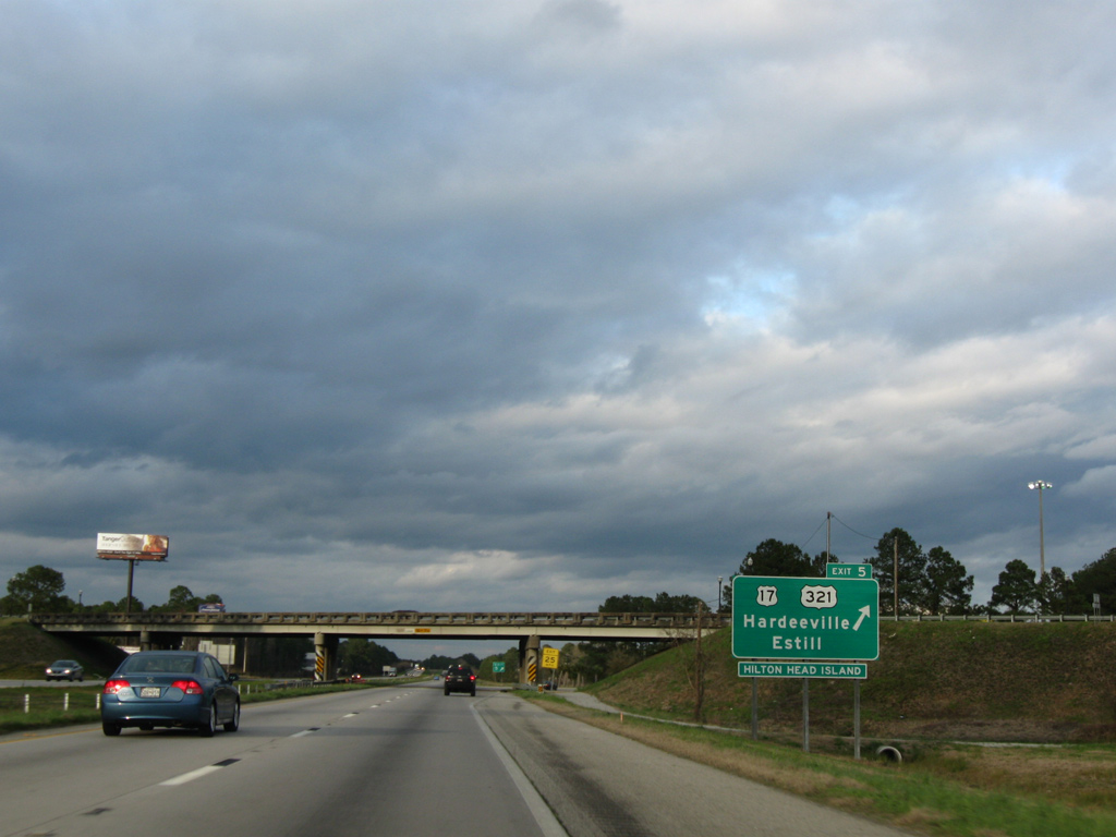
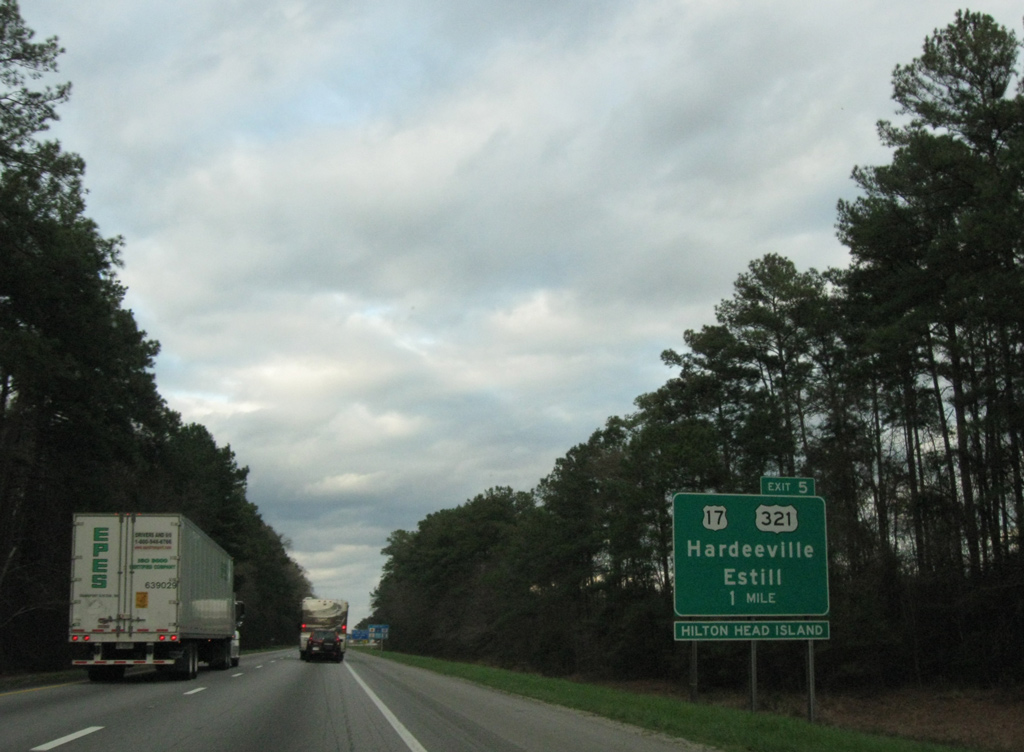
Exit 5 looped away from Interstate 95 north for U.S. 17 (Coastal Highway) at Hardeeville. U.S. 321 begins a short distance to the north, providing a more direct, yet slower route to Columbia from Savannah. 03/14/10
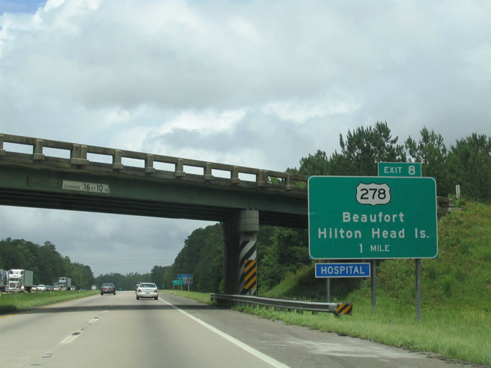
Replaced guide sign posted one mile south of U.S. 278 (Exit 8) on I-95 north in Hardeeville. 06/12/05
The replacement of this auxiliary guide sign for Exit 8 added Parris Island. 06/12/05
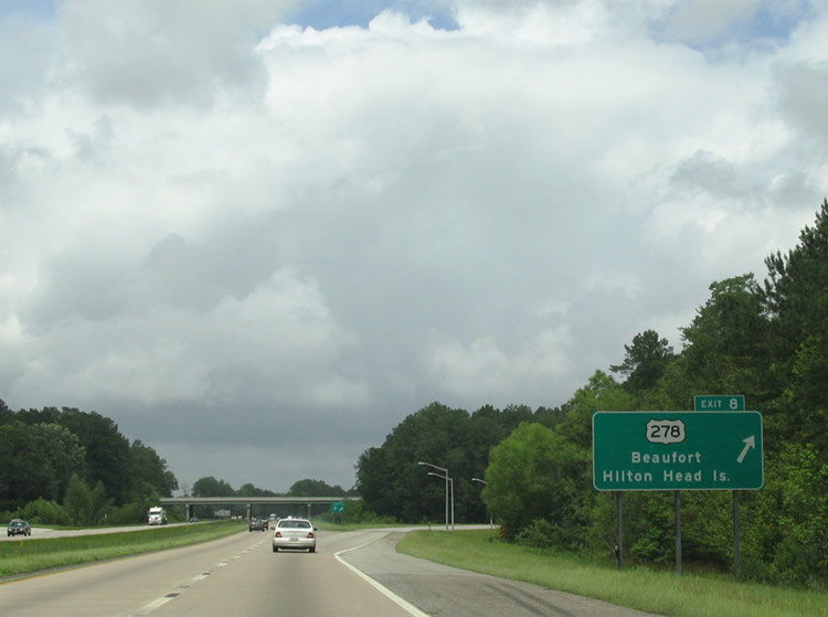
I-95 north at Exit 8 to U.S. 278 (Independence Boulevard) east to Beaufort and Hilton Head Island. 06/12/05
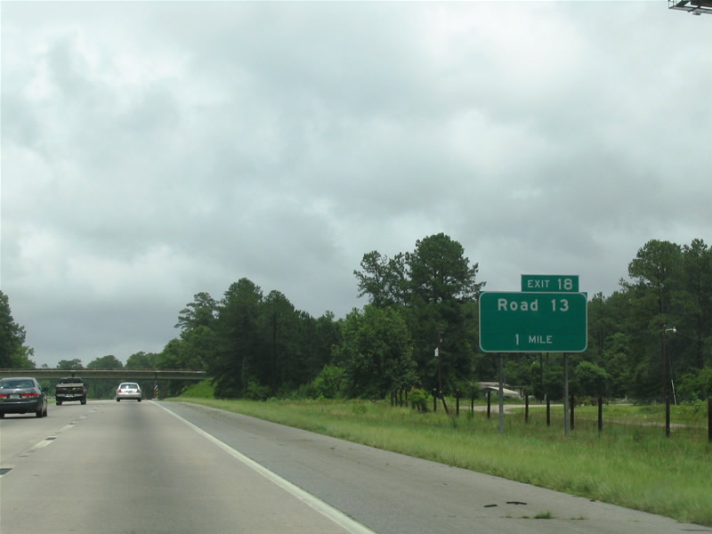
Guide signs for Exit 18 on the south side of Ridgeland were updated to reflect Bees Creek Road, the formal name of Road 13. 06/12/05
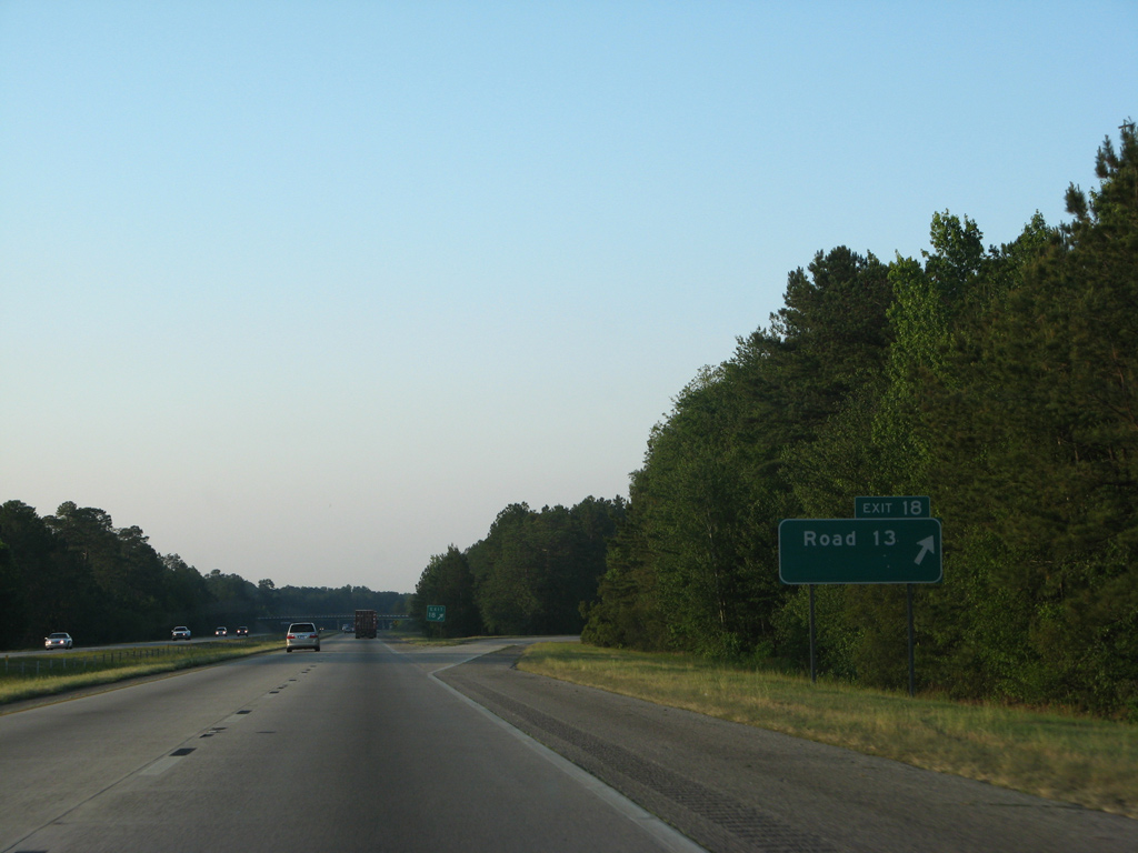
Road 13 links Interstate 95 with adjacent U.S. 17/278 (Jacob Smart Boulevard) north into the Ridgeland town center. 05/29/07
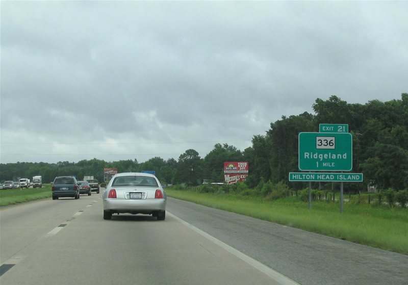
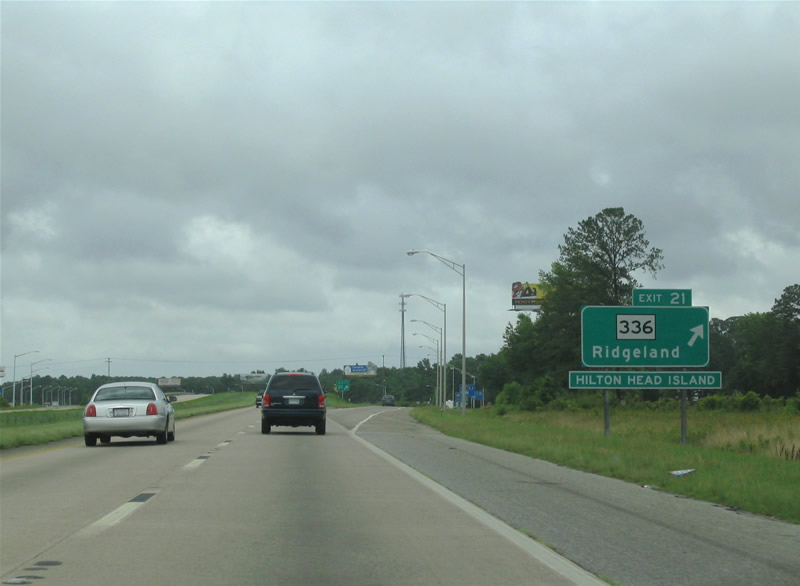
Previous guide signs for Exit 21 included a placard for Hilton Head Island. S.C. 336, in conjunction with S.C. 462 south, provides a back route to U.S. 278 and Hilton Head Island. Previous maps showed this alignment as U.S. 278 Alternate. 06/12/05
Interstate 95 northbound entered the Ridgeland city limits at the Smiths Crossing over crossing in 2007. Those limits were extended southward to Crow Field Road by 2013. 06/12/05
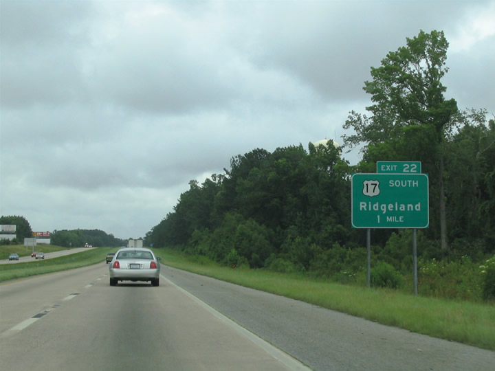
The former one mile sign for Exit 22 to U.S. 17 south and old U.S. 17 (Frontage Road) north. 06/12/05
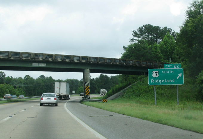
Entering the trumpet interchange (Exit 22) with U.S. 17 south and a north side frontage road to Ricetown on I-95 north. 06/12/05
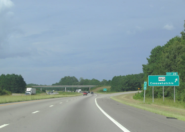
Approaching the settlement of Coosawhatchie and S.C. 462 (Exit 28) on I-95 north. 06/12/05
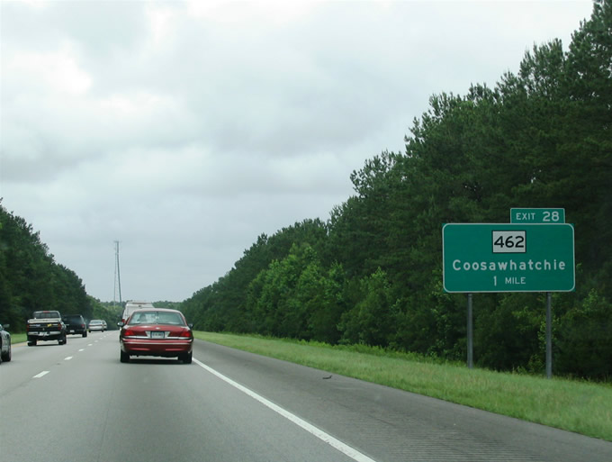
Replaced guide sign at the rural diamond interchange (Exit 28) with S.C. 462 (Coosaw Scenic Drive) on I-95 north. 08/28/04
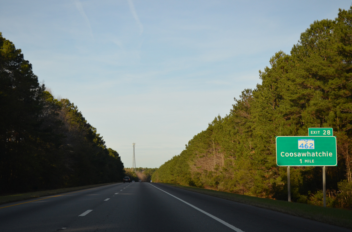
Trees were cleared from the median of I-95 ahead of Exit 28 in 2017-18. 12/19/13
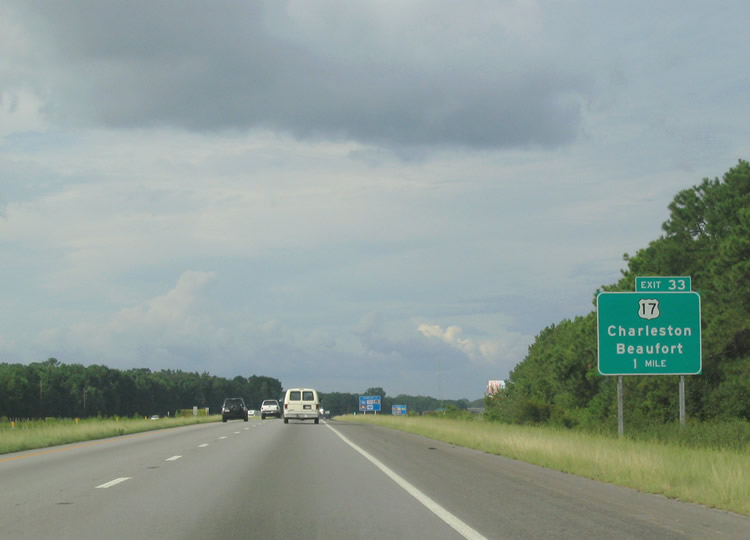
A pair of frontage roads accompany I-95/U.S. 17 north ahead of their split at Exit 33. 08/28/04
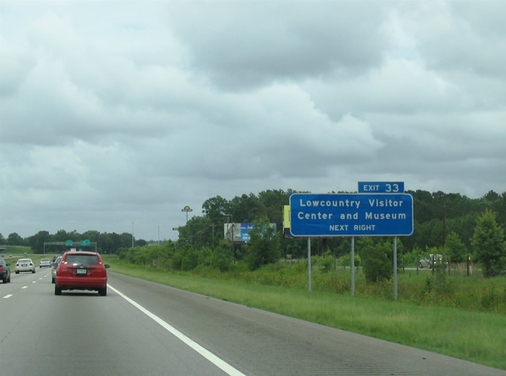
Forthcoming Exit 33 serves interests to the LowCountry Visitors Center and Museum located nearby along U.S. 17. 06/12/05
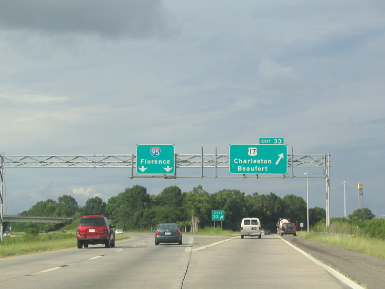
U.S. 17 splits nearby with U.S. 17 Alternate, a pre-Interstate system greater bypass of Charleston for U.S. 17 between Pocotaligo and Georgetown. 06/12/05
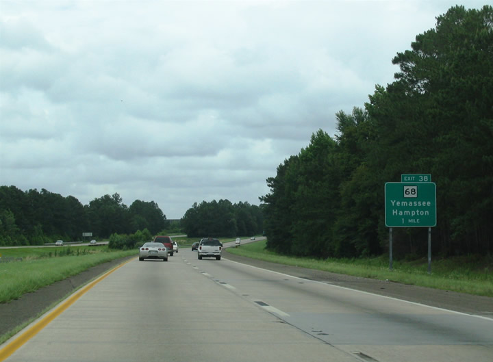
Interstate 95 turns more easterly on the one mile approach to Exit 38 with S.C. 68 at Yemassee. 06/12/05
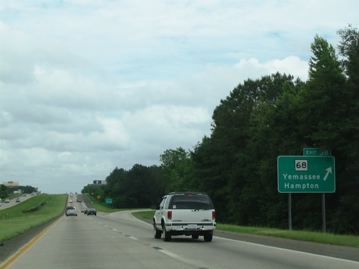
The folded diamond interchange with S.C. 68 (Yemassee Highway) lies wholly within the Yemassee city limits. 06/12/05

Interstate 95 north climbs a bluff from the Combahee River flood plain to meet U.S. 21 (Low Country Highway) at Exit 42. 06/12/05

U.S. 21 constitutes a rural route north from U.S. 17 Alternate near Jonesville to Orangeburg. 06/12/05

Approaching the outskirts of Walterboro, one mile south of Exit 53 with S.C. 63 (Sniders Highway). 06/12/05

Exit 53 parted ways with Interstate 95 north for S.C. 63 east to U.S. 17 Alternate and Walterboro. 06/12/05

S.C. 64 (Bells Highway) branches northwest from U.S. 15 (Jeffries Boulevard) to cross paths with Interstate 95 in one mile. 06/12/05

Connections with U.S. 17 (Savannah Highway) east (north) from the end of S.C. 64 leads motorists to S.C. 174 south to Edisto Beach. 06/12/05

Replaced guide sign for Exit 57 and S.C. 64 east to Downtown Walterboro and west to Lodge. 06/12/05

Signs for Exit 62 previously referenced Road 34. They were updated to reflect McLeod Road, the formal name for Road 34. 06/12/05

McLeod Road (Road 34) east to Pleasant Grove Road connects I-95 with U.S. 15 in 1.9 miles. 06/12/05

The final Colleton County exit departs in one mile for S.C. 61 (Augusta Highway). 06/12/05

S.C. 61 is a rural route leading west toward Bamberg and southeast to Canadys and Summerville. 06/12/05

Interstate 95 meets U.S. 78 on the outskirts of St. George in one mile. Within town, the US highway travels Memorial Boulevard two miles east to U.S. 15 (Parler Avenue). 06/12/05

Exit 77 leaves I-95 north for U.S. 78. U.S. 78 travels 715 miles overall from Charleston and the LowCountry west to Augusta, Atlanta, Birmingham and Memphis. 06/12/05

One mile south of Exit 82 with U.S. 178 in rural north Dorchester County on I-95. 06/12/05

U.S. 176 travels southeast two miles from Exit 82 to U.S. 15 at Rosinville. 06/12/05

Two miles out from the cloverleaf interchange (Exits 86A/B) with I-26 on I-95 north. This sign was carbon copied with Clearview font. 06/12/05

This sign bridge for Exits 86A/B to Interstate 26 was replaced with a new assembly 06/12/05

I-95 north at I-26 west. A Clearview font based overhead replaced this assembly by 2017. 12/19/13

Concrete pavement north of I-26 was paved over with asphalt by 2013. 05/30/07

One mile south of U.S. 176. 05/30/07
Photos by AARoads, Carter Buchanan (08/28/04, 06/12/05)
Page Updated Friday January 24, 2025.