
Interstate 275 Florida – North
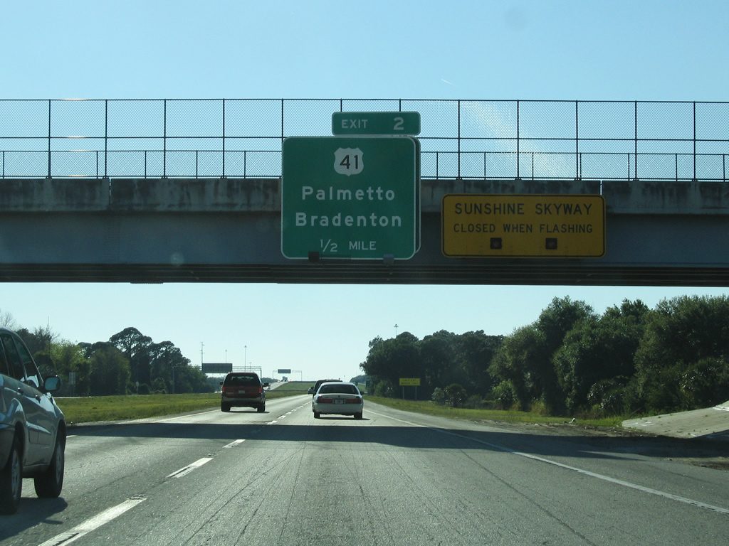
A look at a previous half-mile guide sign for U.S. 41 (Exit 2) and of the prior warning system for the upcoming Sunshine Skyway bridge. 03/26/06
Until early 2014 emergency call boxes such as this one past Exit 2 were in place along every mile of Interstate in Florida. They existed to aid motorists with vehicle distress, but with advancements in technology their use has become obsolete. 03/26/06
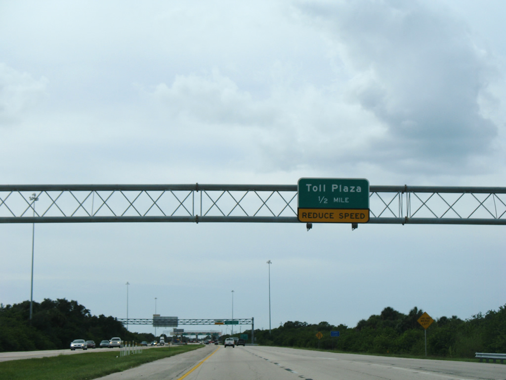
On the half-mile approach to the mainline toll plaza for northbound traffic crossing the Sunshine Skyway. A replacement for this assembly resulted in a full black on yellow sign. 03/26/06
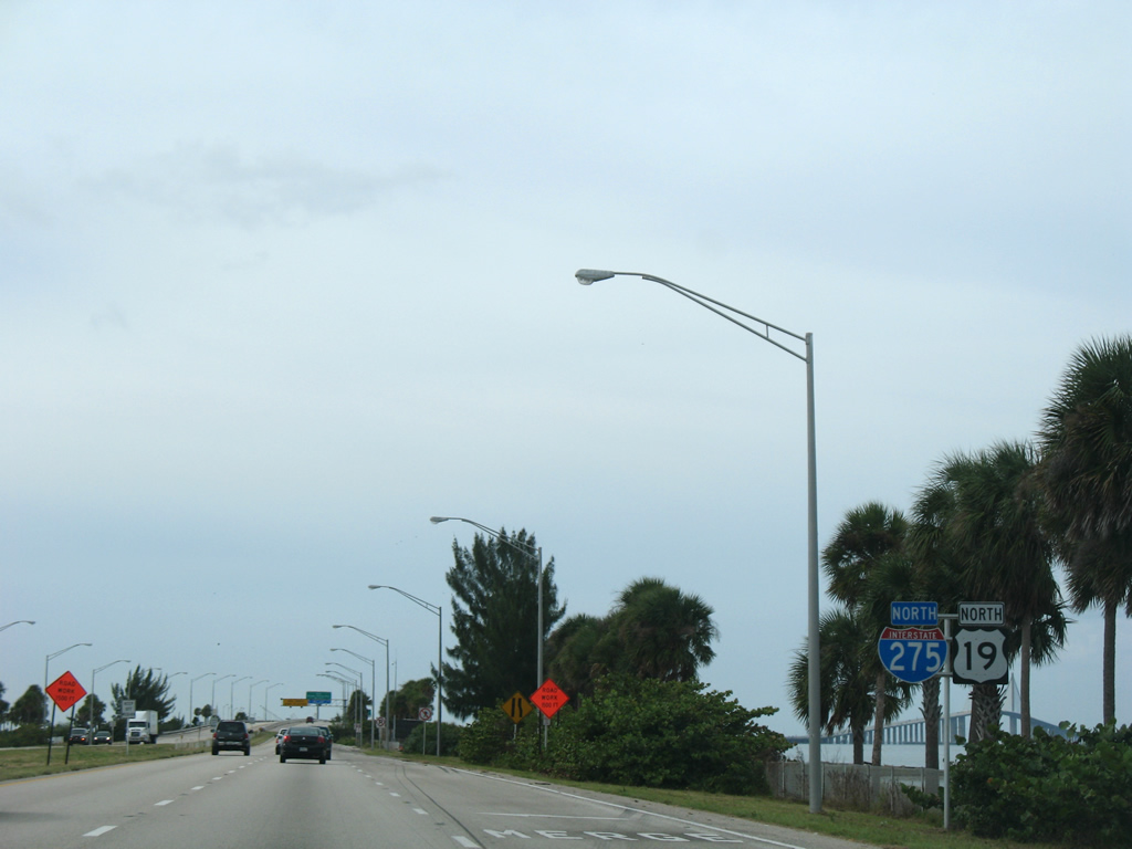
This single-pole shield assembly along Interstate 275 & U.S. 19 north after the south rest area was replaced sometime after 2007 with two separate assemblies. 10/16/07
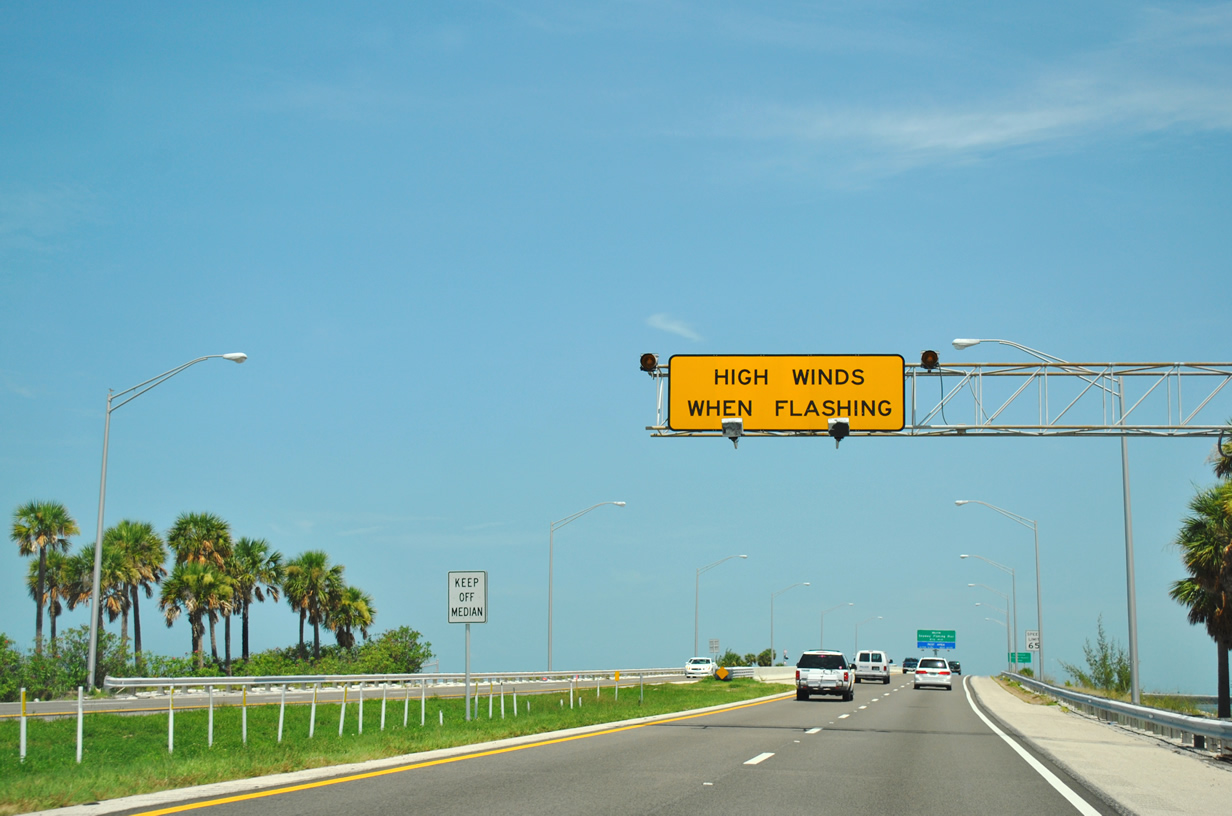
A high wind advisory sign was placed at the northbound entrance to the Sunshine Skyway to alert drivers when prevailing winds were in excess of 40 mph across the span. This system has since been replaced with Intelligent Transportation System (ITS) digital message boards along all of Interstate 275. 07/10/11
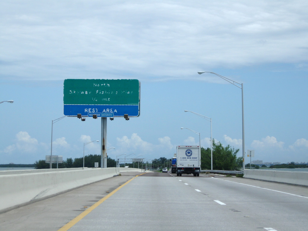
An older and weather worn guide sign on the quarter-mile approach to the North Skyway Fishing Pier and rest area. 06/08/09
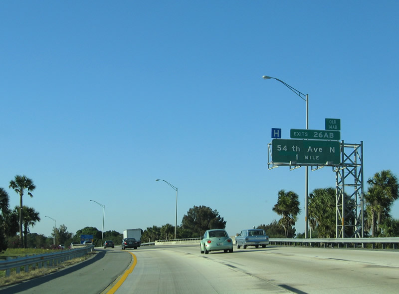
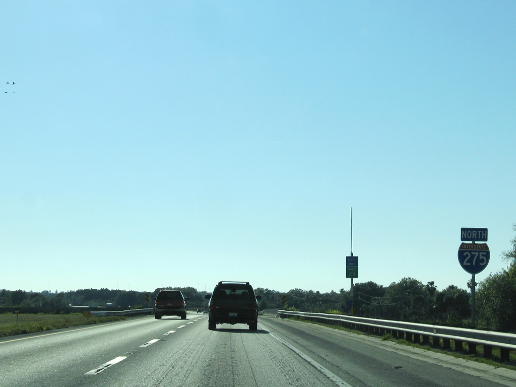
1 mile south of 54th Avenue N in St. Petersburg. 03/26/06
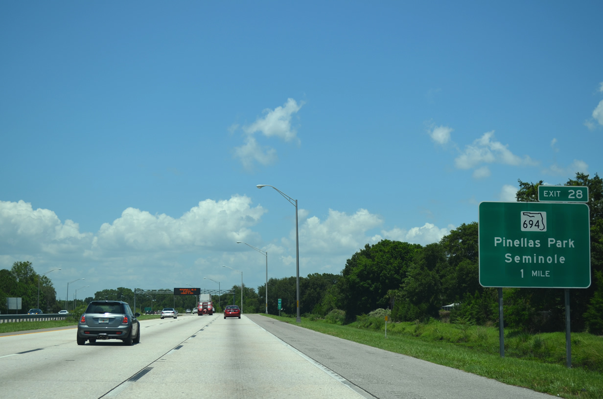
I-275 north at SR 694 (Gandy Blvd). 07/06/13
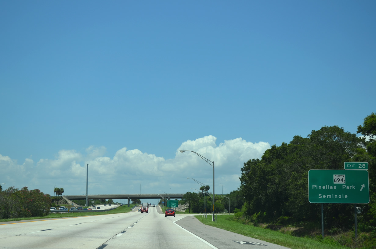
Signs for Exit 28 on I-275 north were replaced by 2016. 07/06/13
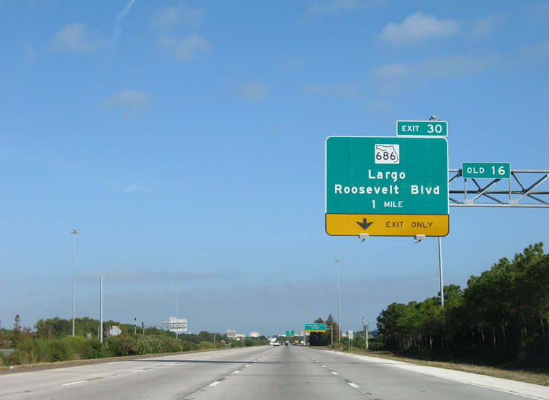
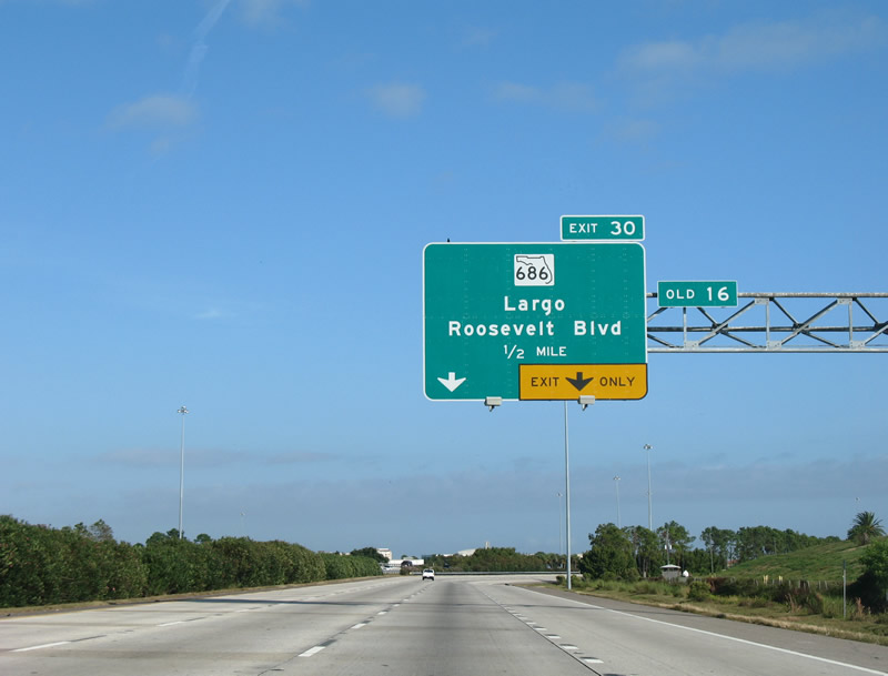
Historic perspective of the one mile advance sign for Florida 686 (Roosevelt Boulevard) to Largo prior to the connection to Pinellas County 296 west (118th Avenue North) in February 2011. All signage along northbound Interstate 275 on the approach to Exit 30 reflected the new connection. 11/26/07
Exit 30 once serviced movements only between Interstate 275 and Florida 686. The short expressway of Pinellas County 296 was tied into the existing interchange in two phases completed in 2005 (southbound I-275 access) and 2011 (northbound I-275 access). 11/26/07
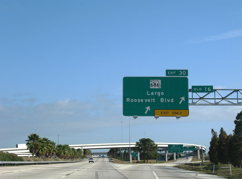
Former overhead signage as two lanes leave for Florida 686 (Roosevelt Boulevard) and Exit 30, splitting to the westbound and eastbound directions for SR 686. Motorists bound for CR 296 (118th Avenue North) must also depart Exit 30 from Interstate 275 north to make the connection. 11/26/07
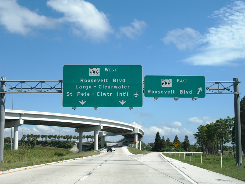
St. Petersburg-Clearwater International Airport (PIE) was mentioned as a destination for Florida 686 west before replacement signs added CR 296. 11/26/07
Previous mileage sign on the approach to the Howard Frankland Bridge did not include the distance to Tampa International Airport (TPA). 05/27/05
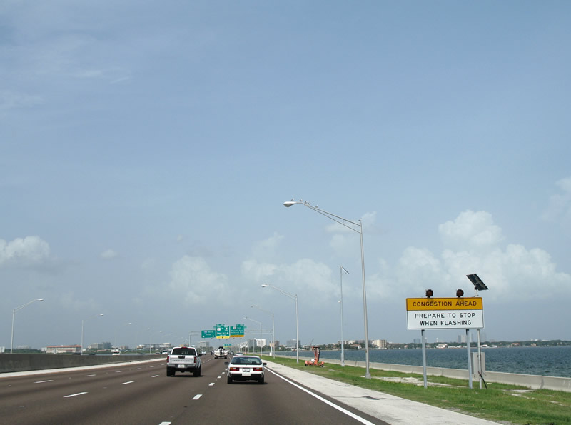
A sign and set of beacons alerted motorists to congestion along the causeway portion of the Howard Frankland Bridge on the one mile approach to Exits 39A/B. This sign was rather impractical given congestion was likely already well underway by the time motorists saw this sign. It was removed after 2008. 07/30/06

Four lanes of I-275 continued from the Howard Frankland Bridge toward the former single lane ramps to Florida 60 east (Exit 39A) and west (Exit 39B). Construction completed in 2010 combined the separate ramps into a single departure point (now Exit 39) from I-275 north. 07/30/06
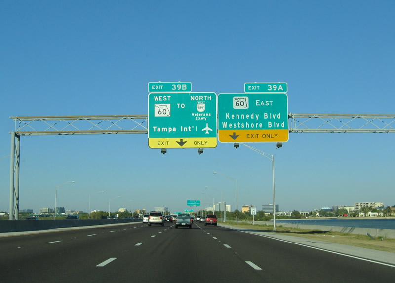
Nearing the former ramp departure of Exit 39A, Interstate 275 enters the city of Tampa, home to an estimated 347,645 people as of 2013. Tampa, a 112 square mile city, was incorporated in 1855.<br /> Exit 39A formed the eastbound beginning of Kennedy Boulevard, a main arterial route into Downtown from Beach Park and Westshore Palms. Kennedy Boulevard connects Interstate 275 north with Florida 60 (Memorial Highway) at WestShore Plaza mall. 03/26/06
Exit 39A originally provided access to Cypress Street west of Florida 60 (Memorial Highway) as well. This connection was removed during the 2005-10 work to upgrade the interchange between SR 60, SR 616 (Spruce Street) and George J. Bean Parkway north to TPA Airport. 07/30/06
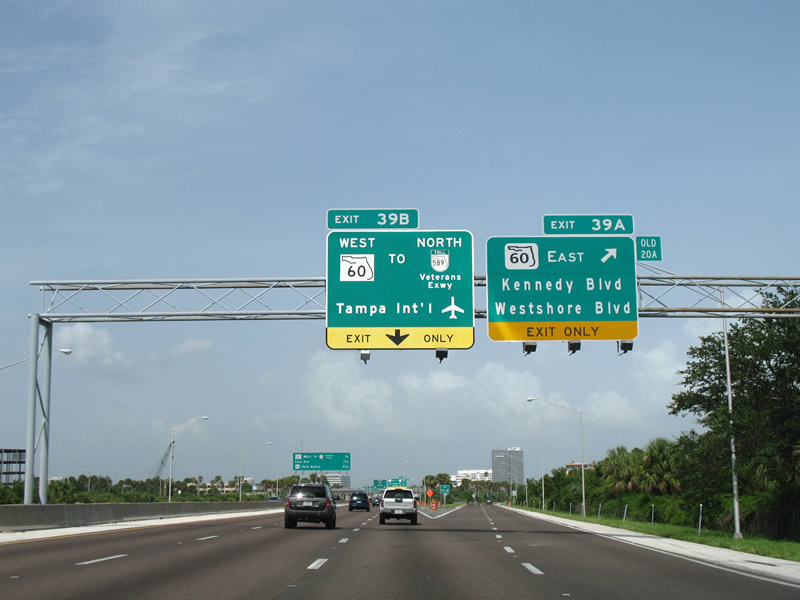
I-275 north at the old gore point for Exit 39A to Kennedy Boulevard east. Kennedy Boulevard begins as an unsigned branch of Florida 60, serving a handful of office buildings before merging with mainline Florida 60 at the Memorial Highway freeway end. The exit ramp provides an alternate route to Florida 60 west at the traffic light with Memorial Highway. 07/30/06
The first in a series of upcoming exits signs posted along Interstate 275 through Tampa preceded the ramp split with Exit 39A. Florida 60 overlayed the original Memorial Highway alignment from Kennedy Boulevard northwest to Spruce Street.<br /> Changes made to this sign by 2010 greened out the line referencing SR 60 west to SR 589 (Veterans Expressway). 07/30/06
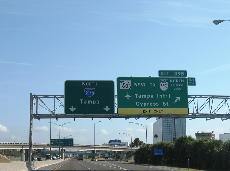
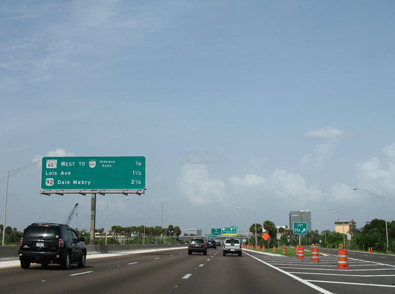
Interstate 275 northbound squeezed into two lanes as the freeway reached its second Tampa exit, Exit 39B for SR 60 west to SR 589 north. Memorial Boulevard leads SR 60 northwest to the Tampa International Airport (TPA) ahead of the Veterans Expressway northbound beginning. 11/26/07
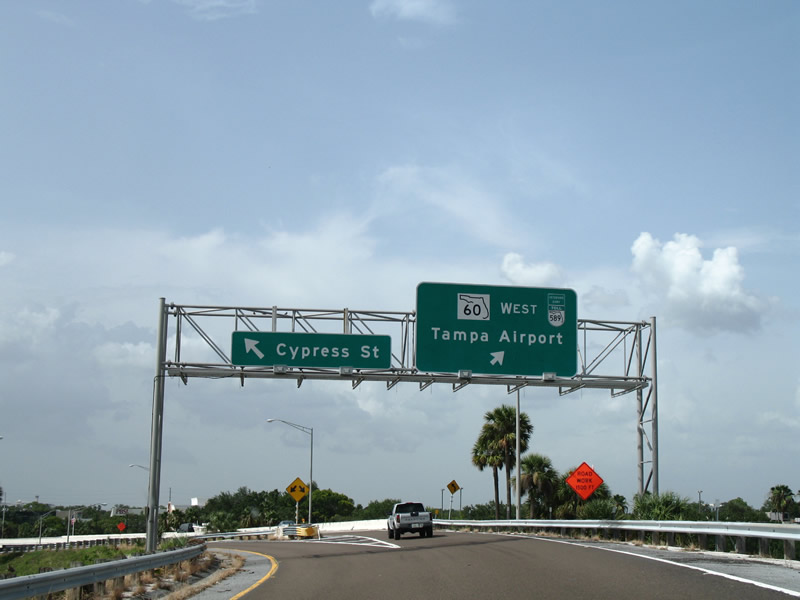
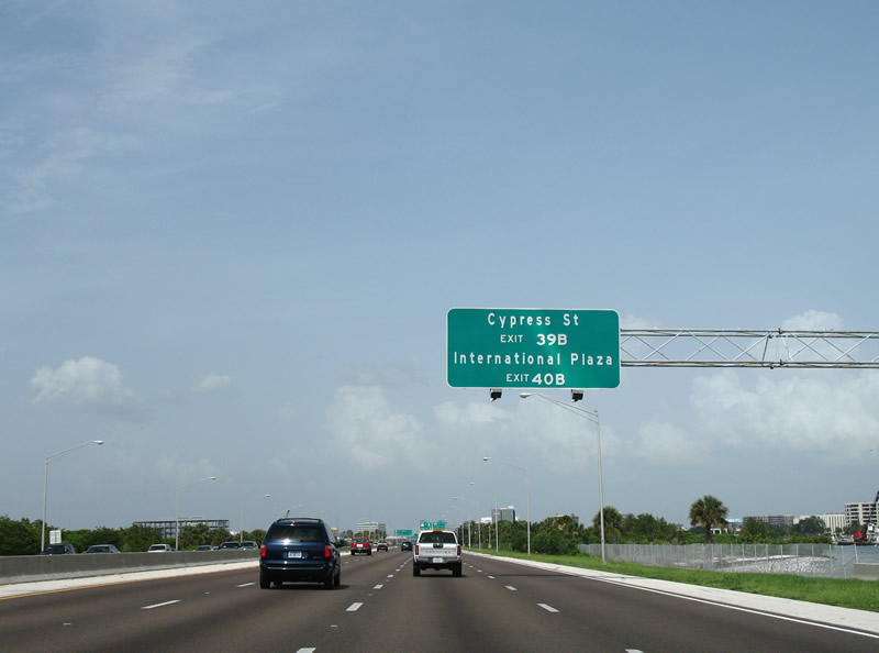
Exit 39B formerly split into components for both Cypress Street and Florida 60 (Memorial Highway) west. Cypress Street ventures east to Westshore Boulevard (CR 587) and Lois Avenue north of Interstate 275 while SR 60 immediately enters the interchange with George Bean Parkway and SR 616 (Spruce Street) east. 07/30/06
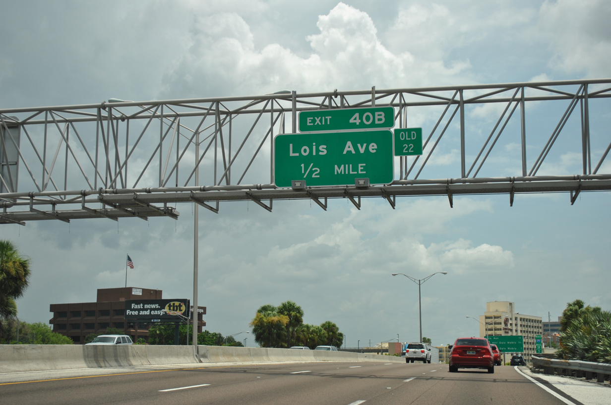
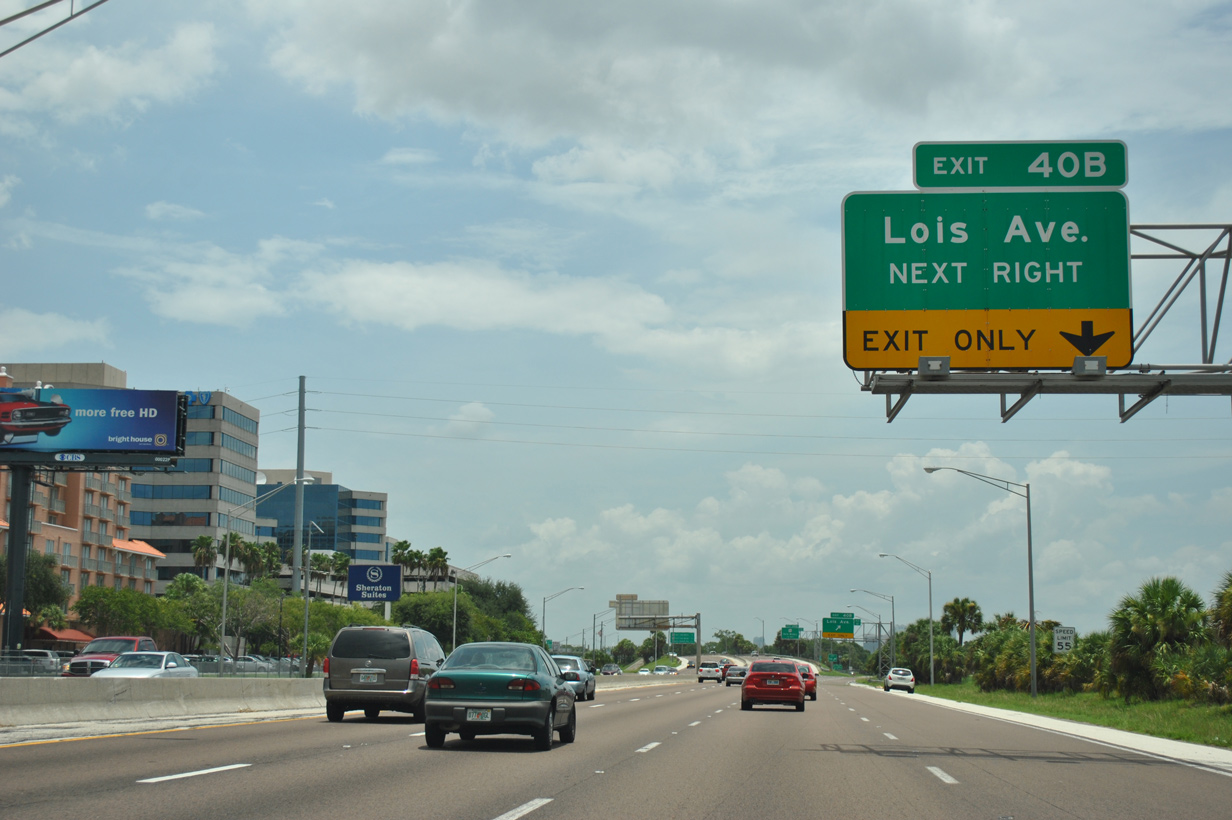
The next exit along northbound is Exit 40B, North Lois Avenue. There is no connection from northbound Interstate 275 to West Shore Boulevard (CR 587), but that interchange is Exit 40A on southbound I-275. 07/10/11
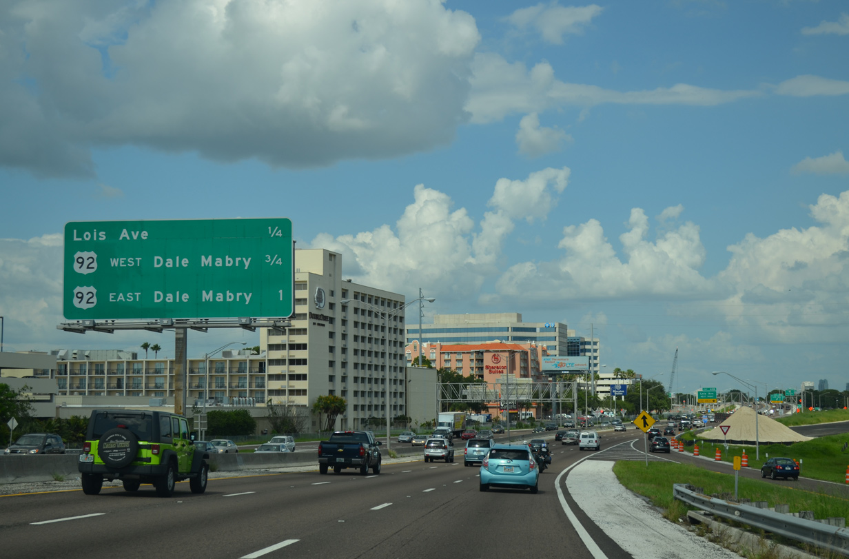
This interchange sequence sign was removed after 2013 during reconstruction of I-275. Both Interstate 275 and U.S. 92 are not traveling in their true directions through western Tampa: I-275 is basically an east-west freeway from the Howard Frankland Bridge east to Interstate 4, while U.S. 92 takes Dale Mabry Highway, a north-south arterial, from SR 618 (Le Roy Selmon Expressway) north to Florida 580 (Hillsborough Avenue). 07/06/13
The two-lane loop ramp from Florida 60 (Memorial Highway) east created a weaving traffic pattern through to the Lois Avenue off-ramp (Exit 40). 07/10/11
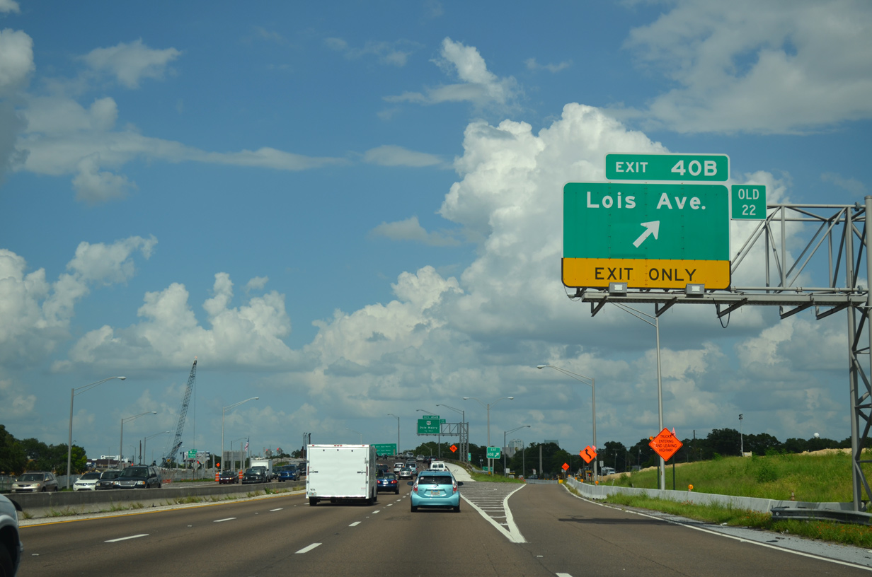
Northbound Interstate 275 reached Exit 40B, North Lois Avenue. Use North Lois Avenue southbound to reach Florida 60 (Kennedy Boulevard) and northbound to reach Florida 616 (Spruce Street) at International Plaza mall. 07/06/13
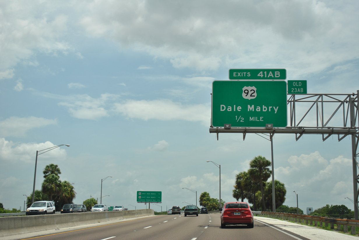
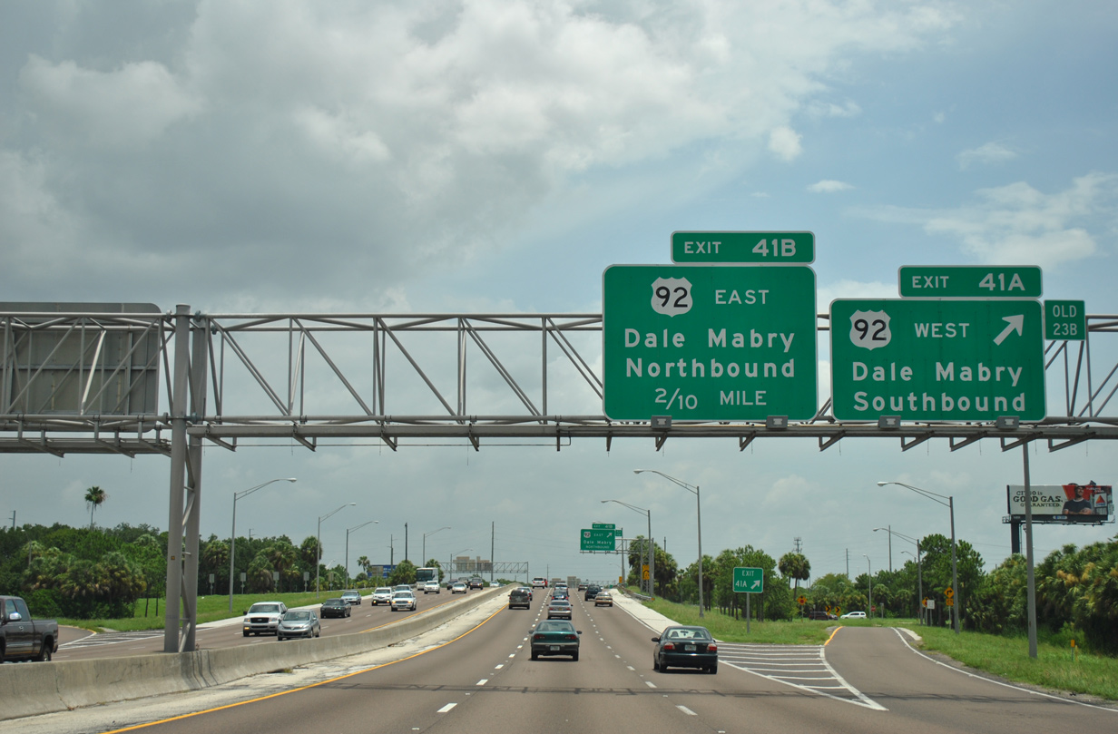
The six-ramp partial-cloverleaf interchange with U.S. 92 was generally extremely congested due to the close proximity of the ramps and the volume of traffic generated from Dale Mabry Highway. 07/10/11
The former loop ramps to U.S. 92 were removed to make way for retention ponds due to the wider foot print of Interstate 275. Exit 41A now carries all traffic bound for U.S. 92 north to Drew Park and south to Palma Ceia. 07/10/11
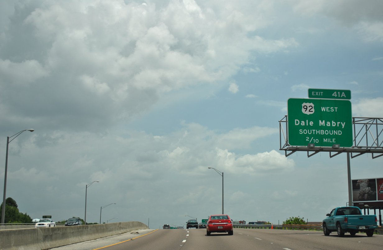
The on-ramp from Lois Avenue formed an auxiliary lane east along I-275 through to Exit 41A and U.S. 92 (Dale Mabry Highway) south. 07/10/11
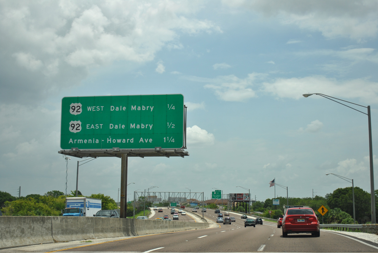
Eastbound Interstate 275 reached Exit 41A for U.S. 92 west. Dale Mabry Highway travels south all the way to MacDill Air Force Base. 07/10/11
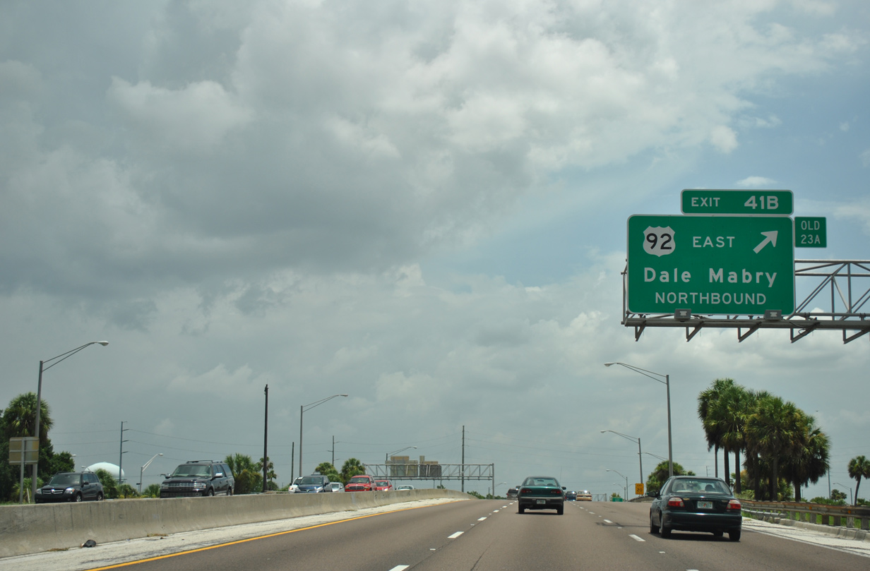
The following ramp (Exit 41B) connected I-275 north with U.S. 92 (Dale Mabry Highway) east. Dale Mabry Highway continues north from U.S. 92 as Florida 580 and 597 into northern Hillsborough County to end at U.S. 41 in Land O' Lakes. 07/10/11
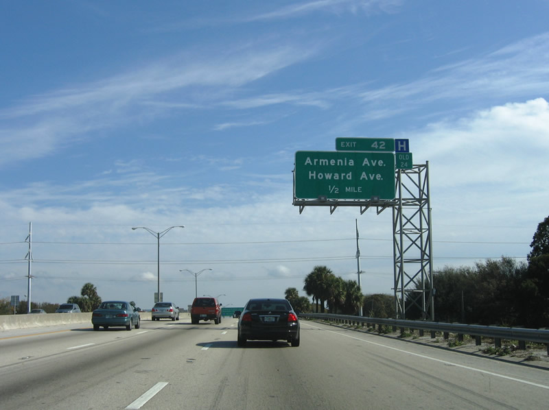
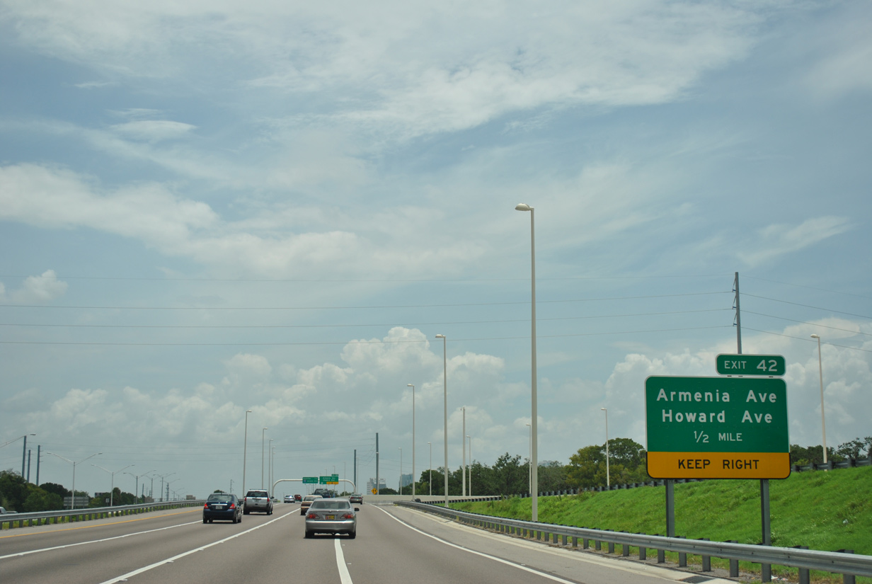
A half-diamond interchange adds traffic from Himes Avenue to Interstate 275 north, one half mile west of the off-ramp (Exit 42) to Howard and Armenia Avenues. Widening of Interstate 275 to redesign the entire freeway with eight overall lanes with a wide grassy median was underway as of Fall 2007. 01/02/06
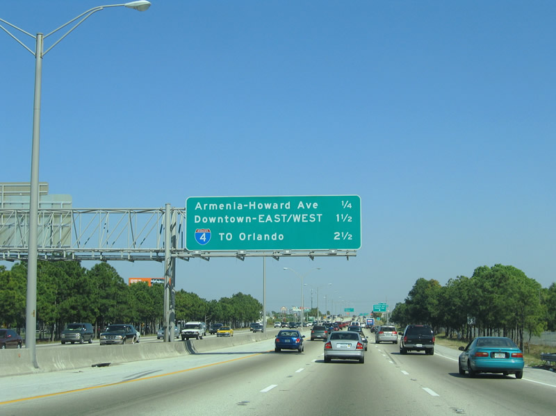
Interstate 4 debuted along Interstate 275 signage on this interchange sequence sign posted one quarter mile west of Exit 42. 03/18/06
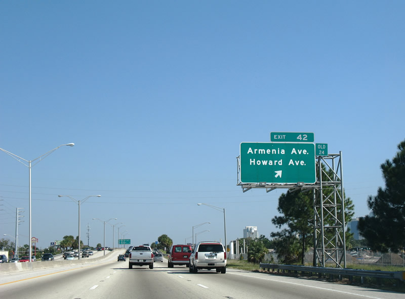
I-275 north at the former off-ramp (Exit 42) to Armenia Avenue south and Howard Avenue north. The new Exit 42 leaves two blocks further west. 11/10/07
A look at the temporary transition from the old I-275 northbound carriageway to the new one opened east of U.S. 92. 07/10/11
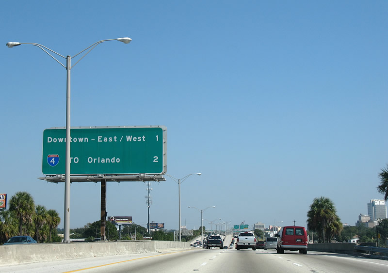
Continuing east, Interstate 275 bee lines toward Downtown and a crossing of the Hillsborough River. Exit 44 joins the freeway with Ashley Drive south and U.S. 41 Business (Tampa Street/ Florida Avenue) at the next interchange. 11/10/07
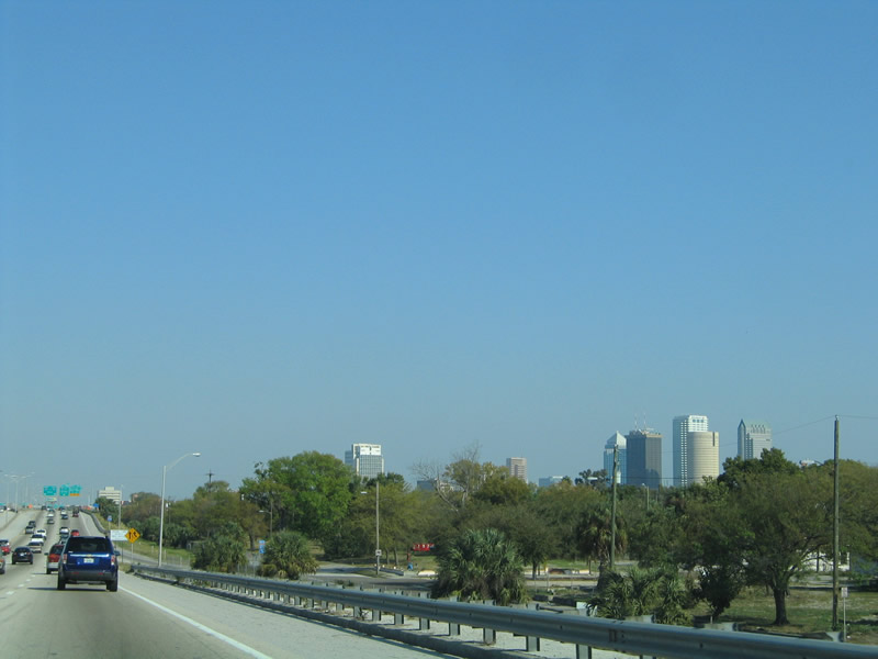
Skyscrapers from Downtown Tampa came into view as Interstate 275 nears its first crossing of the Hillsborough River. Note the clearing of houses and trees along the eastbound side. The demolition represented the first stage in the overall I-275 reconstruction project. 03/05/06
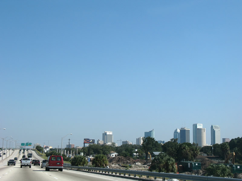
Skyscrapers from Downtown Tampa came into view as Interstate 275 nears its first crossing of the Hillsborough River. Note the clearing of houses and trees along the eastbound side. The demolition represented the first stage in the overall I-275 reconstruction project. 11/10/07
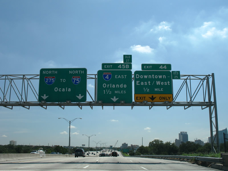
I-275 north ahead of Exit 44 for Ashley Dr south and Scott St east and the split with I-4 east (Exit 45B). 08/25/07
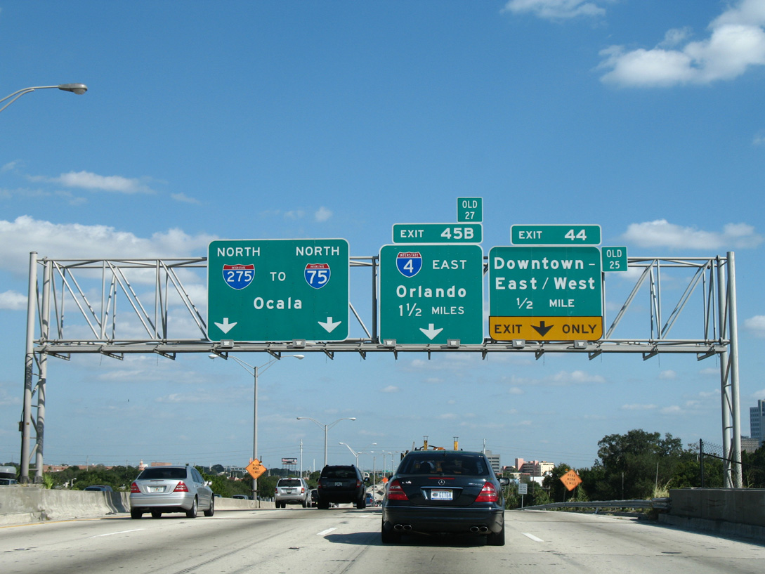
There is no Exit 45A along I-275 north. 11/04/06
Photos by AARoads
Page Updated Friday January 24, 2025.