
I-95/495 Capital Beltway - Inner Loop


Exit 176B connects the local lanes of I-95/495 with SR 241 (Telegraph Road) north to the George Washington Masonic National Memorial and Eisenhower Avenue near the Metro Yellow Line station. 07/01/05

SR 241 runs 1.88 miles north from U.S. 1 (Richmond Highway) to a trumpet interchange with SR 236 (Duke Street) in Alexandria. 07/01/05

07/01/05

A loop ramp carries drives from the local lanes of I-95/495 west onto SR 241 (Telegraph Road) south at Exit 176A. 12/26/06

I-95/495 next approached the Eisenhower Avenue Connector (Exit 174). 06/17/05

The Local and Through roadways of the Capital Beltway merge ahead of the diamond interchange (Exit 174) with the Eisenhower Connector. 06/17/05

Exit 174 departed Interstates 95 south & 495 west for Eisenhower Avenue west to VA 401 (Van Dorn Street) and east to Telegraph Road in south Alexandria. 06/17/05
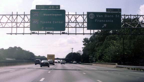
Before 2001, the Van Dorn Street off-ramp was signed as Exit 3. The exit numbering system of the Capital Beltway saw numbers increase from the Potomac River westward along the Inner loop and decrease along the Outer loop. Interstate 95 mileage based exit numbers did not begin until the route departed the beltway at Springfield. 08/12/00
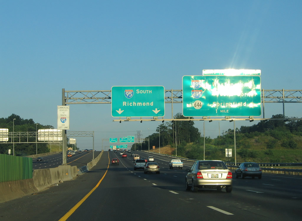
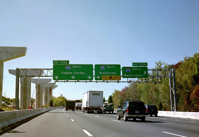
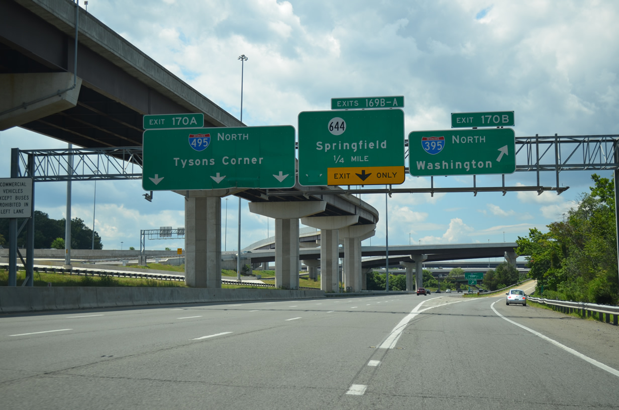
Older guide signs posted above I-95 south & 495 west for the Springfield Interchange. Interstate 95 once used a cloverleaf ramp to continue southward from the Beltway. That movement was replaced with a two-lane high speed flyover. 06/17/05
A look at the previous sign bridge posted on the one mile approach to the Springfield Interchange. A directional-cloverleaf interchange handled movements originally. 10/14/01

This sign bridge for Exit 170 displayed the northern Virginia control points of Springfield for Interstate 95 south and Arlington for Interstate 395 north. The beginnings of the new flyover ramps took place in this westward looking scene. 10/14/01
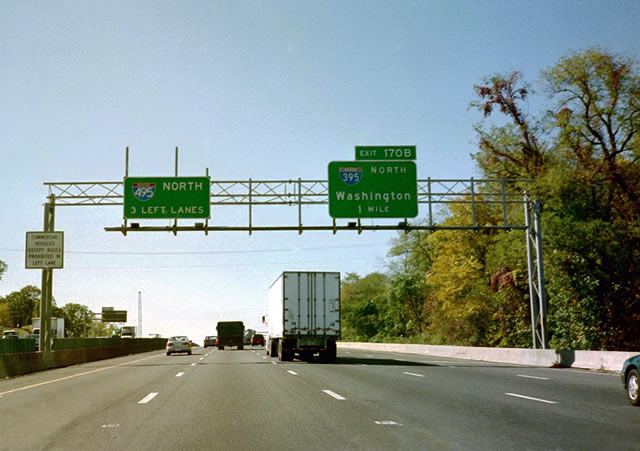
A look at the previous configuration of the Interstate 395 (Henry G. Shirley Memorial Highway) northbound departure from the Capital Beltway via Exit 170B. Interstate 395 provides a 13.39 mile long freeway through Alexandria, Arlington, the Pentagon vicinity, and downtown Washington, D.C. The freeway continued the HOV-2 reversible lane system of Interstate 95 northward toward the Potomac River. 10/14/01

Interstate 95 used to leave the Capital Beltway via a two lane directional ramp. This ramp was overwhelmed at most times of the day due to the volume of traffic at the Springfield Interchange. The substandard nature of the ramp was one of the main reasons for upgrading the exchange. 10/14/01
08/04/13
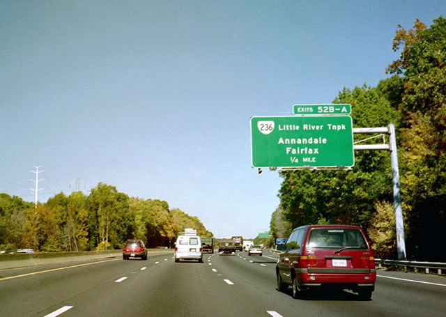
Interstate 495 northbound within the vicinity of Wakefield Park, one half mile south of the Virginia 234 (Little River Turnpike) full-cloverleaf interchange. Virginia 234 comprises an east-west arterial between the cities of Fairfax and Annandale. 10/14/01
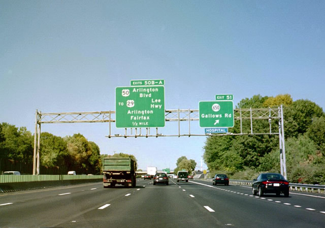
Virginia Secondary 650 (Gallows Road) intersects the Capital Beltway via a partial cloverleaf interchange at Exit 51. Gallows Road travels north from Virginia 244 (Columbia Pike) at Annandale to Virginia 7 (Leesburg Pike) at Tysons Corner. 10/14/01
A collector/distributor system handles the movements at the cloverleaf interchange with U.S. 50 (Arlington Boulevard). The exchange lies adjacent to the U.S. 50 interchanges with Fairview Park Drive and Gallows Road. This configuration was vastly unchanged with the addition of the express toll lanes in the middle of Interstate 495. 10/14/01

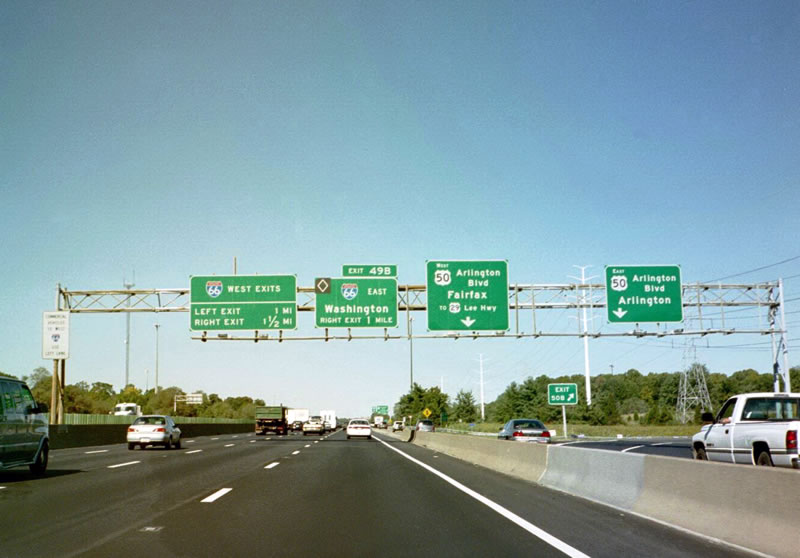
Five lanes of the Capital Beltway traveled underneath U.S. 29 (Lee Highway), one half mile south of Interstate 66. Two ramps connected the beltway northbound with I-66 westbound. A left-hand ramp departed in one half mile and a loop ramp followed beyond the off-ramp (Exit 49B) to Interstate 66 east. 10/14/01

A former state-named shield for Interstate 495 north. Capital Beltway trailblazers were installed in the early 1990s indicating Inner and Outer cardinal directions. However the concept apparently never caught on with motorists, as most of the assemblies were removed in the ensuing decade. 10/14/01

Traffic to Interstate 66 eastbound diverged from the Capital Beltway via Exit 49B. Since converted to a toll road, the freeway (Custis Memorial Parkway) was an HOV-2 facility from Interstate 495 eastward into Washington, D.C. The HOV enforcement affected all six lanes of the freeway and was enforced during the morning and evening commutes for the respective direction of heavy travel. This interchange remains vastly the same in its handling of movements between I-66 and 495 though additional ramps were added for the 495 ExpressLanes. 10/14/01
Photos by AARoads, Carter Buchanan (08/12/00, 07/01/05)
Page Updated Friday January 24, 2025.