
Rochester, New York
Photos of Rochester city streets and boulevards from 2000 and 2005.
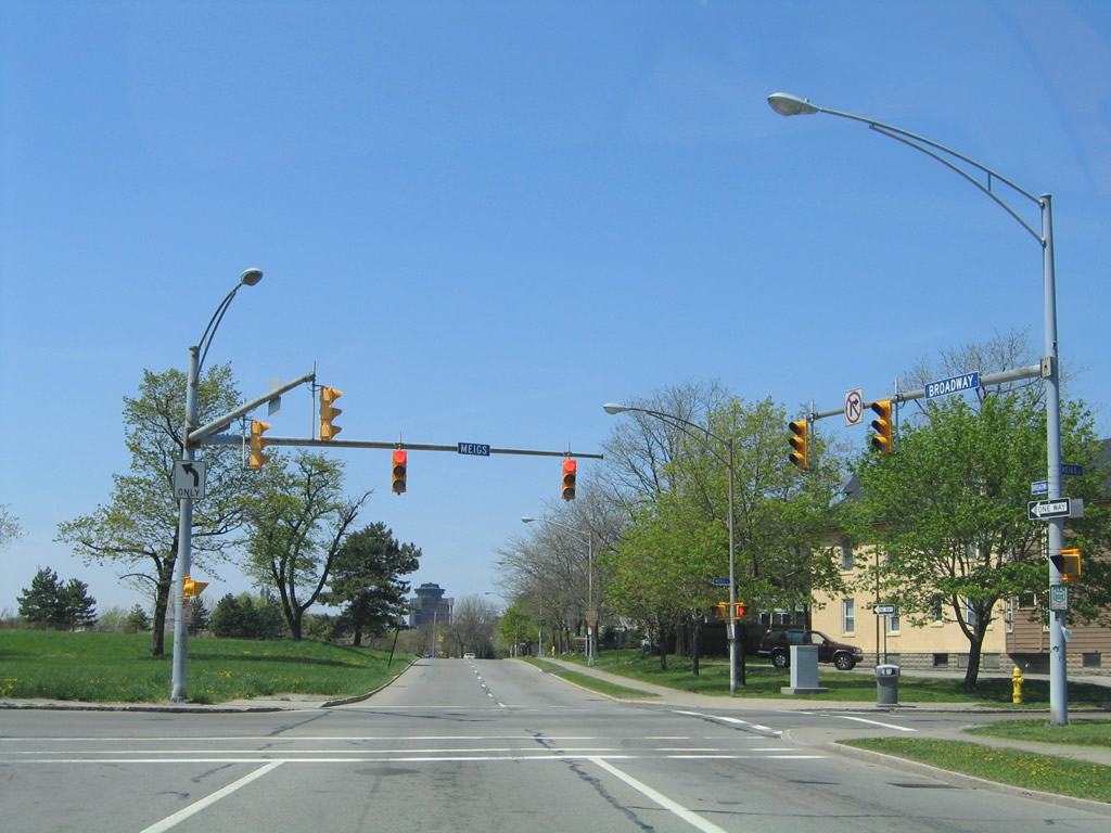
Broadway north at Meigs Street. Meigs Street crosses I-490 and meets NY 31 (Monroe Street) to the north. 05/10/05
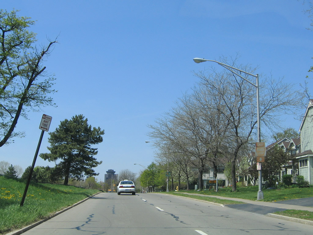
East Inner Loop trailblazer posted along Broadway northbound between Meigs Street and Averill Avenue. 05/10/05
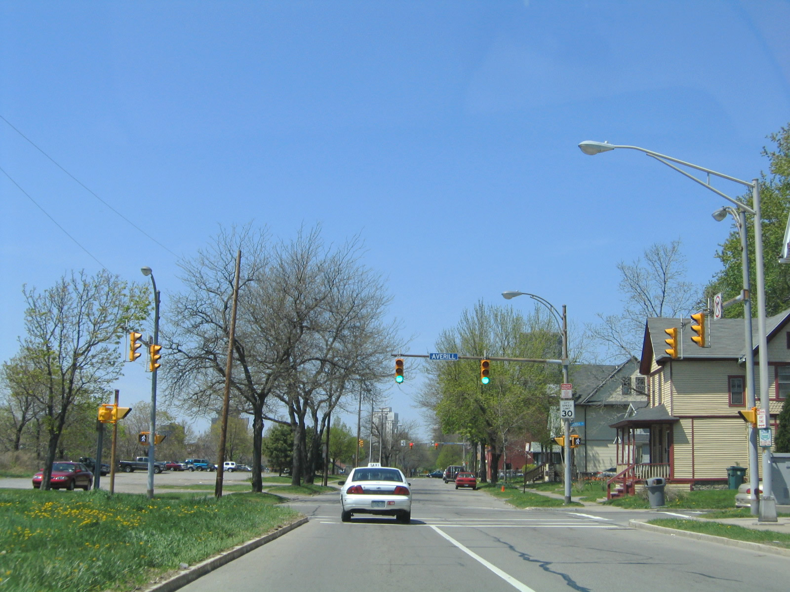
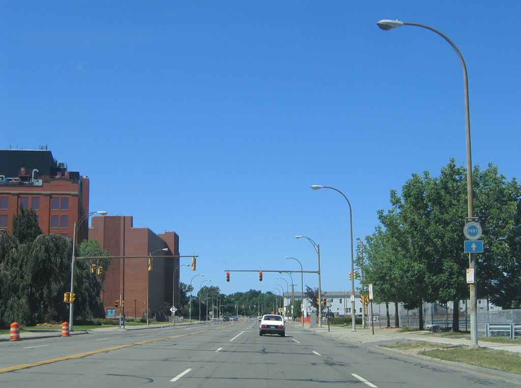
Northbound Broadway at Averill Avenue. Averill Avenue spans I-490 west to NY 15 (Mt. Hope Avenue). 05/10/05

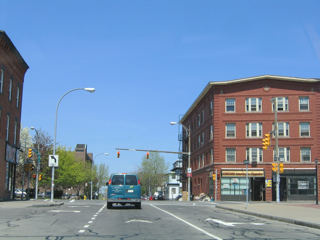
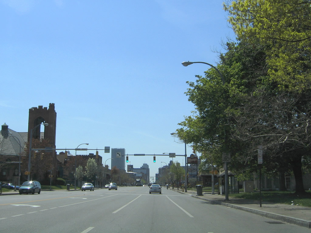
Broadway north at Alexander Street. 05/10/05
Broadway transitions onto Union Street north ahead of NY 31 (Monroe Avenue). 05/10/05
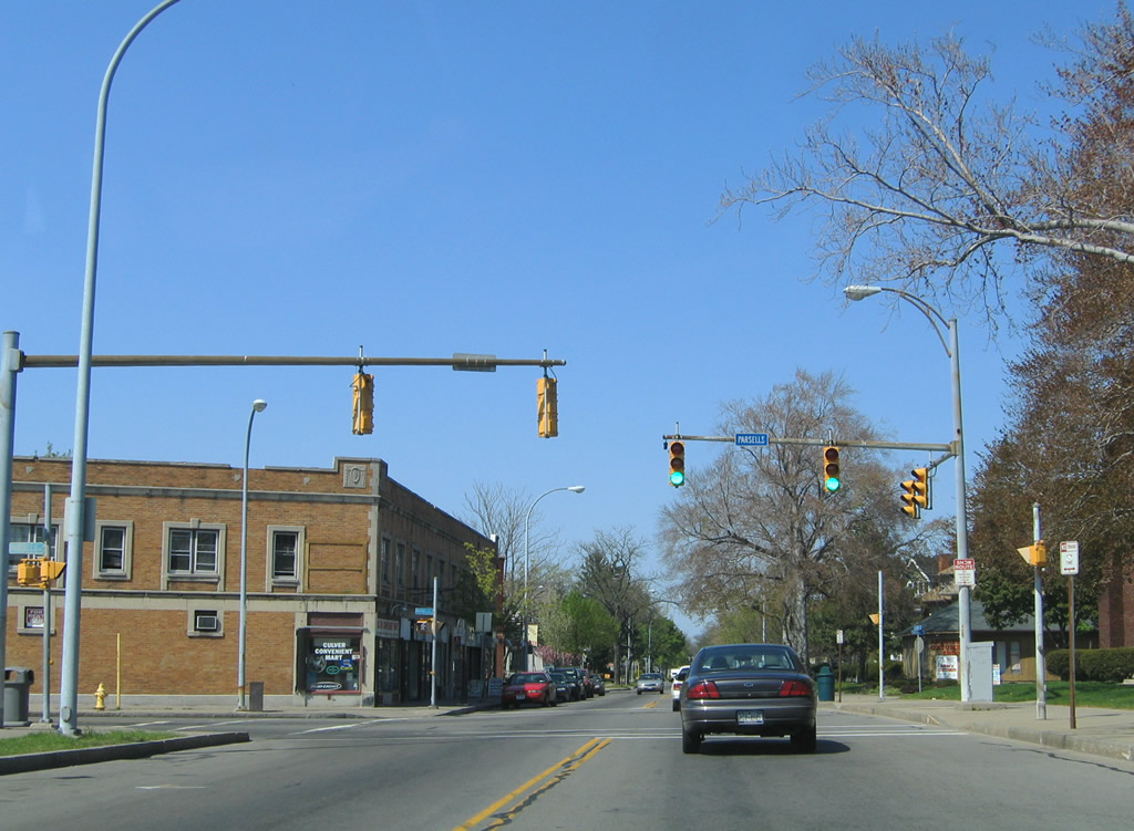
Culver Road northbound at Parsells Avenue west. Further north, Culver Road represents a historic alignment of U.S. 104 between Empire Boulevard and E Ridge Road. 05/10/05
Lake Avenue northbound at Ridgeway Avenue near Kodak Park. Ridgeway Avenue provides access onto NY 104 (W Ridge Road) east to the Keeler Expressway. 07/02/05
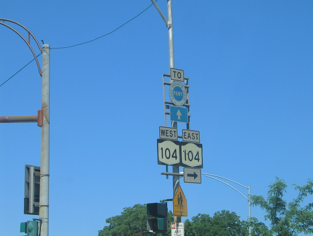
NY 104 and Lake Ontario State Parkway shield assembly posted on Lake Avenue north at Ridgeway Avenue. The east NY 104 shield was a repurposed NY 283 marker. 07/02/05
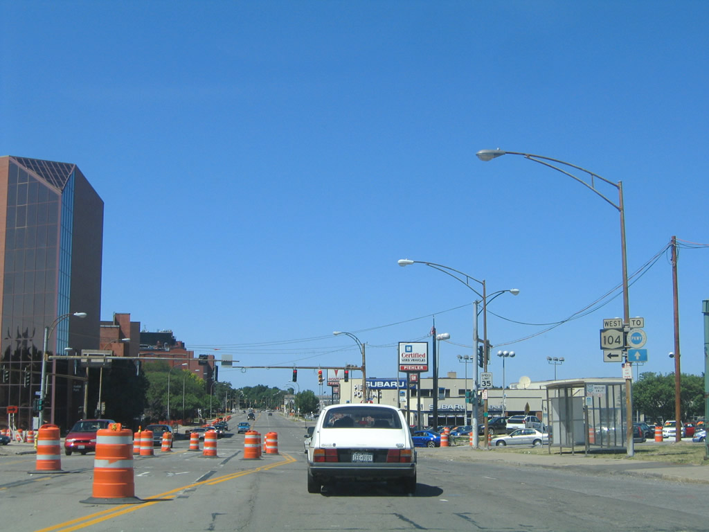
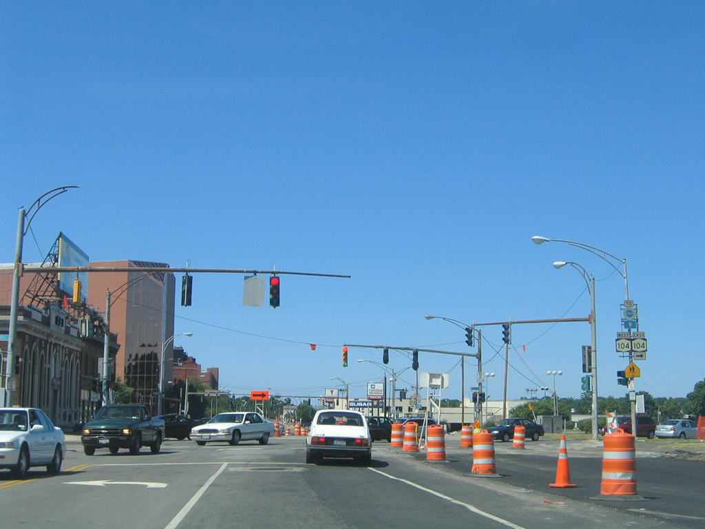
NY 104 (W Ridge Road) crosses Lake Avenue at the next intersection. NY 104 continues along W Ridge Road along an industrial corridor to NY 390 (Outer Loop) at Greece. 07/02/05
Another blue Lake Ontario State Parkway trailblazer was posted along Lake Avenue northbound ahead of Keehl Street. Keehl Street heads east from the Kodak park area to Maplewood Drive at Maplewood Park. 07/02/05
Lake Avenue runs along side Holy Sepulchre Cemetery north of Kodak Park and south of the Charlotte section of the city. 07/02/05
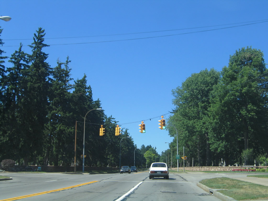
Lake Avenue emerges from the Riverside Cemetery area in a residential area at Wyndham Road. 07/02/05
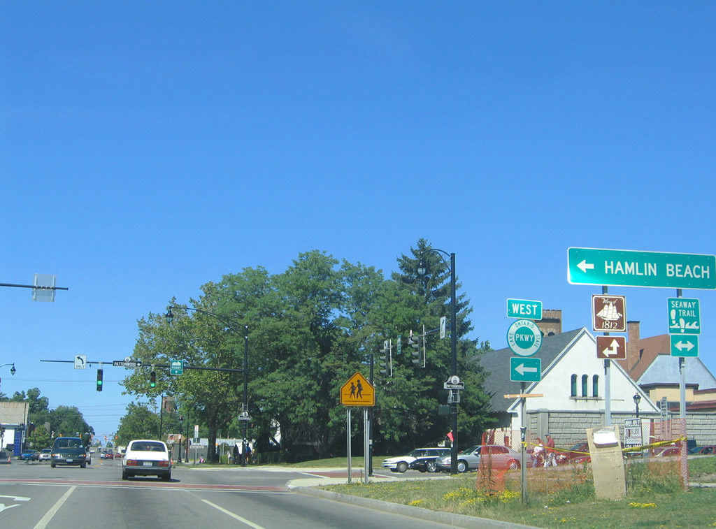
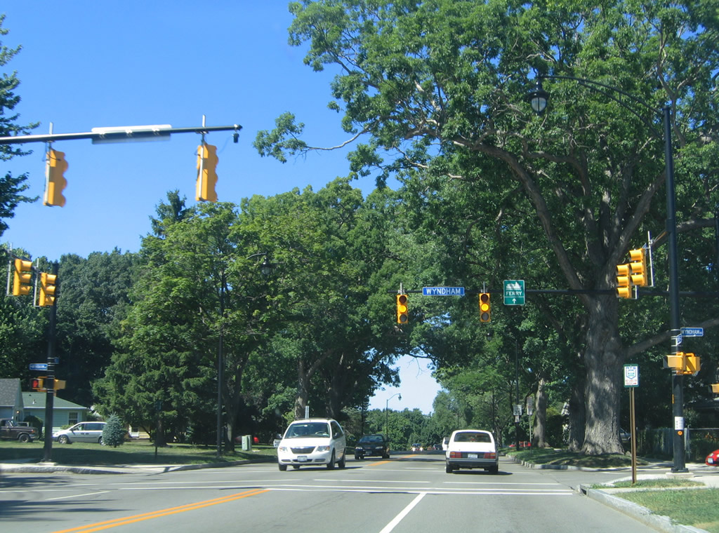
Within the Charlotte neighborhood of north Rochester, Lake Avenue meets Lake Ontario State Parkway west and the Col. Patrick O'Rorke Memorial Bridge east to Pattonwood Drive. 07/02/05

Latta Road travels west from River Street on the Genesee River to a partial interchange with Lake Ontario State Parkway. Further west, the road becomes a part of NY 18. 07/02/05
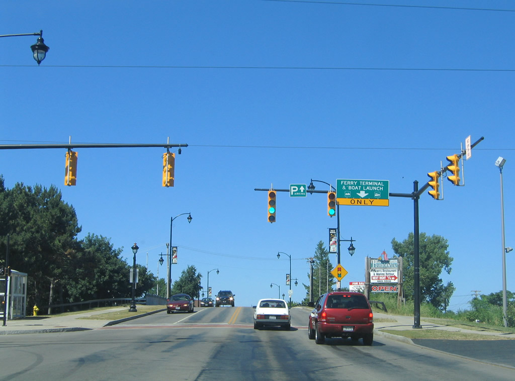
Lake Avenue spans a defunct railroad line ahead of the former Fast Ferry terminal. 07/02/05
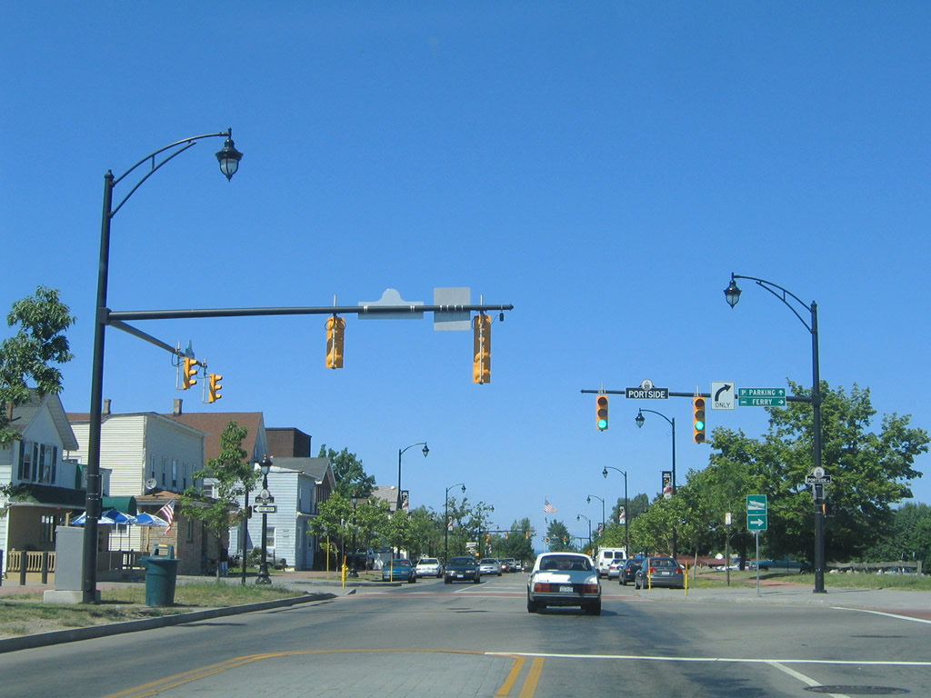
The Fast Ferry service ran between 2004 and 2005 between Rochester and Toronto, Ontario. Funding woes cancelled the service once in 2005 and again for good by early 2006. 07/02/05
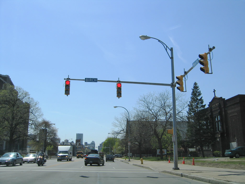
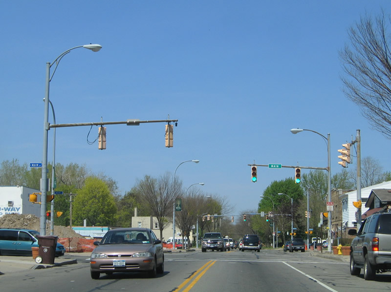
E Main Street bee lines for Downtown Rochester from Goodman Street westward. Pictured here is the signalized intersection at Birch Crescent. 05/10/05
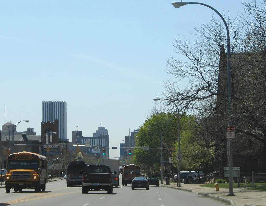
Approaching Prince Street and Downtown Rochester on E Main Street west. 05/10/05
Alexander Street heads north from University Avenue across E Main Street to Kenilworth Terrace. 05/10/05
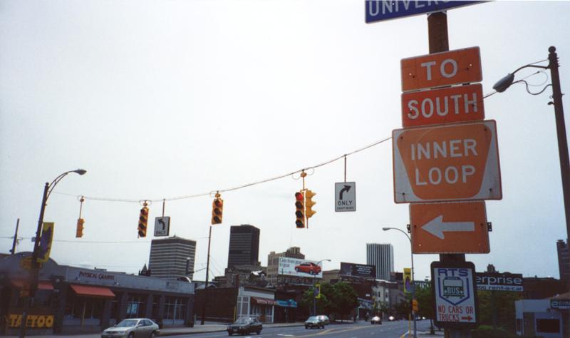
Inner Loop trailblazer on E Main Street west at University Avenue. The Inner Loop south of E Main Street was converted to an urban boulevard. 05/28/00
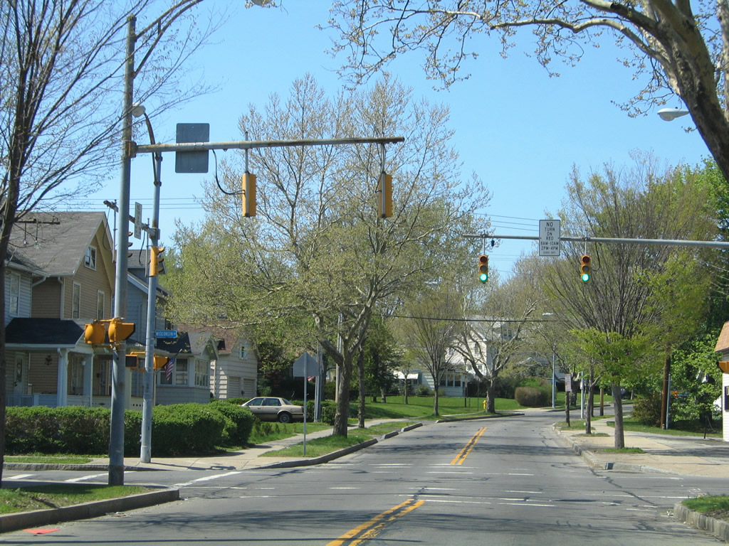
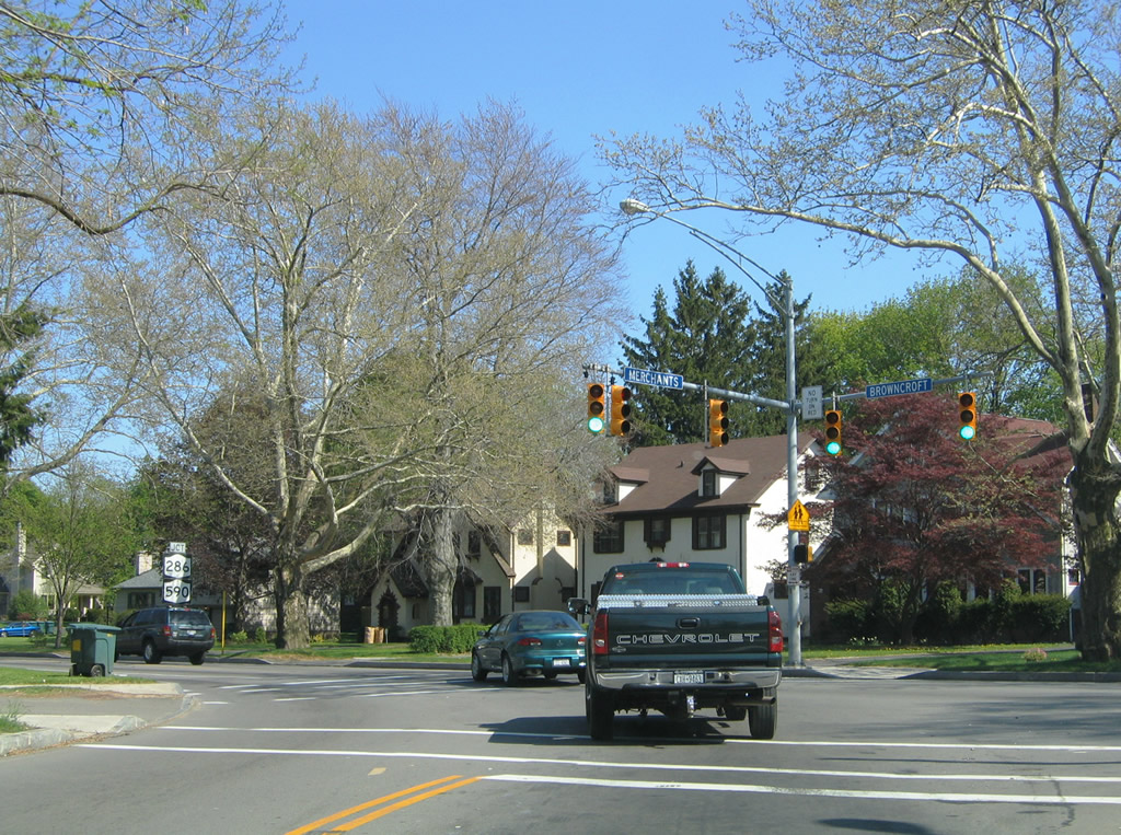
Mrchants Road north at Wisconsin Street south and Wyand Crescent north. Merchants Road provides a cut-off between Browncroft Road west from NY 286/590 to Culver Road north. 05/10/05
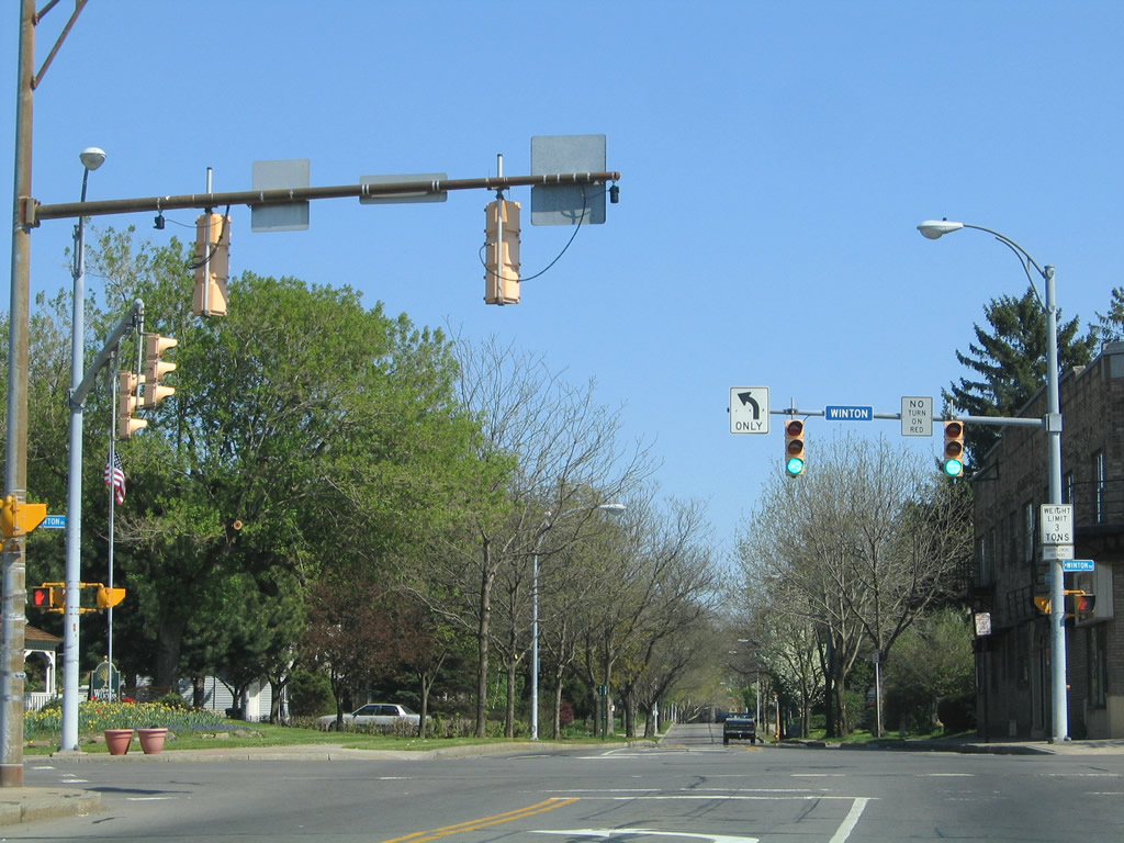
Southbound Merchants Road at the five point intersection with Winton Road and Elm Drive east. Winton Road heads south to I-490 (Exit 20) and north to NY 404 near NY 590 (Seabreeze Expressway). 05/10/05
Merchants Road south merges with Browncroft Boulevard east ahead of the parclo interchange with NY 590. Browncroft becomes NY 286 east from NY 590 into Penfield. 05/10/05
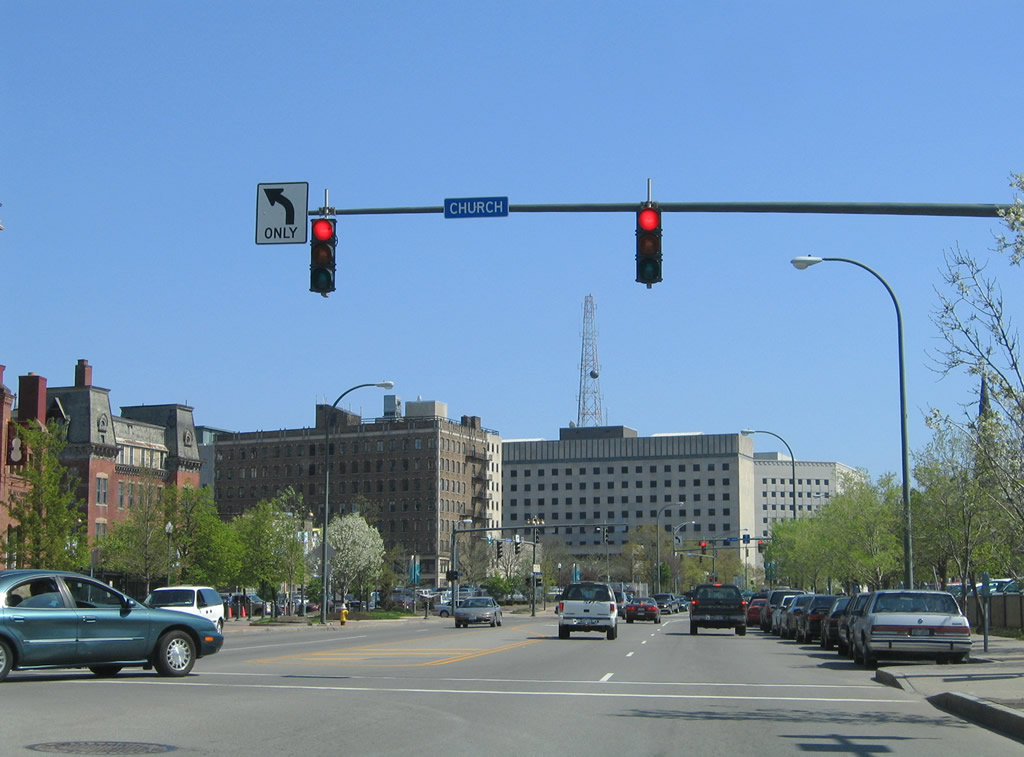
Traveling south on Plymouth Avenue from the Inner Loop to W Main Street at Church Street. Church Street connects Plymouth with State Street. 05/10/05
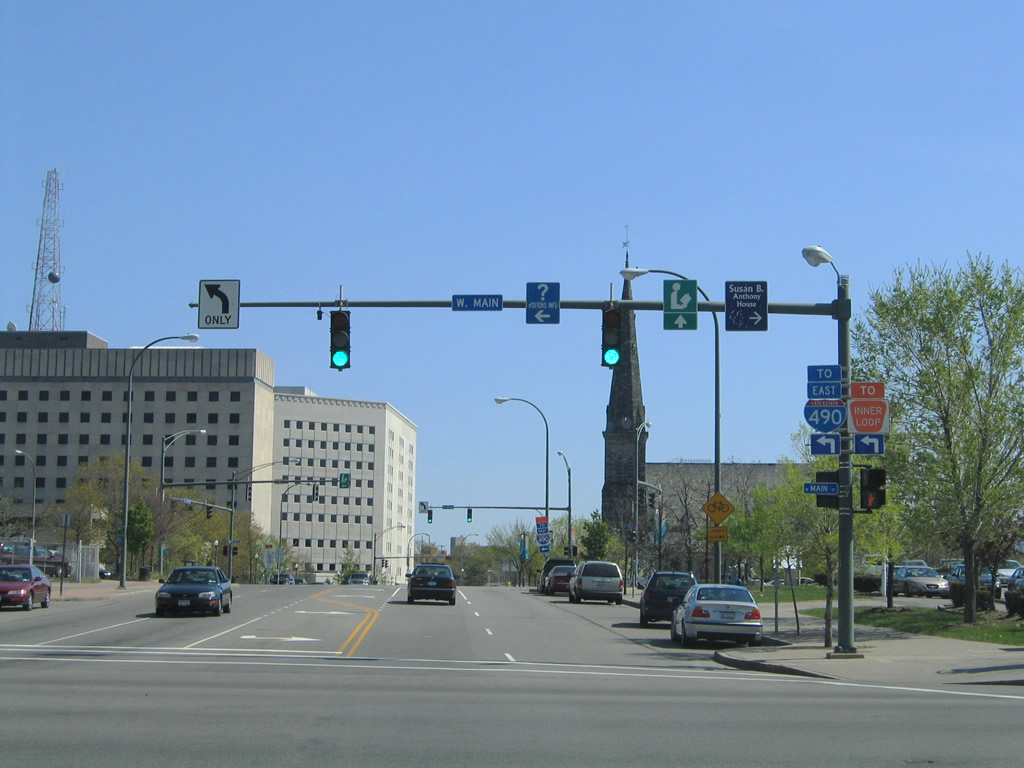
Southbound Plymouth Avenue at W Main Street. Travelers bound for I-490 east and the Inner Loop are directed one block further south to NY 31 (Broad Street). 05/10/05
State Street north at Commercial Street within the High Falls area of Downtown Rochester. Commercial Street heads two blocks to Browns Race within the High Falls Heritage Area. 05/10/05
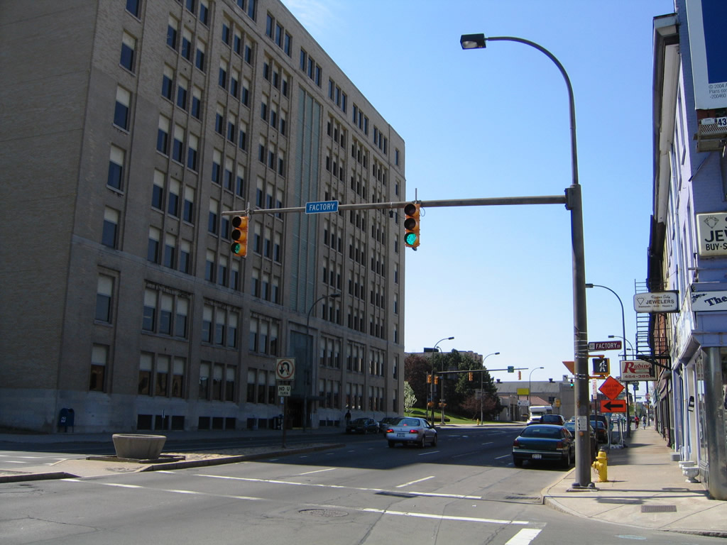
Westbound at the north end of Factory Street beside the Kodak Building. Factory Street runs between State and Mill Streets. 05/10/05
Southward facing view of State Street at Platt Street. Platt Street flows northward from the Frontier Field area to the Pont de Rennes pedestrian bridge across the Genesee River. 05/10/05
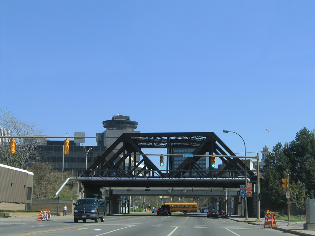
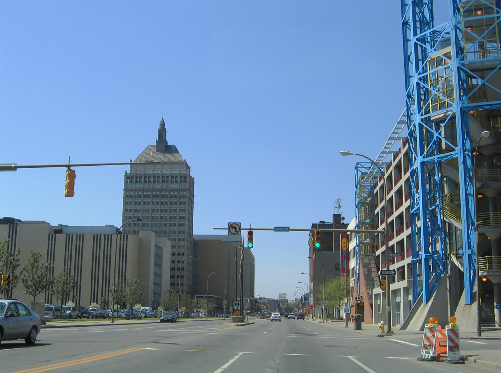
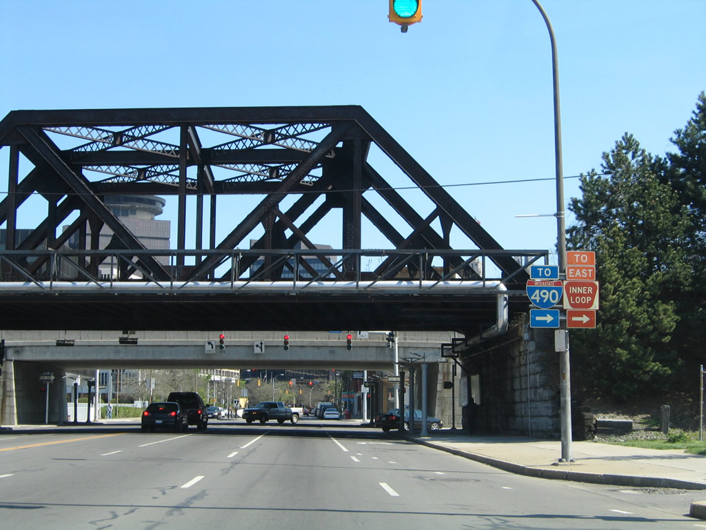
Nearing the Inner Loop freeway, State Street intersects Commercial Street. A truss bridge carries a CSX Railroad above State Street between the traffic light and Central Avenue west. 05/10/05
Central Avenue connects the split diamond interchange of the Inner Loop between State Street and Plymouth Avenue. The westbound frontage street provides access to the Inner Loop on-ramp to I-490 west. 05/10/05
Winton Road is a through street in east Rochester. Pictured here is the northbound intersection with Main Street; Main Street stems west from Winton to Downtown. 05/10/05

The next traffic light along Winton Road north is at Merchants Road, a through street between Browncroft Boulevard near NY 590 and Culver Road. 05/10/05
Looking east down Mill Street within the High Falls Heritage Area. 05/10/05
Northerly view from Mill Street at the Kodak Building adjacent to the intersection of Factory Street and State Street. 05/10/05

Platt Street at Browns Race, near the Pont de Rennes (Bridge of Rennes). 05/10/05
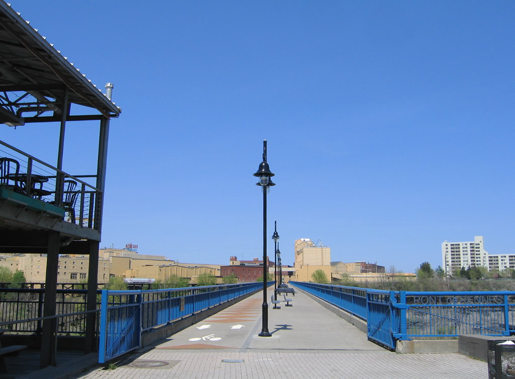
The Pont de Rennes is a pedestrian bridge high above the Genesee River between the High Falls Heritage Area and the Genesee Brewing Company area on St. Paul Street. The bridge commemorates the friendship between Rochester and Rennes, France, the first sister city, established in 1958. 05/10/05
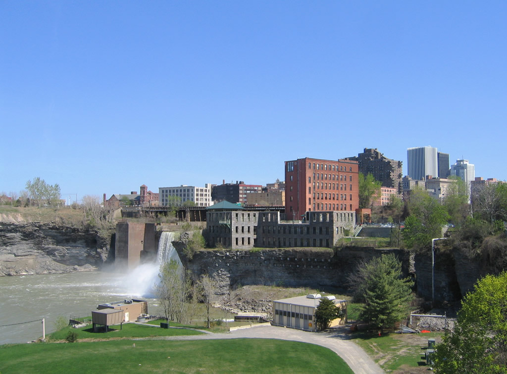
Viewing High Falls from the Pont de Rennes. 05/10/05

Viewing High Falls from the Pont de Rennes. 05/10/05
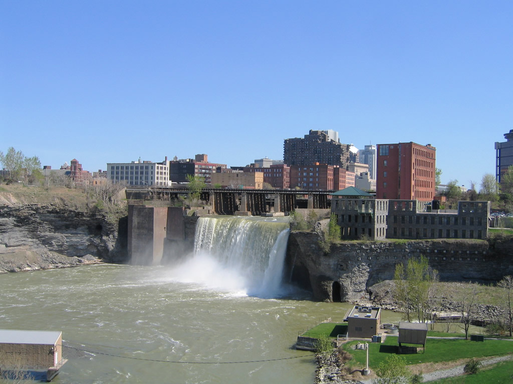
Passing just above High Falls are the CSX Railroad and Inner Loop freeway bridges. 05/10/05

Passing just above High Falls are the CSX Railroad and Inner Loop freeway bridges. 05/10/05
Photos by Alex Nitzman
Page Updated Tuesday June 09, 2020.