
U.S. 13 Delaware – South

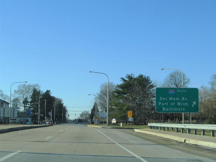
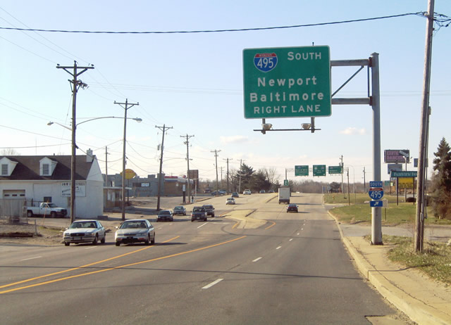
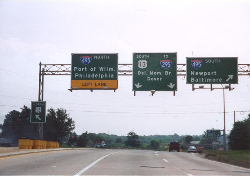
Signs for I-495 south at Claymont feature three destinations, instead of two as found elsewhere in the state. 12/16/05
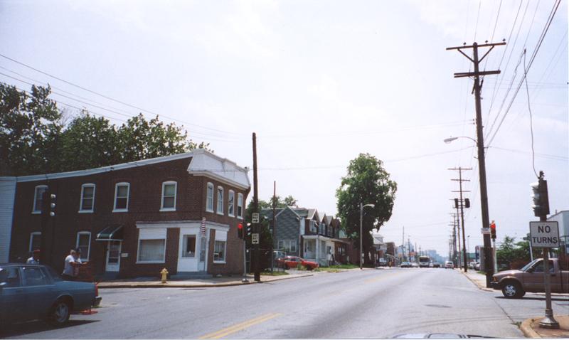
U.S. 13 Business transitions to Market Street along the Wilmington city line to 36th Street. Replaced with span-wire based signals by 2012, pictured here were pedestal signals at 40th Street. May 2000
A recycled outline shield for U.S. 13 was posted on 4th Street east at Church Street (U.S. 13 north). It was replaced by August 2004. 04/10/04
US 13/SR 9 south at Church Street (US 13 north). This shield assembly was replaced by 2014. 08/31/04
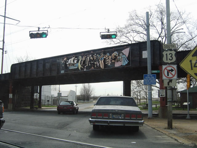
A shield for SR 9 at 4th and Church Streets was replaced with a no right turn sign for the southern segment of Church Street. The whole assembly was replaced by 2014. 04/10/04
Turning south onto Heald Street, U.S. 13 /SR 9 approach SR 9A (Christina Avenue). This shield assembly was replaced by August 2004. 04/10/04
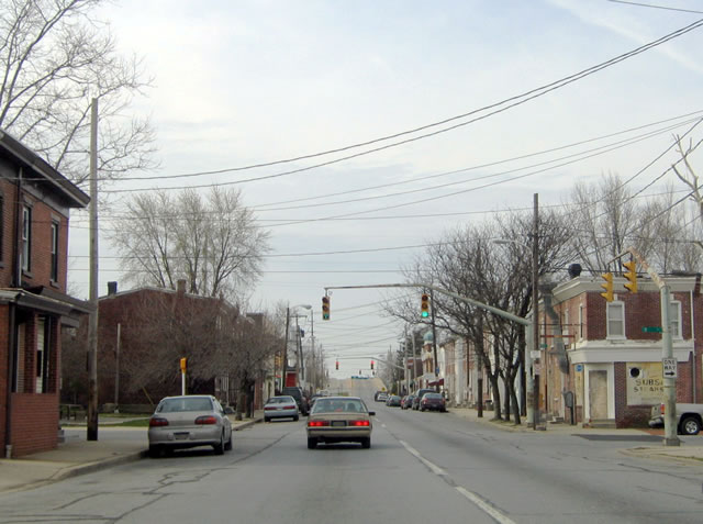
U.S. 13/SR 9 split into the couplet of Heald Street south and New Castle Avenue north at Lobdell Street. The first in a series of old style mast arm assemblies with 36 inch Eagle flatback signals appeared here until August 2004. 04/10/04
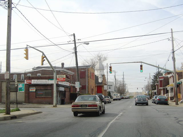
Old style mast arm signals formerly in use on U.S. 13/SR 9 (Heald Street) south at A Street in Wilmington. 04/10/04
Replaced signal assemblies on U.S. 13/SR 9 south at B Street in Southbridge, Wilmington. 04/10/04
Only one Eagle flatback signal was used for each direction of C Street at Heald Street. 04/10/04
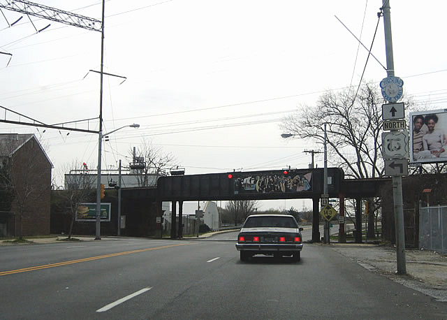
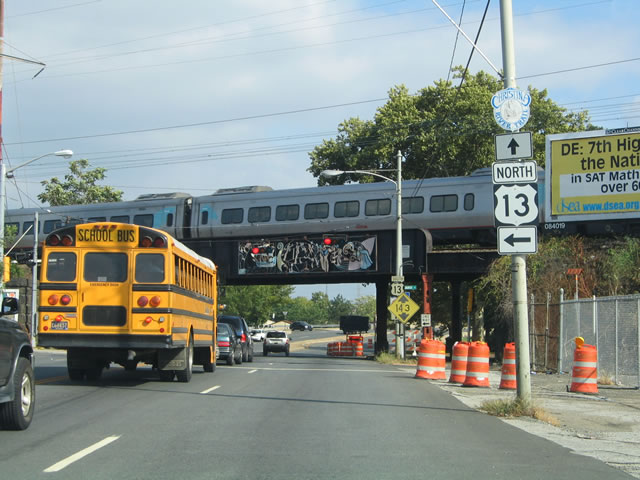
These 1970s overheads were replaced by 2007, and Baltimore was removed as a control point for U.S. 13. 04/10/04
This sign overlay predated construction to add northbound access to I-495 north from U.S. 13 (Dupont Highway) south. It was carbon copied in 2008. 03/22/04
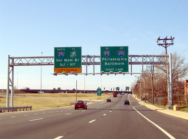
A new set of overheads was added in 2000 coinciding with the opening of a ramp from U.S. 13 south to I-495 north. This set of signs was later amended to green out the left lane placard with one referencing 2000 feet. June 2000
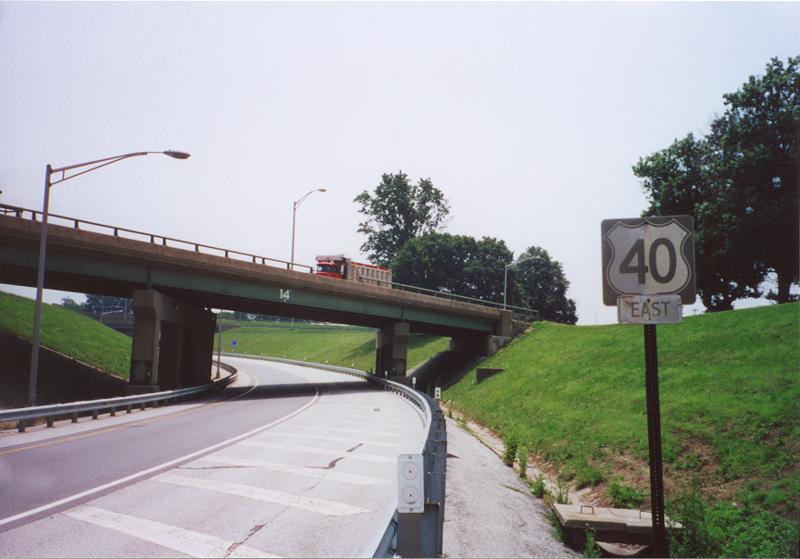
Entering the Farnhurst Interchange with I-295 and U.S. 40 east along U.S. 13 (Dupont Highway) south. Adjustments made by August 2004 to these overheads added during the 2001-03 revamp of the interchange overheads included adding an exit only placard on the right sign. 03/22/04
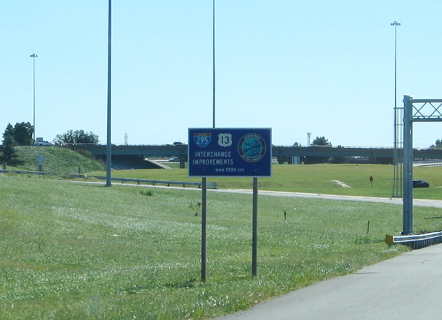
DRBA signage installed during the 2001-03 interchange improvement project on U.S. 13 southbound. 09/19/04
Pictured here was the original on-ramp from U.S. 13 south to I-295/U.S. 40 east. This location was also the south end of U.S. 202 until 1970 and north end of U.S. 301 until 1993. February 1995
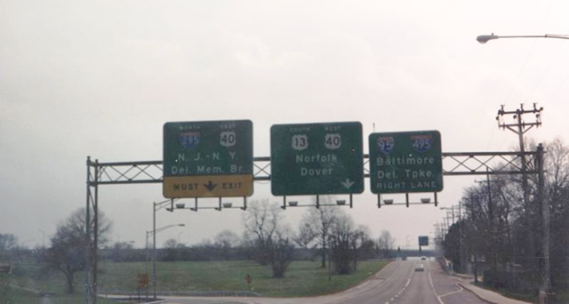
A look at the former direct ramp from U.S. 13 south to I-295 north. An older U.S. 40 shield remained in service here through to the dismantling of the ramp. Traveling above was the northbound mainline for U.S. 13. May 2000
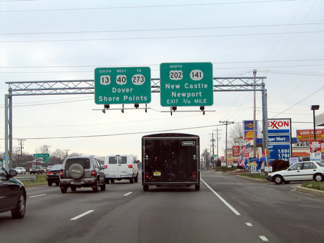
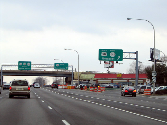
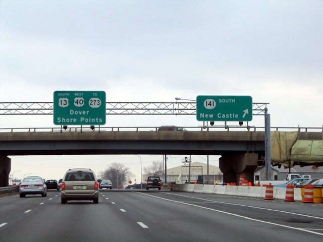
Traveling through the Wilmington Manor area along U.S. 13/40 south ahead of SR 141 (Basin Road) and U.S. 202 north. This set of signs was replaced by Fall 2004, with the U.S. 13 control point of Shore Points replaced with Beaches. 03/27/04
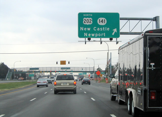
This overhead for the c/d roadway to U.S. 202 north and SR 141 was carbon copied in fall 2004. U.S. 202 is vastly unsigned along Basin Road north to I-95. 03/27/04
Early 1990s sign installations for SR 141 on U.S. 13/40 added U.S. 202. 03/27/04
Replaced overheads that were posted at the loop ramp for SR 141 south to New Castle on Dupont Parkway south. A project underway at that time repainted the Basin Road overpass. 03/27/04
This U.S. 13 shield was posted after the Dupont Highway intersection with SR 273 at Hares Corner. It was removed by 2007. 04/04/04
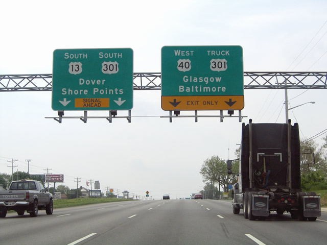
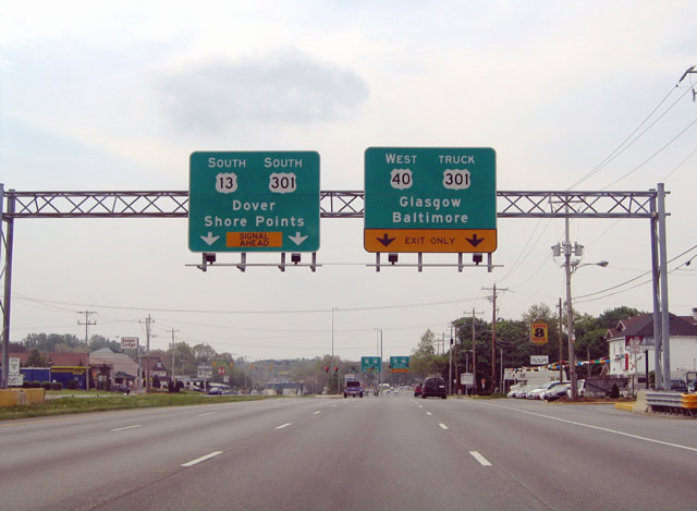
This set of signs was installed by 1993 but continued to reflect the former overlap of U.S. 301 with Dupont Highway south and U.S. 301 Truck on Pulaski Highway (U.S. 40) west. Sign changes made by fall 2004 amended the overheads to display TO SR 1 and U.S. 301 for U.S. 13 south. 05/01/04
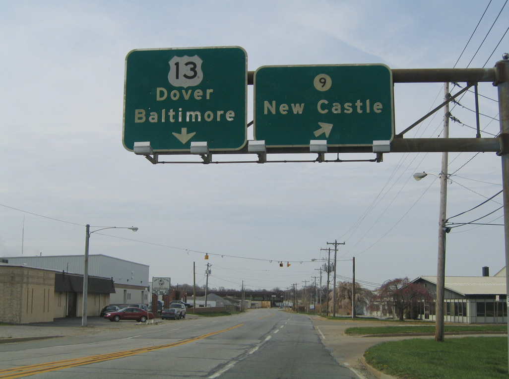
Previous signs posted at State Road referenced Norfolk as the second control city for U.S. 13 south and Annapolis as the second entry for U.S. 40 west. DelDOT replaced those with Shore Points for SR 1 south of Dover and Glasgow for the U.S. 40 junction with SR 896. 05/01/04
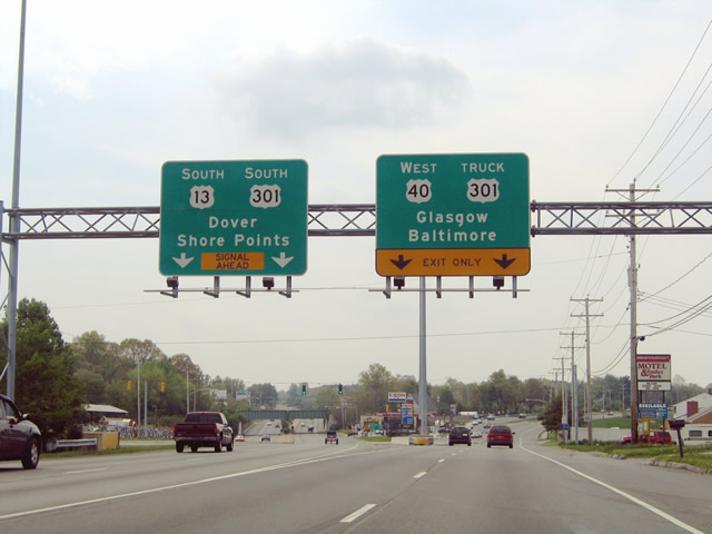
Truck U.S. 301 ran west along U.S. 40 (Pulaski Highway) to SR 896 south and the U.S. 301 beginning in Glasgow. The State Road wye intersection was historically also the south end of U.S. 202. 05/01/04
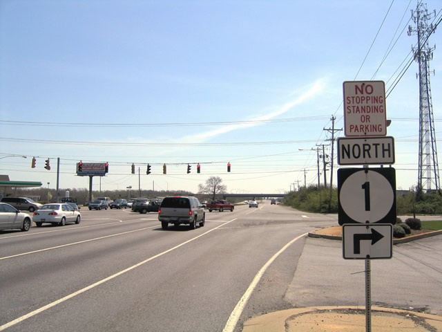
Northbound SR 1 trailblazer posted along U.S. 13 (Dupont Highway) south at Bear Road for the adjacent on-ramp. 04/17/04
SR 71 (Red Lion Road) stems southwest from U.S. 13 within the SR 1 interchange outside Bear. Traffic lights were added to the intersection on October 25, 2007. 04/17/04
Traveling above SR 1 on U.S. 13 & SR 72 (Wrangle Hill Road) south ahead of the northbound on-ramp to Wilmington. 04/17/04

Construction in 2015 reconfigured the exchange joining U.S. 13/SR 1-72 into a diverging diamond interchange (DDI). 04/17/04

U.S. 13 south at the turn back onto Dupont Parkway from SR 72 (Wrangle Hill Road) east at SR 7. 08/05/07
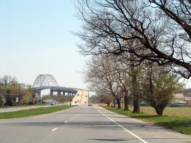
U.S. 13 (Dupont Highway) south ahead of the St. Georges Bridge over the Chesapeake and Delaware Canal. 04/17/04
The entrance ramp linking U.S. 13 at South St. Georges with SR 1 north was replaced with a new connection further south at Port Penn Road. 06/17/12
U.S. 13 south at the former entrance ramp to SR 1 north for the William Roth Bridge across the C & D Canal. 01/15/17
Trailblazer for U.S. 13 south formerly posted after the Lorewood Grove Road ramps at South St. Georges. This assembly was removed by 2007. 04/04/04
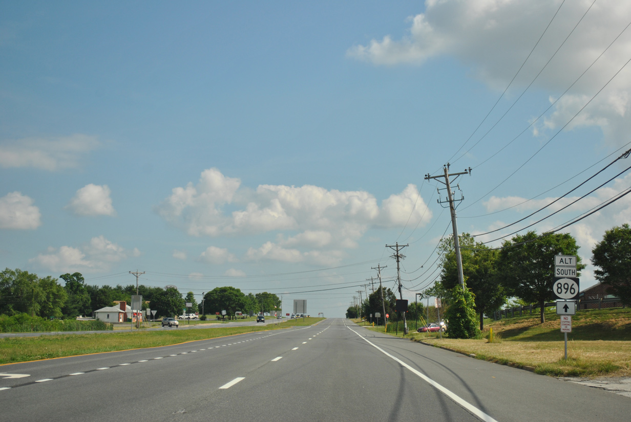
An Alternate SR 896 shield appeared as U.S. 13 intersected Port Penn Road east to Thorntown and SR 9 at Port Penn. The bannered route is no longer designated. 06/17/12
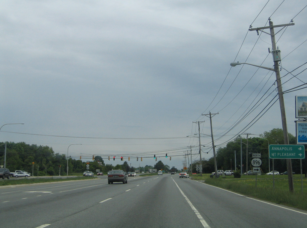
Replaced guide sign posted for the SR 896 connection from U.S. 13 at Boyds Corner to U.S. 301 at Mount Pleasant. 05/15/05
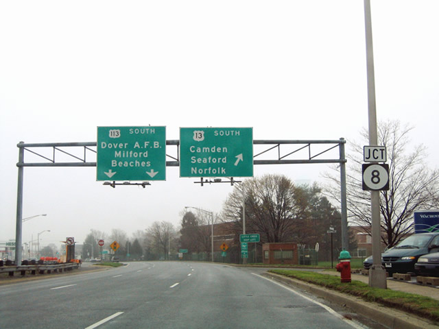
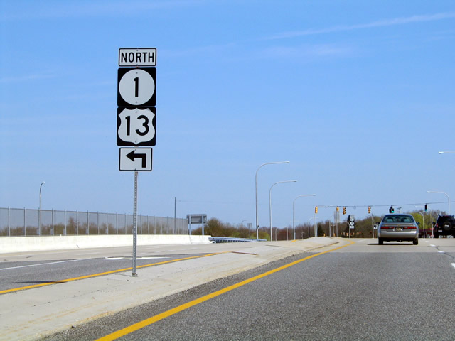
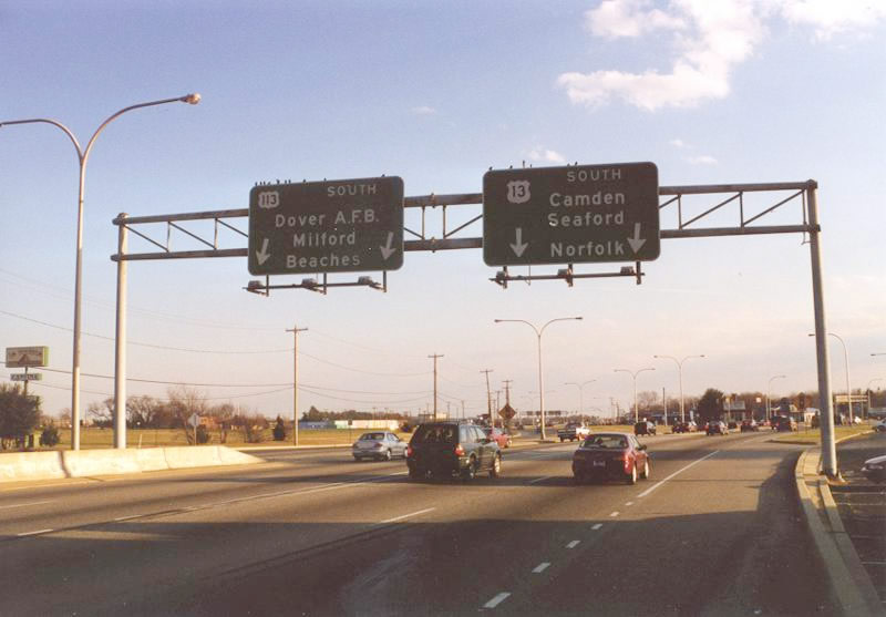
Dupont Highway south ahead of SR 8 (Division Street) and U.S. 113. This set of signs was replaced, with Norfolk dropped for U.S. 13 south and the U.S. 113 panel reflecting the connection to SR 1/Beaches. 04/13/04
A historic look at the southbound beginning of U.S. 113 from U.S. 13 (Dupont Highway). U.S. 113 followed Bay Road south to Dover Air Force Base and the Milford bypass along SR 1. December 1999
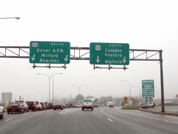
The former partition of U.S. 13/113 south in Dover. U.S. 113 was truncated from Dover south to Milford in February 2004. Signs for U.S. 113 were taken down throughout 2004. 04/13/04
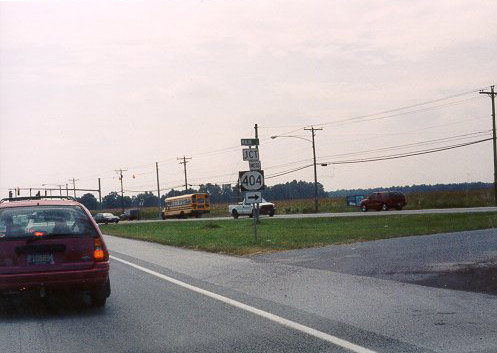
U.S. 13/SR 404 south split at the return of U.S. 13 Business /SR 404 Business from Main Street and Bridgeville. This intersection changed in 2008 to improve safety by eliminating the acute angle in which SR 404 and SR 404 Business crossed Sussex Highway. 09/04/01
Photos by AARoads, JP Nasiatka (09/04/01)
Page Updated Friday January 24, 2025.