Google Earth and a Video Tour of Florida Cities
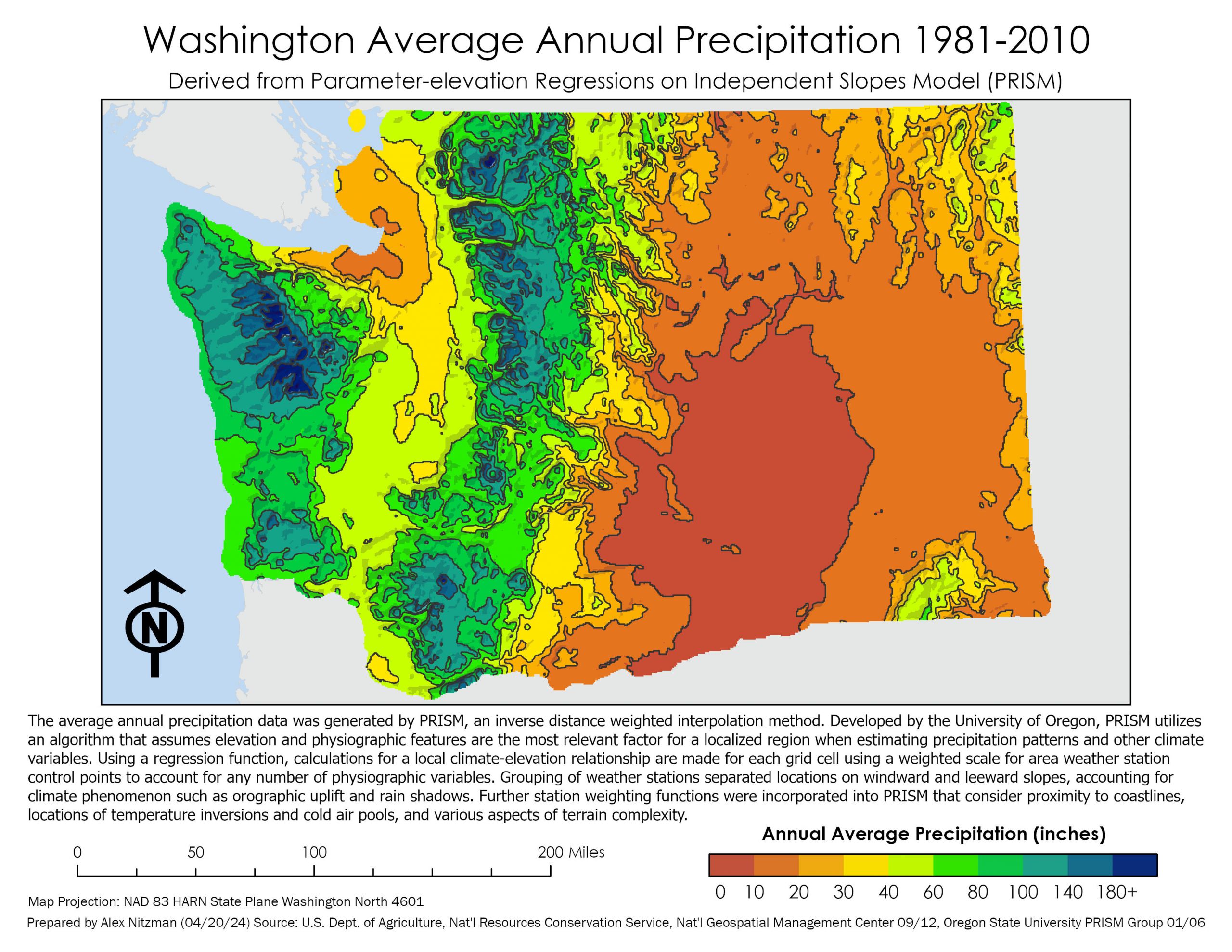
The final module of Computer Cartography returns us to Google Earth to work with KML (Keyhole Markup Language) files and explore some additional functionality of the software. We previously used Google Earth with data collected using ArcGIS Field Maps and a KML file of point data imported from ArcGIS. The use of KML files with Google Earth allows us to share geographic data with a general audience that may have zero to [...]