
California
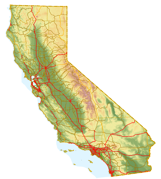
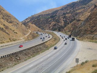
Welcome to California, the Golden State. This page features roads and highways throughout the state of California, including Inter state routes, U.S. highways, state routes, county routes, business routes, and local streets and highways.
This page is sorted by route number and designation (see our list of routes below). In addition to following modern highways (typically in a south to north or west to east direction), pages here also cover historic routes, such as old U.S. highways that were largely decommissioned in 1964. Highways on this site are typically referred to as "Interstate xx, I-xx, U.S. xx, California xx, SR xx (State Route), or CR xx (County Route)".
Route Categories
Interstates
28 routes, 2,312 photos
Business Routes
25 routes, 606 photos
U.S. Highways
15 routes, 1,346 photos

State Routes 1-50
42 routes, 3,011 photos
State Routes 51-100
43 routes, 2,208 photos

State Routes 101-150
40 routes, 1,424 photos
State Routes 151-200
41 routes, 1,182 photos
State Routes 201-250
33 routes, 702 photos
State Routes 251-999
27 routes, 968 photos
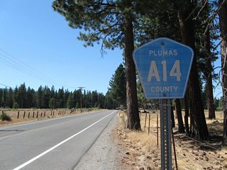
County Routes
31 routes, 776 photos

Other Roads
6 routes, 147 photos
City/Area Guides
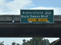
Bakersfield
13 Photos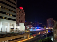
Long Beach
93 Photos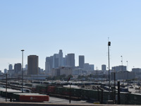
Los Angeles
104 Photos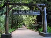
Marin County
119 Photos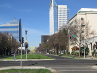
Sacramento
105 Photos
San Diego
171 Photos
San Francisco
97 PhotosOther Guides

California State Route Log
California Postmile System
Caltrans uses a post mile system to classify the state route system. Postmiles consist of white paddles with the following components:
- County - a two or three letter code
- Route Number
- Route Suffix - for qualified routes
- Postmile Prefix Code - for qualified routes
- Postmile Value - distance measured from the state of a route, or the point in which a route enters the county
- Postmile Suffix Code - for qualified routes
Route Suffixes are S for Supplemental and U for Unrelinquished. There are ten Postmile Prefixes referencing changes such as duplicate postmiles, realignments, spurs and overlaps. Postmile Suffixes cover instances where a major route separates along substantially different paths. The Caltrans Postmile Query Tool provides detailed information and a FAQ on postmiles.
An example of Postmile Suffixes is Interstate 80, where it was relocated over I-880 around the north side of Sacramento in 1981. Postmiles on this section of I-80 are designated with the letter "M" for realignment of R mileage. All non-prefixed mileages used in California date from 1964. If a segment was realigned since 1964, the realigned portion uses the prefix "R" for first realignment. Postmile "equations" (AHD - ahead / BK - back) are used where the realigned portion leaves and rejoins the original alignment. If that first relocation is rerouted again, this second realignment uses the prefix "N" for realignment of M mileage.
C Blocks
A "C" block is a concrete right of way monument (marker) that was used by the California Division of Highways to mark its rights of way along many old highways. These markers are found all along Chuckwalla Road; in most cases, they were not removed when the old road was decommissioned from the state highway system. According to Joel Windmiller (the California Highwayman), "C" Blocks were placed along state routes from 1914 to 1934.
The monuments are distinctive for the capital embossed "C" found on top of the monument. "C" Blocks are projected about six inches above the surface of the ground but sometimes were placed higher. The "C" Block is made of concrete six inches square and 3.5 feet feet tall, including the portion below ground (the majority of the monument is below ground). The edges of the upper portions are beveled and a letter "C" is embossed on one side for identification. There is a copper plug on the top center that marks the exact point of the angle.
These monuments were made necessary due to imprecise surveying records that were compiled when the highway system was laid out and real estate was not as valuable as it is today. The old surveying techniques gave boundary lines little meaning; they often relied on landmarks such as buildings, trees, rocks, mountains, and the roads themselves. However, many of these features were not permanent and often disappeared or changed position. To ensure accuracy, the California Highway Commission carefully surveyed and placed these markers along the side of the roadway at each and every angle or curve point and at fixed intervals on straight sections starting in 1914.
Population
| State Population | |||||
|---|---|---|---|---|---|
| 37,253,956 - 2010 U.S. Census | |||||
| 39,538,223 - 2020 U.S. Census | |||||
| Metropolitan Populations | |||||
| Los Angeles-Long Beach- Anaheim | 13,200,998 | San Francisco-Oakland- Berkeley | 4,749,008 | Riverside-San Bernardino- Ontario | 4,599,839 |
| San Diego-Chula Vista- Carlsbad | 3,298,634 | Sacramento-Roseville- Folsom | 2,397,382 | San Jose-Sunnyvale- Santa Clara | 2,000,468 |
| Fresno | 1,008,654 | Bakersfield | 909,235 | Oxnard-Thousand Oaks-Ventura | 843,843 |
| Top County Populations | |||||
| Los Angeles | 10,014,009 | San Diego | 3,298,634 | Orange | 3,186,989 |
| Riverside | 2,418,185 | San Bernardino | 2,181,654 | Santa Clara | 1,936,259 |
| Alameda | 1,682,353 | Sacramento | 1,585,055 | Contra Costa | 1,165,927 |
| Fresno | 1,008,654 | Kern County | 909,235 | San Francisco | 873,965 |
| Top City Populations | |||||
| Los Angeles | 3,970,219 | San Diego | 1,422,420 | San Jose | 1,013,616 |
| San Francisco | 866,606 | Fresno | 530,267 | Sacramento | 512,838 |
| Long Beach | 454,681 | Oakland | 424,891 | Bakersfield | 385,725 |
| Anaheim | 353,676 | Santa Ana | 331,301 | Riverside | 330,786 |
| Stockton | 312,716 | Irvine | 283,700 | Chula Vista | 272,979 |
| Sources: 2020 U.S. Census Data (metro populations and counties), 2020 U.S. Census Estimate (cities) | |||||
About California
- Capital:
 Sacramento
 - Nickname: Golden State
- If it were its own country, California would rank sixth among the world' richest nations based on the value of goods and services the state produces (as of 2000).
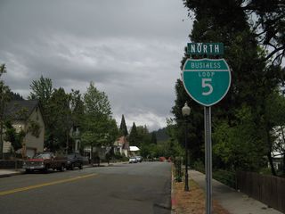
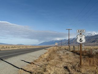
- California decommissioned (eliminated) most of its U.S. routes starting in 1964: U.S. 40, U.S. 60, U.S. 66, U.S. 70, U.S. 80, U.S. 91, U.S. 99, U.S. 299, U.S. 399, and U.S. 466. Most of the decommissioned routes were no longer signed by no later than 1972. Other routes that were truncated or reduced in length include U.S. 6, U.S. 50, U.S. 101, and U.S. 395. Only U.S. 95, U.S. 97, and U.S. 199 were left alone after the actions of 1964.
- California 49, the Gold Chain (Mother Lode) Highway, is so numbered because gold was discovered in the Sierra Nevada Mountain foothills in 1848, with a plethora of treasure seekers traversing the foothills in the Gold Rush of 1849.
- Area: 163,695.57 square miles or 411,049 square kilometers, 3rd largest
- Statehood: 31st state; admitted September 9, 1850
- Total Interstate Mileage: 2,455.74 miles
- Highest Point: Mount Whitney (west of Lone Pine partially in Sequoia National Park and Inyo National Forest in the Sierra Nevada) is 14,494 feet. This is the highest point in the 48 contiguous states.
- Lowest Point: Badwater Basin in Death Valley National Park sits at an elevation of -282 feet below sea level. This is the lowest point in the 48 contiguous states.
- The Sierra Nevada and Cascade Range follow the spine of California south to north, while the Coast Range separates the Pacific Ocean from the Central Valley.
- The San Gabriel Mountains north of the Los Angeles Basin run east-west, unlike the north-south alignment of the state' other mountain chains: Sierra Nevada, Coast Range, and Cascades.
- The Central Valley (formed by the Sacramento and San Joaquin Rivers) is the chief agricultural area of the state, followed by the irrigated Imperial Valley in the southern desert.
Photography contributed by Alex Nitzman, Andy Field, Brent Ivy, Jake Bear, Jeff Royston, Kevin Trinkle and many others. In addition, we extend our thanks to a variety of people who have contributed to this site or have joined us on our trips to tour the Golden State: Leland Bailey, Michael Ballard, Trevor Carrier, Russ Connelly, Casey Cooper, Justin Cozart, Daniel Faigin, Mark Furqueron, Martin Grahl, Steve Hanudel, Dominic Ielati, Cameron Kaiser, C.J. Moon, Scott Parker, Joe Rouse, Pete Sison, Jeff Waller, Joel Windmiller, Mark Yoshinaka, and many others for participating in taking trips with us and submitting photos from the state of California. A list of resources used to create this site are listed at the bottom of this page.
Sources
We use quite a few resources to construct this page, and we try to keep it up to date (but that is not always the case!). We use mainly official sites, but many of the AARoads contributors also have sites of their own that have proven helpful in providing reference material for this site. To complete the AARoads California Roads and Highways pages, we have utilized a variety of resources including:
- U.S. Census for population figures (mostly from the 2000 and 2010 data collection), geographical size, and demographic information
- League of California Cities - for incorporation dates of California cities
- Benchmark California Atlas - to confirm elevations and identify nearby geographical information near highways
- Rand McNally Atlas and Thomas Guides - to confirm exit numbers, exit configurations, and identify street names within urban areas
- Automobile Association of America - for still more map research, especially current and vintage maps issued by the Automobile Club of Southern California (ACSC) and California State Automobile Association (CSAA)
- California Department of Transportation (Caltrans) Bridge Logs - these booklets help us to determine dates of highway construction and dates of highway realignment
- California Historic U.S. Highways - the web site compiled by Casey Cooper has a great deal of information about the old U.S. highways of California and offers scans of old pictures from vintage California Highways and Public Works (CHPW) magazines
- Southern California Regional Rocks and Roads - administered by Michael Ballard, this site has a great deal of historic highway information including pictures focusing primarily on old alignments in Southern California
- California Highways - this very detailed page administered by Daniel Faigin offers the latest information on state highway legislative routings and details the historical changes made to the routes through the years (including old map scans and links to construction projects)
- Floodgap Roadgap - this site, run by Cameron Kaiser, has very detailed information about several highways that run through the Golden State, especially U.S. 395 and U.S. 6 (I doubt anyone has put together as comprehensive a page on U.S. 395 as Cameron has done)
- Official state, county, city, regional planning agency, and chamber of commerce webpages help us to obtain unique facts about each region, county, city, or area.
- Wikipedia - if we cannot find specific information anywhere else, the on-line encyclopedia may have additional information
- Other resources include personal observations from hundreds of trips around the Golden State and newspaper articles that are individually cited mostly for ongoing construction projects and completion dates
A special thanks also to C.J. Moon for his assistance in providing historical chronologies for many of the Interstates and other numbered routes across the state of California. We try to cite any other sources used on individual pages where we can.
Last updated: Wednesday August 20, 2025