
Long Beach, CA

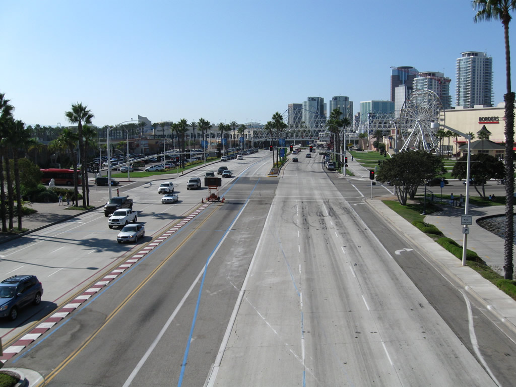
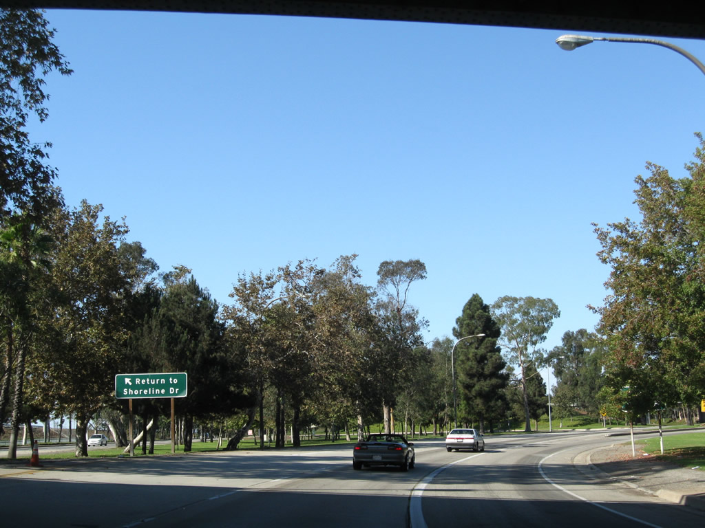
This view looks east along Shoreline Drive from the pedestrian bridge between the Long Beach Convention Center and Rainbow Harbor. - 09/28/2008
Overview
The city of Long Beach is the second largest city in Los Angeles County and is one of the most populated cities in California. Long Beach was incorporated on February 10, 1888 and then disincorporated July 24, 1896. It incorporated again on December 13, 1897. The city of Long Beach ("Many Unique Neighborhoods, One Great City") is home to the busy Port of Long Beach, Queen Mary, Aquarium of the Pacific, and California State University at Long Beach (CSULB). The city consists of 50 square miles (excluding water acreage) and had a population of 462,257 as of the 2010 Census. A vibrant waterfront, coupled with multiple tourist attractions, makes Long Beach a popular year-round tourist attraction.


Shoreline Drive runs southwest from Ocean Boulevard toward Long Beach Harbor. North beyond Shoreline Drive is the Long Beach Convention & Entertainment Center, Long Beach Arena and the Pike at Rainbow Harbor. South of the multi-lane boulevard is the Downtown Long Beach Marina, Shoreline Village and Rainbow Harbor.
Routes
 San Diego Freeway
Interstate 405 is the San Diego Freeway, traveling from east to west through most of Long Beach. A major regional route, I-405 carries traffic from Orange County and points south into Long Beach, then proceeds north to Los Angeles International Airport (LAX) and converges with I-5 near Sylmar.
 Long Beach Freeway
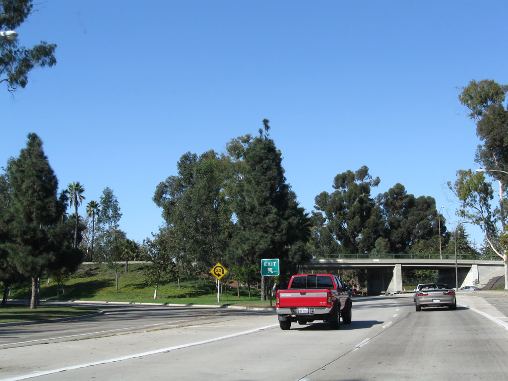
Interstate 710 is the Long Beach Freeway, following the Los Angeles River south into the city of Long Beach. The principal route into the Port of Long Beach, Downtown Long Beach, and the Queen Mary/Cruise Ship Terminal, I-710 divides into several freeway routes upon reaching Downtown Long Beach. These freeway spurs are (in sequence as one travels south on I-710): Shoreline Drive, Harbor Scenic Drive, and Ocean Boulevard. Shoreline Drive connects to downtown, the Aquarium of the Pacific, the Pike, and Convention Center; Harbor Scenic Drive continues south as a freeway to the Queen Mary and Cruise Ship Terminal; and Ocean Boulevard carries Interstate 710 west to Terminal Island. The official south end for I-710 is at SR 47 on Terminal Island near the border between the Port of Long Beach and the Port of Los Angeles.
 Pacific Coast Highway
California State Route 1 is the Pacific Coast Highway. Despite its name, the Pacific Coast Highway stays well inland, away from Downtown Long Beach and mostly north of the main port area. Through Long Beach, SR 1 takes a mostly east-west approach.
 Lakewood Boulevard
California State Route 19 is a major arterial that travels north-south through eastern Long Beach. Originating at Los Alamitos Traffic Circle with SR 1 (Pacific Coast Highway), SR 19 follows Lakewood Boulevard. The highway passes under a runway for Long Beach Airport, then proceeds north into Lakewood.
 Seventh Street
California State Route 22 enters Long Beach from the east, following Seventh Street from the I-405/605 interchange complex to SR 1 (Pacific Coast Highway). Most of SR 22 within Long Beach city limits is not a freeway. The state route upgrades to a freeway east of Interstate 405, as it passes through Garden Grove, Santa Ana and Orange.
 Terminal Island Freeway
SR 47 and SR 103 follow the Terminal Island Freeway alignment from Interstate 710 (Ocean Boulevard) north to the end of the freeway at Willow Street. SR 47 departs from the freeway at the off-ramp for Anaheim Street and Henry Ford Avenue. A portion of the Terminal Island Freeway is located in Los Angeles, and the remainder is in Long Beach. State Route 47 also follows Ocean Boulevard west of the Interstate 710 interchange until passing into Los Angeles.
 Artesia Freeway
California State Route 91 is the Artesia Freeway. Carrying significant traffic across the northern tier of Long Beach, SR 91 also connects to Gardena to the west and Anaheim and Riverside to the east. This major freeway sees substantial use especially east of SR 55 as it travels up the Santa Ana Canyon.
Harbor Scenic Drive
Harbor Scenic Drive connects Interstate 710 with the Queen Mary and Long Beach Cruise Ship terminal, all within the Port of Long Beach.
Ocean Boulevard
Queens Way
Shoreline Drive
Originating at the intersection of Ocean Boulevard and Alamitos Avenue east of Downtown Long Beach, Shoreline Drive loops southwest toward Rainbow Harbor, then west to the Los Angeles River. Paralleling the river, Shoreline Drive forms part of the Downtown spur expressway to Interstate 710.
City Streets and Roads

Harbor Scenic Dr (17 photos)

Ocean Blvd - East (10 photos)

Ocean Blvd - West (34 photos)

Queens Way (15 photos)

Shoreline Dr (17 photos)
Shoreline Dr
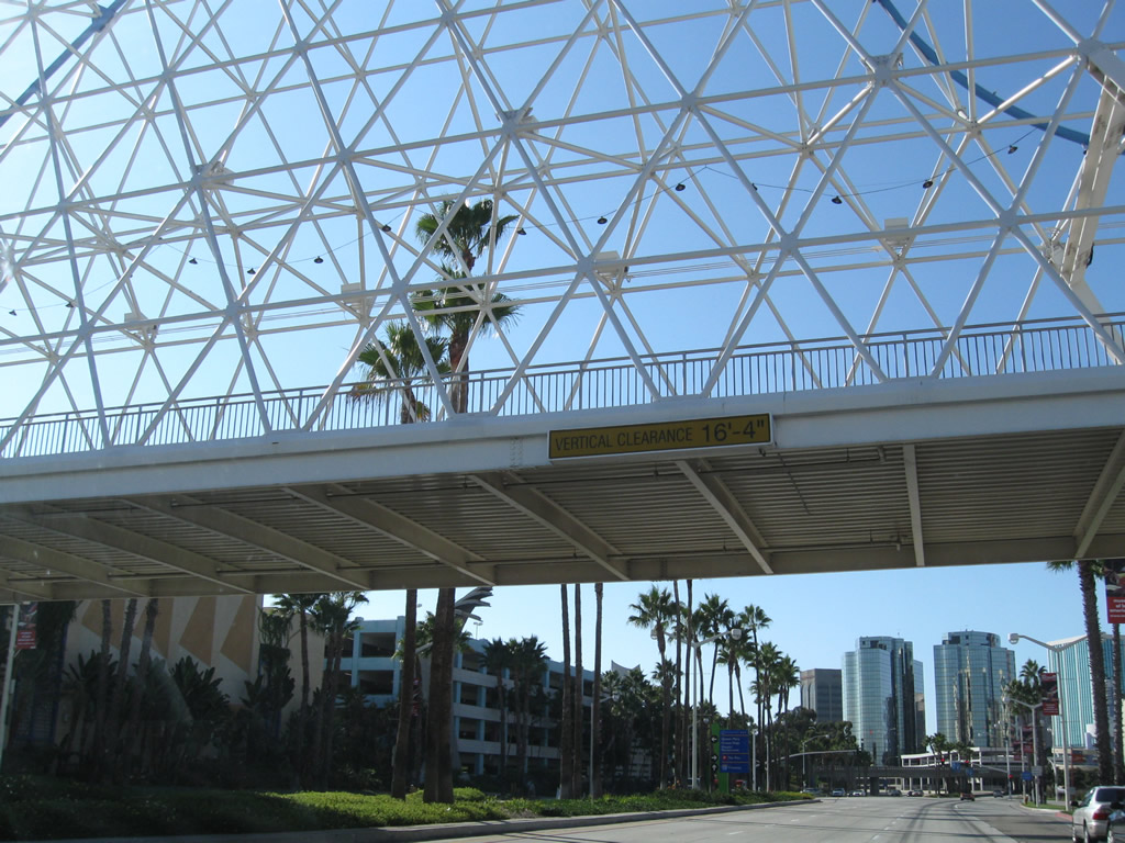
Beyond the traffic signal with Aquarium Way, Shoreline Drive passes under an elaborate pedestrian bridge that links The Pike shopping area on the north side of Shoreline Drive with the Aquarium of the Pacific on the south side of the roadway. 09/28/08
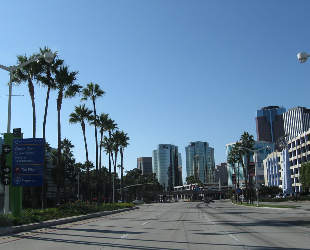
The next traffic signal along Shoreline Drive west is with ramps to Queens Way. The Queens Way freeway south spans Queensway Bay to Pier H (Cruise Ship Terminal and Queen Mary). 09/28/08
A large parking garage is located next to The Pike market on the north side of Shoreline Drive. 09/28/08
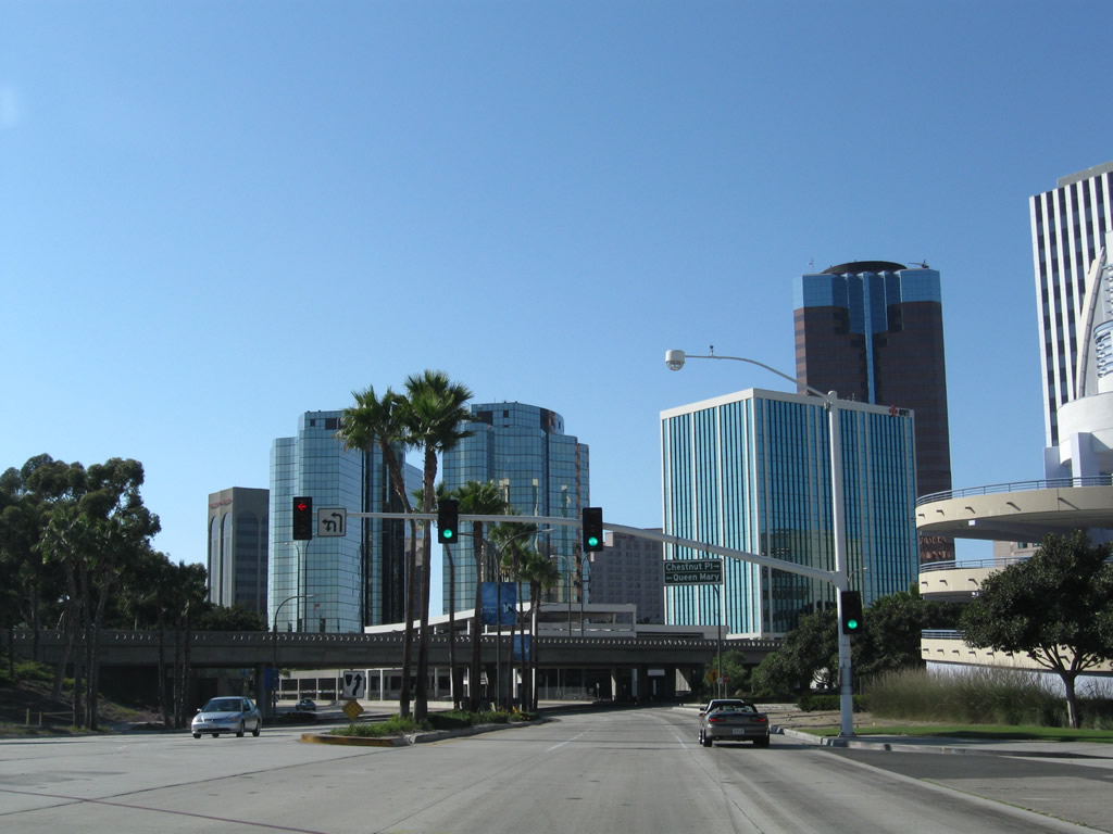
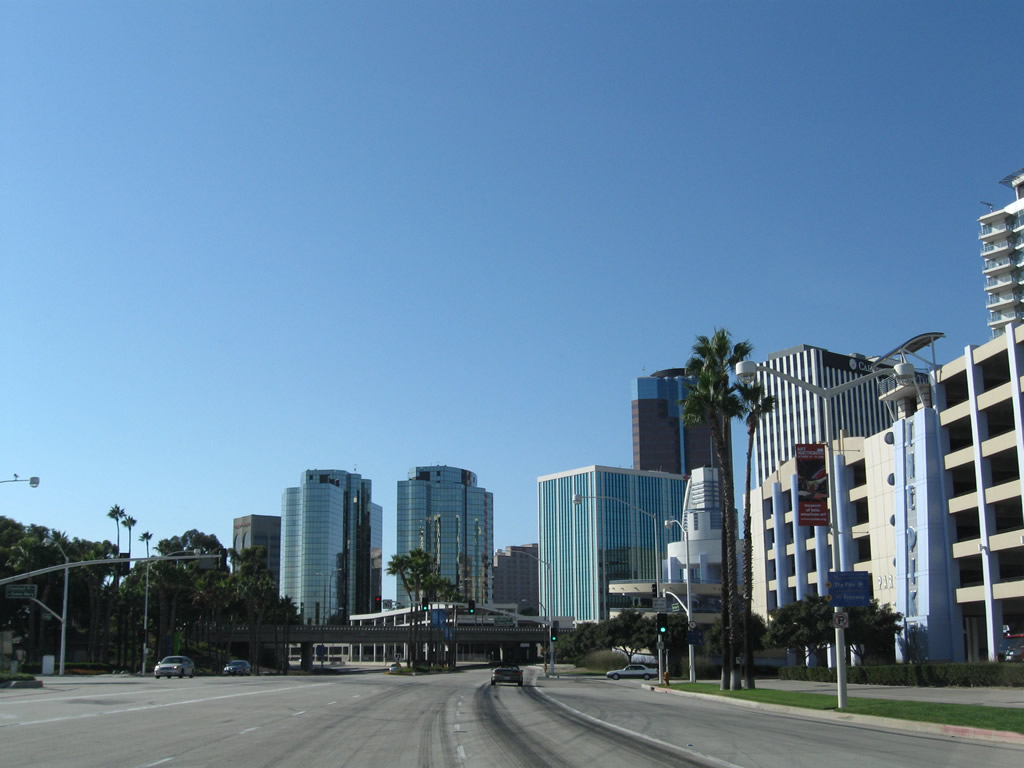
The Downtown Long Beach skyline rises just west the intersection with Queens Way south and Chestnut Place north. A wye interchange joins Shoreline Drive with Queens Way, which is a freeway all the way to the parking entrance for the Queen Mary and Cruise Ship Terminal. 09/28/08
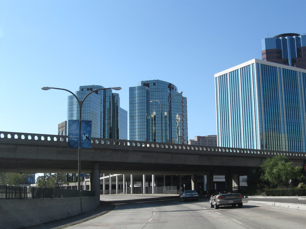
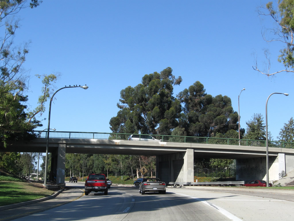
Westbound Shoreline Drive passes under the Queens Way viaduct. 09/28/08

West from Queens Way, Shoreline Drive transitions to a freeway. Shoreline Drive is locally maintained by the Port or City of Long Beach, and not a part of Interstate 710. 09/28/08

Shoreline Drive passes under Golden Shore and curves to follow the east bank of the Los Angeles River. A loop ramp departs next for Ocean Boulevard. 09/28/08
The loop ramp connects directly to Ocean Boulevard west to Interstate 710 south and use Golden Avenue south for Ocean Boulevard east into Downtown Long Beach. 09/28/08
A left side ramp follows for a U-turn back to Shoreline Drive east to Rainbow Harbor, the Aquarium of the Pacific, and the Long Beach Convention Center. 09/28/08
A left side ramp follows for a U-turn back to Shoreline Drive east to Rainbow Harbor, the Aquarium of the Pacific, and the Long Beach Convention Center. 09/28/08
Shoreline Drive passes under the ramp from Shoreline Boulevard south to Broadway east. 09/28/08
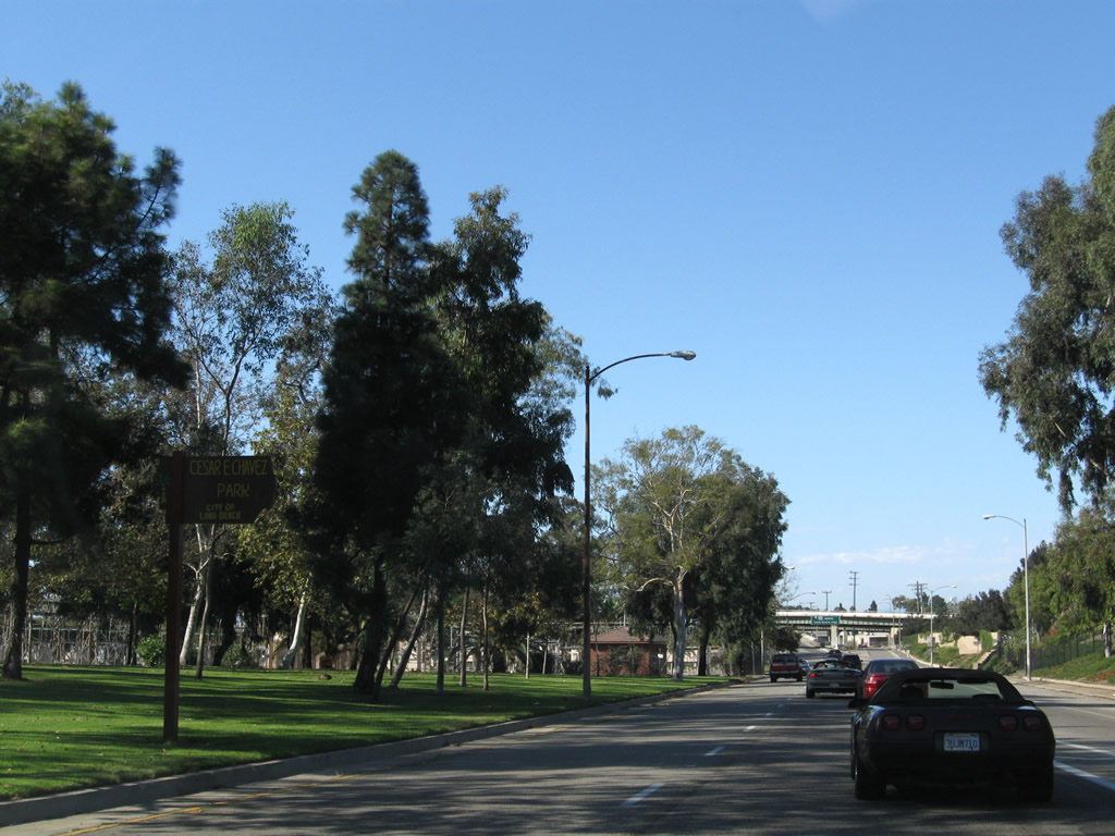
A wide median separates the two directions of Shoreline Drive between Ocean Boulevard and the merge with Interstate 710. A passive park with turf and trees offers visual relief to passing traffic. Named Cesar Chavez Park, it does not seem to have any pedestrian access from the freeway. 09/28/08
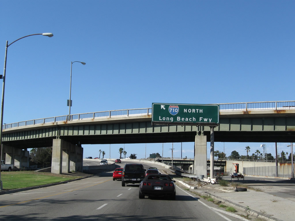
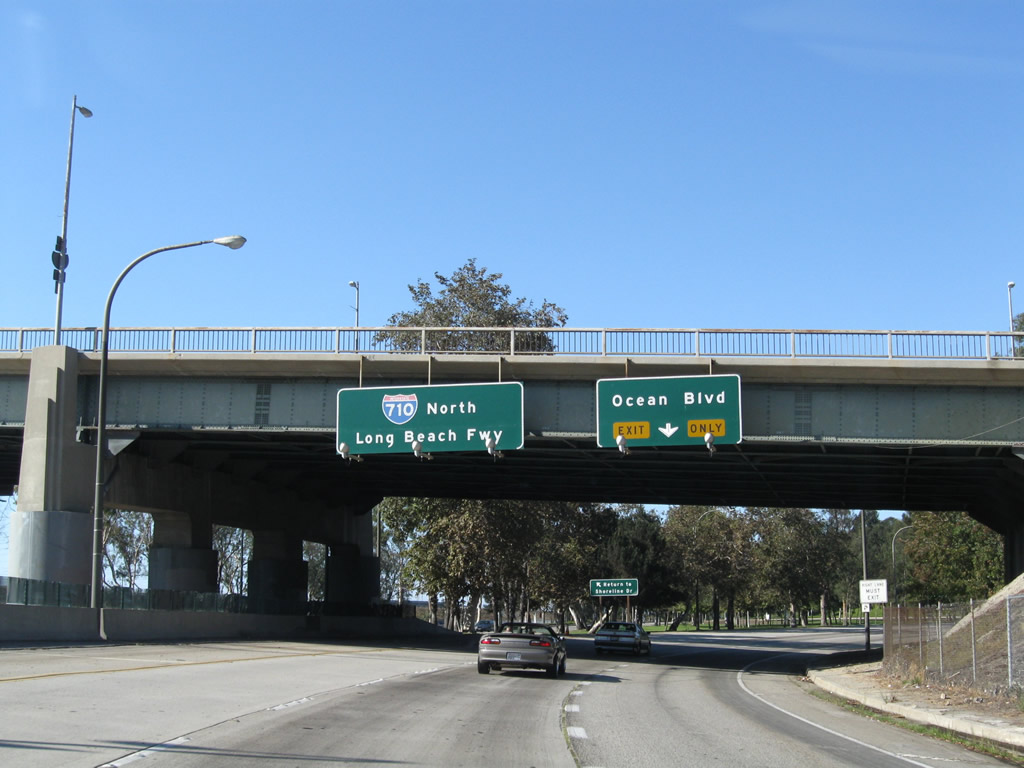
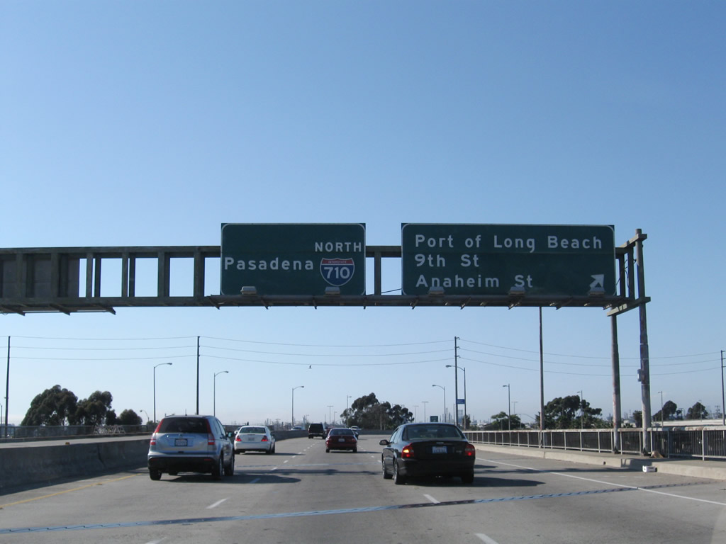
The freeway turns northwest to cross over the Los Angeles River via the Shoemaker Bridge to connect with Interstate 710 (Long Beach Freeway) north toward Pasadena. 09/28/08
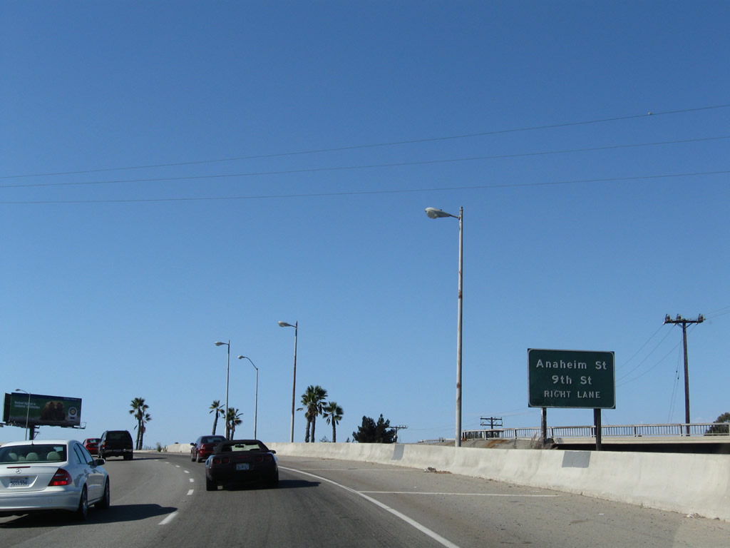
The ensuing exit is for Anaheim Street and Ninth Street. This is the final off-ramp from Shoreline Drive north. 09/28/08
Northbound Shoreline Drive meets the off-ramp to 9th Street, which extends west to Anaheim Street. 09/28/08