
Washington, DC
Overview
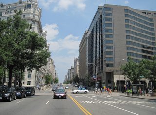
The U.S. Capital City, Washington, D.C. was founded on July 16, 1790 by the Constitution of the United States. The location for Washington along the Potomac and Anacostia Rivers was chosen as a compromise between northern and southern states. The city site was selected by President George Washington, whom appointed three commissioners to aid in the transition of government to the new city in 1800. The city street plan was the design of Pierre Charles L'Enfant, a Frenchman who modeled Washington after Paris with sweeping boulevards and ceremonial spaces. Benjamin Banneker aided in the surveying and laying out of the city, which features streets radiating out from rectangles.1
The government center in Washington, including the White House, was leveled during the War of 1812 by British forces, who retaliated for the American sacking of York (now Toronto).1 Until 1846, the District of Columbia included Alexandria County, VA. The county, which included today's city of Alexandria, was ceded back to the Commonwealth of Virginia on July 9th of that year. The jurisdictional transfer took place to give area residents representation in Congress and voting rights. Furthermore Washington residents previously argued that the port town was hurting business upriver, and that the city would never expand that far south. The city of Alexandria subsequently seceded from Alexandria County in 1852, and Alexandria County was eventually renamed Arlington County in 1920.2 Growth after the Civil War encompassed Georgetown, Maryland and surrounding rural areas beyond L'Enfant's original layout for the city. The city ended at Florida Avenue (original Boundary Street) until that time.1
Mid-19th century street car lines further pushed out Washington, leading to the establishment of LeDroit Park and Anacostia as suburban communities. Development of the National Mall, and the many monuments that visitors frequent in Washington, gathered steam after 1900.1
Washington boasts a handful of freeways that supplement its spoke-like street system. Plans for the majority of the freeway network in D.C., especially north of Downtown, however never came to fruition. Interstate 95 was intended to travel through the city instead of around it on the Capital Beltway. Interstate 66 east was planned to tie into the Center Leg Freeway of I-95, with Interstate 266 acting as a bypass for I-66 west to the Three Sisters Bridge and Virginia. Interstate 295 along the East Leg Freeway, was to be an urban loop northward to the junction of I-95 and U.S. 50 from the east. Interstate 695 was proposed to travel west by the Tidal Basin to I-66 at the Theodore Roosevelt Bridge.
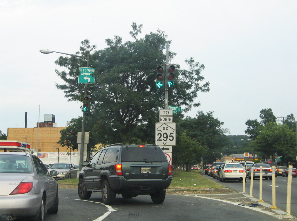
US routes serving the capital city include U.S. 1, 29 and 50. A deleted route, U.S. 240, was the original connector between the city and Frederick, Maryland, to the northwest. The District of Columbia gained its first signed route in 1994: D.C. 295 along the northern portion of the Anacostia Freeway. Historically, D.C. 4 was established along Pennsylvania Avenue, continuing the Maryland 4 numbering convention into the city.
Routes
 Theodore Roosevelt Memorial Bridge / West Leg Freeway
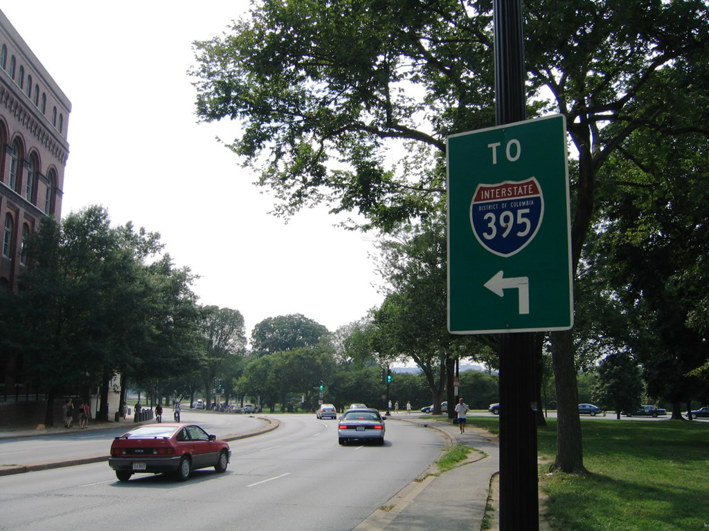
Interstate 66 briefly enters the city of Washington before ending at U.S. 29 (Whitehurst Freeway west / K Street east). The 1.48-mile route was planned to continue east along the North Leg of the Inner Loop freeway to a planned terminus at Interstate 95, where the Interstate 395 ends today. Additionally Interstate 266 was planned as a bypass route between the current Interstate 66 end and Cherrydale, Virginia. In 1977 all unconstructed segments of the D.C. Freeway network were cancelled5 including the extension of I-66.
 North Central Freeway
 Southwest Freeway / Center Leg Freeway
For the most part, Interstate 95 does not enter the District of Columbia; instead it is routed along the Capital Beltway along side Interstate 495. A 0.10-mile portion of the Woodrow Wilson Memorial Bridge passes through Washington.
Originally I-95 was intended to serve a much greater portion of the district along the Southwest, Center Leg, North Leg, North Central and Northeast freeways. Work on the Southwest Freeway commenced in separate contracts between December 1957 and March 1960. The freeway opened between the 14th Street Bridge and 9th Street SW on July 31, 1962, and from 9th Street east to South Capitol Street on August 16, 1963.6
I-95 was applied to the Center Leg Freeway in 1958, with construction kicking off along the route in 1966 between the Southeast Freeway and D Street. It opened northward to E Street on November 5, 1973, around the same time that the North Central and Northeast Freeways were canceled. This resulted in a new proposal taking I-95 northeast to the proposed New York Avenue Industrial Freeway and then along Baltimore Washington Parkway north. Three years later, the New York Avenue Industrial Freeway was dropped, leading to the 1977 redesignation of I-95 in Washington as Interstate 395.7
Interstate 95 was also signed along the Southwest Freeway and Henry G. Shirley Memorial Highway from Washington to Springfield, Virginia. Those routes were also renumbered as part of Interstate 395 in 1977.
Northward at the current northern junction of I-95/495 near College Park, Maryland, provisions were made at that interchange for I-95 south from the Northeast Freeway. The unused roadway was later repurposed as a truck weigh station and park and ride lot.
 Whitehurst Freeway
Interstate 266 was canceled in 1972.5 The freeway was proposed as a bypass route for I-66 east into the District of Columbia. The corridor extended from the Spout Run Parkway area of Fort CF Smith Park, near Exit 72 along I-66 in Virginia, across the Potomac River to the Whitehurst Freeway and its interchange with K Street. Proposed I-266 included the Three Sisters Bridge, a controversial six-lane crossing of the Potomac above Three Sisters Islands.
 Anacostia Freeway
Interstate 295 follows the Anacostia Freeway northward from the Capital Beltway to Interstate 695 (11th Street Bridge) and the transition to District of Columbia 295 north. I-695 onto the Southeast Freeway continues the drive westward for commuters bound for Downtown Washington while D.C. 295 extends the Anacostia Freeway northeast toward Baltimore-Washington Parkway.
Historically, Interstate 295 was part of the East Leg Freeway of the Washington Inner Loop. Unconstructed from Pennsylvania Avenue northward, I-295 would have followed the Anacostia River to Lake Kingman and a northwestern turn to a planned interchange with Interstate 95 and U.S. 50 at Eckington. A portion of the route (since demolished), from the 11th Street Bridge to Pennsylvania Avenue, was the only aspect of this route built.
Interstate 295 officially ended at the 11th Street Bridge interchange with the Southeast Freeway (unsigned I-695) until 2009. Mid-1990s plans called for I-695 to follow the Barney Circle Freeway northeast, with a four-lane bridge across the Anacostia River to D.C. 295, south of Capitol Street. These plans were dropped and instead work underway between December 2009 and late 2013 replaced the 11th Street Bridges and upgraded the interchange with the Anacostia Freeway to provide full access to D.C. 295. These improvements included the signing of Interstate 695, with signs unveiled in 2012 along the Southeast Freeway, and an extension of the route southward across the Anacostia River to the joint terminus of I-295 north and D.C. 295 south.
 Southwest Freeway
Interstate 395 replaced Interstate 95 along the Henry G. Shirley Memorial Highway from Springfield northeast to Washington, DC, and along the Southeast and Center Leg Freeways within the district. The change occurred in 1977 when plans for I-95 through the city were dropped. The Shirley Highway was designated as Virginia 350 when it first opened between Woodbridge and Arlington on September 6, 1949.3
Work on the northernmost portion of the Center Leg Freeway, from Massachusetts Avenue to K Street, started in 1975 but was delayed by 1978 due to a lack of funds. The nearly completed roadway sat idle until 1984, when funding was allocated toward the roadway. The northbound lanes opened on December 16, 1986, followed by the southbound roadway on February 6, 1987.7
Some mid-1980s maps show the Center Leg Freeway as Interstate 195 and the Southeast Freeway (current I-695) as an extension of I-395 east to I-295. Exit numbers were implemented along I-395 in D.C. in mid-2008.
 Capital Beltway
Although only touching the extreme southern point of the district, the Capital Beltway plays a pivotal role in the traffic scheme for metropolitan Washington. The zero milepost for the highway is located at the Woodrow Wilson Memorial Bridge. The 10-lane span, completed in 2008, represents one of the few Interstate draw bridges in the country.
The Springfield Interchange, where Interstates 95, 395 and 495 come together in Northern Virginia, underwent a transformation from an outdated cloverleaf interchange to a high-speed systems exchange as part of $676 million in roadwork between 1999 and 2007. The upgraded exchange includes flyovers connecting the reversible HOV roadways of I-95 south and I-395 north.
Interstate 95 was relocated from the Shirley Memorial Highway onto the eastern half of the Capital Beltway in 1977. Interstate 495 was subsequently dropped on this section, but restored in 1989.
 Southeast Freeway
Until 2009, Interstate 695 consisted of a 1.39 mile long, unsigned route along the Southeast Freeway, between I-395 (Center Leg Freeway) and the freeway end at Pennsylvania Avenue SE. Planned also as part of the South Leg Freeway, Interstate 695 was to extend west from the Southwest Freeway along Maine Avenue to connect with Interstate 66 at the Constitution Avenue interchange. A pair of two lane ramps were built from the Southwest Freeway (former I-95 / current I-395) to Maine Avenue, but the rest of the segment by the Lincoln Memorial was canceled by 1977.5
Costing $365 million, construction underway in December 2009 involved replacing the 11th Street Bridges across the Anacostia River between the Southeast Freeway (I-695) and the Anacostia Freeway (I-295). Work included the building of a new directional T interchange with ramps to the D.C. 295 freeway.4 This work coincided with the renumbering of the 11th Street Bridge as an extension of I-695 south to a shortened I-295. Work continued through 2012, when the ramp from new I-695 south to D.C. 295 north opened on December 19th.
The unused freeway east from the 11th Street Bridge north end to Pennsylvania Avenue was demolished by 2014. I-695 now travels 2.00 miles in length.
 U.S. Route 1
U.S. 1 travels 7.0 miles through the District of Columbia, entering Washington along side Interstate 395 across the 14th Street Bridge. The US route splits with the Southwest Freeway for 14th Street SW by the Washington Monument to combine with U.S. 50 along Constitution Avenue east to 6th Street north. U.S. 50 east splits with U.S. 1 north for New York Avenue east while U.S. 1 remains along 6th Street to Rhode Island Avenue. Rhode Island Avenue carries the route northeast through LeDroit Park to exit the city at Mount Ranier, Maryland. The majority of U.S. 1 through Washington, DC is either poorly signed or not signed at all.
U.S. 1 Alternate is a mostly unsigned route following U.S. 50 (New York Avenue) east from U.S. 1 to Bladensburg Road north to Cottage City and Edmonston, Maryland.
 U.S. Route 29
Traveling 8.6 miles through the District of Columbia, U.S. 29 follows an L-shaped route east from the Francis Scott Key Bridge, where M Street links the bridge end with the Whitehurst Freeway along the Potomac River. U.S. 29 lines the freeway east to Interstate 66 and K Street by George Washington University. K Street doubles as the route of U.S. 29 through to 11th Street NW.
11th Street leads U.S. 29 north to Rhode Island Avenue east for 7th Street. Left-hand turns are prohibited from Rhode Island Avenue east onto 7th Street north, which makes U.S. 29 north discontinuous. 7th Street NW otherwise leads U.S. 29 north to Howard University, Park View, Brightwood and Silver Spring, Maryland.
 U.S. Route 50
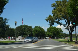
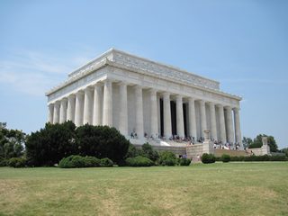
U.S. 50 crosses the District of Columbia line along side Interstate 66 across the Theodore Roosevelt Memorial Bridge. Just northwest of the Lincoln Memorial, U.S. 50 branches away from I-66 for Constitution Avenue NW along the National Mall. U.S. 1 joins U.S. 50 from 14th Street NW east to 6th Street, where the pair turn northward to New York Avenue. New York Avenue doubles as the route of U.S. 50 east to Brentwood Park and a freeway leading east to Cheverly, Maryland and the Chesapeake Bay Bridge in Maryland. The route travels 7.7 miles through the District of Columbia.
 Former U.S. 211
U.S. 211 overlapped with U.S. 29 to the Francis Scott Key Bridge. The duplication alongside U.S. 29 east from Warrenton was eliminated by 1984.
 Former U.S. 240
U.S. 240 followed Maryland Route 355 (Rockville Pike) south from Rockville, Maryland to Washington via Wisconsin Avenue. Within Washington, the route varied between routes along Wisconsin and Massachusetts Avenues to the west and Connecticut Avenue to the east. Reconvening along 23rd Street NW, U.S. 240 concluded at U.S. 50 (Constitution Avenue) by the National Mall in the 1960s. It previously ran across the Potomac River, via the Arlington Memorial Bridge, to an end in Arlington, Virginia in the 1940s.
Suitland Parkway
One of several Washington area roads maintained by the National Park Service, Suitland Parkway joins South Capitol Street with Maryland Route 4 (Pennsylvania Avenue) at Joint Base Andrews.
City Streets and Roads
17th St north (8 photos)
L'Enfant Promenade (6 photos)
Lincoln Memorial Cir (11 photos)

Pennsylvania Ave NW (10 photos)
S Capitol St (14 photos)
Other Roads (23 photos)
Other Roads
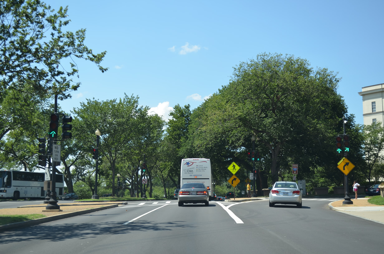
Interstate 395 trailblazer posted along Independence Avenue SW westbound between U.S. 1 (14th Street SW) and Raoul Wallenburg Place. Raoul Wallenburg Place south to Basin Drive SW leads drivers onto Interstate 395 south at the George Mason Bridge. This sign was replaced by 2014. 08/01/05
Independence Avenue splits into separate roadways west of 15th Street SW. Westbound leads to Maine Avenue SW and 17th Street SW. 08/01/05
A wye interchange with two lane ramps connects Interstate 395 (Southwest Freeway) to Maine Avenue by L'Enfant Plaza. The ramps were constructed for the South Leg Freeway, that would have carried Interstate 695 northwest to I-66 & U.S. 50 at the east end of the Theodore Roosevelt Memorial Bridge. 08/04/13
A loop ramp joins Maine Avenue SW north with U.S. 1 (14th Street SW) south to Interstate 395 south to Arlington, Virginia. 08/04/13
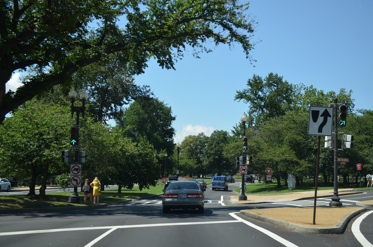
A traffic light follows with Rauol Wallenberg Place north to 14th Street NW by the Bureau of Engraving and Printing. 08/04/13
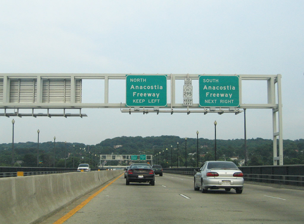
Pennsylvania Avenue carries traffic from the east end of Southeast Boulevard across the Anacostia River to the Anacostia Freeway (D.C. 295). 06/22/05
Leaving the John Phillip Sousa Bridge, Pennsylvania Avenue SE east approaches a three-quarter cloverleaf interchange with District of Columbia 295 (Anacostia Freeway). 06/22/05
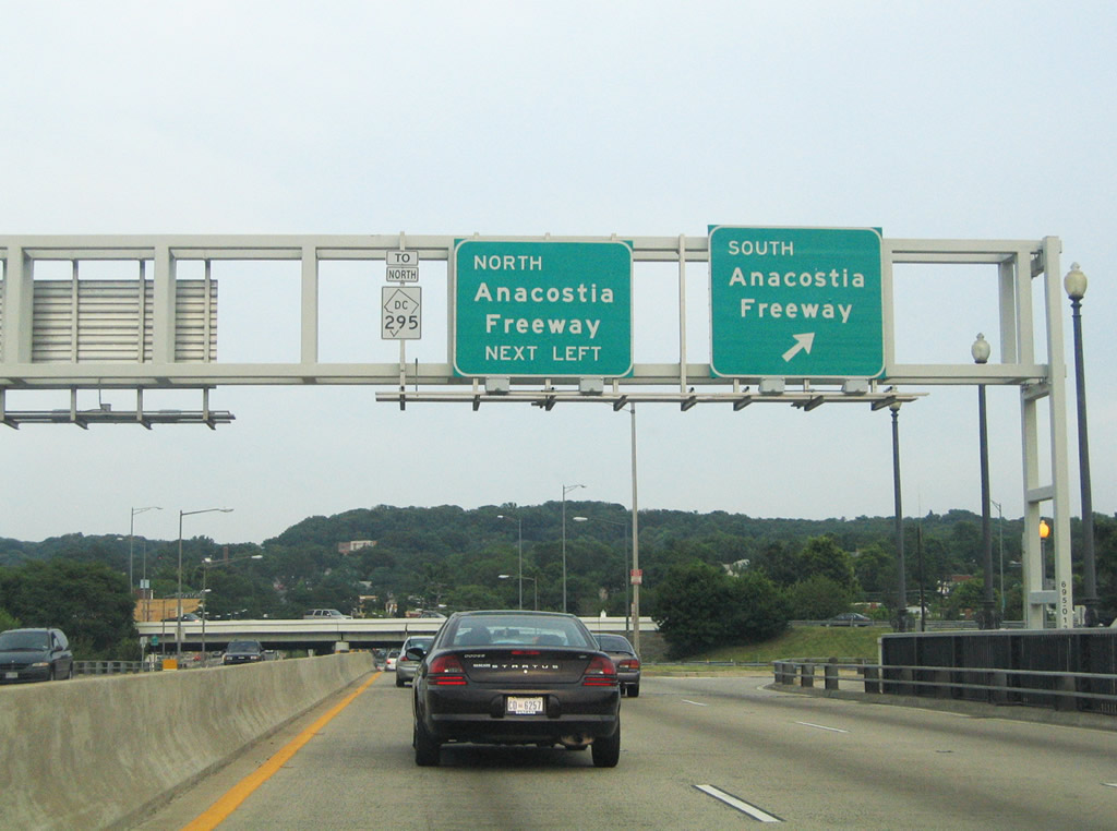
A left turn opposite Fairlawn Avenue SE joins Pennsylvania Avenue SE east with the Anacostia Freeway northbound on-ramp. D.C. 295 heads northeast to Kenilworth Avenue and the Benning section of the city. 06/22/05