State Route 21 North

Home » Guides » Alabama » State Route 21 North

Alabama Route 21 North
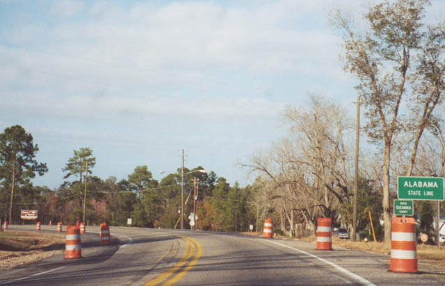
SR 97 northbound as it transitions to SR 21 at the state line. Note the highway construction in this photograph has resulted in the widening of SR 21 to incorporate a center turn lane. 11/25/01
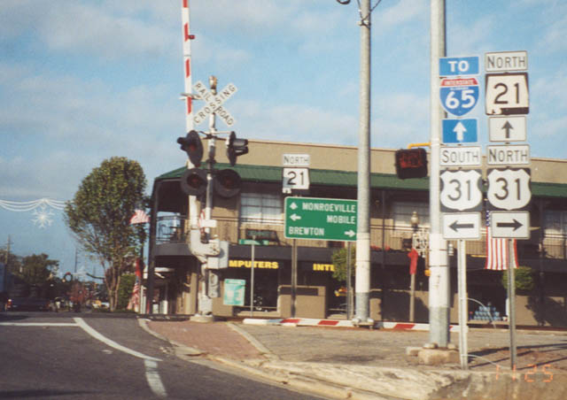
SR 21 (Main Street) intersects U.S. 31 (Nashville Avenue) within downtown Atmore. Atmore lies at the crossroads of the CSX and Alabama & Gulf Coast Railroad lines adjacent to the Florida state line. The state route continues north from the city and expands to four lanes as it approaches Interstate 65. 11/25/04
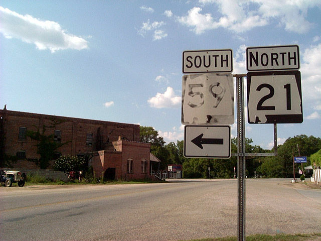
SR 21 northbound at the terminus of SR 59 within the unincorporated community of Uriah (pronounced You-Rye). SR 59 begins at a wye intersection adjacent to the abandoned brick building pictured here. 06/01/02
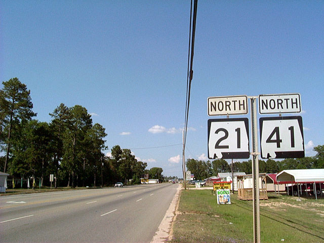
SR 21 and 41 share pavement for three miles between Monroeville and U.S. 84 north of Excel. Amid light development, the two highways carry five lanes as they enter the seat of Monroe County.
SR 21 enters Monroeville after trekking through Frisco City, Uriah, and Atmore near the Florida state line. SR 41 also begins at the Florida state line, traveling through Brewton and Repton before tagging along U.S. 84. 06/01/02
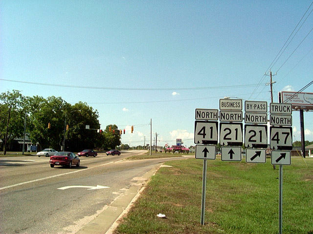
Just outside of Monroeville, SR 21 splits between Business (to downtown) and Bypass (to the east) segments. SR 41 follows the Business portion through downtown Monroeville. The business/bypass partition of SR 21 is a format used commonly throughout the Tar Heel State of North Carolina, but not as frequently in Alabama. Truck SR 47 consists of a bypass of Monroeville that follows U.S. 84 and SR 21 & 41 to the south and east. The route returns to SR 47 north via the bypass. 06/01/02
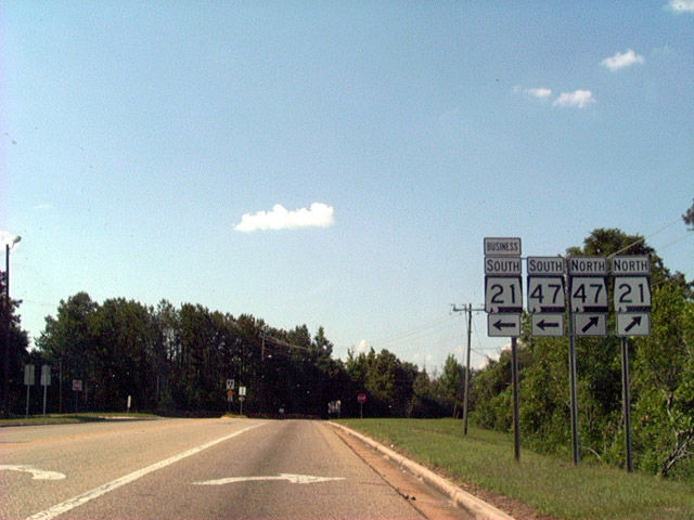
SR 21 Bypass northbound at the merge with SR 21 Business. SR 47 enters the picture and combines with the business portion from downtown. The bypass carries four lanes.
Not much is located along the bypass outside of a Wal-mart. 06/01/02
Northbound SR 21 and 47 reassurance shields posted after the merge of the partitioned SR 21. The two routes share a quiet stretch for 13 miles en route to the village of Beatrice. Speed limits signs throughout the Monroeville area indicate a slower limit for trucks. 06/01/02
U.S. 80 East Alabama Route 21 North
U.S. 80/SR 21 come together at a rural area in eastern Lowndes County. The two overlap 10.18 miles east to south Montgomery. 02/06/12
Lowndes County Road 37 leads north from U.S. 80/SR 21 to Manack and County Road 54. 02/06/12
The southern branch of County Road 37 departs U.S. 80/SR 21 for Letohatchee, Fort Deposit and Butler County. 02/06/12
CR 37 is the last through road meeting U.S. 80/SR 21 in Lowndes County. CR 37 leads 9.9 miles south to SR 97. 02/06/12
A second U.S. 80 eastbound shield stands between County Road 37 south and Pintlala Creek. 02/06/12
Pintalala Creek separates Lowndes and Montgomery Counties southward from the Alabama River to an area west of Suggs Pond. 02/06/12
CR 7 south ties into U.S. 80/SR 21 at the Mt. Sinai community in western Montgomery County. 02/06/12
Montgomery County Route 7 (Cantelou Road) leads northeast 4.4 miles to Antioch and CR 54 (Old Selma Road). 02/06/12
U.S. 80/SR 21 markers posted after County Route 7 at Mt. Sinai. 02/06/12
Meeting U.S. 80 east / SR 21 north next is County Road 403 (Robert C. Ham Road) south. 02/06/12
The planned route of SR 108, the Montgomery Outer Loop, ties into U.S. 80/SR 21 in the area where CR 403 intersects Selma Highway. 02/06/12
Advancing to the Montgomery city line, U.S. 80/SR 21 east meet CR 17 (Mitchell Young Road) north. 02/06/12
CR 17 lines western reaches of the Montgomery city limits through Catoma to CR 54 (Old Selma Road) at Fairview. 02/06/12
Heading east from County Route 17, U.S. 80/SR 21 remains generally rural. 02/06/12
CR 103 (Felder Road) north and Old Hayneville Road west come together at U.S. 80/SR 21 next. 02/06/12
CR 103 follows Felder Road southeast to CR 15 near McGehees. The route includes a proposed diamond interchange with the Outer Loop (SR 108). Old Hayneville Road branches northeast from U.S. 80/SR 21 to Dannelly Pines. 02/06/12
U.S. 80/SR 21 run along northern reaches of Dannelly Field (MGM) after County Route 103. 02/06/12
Shields posted for U.S. 80 and SR 21 between Montgomery Regional Airport (MGM) and Gateway Drive north to the Brewer Heights community. 02/06/12
CR 15 (Lamar Road) meanders around the east side of Dannelly Field (MGM) to U.S. 80/SR 21 (Selma Highway). 02/06/12
CR 15 travels south to serve the Alabama Army National Guard complex on the back side of Dannelly Field. CR 15 continues to McGehees and Lowndes County. 02/06/12
Passing by a distribution facility, U.S. 80/SR 21 continue to their separation at the diamond interchange with U.S. 31 (Mobile Highway). 02/06/12
SR 21 parts ways with U.S. 80 for a 1.5 mile long overlap with U.S. 31 (Mobile Highway) north to South Boulevard. U.S. 80 combined with U.S. 31 until 992, when the short freeway opened east to Interstate 65. 08/23/03
U.S. 31 heads south out of Montgomery from Hope Hull and runs along the west side of the capital city by Maxwell Air Force Base to Prattville. Montgomery from Hope Hull to the south. 08/22/03
Alabama Route 21 North
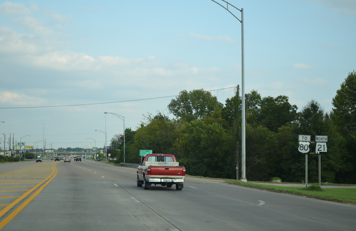
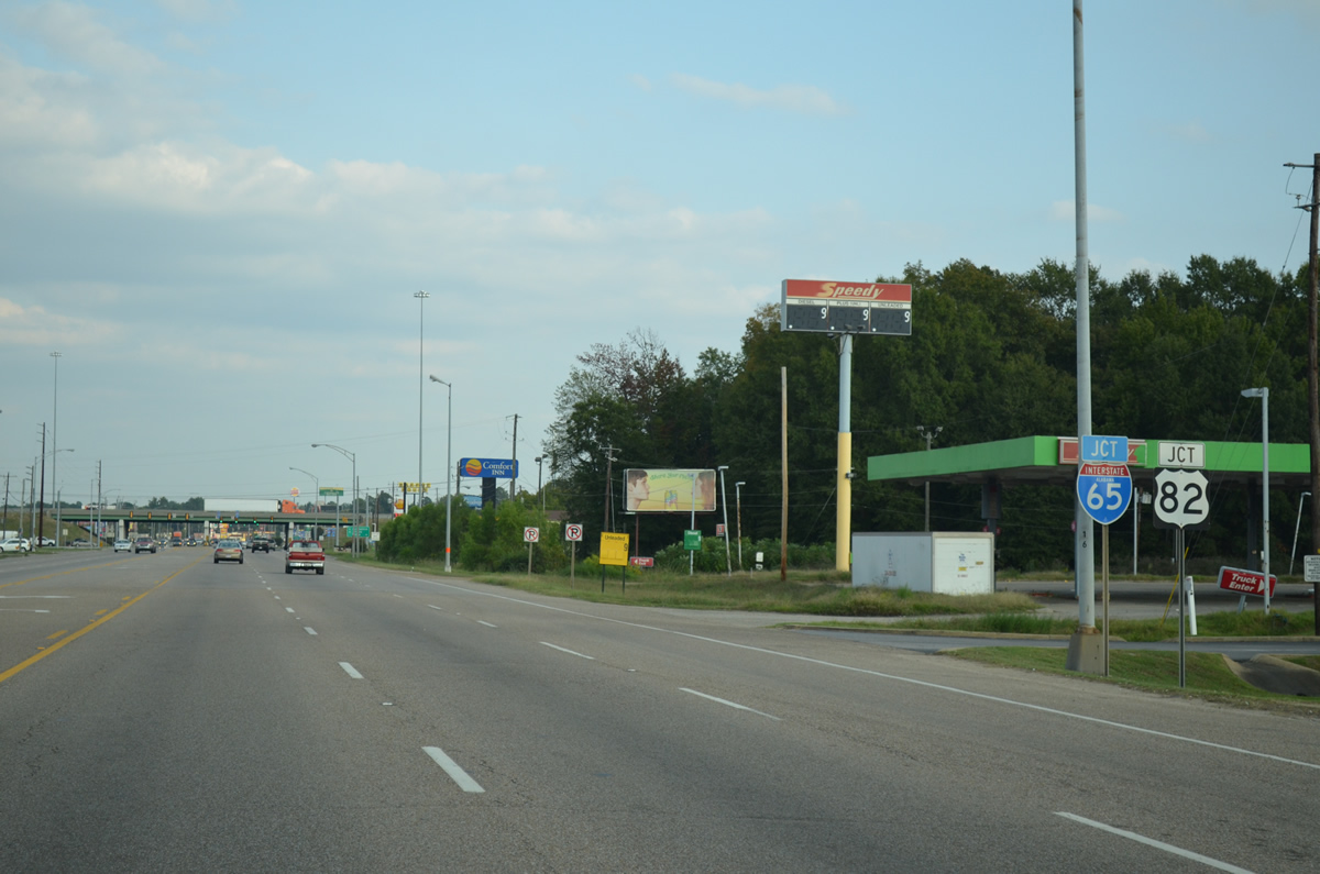
SR 21 (South Boulevard) heads 0.56 miles east from U.S. 31 (West Boulevard) into a commercialized diamond interchange with I-65/U.S. 80-82. 10/06/12
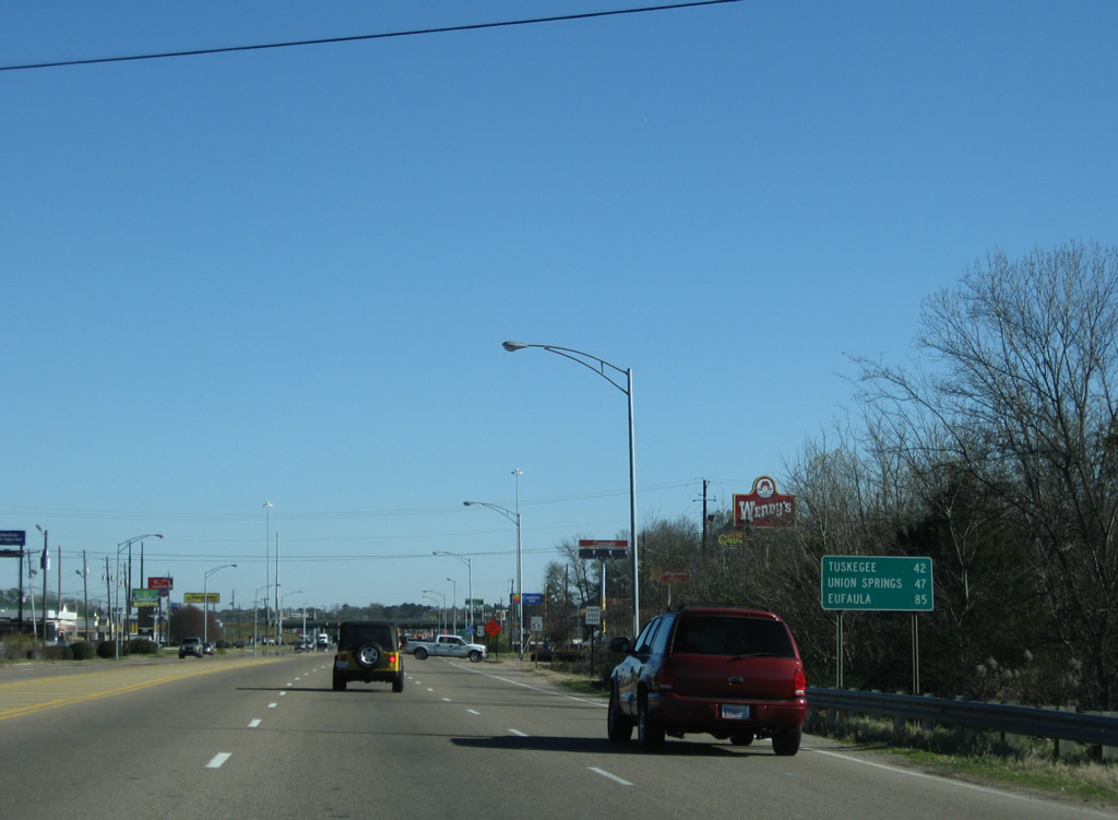
South Boulevard between U.S. 31 (Mobile Highway) and I-65 was previously part of U.S. 80 and U.S. 82, which the following sign reflects with distances to Tuskegee, Union Springs and Eufaula. 12/28/09
U.S. 80 overlaps with I-65 north to SR 21 at Exit 169. U.S. 82 overlaps with I-65 south from Prattville to South Boulevard. 01/16/04
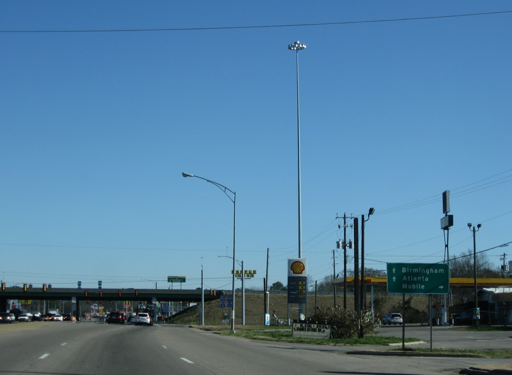
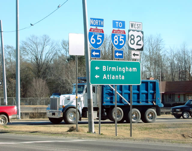
I-65/U.S. 82 connect with Interstate 85 north to Atlanta, Georgia in 2.94 miles. 12/28/09
U.S. 80 branches west from I-65 south in 1.11 miles to Selma. I-65 continues 163 miles southwest from SR 21 in Montgomery to Mobile. 10/06/12
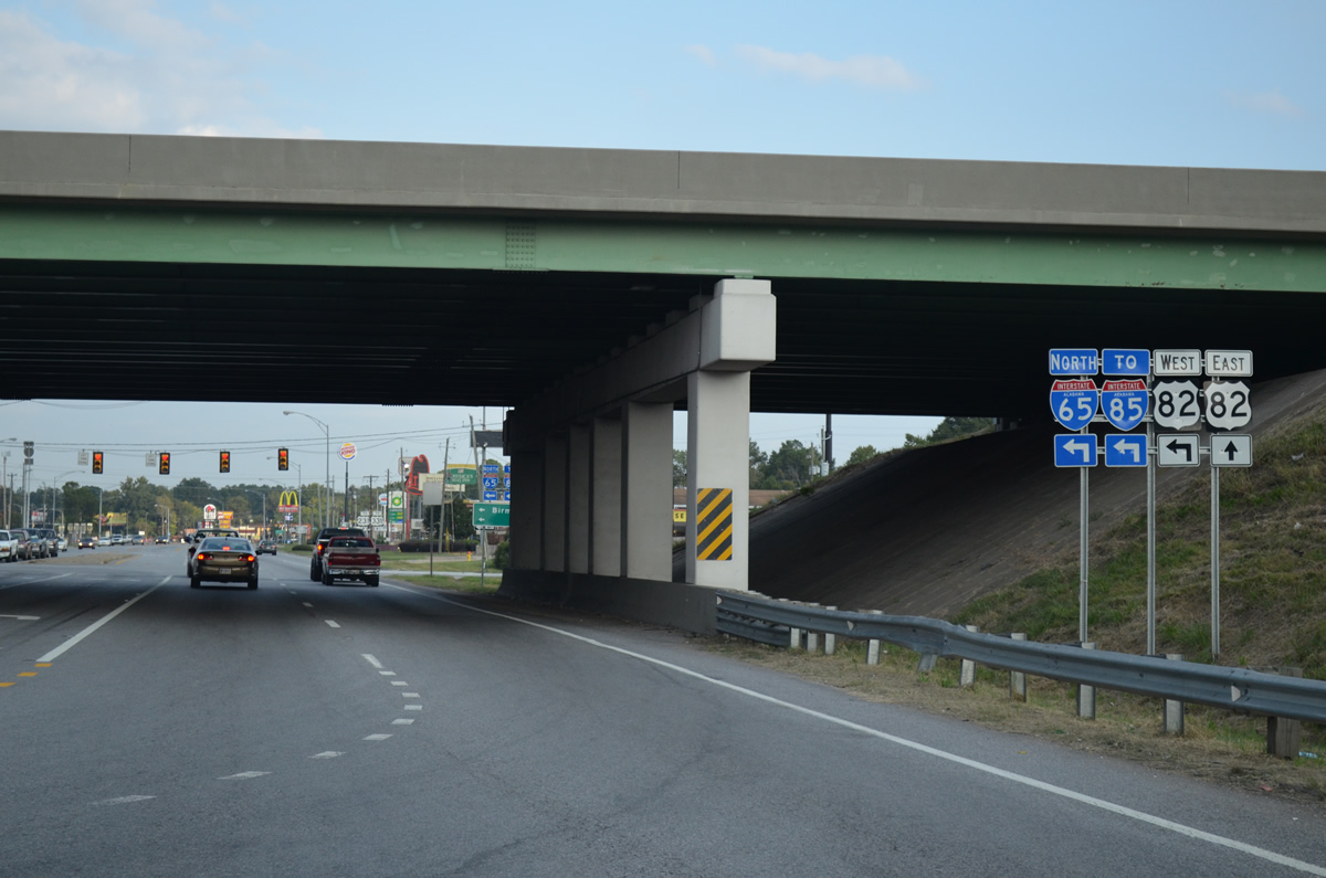
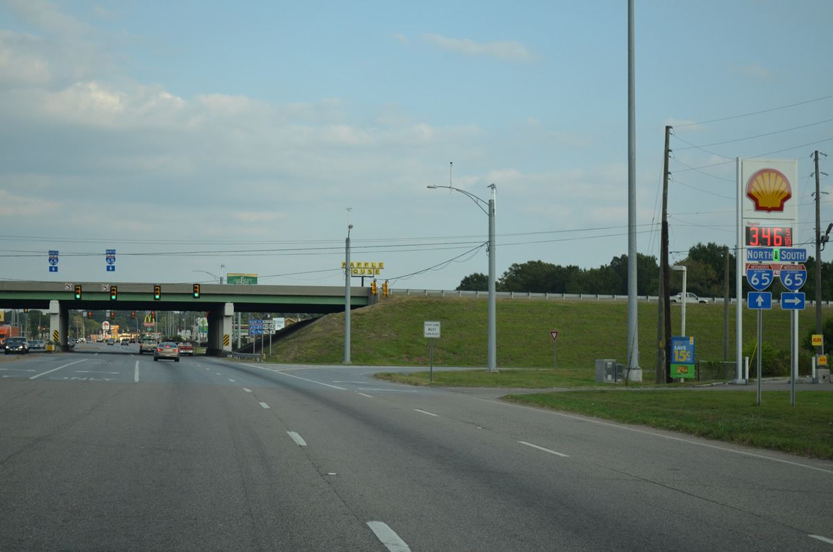
Southbound Boulevard gains U.S. 82 east from the southbound off-ramp of I-65 and passes under the freeway mainline to the northbound on-ramp to downtown and Interstate 85. 10/06/12
Drivers joining Interstate 65 north & U.S. 82 west reach the northbound beginning of Interstate 85 in 1.5 miles. The tandem otherwise veer northwesterly to Prattville. 01/16/04
U.S. 80 U.S. 82 East Alabama Route 21 North
U.S. 231/331 trailblazers posted just beyond the exchange joining I-65/U.S. 80-82 with South Boulevard. U.S. 231 enters Eastern Boulevard where U.S. 82 leaves South Boulevard, six miles to the east. 10/06/12
Reassurance shields for U.S. 80-82 east/SR 21 north posted east of Interstate 65. South Boulevard, a six lane arterial, hosts an array of traveler services for I-65 motorists. 10/06/12
Davenport Drive spurs north to Gateway Golf Course and residential areas east along Gaston Avenue from a traffic light with South Boulevard. 10/06/12
South Boulevard elevates to pass over a CSX Railroad line ahead of the signalized intersection with Rosa L. Parks Avenue. 10/06/12
U.S. 80-82/SR 21 gain a frontage road system from Rose L. Parks Avenue eastward to Lynndale and Hannon Slough. 12/28/09
Advancing east, South Boulevard next meets the north end of U.S. 331. U.S. 331 travels 100 miles northward from the Sunshine State near Florala, and 155 miles overall, to conclude at U.S. 80-82/SR 21. 10/06/12
Court Street continues north from U.S. 331 to Fairview Avenue, where the street becomes one way in the southbound direction. U.S. 331 originally followed Norman Bridge Road north from Wiley to cross South Boulevard at the succeeding traffic light. Norman Bridge Road continued U.S. 331 north to Fairview Avenue where the route shifted west to the one way couplet of Perry Street (north) and Hull Street (south). 10/06/12
U.S. 80-82/SR 21 continue another 3.90 miles east from U.S. 331 to their separation at U.S. 231. 06/07/17
South Boulevard eastbound at Norman Bridge Road (former U.S. 331/SR 9). 06/07/17
Continuing east from Norman Bridge Road, U.S. 80-82/SR 21 pass between residential areas. 06/07/17
A distance sign remains posted east of Norman Bridge Road, acknowledging the historic junction with U.S. 331. Tuskegee lies 39 miles to the east via U.S. 80 while Union Springs is a 44 mile drive to the southeast via U.S. 82. 06/07/17
Reassurance markers posted after Narrow Lane Road along South Boulevard east. 06/07/17
Morrow Drive represents the main entrance road for UAB-Health Center Montgomery from this signal along South Boulevard. 06/07/17
U.S. 80-82/SR 21 (South Boulevard) east at Bonaparte Boulevard and Capital Plaza Shopping Center. An array of retail centers line South Boulevard east from here to McGehee Road and U.S. 231. 06/07/17
Woodley Road angles southeast from the McGehee Estates neighborhood to Spring Valley and Pinedale in south Montgomery. Beyond the city line, Woodley Road is a part of CR 39 leading to Davis Crossroads and Dublin. 06/07/17
The last set of confirming markers for the 5.48 mile long overlap between U.S. 80 and 82 east stands beyond Woodley Road. 06/07/17
Dorchester Drive stems south from this signal with U.S. 80-82/SR 21 (South Boulevard) and South Square shopping center to the Woodley Park neighborhood. 06/07/17
U.S. 80/SR 21 (South Boulevard) converges with McGehee Road (old U.S. 231) south and U.S. 231 north at the forthcoming separation with U.S. 82 east. 06/07/17
Strathmore Drive ties into U.S. 80/82 just ahead of their split at McGehee Road. The shuttered Montgomery Mall occupies the northwest quadrant of the ensuing intersection with U.S. 231. 06/07/17
U.S. 82 east/231 south combine southeast for 12 miles. U.S. 231 joins Montgomery with Troy, Ozark, Dothan, and ultimately the Florida Panhandle and Panama City. U.S. 82 sinks southeastward to Union Springs and Eufaula, before crossing the Chattahoochee River into the Peach State. 06/07/17
U.S. 80/SR 21 (South Boulevard) transition to Eastern Boulevard at the split with U.S. 82 east. U.S. 231 combines with U.S. 80/SR 21 for 3.12 miles to Interstate 85. 06/07/17
U.S. 82 & 231 (Troy Highway) head southeast 3.42 miles along a suburban arterial to SR 271 at Barachias in south Montgomery. The rural town of Pike Road follows along the four lane highway. 06/07/17
U.S. 80 East U.S. 231 Alabama Route 21 North
North of Woodmere Boulevard, U.S. 80 east & U.S. 231-SR 21 (Eastern Boulevard) north approach the directional cloverleaf interchange with Interstate 85. A congested roadway, Eastern Boulevard both north and south of I-85 includes service roads lined with numerous shopping centers and traveler services. 12/07/99
Alabama Route 21 North
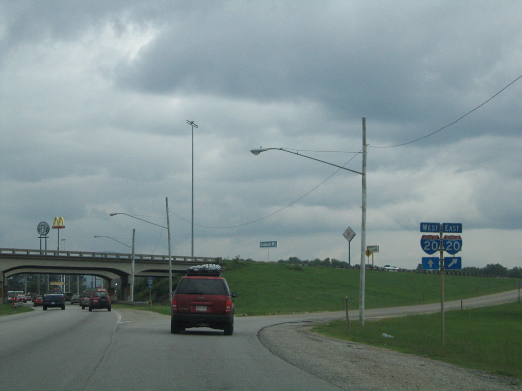
SR 21 (Jacksonville State University Highway) northbound at the Interstate 20 eastbound on-ramp at Oxford. Interstate 20 travels through the southern reaches of the Anniston metropolitan area between Exits 179 and 191. SR 21 continues north one half mile to its merge with U.S. 431 (Quintard Drive) at U.S. 78 (Hamric Drive). The state route links the city of Anniston with Jacksonville to the north and Talladega to the south. 07/15/05


Photo Credits:

  • 12/07/99 by AARoads.
  • 11/25/01 by AARoads and Adam Froehlig.
  • 06/01/02 by AARoads.
  • 08/22/03 by AARoads and Justin Cozart.
  • 08/23/03 by AARoads and Justin Cozart.
  • 01/16/04 by AARoads.
  • 11/25/04 by AARoads and Adam Froehlig.
  • 07/15/05 by AARoads.
  • 12/28/09 by AARoads.
  • 02/06/12 by AARoads.
  • 10/06/12 by AARoads.
  • 06/07/17 by AARoads.

Page Updated 10-09-2012.

Go to Top