
State Road 4 East

 East
East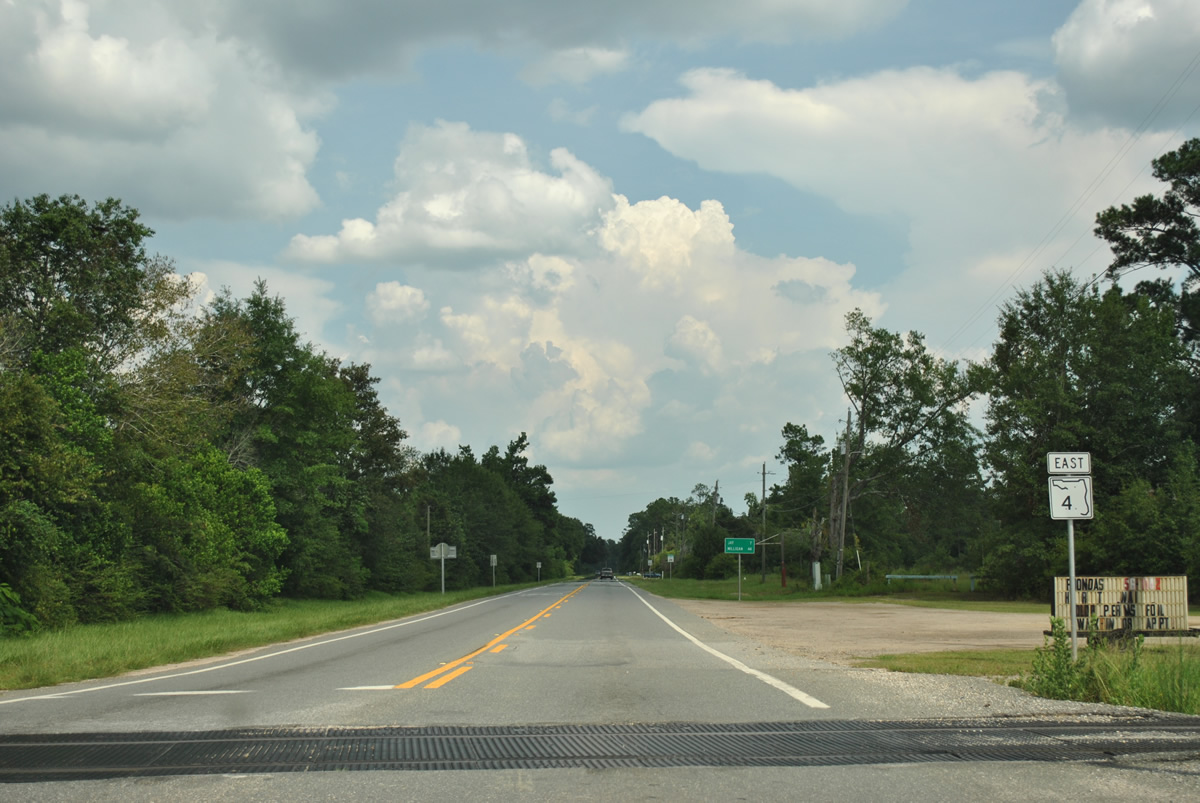
Jay Road leads east from U.S. 29 (Century Boulevard) as SR 4 within the city limits of Century. The first shield follows a CSX Railroad that parallels U.S. 29 north to Flomaton and south to Pensacola.
07/31/11
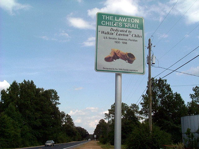
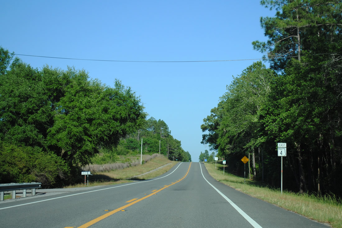
A short distance further east along SR 4, drivers pass by the first Lawton Chiles Trail trailblazer. This route was dedicated to honor the former Florida Governor in 1999 and stretches from Century all the way to Key Largo along U.S. 1. Entailing 1,003 miles of roadway, the trail marks roads where Chiles walked over the course of 91 days in 1970 as a U.S. Senate canditate.1
08/24/02
Old State Road 4 shoots off to the east from SR 4 to a boat ramp on the Escambia River.
02/07/06
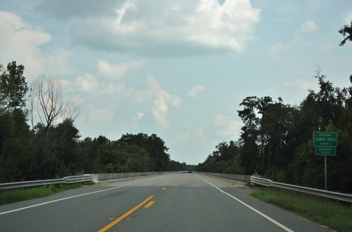
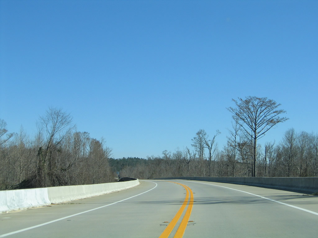
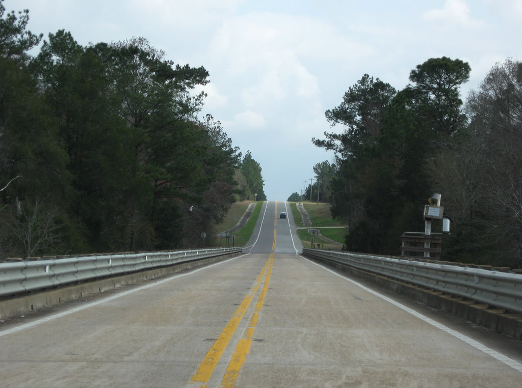
A 1.2 mile long viaduct carries State Road 4 over the Escambia River and its adjacent flood plain. Motorists cross the Santa Rosa County line midway across the river itself.
07/31/11
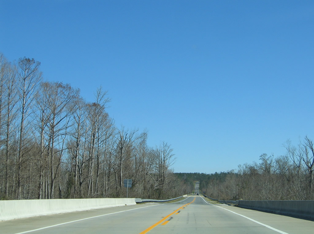
SR 4 rejoins its original alignment from the viaduct end ahead of Black Lake.
02/07/06
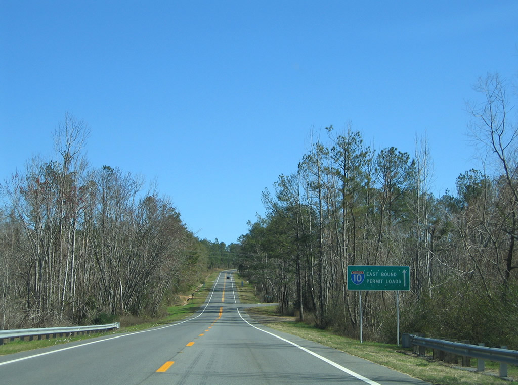
For a period of time between September 2004 and November 2006, State Road 4 doubled as an Interstate 10 truck route for wide and overweight loads. Restrictions at the Escambia Bay crossing were implemented due to damage done by Hurricane Ivan.
02/07/06
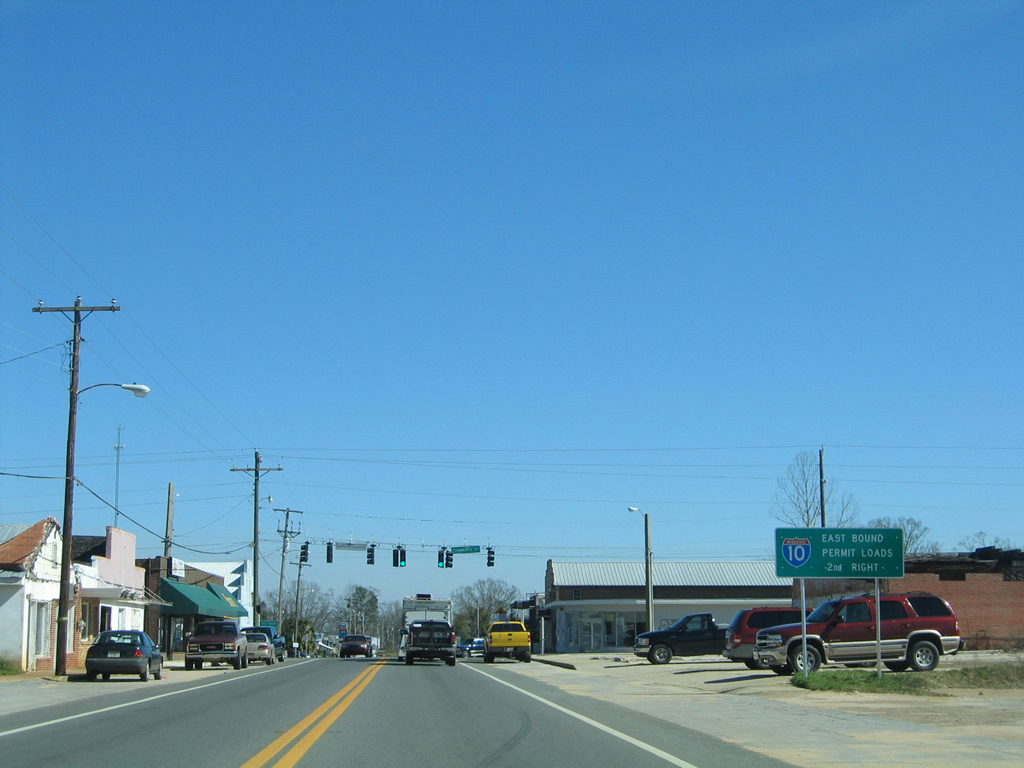
Eastbound motorists enter the city limits of Jay and approach the traffic light with Commerce Street. An I-10 truck route sign, related to Escambia Bay Bridges, guided drivers onto SR 89 south from the second right as Commerce Street provides a short cut to the state road through downtown.
02/07/06
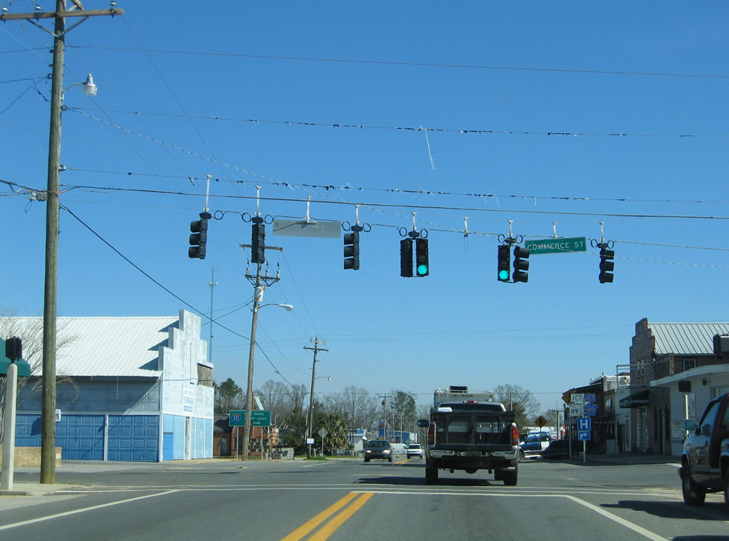
Commerce Street veers north from SR 89 (Alabama Street) to intersect SR 4 at this signal. The street ends at an industrial park nearby.
Although unsigned, County Road 197A begins here and follows Commerce Street south to adjacent Spring Street. CR-197A turns onto Spring Street for a 3.2 mile drive to CR-197 (Chumuckla Highway).
02/07/06
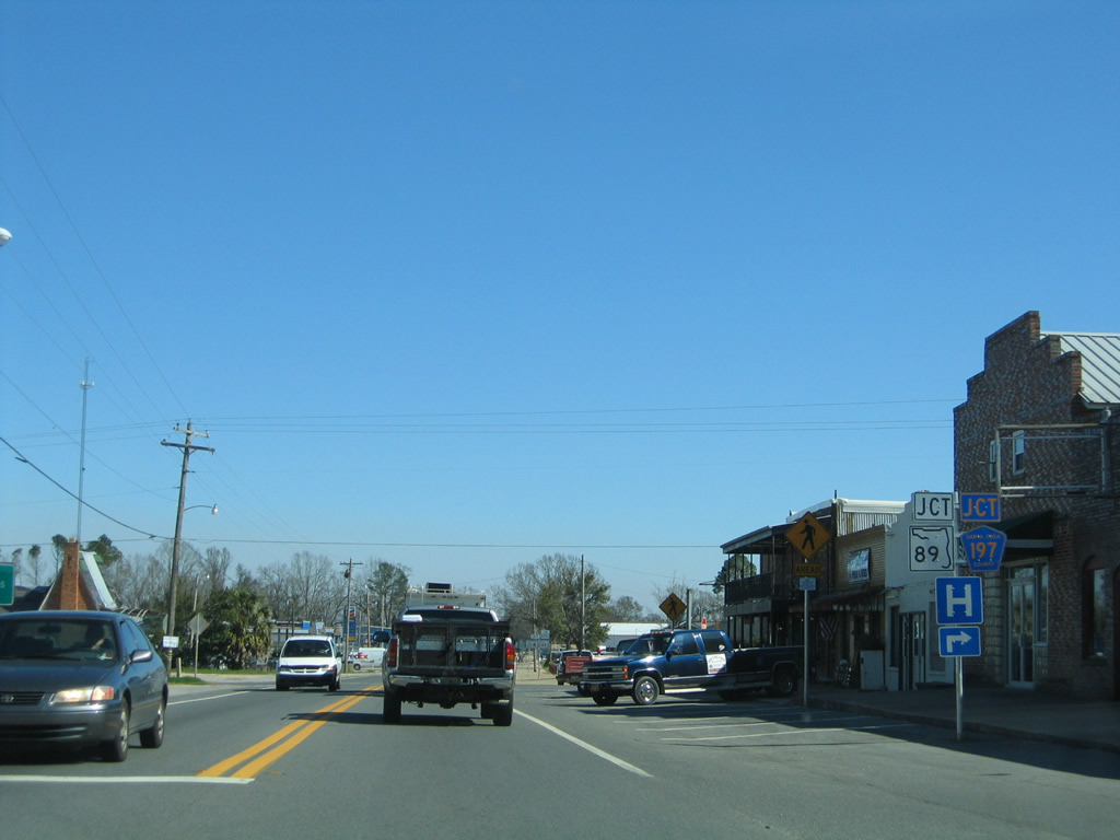
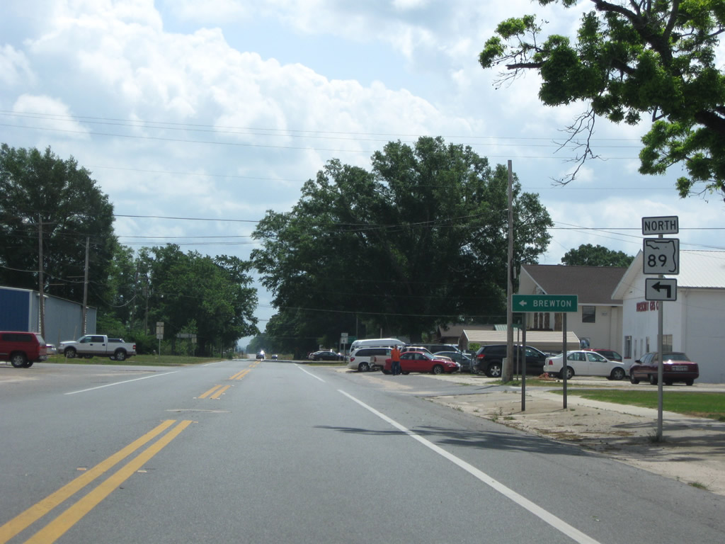
SR 89 (Alabama Street) meets SR 4 at the next intersection. SR 89 leads south to CR-197 outside town before edging eastward to Point Baker and Milton. CR-197 links Jay with Brownsdale, Chumuckla and Pace. Alabama Street north provides a local cutoff to SR 89 north to Mt. Carmel.
02/07/06
East  North
North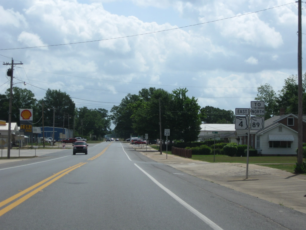
SR 89 turns east from Alabama Street onto SR 4 for a 0.187 mile overlap.
05/03/09
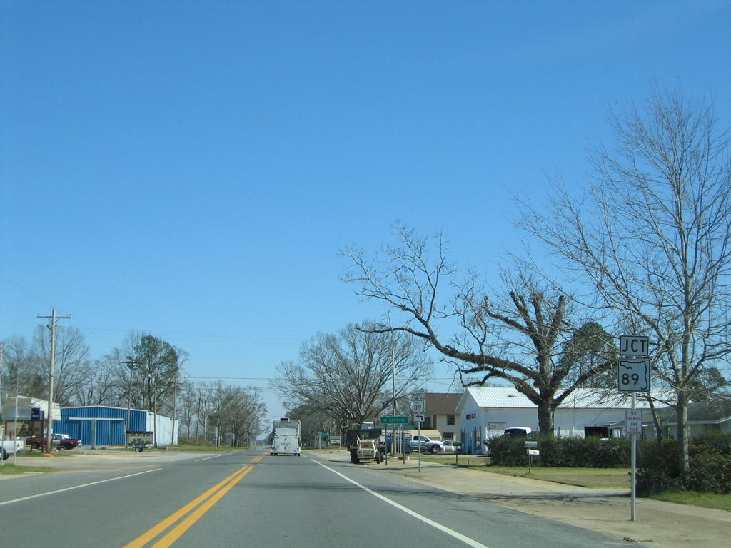
Resuming a northward course, SR 89 leaves Jay on a 4.03 mile drive to the Alabama state line beyond Mt. Carmel.
02/07/06
SR 89 becomes Escambia County Road 55 north in Alabama en route to Riverview and Alabama 41. Alabama 41 continues the drive across the Conecuh River into East Brewton and Brewton.
05/03/09
East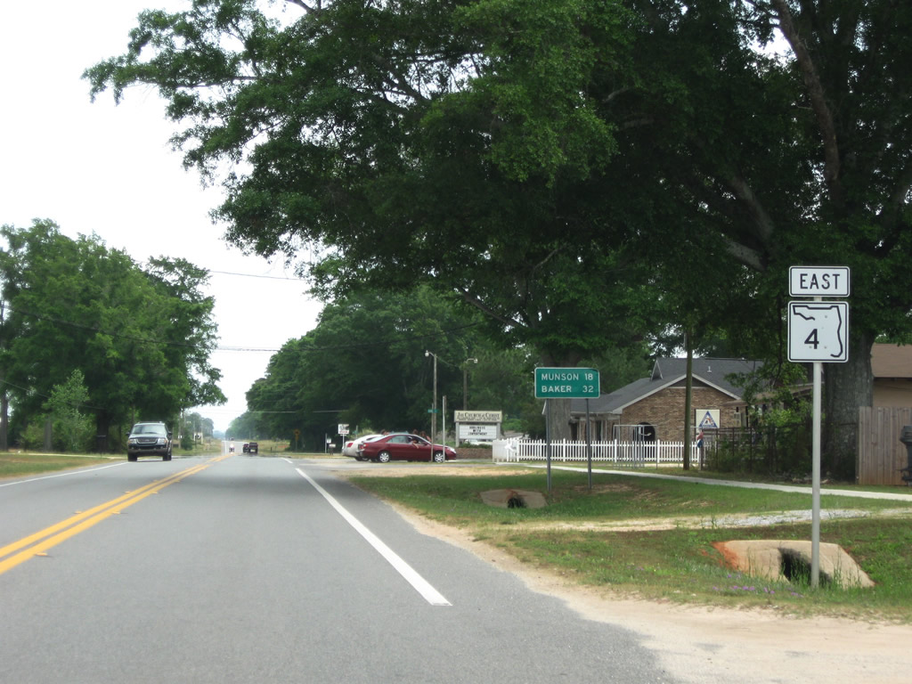
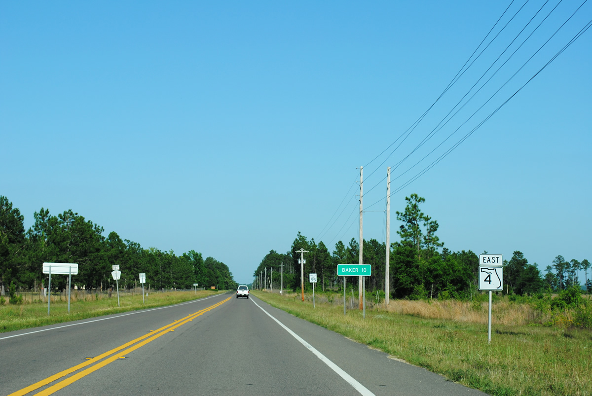
Heading east from SR 89 and Jay, SR 4 reaches Munson in 18 miles and Baker (junction SR 189) in 32 miles.
05/03/09
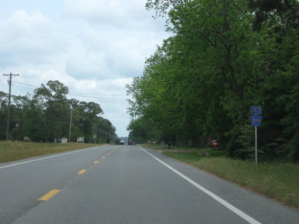
Approaching the northernmost segment of County Road 399 (Tractor Trail) along SR 4 east. Tractor Trail connects State Roads 4 and 89 at Mt. Carmel along a 1.86 mile rural road.
05/03/09
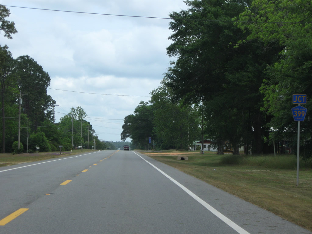
One half mile east of Tractor Trail is the southbound departure of Santa Rosa County Road 399 along Country Mill Road.
05/03/09
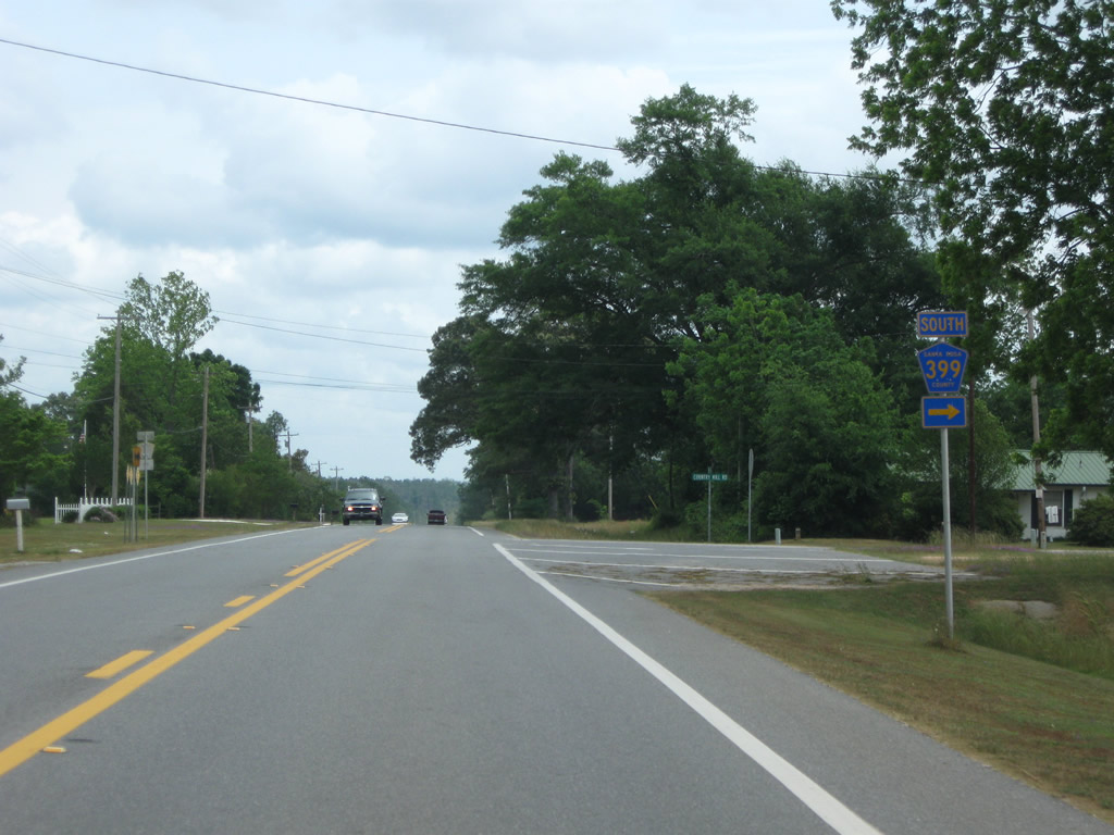
Country Mill Road arcs southeast from SR 4, 7.08 miles to SR 87 at Whitfield.
05/03/09
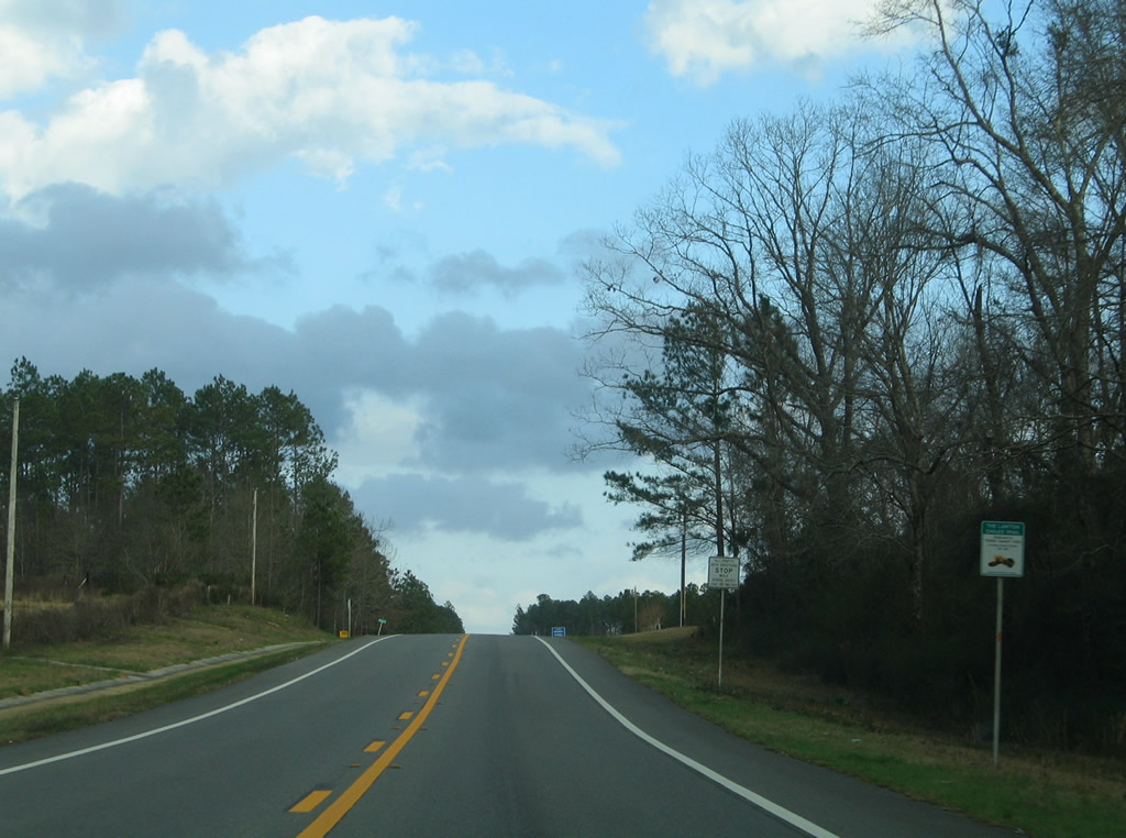
Leaving the intersection with Santa Rosa County Road 191 at Munson, SR 4 continues ten miles to Baker.
04/30/11

Lowering toward a crossing of Sweetwater Creek along a hilly stretch of SR 4 through Blackwater River State Forest.
04/30/11
Hurricane Lake Road angles northeast from SR 4 to Okaloosa County and Hurricane Lake Recreation Area within Blackwater River State Forest.
04/30/11
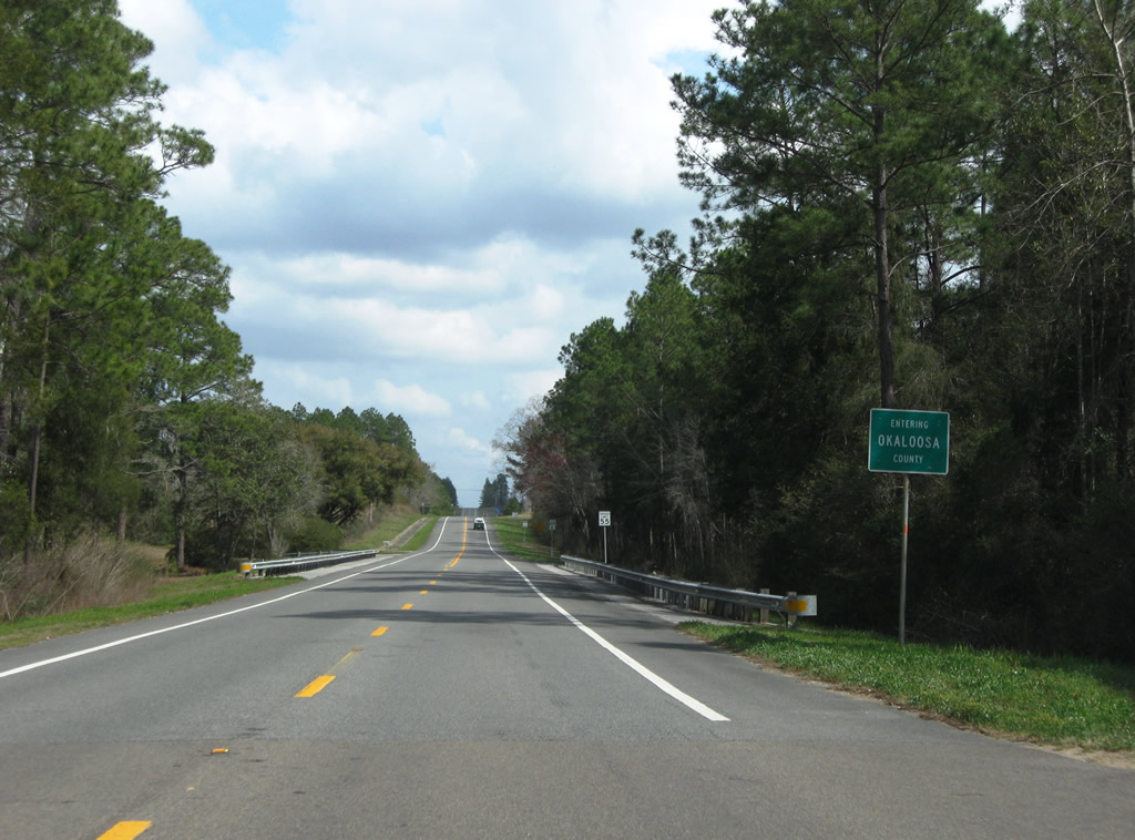
Crossing the Okaloosa County line along SR 4 east.
03/09/09
A reassurance marker follows the Santa Rosa County line along SR 4 east between Beaver Creek and Muddy Branch.
04/30/11
Eastbound drivers also pass by a Lawton Chiles Trail marker after the county line.
06/06/06
Turning more southward, SR 4 lowers into a valley to span the Blackwater River.
03/09/09

Okaloosa County Road 4A stems east from SR 4 to link with SR 189 north of Baker.
04/30/11
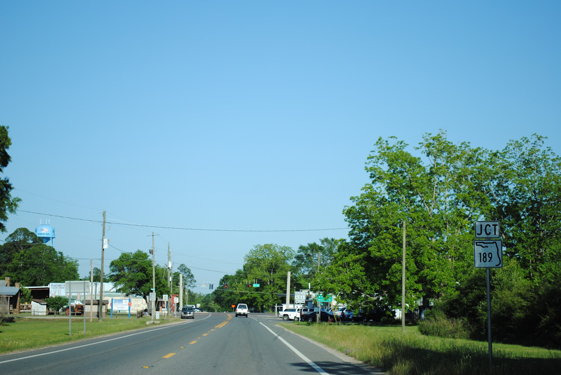
SR 4 reaches the unincorporated town of Baker and the south end of the northern section of SR 189.
04/30/11

SR 189 travels north from SR 4 (Georgia Avenue) and Baker 14.41 miles through Blackman and Escambia Farms to become Alabama 137 en route to Andalusia. A southern section of SR 189 loops northward from Fort Walton Beach to Wright and SR 85 north of Shalimar.
04/30/11
SR 4 travels south from SR 189 in Baker to the split with Okaloosa County Road 189.
05/02/09
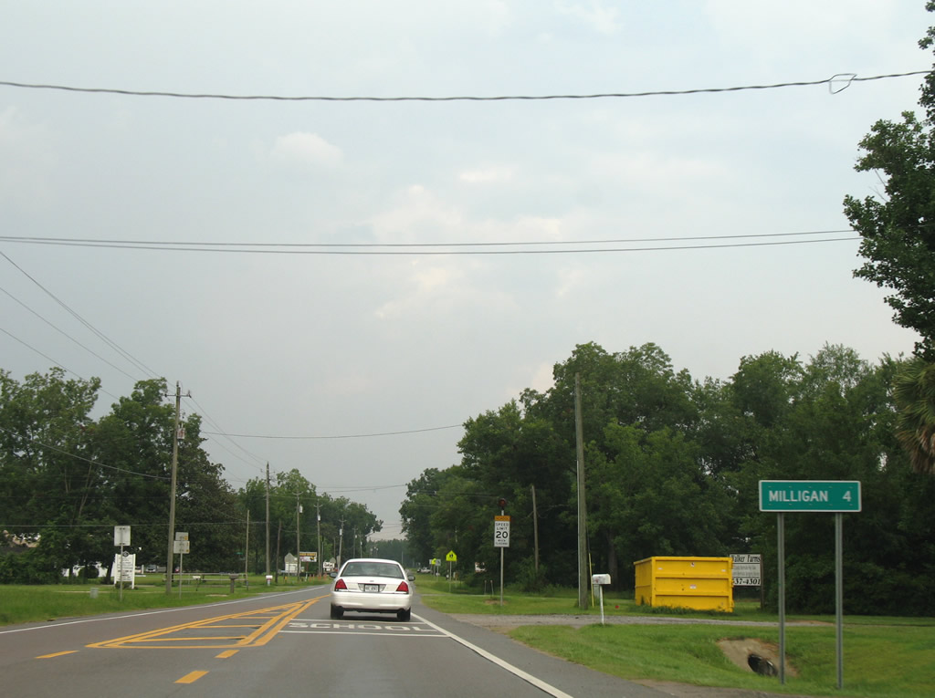
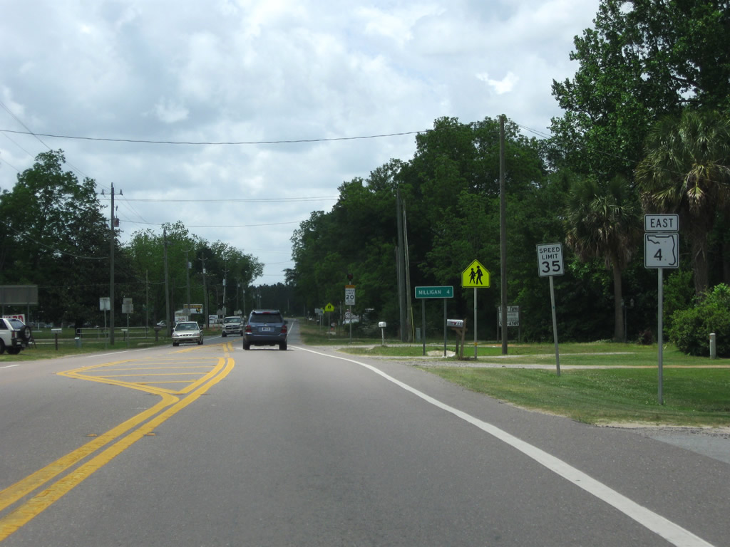
Milligan represents the SR 4 eastern terminus, four miles southeast of Baker.
07/13/07
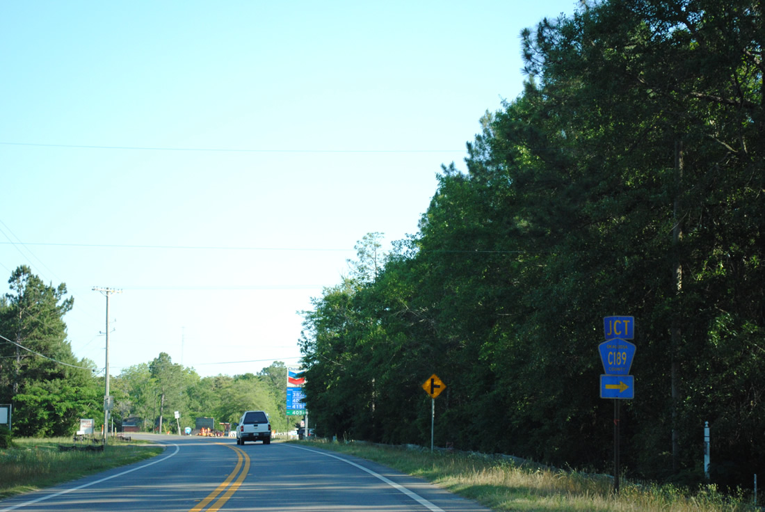
Okaloosa County Road 189 departs SR 4 east along Galliver Cutoff south. The county road travels 4.51 miles south to U.S. 90 at Galliver, providing a more direct route west to Holt and Milton over SR 4 east.
04/30/11
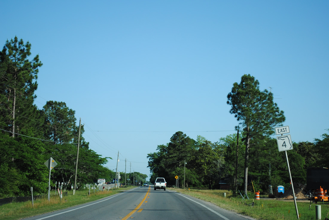
Curving southeastward from CR 189 along SR 4 east. Development increases along the route as the state road approaches Crestview.
04/30/11
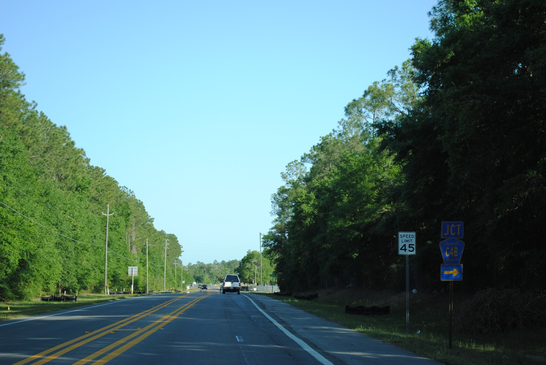
County Road 4B provides a connector west from SR 4 to Okaloosa County Road 189 (Galliver Cutoff).
04/30/11
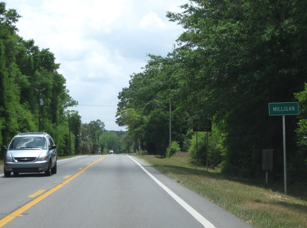
SR 4 concludes at the community of Milligan, which consists of a small street grid centered on SR 4 and U.S. 90.
05/02/09
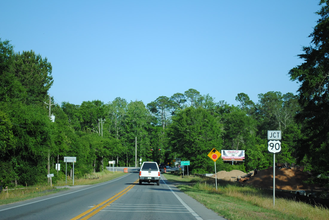
Rumble strips line the final feet of SR 4 as the route nears the stop sign with U.S. 90. U.S. 90 spans the Yellow River to the east ahead of the four lane stretch leading into Crestview.
04/30/11
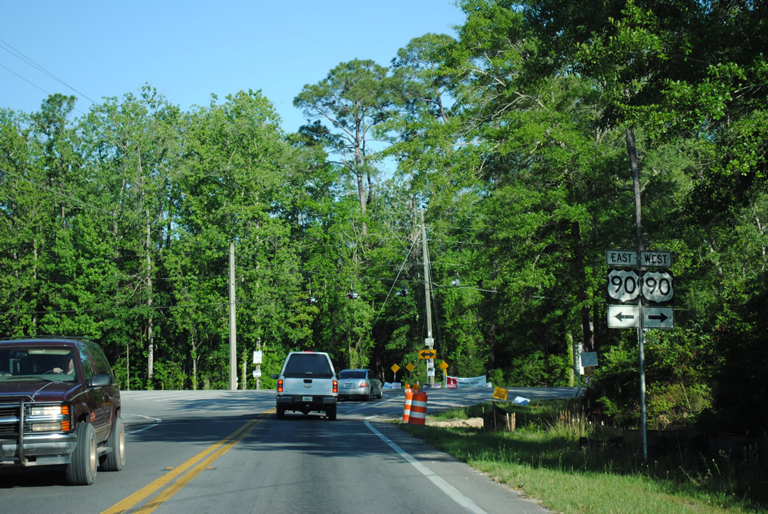
A set of flashers hang above the eastern terminus of SR 4 presently. Growth of Crestview as a bedroom community for Eglin Air Force Base sees increased traffic on U.S. 90 west to SR 4. It is likely that the junction between the two will be upgraded to a full traffic signal in the future.
04/30/11
References:
- "Bush signs bill for Lawton Chiles trail." Boca Raton News, May 12, 1999.
Photo Credits:
- Brent Ivy: 03/09/09, 05/02/09, 05/03/09, 07/31/11
- Alex Nitzman: 08/24/02, 02/07/06, 06/06/06, 07/13/07
- ABRoads: 04/30/11
Connect with:
Page Updated Monday November 26, 2012.