
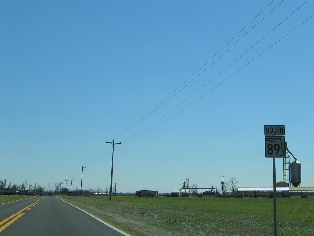
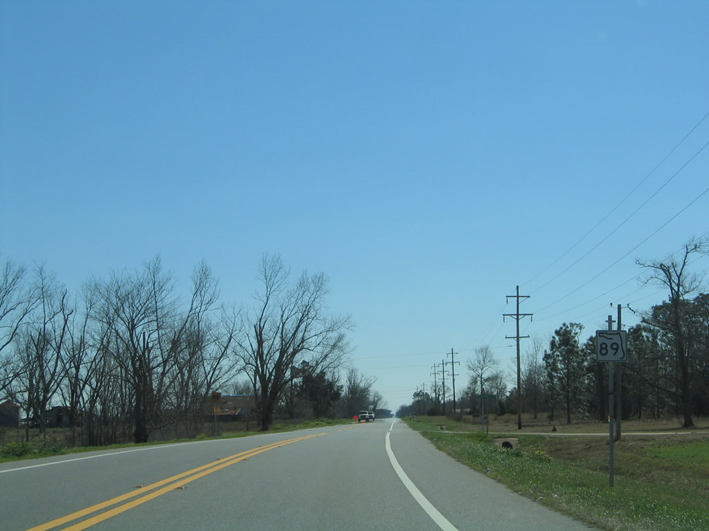
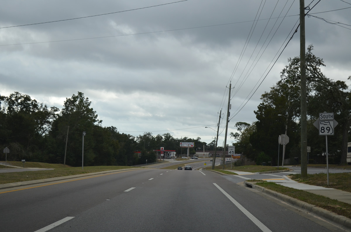
State Road 89 South
 South
South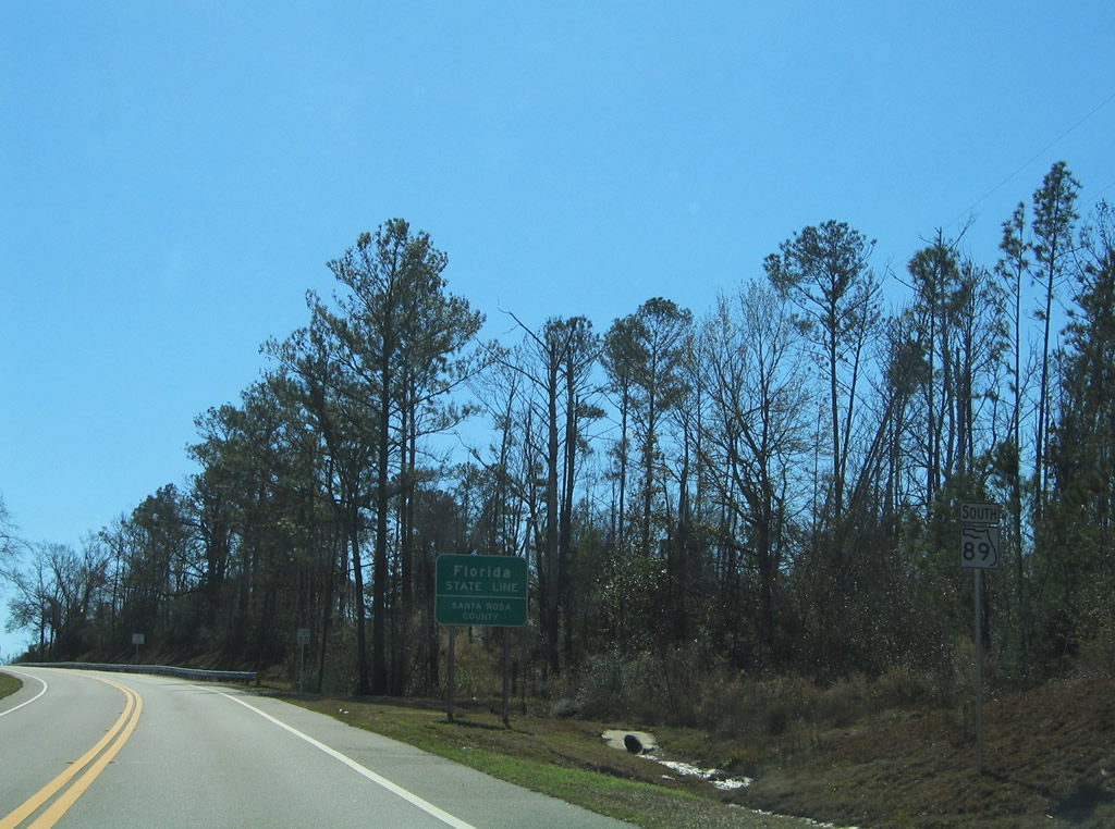
The first southbound shield of SR 89 stands by the Alabama state line. Extending from Escambia County Road 55 south, SR 89 transitions from forest land to open farm fields on the four mile drive to Jay.
02/07/06
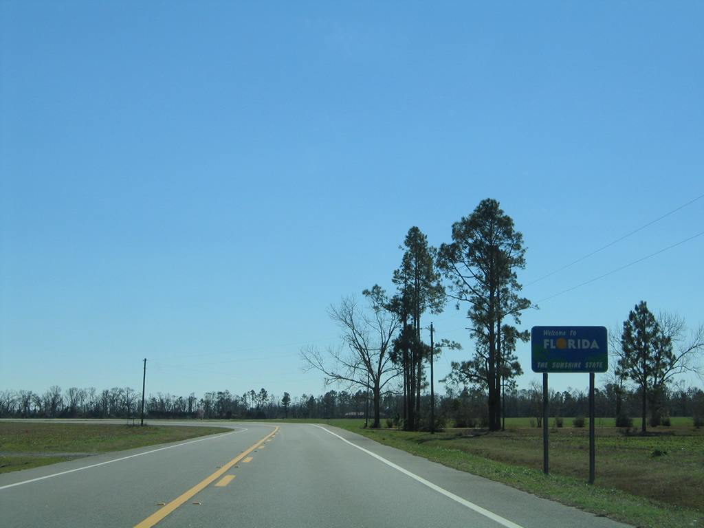
A welcome sign follows for southbound drivers entering Florida from Escambia County, Alabama along State Road 89.
02/07/06
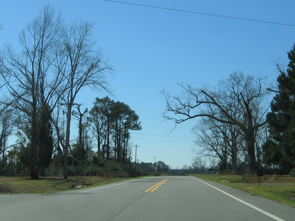
Santa Rosa County Road 399 stems south from SR 89 at Mt. Carmel to SR 4 east of Jay. This is the northernmost segment of CR-399. Another section of CR 399 is assigned in northern Santa Rosa County, while the others serve Navarre and the Gulf Beaches.
02/07/06
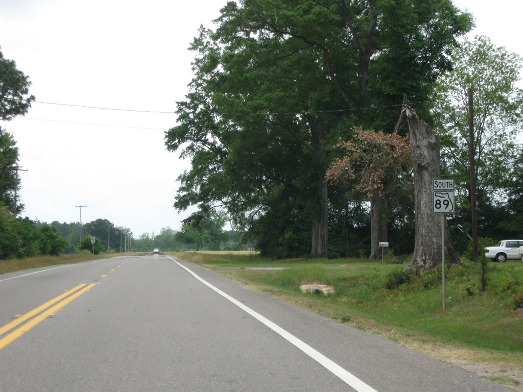
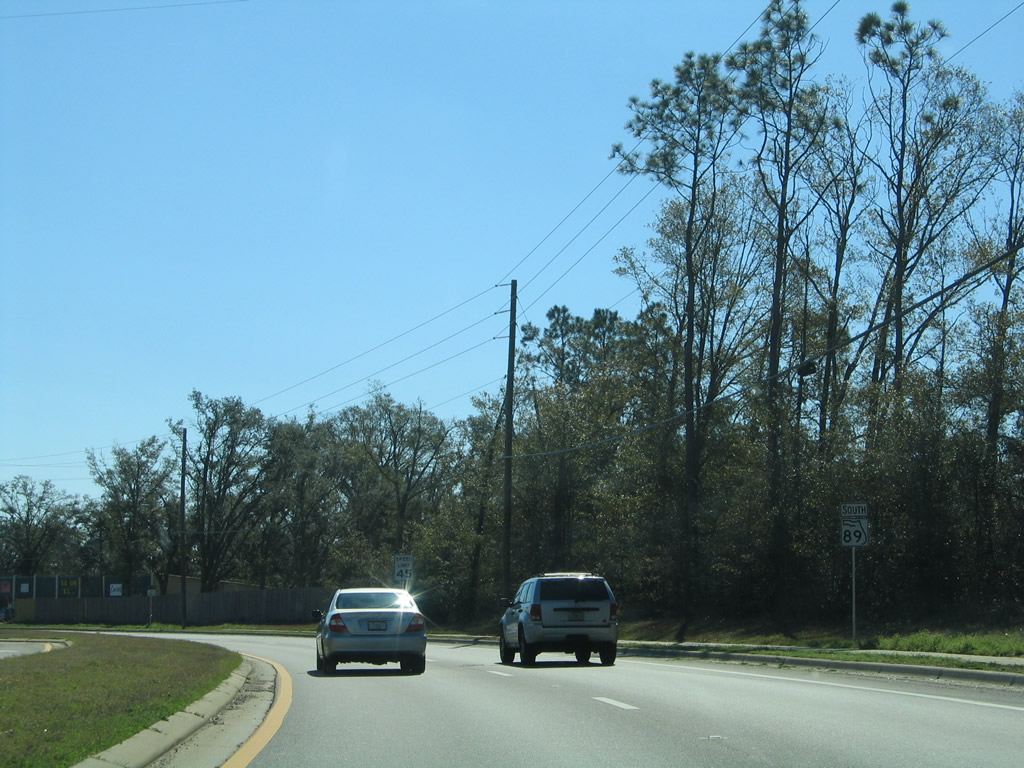
The second shield of SR 89 south appears beyond Tractor Trail (CR 399).
05/03/09
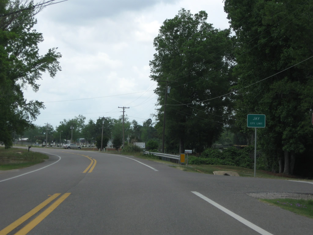
Old Pollard Road ties into SR 89 south as the state road enters the Jay city limits.
05/03/09
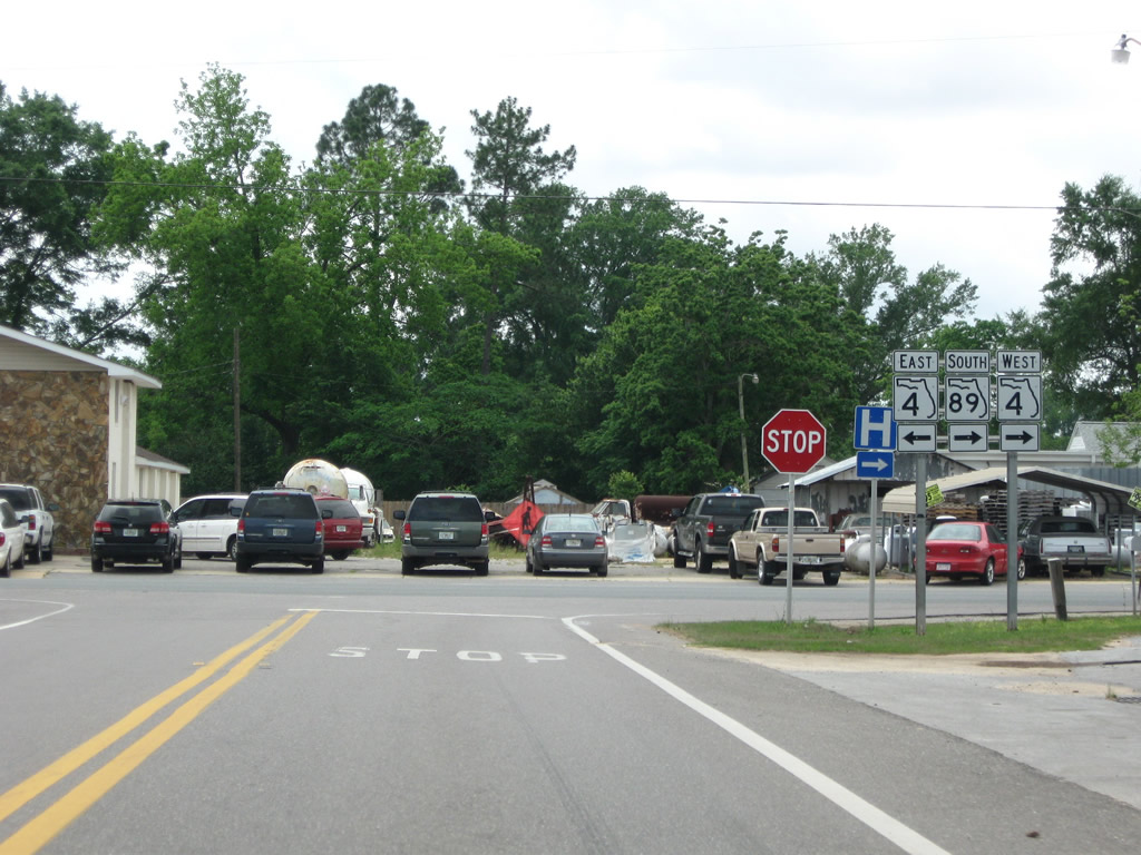
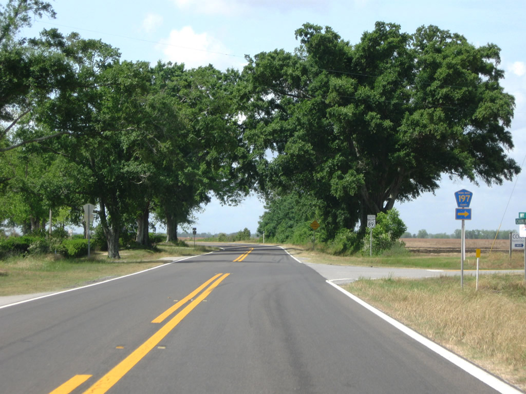
SR 89 splits with Alabama Street (County Road 197) and heads south to merge with SR 4 west in Jay.
05/03/09
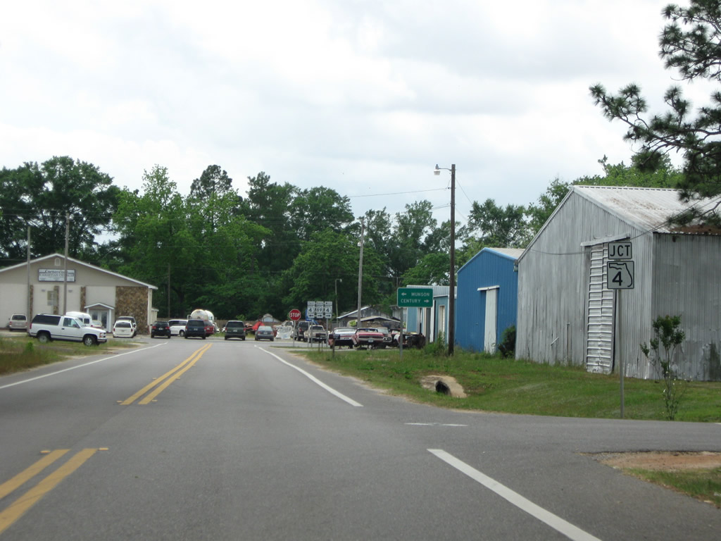
SR 4 east exits Jay on a rural course to Berrydale, Munson and Baker in Okaloosa County.
05/03/09
 West South
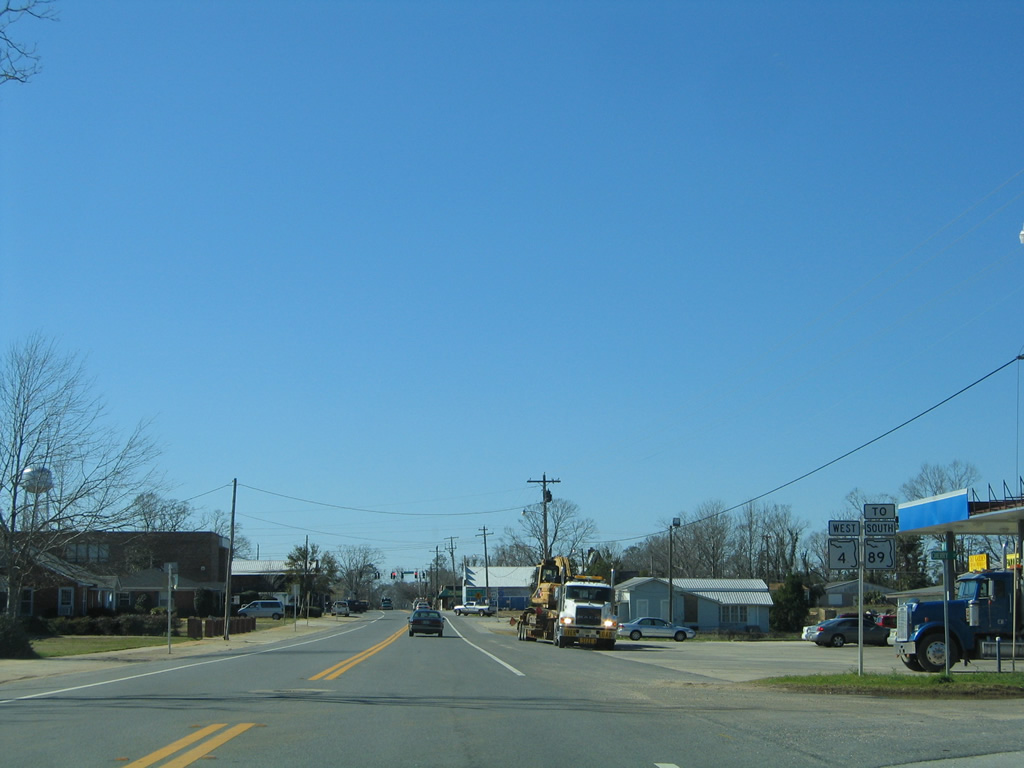
SR 89 south joins SR 4 west for 0.187 miles to connect with Alabama Street south.
02/07/06
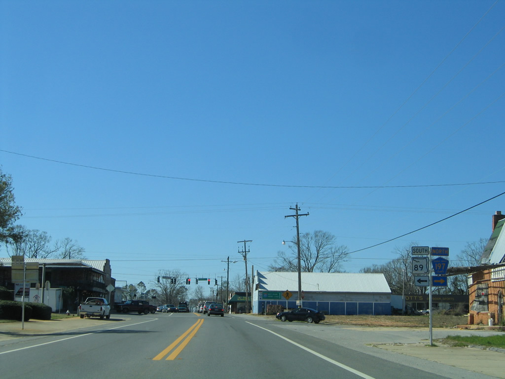
SR 89 parts ways with SR 4 west at Alabama Street (County Road 197). Another seven miles of SR 4 lie west from Jay to Century (U.S. 29) in northern Escambia County.
02/07/06
South
Resuming a southward trajectory, SR 89 follows Alabama Street by Jay Hospital to exit the city at Escambia Avenue.
02/07/06
Commerce Street merges with SR 89 (Alabama Street) at this distance sign posted 26 miles north of the county seat. County Road 197A follows Commerce Street between SR 4 and Spring Street in downtown. The county road parallels SR 89 southwest to end at County Road 197 (Chumuckla Highway).
02/07/06
County Road 197 splits from SR 89 for Chumuckla Highway west. The county highway represents the main route between Jay and Pace.
05/03/09
Chumuckla Highway travels between SR 89, Brownsdale, Chumuckla, Wallace and U.S. 90 in Pace.
05/03/09
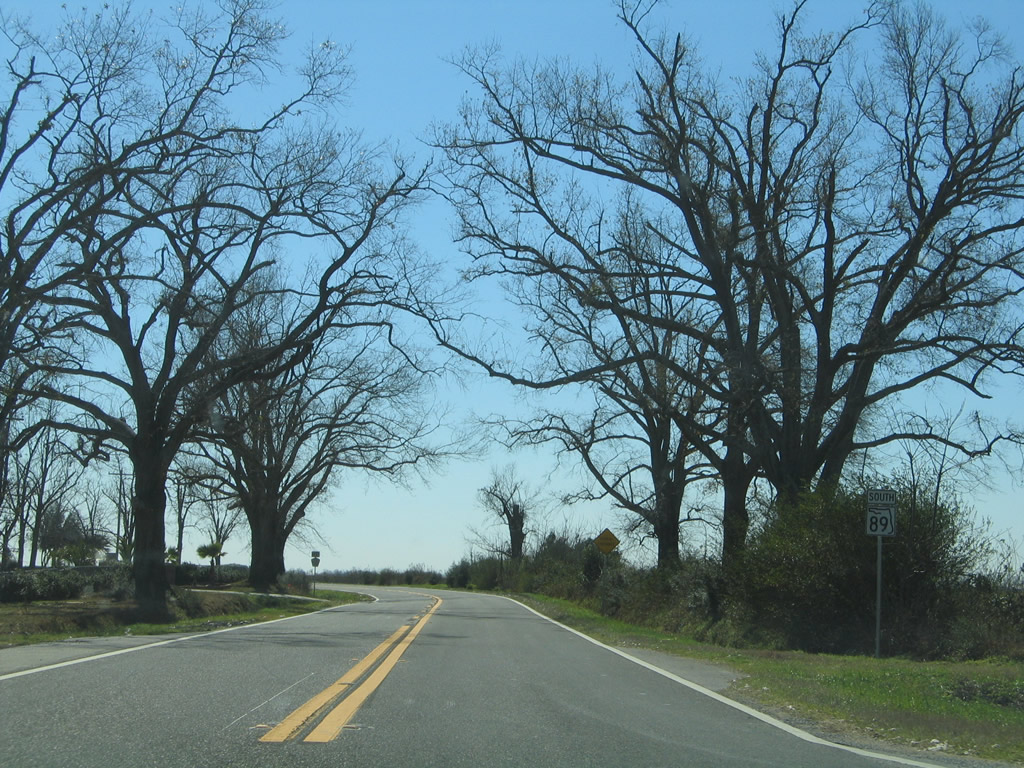
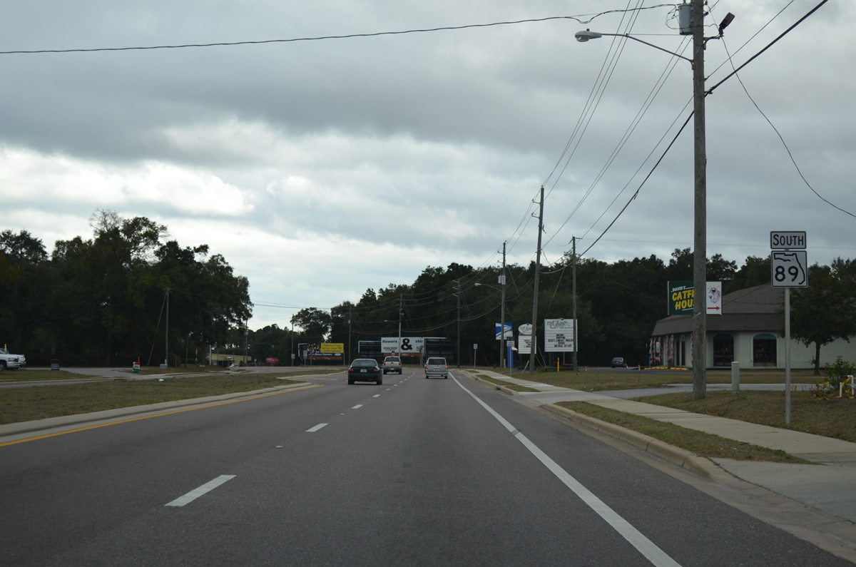
Southbound shield for SR 89 posted after Santa Rosa County Road 197 south.
02/07/06
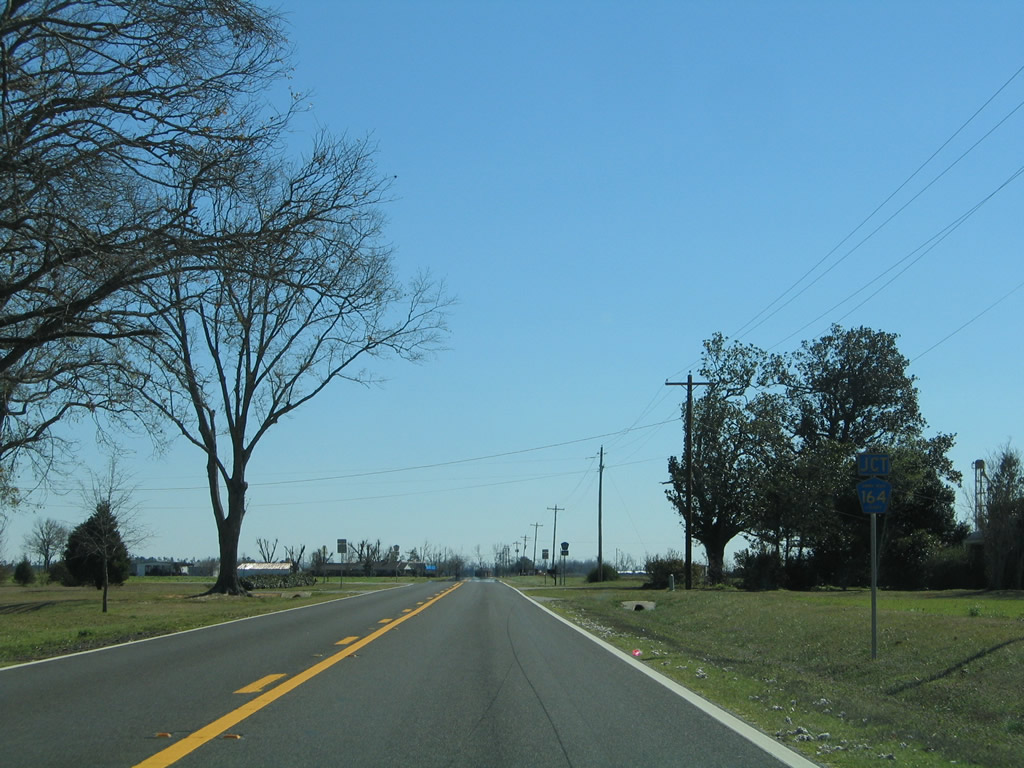
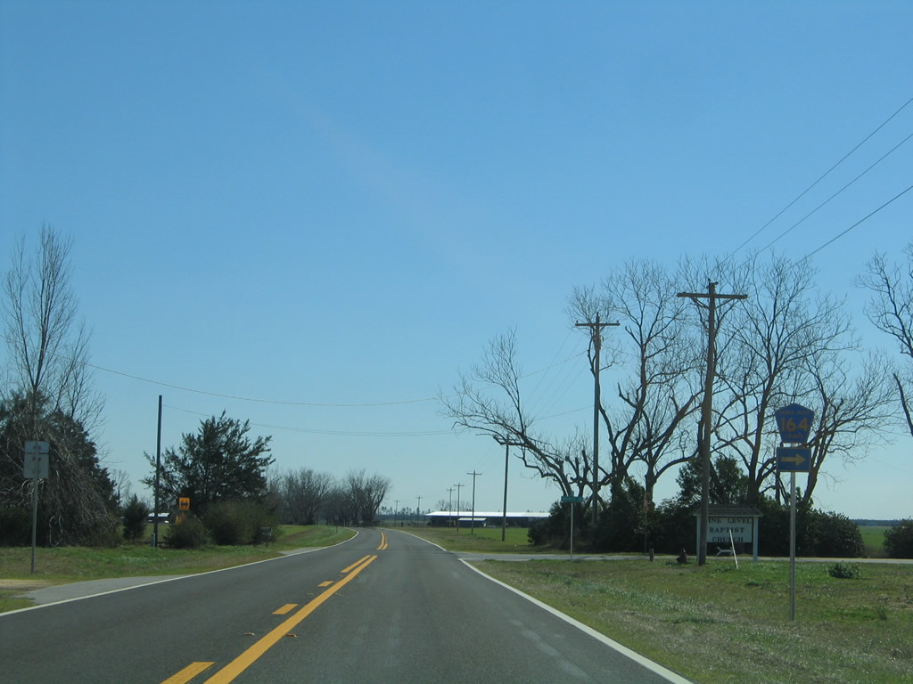
Next along SR 89 southbound is the west end Greenwood Road (Santa Rosa County Road 164).
02/07/06
County Road 164 follows Greenwood Road east to Cobbtown, CR 399 (Country Mill Road) and SR 4 west of Berrydale.
02/07/06
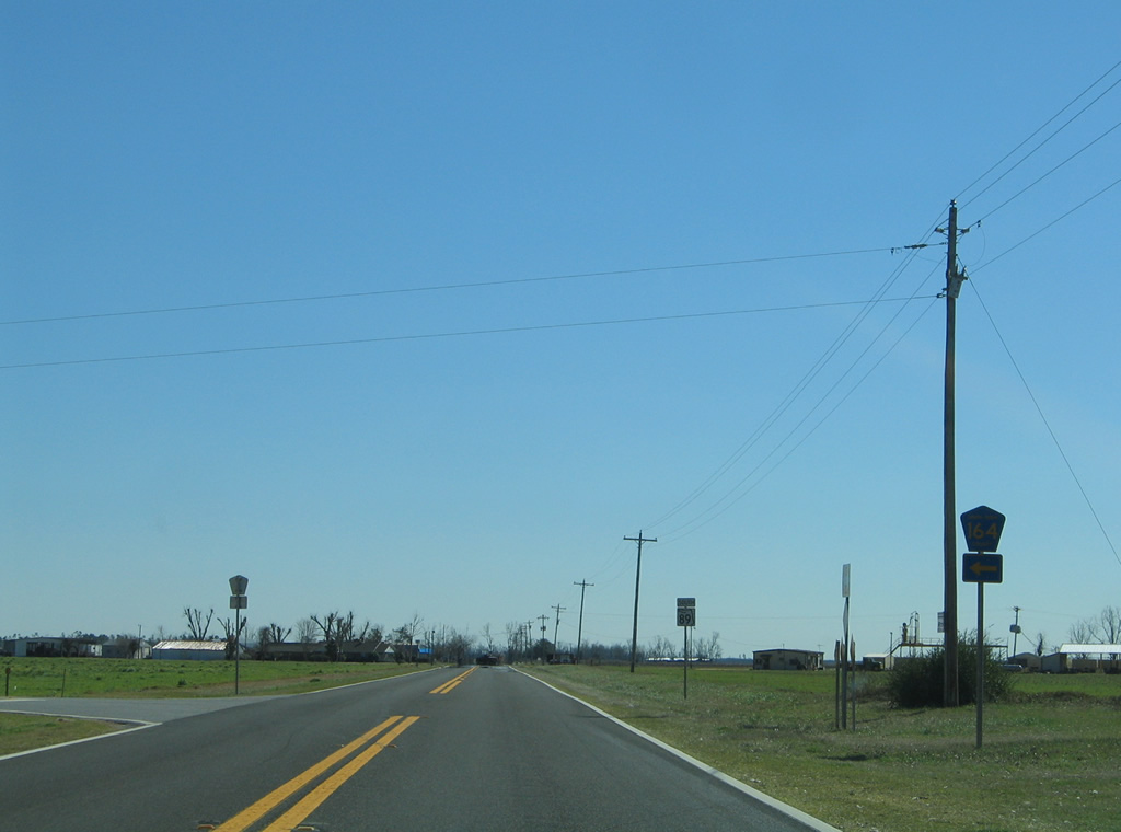
SR 89 angles southeast from the eastern segment of Santa Rosa County Road 164 toward the western one.
02/07/06

Harvest Road carries Santa Rosa County Road 164 west from SR 89 to Chumuckla Highway (County Road 197) at Brownsdale.
02/07/06
The western branch of Santa Rosa County Road 164 travels 3.81 miles to CR 197. Another section of CR 164 is located in Escambia County between McDavid (U.S. 29) and SR 97.
02/07/06
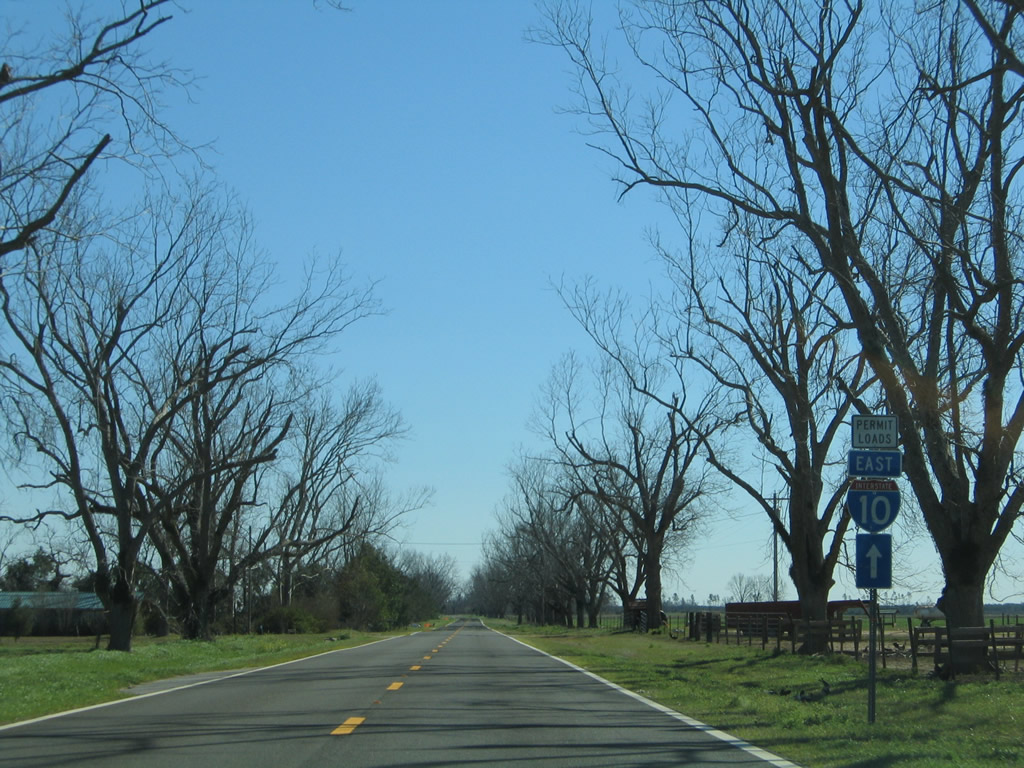
Heading southeast from Harvest Road along SR 89. Between September 2004 and November 2006, the state road was part of a network of detour routes for overweight and wide loads prohibited from crossing the damaged spans of Interstate 10 across Escambia Bay. Trailblazers for I-10/Permit Loads were posted along SR 89, SR 4, U.S. 29 and other roads in northern Escambia and Santa Rosa Counties.
02/07/06
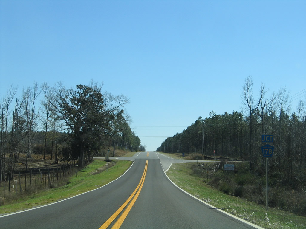
Santa Rosa County Road 178 (Spanish Trail) crosses paths with SR 89 at the next intersection.
02/07/06
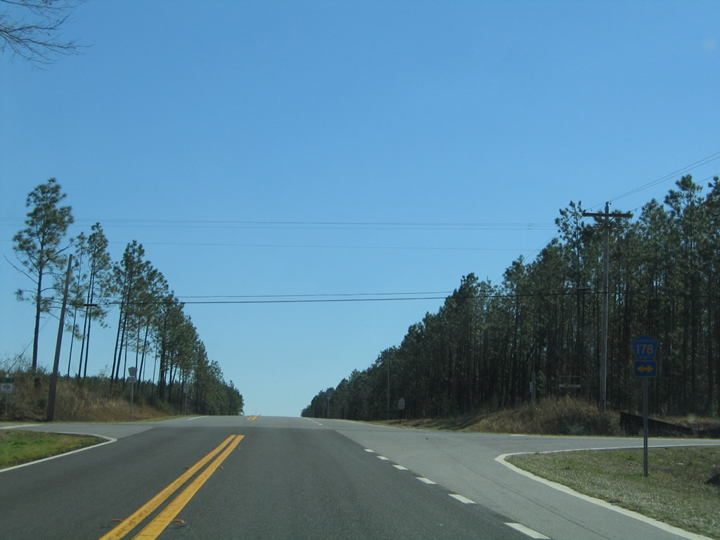
West from SR 89, CR 178 leads to CR 197 at the settlement of New York. Eastward, the county highway ends at SR 87, south of Whitfield.
02/07/06
Penton Road provides a cutoff to County Road 178 east from SR 89 north. A southbound reassurance shield follows the intersection.
02/07/06
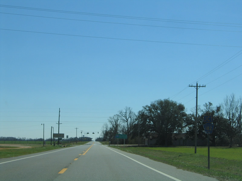
Approaching Santa Rosa County Road 182 along SR 89 south near Allentown.
02/07/06
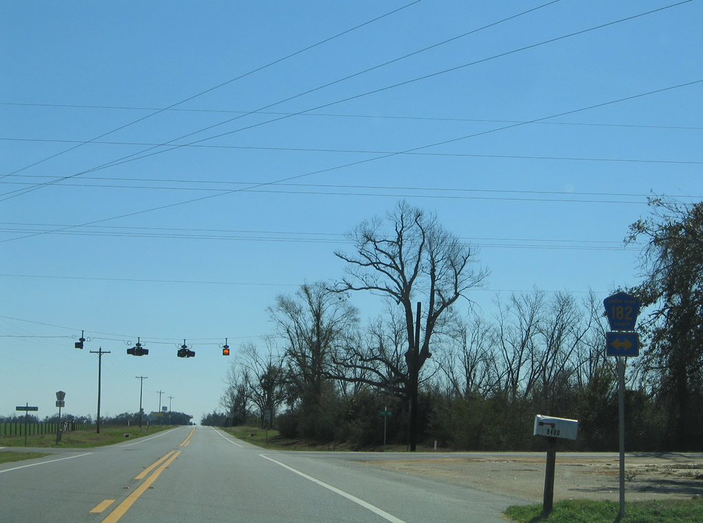
Central School Road carries County Road 182 southeast to Central High School and Allentown Road. Chumuckla lies west of SR 89 along Santa Rosa County Road 182.
02/07/06
The rural drive of SR 89 continues from County Road 182 to Allentown Road east and the northern outskirts of Milton at Point Baker.
02/07/06
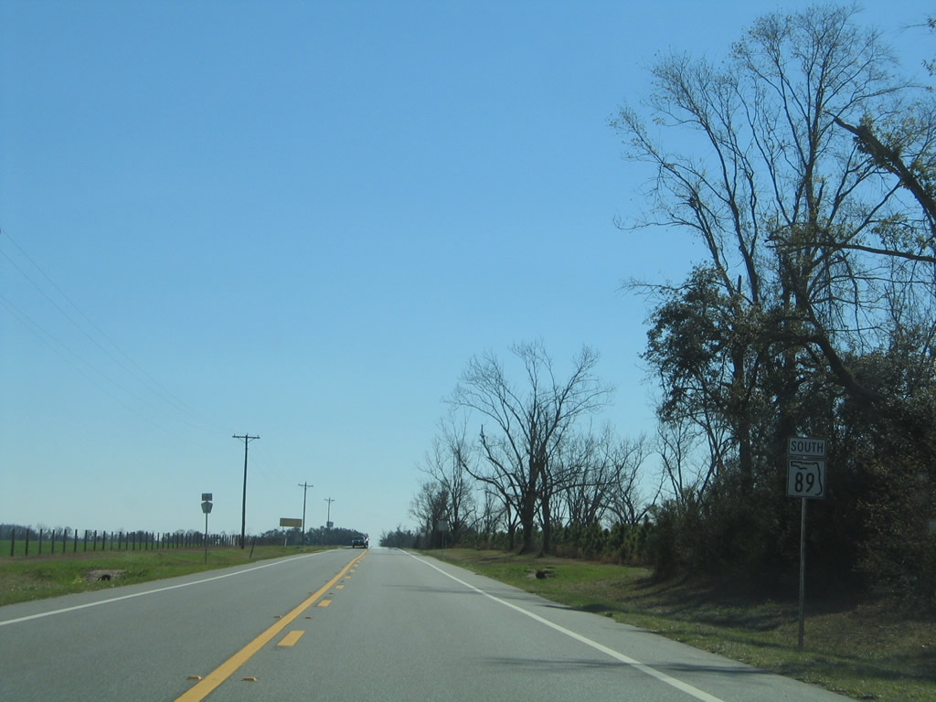
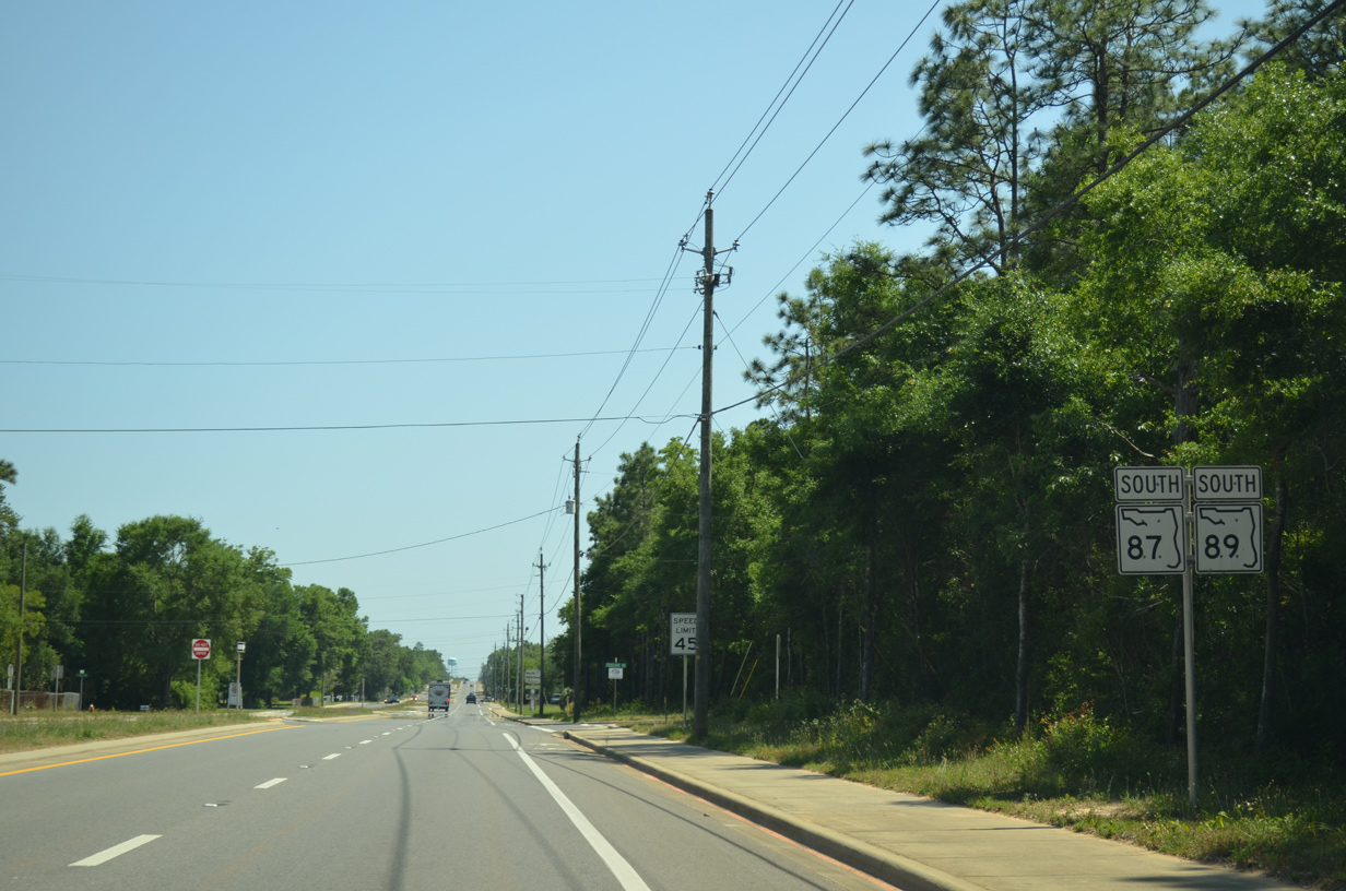
A final eastward turn occurs along SR 89 after Pine Blossom Road, bringing the state road to SR 87 at Point Baker.
02/07/06
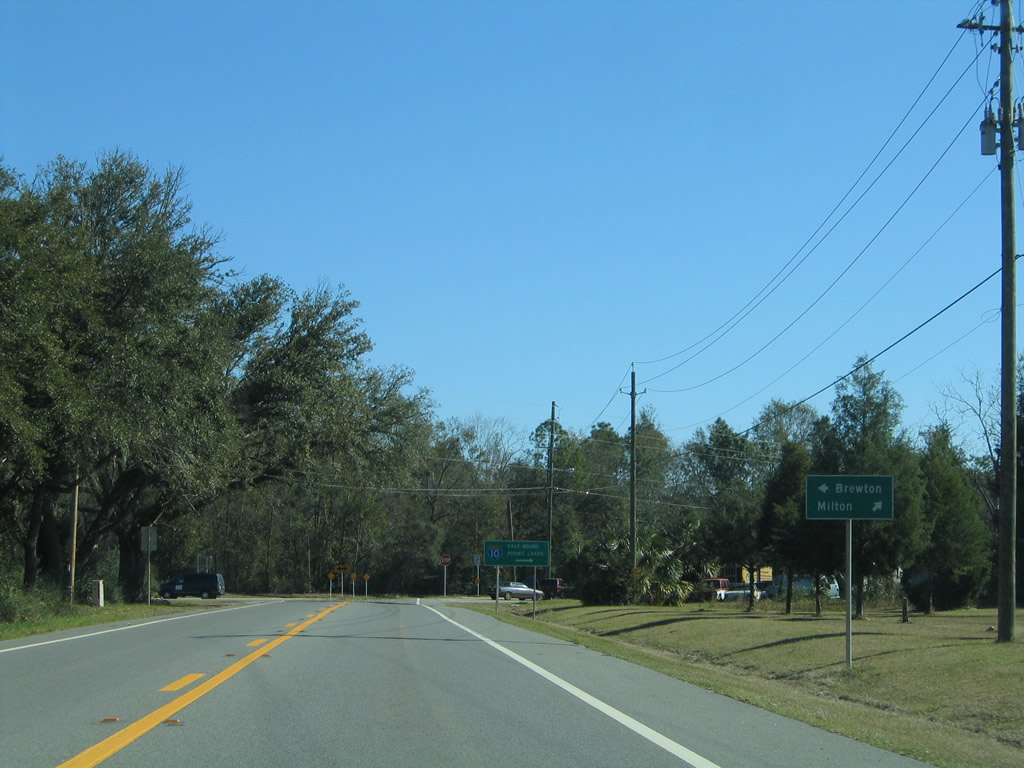
State Road 87 stretches nearly the height of Santa Rosa County, beginning in Navarre from U.S. 98 and leading north through Milton to become SR 41 en route to Brewton, Alabama.
02/07/06
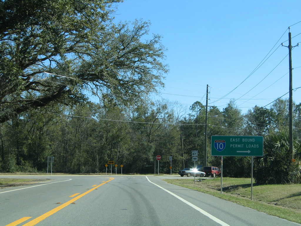
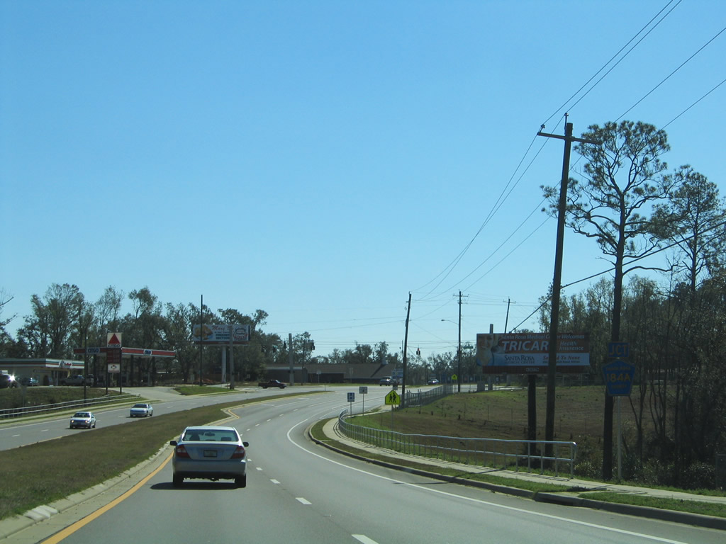
Guide signs were posted for the truck detour of Interstate 10 along with the trailblazers for the long loop to the SR 4 crossing of the Escambia River. Damage caused by Hurricane Ivan in September 2004 rendered the Escambia Bay bridges impassable for a period of time and ultimately led to their replacement.
02/07/06
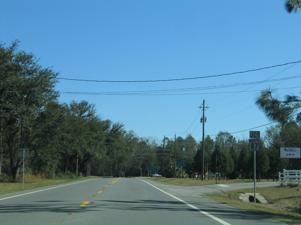
SR 87/89 overlap for 1.64 miles south from Point Baker to Stewart Street. A number of residential streets and mobile home parks line the arterial on this stretch.
05/18/14
South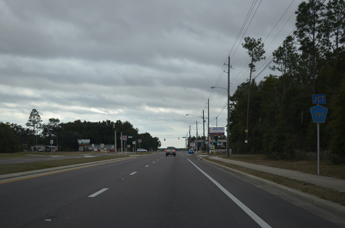
Dogwood Drive comprises a four lane divided highway south from Stewart Street to U.S. 90 (Caroline Street) through Milton. Just inside the city limits is the junction with County Road 191 (Magnolia Street east / Willard Norris Road west) along SR 89 south.
12/09/12
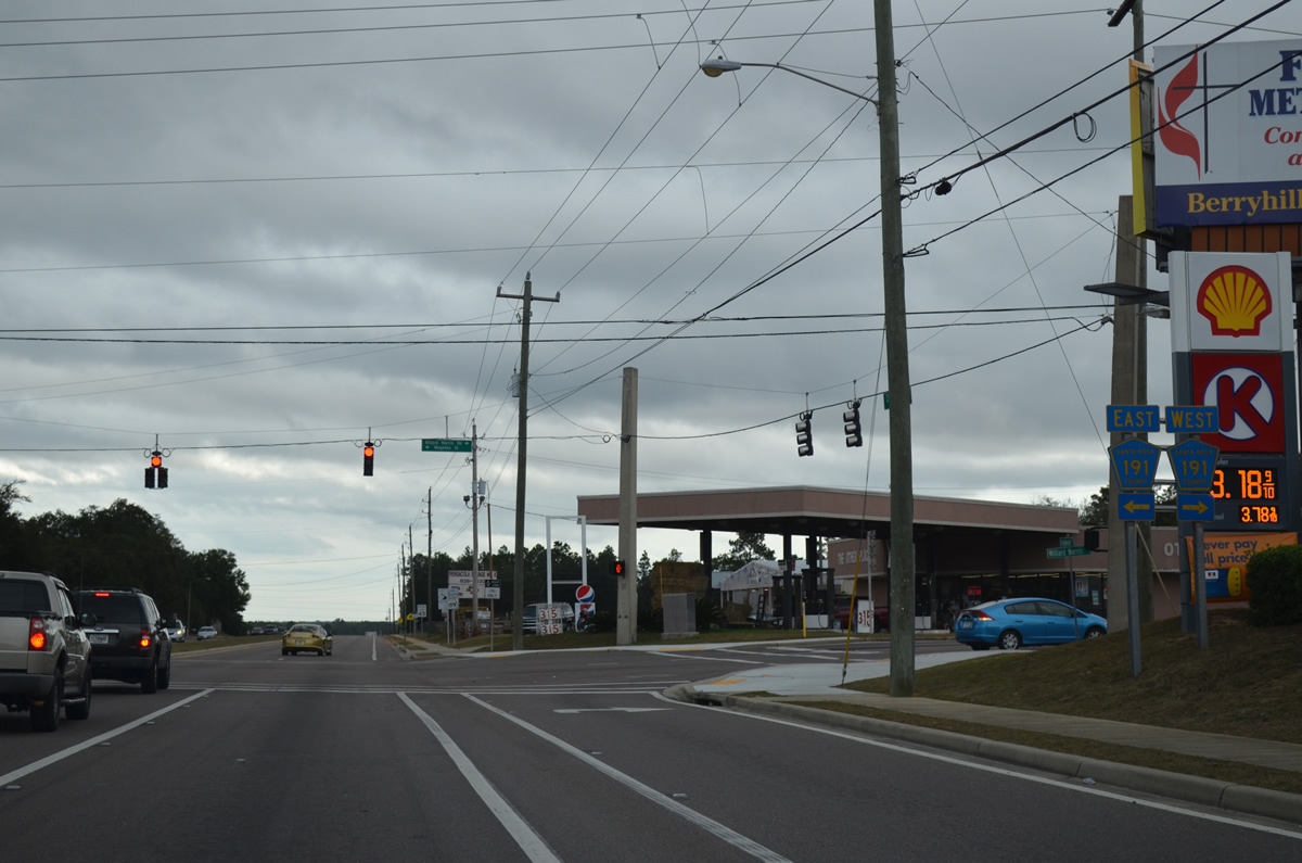
Santa Rosa County Road 191 exists in three segments radiating outward from Milton. Millard Norris Road represents the northwestern branch connecting the county seat with County Road 197 (Chumuckla Highway) near Wallace and NAS Whiting OLF Pace. CR-191 east ends at SR 87 nearby via Magnolia Street.
12/09/12
South of Magnolia Street along SR 89 (Dogwood Drive).
12/09/12
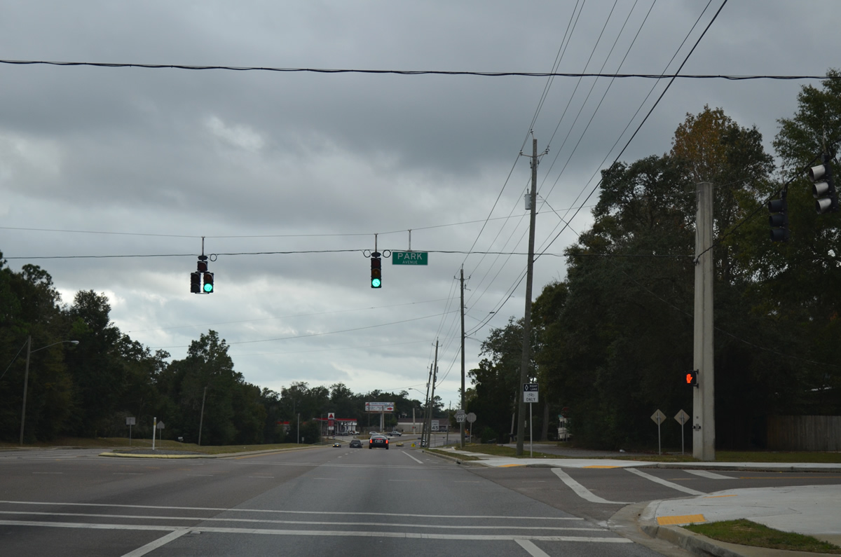
Park Avenue connects residential areas west of Dogwood Drive with Milton High School and SR 87 (Stewart Street) near the northeastern branch of County Road 191 (Munson Highway).
12/09/12
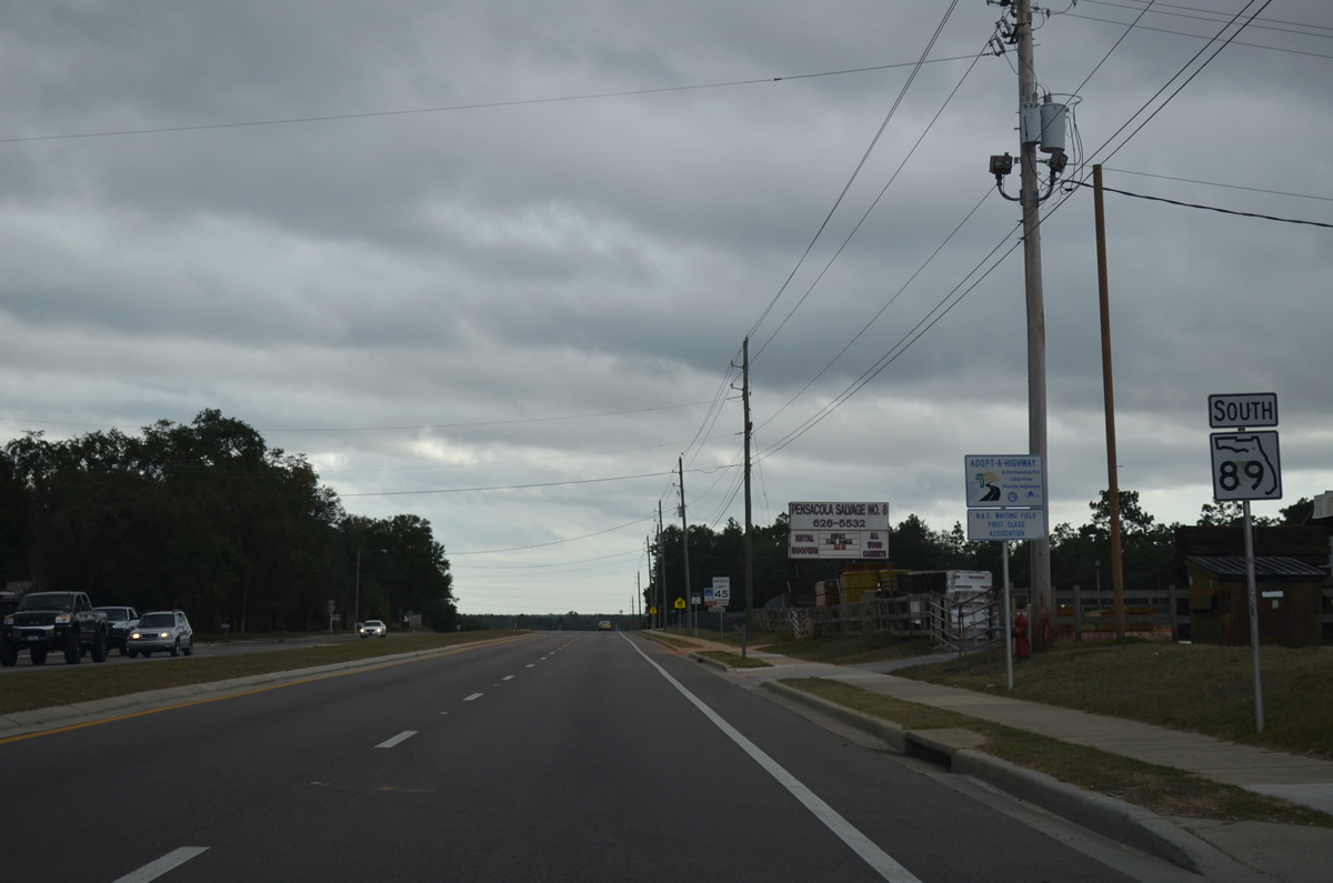
SR 89 kinks westward to cross Collins Creek from Park Avenue to Berryhill Road.
12/09/12
Berryhill Road doubles as Santa Rosa County Road 184A west from SR 89 (Dogwood Drive) to County Road 197 (Chumuckla Highway) at Pace.
This shield was missing by December 9, 2012.
02/07/06
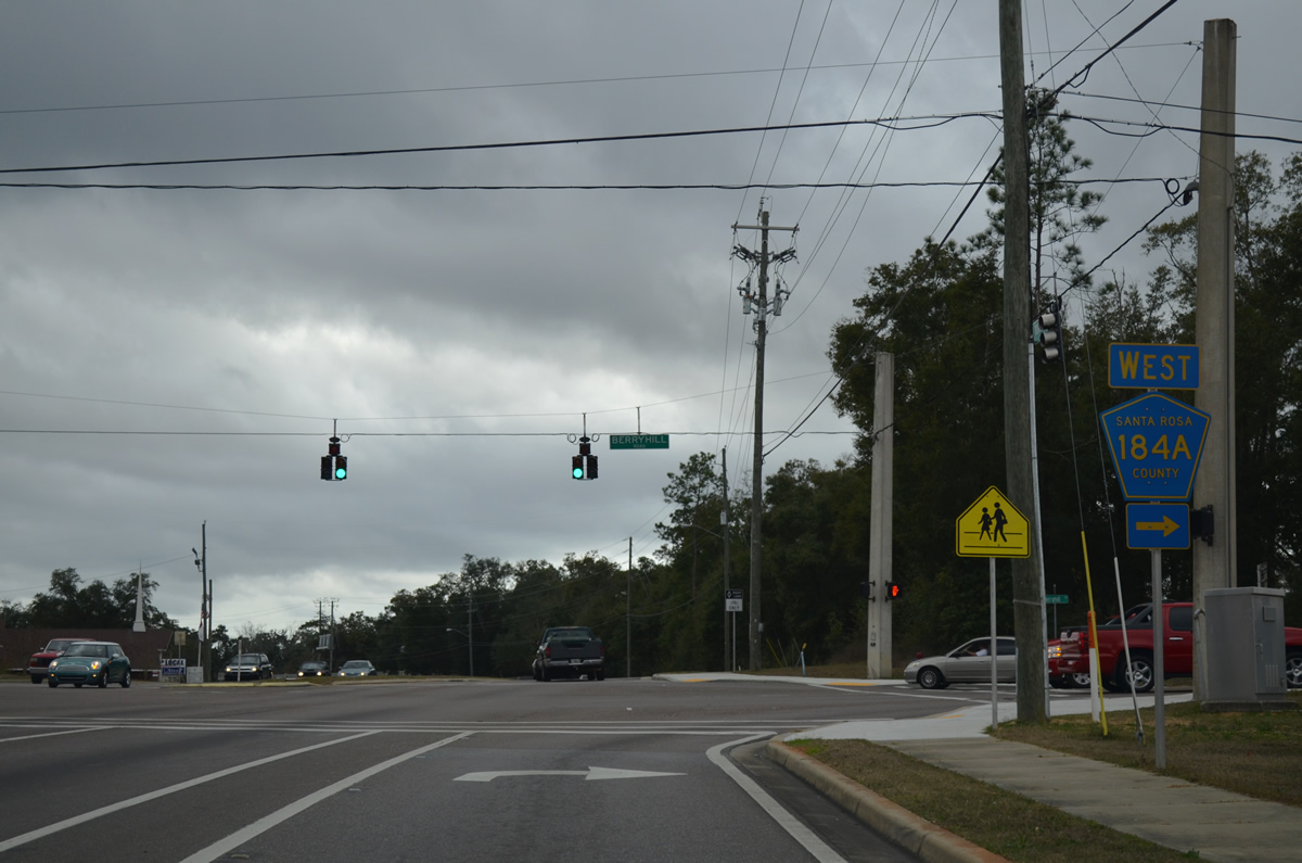
County Road 184A stretches 7.88 miles west from Dogwood Drive to CR-197. The county road used to continue east along Berryhill Drive to SR 87 (Stewart Street) and Broad Street (unsigned CR-191) at downtown Milton.
12/09/12
A shield for SR 89 was posted along the curve of Dogwood Drive south between Berryhill and Hamilton Bridge Roads. It was removed by December 2012.
02/07/06

Hamilton Bridge Road heads northeast from Glover Lane to meet SR 89 just ahead of its end at Berryhill Road. The road links Milton with Spencer Field to the west as a former county highway.
12/09/12
The final shield of SR 89 follows Hamilton Bridge Road as Dogwood Drive turns southeast toward U.S. 90 (Caroline Street).
12/09/12
SR 89 south concludes at Caroline Street, just west of downtown Milton and northeast of Galt City. County Road 89 stems south from U.S. 90, east of the Blackwater River, to Interstate 10 (Exit 28) and Ward Basin. U.S. 90 continues west otherwise to Pea Ridge and Pace.
12/09/12
Photo Credits:
- Alex Nitzman: 02/07/06
- Brent Ivy: 05/03/09
- ABRoads: 12/09/12, 05/18/14
Connect with:
Page Updated Monday December 10, 2012.