
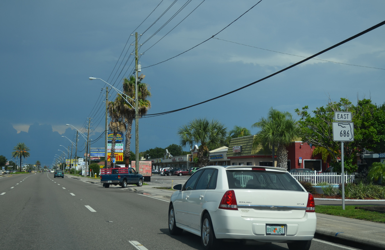
State Road 686 East
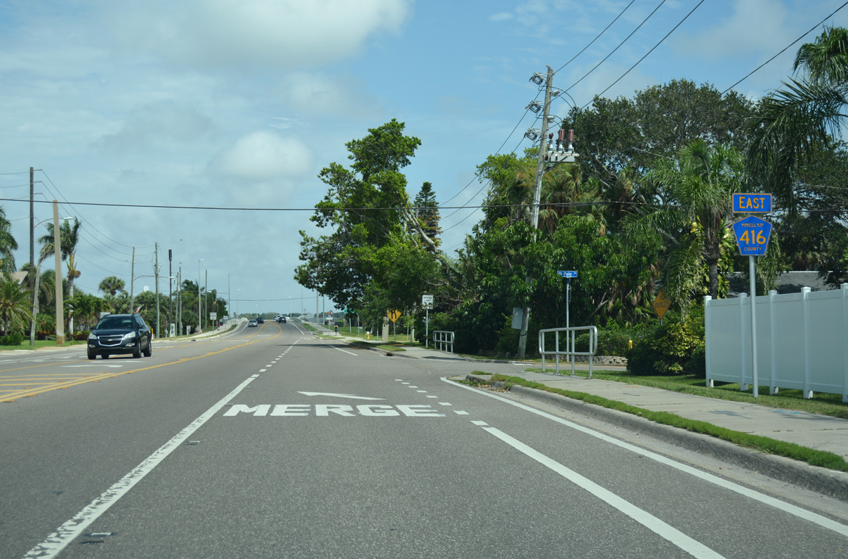
Belleair Beach Causeway stems east from Gulf Boulevard (CR 183) through the city of Belleair Beach. Three residential streets tie into CR 416 ahead of Clearwater Harbor relief channel.
05/04/19
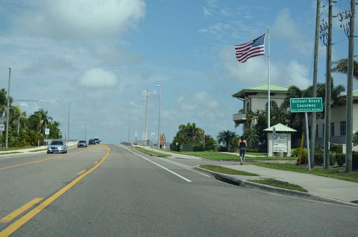
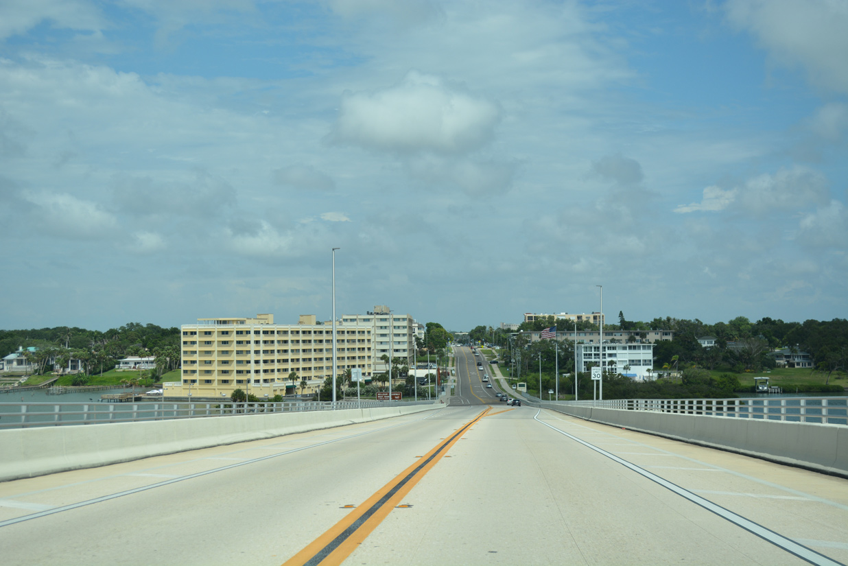
Belleair Beach Causeway spans Clearwater Harbor east from Shell Point on Sand Key to the city of Belleair Bluffs.
05/04/19
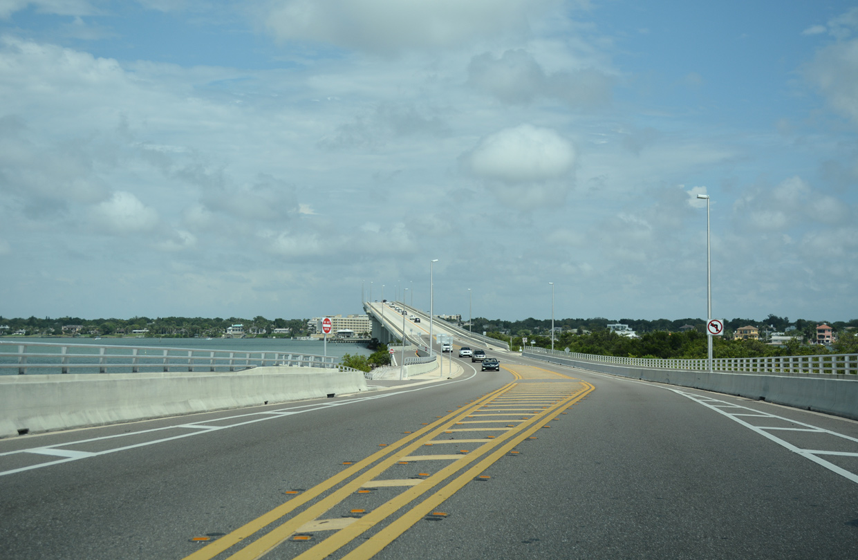
The Belleair Beach Causeway bridge system was rebuilt and completed in 2009. The 324.2 foot long Clearwater Harbor relief channel bridge crosses onto a man made island ahead of the high rise bridge (Baughn, n.d.).
05/04/19
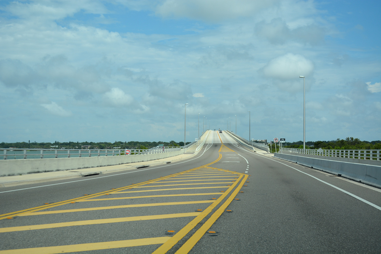
The Bellair Bridge opened to two-way traffic on May 29, 2009. Constructed at a cost of $72.3 million, the 75 foot high span accommodates a 12 foot wide travel lane, 8 foot wide sidewalks and 10 foot wide shoulders (with five foot bicycle lanes) in each direction (St. Petersburg Times, 2009).
05/04/19
Work to replace the 50-year old drawbridge along Bellair Beach Causeway across Clearwater Harbor commenced in March 2007. The project finished ahead of schedule in late November 2009 (St. Petersburg Times, 2009).
05/04/19

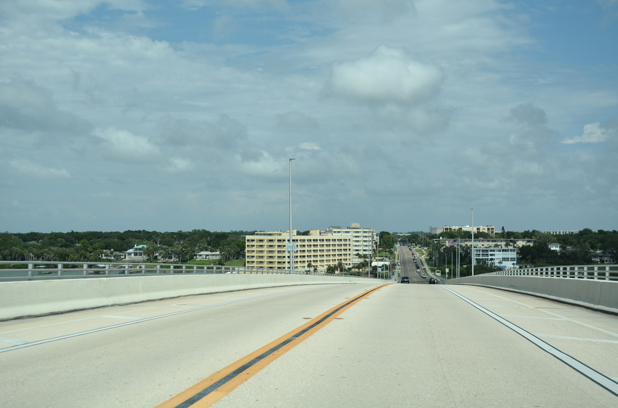
CR 416 (Belleair Beach Causeway) transitions to West Bay Drive through the small city of Belleair Bluffs.
05/04/19
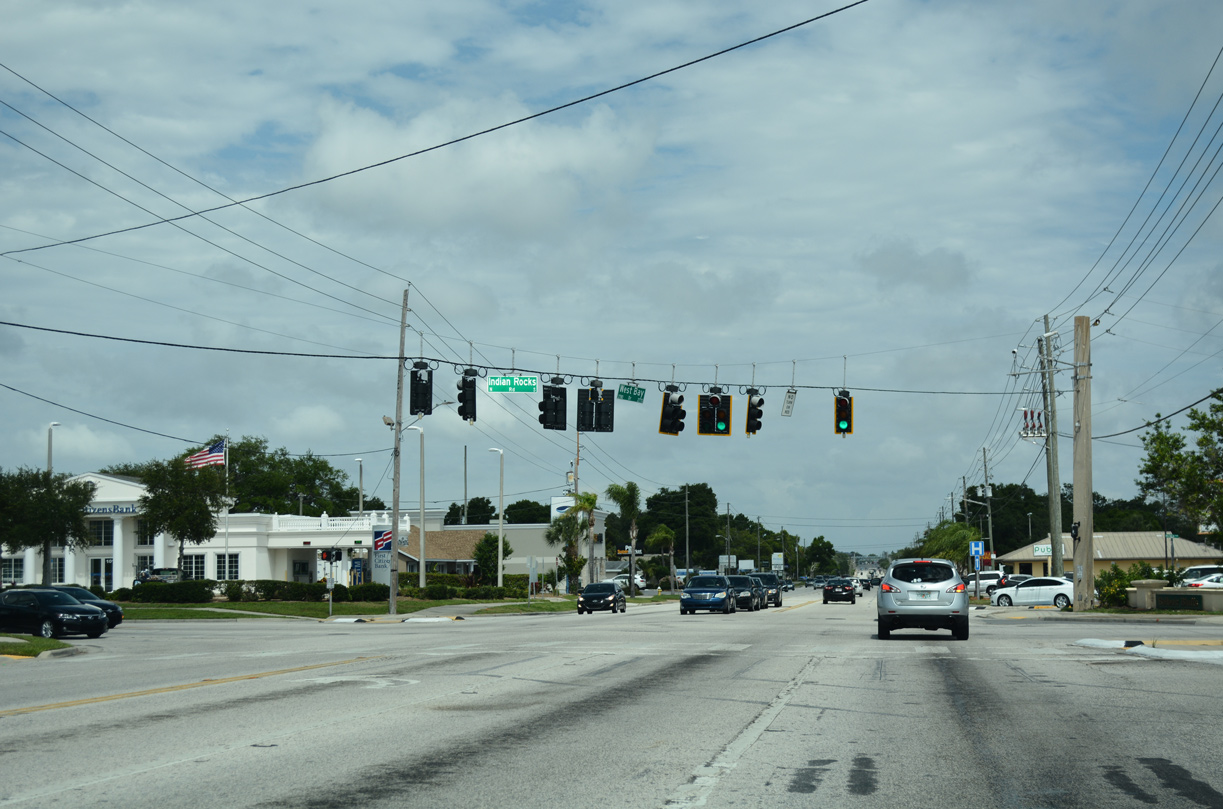
Indian Rocks Road (CR 233) angles across West Bay Drive (CR 416) at a commercialized intersection in Bellair Bluffs. CR 233 leads south to Harbor Bluffs and west Largo and north to the town of Belleair.
05/04/19
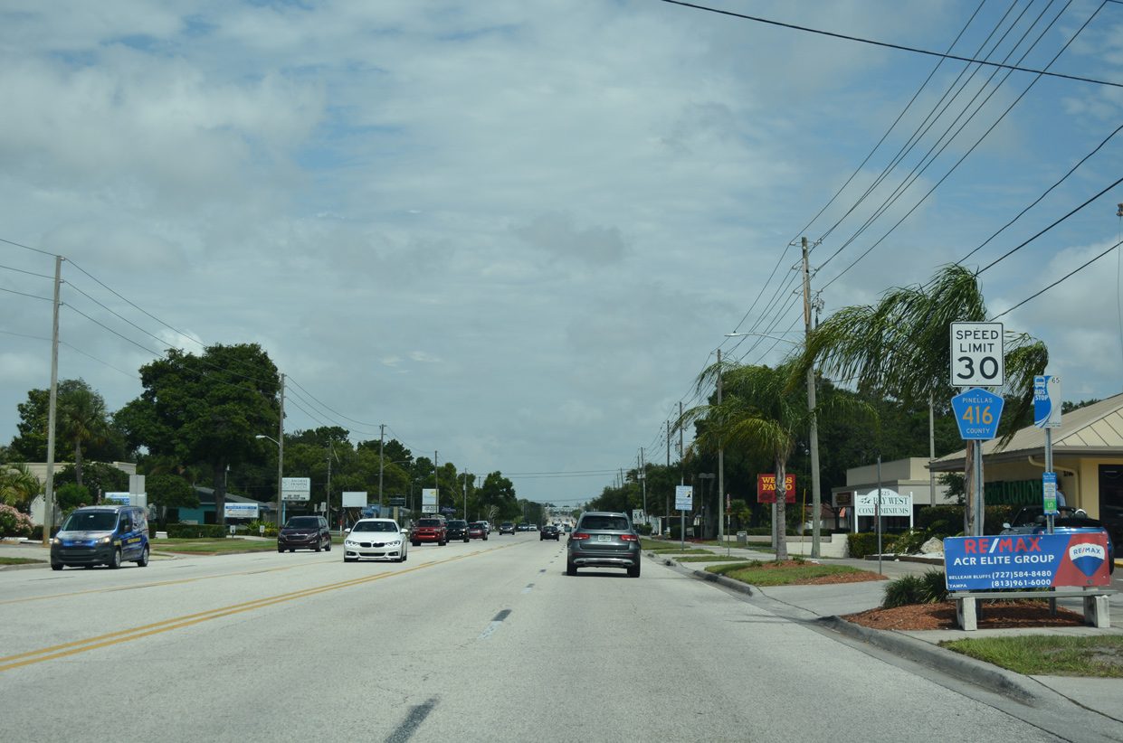
The second and last confirming marker for County Road 416 stands along West Bay Drive beyond Indian Rocks Road (CR 233).
05/04/19
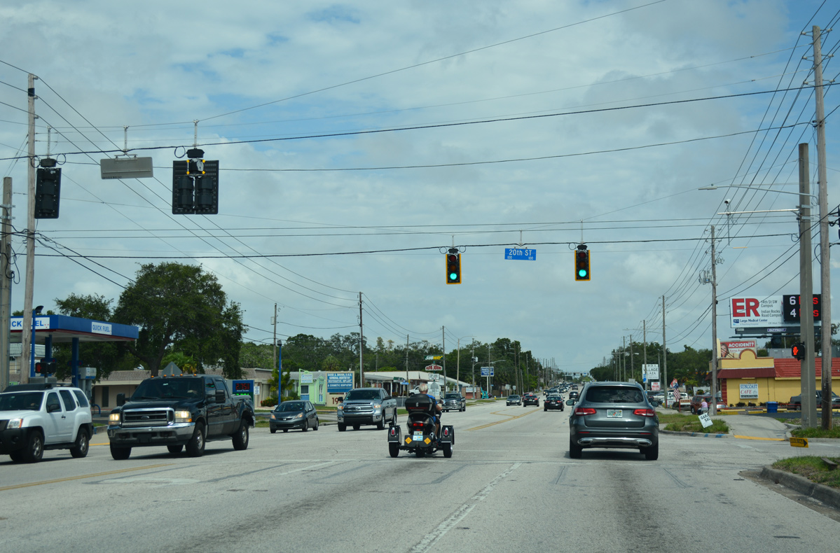
West Bay Drive advances east into the city of Largo, meeting 20th Street at the succeeding traffic light.
05/04/19
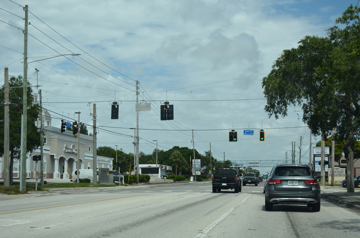
West Bay Drive (CR 416) intersects 14th Street by Largo Medical Center.
05/04/19
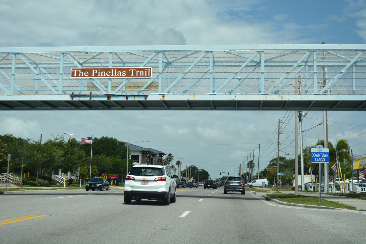
A pedestrian bridge spans West Bay Drive along the Pinellas Trail at Downtown Largo.
05/04/19
Clearwater Largo Road extends north from Ridge Road through Largo as a varying six lane arterial or five lane boulevard. North from West Bay Drive to Fort Harrison Avenue in Clearwater, Clearwater Largo Road is the former alignment of U.S. 19 Alternate.
05/04/19
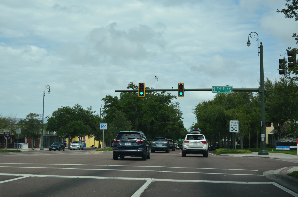
The traffic light with 4th Street NW/SE lies midway between Clearwater Largo Road and U.S. 19 Alternate on West Bay Drive.
05/04/19
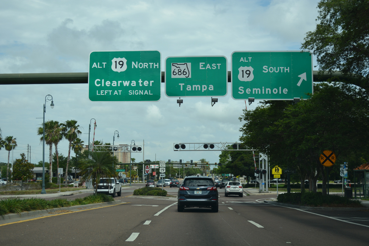
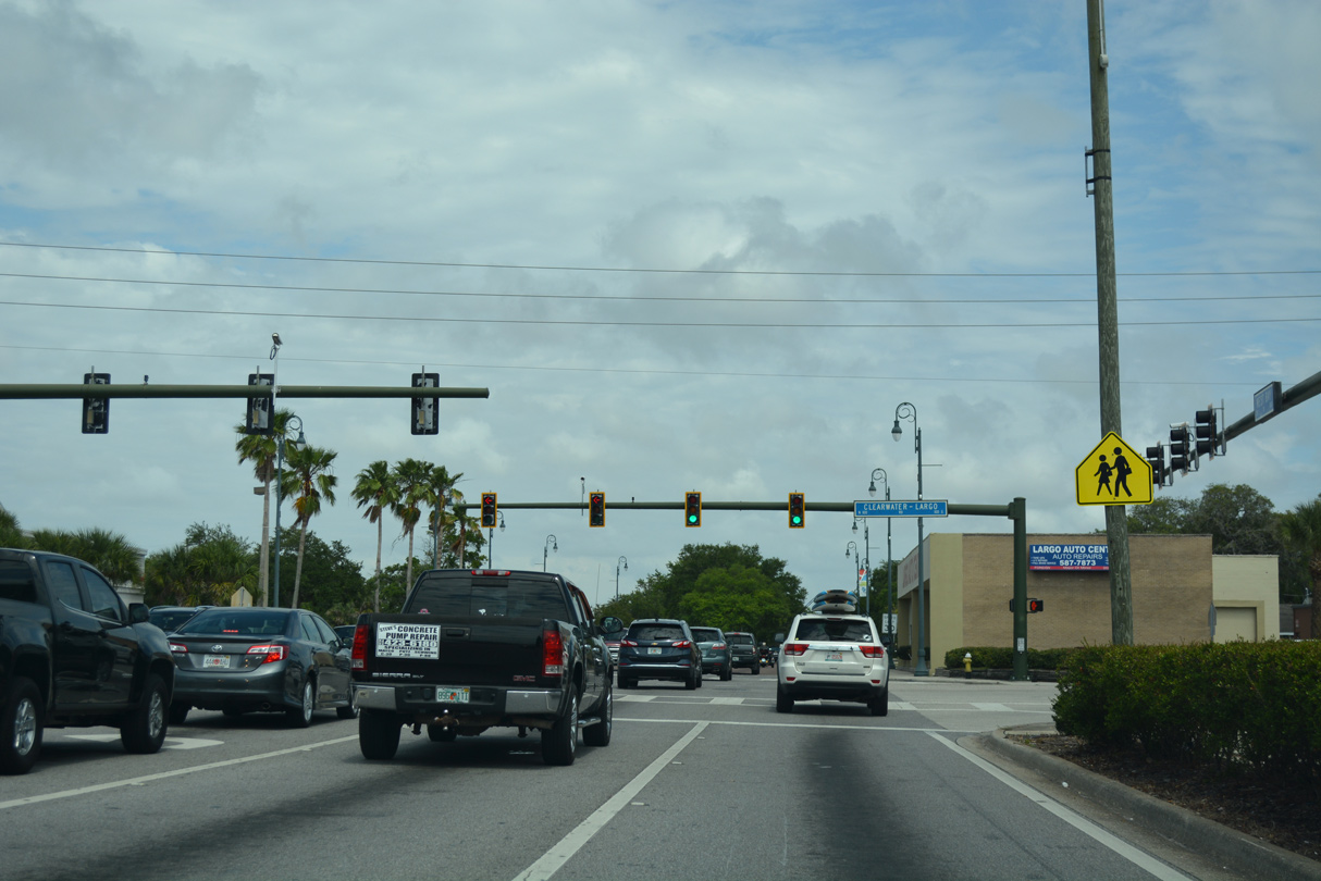
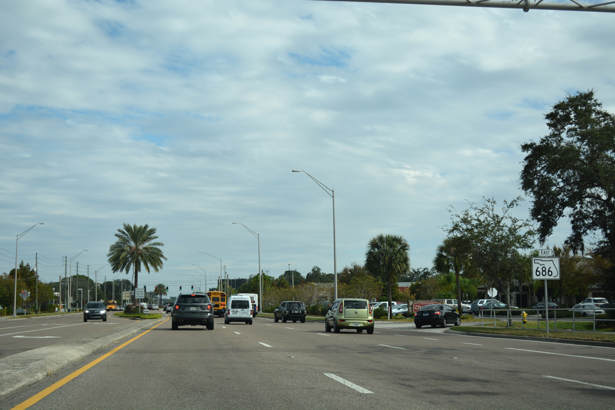
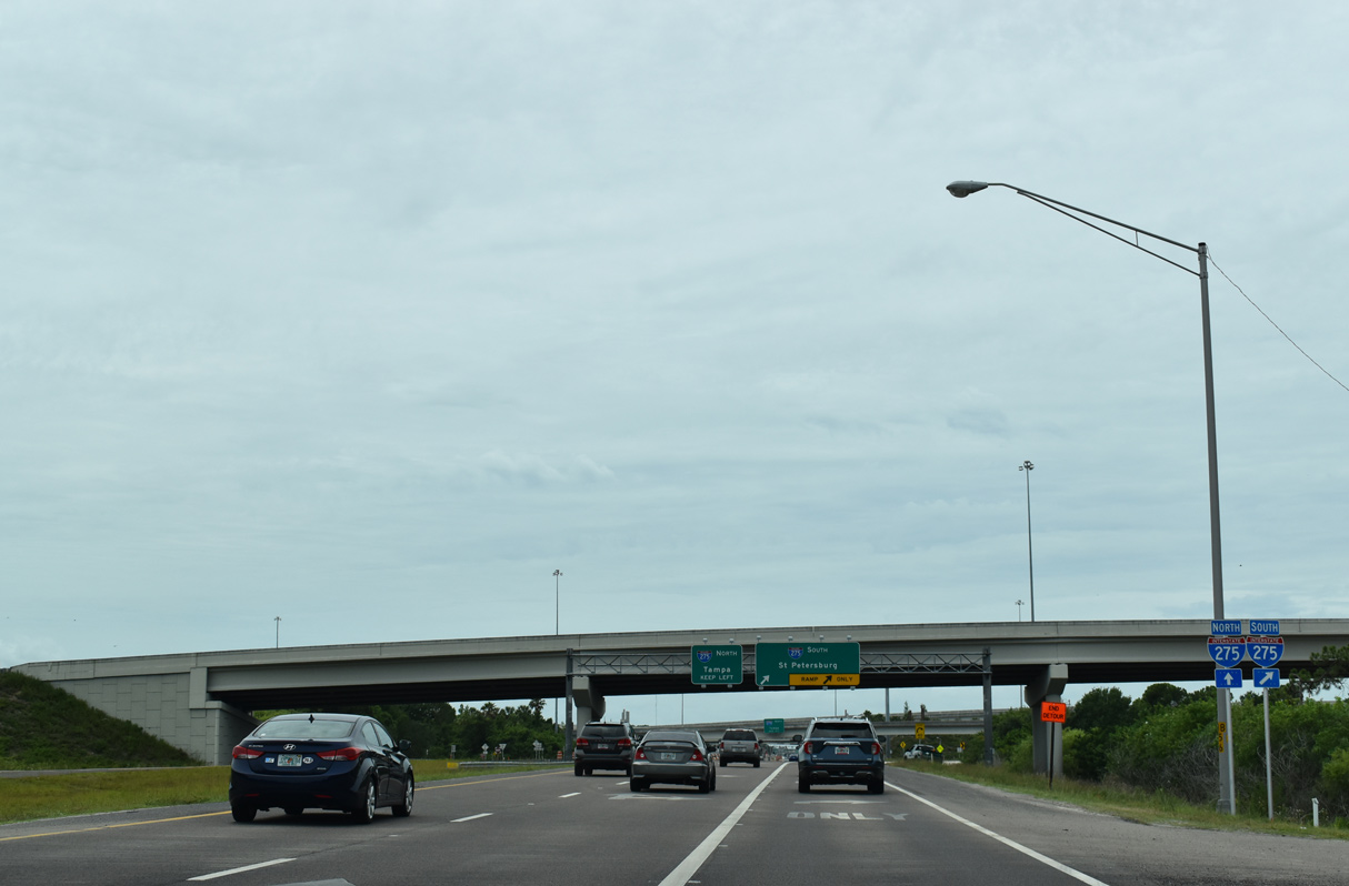
County Road 416 (West Bay Drive) intersects U.S. 19 Alternate at the west end of State Road 686. U.S. 19 Alternate follows Missouri Avenue north to SR 60 (Court Street) in Clearwater and Seminole Boulevard south to SR 666 (Tom Stuart Causeway) in Seminole.
05/04/19
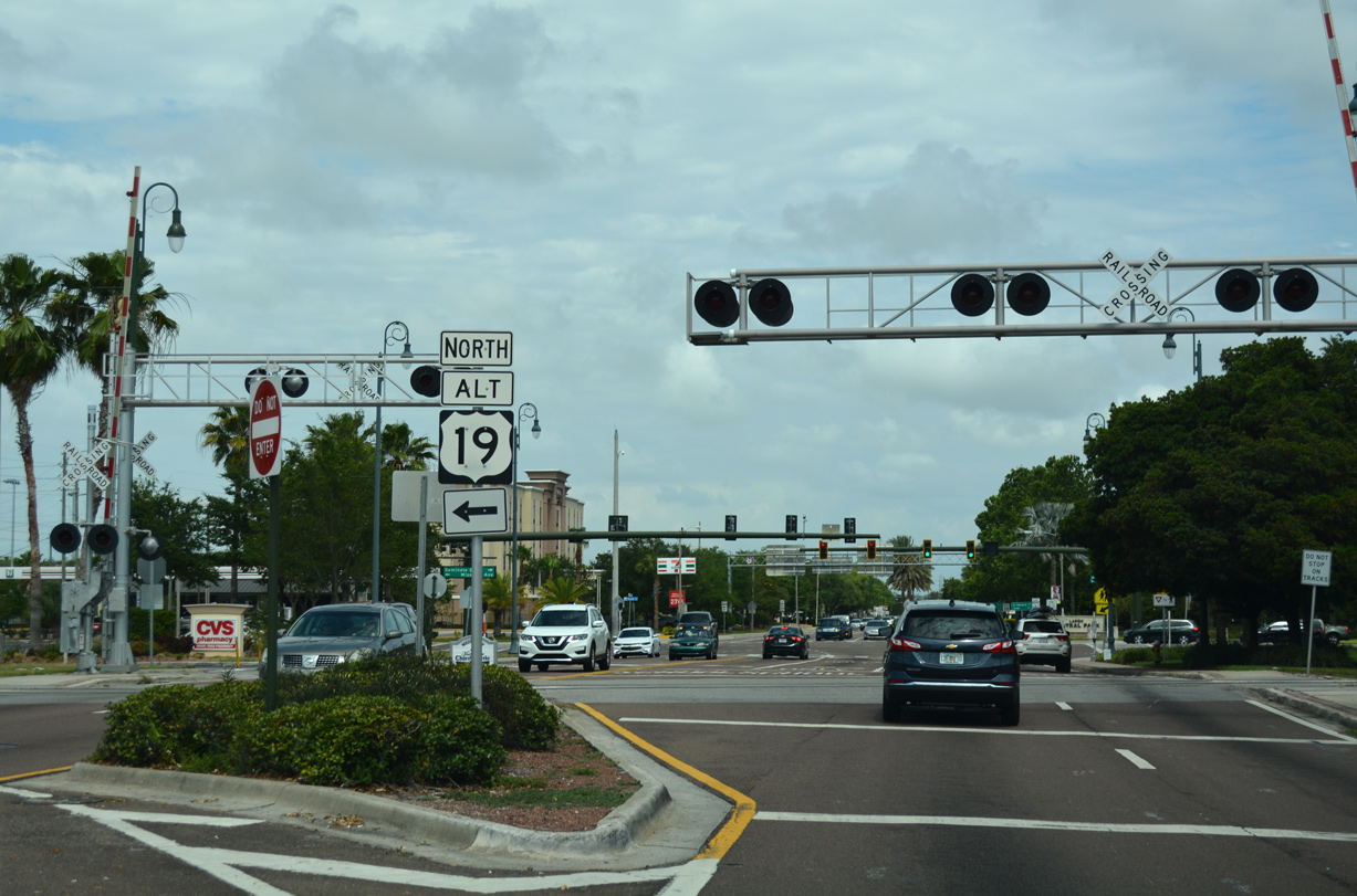
1st Street NW and a CSX Railroad line cross West Bay Drive just ahead of U.S. 19 Alternate.
05/04/19
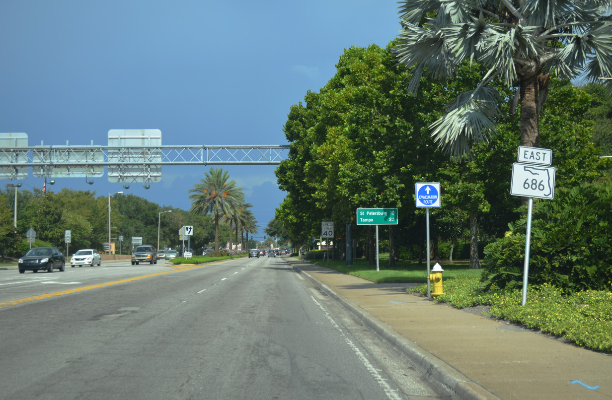
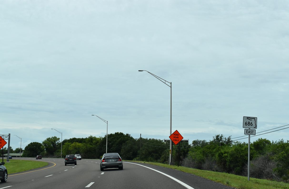
State Road 686 begins at U.S. 19 Alternate (Seminole Boulevard) where West and East Bay Drive come together in Largo. The first shield stands adjacent to Largo Central Park.
08/15/15
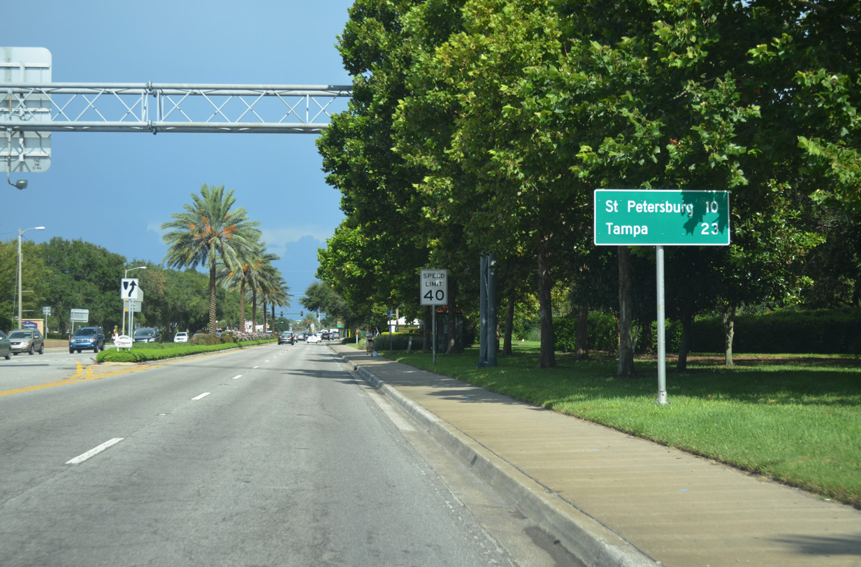
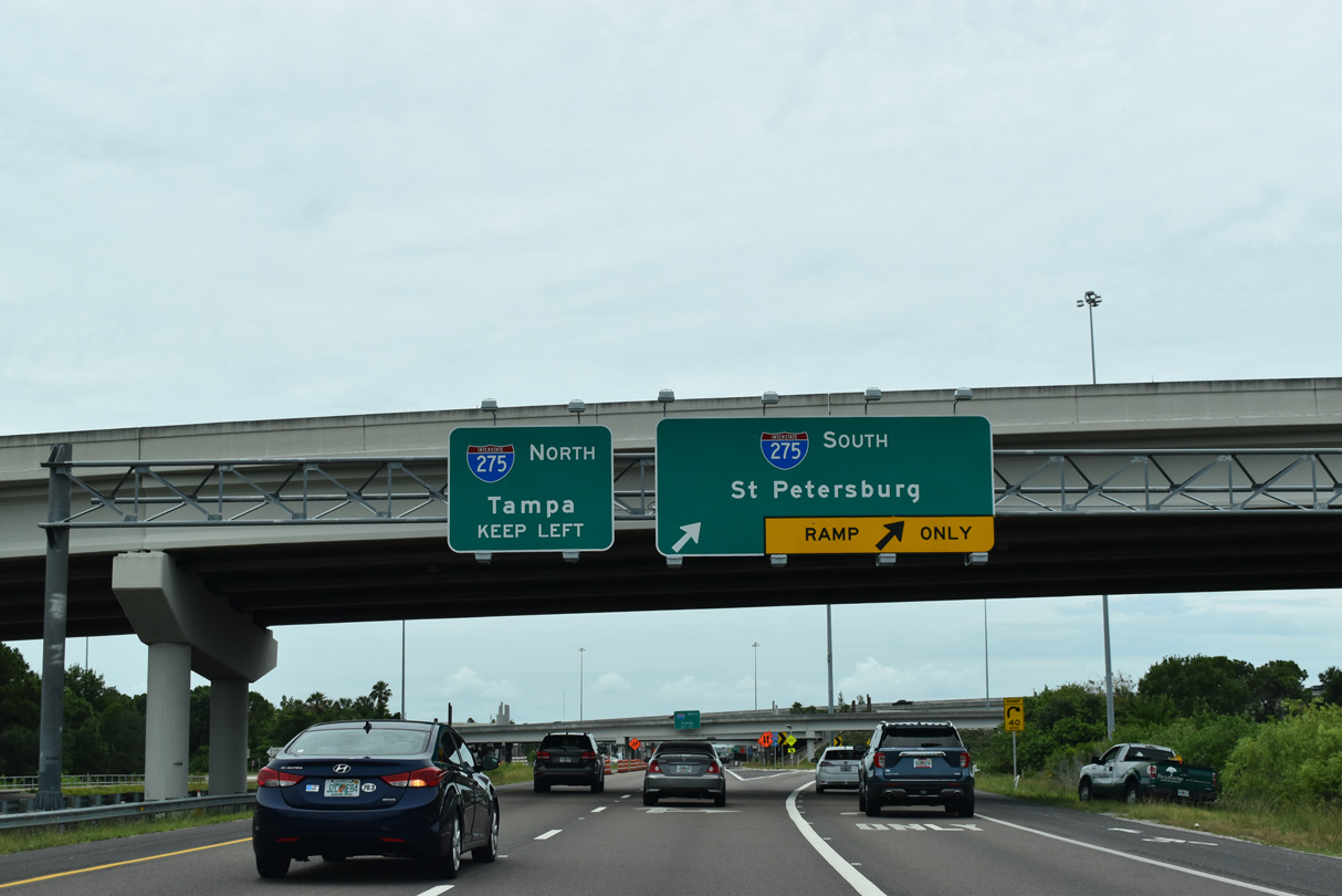
East Bay Drive takes SR 686 east to U.S. 19 and Roosevelt Boulevard. Roosevelt Boulevard extends the state road southeast to connections with Interstate 275 for both St. Petersburg and Tampa.
08/15/15
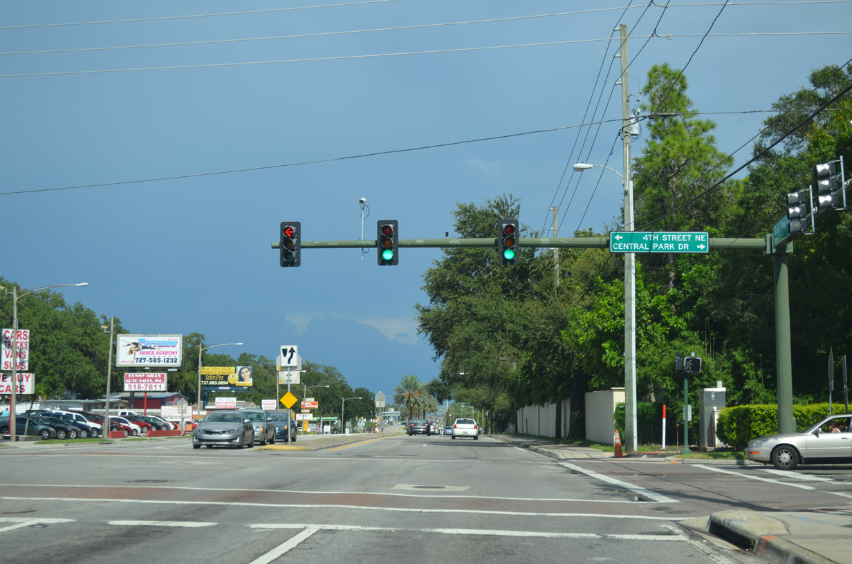
Central Park Drive winds north to tie into SR 686 (East Bay Drive) opposite 4th Street NE near Largo High School.
08/15/15
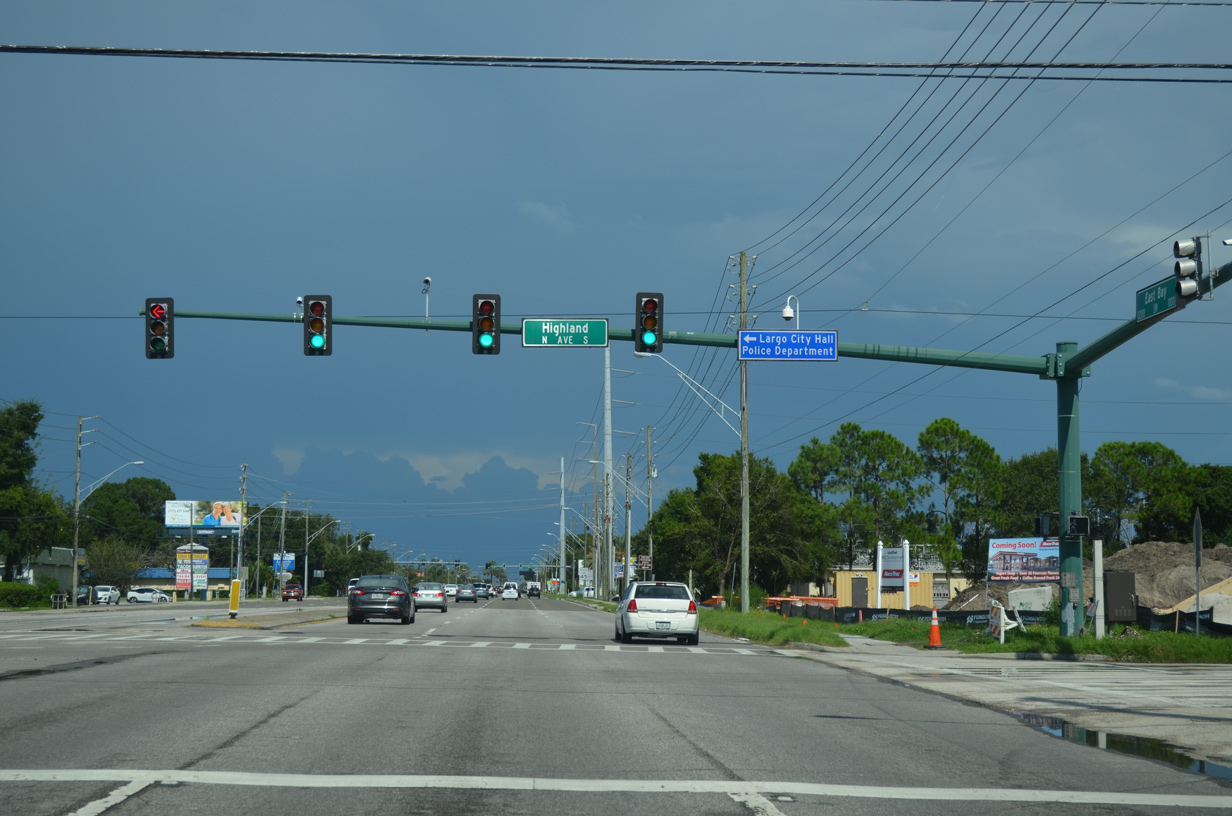
Highland Avenue heads north from East Bay Drive to Largo City Hall and the city of Clearwater.
08/15/15
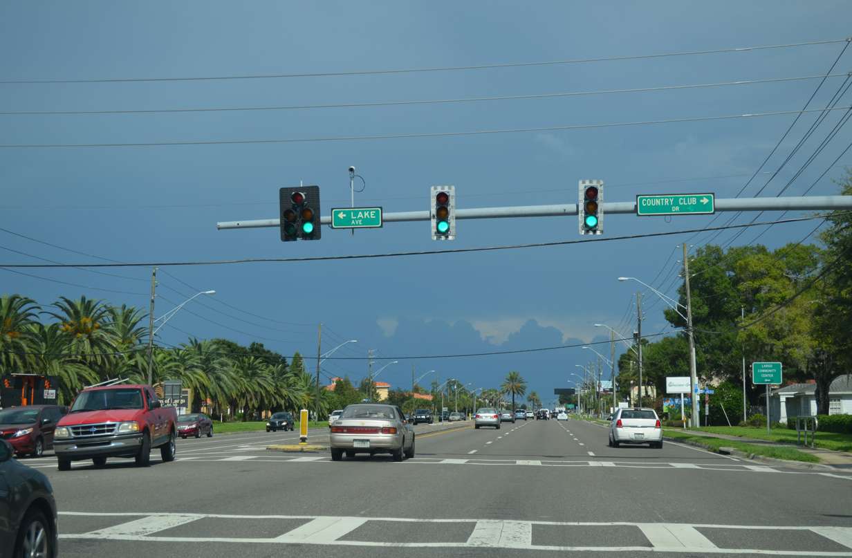
Lake Avenue south and Country Club Drive north come together at the next signal along SR 686 (East Bay Drive) east.
08/15/15
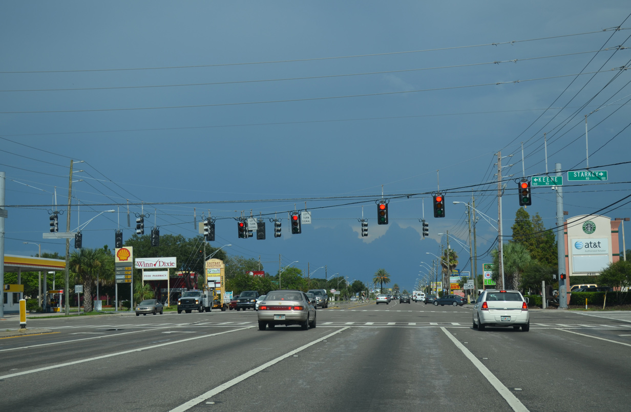
Starkey Road north from the city of Seminole becomes Keene Road at SR 686 (East Bay Drive) in Largo. Keene Road extends the arterial north to Skycrest in Clearwater and the city of Dunedin. The two roads are both a part of Pinellas County Road 1.
08/15/15
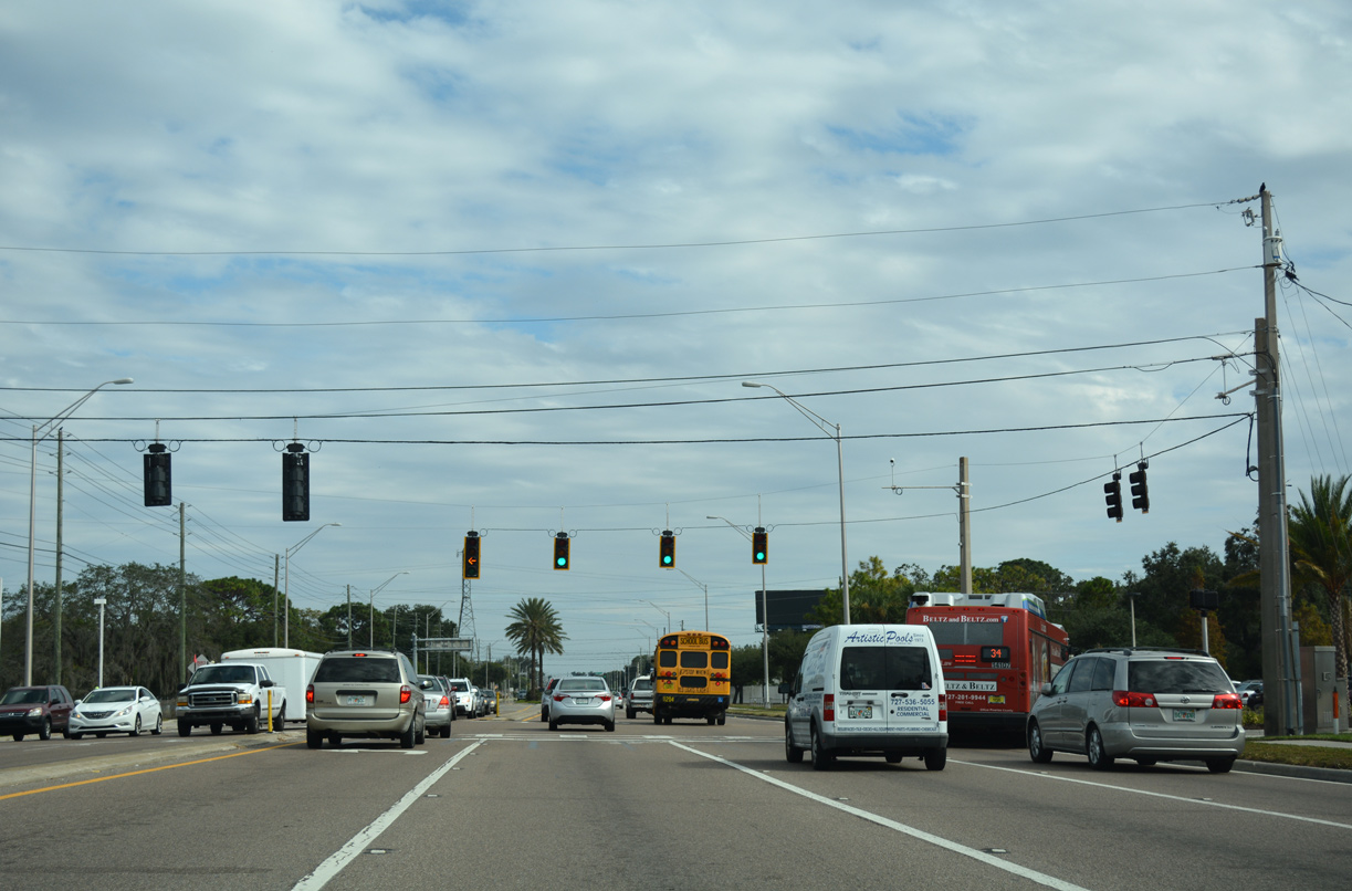
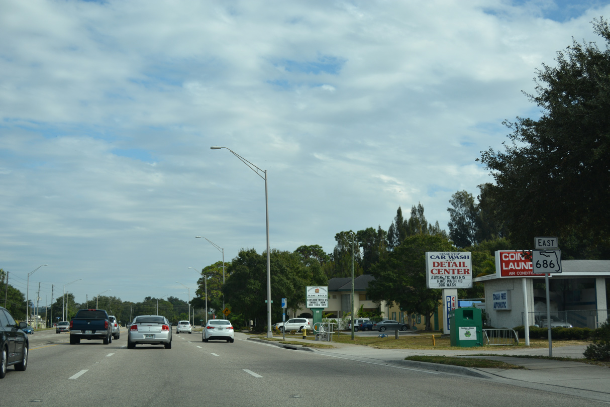
State Road 686 remains with six lanes east from CR 1 to CR 611 (49th Street N).
08/15/15
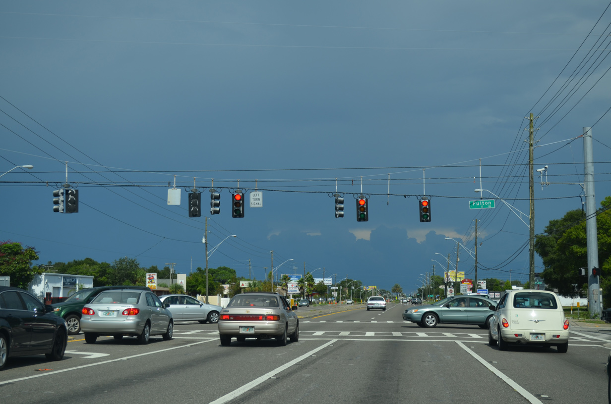
Fulton Street connects SR 686 with the adjacent street grid at the subsequent eastbound signal on East Bay Drive.
08/15/15
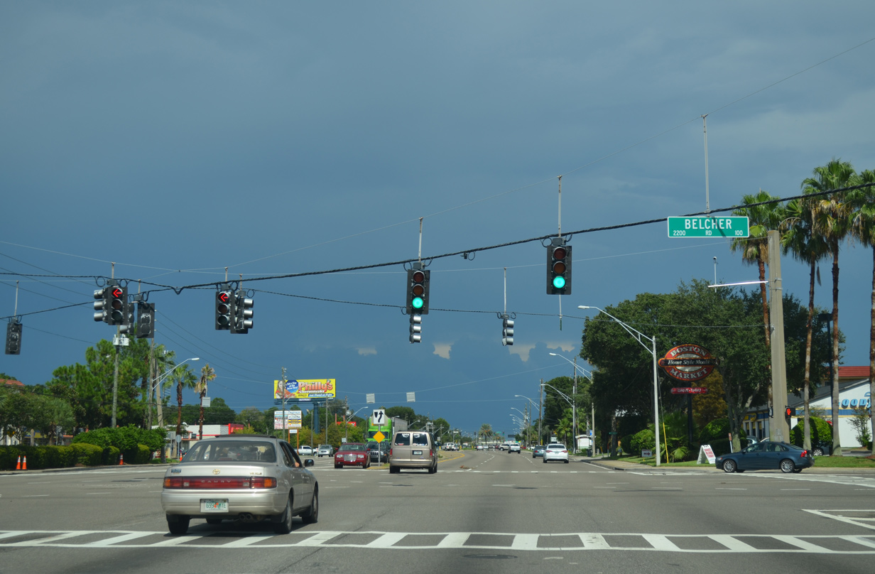
Belcher Road (CR 501) mirrors the course of CR 1 one mile to the east between Pinellas Park and Clearwater. The road constitutes a six lane arterial with a grass median southward to CR 694 (Park Boulevard).
08/15/15
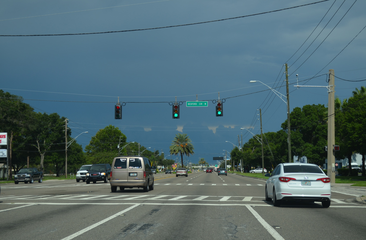
Bedford Circle loops south to the Newport subdivision from East Bay Drive at this traffic light.
08/15/15
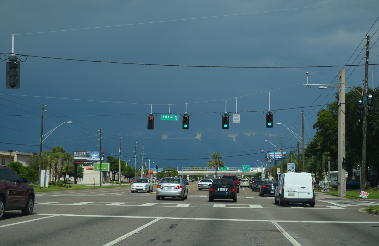
The St. Petersburg street numbering grid extends northward to SR 686 (East Bay Drive) at 69th Street N, a local road south to a large mobile home park.
08/15/15
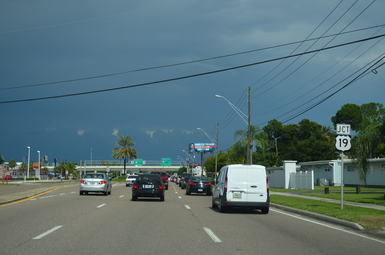
U.S. 19 follows a freeway northward from CR 611 (49th Street N) in Pinellas Park to SR 580 near Dunedin. A single point urban interchange (SPUI) joins the US highway with SR 686.
08/15/15
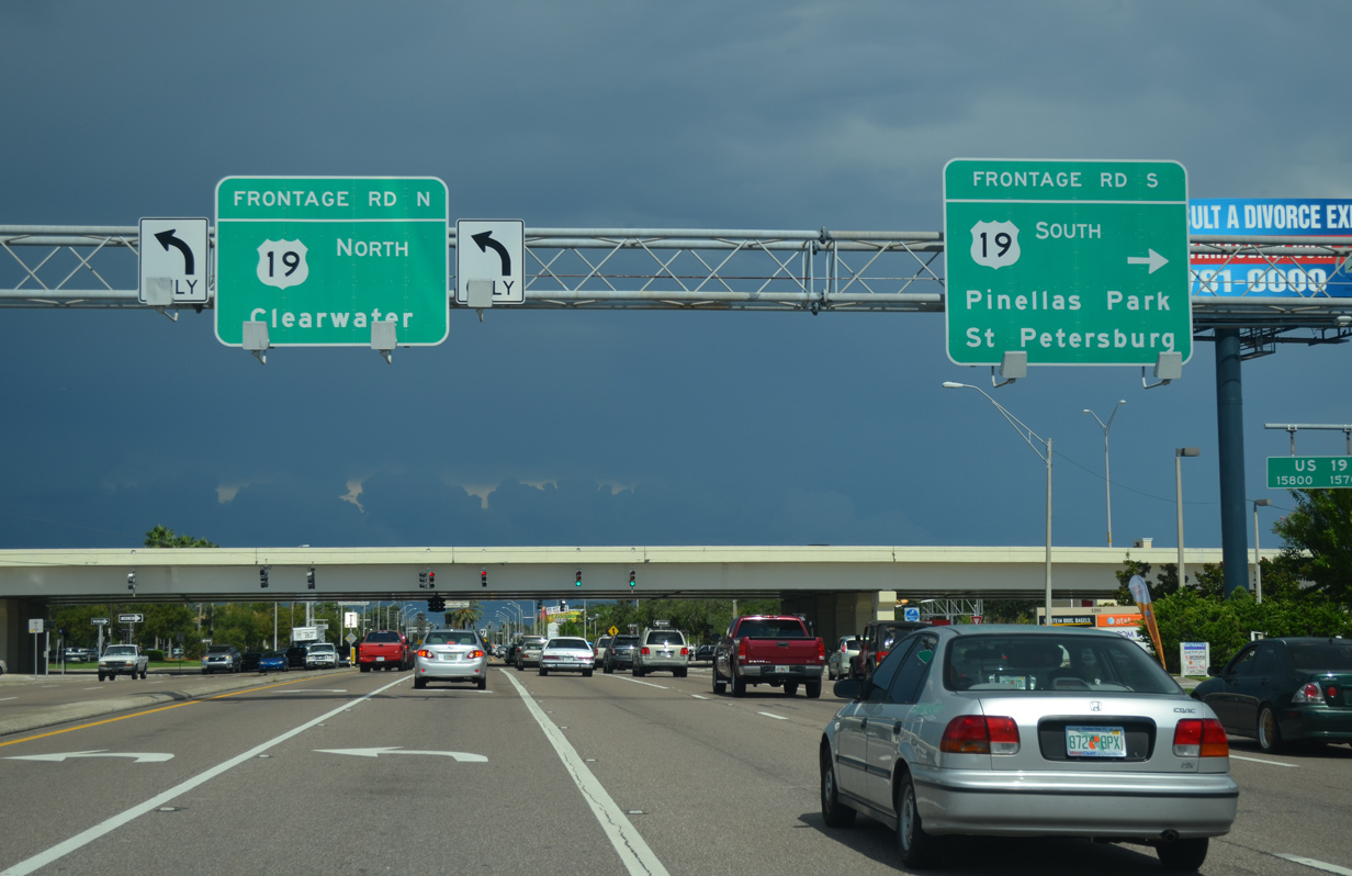
A frontage road system accompanies the six lane freeway along U.S. 19 south into Pinellas Park and north to Clearwater.
08/15/15
The service roads provide access to adjacent businesses and residential streets that U.S. 19 bypasses.
04/28/24

The entrance ramp connecting SR 686 (Roosevelt Boulevard) with U.S. 19 joins the freeway ahead of the separation with SR 693 (66th Street N).
04/28/24

A number of apartment complexes and a mobile home park line SR 686 (Roosevelt Boulevard) east of U.S. 19.
11/15/16
Dodge Street ties into SR 686 at the signalized intersection with Gateway North Apartments and adjacent retail in east Largo.
11/15/16
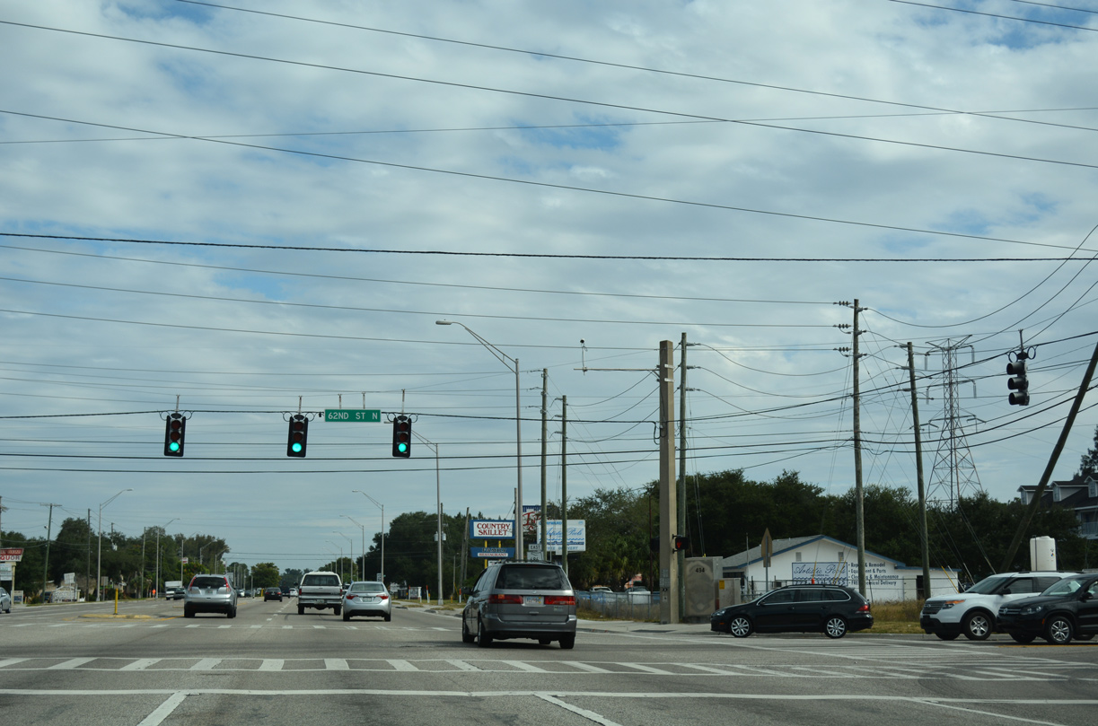
SR 686 (Roosevelt Boulevard) east at 62nd Street N. 62nd Street N leads south to Pinellas Technical Education Center, Mears Industrial Park and SR 688 (Ulmerton Road).
11/15/16
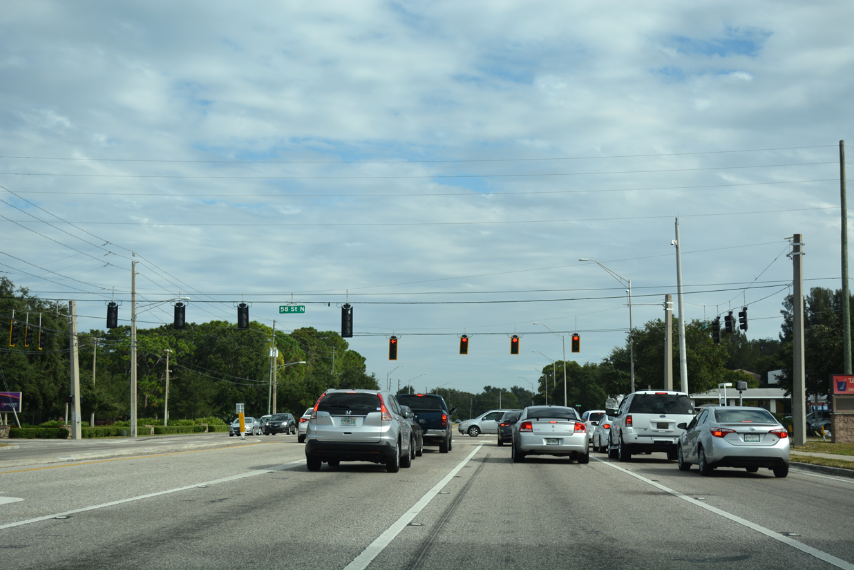
58th Street N, a through route north to Whitney Road and south to SR 688 through High Point, crosses SR 686 (Roosevelt Boulevard) at the next eastbound traffic light.
11/15/16
Eastbound reassurance shield posted after 58th Street N at High Point.
11/15/16
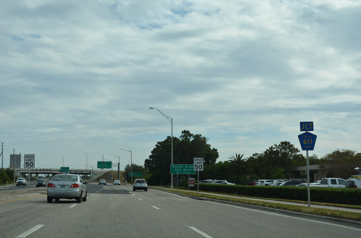
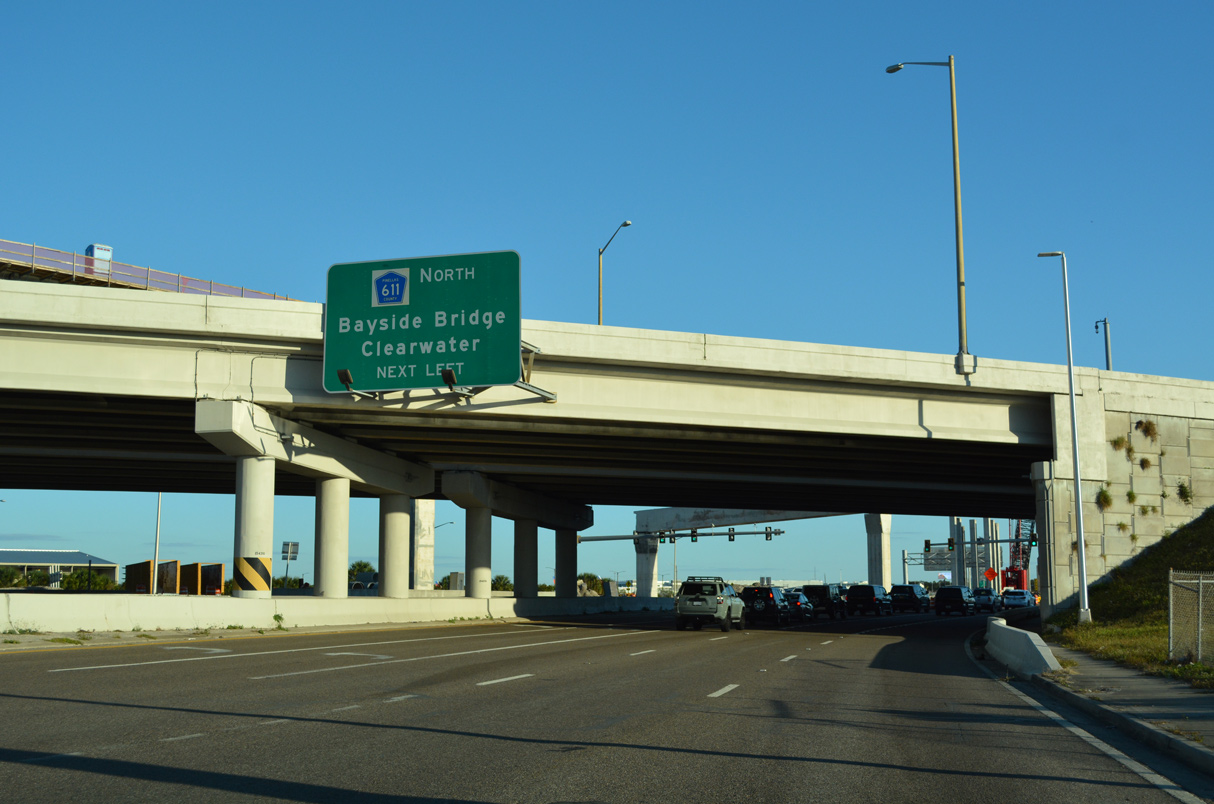
Roosevelt Boulevard turns southeast ahead of Pinellas County Road 611 (49th Street N) and the Bayside Bridge.
04/28/24
CR 611 follows 49th Street southward into central Pinellas Park and west St. Petersburg. CR 611 south concludes at 31st Avenue S in Gulfport at Boca Ciega Bay.
04/28/24
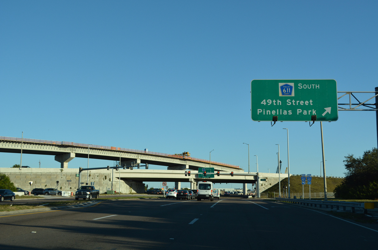
A diamond interchange joins SR 686 (Roosevelt Boulevard) and CR 611 (49th Street N). The flyover spanning the exchange is part of the Gateway Expressway (SR 686A).
04/28/24
Roosevelt Boulevard continues southeast beyond CR 611 toward St. Pete-Clearwater International Airport (PIE).
04/28/24
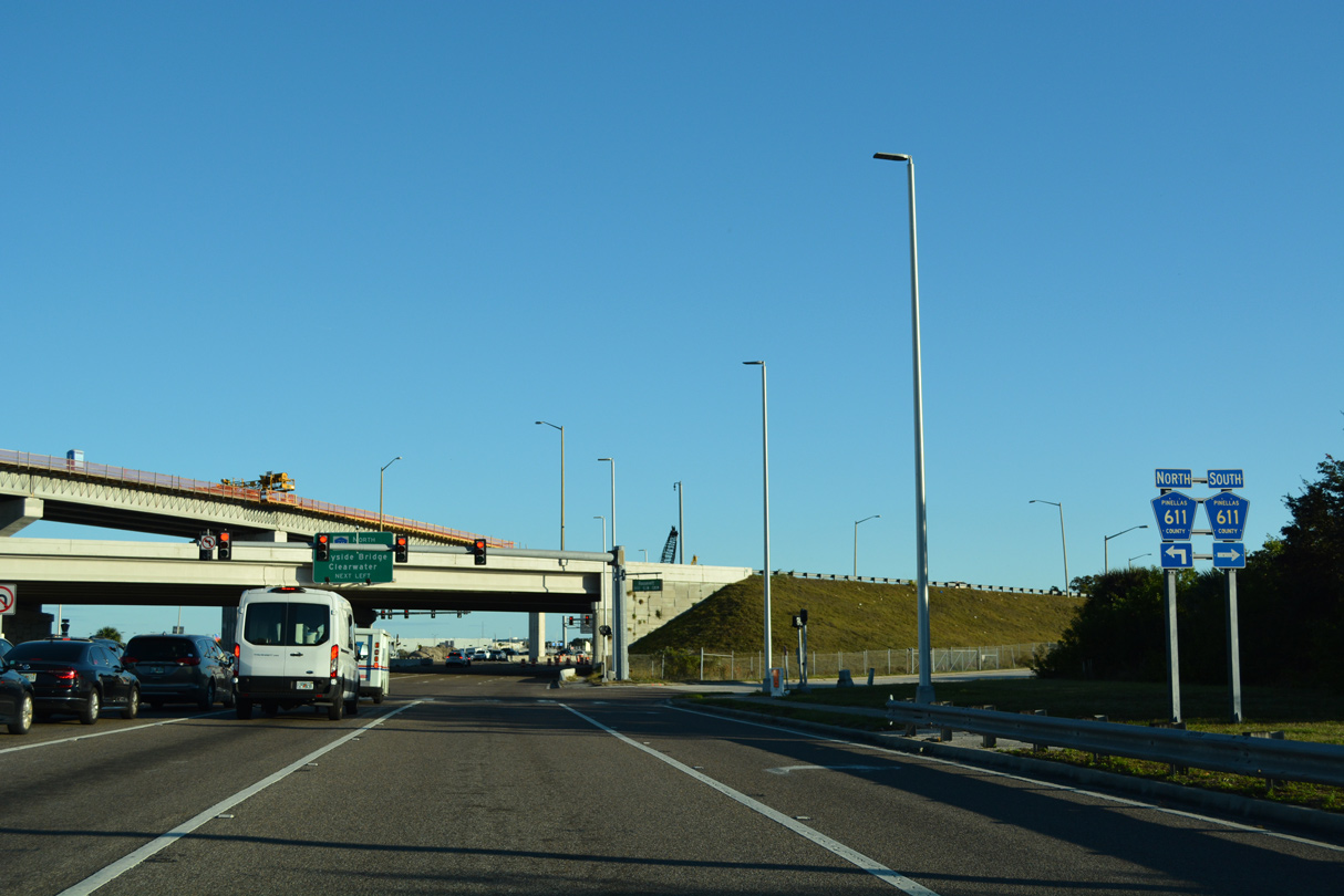
CR 611 upgrades to a freeway north from SR 686 (Roosevelt Boulevard) along the Bayside Bridge. The Bayside Bridge spans western reaches of Old Tampa Bay with six overall lanes between SR 686 and SR 60 (Gulf to Bay Boulevard).
04/28/24

The entrance ramp from Roosevelt Boulevard eastbound to the Gateway Expressway (SR 686A) precedes Terminal Boulevard.
04/28/24

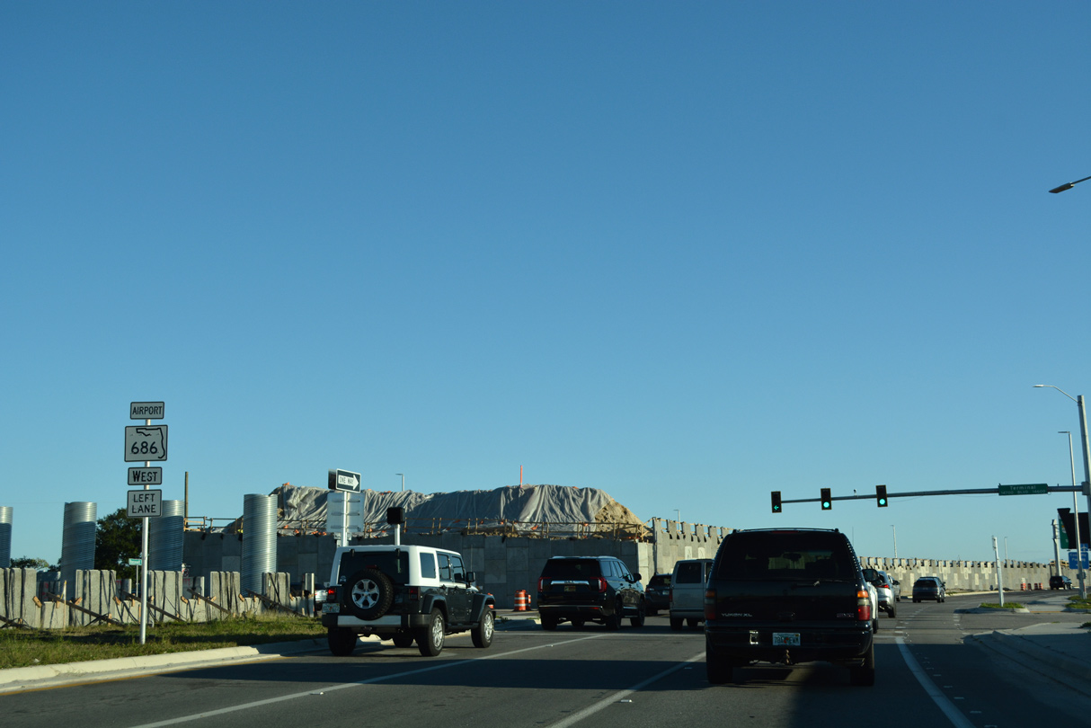
The tolled Gateway Expressway (SR 686A) leads southeast along SR 686 (Roosevelt Boulevard) to SR 690.
04/28/24
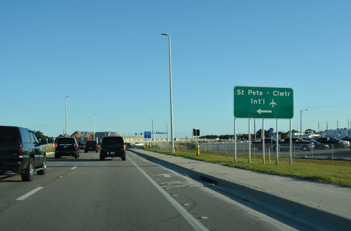
Terminal Boulevard loops to the passenger terminal at St. Pete-Clearwater Airport (PIE). Despite it smaller size, the airport handles a number of flights linking Pinellas County with the Northeast and Midwest.
04/28/24
Fairchild Drive stems north from Terminal Boulevard to northern reaches of the airport and its cargo facilities.
03/07/23
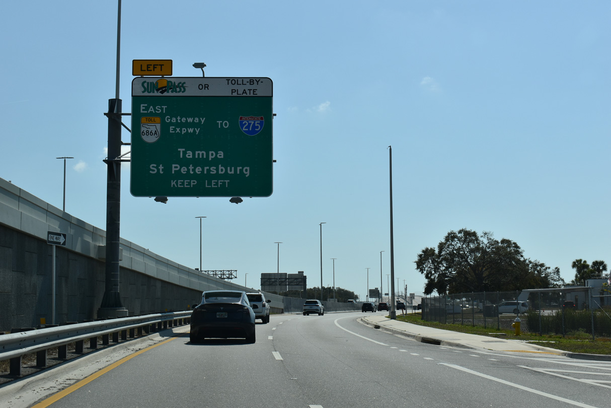
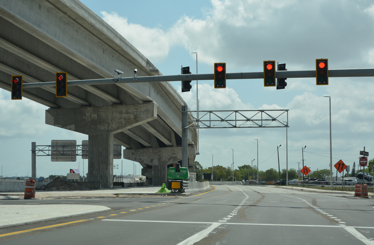
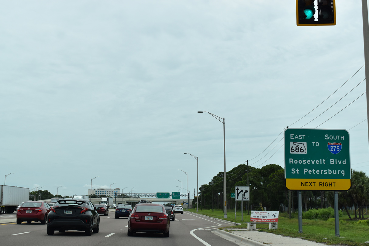
SR 686 (Roosevelt Boulevard) turns south along PIE Airport and the Gateway Expressway (SR 686A) to SR 688 (Ulmerton Road).
02/15/26
The elevated roadway for the Gateway Expressway spans the intersection joining SR 686 (Roosevelt Boulevard) east with SR 688 (Ulmerton Road). Opened to traffic on April 26, 2024, the toll road links PIE Airport with I-275.
02/15/26
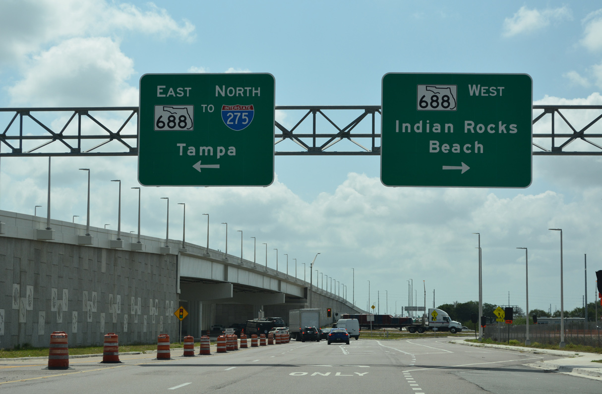
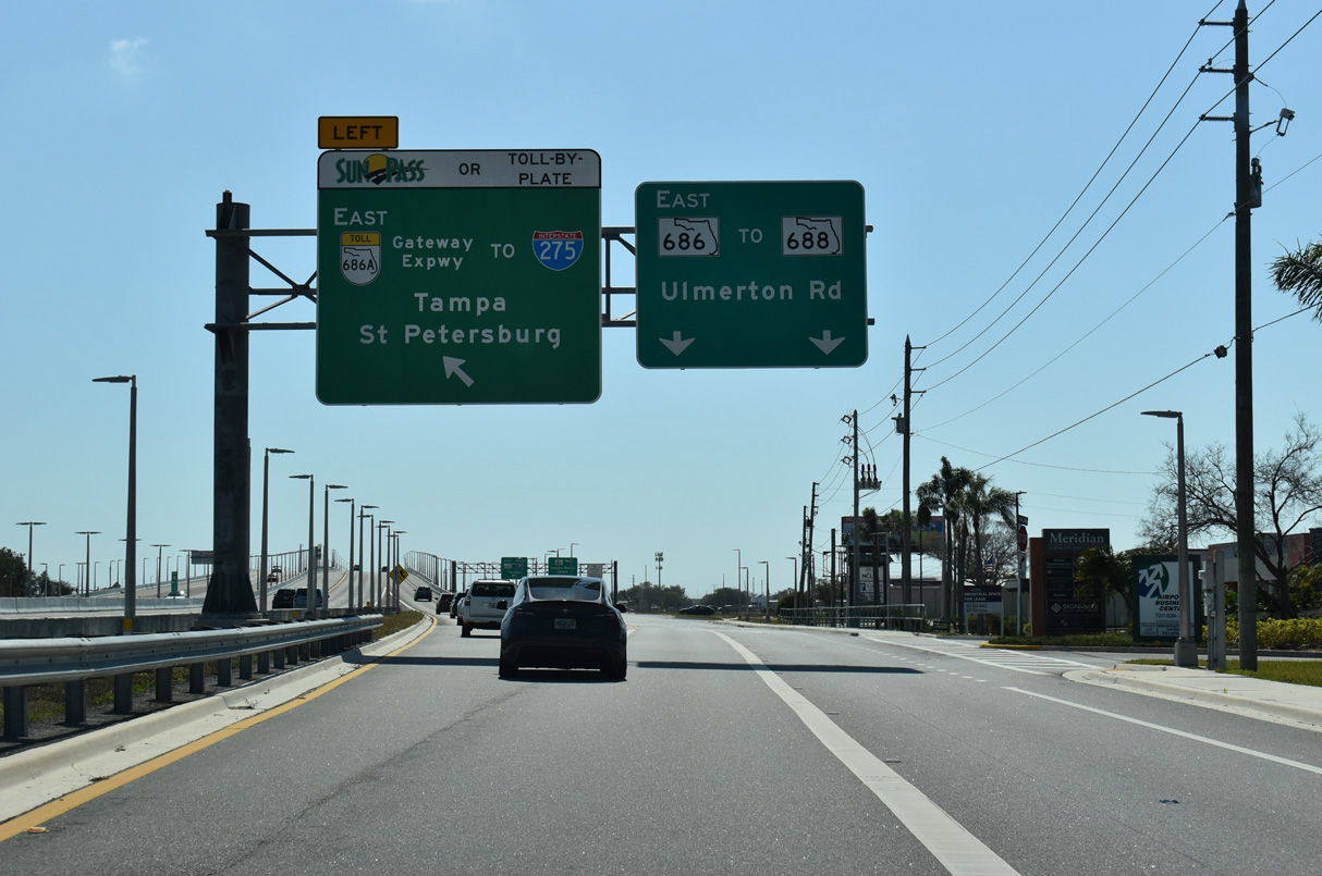
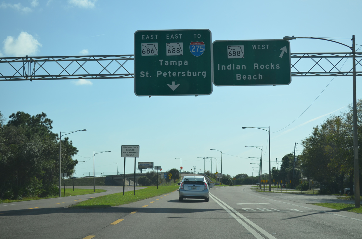
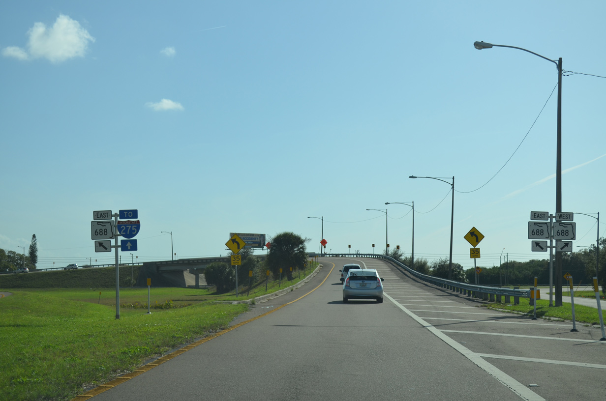
SR 688 (Ulmerton Road) meets SR 686 (Roosevelt Boulevard) below the Gateway Expressway (SR 686A). SR 688 is a major arterial route west across Largo to SR 699 (Gulf Boulevard) at Indian Rocks Beach.
02/15/26
The previous overpass taking SR 686 east onto SR 688 (Ulmerton Road) was demolished to make way for the Gateway Expressway.
01/03/15
The former ramp partition for SR 688 (Ulmerton Road) east and west on SR 686 (Roosevelt Boulevard) east.
01/03/15
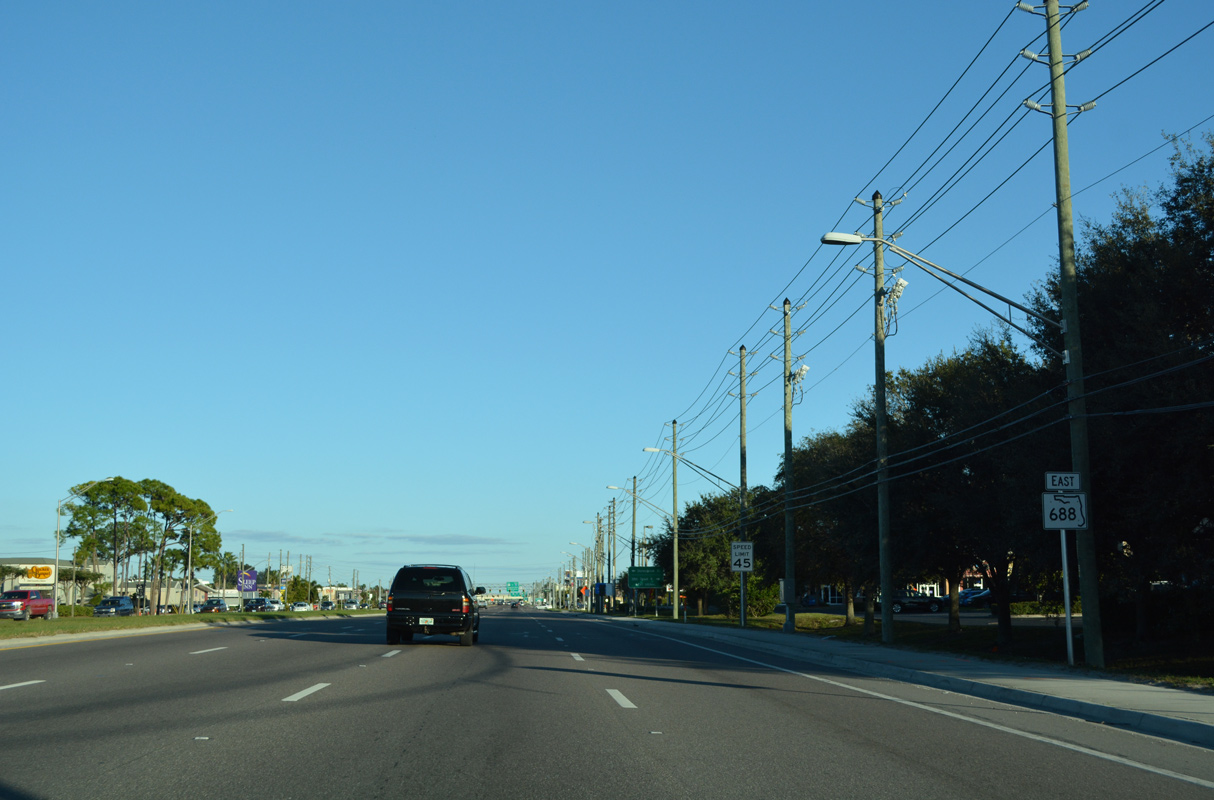
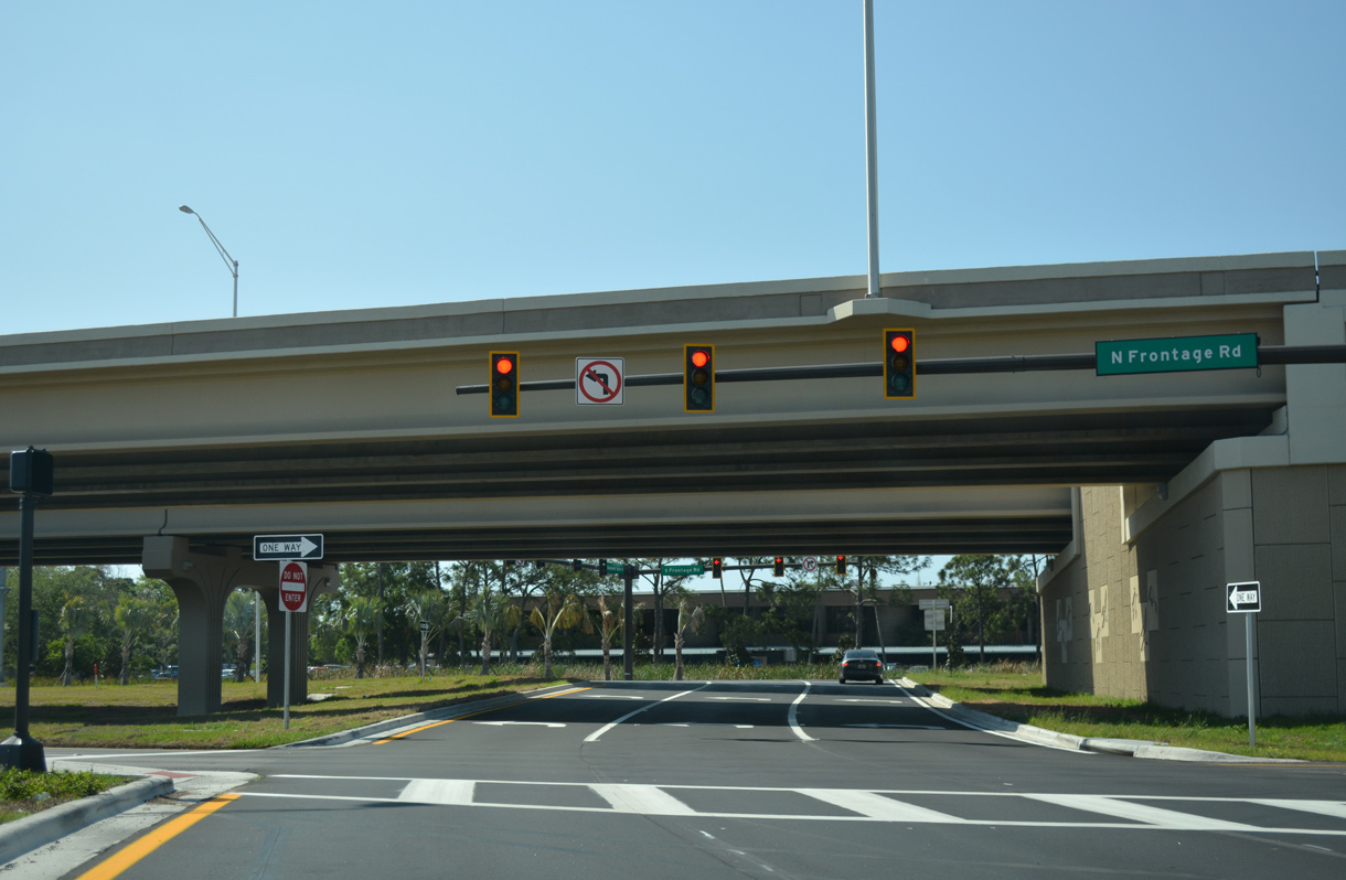
SR 686/688 combine along Ulmerton Road on the north side of Pinellas Park. However, SR 686 is omitted from this confirming marker preceding 40th Street N. A traffic light was previously located here.
02/15/26
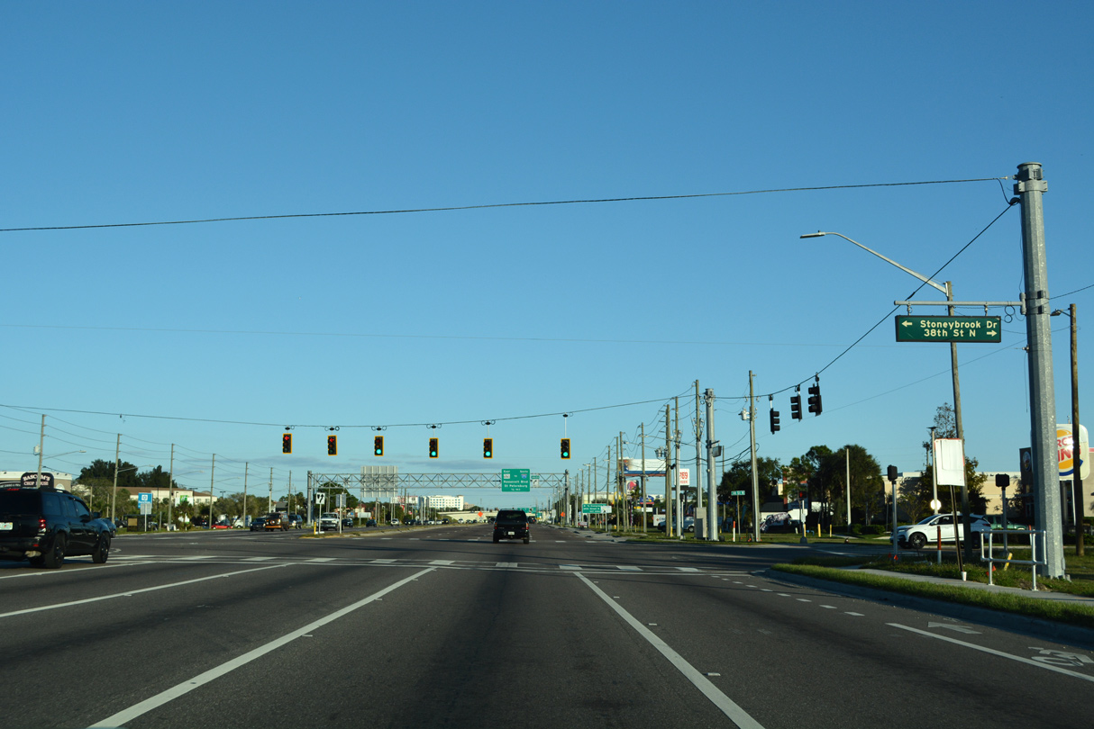
38th Street N and Stoneybrook Drive come together at a traffic light along SR 686/688 (Ulmerton Road) by Airway Industrial Park.
04/28/24
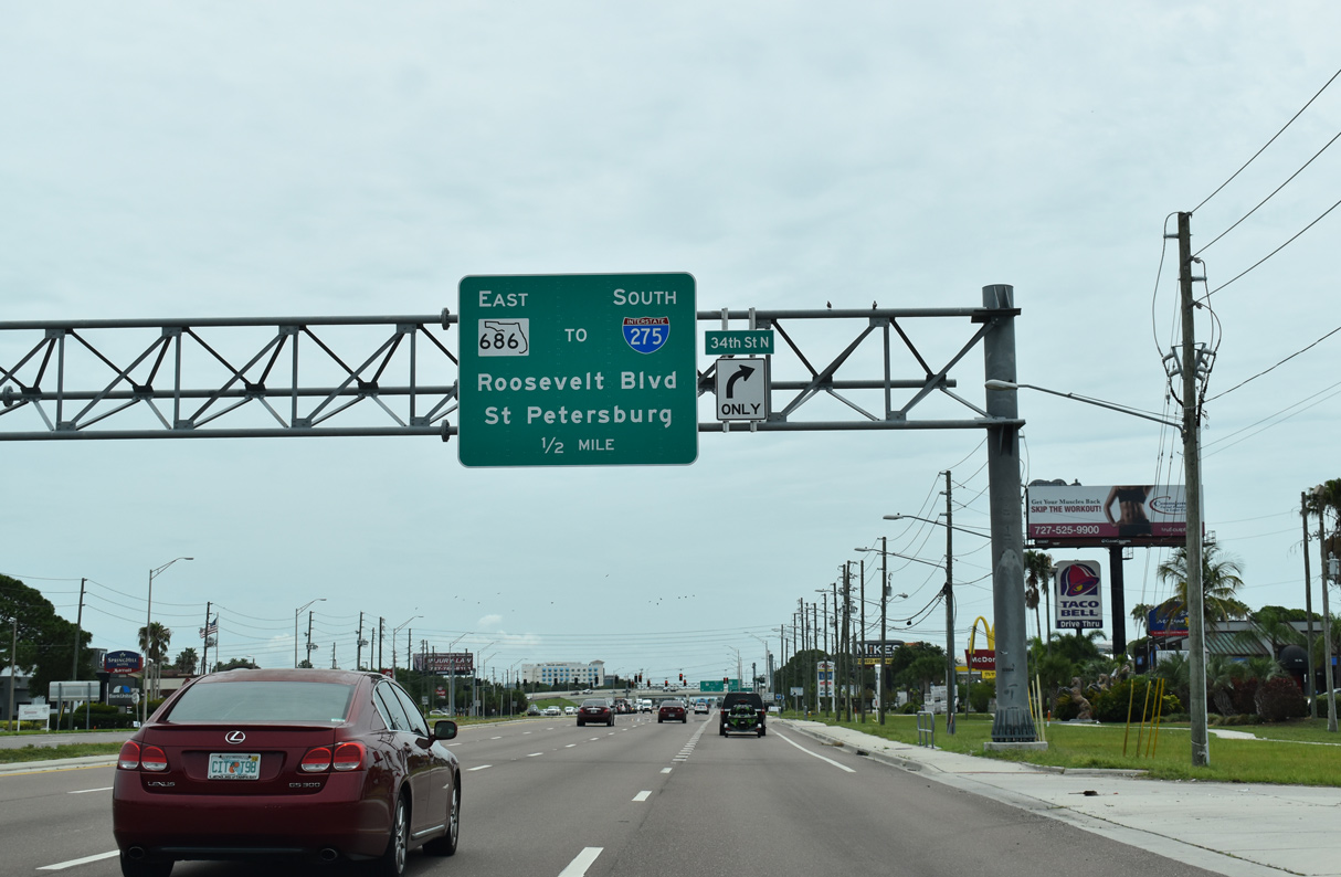
SR 686/688 (Ulmerton Road) east next intersects 34th Street N, a 1.03 mile long major collector south to CR 296 (118th Avenue N).
02/15/26
04/28/24
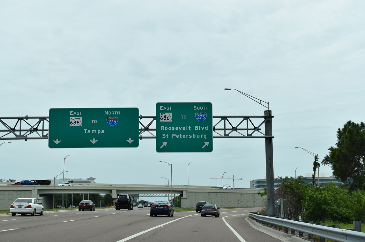
Roosevelt Boulevard angles SR 686 southeast 2.99 miles to I-275 and SR 694 (Gandy Boulevard) at U.S. 92/SR 687 (4th Street N) in the Gateway area of north St. Petersburg.
02/15/26
SR 688 (Ulmerton Road) continues east from SR 686 (Roosevelt Boulevard) between Feather Sound and Lake Carillon to a wye interchange with I-275 north at the Howard Frankland Bridge.
02/15/26
Adjacent Tech Drive represents a section of old Roosevelt Boulevard by this confirming marker posted south of SR 688 (Ulmerton Road).
06/05/20
Roosevelt Boulevard heads southeast between Carillon Business Complex and Roosevelt Lakes Commerce Park with six overall lanes. A five lane boulevard, 28th Street N runs 2.57 miles south from Lake Carillon Drive to Grand Avenue.
06/05/20
SR 686 (Roosevelt Boulevard) runs along the St. Petersburg city limits from the split with SR 688 and fully enters them southeast of 28th Street N.
06/05/20
SR 686 continues as a controlled access arterial through a diamond interchange with I-275 to 16th Street N.
04/28/24
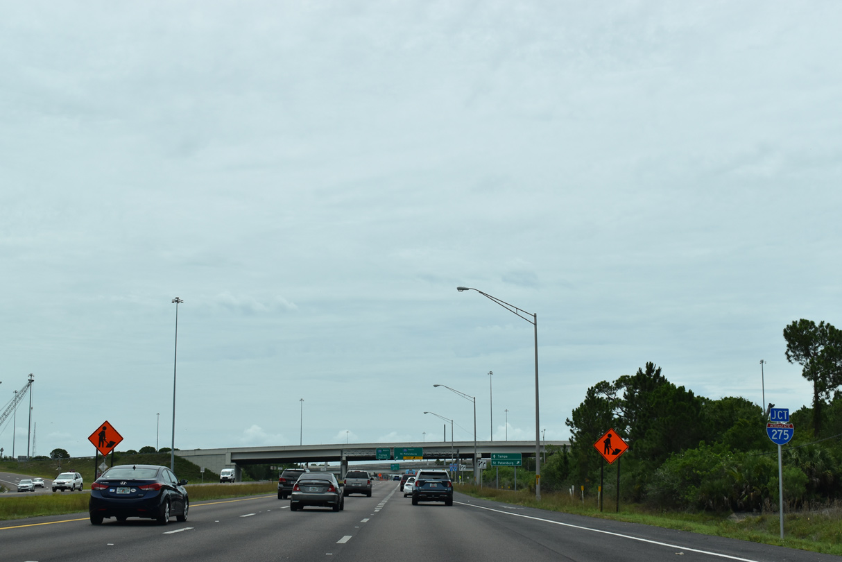
The flyover linking I-275 north with CR 296 spans SR 686 (Roosevelt Boulevard) in the distance. The ramp was completed in 2011.
04/28/24
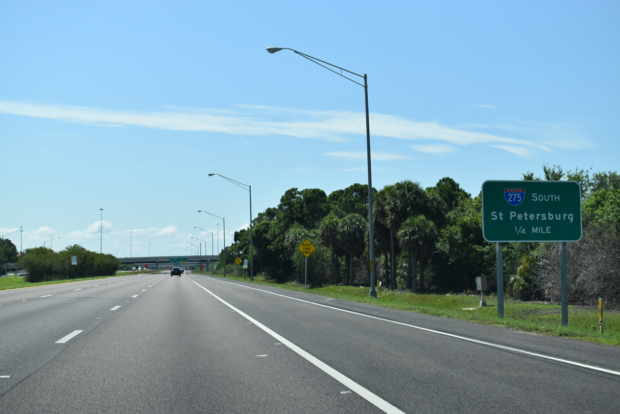
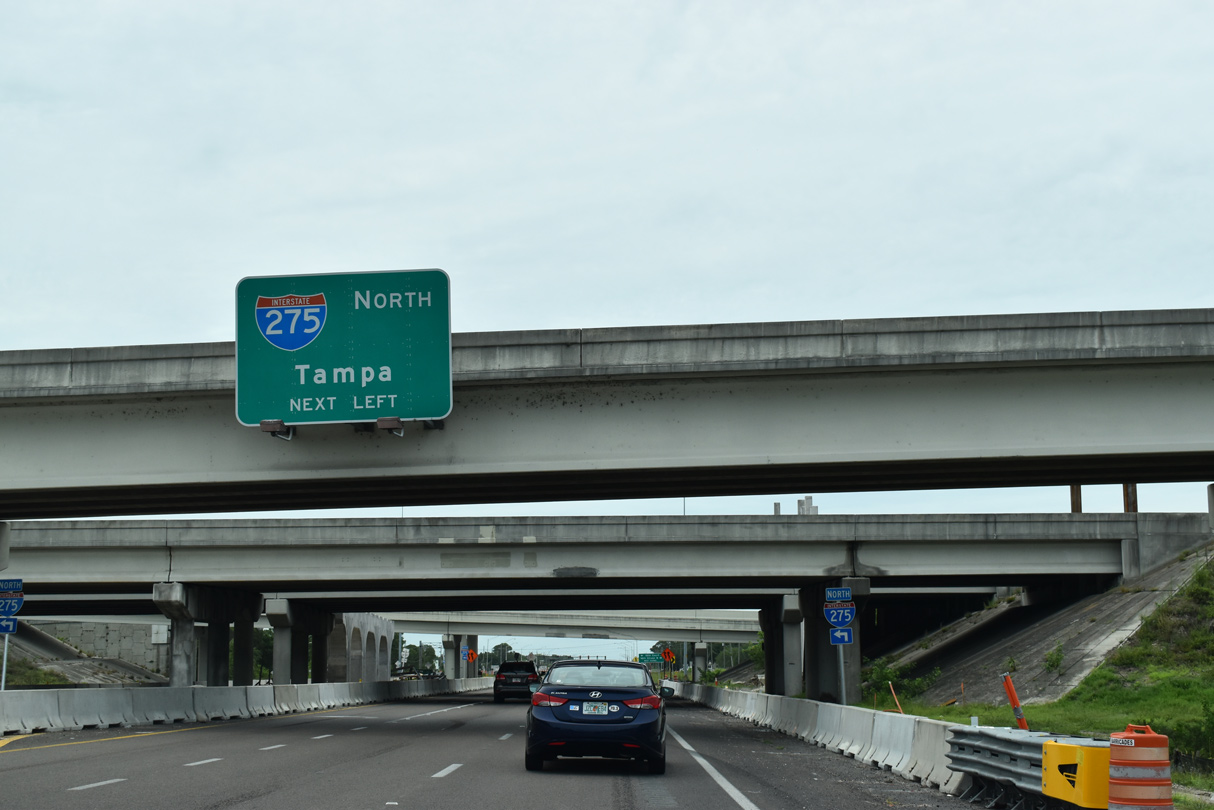
Interstate 275 curves southward from SR 686 toward Downtown St. Petersburg. The freeway reaches the Sunshine Skyway across Tampa Bay in 17.5 miles.
04/28/24
I-275 forms a 60.64 mile long loop west from I-75 in Manatee County, south of Tampa Bay, to Wesley Chapel north of Tampa. The bulk of the route is urban, with exceptions south of the Skyway and north by Lutz.
06/05/20
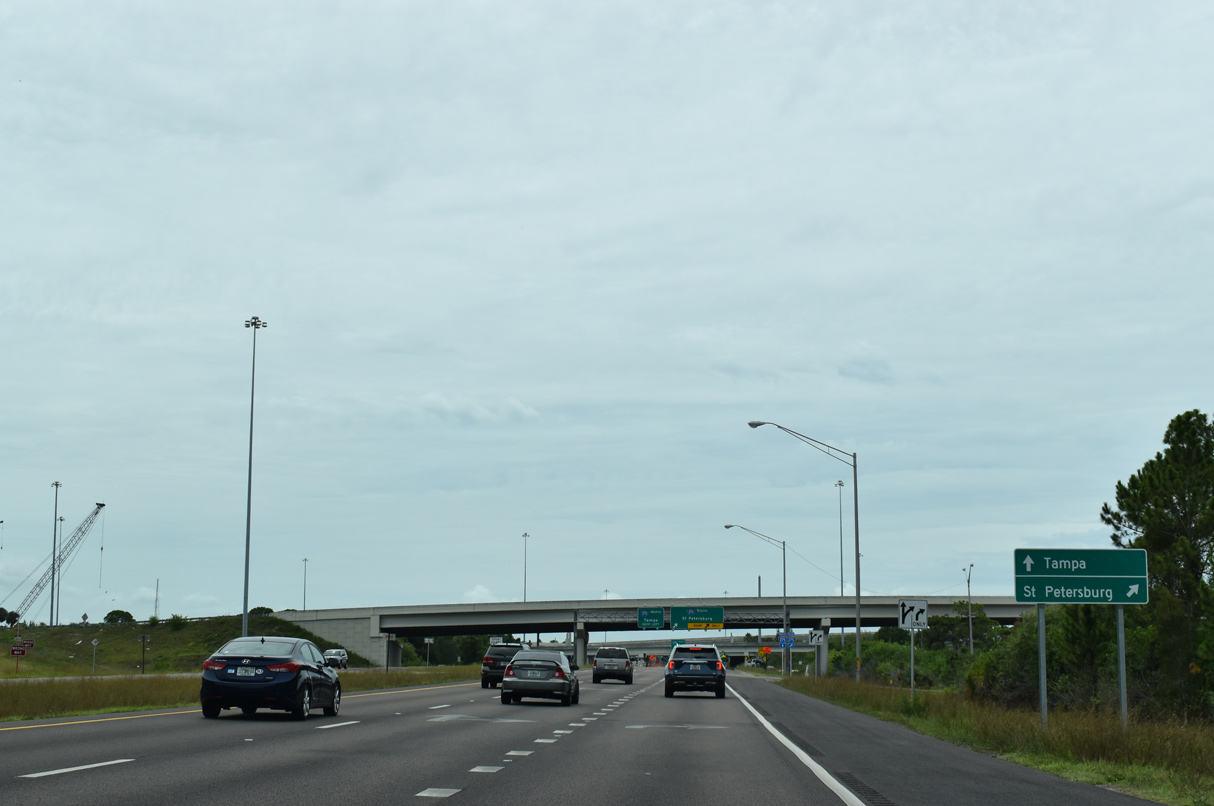
Two lanes depart SR 686 (Roosevelt Boulevard) east for I-275 leading south. The freeway next meets Gandy Boulevard (SR 694) by Sawgrass Lake.
04/28/24
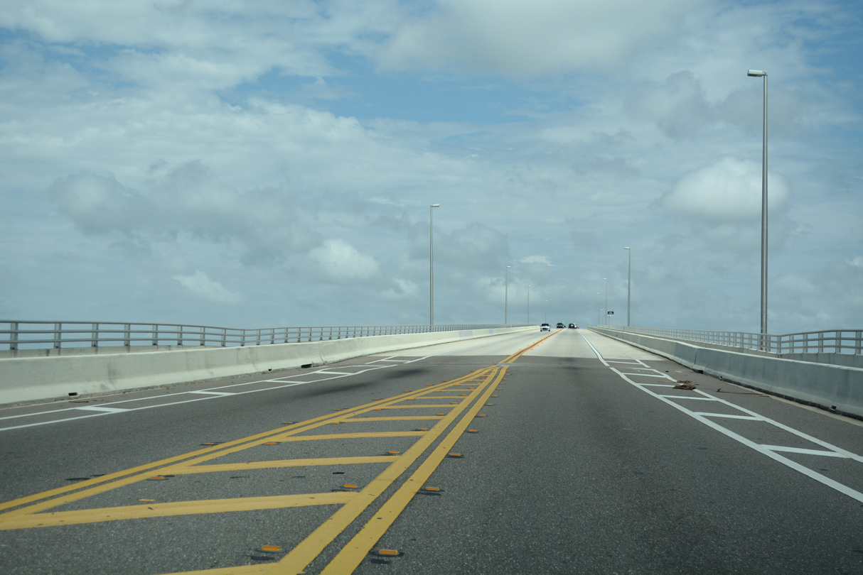
Downtown Tampa is 14 miles to the northeast across the Howard Frankland Bridge via I-275.
04/28/24

Beyond I-275, SR 686 (Roosevelt Boulevard) eastbound intersects 16th Court N to Roosevelt Industrial Centre and 16th Street N to Gateway Lakes Business Park.
04/28/24
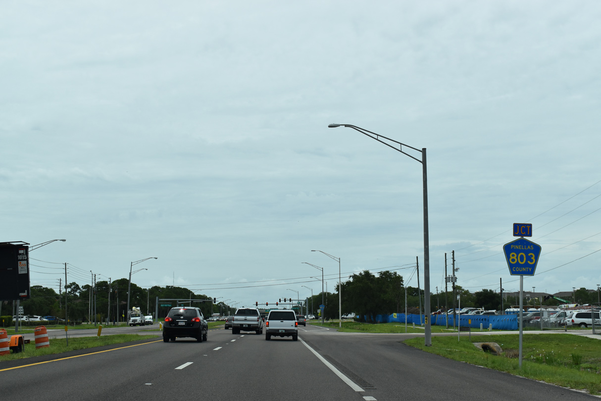
SR 686 converges with CR 803 at Dr. Martin Luther King, Jr. Street (9th Avenue N). CR 803 follows MLK Street north to I-275 and south to 73rd Avenue N in the Fossil Park neighborhood of St. Petersburg.
04/28/24
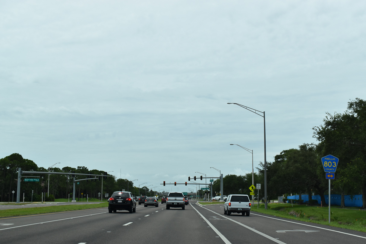
Dr. Martin Luther King, Jr. Street (CR 803) constitutes a urban boulevard southward from the Howard Frankland Bridge into the Northside, Allendale and Crescent Lake communities in north St. Petersburg.
04/28/24
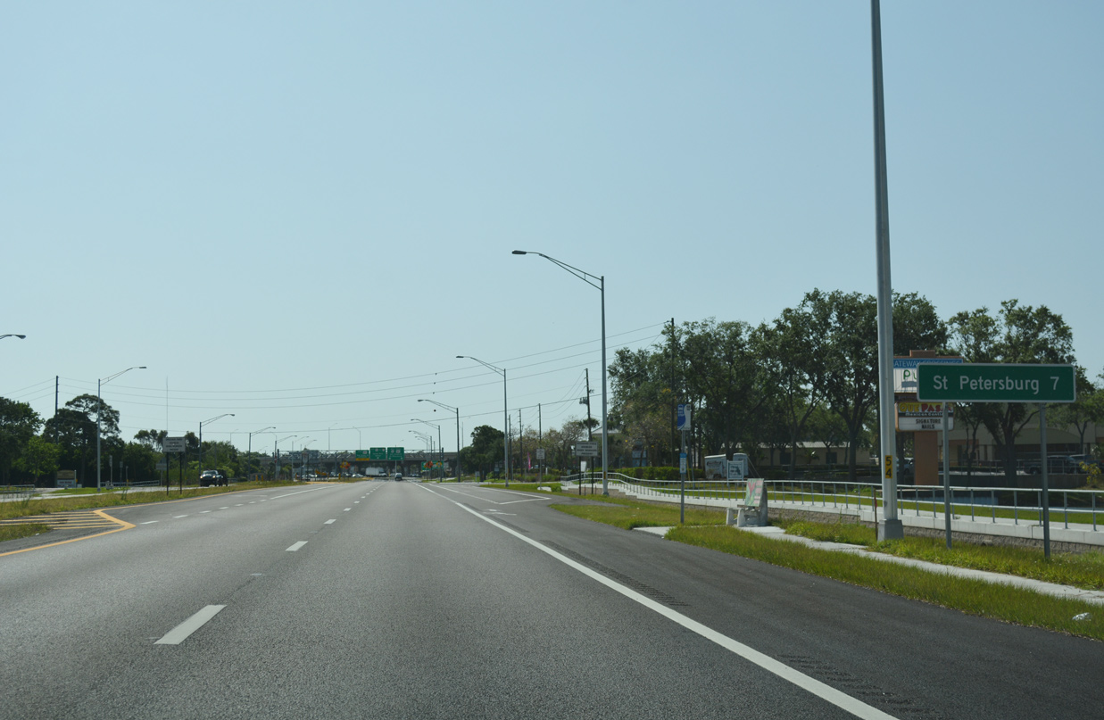
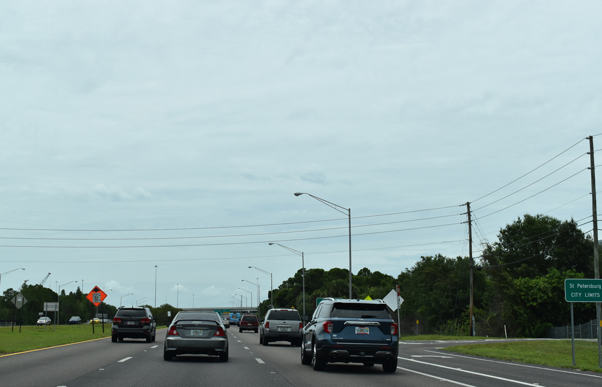
St. Petersburg distance sign posted for the SR 686 connection to U.S. 92 west / SR 687 (4th Street N) south toward Downtown.
04/28/24
SR 686 Roosevelt Boulevard) converges with SR 694 (Gandy Boulevard) just west of U.S. 92/SR 687 (4th Street N) at the Gateway section of St. Petersburg.
01/17/20

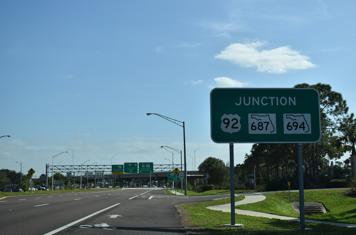
State Road 694 (Gandy Boulevard) extends southwest from U.S. 92, SR 686, and SR 687 to Interstate 275 at Exit 28 and Pinellas Park.
01/17/20
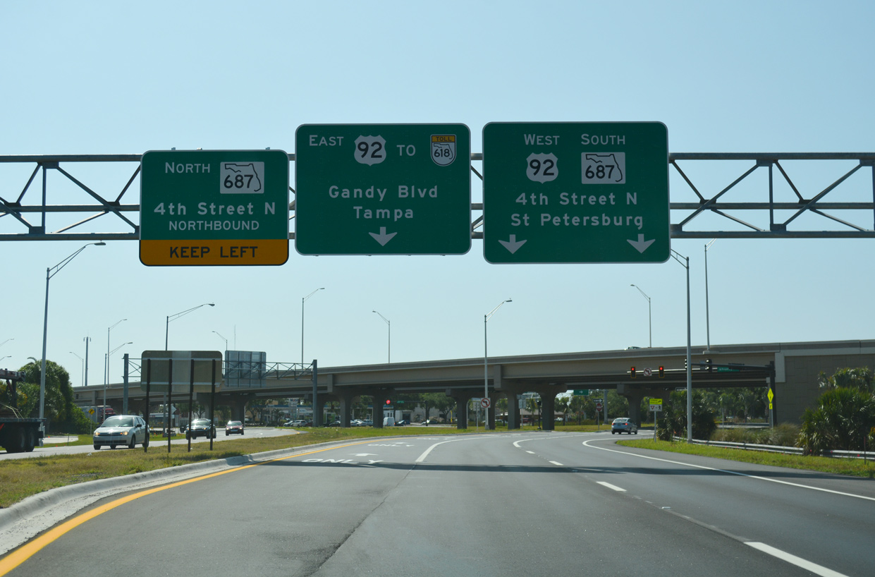
SR 686 eastbound connects with the Gandy Boulevard frontage road ahead of 4th Street N. U.S. 92 follows 4th Street N (SR 687) south to Fossil Park and Downtown St. Petersburg. U.S. 92 east continues along Gandy Boulevard to the Gandy Bridge and South Tampa.
04/13/18
Construction through Summer 2017 elevated Gandy Boulevard above both Roosevelt Boulevard and 4th Street N. Work on the frontage road system connecting SR 686 with SR 687 wrapped up in Spring 2018.
04/13/18
References:
Baughn, J. (n.d.). CR-416 (CSWY BLVD) over CLEARWATER HARBOR RELIEF, Pinellas County, Florida. BridgeReports.com. http://bridgereports.com/1080530
Cars roll across causeway bridge. (2009, May 31). St. Petersburg Times.
Photo Credits:
- Alex Nitzman: 11/15/16, 04/13/18, 05/04/19, 03/07/23
- AARoads: 08/15/15
- Brent Ivy: 04/28/24
- ABRoads: 01/03/15, 01/17/20, 06/05/20, 02/15/26
Connect with:
Page Updated Wednesday March 04, 2026.