
Florida's Turnpike South - Yeehaw Junction to Martin County


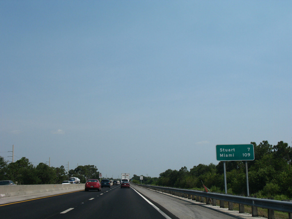
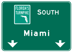
Fort Pierce, seat of St. Lucie County, is the next designation along the southbound turnpike. Miami is 159 miles to the south of Yeehaw Junction.
07/25/17
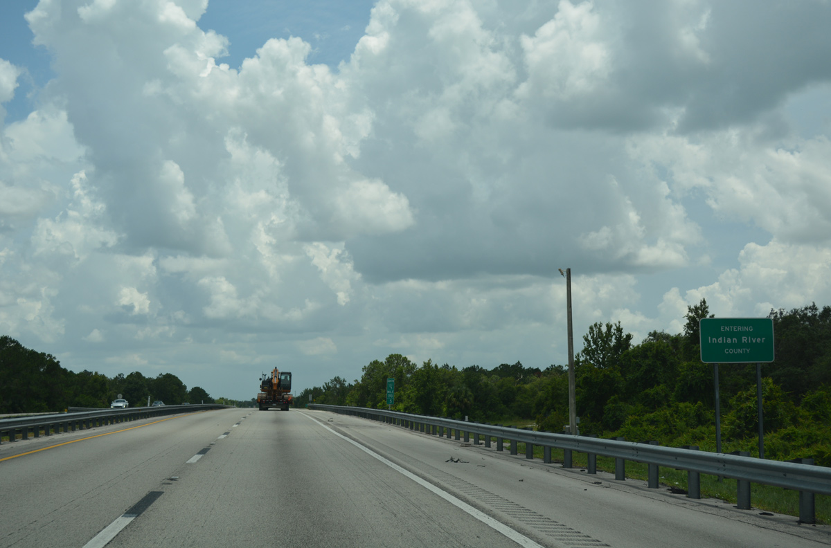
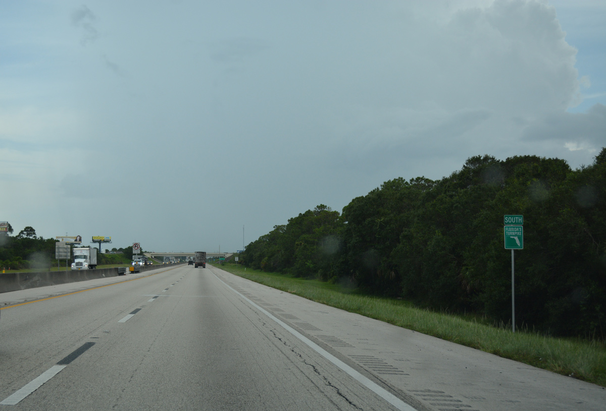
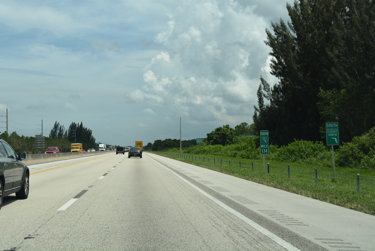
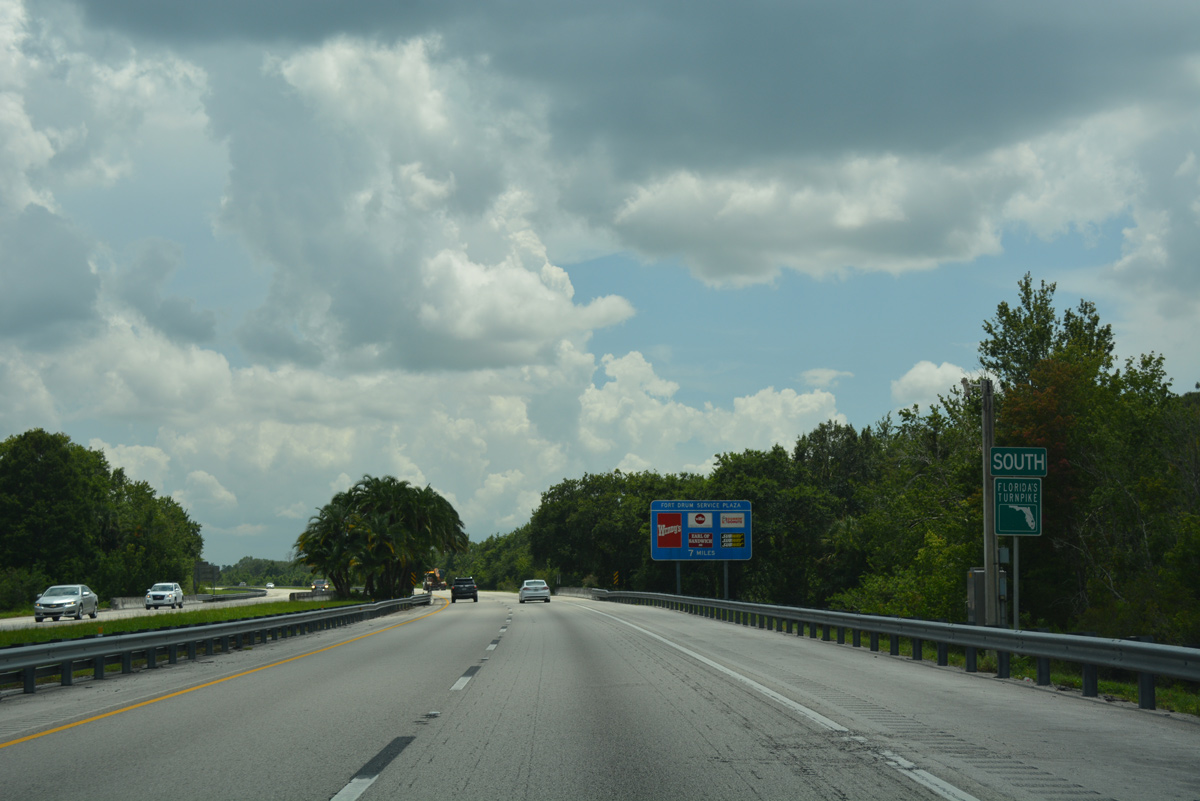
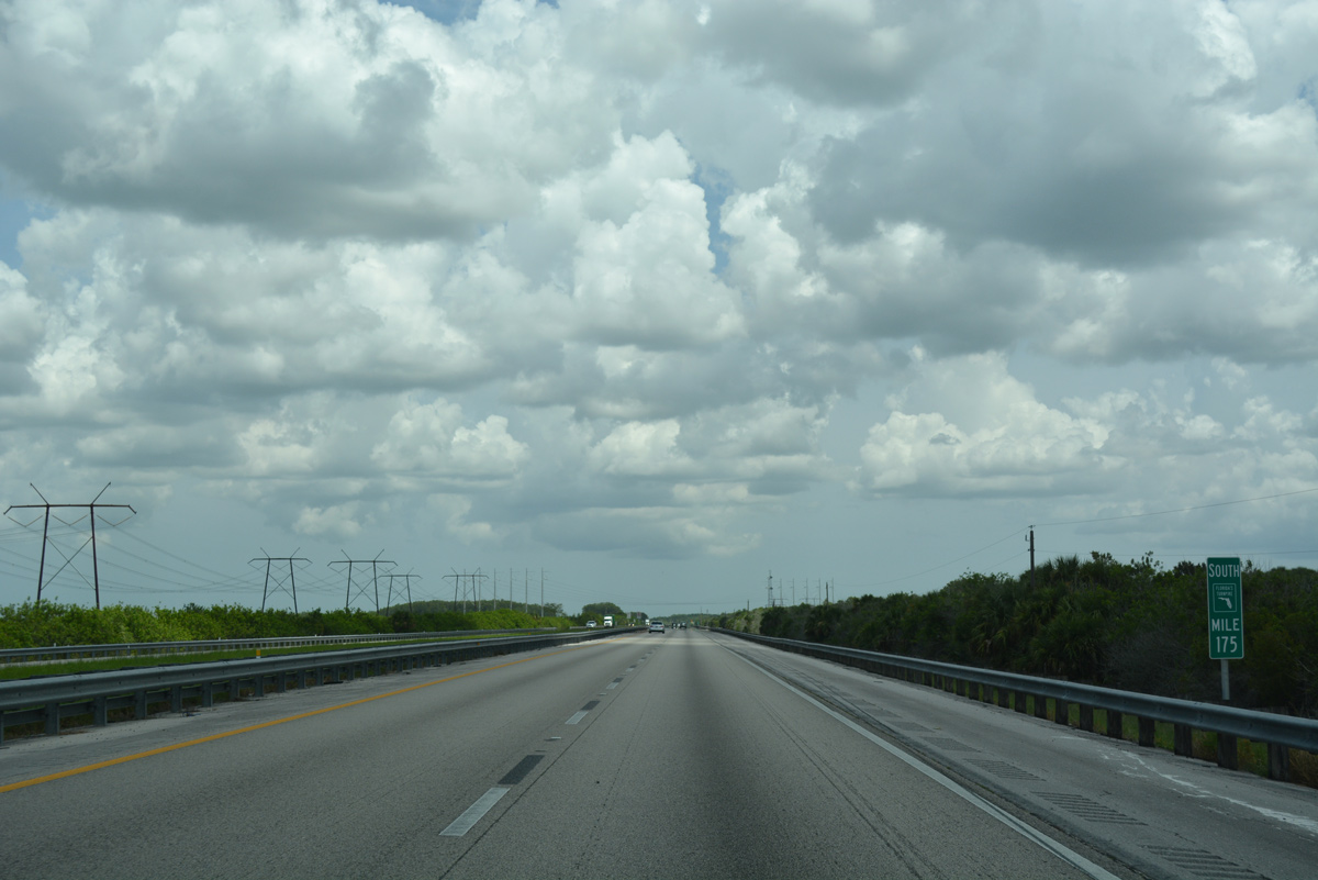
Florida's Turnpike nips a southwestern corner of Indian River County between Osceola and Okeechobee Counties.
07/25/17
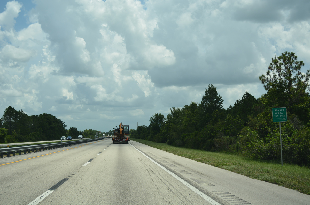
Ronald Reagan Turnpike sign posted along the 1.46 mile segment of Florida's Turnpike in Indian River County.
07/25/17
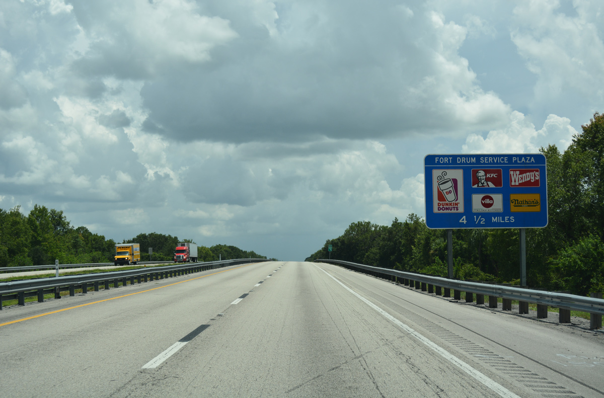
Crossing Padgett Branch, four a and a half miles ahead of the Fort Drum Service Plaza on the Turnpike south.
07/25/17
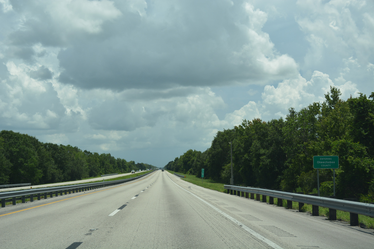
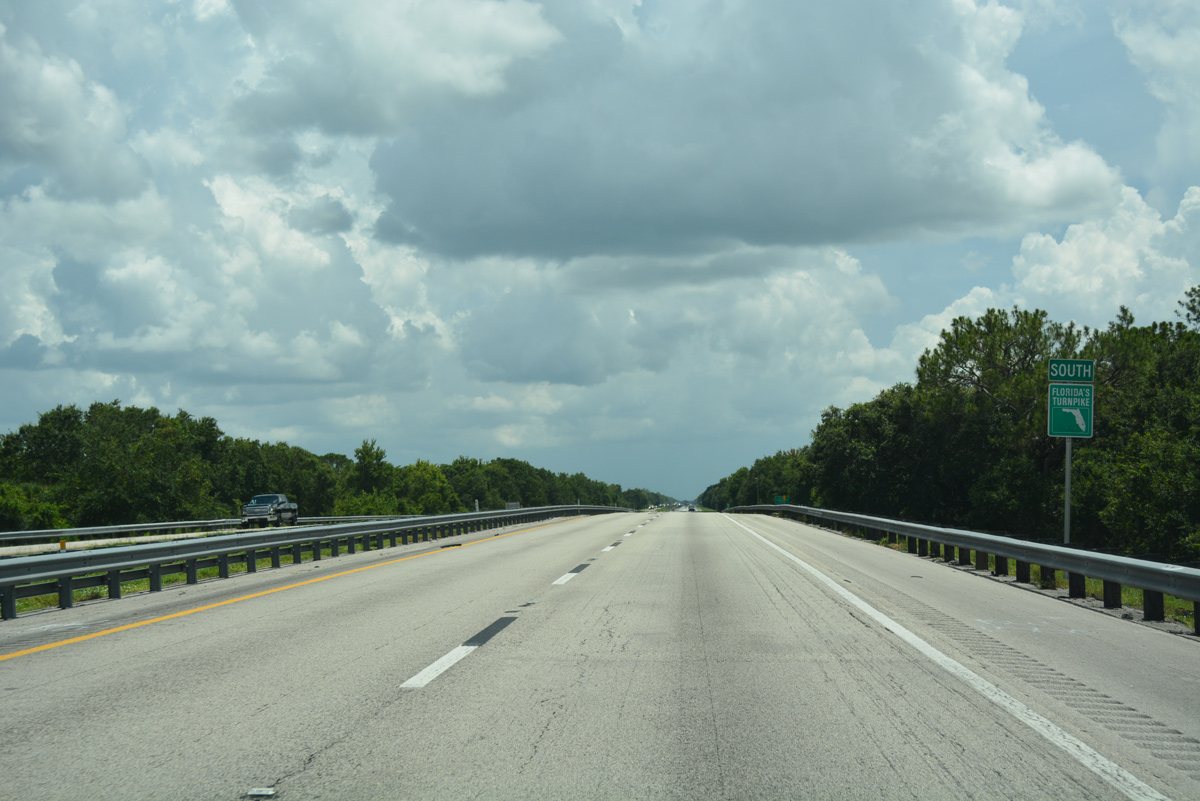
Southbound travelers enter the northeast corner of Okeechobee County.
07/25/17
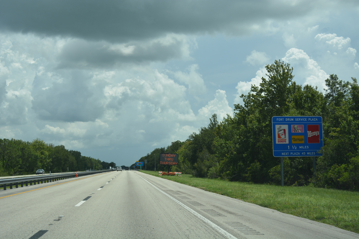
The toll road runs alongside Jim Green Creek to the Fort Drum Service Plaza at milepost 184.
07/25/17
Fort Drum Service Plaza also resides between the travel lanes of Florida's Turnpike mainline. Amenities include fast food, a gas station and a gift shop.
07/25/17
Florida's Turnpike crosses Jim Green Creek by this confirming marker south of Fort Drum Service Plaza.
07/25/17
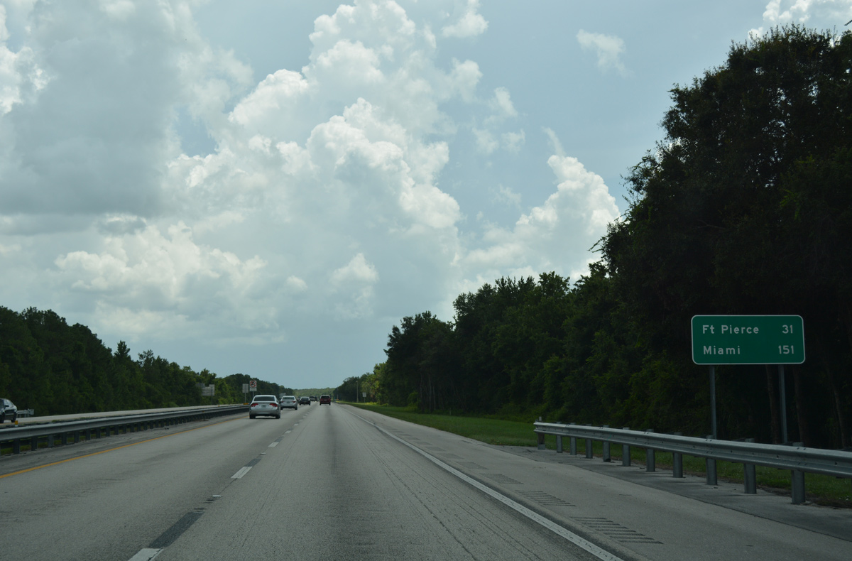
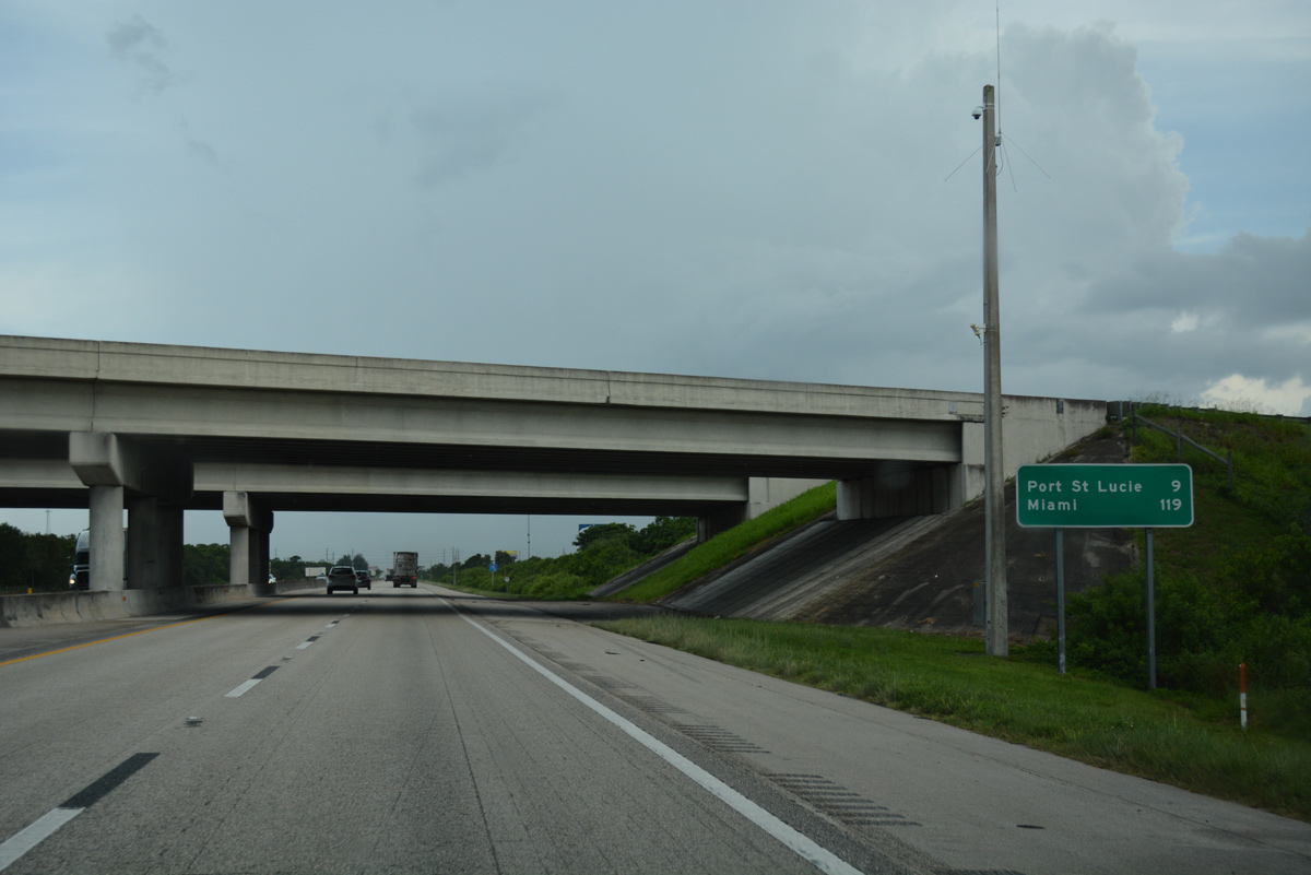
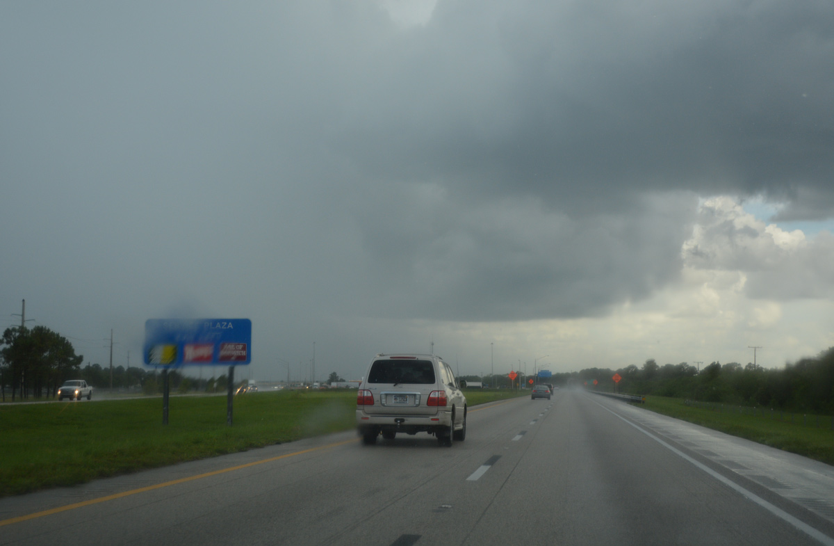
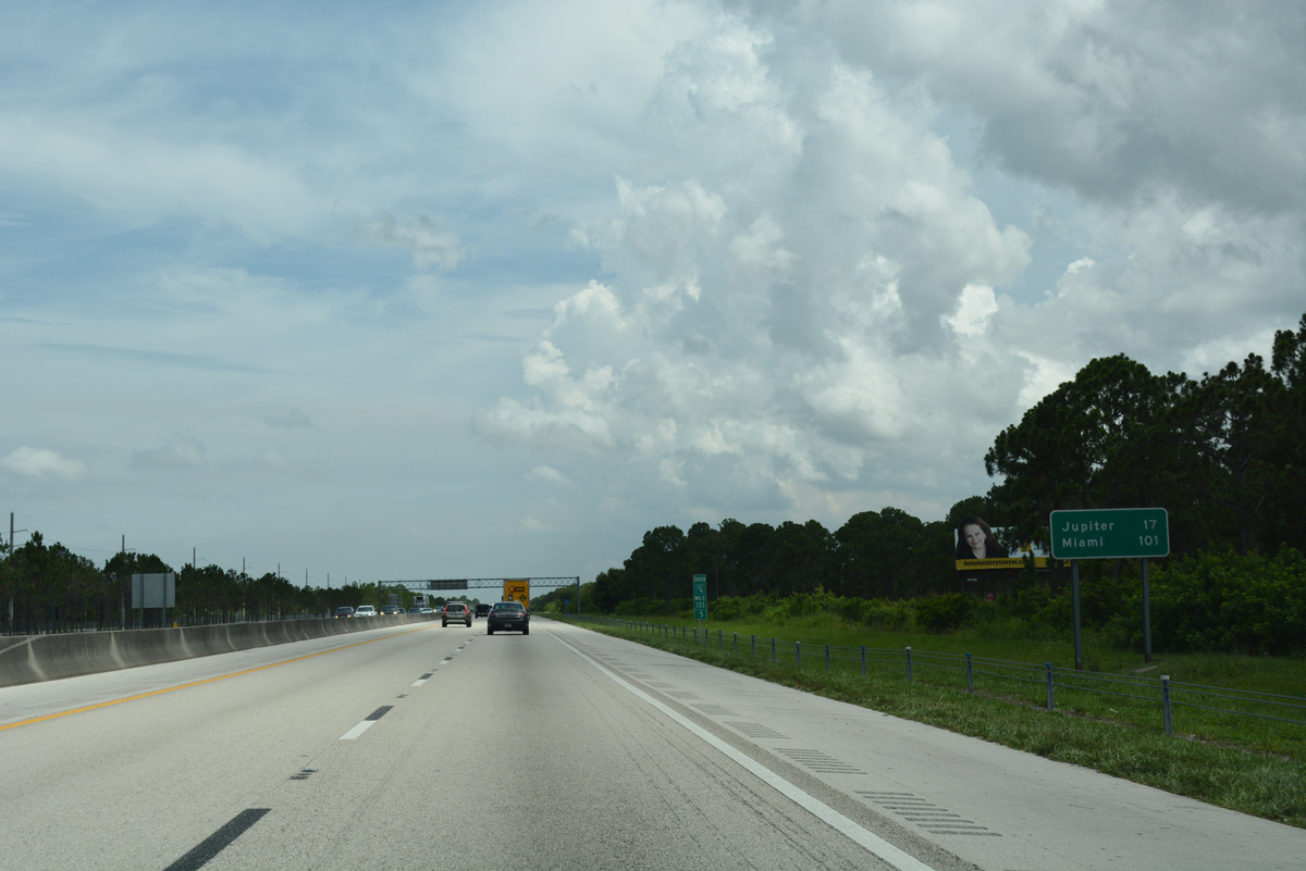
Fort Pierce is another 31 miles to the southeast along the Turnpike. Miami is now 151 miles away.
07/25/17

Veering east across Form Drum Creek, Florida's Turnpike reenters Indian River County, straddling the south county line to St. Johns Marsh.
07/25/17
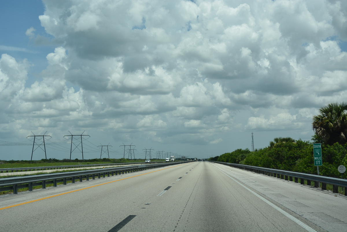
Florida Power and Light (FPL) transmission lines accompany the Turnpike east from near the Okeechobee County line to milepost 164.
07/25/17
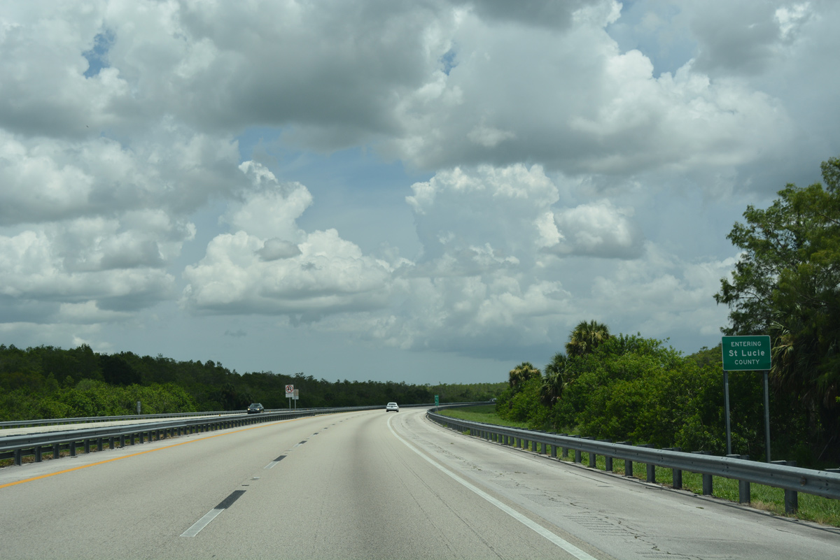
Curving southeast again, Florida's Turnpike enters St. Lucie County.
07/25/17
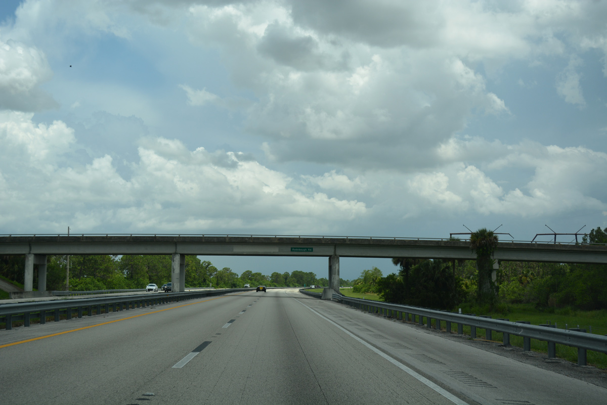
Radebaugh Road, a local ranch road, spans the Turnpike as it traverses St. Johns Swamp. Waters from the swamp flow northward to form the St. Johns River.
07/25/17
The adjacent FPL lines shift to the south side of the Turnpike and stay well west of Fort Pierce and Port St. Lucie.
07/25/17
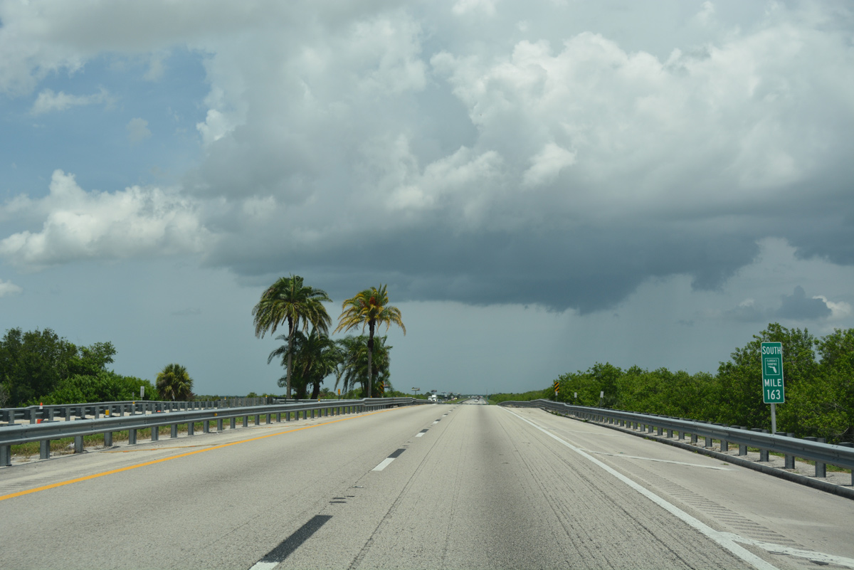
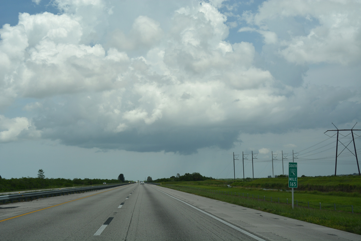
The toll road orientates in an east-west fashion to the south of St. Johns Marsh. A ranch road passes under the highway at milepost 163.
07/25/17
Nearing the Interstate 95 corridor, the Turnpike turns southeast ahead of Belcher Canal.
07/25/17
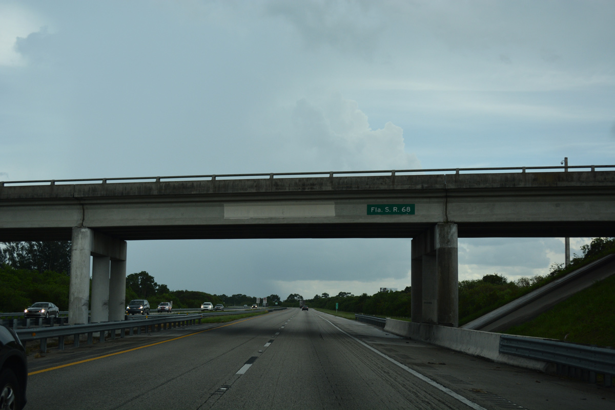
Orange Avenue (County Road 68) crosses over the Turnpike along a linear course east from U.S. 441 in Okeechobee County to Downtown Fort Pierce. The eastern 4.5 miles of the route are still state maintained.
07/25/17
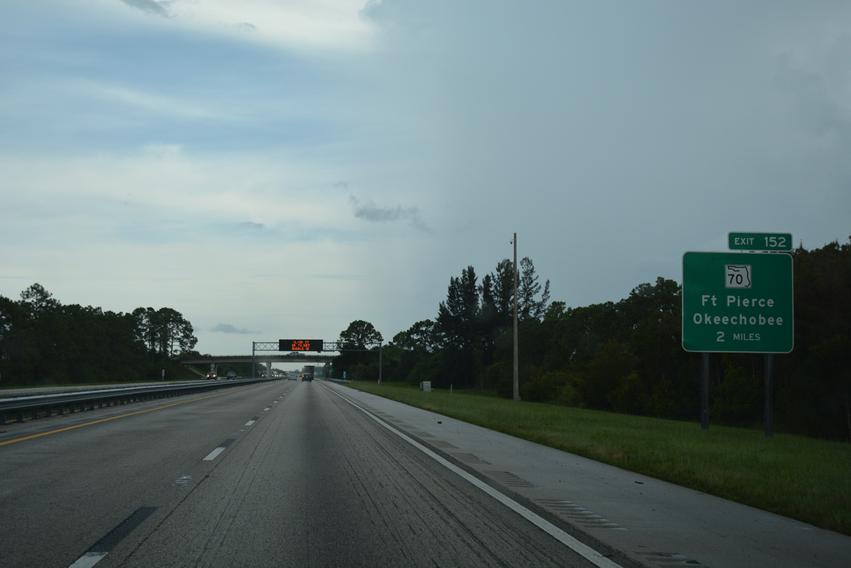
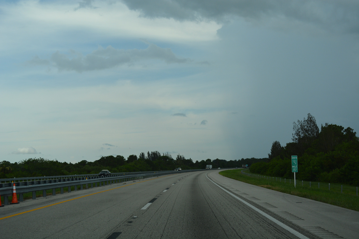
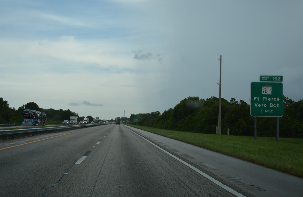
SR 70, a cross peninsular route from Bradenton east to Fort Pierce, meets Florida's Turnpike in two miles at Exit 152.
07/25/17
SR 713 (Kings Highway) stems 10.20 miles north from the Turnpike access road at Exit 152 to U.S. 1 near the Indian River County and city of Vero Beach.
07/25/17
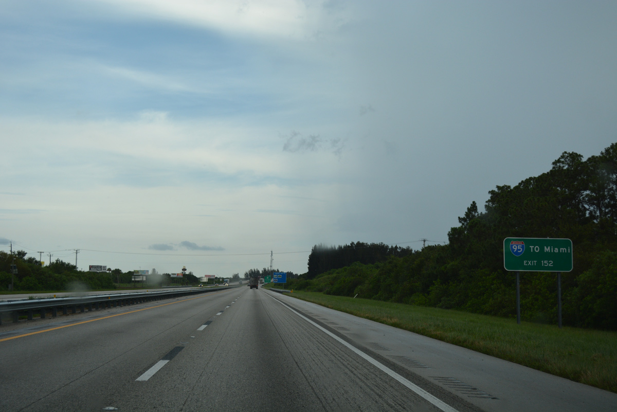
Interstate 95 and Florida's Turnpike intertwine southward from Fort Pierce to the Golden Glades Interchange at Miami Gardens. SR 70 provides the first link between the two corridors from Exit 152.
07/25/17
The 148 mile route of SR 70 originates at Virginia Avenue and U.S. 1 in Fort Pierce. The state road overtakes Okeechobee Road southwest from the Orange Blossom Business Center (formerly Mall) along a four lane divided highway to Okeechobee.
07/25/17
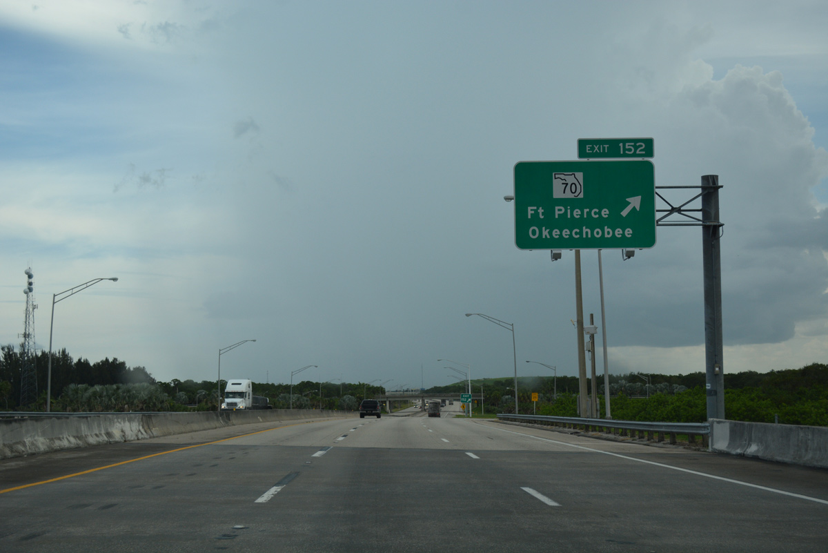
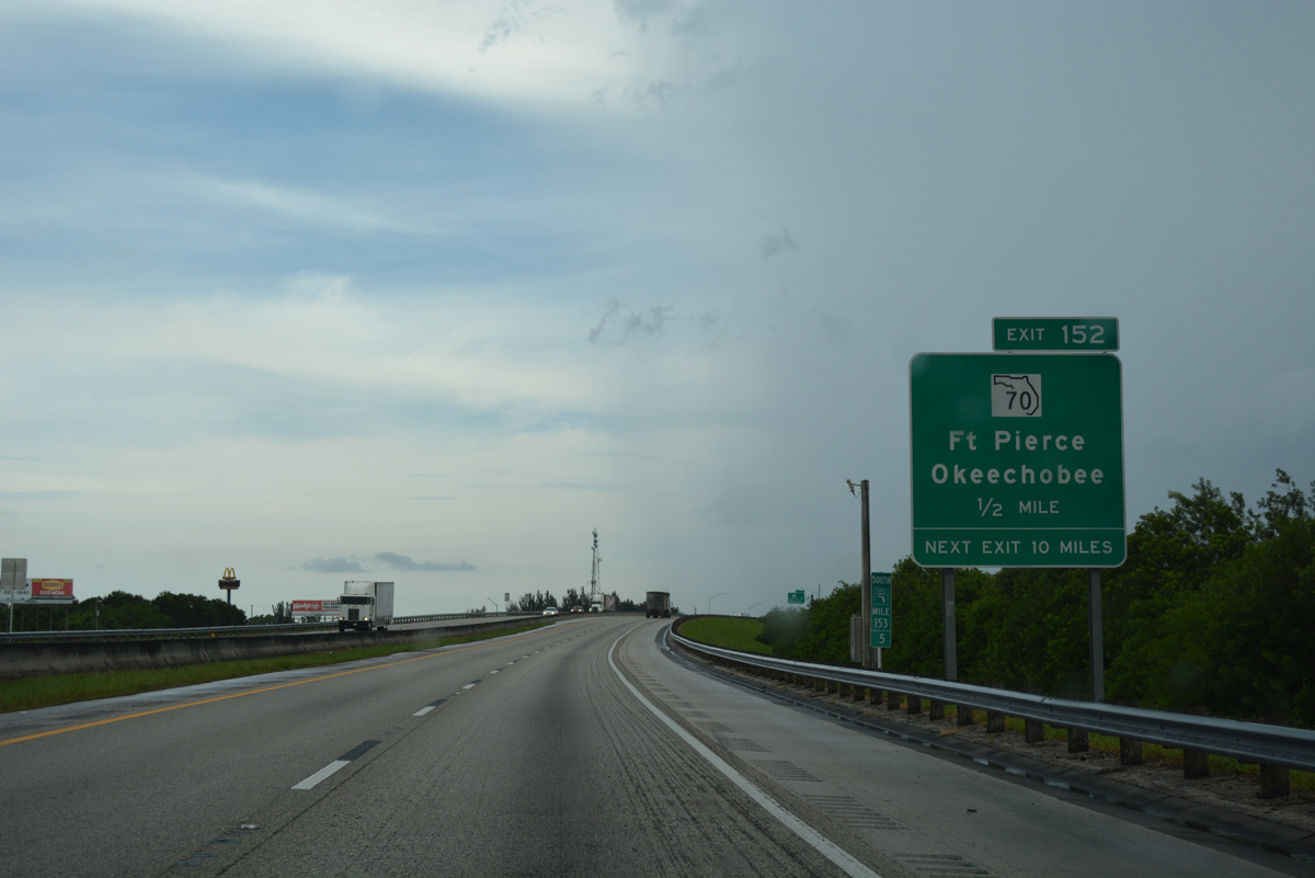
Exit 152 leaves the Turnpike southbound after the SR 70 underpass. SR 70 ventures 31 miles southwest to the Okeechobee County seat.
07/25/17
This reassurance shield assembly precedes Ten Mile Creek and the Gordy Road Preserve.
07/25/17
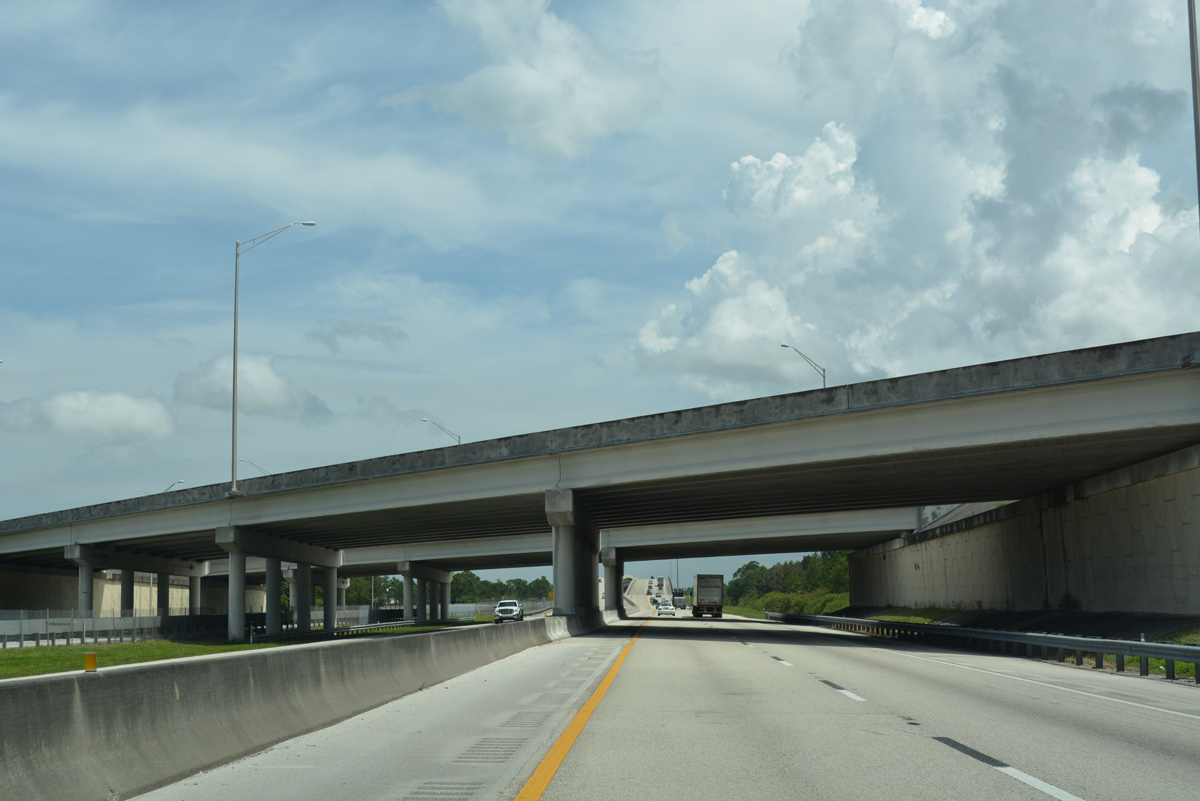
Interstate 95 crosses over Florida's Turnpike as it loops westward from Fort Pierce to encircle the west side of Port St. Lucie. The toll road passes through Port St. Lucie, meeting SR 716 east next in nine miles.
07/25/17
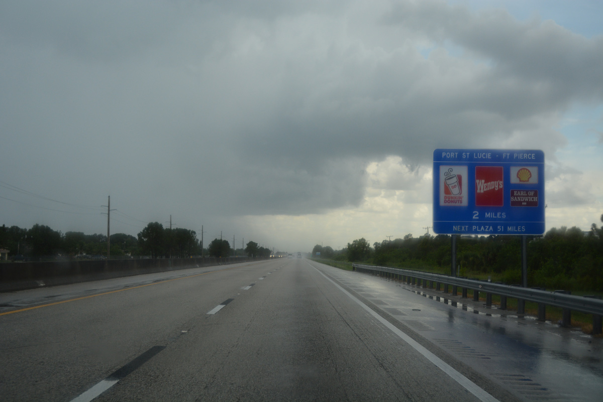
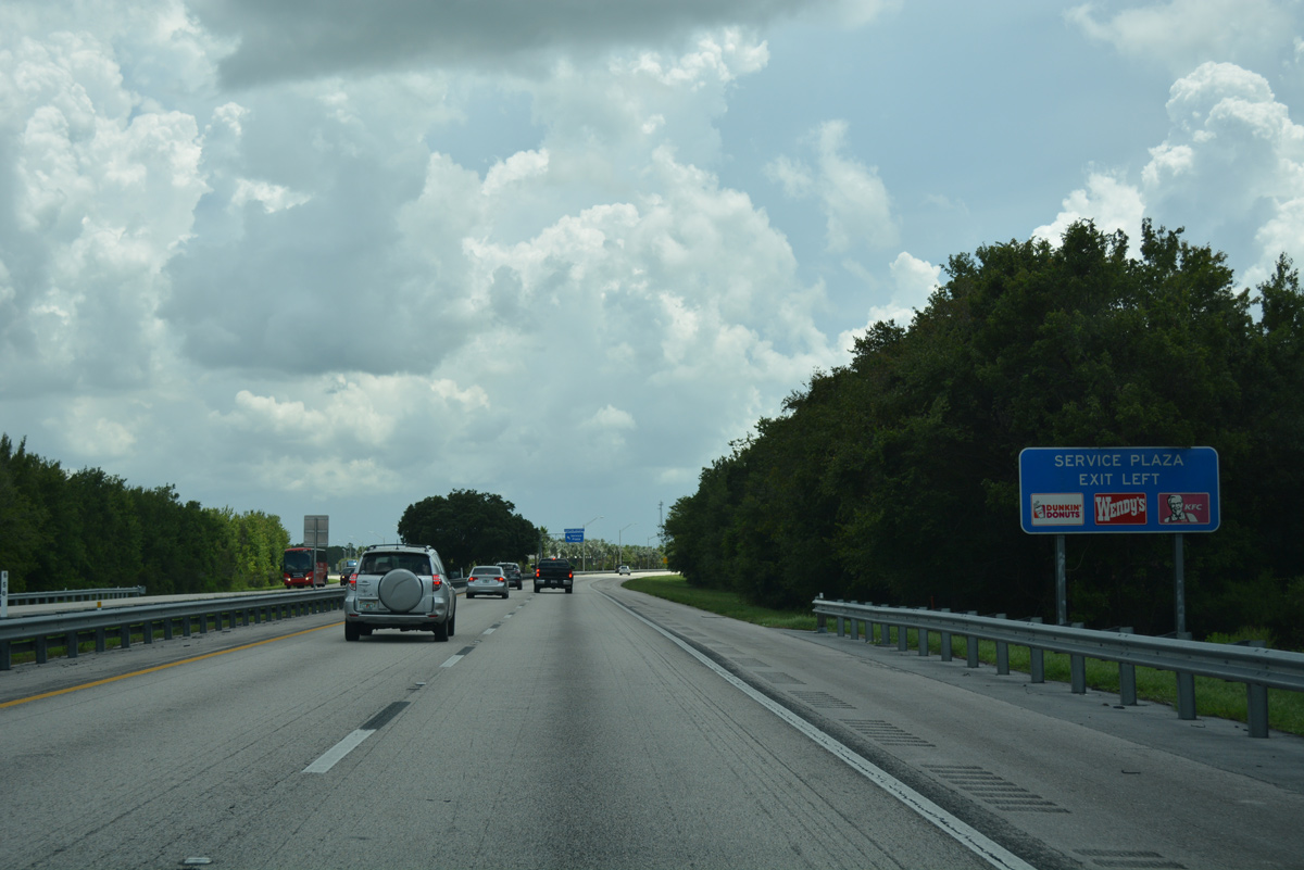
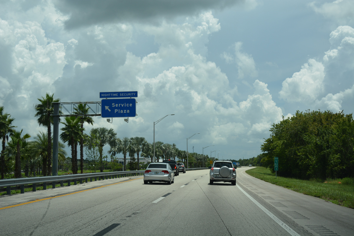
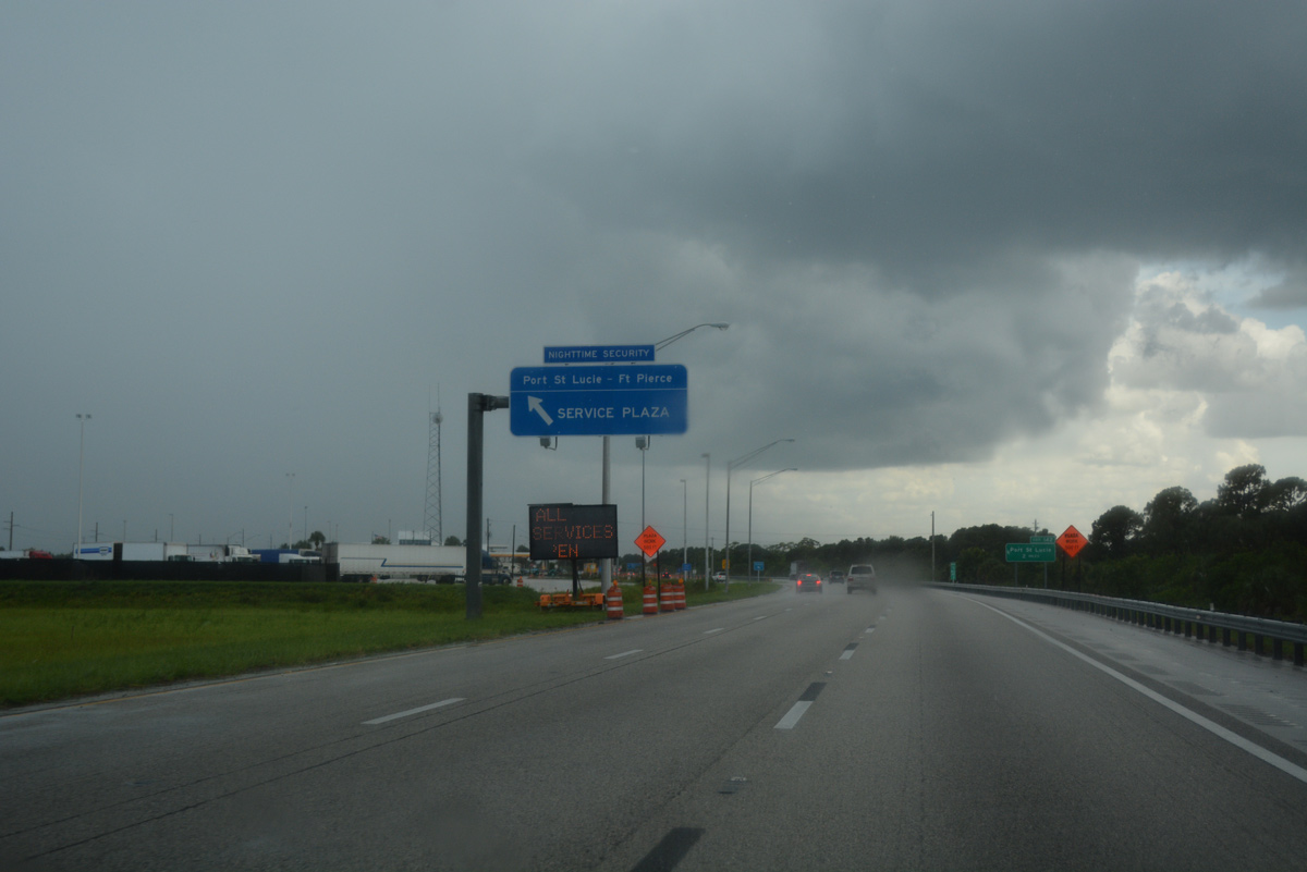
Continuing south into the city of Port St. Lucie, Florida's Turnpike travels by St. James Golf Club two miles ahead of the Port St. Lucie - Fort Pierce Service Area.
07/25/17
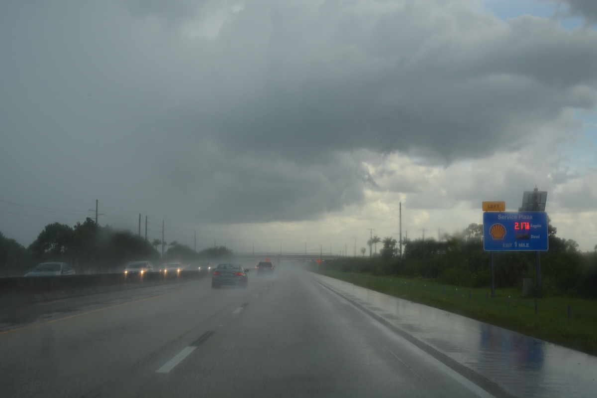
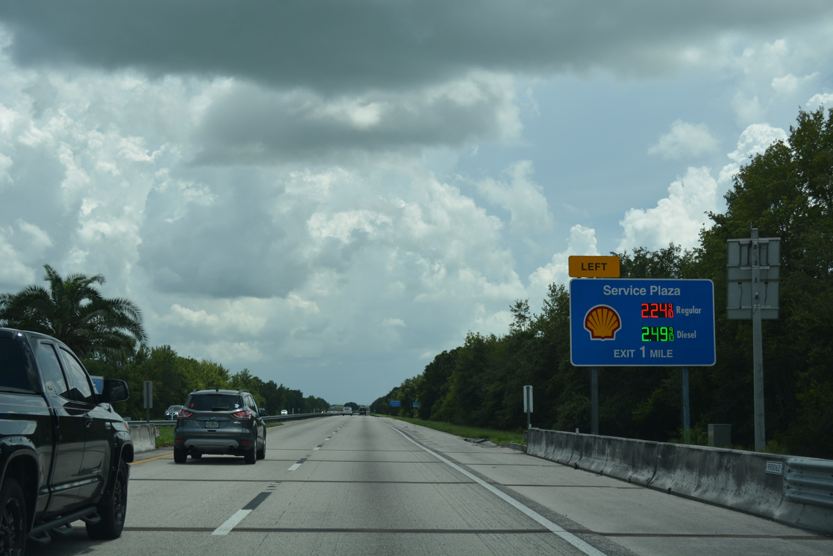
St. Lucie West Boulevard crosses the Turnpike beyond this sign displaying prices for the Port St. Lucie - Fort Pierce Service Area gas station.
07/25/17
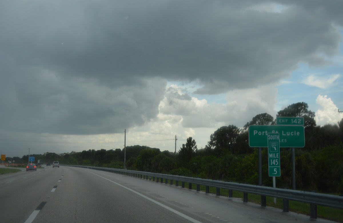
The left side ramp for the Port St. Lucie - Fort Pierce Service Area separates from the Turnpike mainline at milepost 145.5.
07/25/17
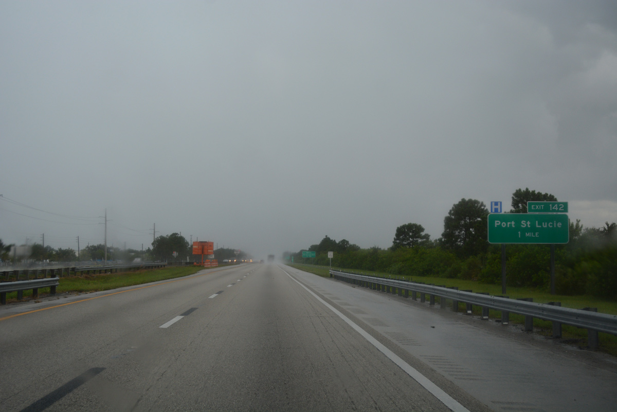
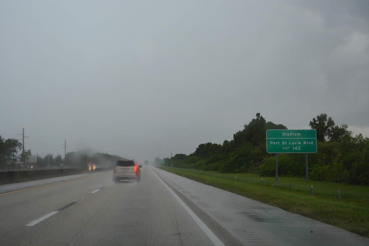
A trumpet interchange (Exit 142) and access road link Florida's Turnpike with Port St. Lucie Boulevard and Bayshore Boulevard in two miles.
07/25/17
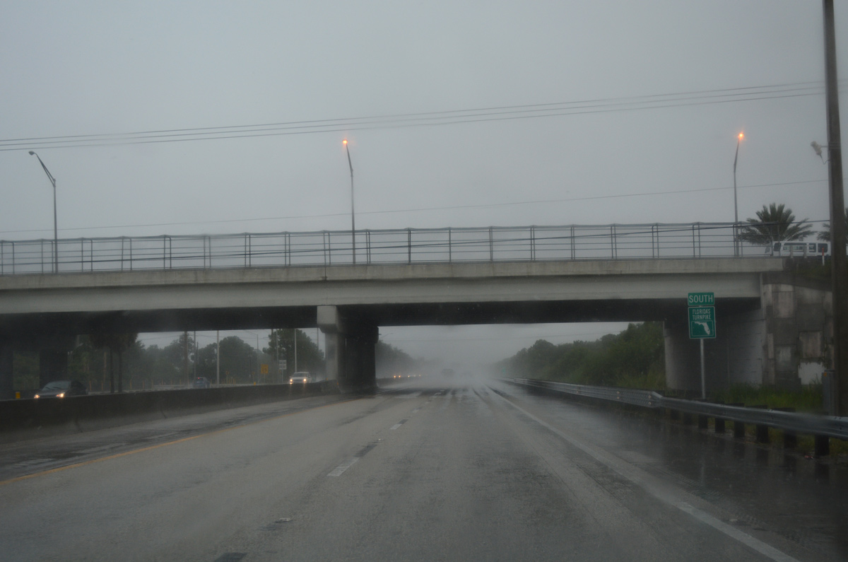
Crosstown Parkway travels above Florida's Turnpike south south of the service plaza in Port St. Lucie.
07/25/17
Port St. Lucie Boulevard forms an arc west from U.S. 1 (Federal Highway) to Gatlin Boulevard and south to Becker Road. The east-west portion together with Gatlin Boulevard represents one of main arterial routes across Port St. Lucie.
07/25/17
Bayshore Boulevard stems north from Exit 142 and Port St. Lucie Boulevard to St. Lucie West Boulevard. St Lucie West Boulevard leads west along a commercial corridor, south of First Data Field (home of NY Mets spring training baseball), and I-95 at Exit 121.
07/25/17
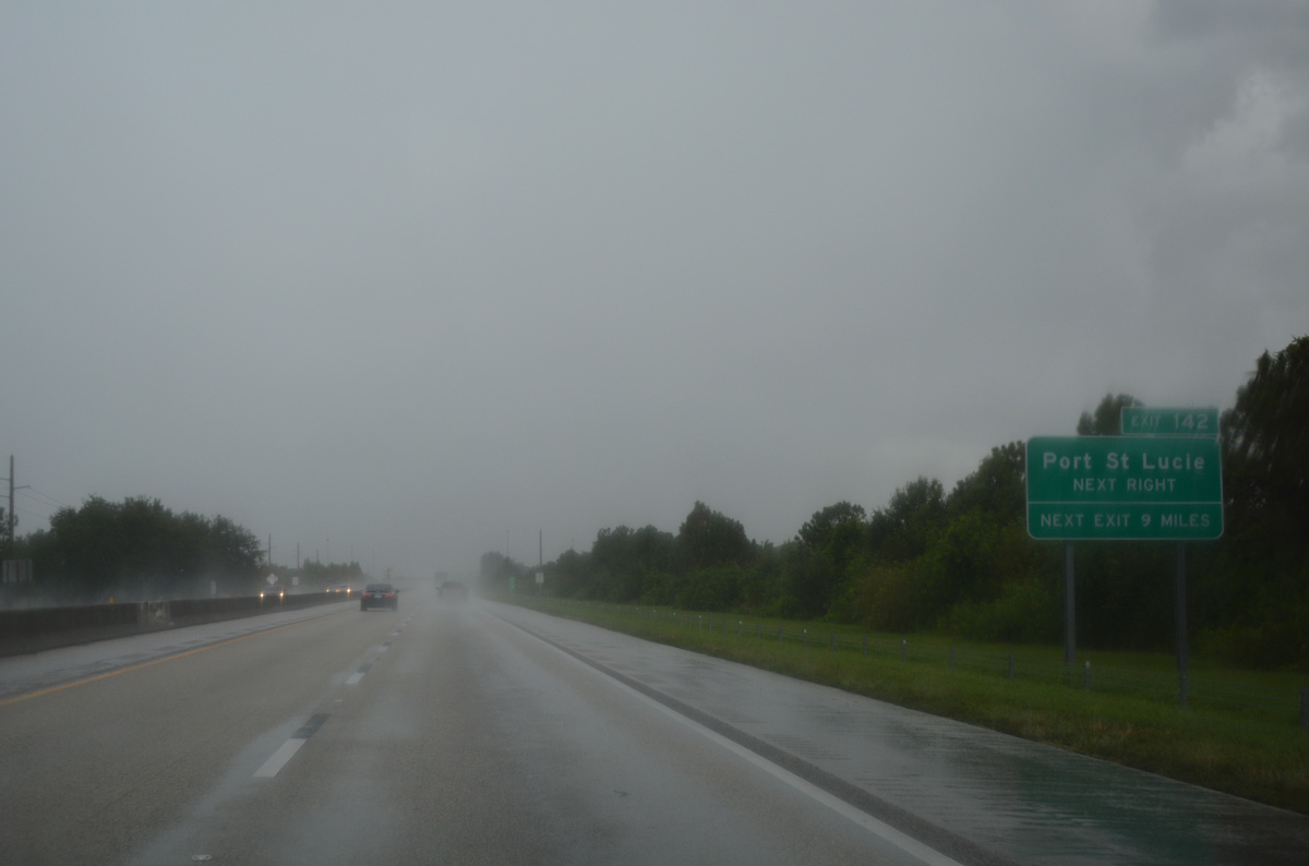
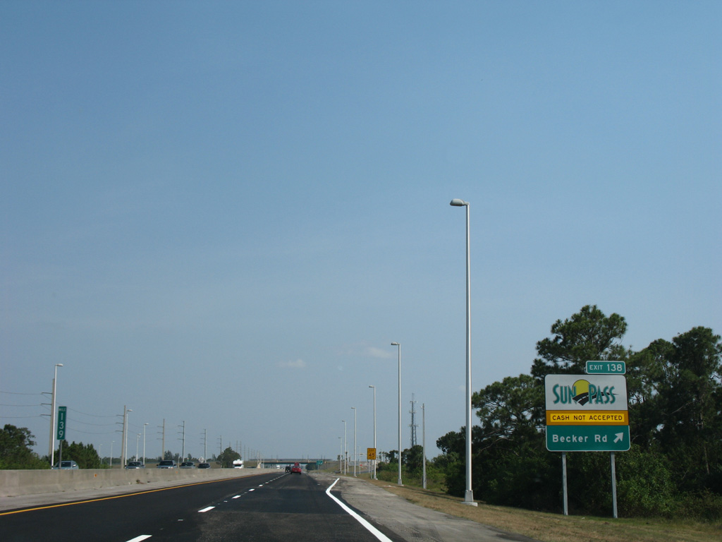
The next exit placard posted a half mile from Exit 142 predates the opening of the Sunpass-only ramps with Becker Road at Exit 138.
07/25/17
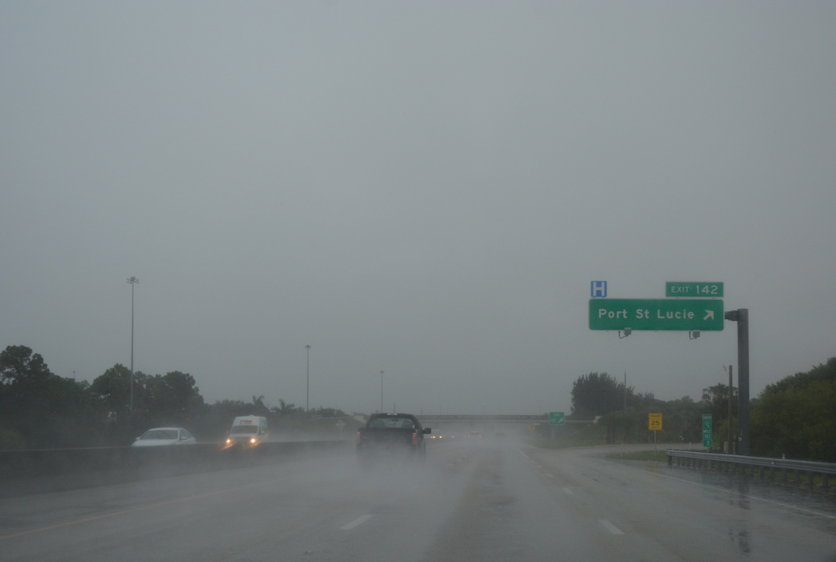
Omitted from guide signs at Exit 142 is SR 716. The 4.36 mile long state road lines Port St. Lucie Boulevard east to U.S. 1.
07/25/17
Confirming marker for Florida's Turnpike south posted at the Port St. Lucie Boulevard overpass.
07/25/17
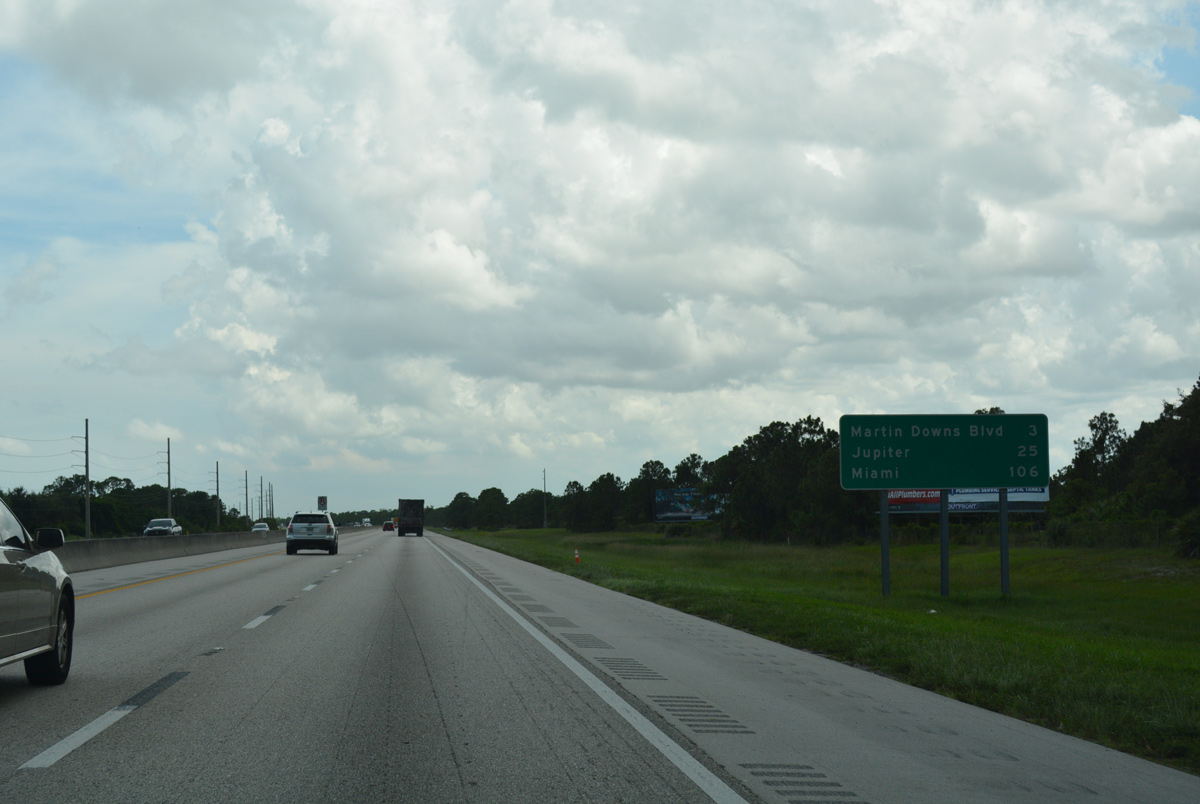
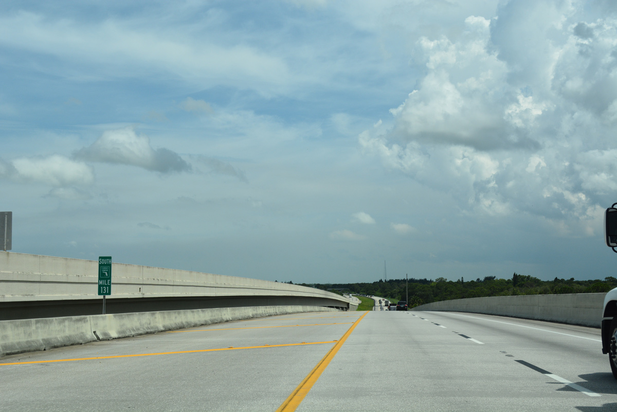
Progressing south from Port St. Lucie, Florida's Turnpike reaches Exit 133 to Palm City and Stuart in seven miles. Miami is 102 miles further south.
05/16/08
Southbend Boulevard forms an east side frontage road to the Turnpike south from the Tesoro Club golf course community to Becker Road.
05/16/08
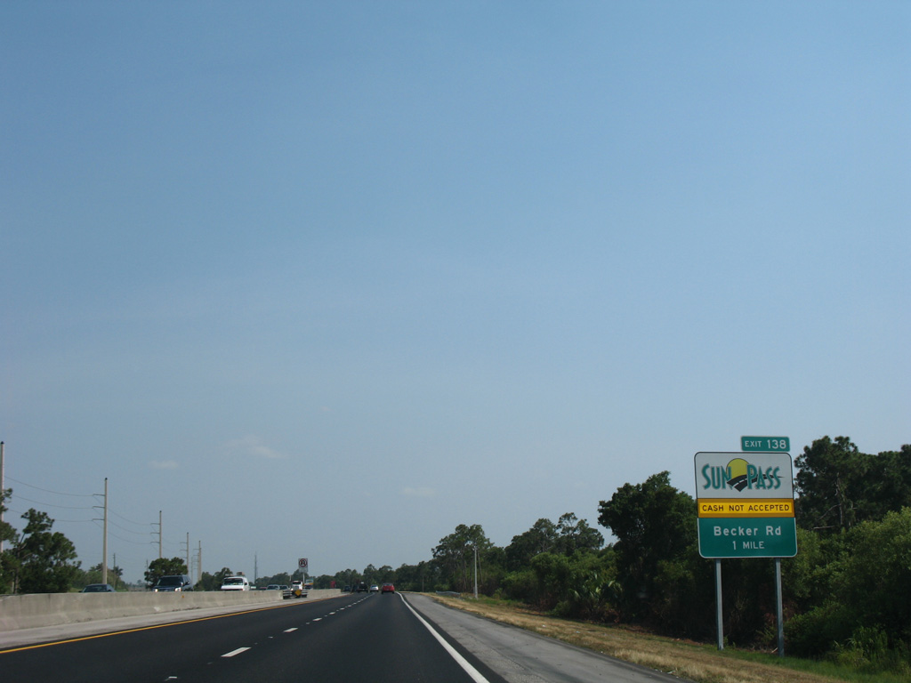
A parclo interchange (Exit 138) joins Florida's Turnpike with Becker Road in one mile in south Port St. Lucie.
05/16/08
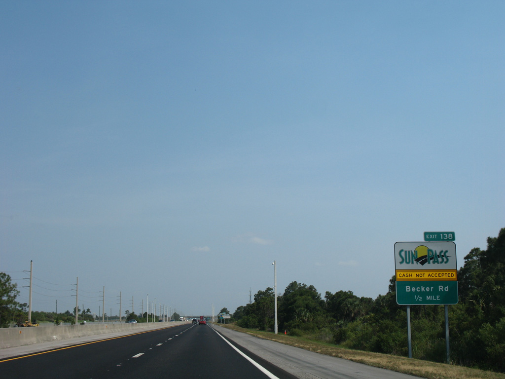
The ramps at Becker Road opened to traffic on May 11, 2007. Costing $19 million, construction of the exchange at Exit 133 was funded for by two area developers, including the builder of adjacent Tesoro Club.1
05/16/08
Becker Road constitutes a four lane, divided arterial west from the nearby Shoppes at Veranda Falls retail plaza to I-95 at Exit 114 and Village Parkway.
05/16/08
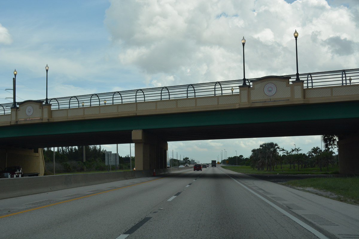
A decorative overpass carries Becker Road above Florida's Turnpike. East from Exit 138, Beck Road connects with Gilson Road / Murphy Road south into Palm City.
07/25/17

The appropriately named County Line Canal marks the boundary between St. Lucie and Martin Counties across Florida's Turnpike.
07/25/17
Florida's Turnpike separates the Evergreen Club and Creek Country Club golf course communities from undeveloped areas to the west.
07/25/17
The lone exit in Martin County lies three miles ahead with Martin Highway and Martin Downs Boulevard. The Palm Beach County town of Jupiter is 25 miles to the south.
07/25/17
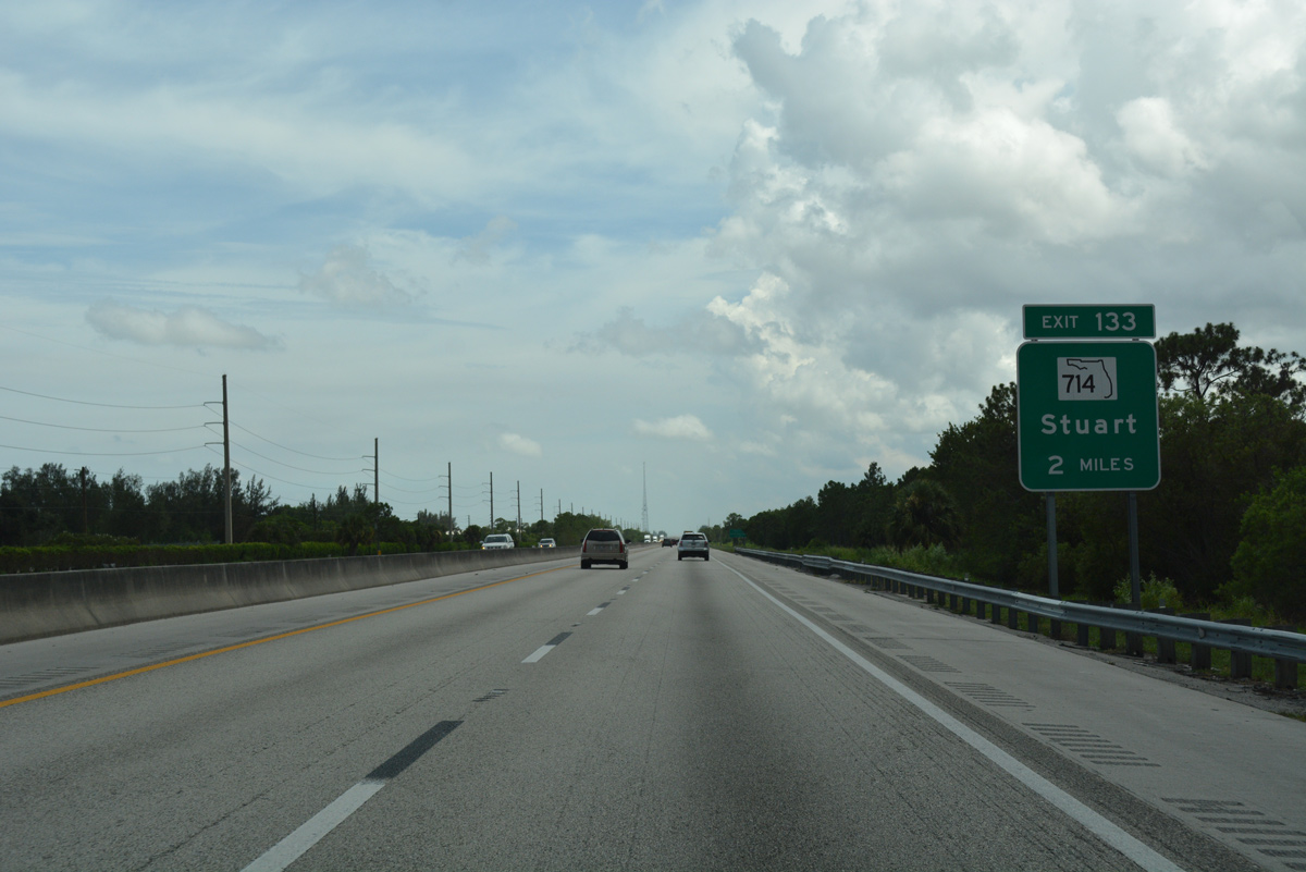
SR 714 (Martin Highway) crosses paths with Florida's Turnpike two miles ahead at the unincorporated community of Palm City.
07/25/17
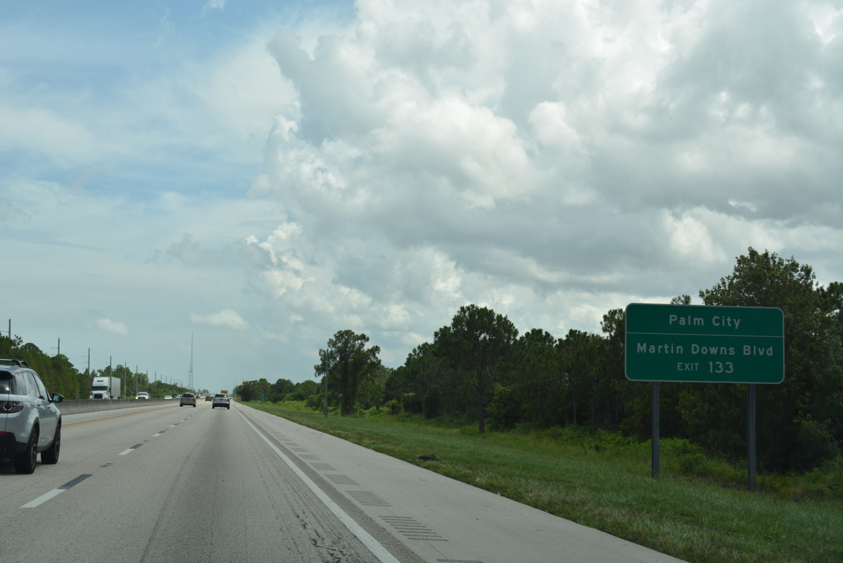
SR 714 turns north from Martin Highway onto Martin Downs Boulevard, an arterial bypass of Palm City east to the St. Lucie River bridge into Stuart.
07/25/17

One mile ahead of the trumpet interchange (Exit 133) and access road linking the Turnpike with SR 714 and CR 714 east. County Road 714 extends Martin Highway east to SW 36th Street and the Veterans Memorial Bridge to SR 76 in south Stuart.
07/25/17
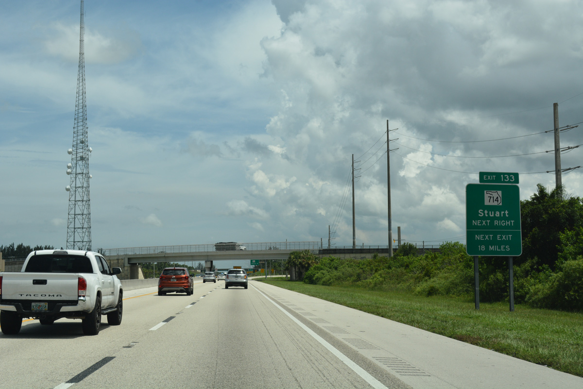
A lengthy exit less stretch ensues south of SR 714 to SR 706 at Jupiter. Martin Highway (SR 714 / CR 714) leads west to SR 710 (Beeline Highway) at the Okeechobee County line.
07/25/17
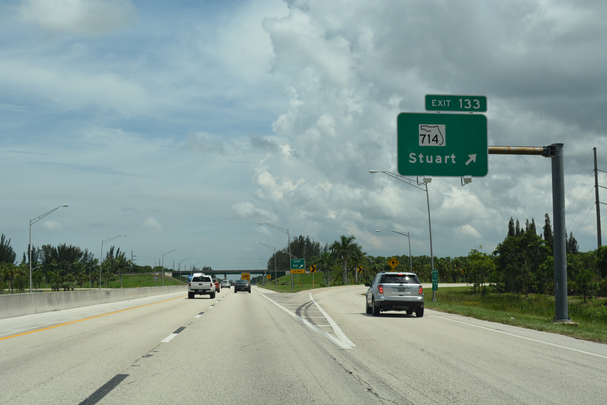
Southbound at the off-ramp (Exit 133) for SR 714 (Martin Downs Boulevard) and CR 710 (Martin Highway) east to Palm City and Martin Highway west to I-95 (Exit 110) and rural areas across the Allapattah Flats.
07/25/17
Advancing south by the Hammock Creek golf course community on Florida's Turnpike.
07/25/17
Miami is now just 101 miles away via the Turnpike and Interstate 95 south from the Golden Glades Interchange.
07/25/17
Interstate 95 returns from the loop west of Port St. Lucie south of milepost 132. The freeway meets CR 713 (High Meadow Avenue) adjacent to Florida's Turnpike.
07/25/17
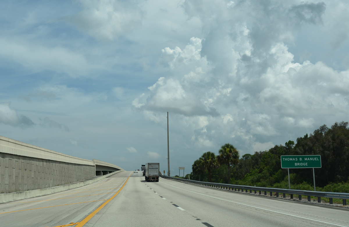
Striped for two lanes in each direction, the Thomas B. Manuel Bridge spans the St. Lucie River just west of I-95. Both bridge decks are wide enough to accommodate three lanes each with shoulders.
07/25/17
Florida's Turnpike travels at just five feet above sea level south of the St. Lucie River.
07/25/17
Interstate 95 and Florida's Turnpike travel side by side south from CR 708 (Bridge Road) across wetland areas west of Jonathan Dickinson State Park.
07/25/17
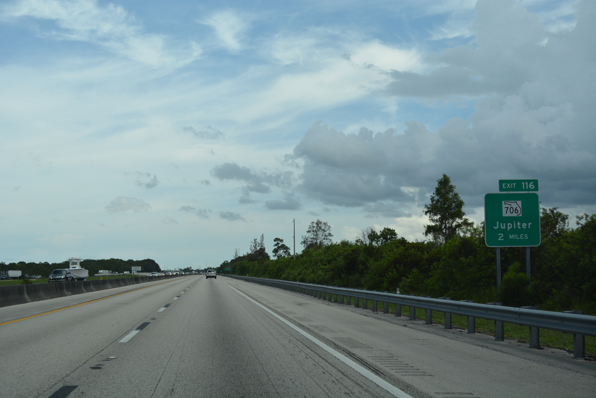
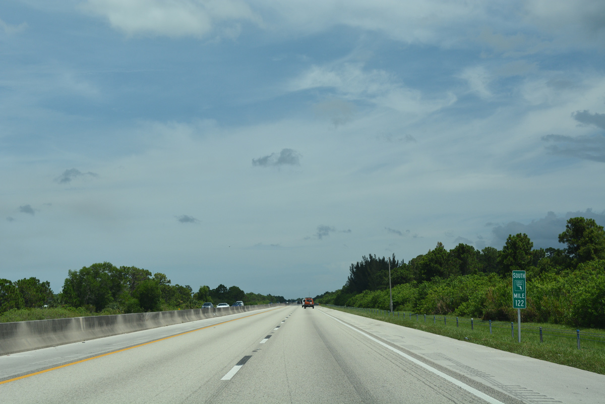
Two miles north of Exit 116 with SR 706 (Indiantown Road) on Florida' Turnpike south by the Loxahatchee River Natural Area.
07/25/17
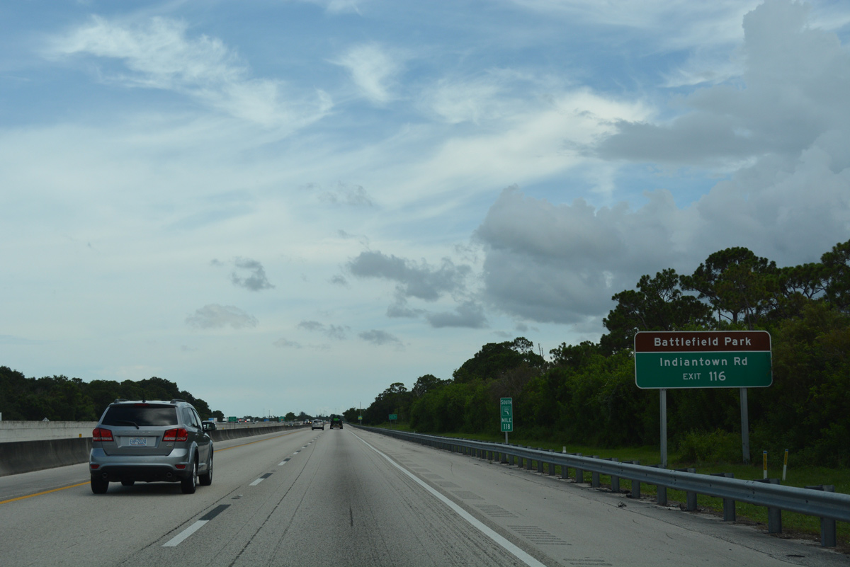
Indiantown Road carries CR 706 west to Loxahatchee River Battlefield Park and SR 710 (Beeline Highway) and SR 706 east into Jupiter.
07/25/17
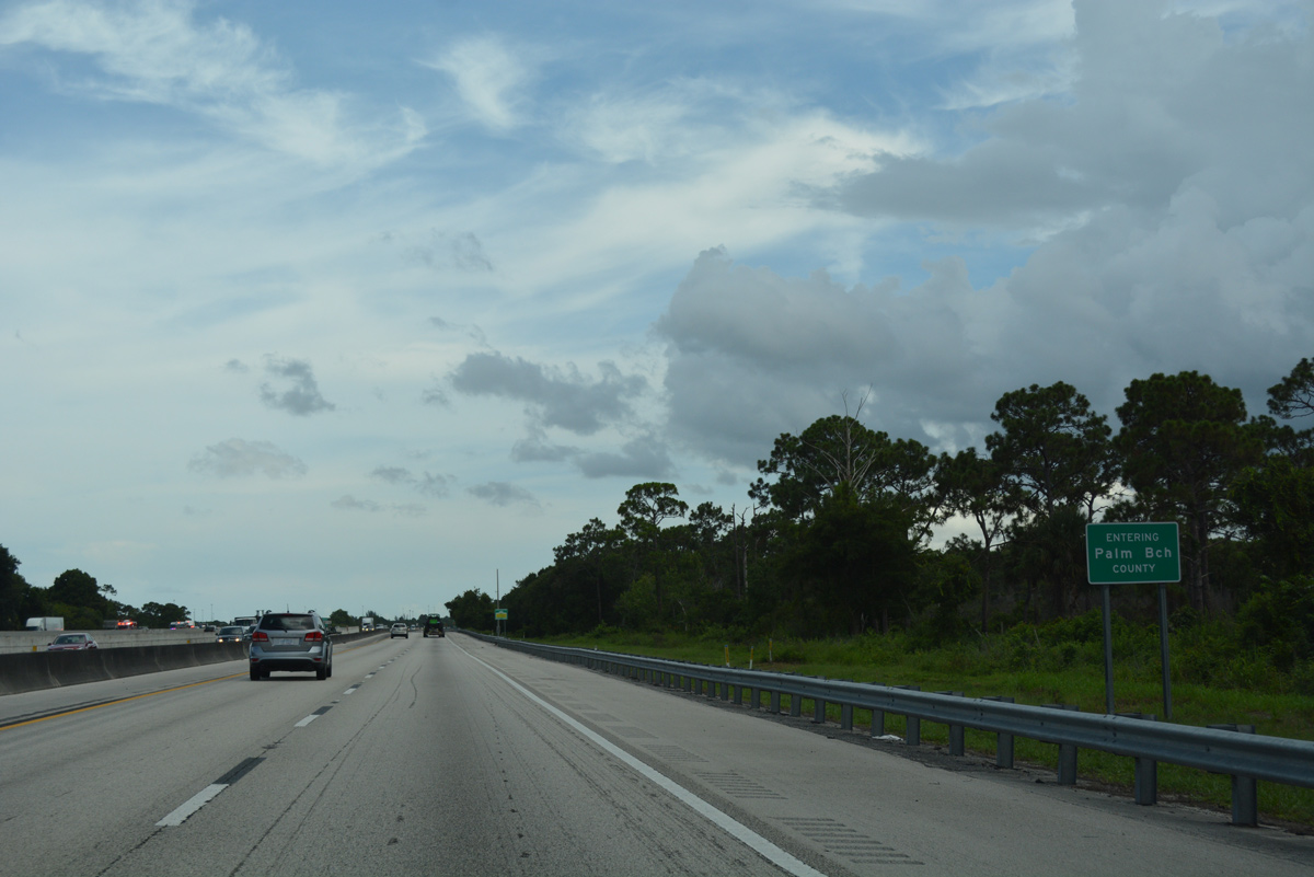
Interstate 95 and Florida's Turnpike enter Palm Beach County just ahead of the Loxahatchee River.
07/25/17

References:
- "$19 Million Turnpike Ramps Open." Palm Beach Post, The (FL), May 12, 2007.
Photo Credits:
- Alex Nitzman: 05/16/08, 07/25/17
Connect with:
Page Updated Friday September 15, 2017.