
Interstate 10 West - El Paso

 West
West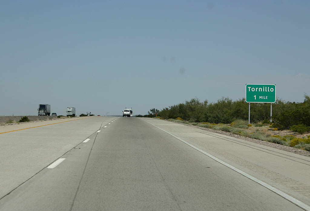
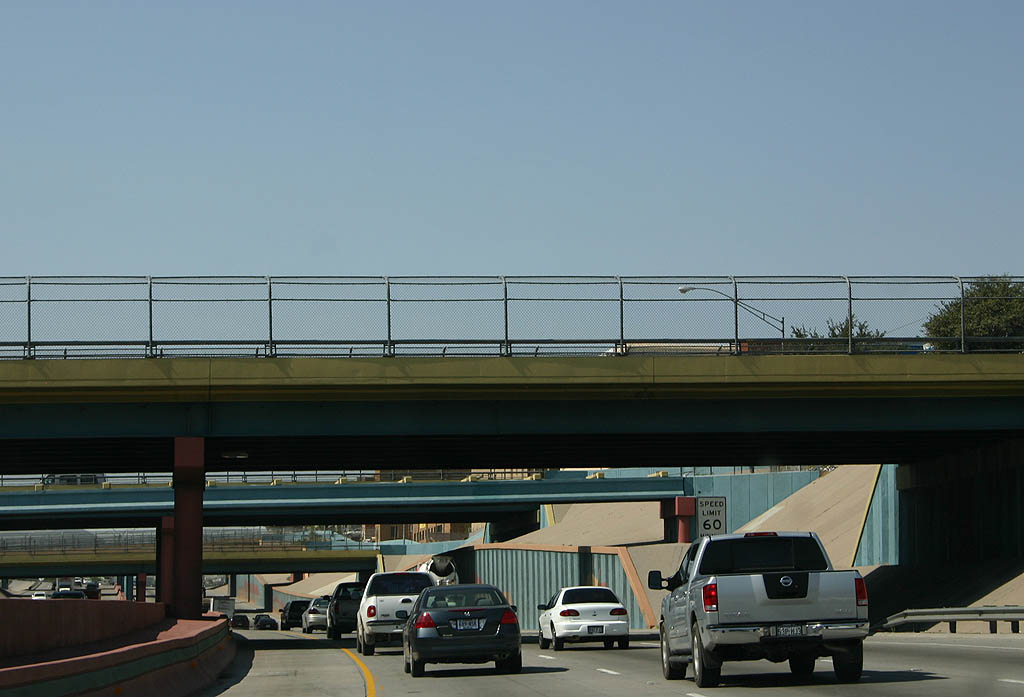
Through southeast El Paso County, IH 10 stays along the mesa rising east of the Rio Grande Valley. FM 3380, a 4.50 mile highway southwest to the Tornillo/Guadalupe International Bridge to Mexico, connects with the freeway at Exit 55.
09/28/06
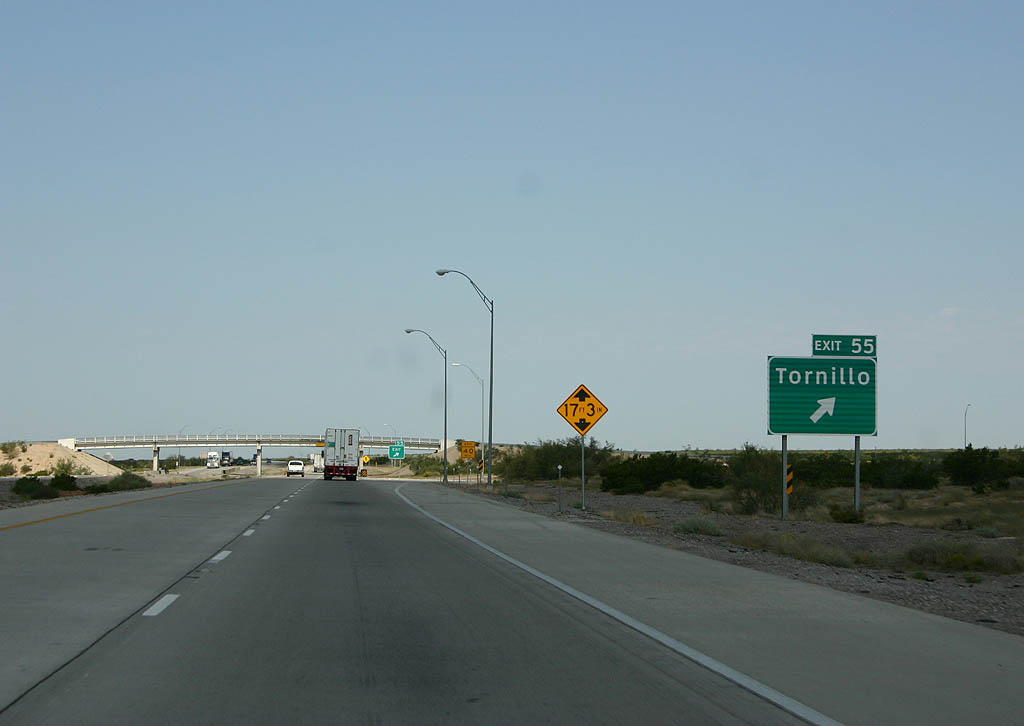
Tornillo is a community of around 1,500 located along SH 20 (old U.S. 80) and the Union Pacific Railroad at O.T. Smith Road. FM 3380, designated from IH 10 to SH 20 in 1994 and extended west to the port of entry for the Rio Grande bridge in 2012, byasses the town to the north.
09/28/06
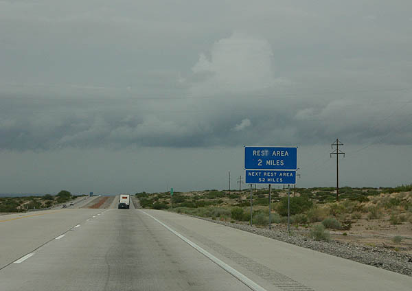
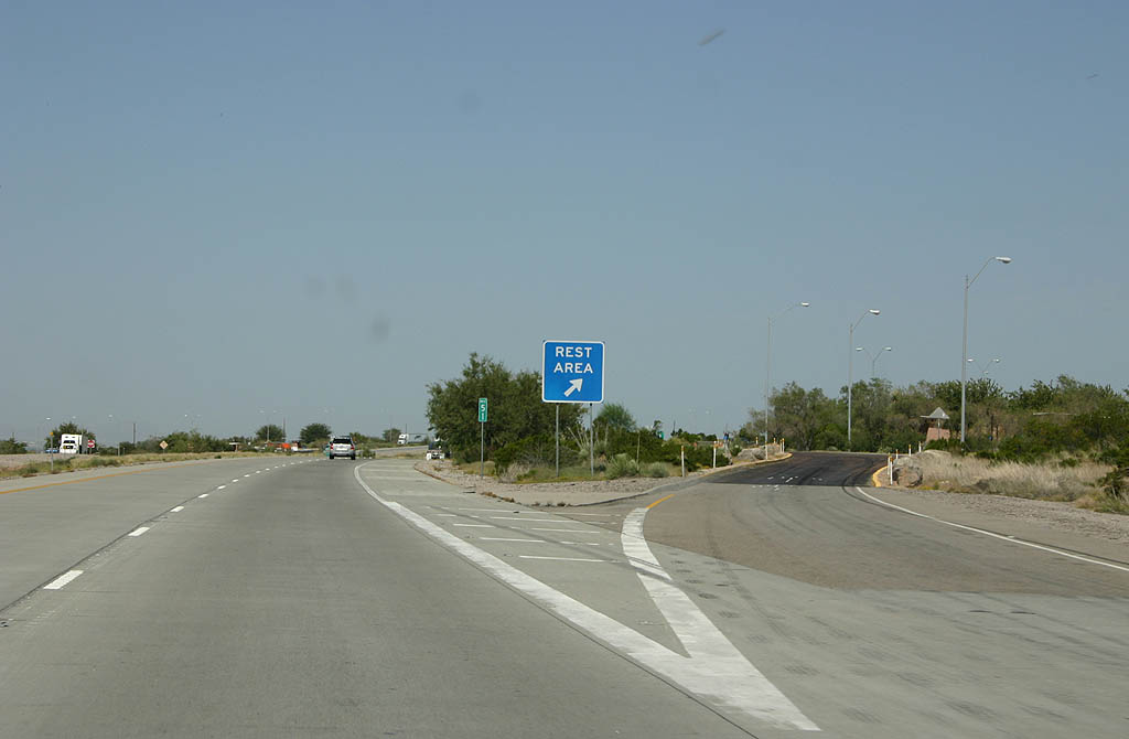
The El Paso County Rest Area ahead of mile marker 51 is the final rest area along IH 10 in Texas. The subsequent rest area is the Anthony Visitor Information Center just across the New Mexico state line.
07/31/06
09/28/06
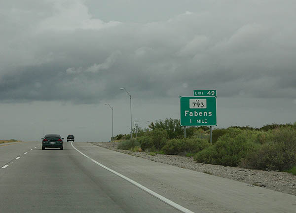
FM 793 was designated in 1959 with the construction of IH 10 to link the freeway with Fabens.
07/31/06
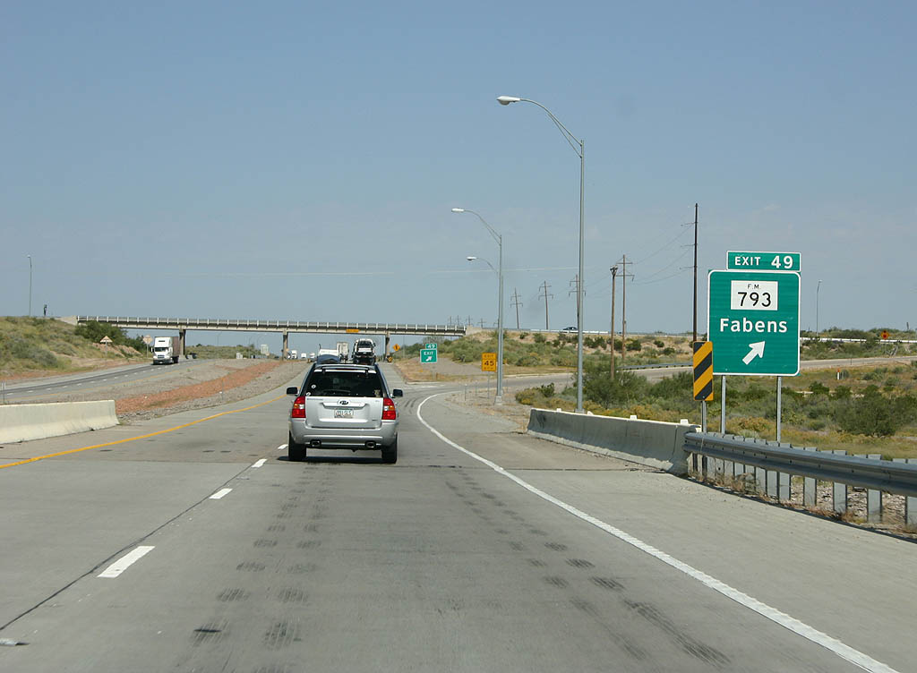
IH 10 enters the diamond interchange (Exit 49) with FM 793 (Fabens Road) juts across San Felipe Arroyo. FM 793 comprises a 1.90 mile route to FM 76 (Camp Street) in the Fabiens residential street grid.
09/28/06
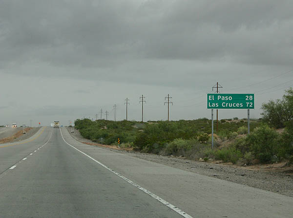
Downtown El Paso is still a 28 mile drive along IH 10 west from Fabens, Las Cruces, where IH 10 meets IH 25, lies 44 miles further north.
07/31/06
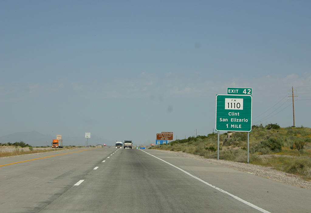
A long straight away ensues along IH 10 north from Fabens to Exit 42 with FM 1110 (Clint-San Elizario).
09/28/06
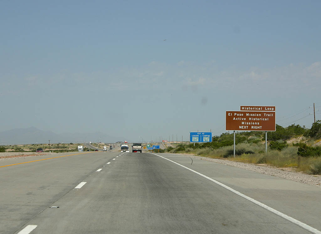
Exit 42 serves the south end of the El Paso Mission Loop.
09/28/06
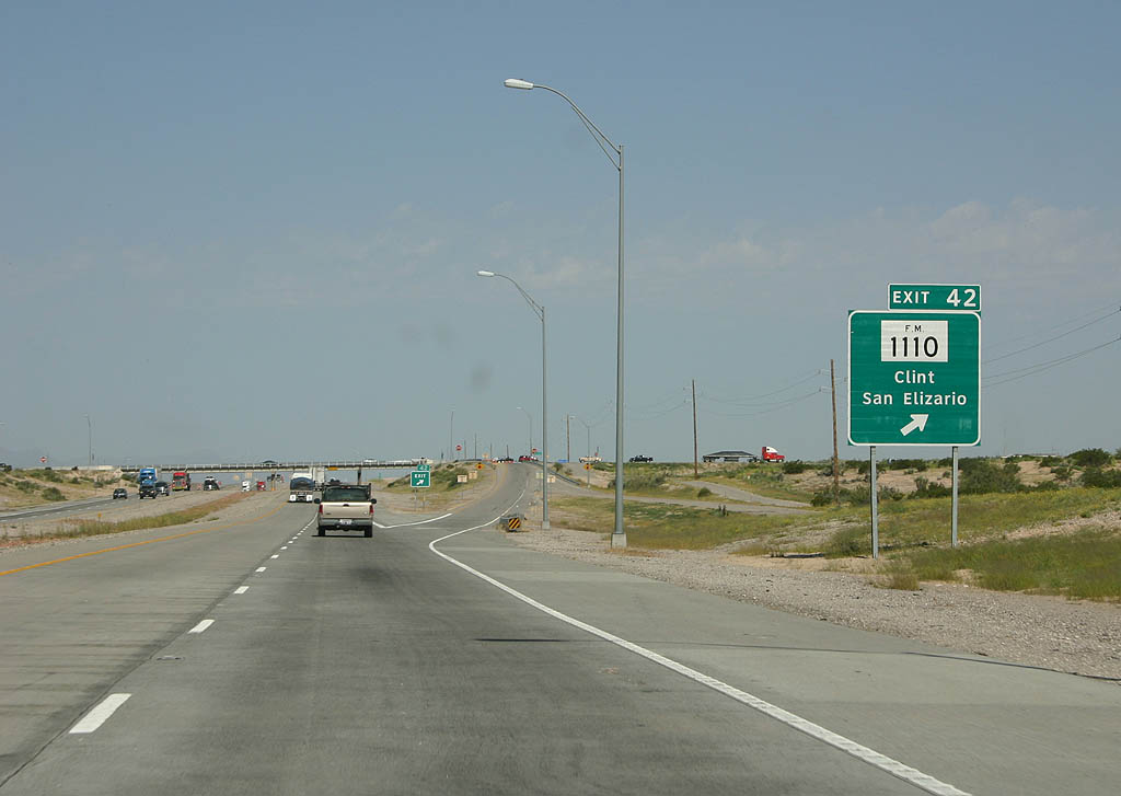
The 1.21 mile long east leg of FM 1110 links IH 10 and Darlington Road with FM 76 (N Loop Drive). The 3.68 mile west leg extends from FM 76 through the town of Clint to SH 20 and FM 258 (Socorro Road).
09/28/06
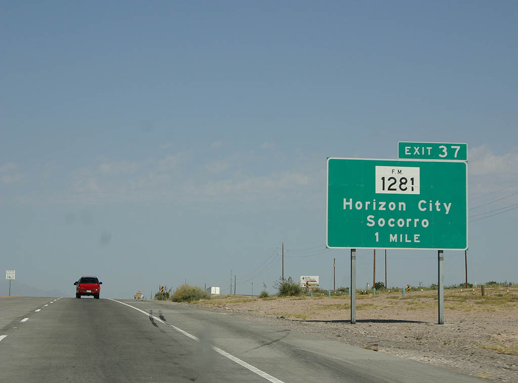
Progressing into southern reaches of the El Paso metropolitan area, IH 10 west crosses paths with FM 1281 (Horizon Boulevard) between the city of Socorro and the community of Sparks.
09/28/06
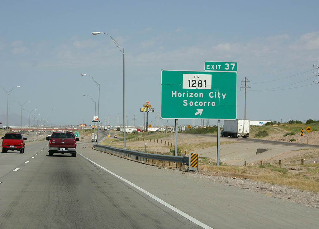
FM 1281 spurs 8.18 miles east from FM 76 in Socorro to Horizon City and Mark Jason Drive.
09/28/06
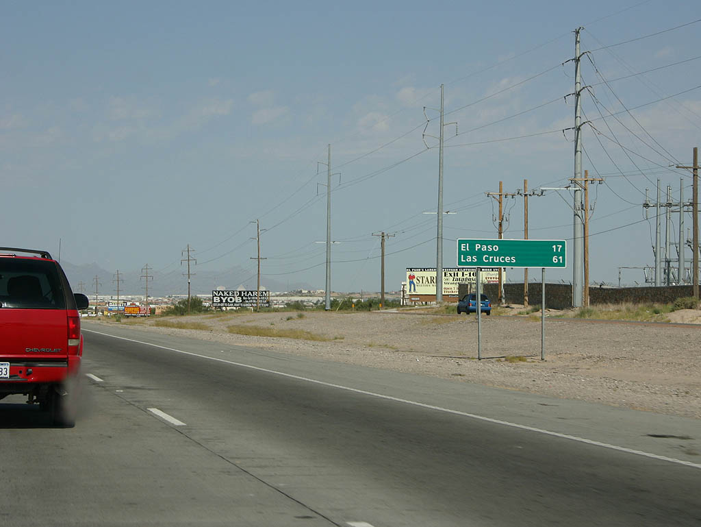
The last distance sign for El Paso along IH 10 stands 17 miles southeast of the city center.
09/28/06
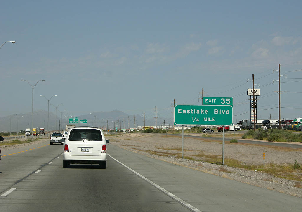
Eastlake Boulevard joins IH 10 with FM 76 (North Loop Drive) in Socorro and areas of suburban development to west of Horizon City.
09/28/06
Eastlake Boulevard was extended east to FM 1281 (Horizon Drive), forming an eight mile long arterial belt route around Horizon City. The succeeding exit along IH 10 west is with SL 375 and Americas Avenue in El Paso.
09/28/06
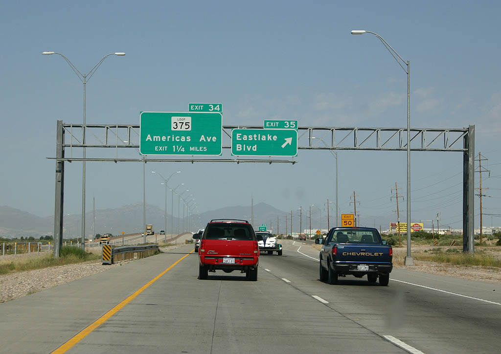
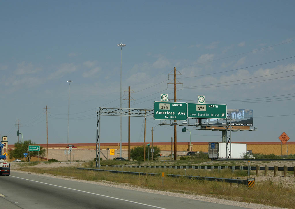
The Eastlake Drive entrance ramp expands IH 10 westbound to four lanes for the systems interchange (Exit 34) with SL 375. The high speed exchange between the two freeways was completed in Fall 2015.
09/28/06
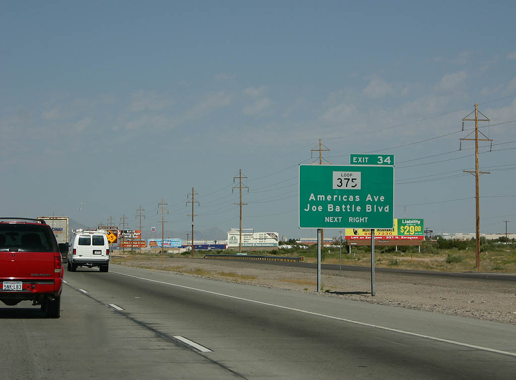
Americas Avenue to the south and Joe Battle Boulevard to the north comprise the frontage road system for the El Paso freeway loop. The original cloverleaf interchange joining IH 10 and SL 375 was retained to connect the respective service roads.
09/28/06
Loop 375 is a 49 mile long beltway around the city of El Paso. The freeway north leads to Fort Bliss Military Reservation and U.S. 54 (Patriot Freeway) at Northeast El Paso. Loop 375 west straddles the Rio Grande along the Cesar E. Chavez Border Highway to Downtown.
09/28/06
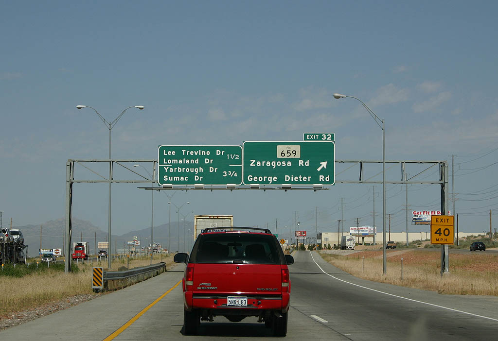
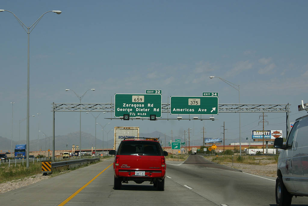
Including auxiliary lanes, IH 10 was expanded to a ten lane freeway between SL 375 and Exit 32 to FM 659 (Zaragoza Road / George Dieter Drive) by 2015. A flyover was constructed for FM 659, a 9.723 mile arterial northeast from FM 78 (N Loop Drive) at Ysleta in El Paso, to U.S. 62/180 west of Homestead Meadows South, by 2013
09/28/06
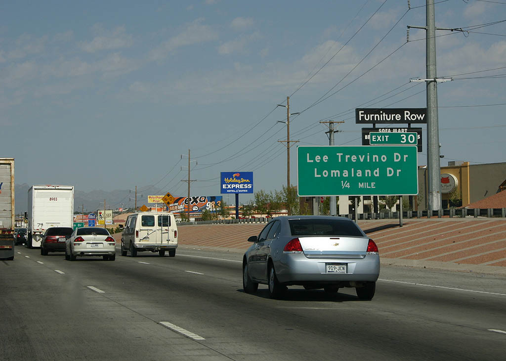
IH 10 plies through a densely developed area of industrial parks and retail complexes to Exit 30 for Lee Trevino Drive and Lomaland Drive.
09/28/06
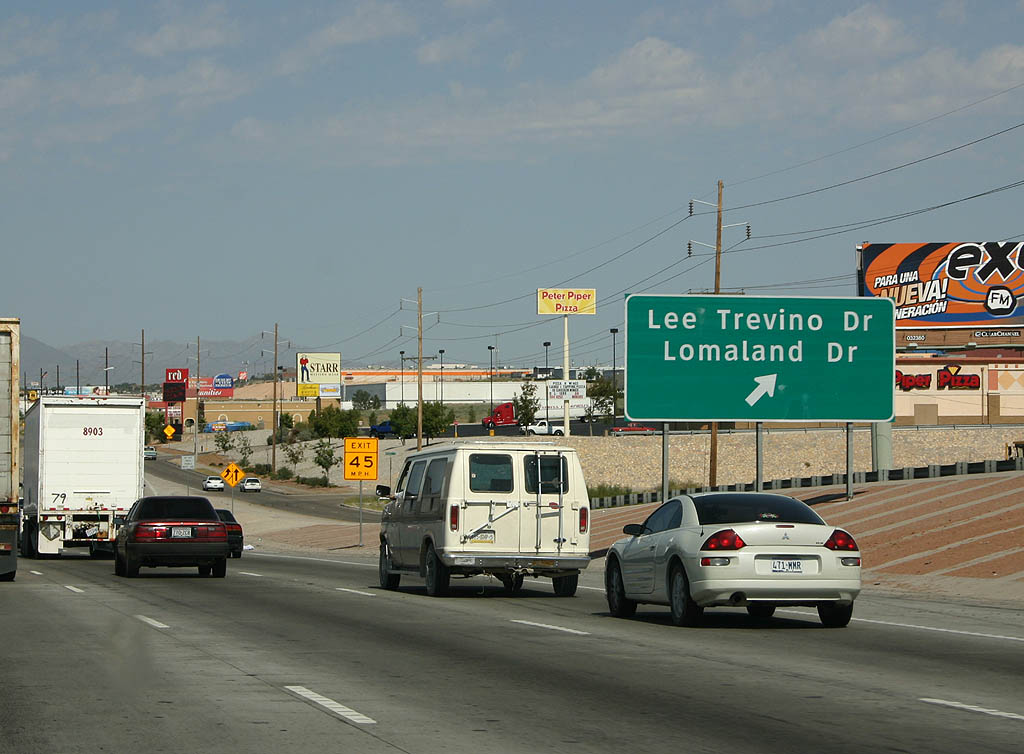
Lee Trevino Drive constitutes an arterial route south to SH 78 (N Loop Drive) at Loma Park and north to U.S. 62/180 (Montana Avenue) along the boundary of Fort Bliss. Lomaland Drive parallels to the west between the Mesa Vista and Vista Hills Park neighborhoods.
09/28/06
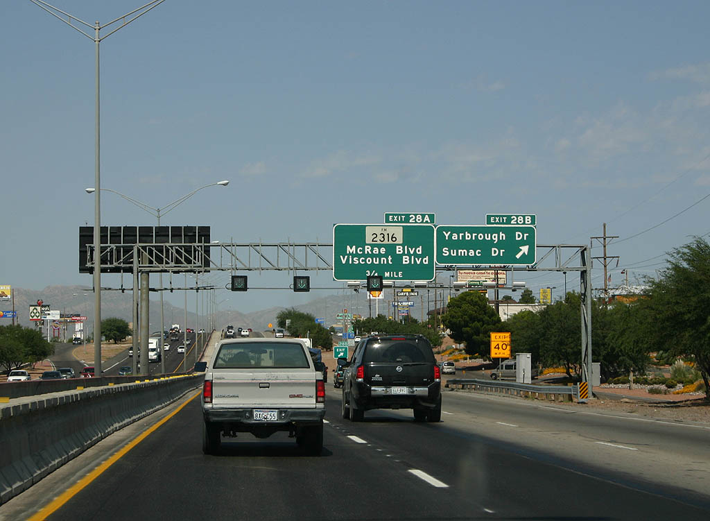
Exit 28B departs IH 10 west next for Yarborough Drive and Sumac Drive to the Travis White, Sageland and Mesa Vista neighborhoods.
09/28/06
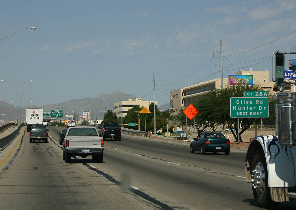
Exit 28A follows from IH 10 west at the Sumac Drive overpass to Giles Road and FM 2316 (McRae Boulevard) at the Stonehaven and Ranchland East neighborhoods.
09/28/06
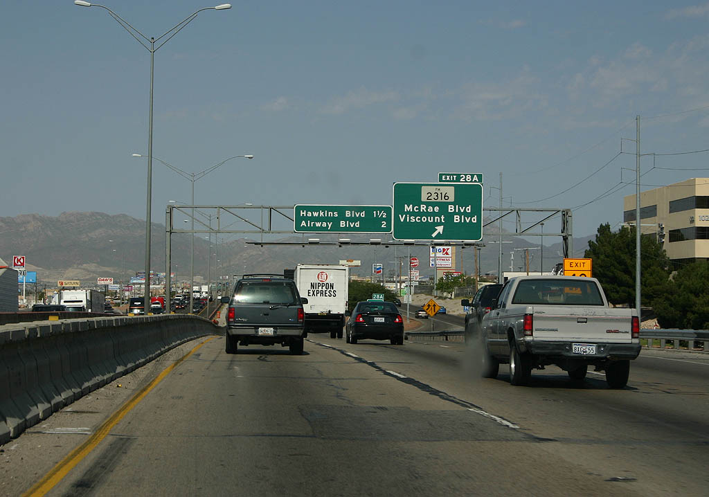
FM 2316 runs 2.51 miles between the Travis White, Montclair and Eastwood Heights neighborhoods north from IH 10 to U.S. 62/180 (Montana Avenue). Hunter Drive encircles retail areas alongside IH 10 and the Cielo Vista community.
09/28/06
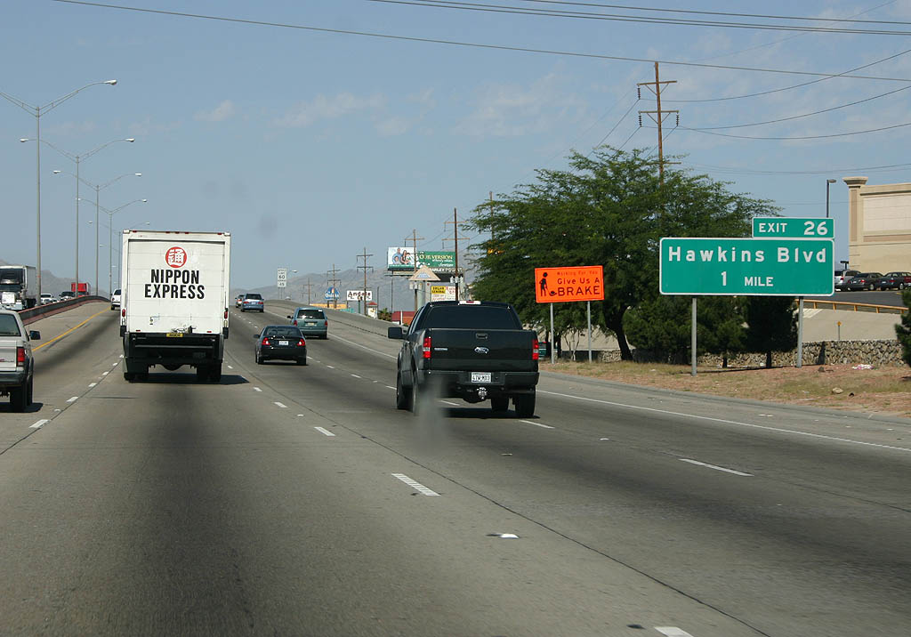
Hawkins Boulevard joins IH 10 with Ceilo Vista Mall and retail areas to the north and a large warehouse district to the south at forthcoming Exit 26.
09/28/06
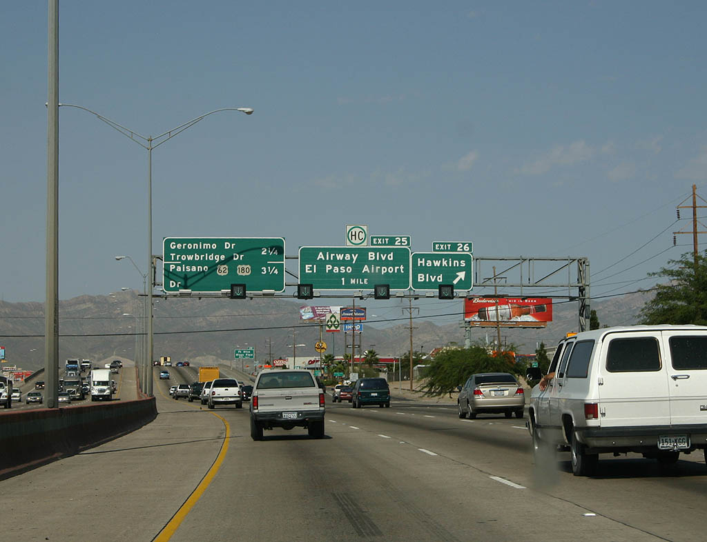
Continuing past Hawkins Boulevard and Cielo Vista Mall, IH 10 meets Airway Boulevard north to El Paso International Airport (ELP).
09/28/06
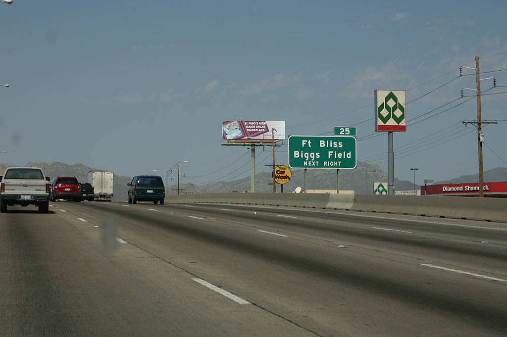
Airway Boulevard north connects with Airport Road north to Biggs Army Air Field and the entrance to Fort Bliss via Buffalo Soldier Road
09/28/06
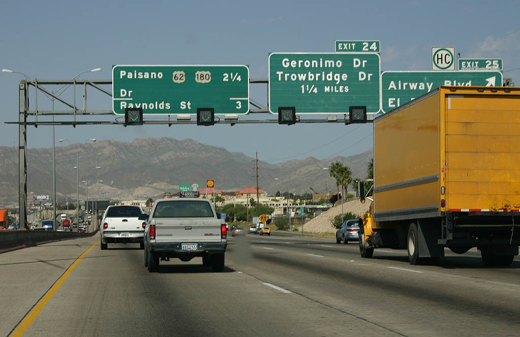
Exit 25 departs IH 10 west, 1.5 miles ahead of Geronimo Drive to Bassett Place mall. Airway Boulevard runs north between the Normandy Park and Cielo Vista neighborhoods to U.S. 62/180 (Montana Avenue).
09/28/06
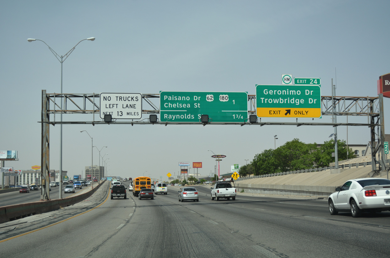
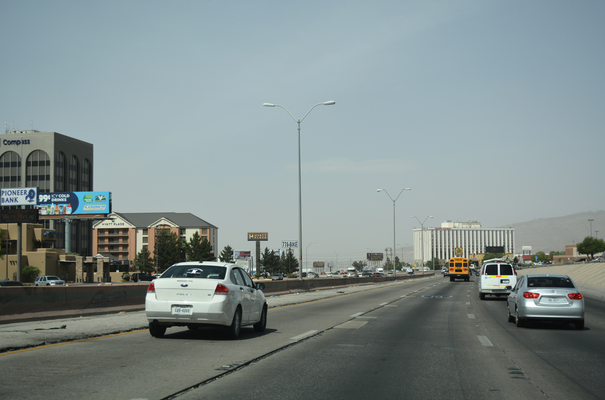
IH 10 navigates through a series of S-curves west to Exit 24 for Geronimo Drive and Trowbridge Drive to the Tejas and San Juan neighborhoods. Succeeding ramps depart for U.S. 62/180 (Paisano Drive) and Raynolds Street to Lorreto Place.
04/25/17
Traffic counts recorded by TxDOT in 2017 range from 192,250 vehicles per day (vpd) to 195,058 vpd along IH 10 west ahead of IH 110 and U.S. 54 (Patriot Freeway) range.
04/25/17
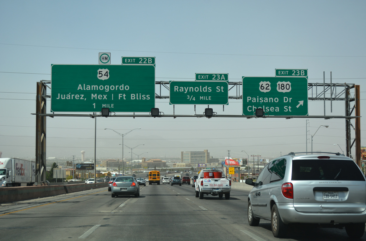
U.S. 62 and U.S. 180 west converge with IH 10 west from Paisano Drive at Exit 23B. The two highways overlap 258 miles northeast from El Paso to Seminole via Carlsbad and Hobbs, New Mexico. Locally U.S. 62/180 follow Montana Avenue, a commercial arterial east between El Paso International Airport (ELP) and the Cielo Vista community.
04/25/17
 West
West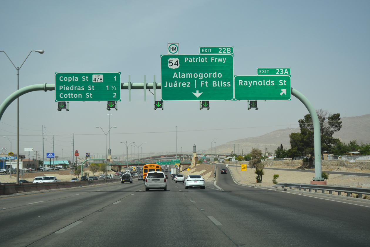
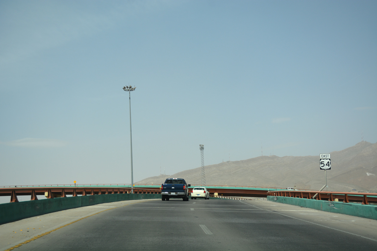
Exit 23A rises onto adjacent Gateway Boulevard to Raynolds Street north to Austin Terrace and south to SH 20 (Alameda Avenue) and U.S. 62 (Paisano Drive). IH 110 and U.S. 54 (Patriot Freeway) connect with IH 10 next from north from the Bridge of the Americas and SL 375 along the Rio Grande.
04/25/17

Exit 22B separates from IH 10/U.S. 180 westbound at Raynolds Street onto flyover ramps for U.S. 54 (Patriot Freeway) north to Fort Bliss and IH 110 south to Chamizal National Memorial Park and Juárez, Mexico.
04/25/17
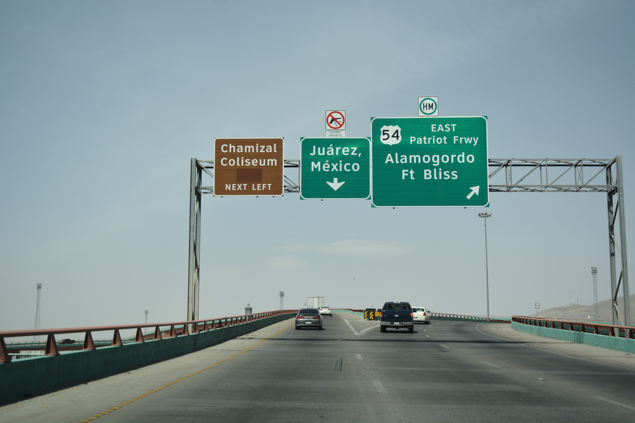
Signs for Exit 22B on IH 10 west do not acknowledge IH 110 south. The 0.9 mile freeway spur leads directly to the Bridge of the Americas into Mexico, but also provides local access to U.S. 62 (Paisano Drive) at Chamizal National Memorial. The exchange with U.S. 62 however will be removed during the I-10 Connect Project.
04/25/17
U.S. 54 follows the Patriot Freeway north to the Sandstone Ranch community in northern El Paso en route to Alamogordo, New Mexico. There is no access to U.S. 54 south to SL 375 (Cesar E. Chavez Border Highway), but the I-10 Connect Project will add that movement during an overhaul of the systems interchange with IH 110, U.S. 54 and IH 10.
04/25/17
Proceeding west through the multi level exchange with U.S. 54 (Patriot Freeway) and IH 110 south, IH 10/U.S. 180 advance between the Five Points East and Durazno neighborhoods. Exit 22A joins the freeway with SL 478 (Copia Street).
09/28/06
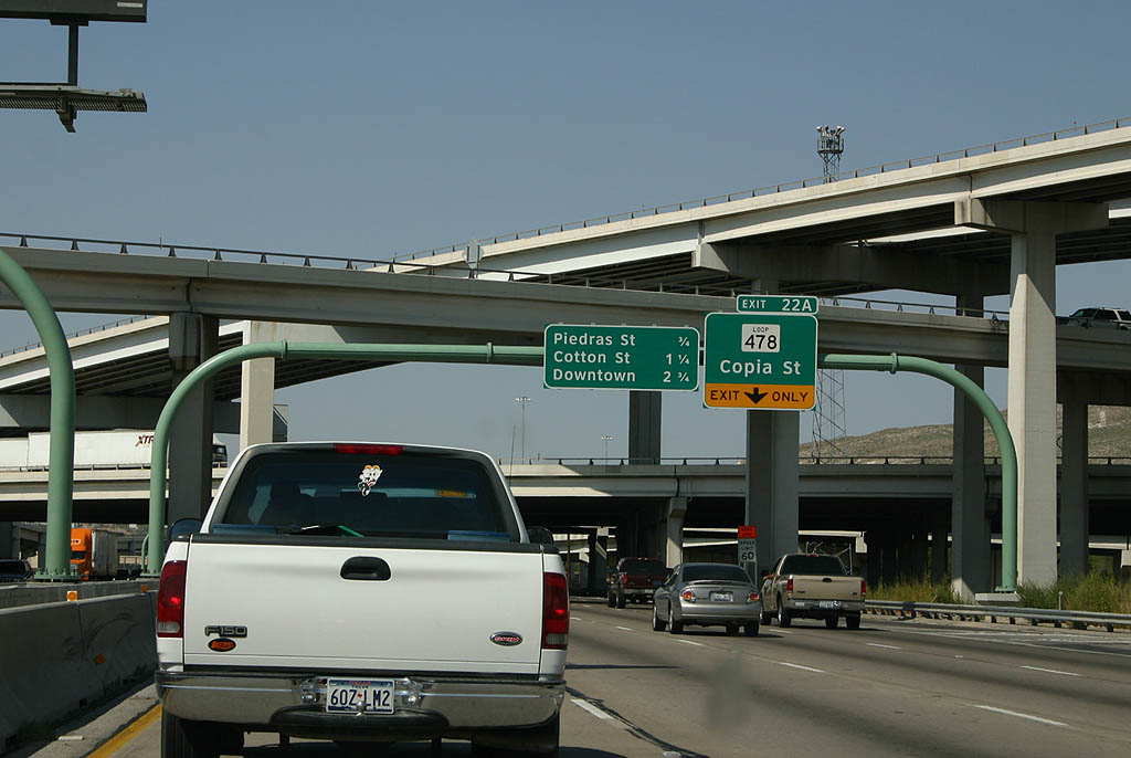
SL 478 stems 1.21 miles north from U.S. 62 at the three level interchange with IH 110 to Pershing Drive. Pershing Drive angles the state highway through the Pershing/Government Hill community to Dyer Street. SL 478 concludes 5.82 miles to the north at Sunrise Acres, where U.S. 54 Business splits from U.S. 54.
09/28/06
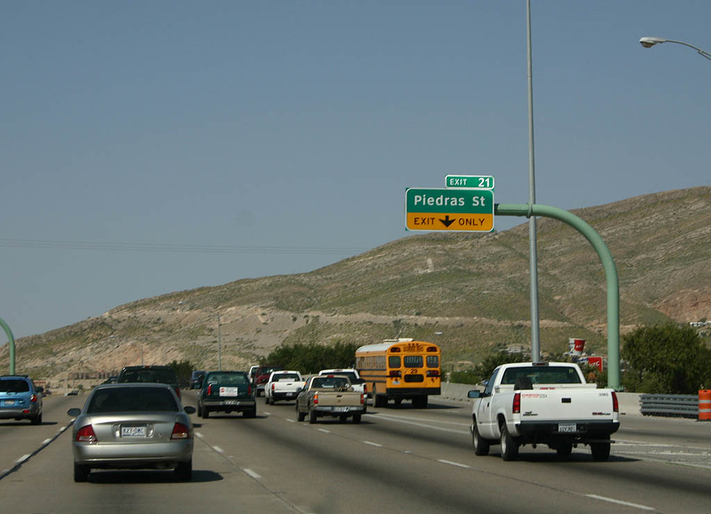
Exit 21 departs IH 10/U.S. 180 west immediately after the SL 478 (Copia Street) overpass to Piedras Street.
09/28/06
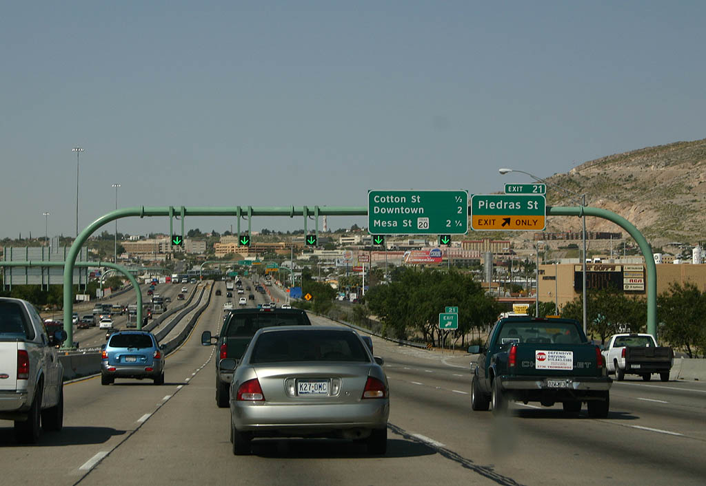
Piedras Street heads south from Exit 21 to U.S. 62 between the Eucalyptus and Chamizal neighborhoods and north to Five Points and Manhattan Heights.
09/28/06
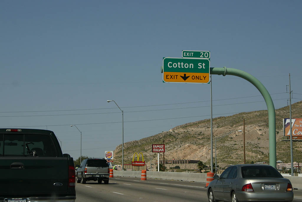
Matching the course of the Rio Grande to the south, IH 10 turns southwesterly toward Downtown El Paso, meeting Cotton Street next at Exit 20.
09/28/06
Cotton Street joins IH 10/U.S. 180 with Golden Hill and Highland Park to the north and the Magoffin and El Segundo Barrio neighborhoods to the south.
01/14/06
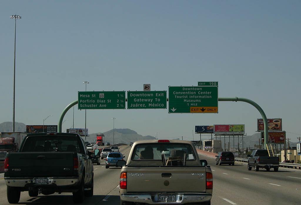
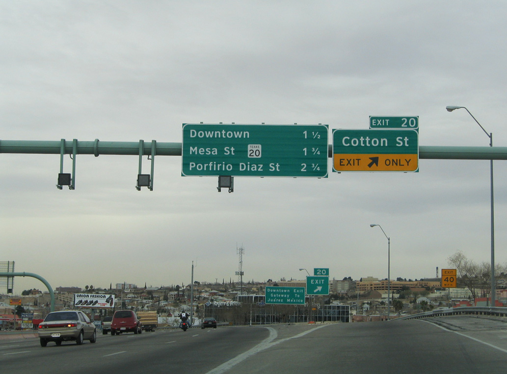
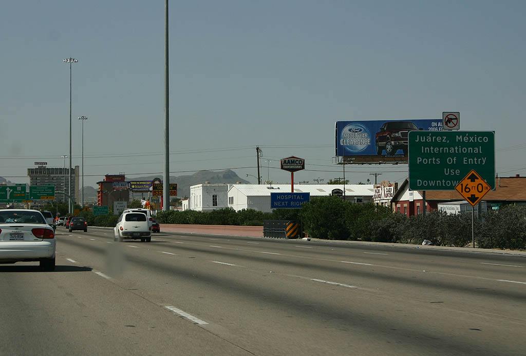
Running alongside a Union Pacific Railroad yard, IH 10/U.S. 180 continue toward Downtown El Paso and Exit 19B for Missouri Avenue.
09/28/06
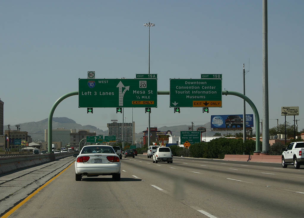
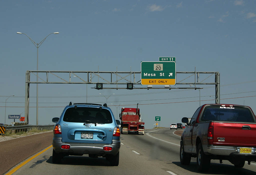
Two lanes separate from IH 10 west at Exit 19A for SH 20 (Mesa Street) and Downtown El Paso. The freeway ended temporary at SH 20 between 1961 and 1969.
09/28/06
U.S. 62/85 combine south along Stanton Street from Paisano Drive to the Good Neighbor Bridge, the main border crossing into Juárez, Mexico.
09/28/06
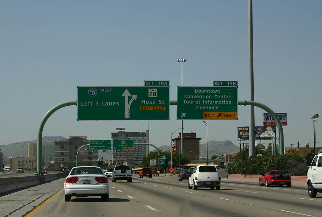
Missouri Avenue parallels the north side of IH 10 to Exit 19B, where the freeway shifts one block over to Wyoming Avenue. Kansas Street leads motorists south into Downtown El Paso.
09/28/06
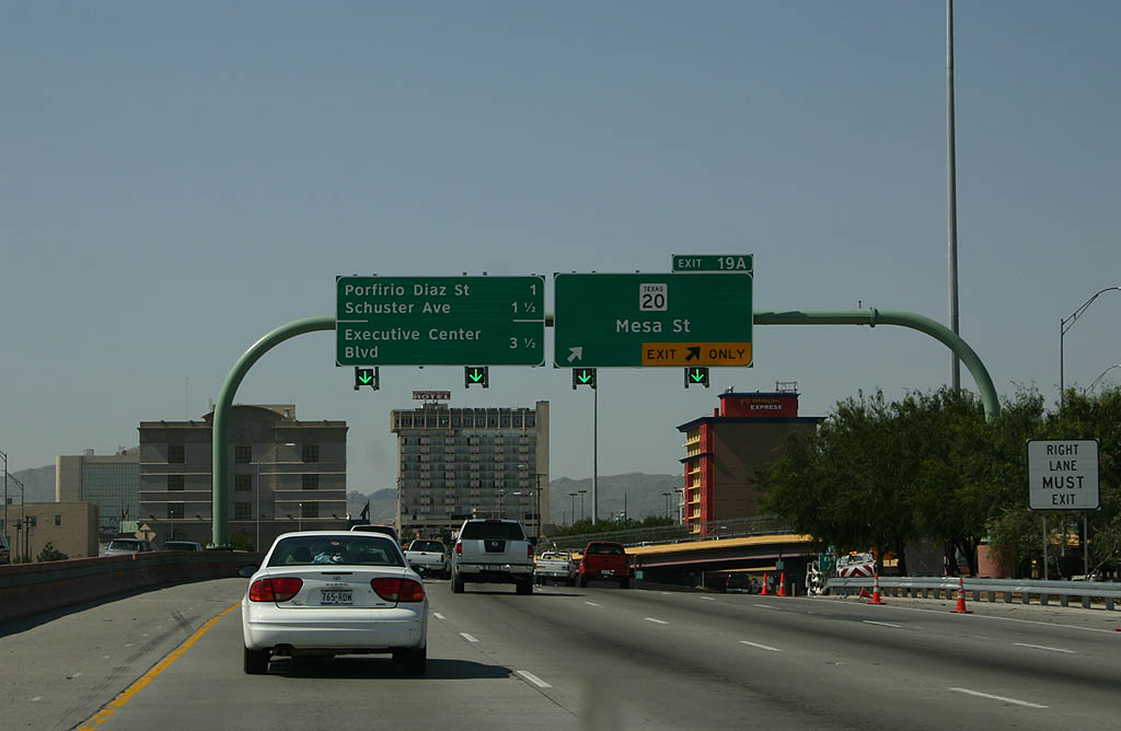
SH 20 turns north from Texas Avenue onto Mesa Street two blocks beyond Exit 19A to Yandell Drive. The state highway continues north from Downtown to the University of Texas at El Paso and the Mission Hills community east of IH 10.
09/28/06
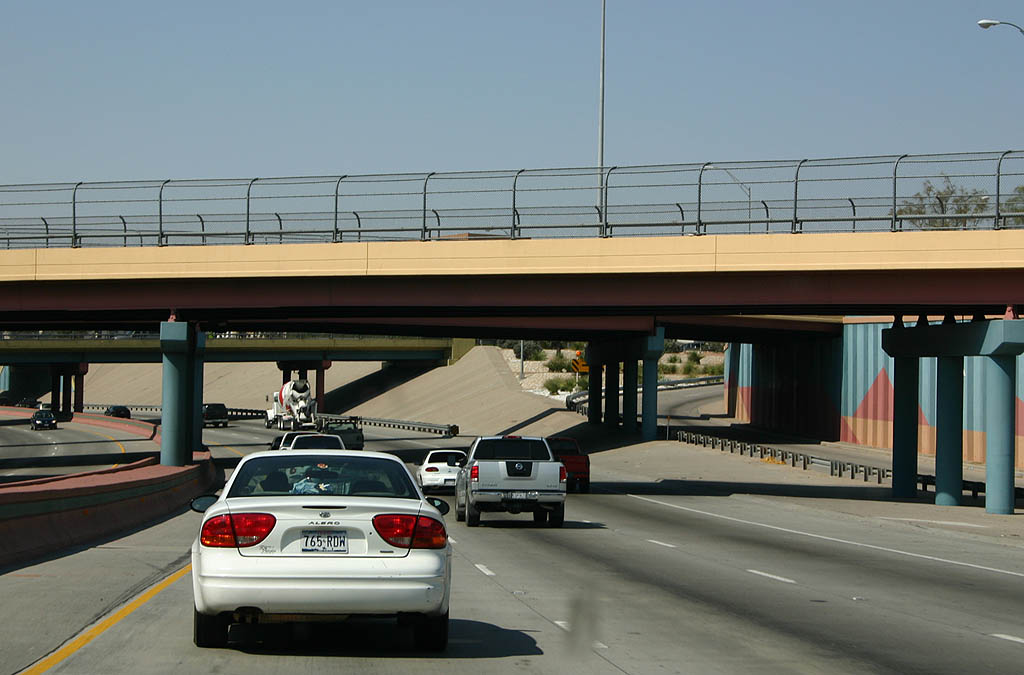
The Downtown El Paso section of IH 10 was completed in 1969, bridging the gap between the older sections completed east and west. Overpasses along the below grade freeway are painted in Southwestern colors.
09/28/06
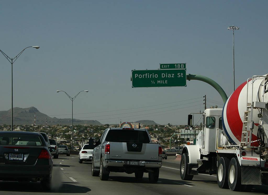
Making a sweeping turn around the Sunset Heights neighborhood, IH 10 advances one quarter mile to Exit 18B with Porfirio Diaz Street. Reflecting how close the two border cities are, the houses in the distance are located in Juárez, Mexico.
09/28/06
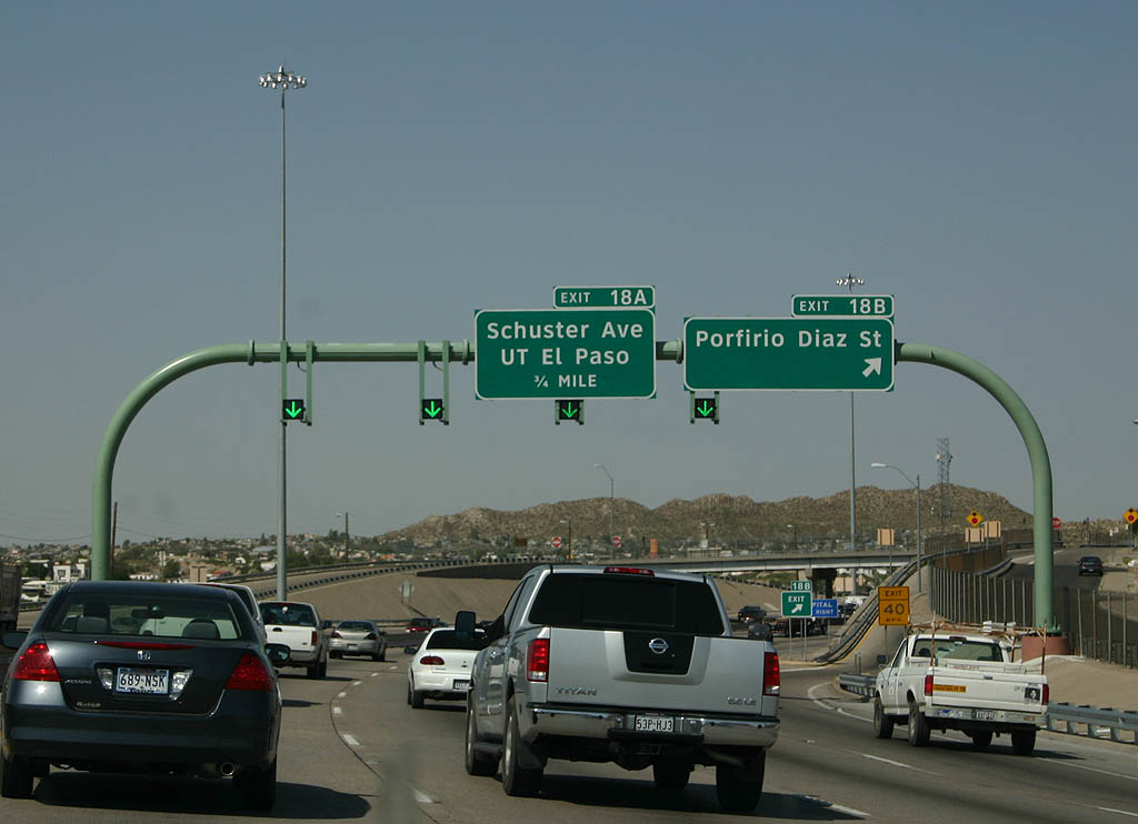
Exit 18B parts ways with IH 10/U.S. 180 west for Porfirio Diaz Street north to Sunset Heights and the University of Texas at El Paso (UTEP).
09/28/06

Exit 18A leaves the freeway for Schuster Avenue and University Avenue to UTEP and Sun Bowl Stadium. Spanning IH 10/U.S. 180, the 0.261 mile route of SS 1966 links Schuster Avenue with U.S. 85 (CanAm Highway).
09/28/06
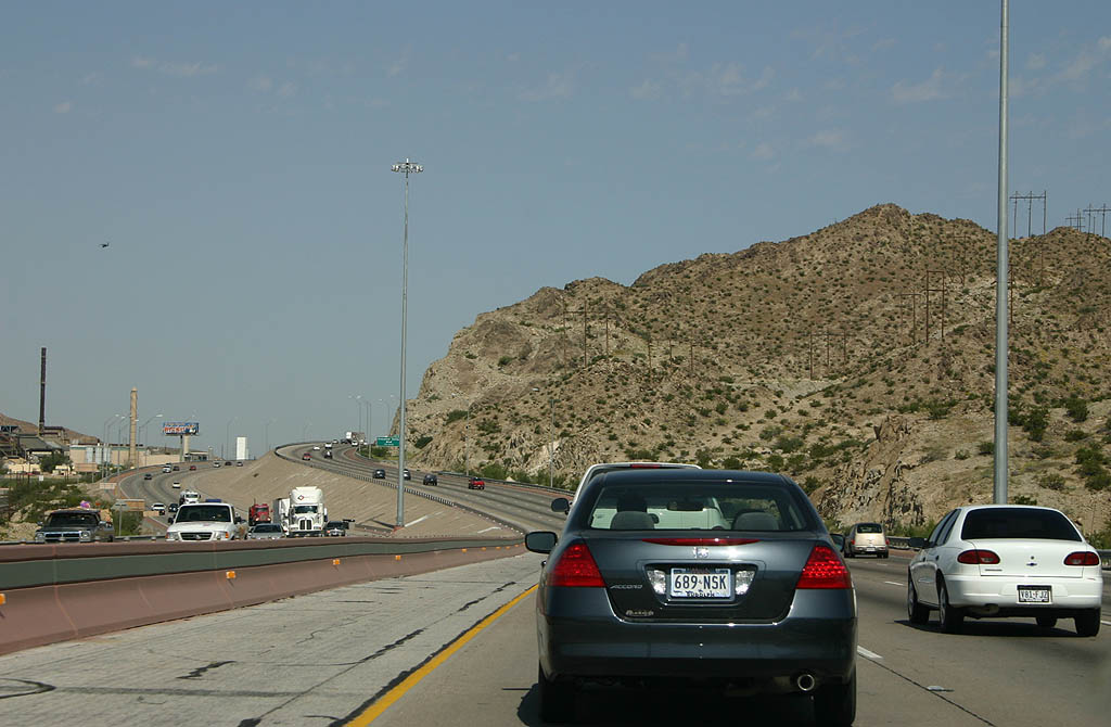
Interstate 10 winds along the hills above the Rio Grande. U.S. 85 lies closer to the river, and is somewhat flood-prone. The idled Asarco copper smelter stacks were located to the immediate west here. The were torn down in 2013 to make way for the Loop 375 Border Highway West Extension Project, a four lane toll road northwest from Downtown to U.S. 85 at Doniphan Drive and IH 10.
09/28/06
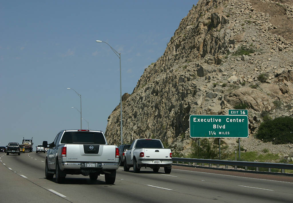
A diamond interchange (Exit 16) lies 1.25 miles ahead with Executive Center Boulevard.
09/28/06
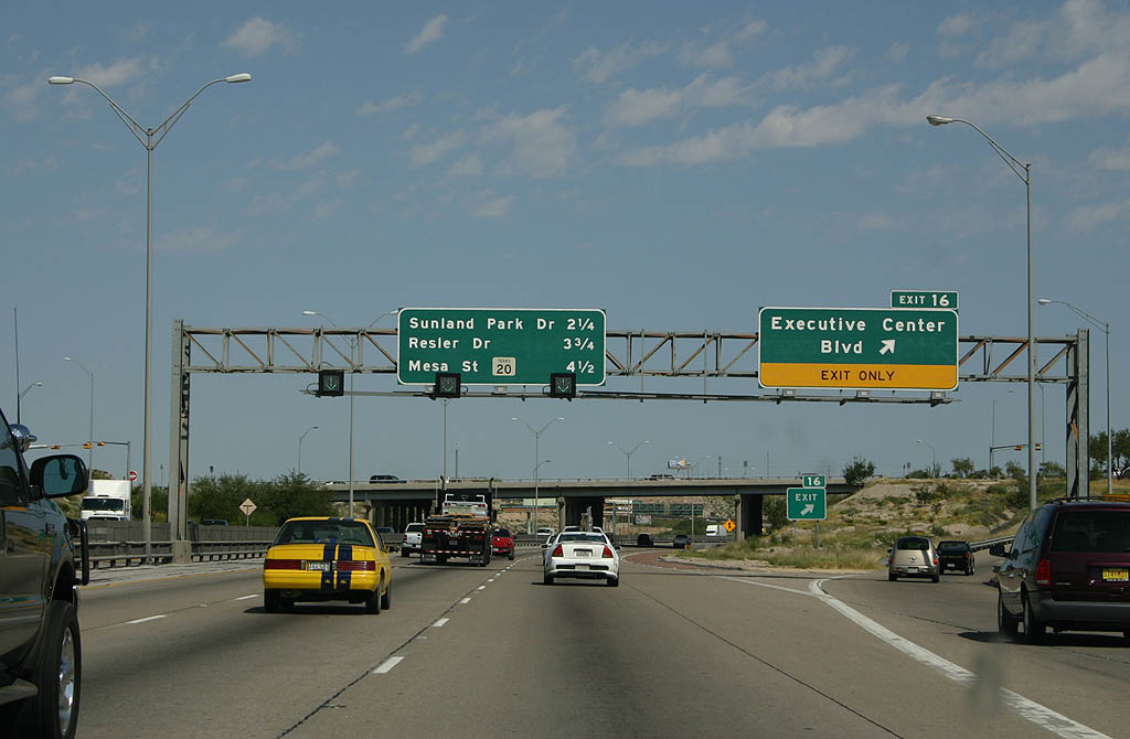
Executive Center Drive constitutes a 1.09 mile arterial joining IH 10/U.S. 180 with U.S. 85 by the La Calavera neighborhood and SH 20 at Ridgecrest.
09/28/06
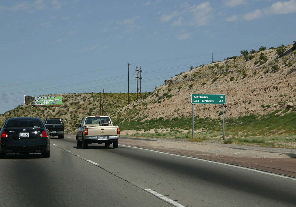
Nearly all of the 16 miles separating IH 10 from Anthony, a town straddling the New Mexico state line, fall within the city of El Paso.
09/28/06
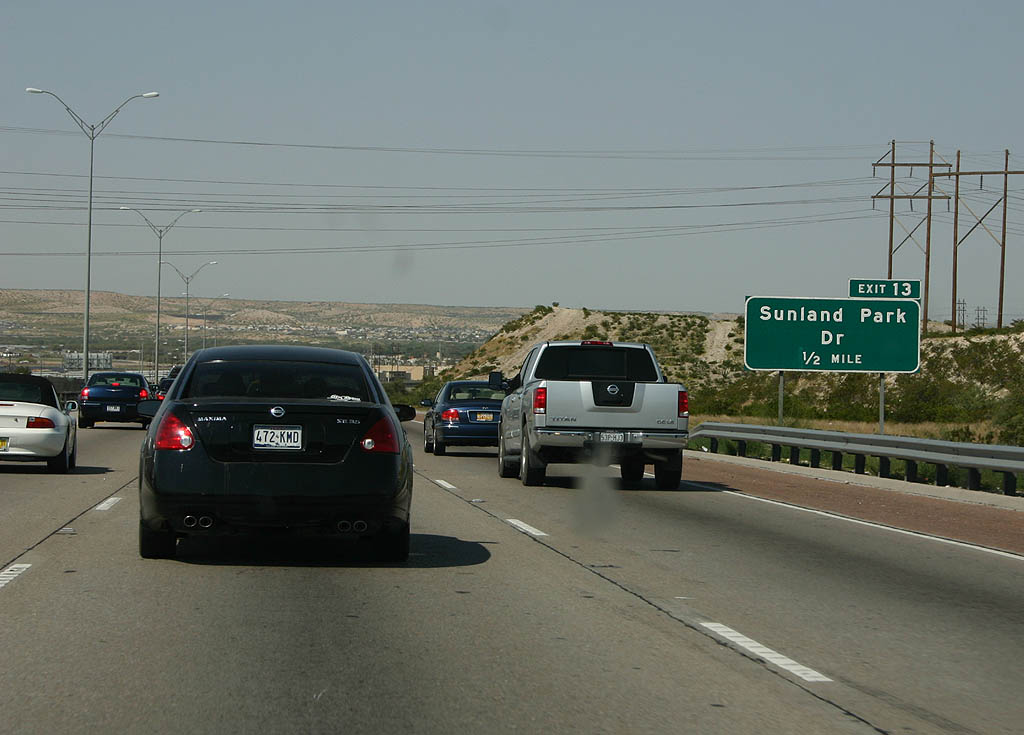
The Loop 375 Border Highway West Extension ties into IH 10 ahead of Exit 13 for Sunland Park Drive and Resler Drive.
09/28/06
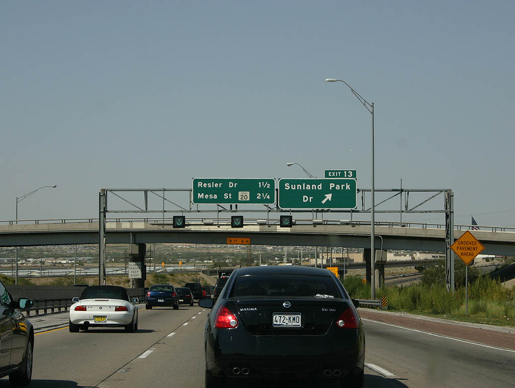
Sunland Park is a major interchange, serving the Sunland Park Racetrack & Casino and Sunland Park Mall, one of the three regional shopping malls in El Paso. U.S. 85 merges onto IH 10/U.S. 180 west, leaving the former alignment with U.S. 80 along Doniphan Drive to Riverbend and Lindbergh in El Paso.
09/28/06
West  North
North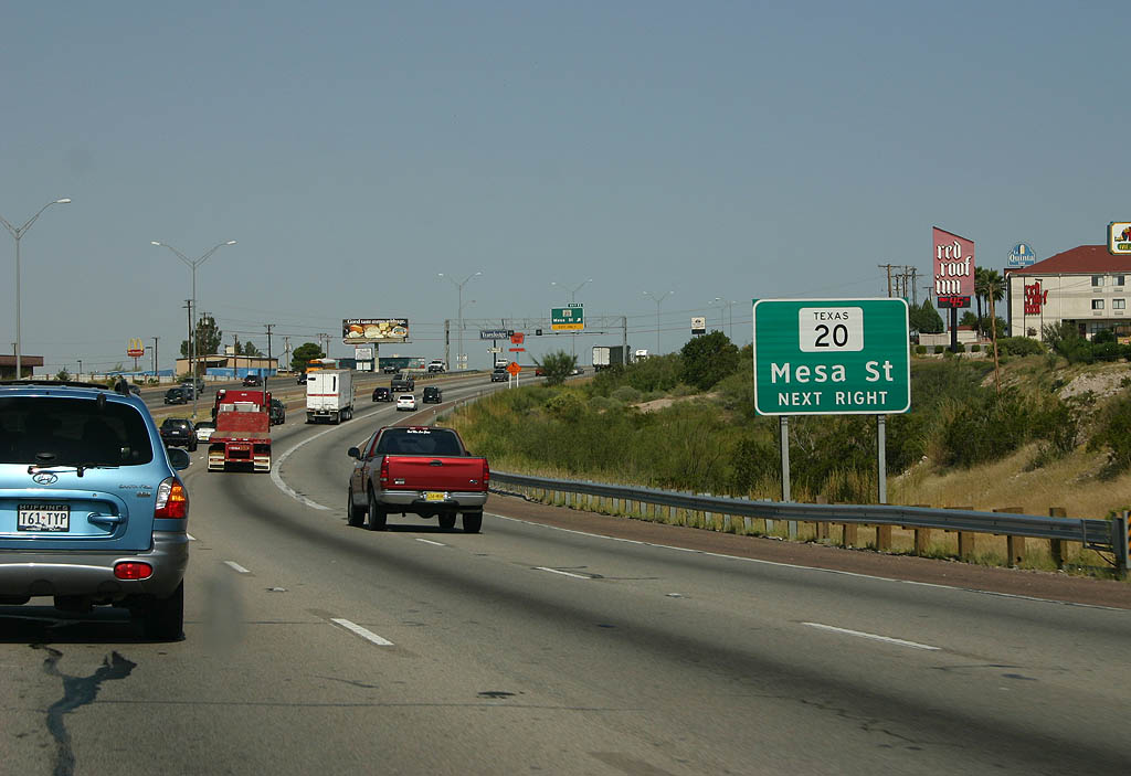
SH 20 (Mesa Street) crosses IH 10 again at forthcoming Exit 11 between the Remco and Roberts neighborhoods.
09/28/06
SH 20 represents the 1939 alignment of U.S. 80 through northwest El Paso. The state highway shifts closer to the Rio Grande to the west, following Doniphan Drive north through the Mesilla Valley.
09/28/06
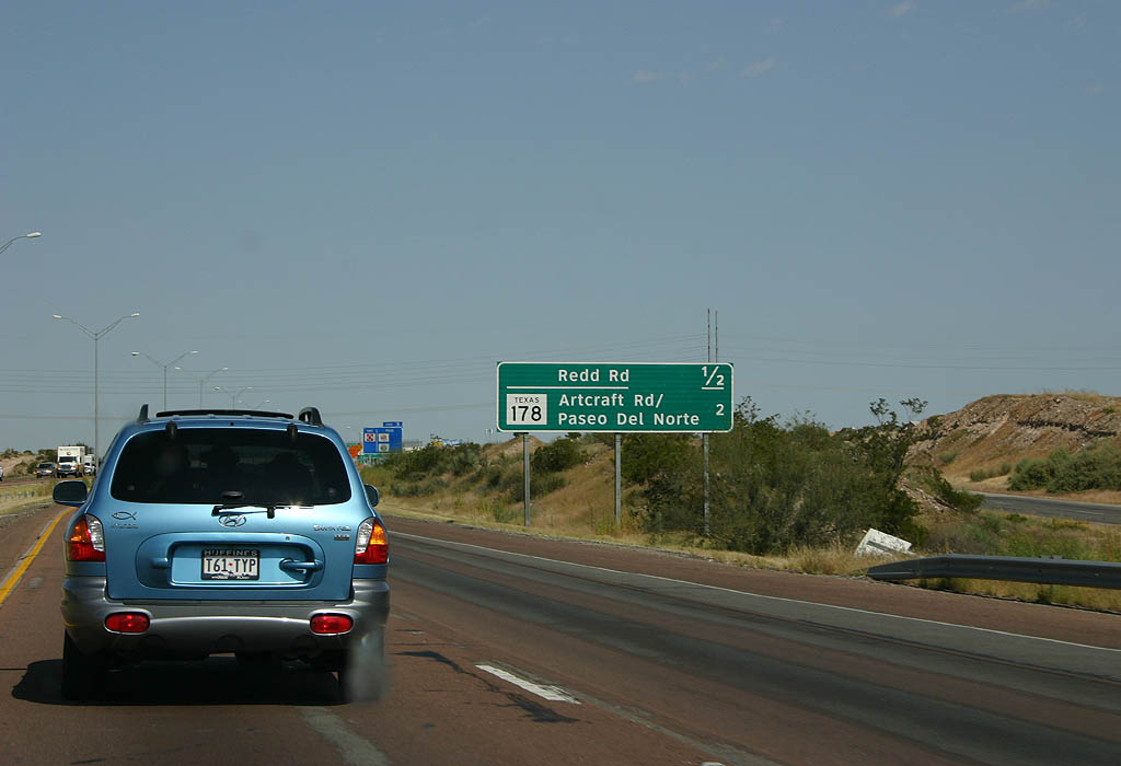
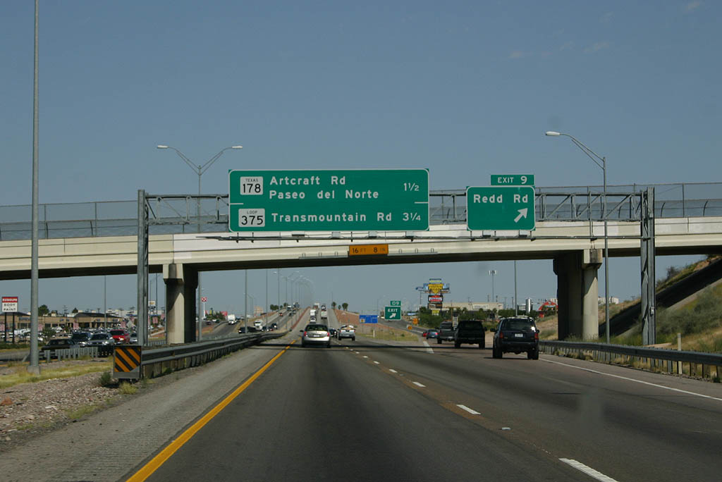
IH 10/U.S. 85-180 head north a half mile to Exit 9 for Redd Road, an arterial west to the Ridge and Lindbergh neighborhoods and east to Lakehurst and High Ridge,
09/28/06
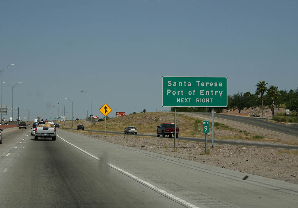
The Santa Teresa Port of Entry via Exit 8, SH 178 and NM 136 is the last border crossing between Texas and Mexico.
09/28/06
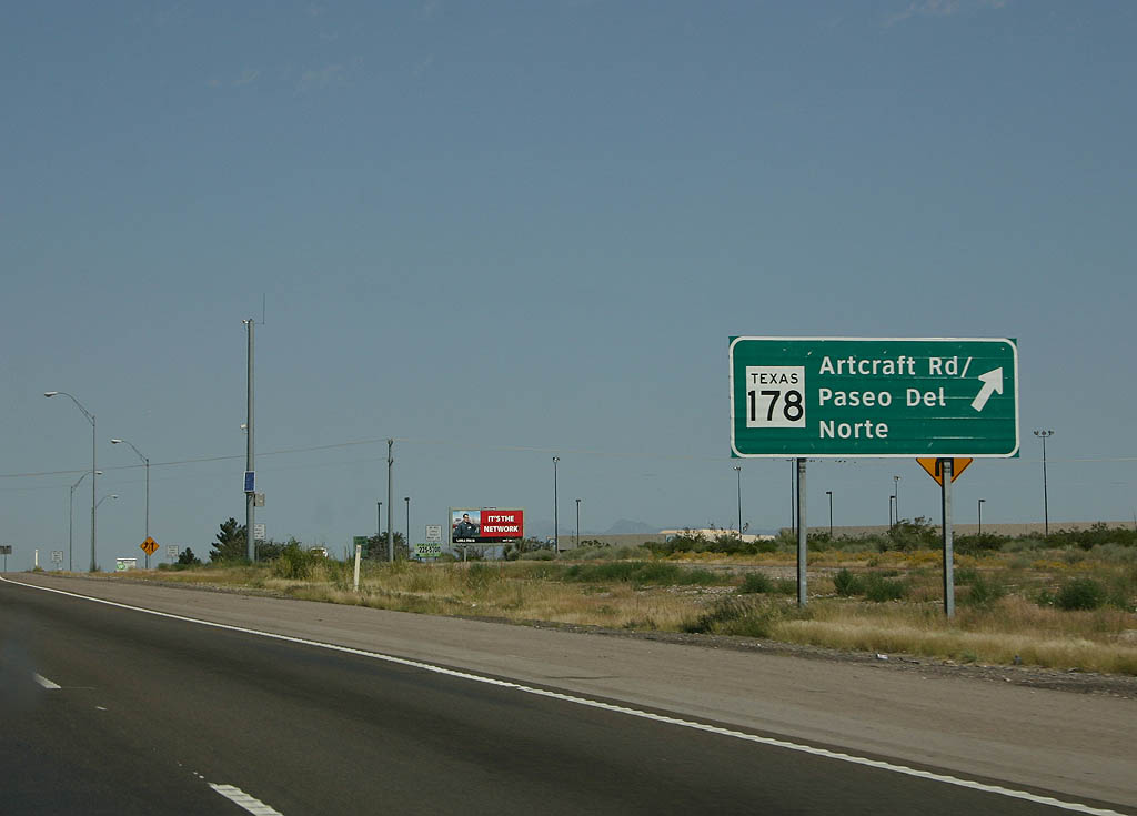
SH 178 lines Artcraft Road west 3.04 miles from Paseo del Norte and a diamond interchange (Exit 8) with IH 10/U.S. 85-185. NM 136 continues the four lane highway southwest 9.16 miles to the Mexican border at Chihuahua.
09/28/06
Staying within the El Paso city limits, IH 10/U.S. 180 west & U.S. 85 north travel one mile north to SL 375 (Transmountain Road) and SS 16. The northwest end of SL 375 links the freeway with SH 20 (Doniphan Drive) at the community of Canutillo.
09/28/06
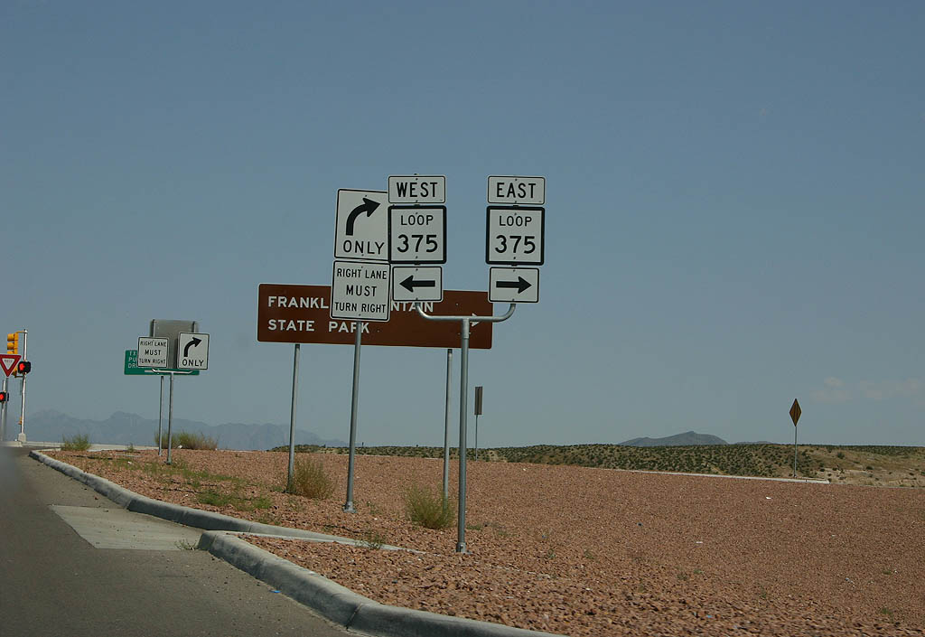
The Woodrow Bean Trans-Mountain Highway crosses the Franklin Mountains, which bisect El Paso, through Franklin Mountains State Park east to Fort Bliss. When constructed in 1967-70, Loop 375 was TXDot's largest excavation project.
09/28/06
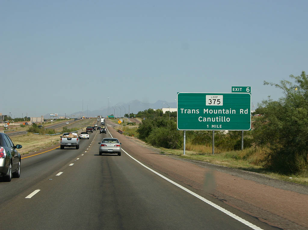
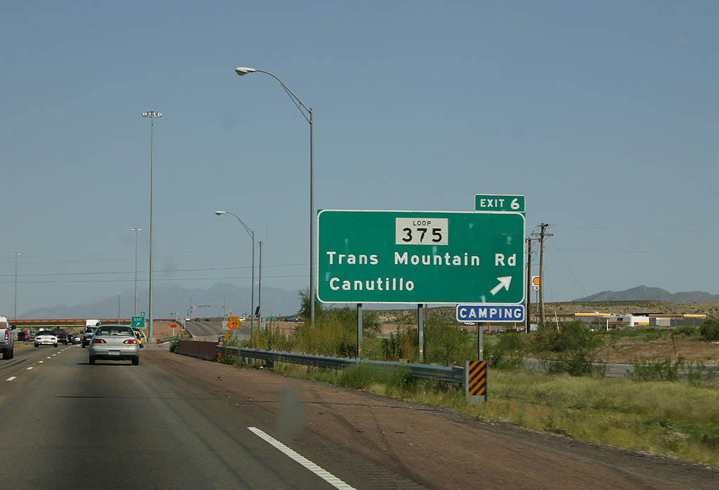
A diamond interchange connects IH 10/U.S. 85-180 with SL 375 (Trans Mountain Road) and SS 16 south at Exit 6. High speed flyovers were built from IH 10 west to SL 375 east and from the loop west to IH 10 east during the Trans Mountain West Project underway from 2012 to June 2014.
09/28/06
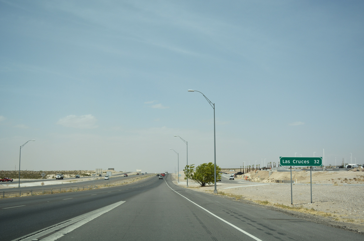
Interstate 10 travels 32 miles northwest from Loop 375 to Las Cruces, New Mexico.
04/25/17
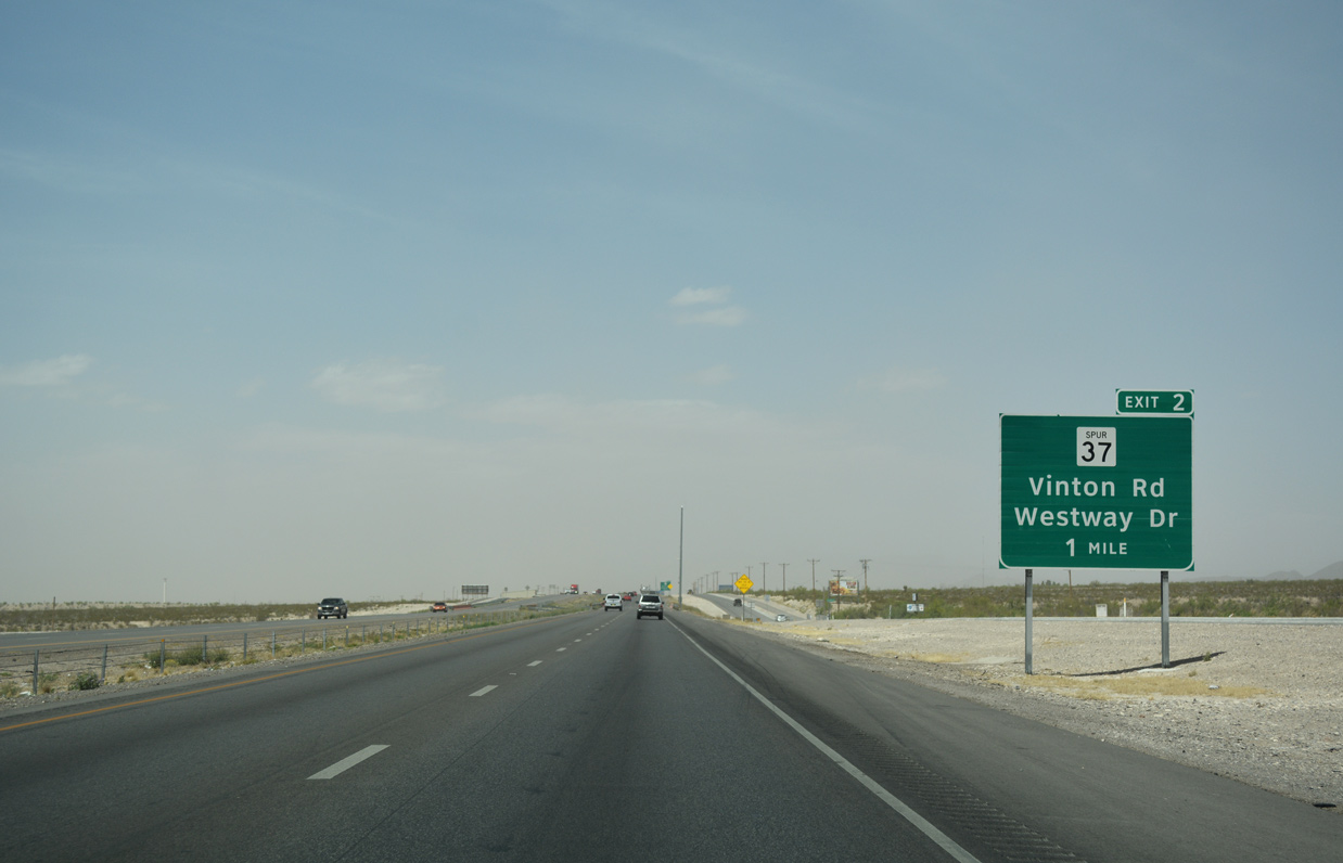
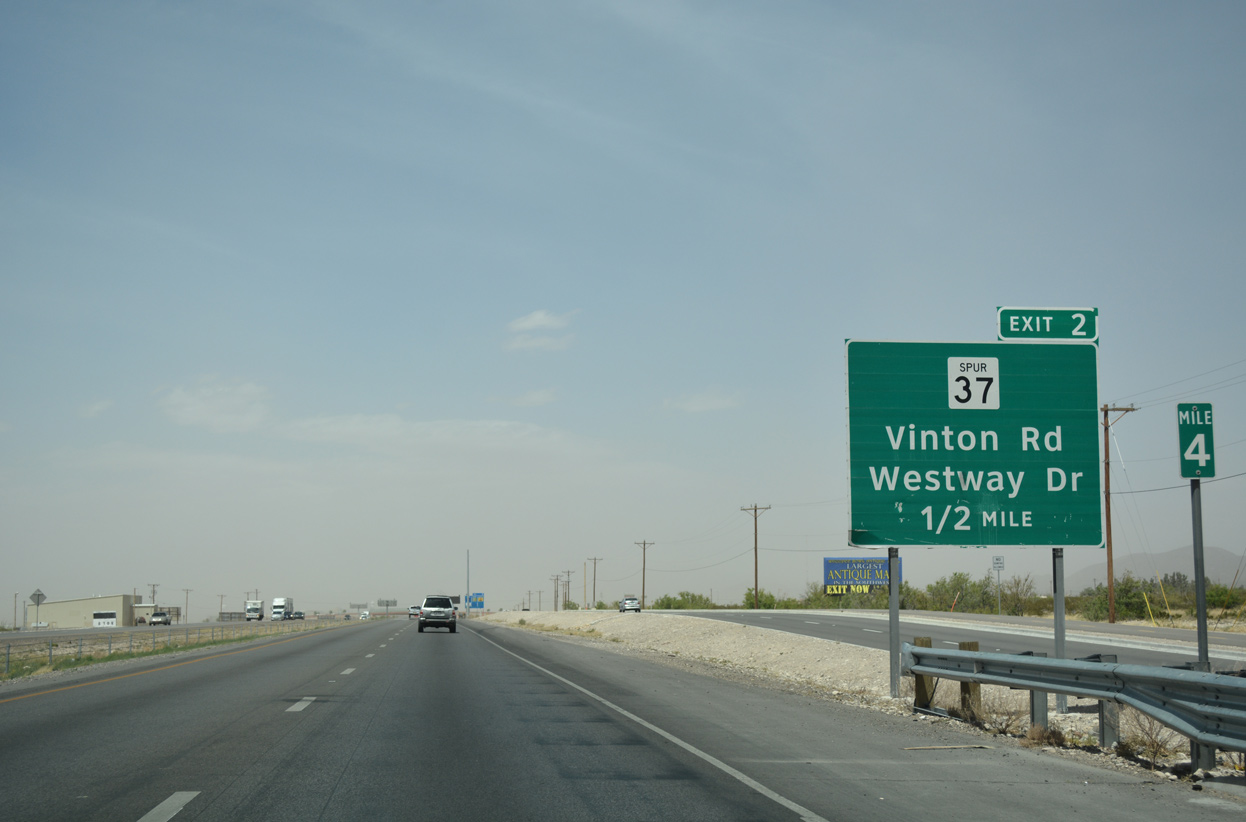
A 1.35 mile route, SS 37 (Vinton Road) connects IH 10 with SH 20 through the village of Vinton.
04/25/17
Westway Boulevard extends east from the diamond interchange joining IH 10 with SS 36 into the community of Westway.
04/25/17
A reassurance marker for IH 10 stands at the entrance ramp from SS 36 and Westway Boulevard. The Vinton Long Carbon Steel plant rises along the freeway's west side.
04/25/17
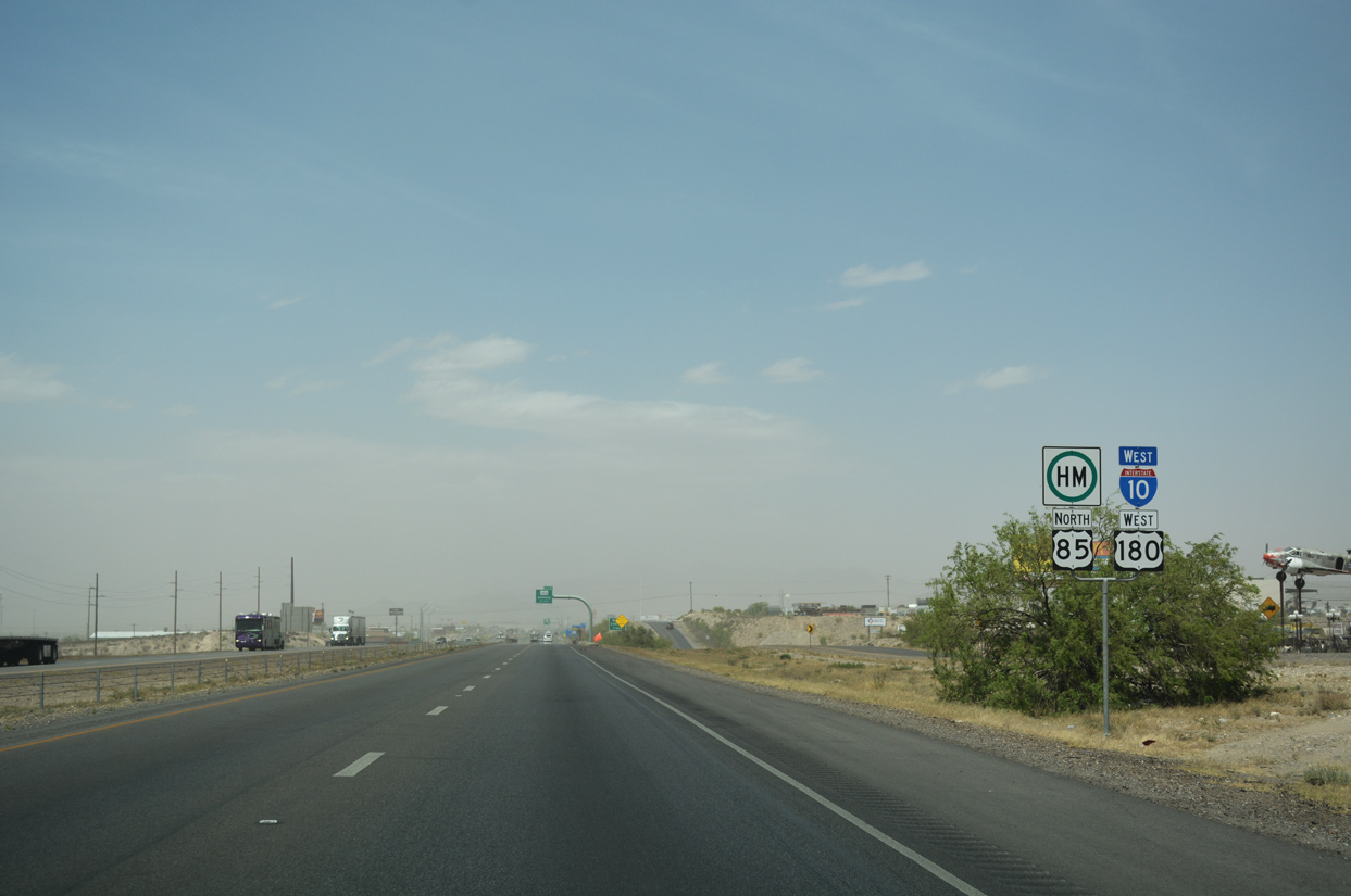
The final confirming marker for U.S. 85 north until Colorado appears alongside shields for IH 10 and U.S. 180 west. U.S. 180 is also not acknowledged along Interstate 10 again until it splits with the freeway at Deming, New Mexico.
04/25/17
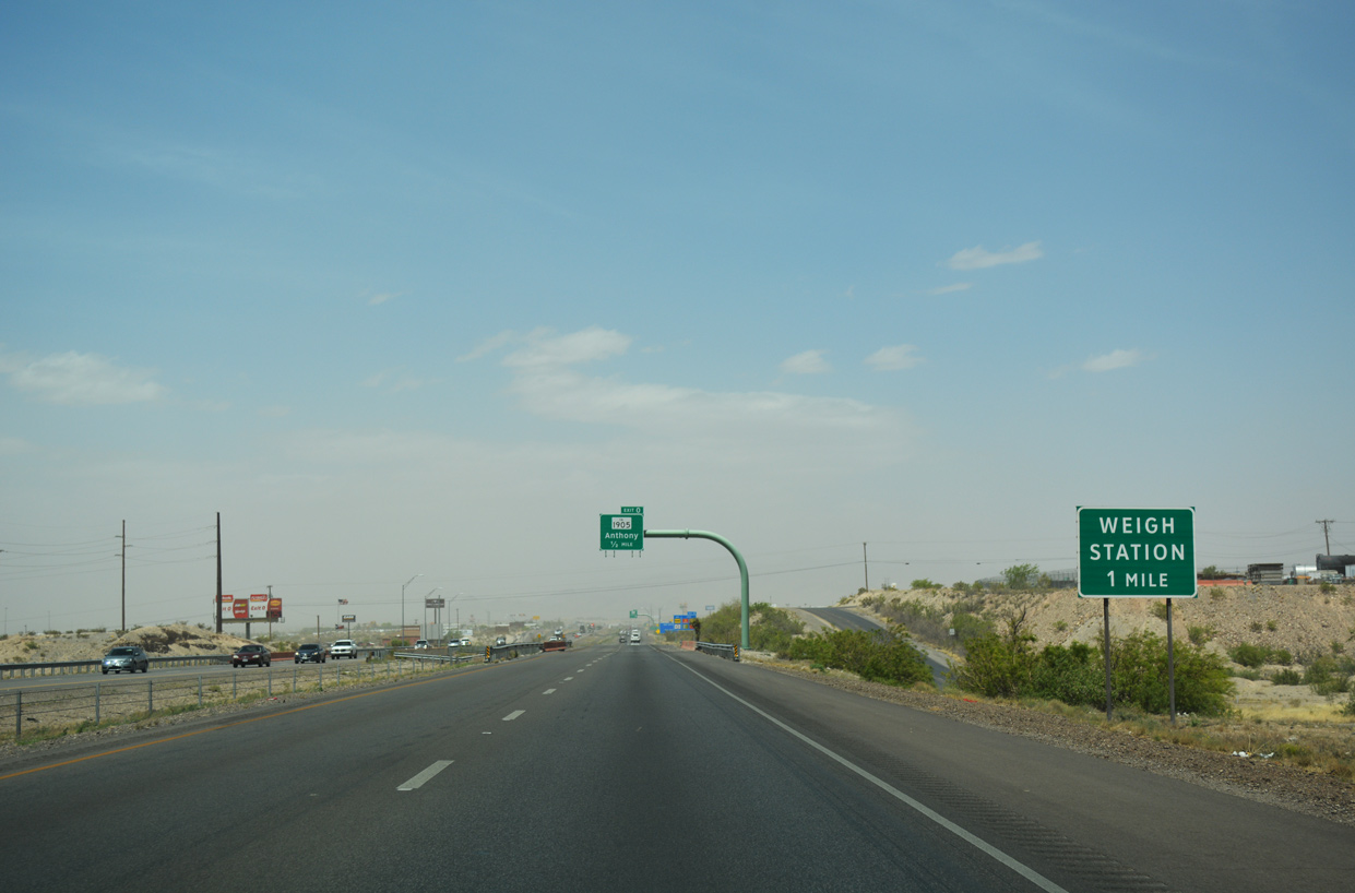
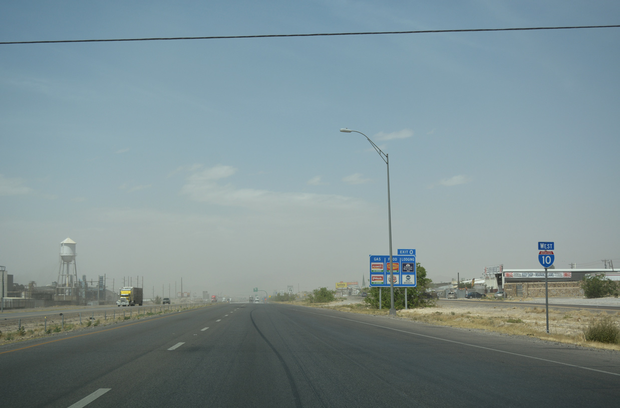
A westbound side weigh station operates just beyond the departure of Exit 0 in the town of Anthony.
04/25/17
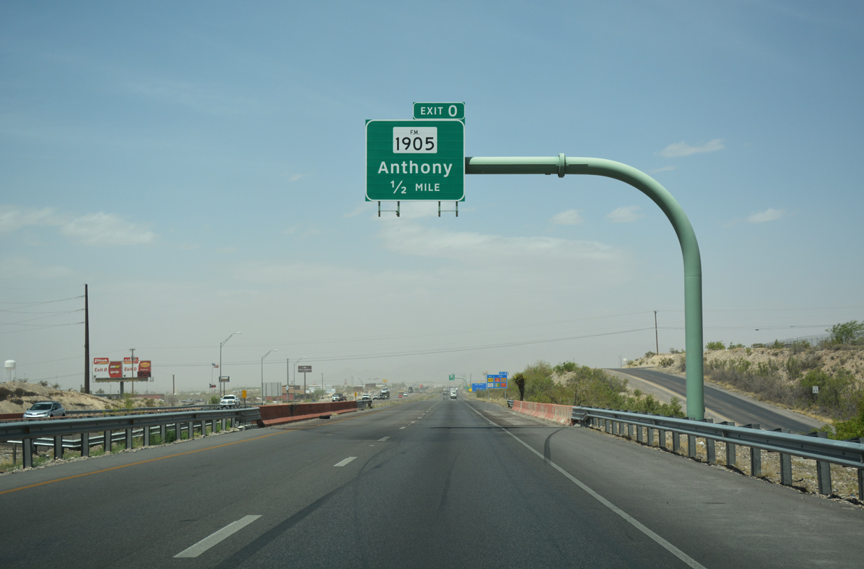
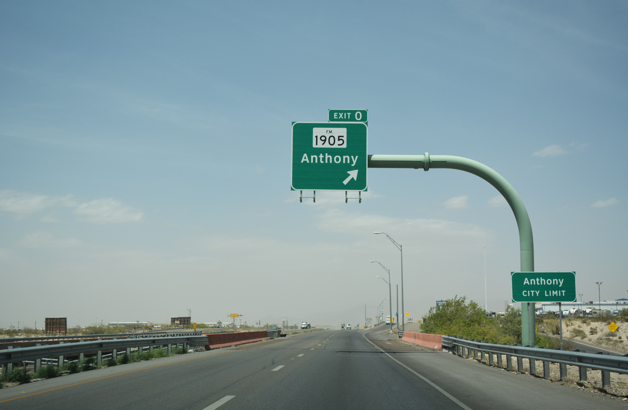
Exit 0 departs in a half mile for FM 1905 (Antonio Street) west and Mountain Pass Boulevard east at Anthony. Anthony was incorporated in 1952 as a two-state city, catering to agricultural needs.
04/25/17
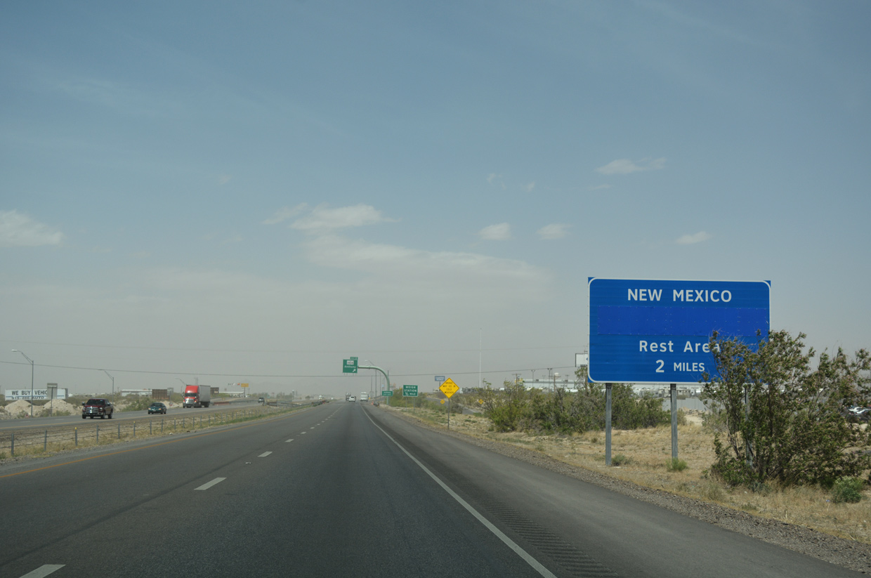
The Anthony Visitor Information Center and IH 10 rest area lies just beyond the New Mexico state line.
04/25/17
Exit 0 departs 1.4 miles south of the FM 1905 (Antonio Street) over crossing. FM 1905 leads 1.42 miles west to SH 20 (Main Street), and another 0.77 miles from Main Street to become NM 225. SS 6 (Wildcat Drive) provides a local bypass of Anthony southwest from FM 1905 nearby 1.49 miles to SH 20.
04/25/17
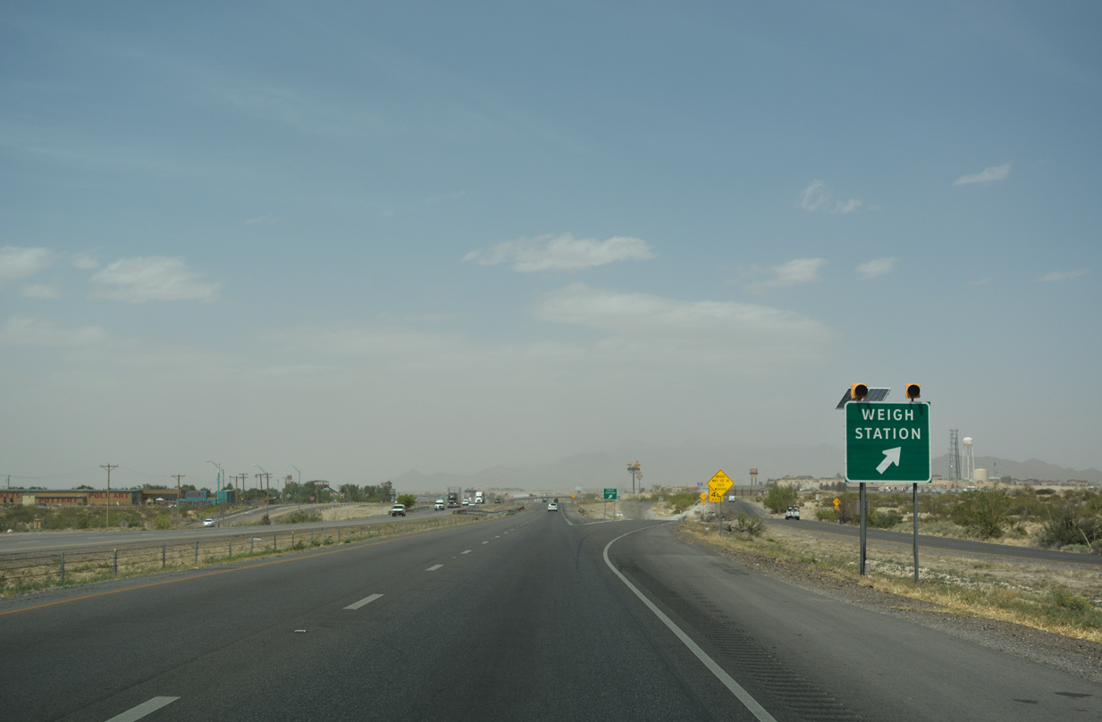
The weigh station lies immediately north of Exit 0. Exit 0 originally departed beyond the facility, but was relocated southward to remove weaving traffic.
04/25/17
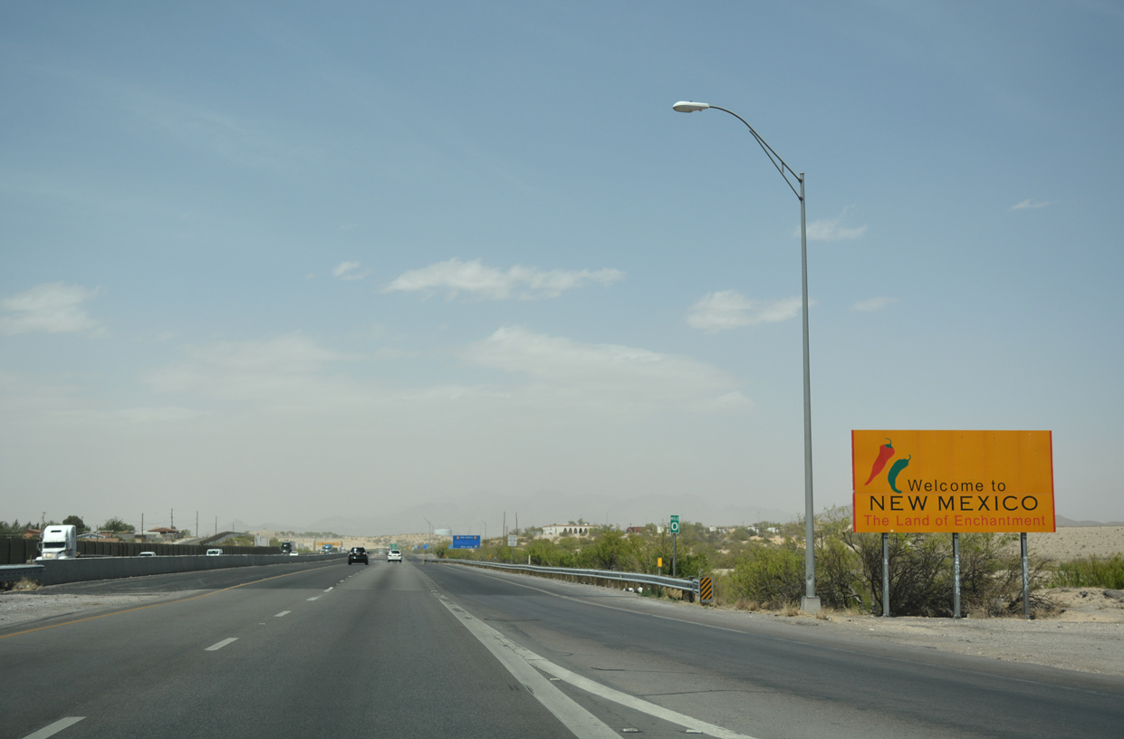
With the signature New Mexico Green Chile and Red Chile Peppers the Land of Enchantment is known for, a welcome sign for New Mexico stands just ahead of milepost zero at the Texas state line.
04/25/17

Photo Credits:
- Kevin Trinkle: 07/31/06, 09/28/06
- ABRoads, Chris Kalina: 04/25/17
- Alex Nitzman: 01/14/06
Connect with:
Page Updated Thursday July 18, 2019.