
Interstate 10 West - Seguin to San Antonio

 West
West
IH 10 trends southward from Luling toward Seguin. A rural diamond interchange (Exit 625) joins the freeway with Highsmith Road north and Darst Field Road south, which is used to access the Darst Oil Field.
05/27/05
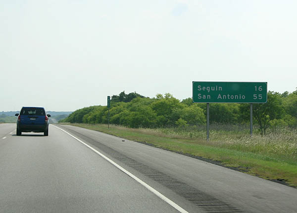
The Guadalupe County seat of Seguin, a city of over 30,000, is 16 miles away. San Antonio is less than an hour's drive.
05/27/05
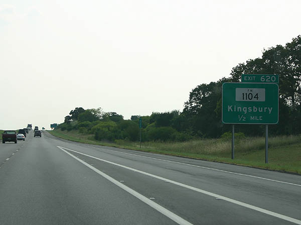
FM 1104 connects with IH 10 at Exit 620 just west of a CMV Weigh Station.
05/27/05
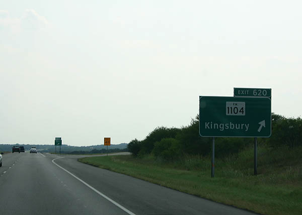
FM 1104 is a 5.77 mile highway heading southeast from Exit 620 to FM 1150 near the Darst Oil Field and northwest to U.S. 90 at Kingsbury. Kingsbury incorporated as a city in 2015.
05/27/05
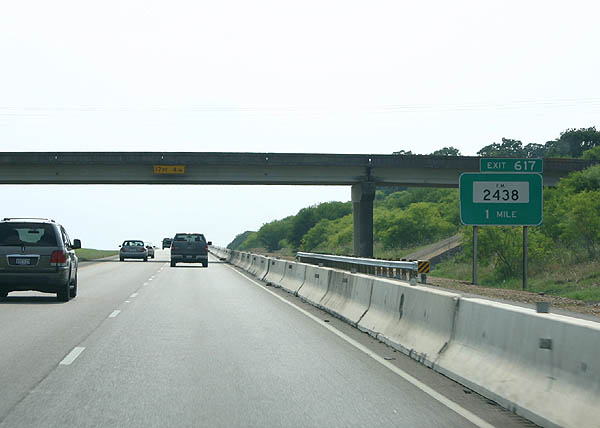
Exit 619 is the Guadalupe County Rest Area built in 2005. The ensuing exit is with FM 2438, a 6.09 mile long route at Kingsbury.
05/27/05
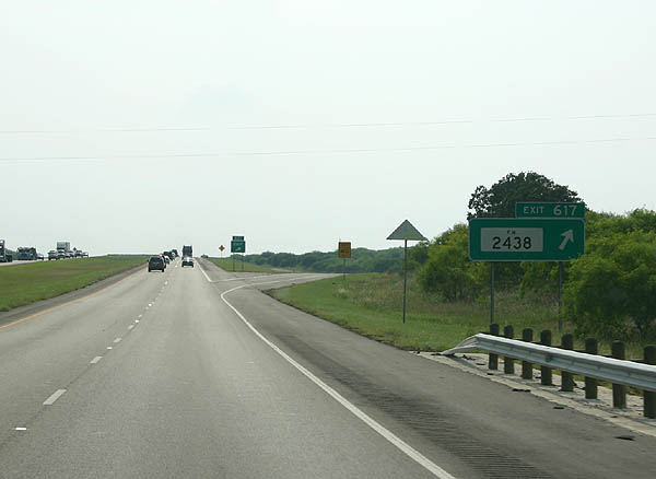
FM 2438 was originally designated northward from Exit 617 to U.S. 90 at Kingsbury. The highway was later extended south to U.S. 90 Alternate.
05/27/05
West 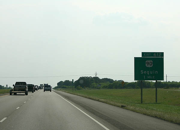
Advancing west to the city of Seguin, IH 10 combines with SH 130 at a two-wye interchange (Exit 614) opened in 2012. U.S. 90 returns to IH 10 again at the succeeding exit parallel to a Union Pacific Railroad.
05/27/05
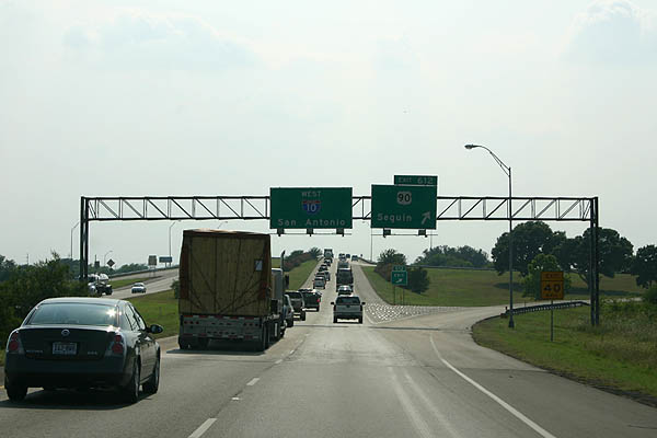
U.S. 90 continues south from a folded diamond interchange (Exit 612) with IH 10/SH 130 along Kingsbury Street to the Seguin street grid.
05/27/05
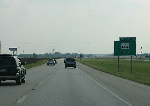
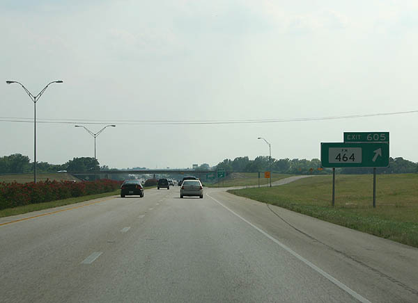
FM 464 spurs 1.76 miles west from the merge of U.S. 90 (Kingsbury Street) and U.S. 90 Alternate (Court Street) to IH 10 at Exit 605 and the CMC Steel Texas plant along the Guadalupe River.
05/27/05
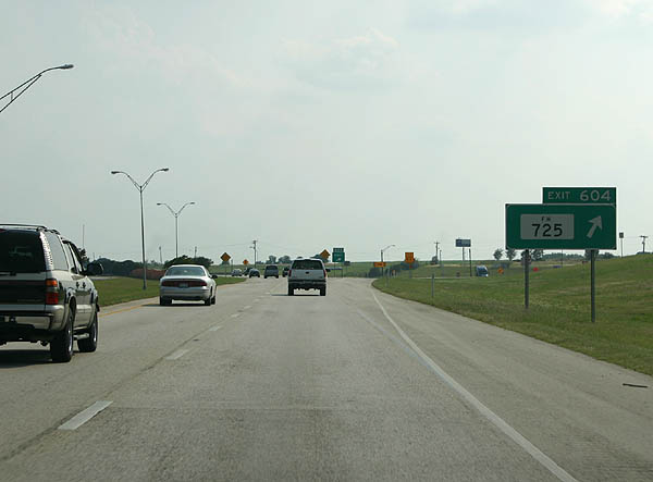
IH 10 west & SH 130 south span Lake Placid along the Guadalupe River ahead of the diamond interchange (Exit 604) with FM 725. A 16.30 mile long route, FM 725 leads north from IH 10 to McQueeney and Business Loop I-35 in New Braunfels and south east to FM 467 in Seguin.
05/27/05
 West
West 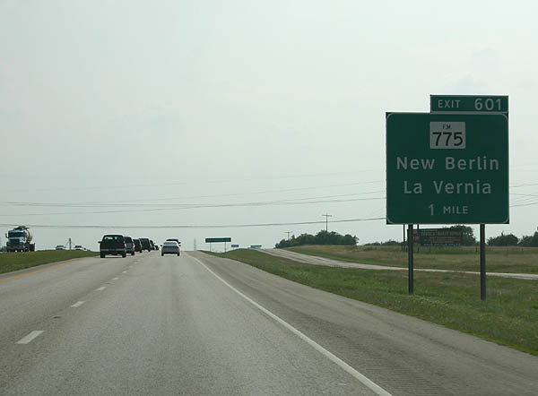
U.S. 90 rejoins IH 10 west from a wye interchange (Exit 603). Exit 601 follows with FM 775 south and Nickerson Farms Road north.
05/27/05
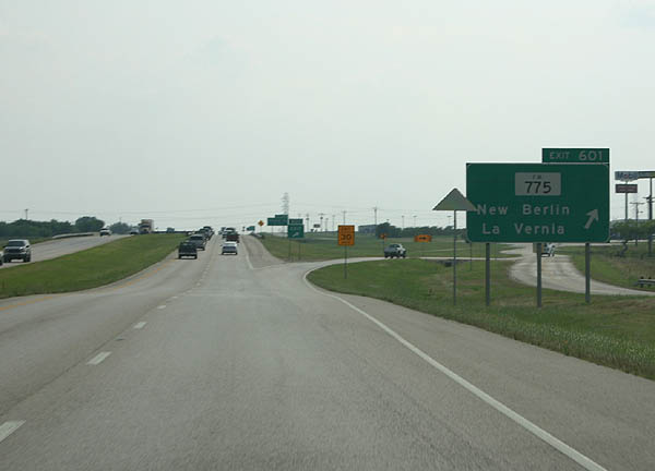
The 31.48 mile route of FM 775 south to New Berlin, La Vernia and FM 1303 at Canada Verde originates at IH 10.
05/27/05
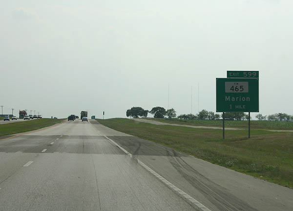
IH 10/U.S. 90 west & SH 130 south traverse agricultural areas to the diamond interchange (Exit 599) with FM 465 north and Linne Road south.
05/27/05
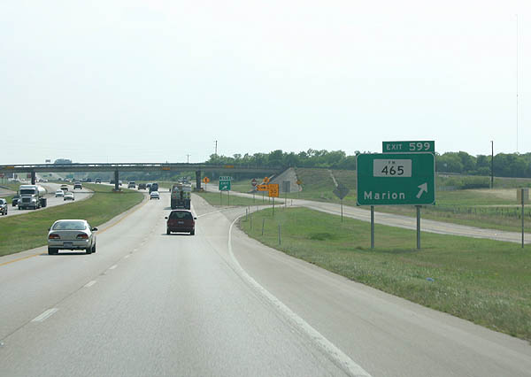
FM 465 runs 3.73 miles north from Exit 599 to SH 78 (San Antonio Street) in the city of Marion.
05/27/05
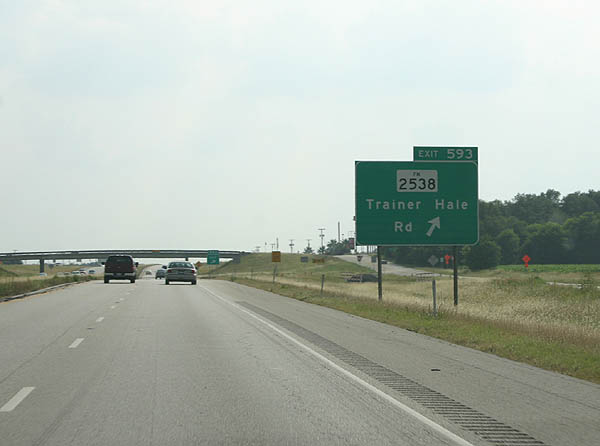
Crossing Cibolo Creek into Bexar County, Interstate 10 westbound meets FM 2538 east and Trainer Hale Road at Exit 593. FM 2538 zigzags southeast 7.85 miles from IH 10 at Friendly Corner to FM 775 at New Berlin.
05/27/05

FM 1518 straddles the Schertz city line north from IH 10/U.S. 90 at Exit 591 toward Randolph Air Force Base and Universal City. Southward, FM 1518 passes through the town of St. Hedwig to SL 1604 (C.W. Anderson Loop).
05/27/05
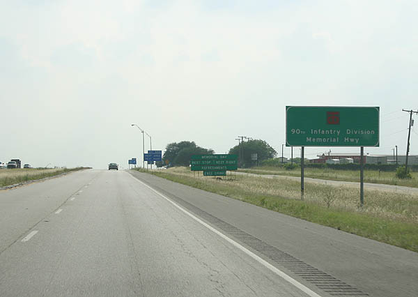
IH 10 from FM 1518 to Loop 410 is the 90th Infantry Division Memorial Highway. Involved in the invasion of Normandy, the 90th Infantry was comprised of Texans and Oklahomans during World War II.
05/27/05

Passing the former rest area, IH 10 runs along the Schertz and San Antonio city line west to Exit 589 with Pfeil Road and Graytown Road.
05/27/05
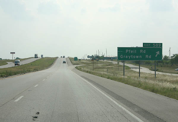
Exit 589 departs IH 10/U.S. 90 west & SH 130 south ahead of Pfeil Road north into Schertz. Graytown Road follows northwest to SL 1604 near Converse.
05/27/05

SL 1604, the C.W. Anderson Loop, is the outer belt route encircling the San Antonio metropolitan area. The southern half of the beltway remains rural and mostly undeveloped. Northward into Converse, SL 1604 is a four lane arterial, and a freeway from SH 78 and Universal City west to IH 35 and U.S. 281.
05/27/05
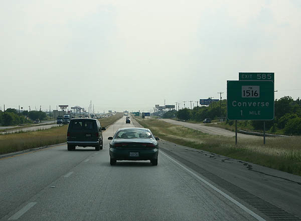
FM 1516 crosses under IH 10 at a diamond interchange (Exit 585) amid a cluster of industrial businesses west of Escondido Creek.
05/27/05
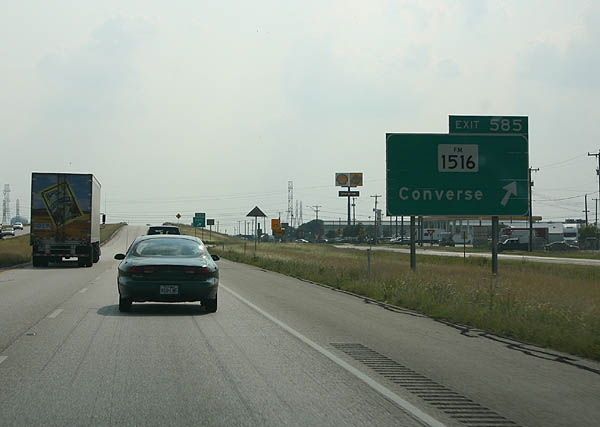
Totaling 9.61 miles, FM 1516 runs north to FM 1976 in the city of Converse and south along a part of the San Antonio city line to U.S. 87 at China Grove.
05/27/05
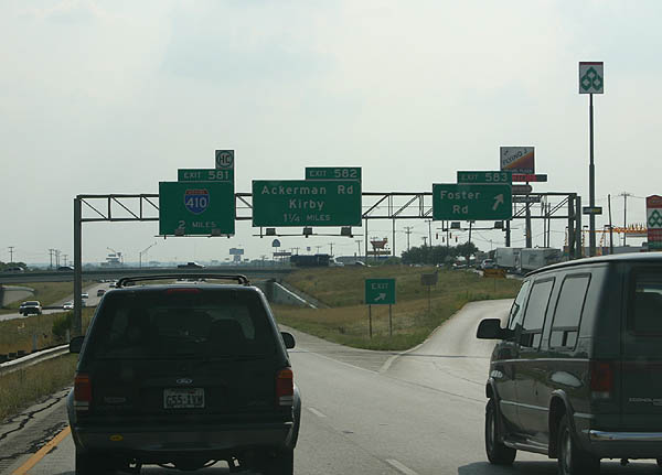
Foster Road meets IH 10 at Exit 583 by a number of truck stops. Widening of IH 10 from SL 1604 to IH 410 to six overall lanes got underway in Fall 2018. Running through 2022, the 6.7 mile long reconstruction project includes improvements at Foster Road, FM 1516 and SL 1604.1
05/27/05
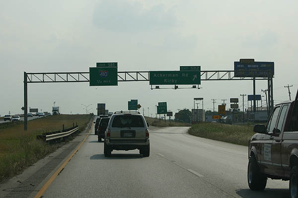
Exit 582 departs from IH 10/U.S. 90 west & SH 130 south a half mile out from IH 410. Ackerman Road stems north through an industrial park area along IH 10 to the city of Kirby. Martindale Army Air Field lies just to the south.
05/27/05
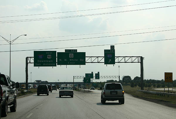
Collector distributor roadways separate from IH 10/U.S. 90 west for the ramps (Exit 581) to IH 410. SH 130 turns south alongside IH 410 to circumvent San Antonio west to IH 35 while IH 410 travels north to IH 35 at Windcrest. Future work will replace this antiquated cloverleaf with a four-level, systems interchange.
05/27/05
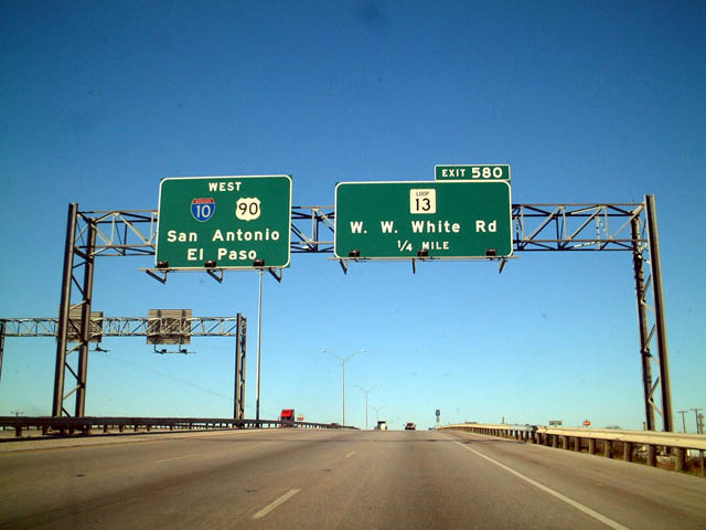
IH 10/U.S. 90 advance west from IH 410/SH 130 to a diamond interchange (Exit 580) with SL 13 (W.W. White Road).
12/31/02
SL 13 forms a 21.49 mile belt route south from IH 35/410 near Kirby through the Eastern Triangle to Brooks City Base and west through South Central San Antonio to Lackland A.F.B. and U.S. 90.
12/31/02

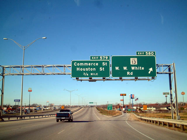
Curving southwest, Commerce Street separates from IH 10/U.S. 90 at Exit 579 ahead of Houston Street. Commerce Street, former U.S. 90 Business, and Houston Street run west through the Arena District to Dignowity Hill outside Downtown San Antonio.
12/31/02
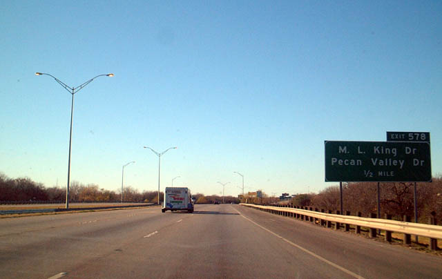
Continuing south across Salado Creek by Martin Luther King Park, IH 10/U.S. 90 (Jose Lopez Freeway) next meet Martin Luther King Drive at Pecan Valley Drive.
12/31/02
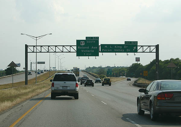
Exit 578 departs for Martin Luther King Drive west to the Arena District and east to the Golden Triangle. Pecan Valley Drive stems south from IH 10/U.S. 90 to U.S. 87 (Rigsby Avenue), Southside Lions Park and the Highlands neighborhood.
05/27/05
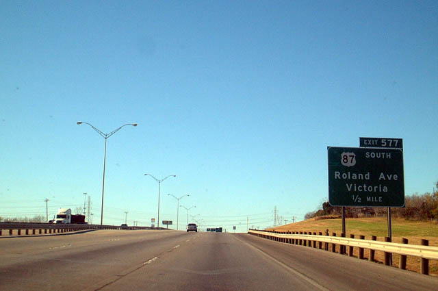
U.S. 87 combines with IH 10/U.S. 90 west from Roland Avenue at the succeeding interchange (Exit 577).
12/31/02
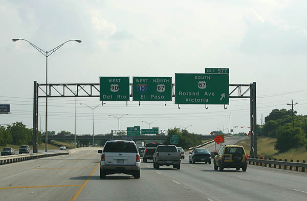
U.S. 87 joins San Antonio with Victoria, located 106 miles to the southeast. U.S. 87 combines with IH 10 west from Exit 577 to Exit 523 at Comfort. The old alignment followed Rigsby Avenue west to New Braunfels Avenue north.
05/27/05
West  North
North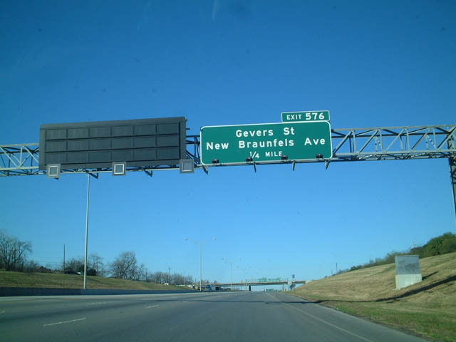
Overlapping split diamond interchanges at Exits 576 and 575 connect IH 10 and U.S. 87/90 with Gevers Street, New Braunfels Avenue and Pine Street.
12/31/02
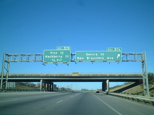
Gevers Street and New Braunfels Avenue run north into the Denver Heights neighborhood and south to Highland Park. New Braunfels Avenue was a part of U.S. 87 north to Commerce Street (old U.S. 90).
12/31/02
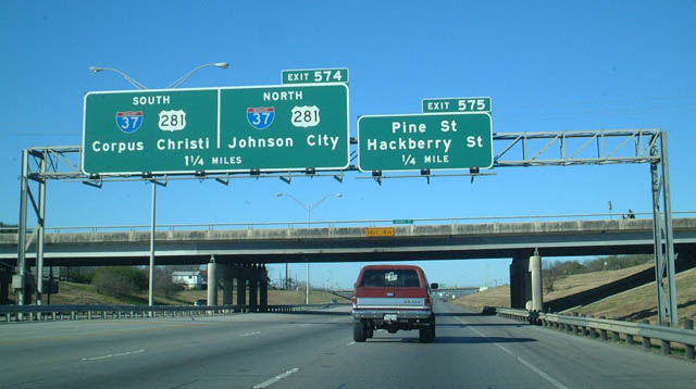
IH 10/U.S. 90 west & U.S. 87 north curve southwestward from Exit 575 to the four level interchange (Exit 574) with IH 37/U.S. 281.
12/31/02
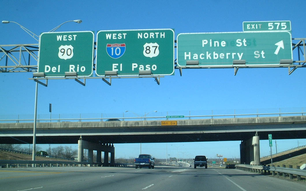
Exit 575 departs IH 10/U.S. 87-90 west beyond the New Braunfels Avenue overpass for Pine Street, a local street through Highland Park, and Hackberry Street. Hackberry Street is a commercial boulevard leading south to the Riverside neighborhood and north parallel to IH 37 to Alamodome Gardens.
12/31/02
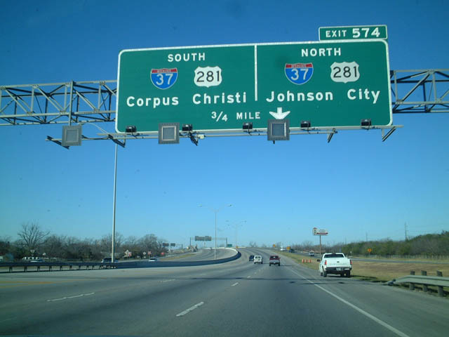
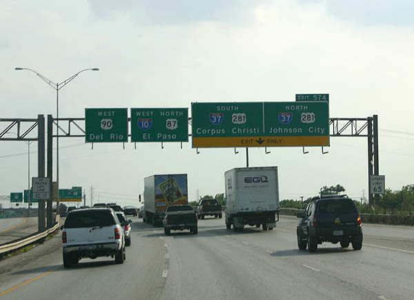
IH 10 makes an S-curve through the systems interchange (Exit 574) with IH 37/U.S. 281. IH 37 extends north to Downtown, ending at IH 35. U.S. 281 continues along the McAllister Freeway to Alamo Heights, San Antonio International Airport (SAT) and Hill Country Village.
12/31/02
Passing over Hackberry Street, an auxiliary lane opens westbound to Exit 574. IH 37 and U.S. 281 overlap southward to IH 410, where U.S. 281 dog legs west to rejoin its original alignment south to Pleasanton. The two rejoin ahead of Campbellton.
05/27/05
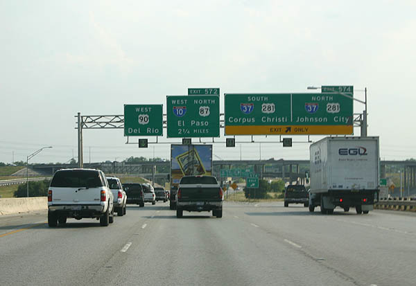
Exit 574 separates from IH 10/U.S. 90 west & U.S. 87 north. IH 37 travels 135 miles southeast to Corpus Christi on the Gulf Coast. U.S. 281 forms part of the IH 69C corridor from George West south to Alice, Falfurrias and the Rio Grande Valley.
05/27/05
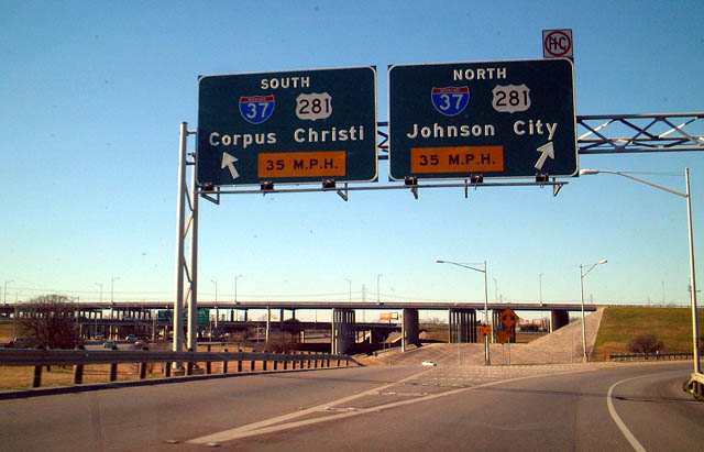
Traffic partitions at Exit 574 for IH 37/U.S. 281 south for Highland Hills and South Central San Antonio. U.S. 281 north heads 66 miles to Johnson City, the Blanco County seat.
12/31/02
Continuing through the lower level of the exchange with IH 37/U.S. 281, IH 10 advances west into the Roosevelt Park neighborhood, next meeting Probandt Street to Spur 536 (Steves Avenue).
05/27/05
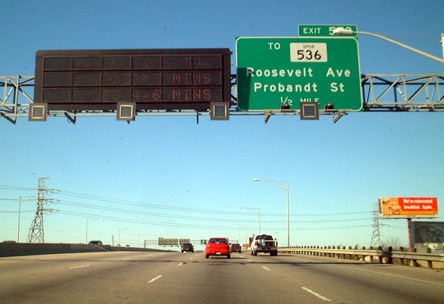
IH 10 (Jose Lopez Freeway) elevates across Roosevelt Avenue a half mile ahead of Exit 573. Spur 536, the former route of U.S. 281, shifts west from Roosevelt Avenue to Probandt Street via Steves Avenue across the San Antonio River.
12/31/02
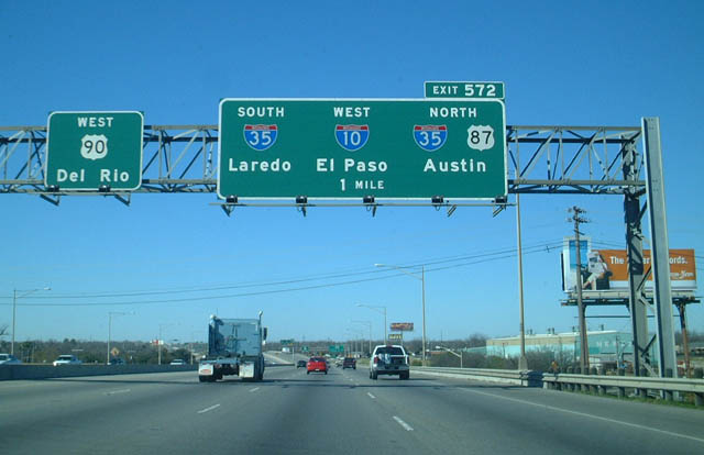
Spanning the San Antonio River, one mile ahead of the IH 10 and U.S. 90 split at IH 35 (Exit 572). The Jose Lopez Freeway mainline defaults onto the Cleto Rodriguez Freeway taking U.S. 90 west to Lackland Air Force Base and Castroville.
12/31/02
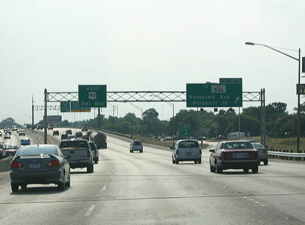
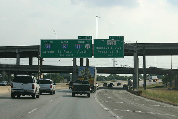
Entering the diamond interchange (Exit 573) with Probandt Street on IH 10/U.S. 87-90 westbound. Probandt Street leads south to Flores Street and South Central San Antonio. North through the Lone Star neighborhood, Probandt Street leads SS 536 to Alamo Street.
05/27/05
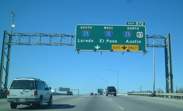
Crossing over Probandt Street with eight overall lanes, IH 10 and U.S. 87/90 meet IH 35 (PanAm Expressway) at a four-level interchange (Exit 572) 0.75 miles to the west.
12/31/02
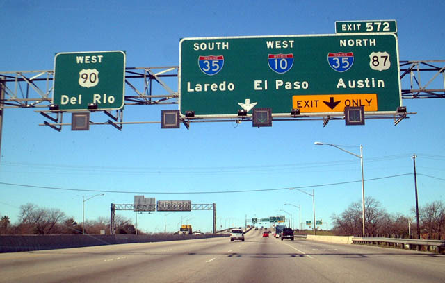
The IH 10 mainline makes TOTSO (turn off to stay on) movements along single lane ramps in both directions at the exchange with U.S. 90 (Cletro Rodriguez Freeway) and IH 35.
12/31/02
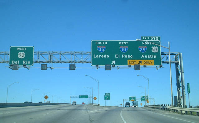
Crossing San Pedro Creek and Flores Street, two lanes depart from U.S. 90 westbound for both the continuation of IH 10 west/U.S. 87 north and IH 35. U.S. 90 continues another 142 miles west from San Antonio to Del Rio.
12/31/02
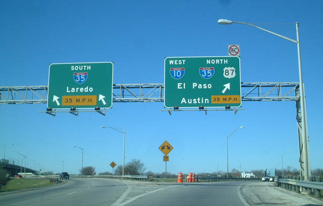
IH 10 west & U.S. 87 combine with IH 35 north to Downtown San Antonio. IH 35 south leads 145 miles to Laredo.
12/31/02


References:
- I-10 East from I-410 to the Bexar/Guadalupe County Line. Texas Department of Transportation (TxDOT), project web page. Accessed July 16, 2019.
Photo Credits:
- Kevin Trinkle: 05/27/05
- AARoads: 12/31/02
Connect with:
Page Updated Tuesday July 16, 2019.