
Interstate 20 East - Lincoln to Georgia
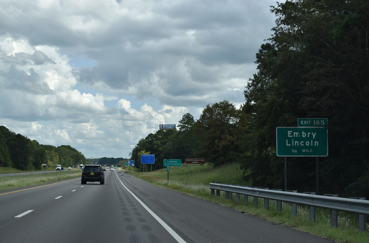
Continuing east from Logan Martin Lake, I-20 next meets Talladega County Route 207 (Honda Drive north / Stemly Road south) at a diamond interchange (Exit 165). CR 207 meanders 8.5 miles south from U.S. 78 (Bankhead Highway) in Lincoln to SR 34 (Stemley Bridge Road) along the periphery of Logan Martin Lake.
09/11/20

Embry Crossroads is the area of Lincoln along Stemly Road at CR 354 (McCraig Road) and Stemly Road adjacent to Exit 165. I-20 enters the city limits of Lincoln ahead of Exit 165 and remains in the municipality to Airport Road, ahead of Exit 173.
09/11/20
Interstate 20 continues east through Lincoln to the south of the Honda Manufacturing of Alabama plant along parallel U.S. 78.
09/11/20

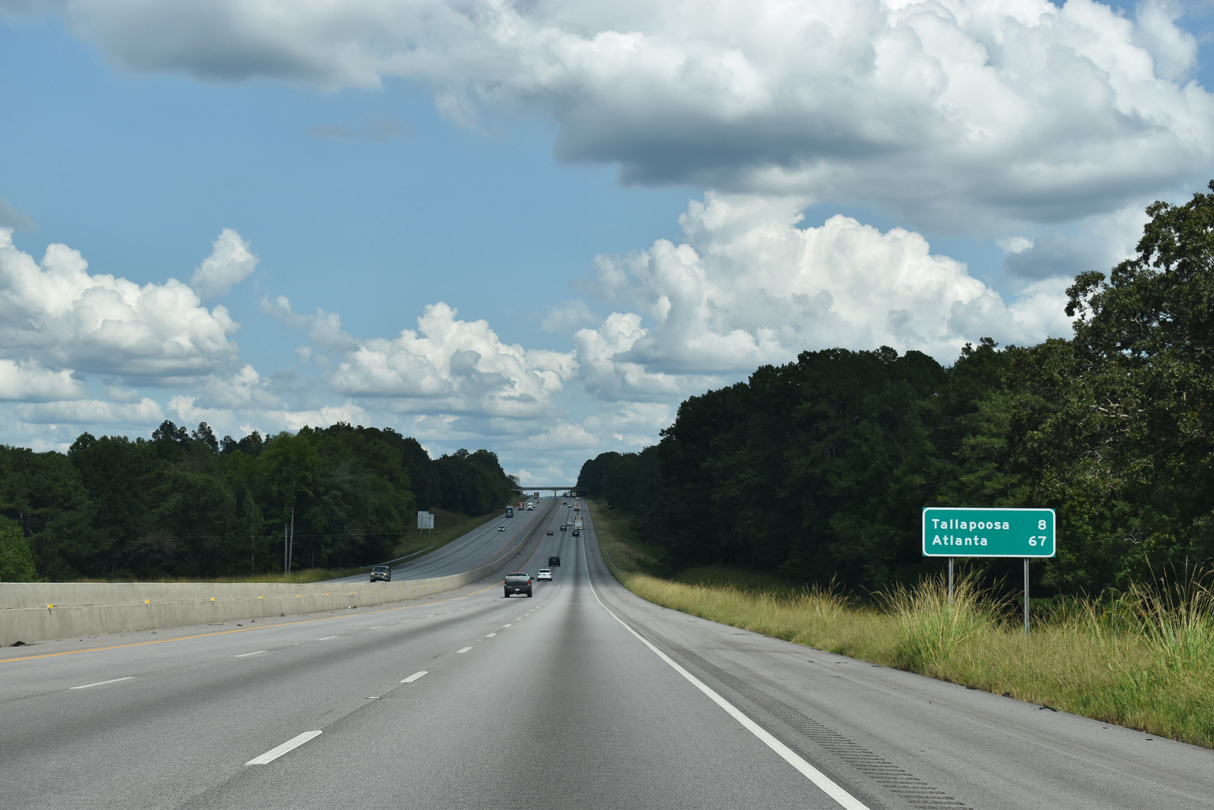
Distance signs consistently reference the old route of U.S. 78 to Atlanta instead of Interstate 20. Downtown Atlanta is 105 miles from this sign referencing the city at 114 miles away.
09/11/20
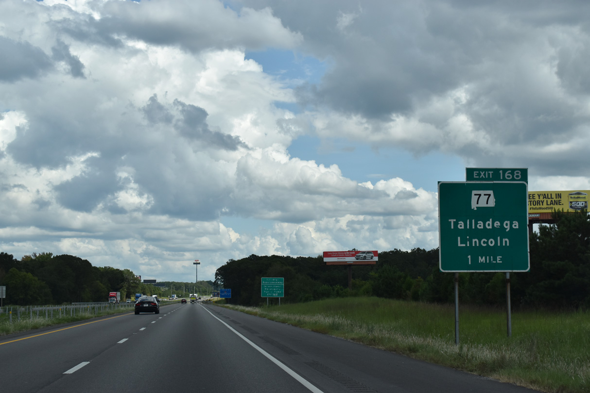
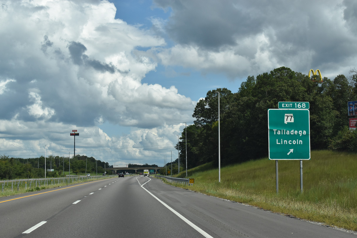
The diamond interchange at Exit 168 connects I-20 east with SR 77 in one mile. SR 77 travels 112.33 miles overall between U.S. 431 at Attalla and U.S. 431 at Lafayette.
09/11/20
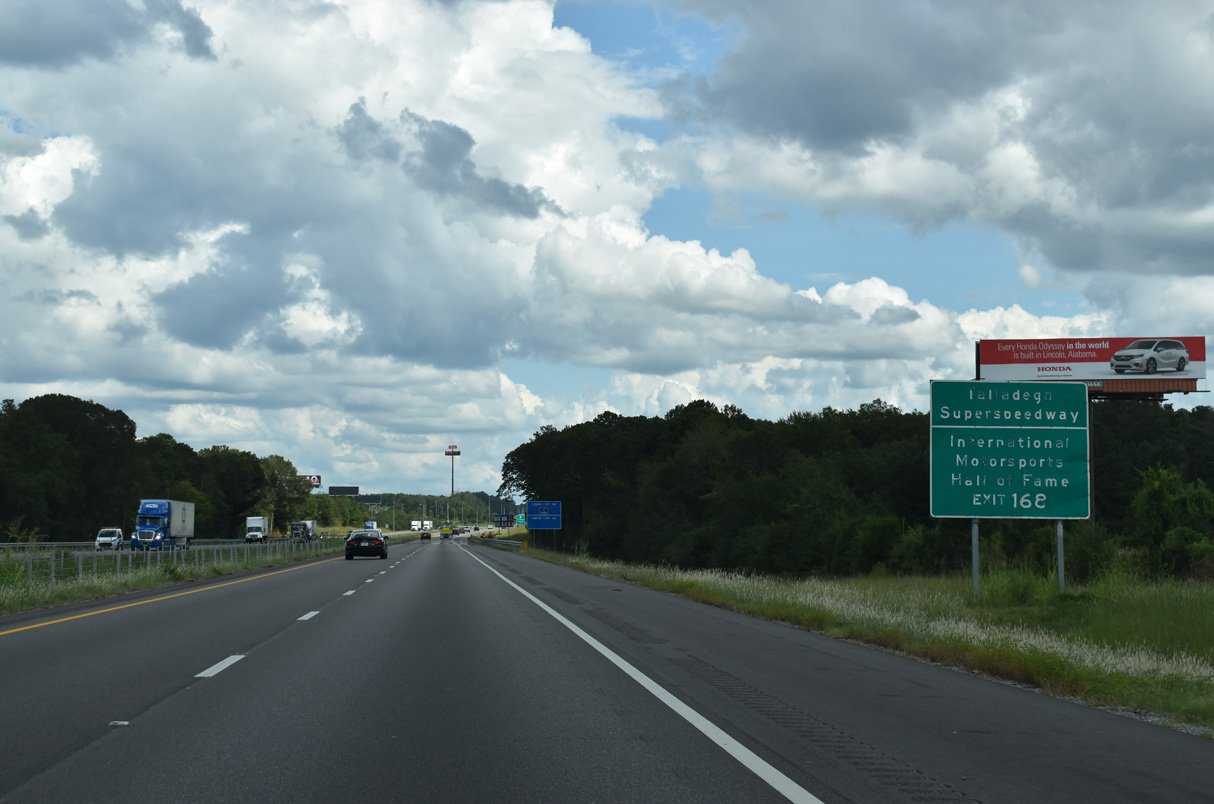
Exit 168 provides one of two access points from I-20 for Talladega Superspeedway and the International Motorsports Hall of Fame. Home to two NASCAR Sprint Cup events and other stock car races, the track was constructed in 1968-89 at the site of former Anniston Air Force Base. The first race at the 2,000-acre site took place on September 13, 1969 (Talladega Superspeedway, 2012).
09/11/20
SR 77 leads 27.5 miles north from Exit 168 to U.S. 411 at Rainbow City and 11.5 miles south to SR 21 in Downtown Talladega.
09/11/20
SR 77 intersects U.S. 78, 1.3 miles to the north of Exit 168 near Yatesville in Lincoln. CR 399 (Speedway Boulevard) stems east from SR 77 to Talladega Superspeedway from 0.7 miles to the south.
10/07/12
Interstate 20 parallels Talladega County Route 399 (Speedway Boulevard) east to Old Eastaboga.
09/11/20

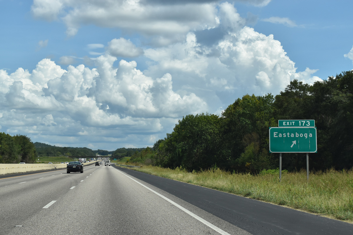
Eastaboga is seven miles to along U.S. 78 the east via John N. Willis Avenue (CR 005) north from Exit 173. Anniston is 21 miles away.
09/11/20

Interstate 20 east passes between Dry Valley and Echo Hills in Lincoln.
09/11/20

Talladega Superspeedway and Horn Mountain appear south of Interstate 20.
09/11/20
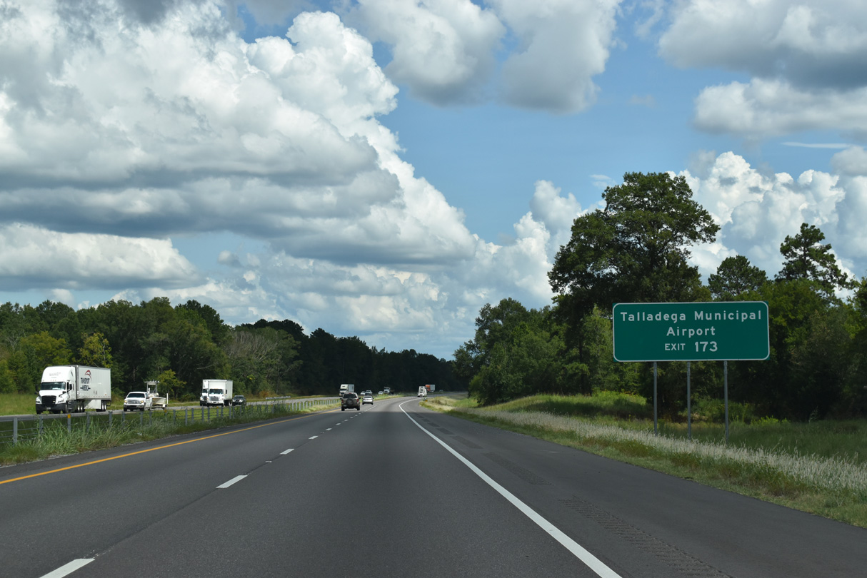
Speedway Boulevard (CR-399) extends west from John N. Willis Avenue (CR 005) and I-20 at Exit 168 to Talladega Municipal Airport (ASN) and Talladega Superspeedway.
09/11/20
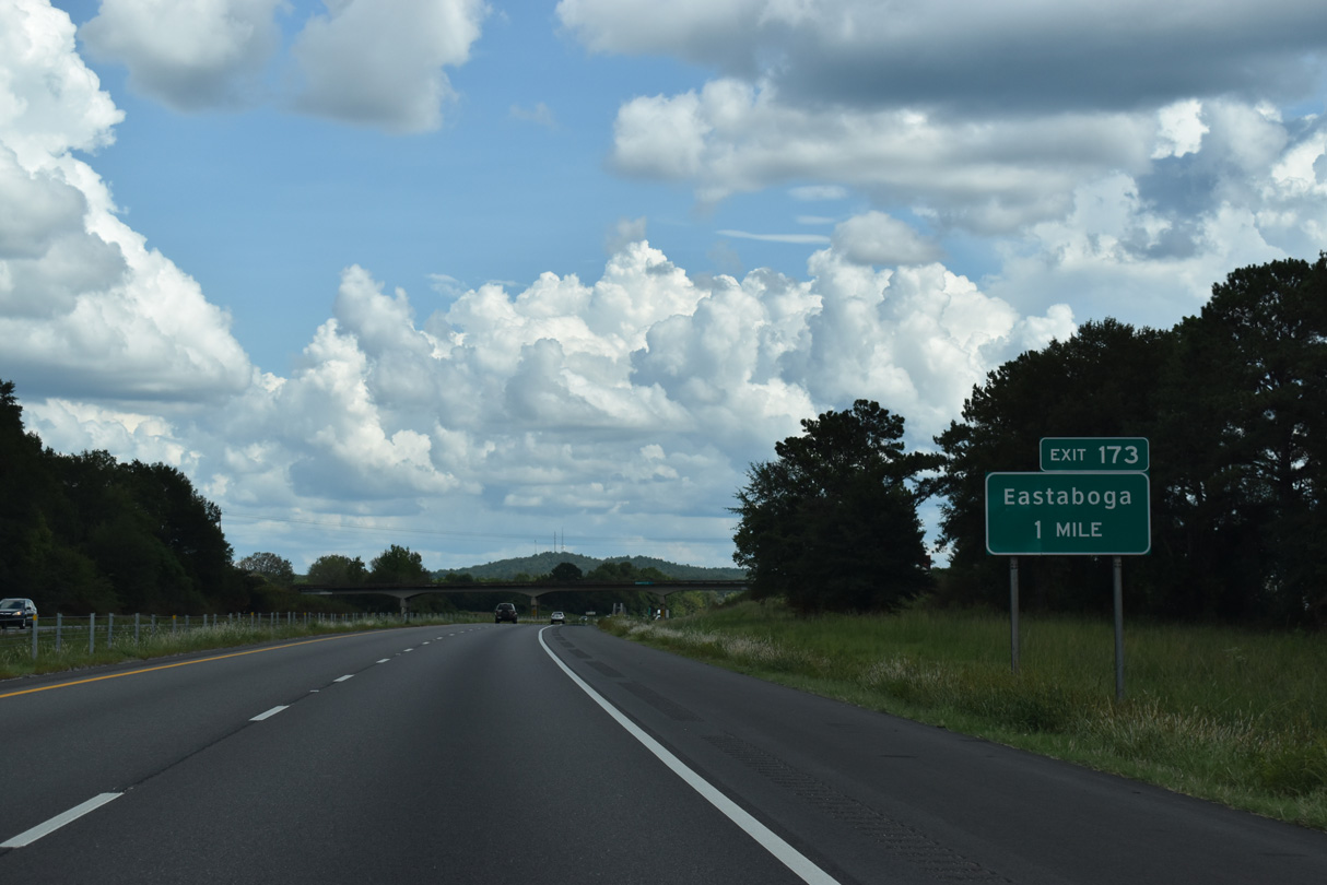
The rural diamond interchange joining I-20 with CR 005 (John N. Wilis Avenue) at Exit 173 lies 1.5 miles south of Eastaboga and U.S. 78.
09/11/20
Talladega County Route 005 (Eastaboga Road) leads south 3.5 miles to Turner and 8.6 miles to the SR 275 (Talladega Bypass) outside of the county seat.
09/11/20
The roadways for Interstate 20 separate on a three mile stretch south of the Calhoun County line and Oxford city limits.
09/11/20
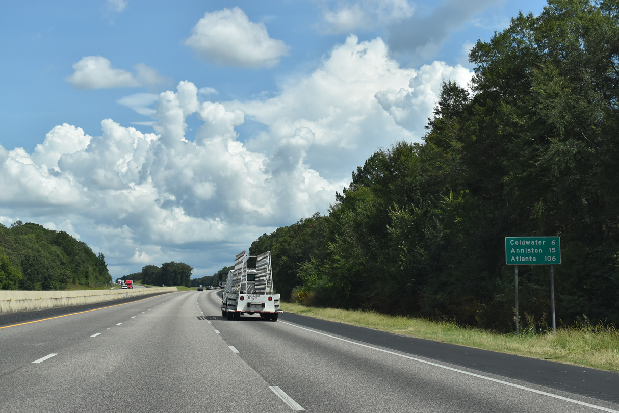
Six miles ahead, the succeeding exit is at Coldwater in western reaches of Oxford. Downtown Atlanta is 91 miles further.
09/11/20
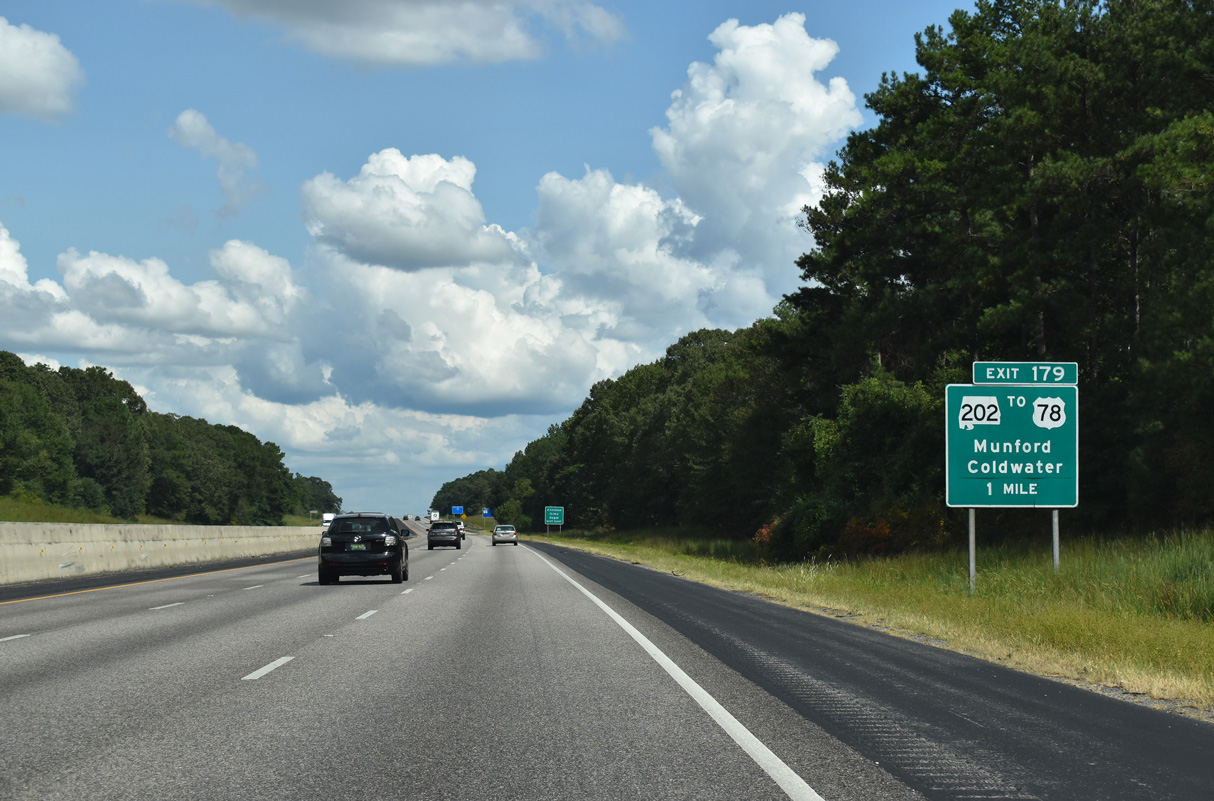
Exit 179 connects with CR 467 (Priebes Mill Road) west and SR 202 (Donald G. Holmes Bypass) north to Coldwater. SR 202 was extended southward from U.S. 78 by Spring 2006. The state route encircles Coldwater Mountain northeast to West End and Anniston.
09/11/20
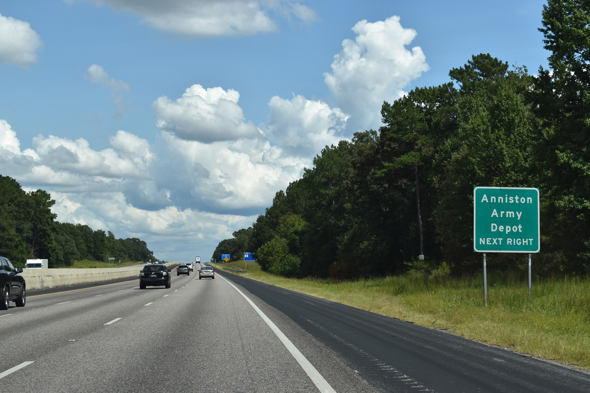
SR 202 arcs northeast by the Anniston Army Depot at Vinnette. The facility is involved in the repair of military vehicles as well as the storage of various chemical weapons and other larger scale munitions.
09/11/20

SR 202 leads 9.11 miles northeast to SR 21 in Anniston. Priebes Mill Road extends 2.90 miles southwest to Jenifer Road in the town of Munford.
09/11/20
Paralleling Choccolocco Creek, Interstate 20 progresses east along the Oxford city line.
09/11/20
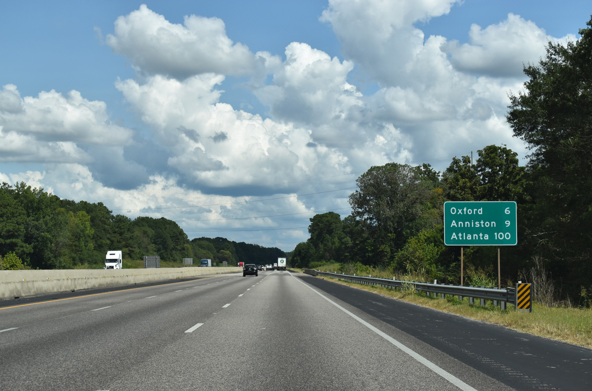
The Oxford city center is six miles to the east via SR 21 north from Exit 185. Atlanta, Georgia is 91 miles away.
09/11/20

Curving northward by Anniston Regional Airport (ANB), Interstate 20 enters Calhoun County.
09/11/20

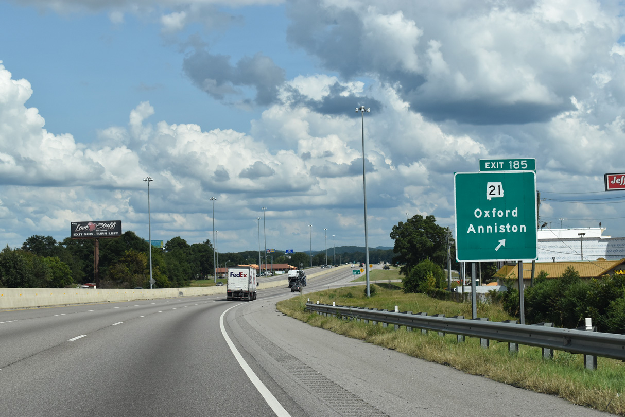
SR 21 (Quintard Drive) meets I-20 at a parclo interchange (Exit 185) in one mile. SR 21 north intersects U.S. 78 in 0.35 miles. Prior to 2016, U.S. 431 overlapped with SR 21 north to Anniston and with U.S. 78 east beyond Oxford.
09/11/20
SR 21 (Jacksonville State University Highway) travels southwest from Oxford to Anniston Metropolitan Airport (ANB), Munford and Talladega. North beyond Anniston, SR 21 continues to Jacksonville and Piedmont.
09/11/20
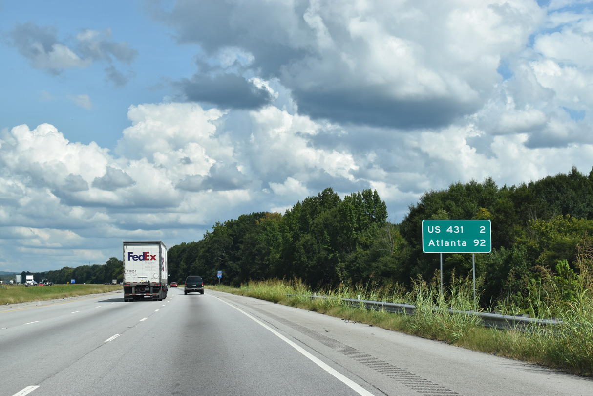
Continuing across Oxford, Interstate 20 advances 2.61 miles east from SR 21 to U.S 431 at the succeeding exit.
09/11/20
Progress20 construction underway between December 2011 and Fall 2013 expanded I-20 between mile marker 185.83 and 193.78 to six overall lanes.
09/11/20
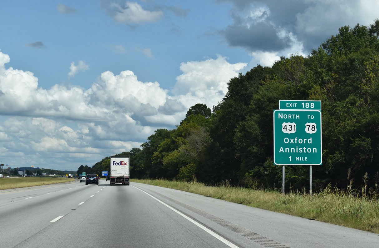
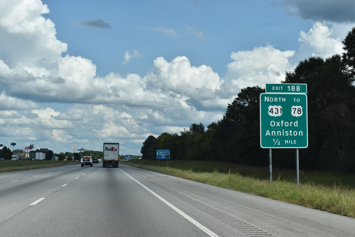
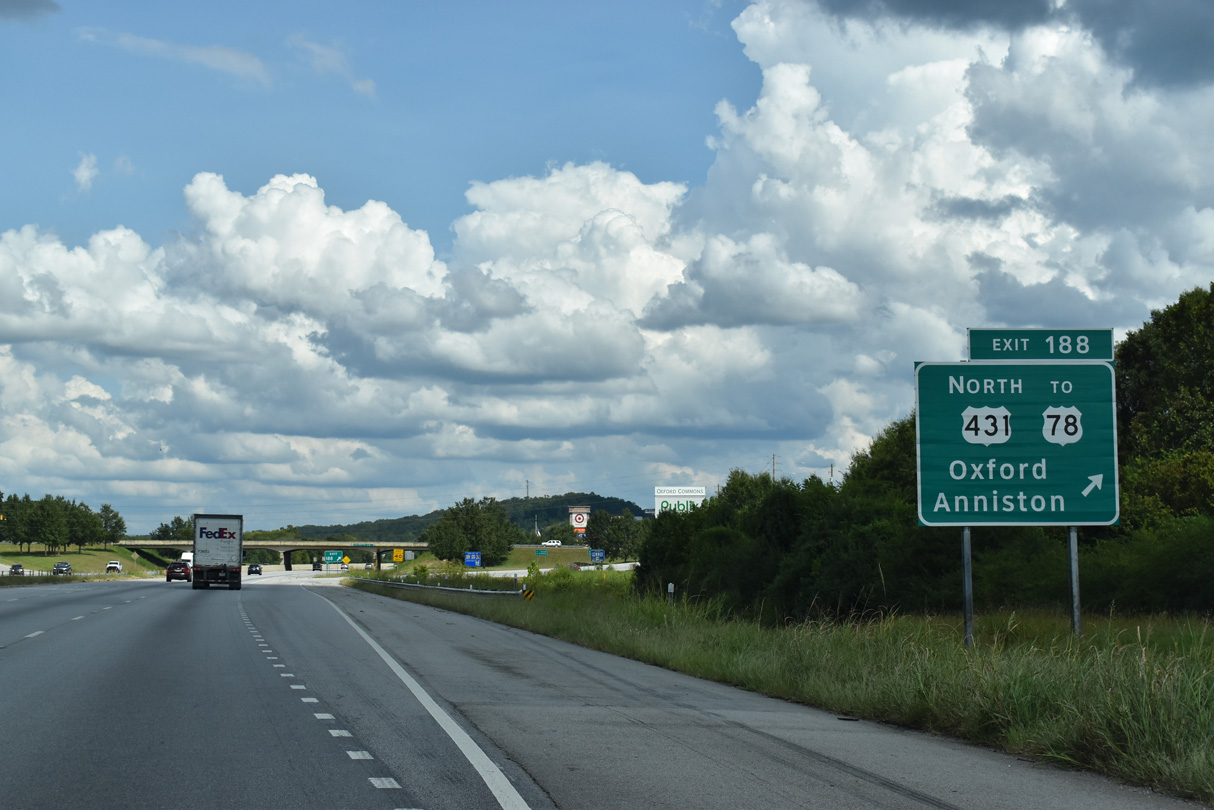
U.S. 431 runs south from the Anniston Eastern Bypass along Golden Springs Road to the diamond interchange at Exit 188. A grade separated intersection connects U.S. 431 with U.S. 78 at Boiling Spring in east Oxford nearby.
09/11/20
Beyond the viaduct across U.S. 78 and a NS Railroad line, U.S. 431 (Golden Springs Road) heads north to Golden Springs in Oxford. The Anniston Eastern Bypass connects with SR 21, 7.47 miles north of Interstate 20 in Anniston.
09/11/20
Construction of the exchange with the realignment of U.S. 431 at Exit 188 also extended south is also built Leon Smith Parkway south to Friendship Road and a realigned McIntosh Road near Hicks.
09/11/20
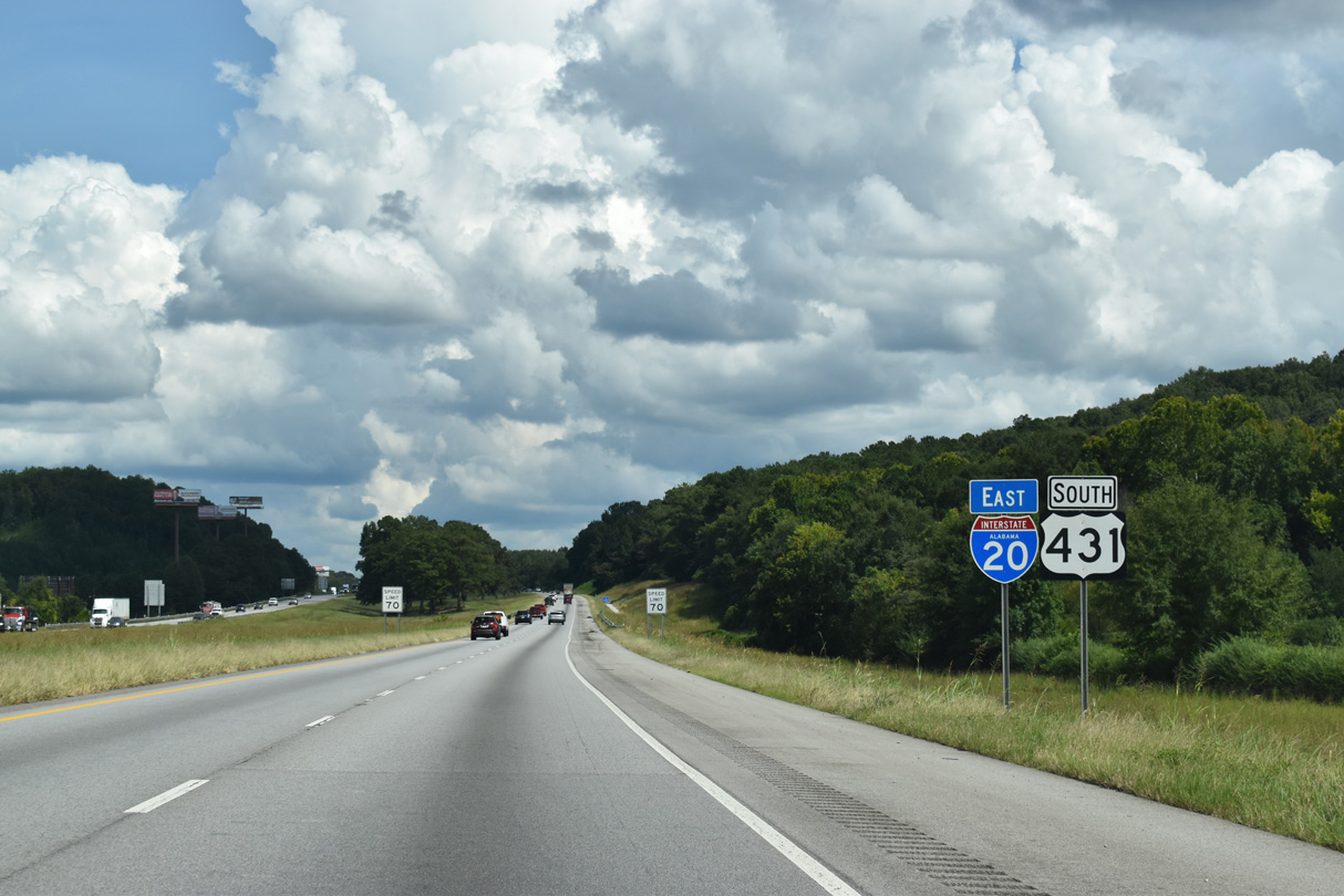
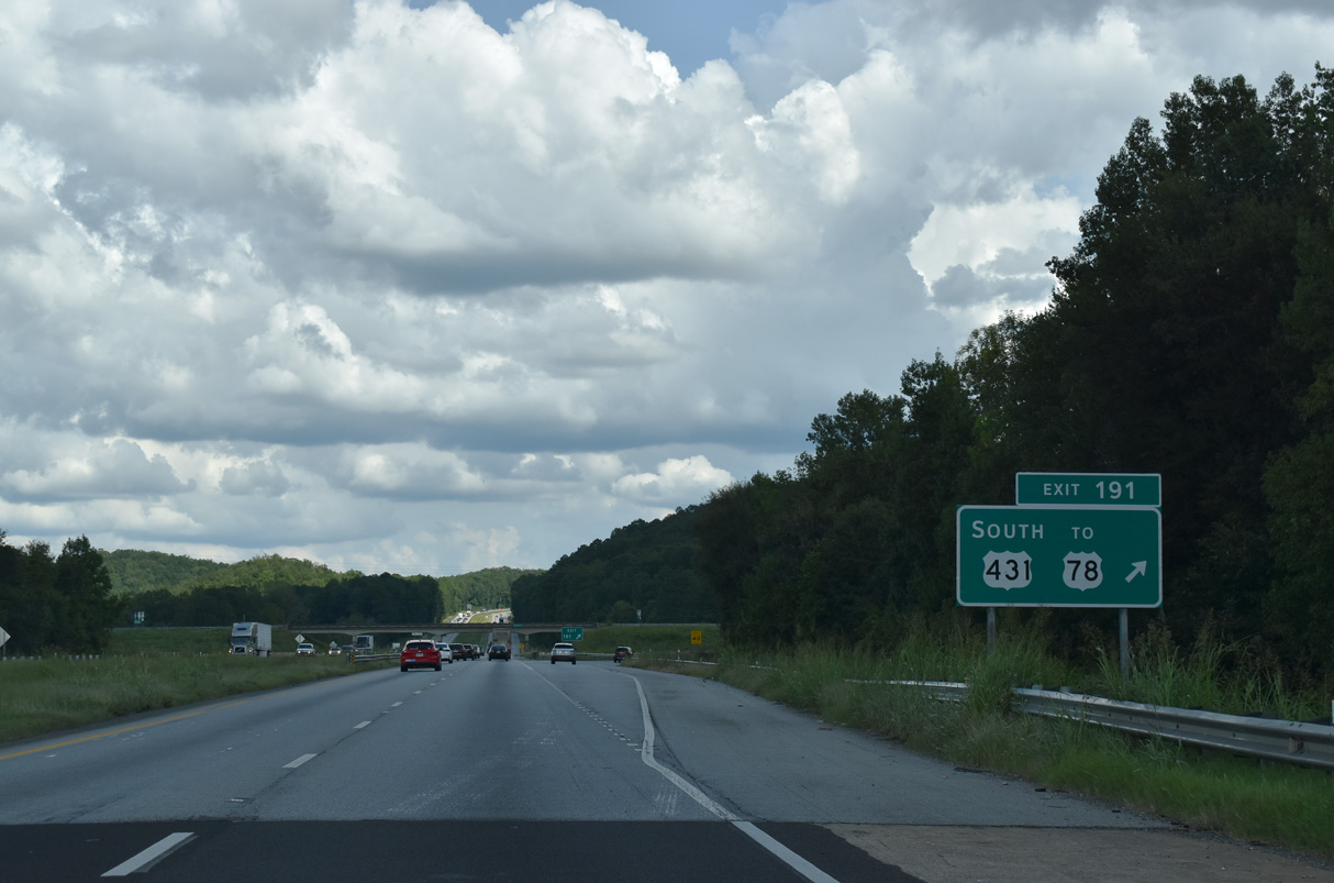
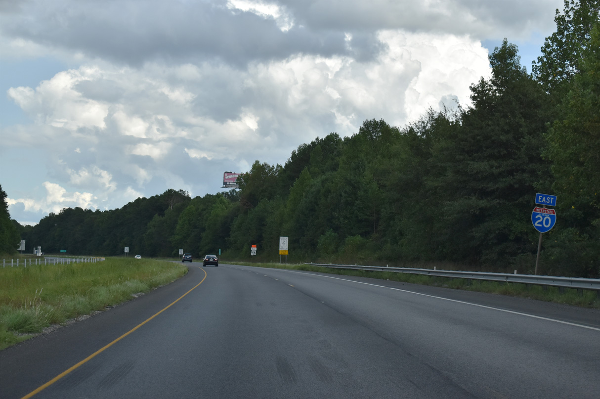
U.S. 431 overlaps with I-20 east for 3.71 miles to Exit 191. The rerouting of U.S. 431/SR 1 was recorded by ALDOT in February 2016.
09/11/20
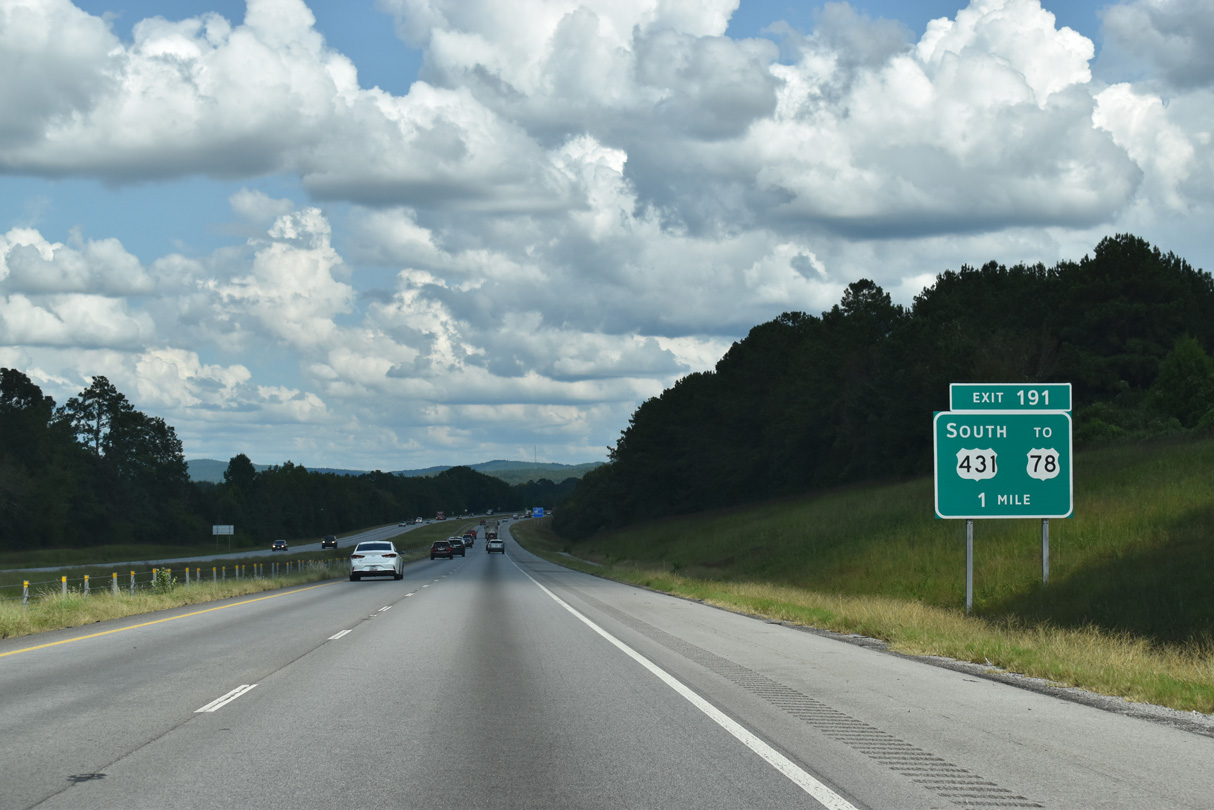
U.S. 431 turns south at Exit 191 into mountainous areas of Talladega National Forest. U.S. 431 continues to the Randolph County seat of Wedowee.
09/11/20
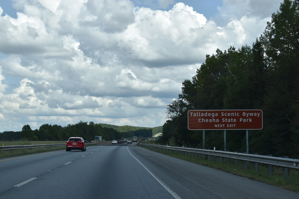
U.S. 431 meets the Talladega Scenic Byway (SR 281) 3.5 miles to the southeast of Exit 191 at a grade separated intersection. SR 281 straddles Talladega, Cheaha, and Horseblock Mountain southwest toward Campbell Springs. Cheaha State Park, home to Mt. Cheaha, the tallest point in the state of Alabama at 2,405 feet, is located along SR 281.
09/11/20
Not acknowledged on guide signs for Exit 191, SR 301 follows Old U.S. 431 north 0.428 miles from I-20 to U.S. 78. U.S. 78 (Bankhead Highway) continues east to Old Davisville (SR 9), Cleburne and the north end of the Talladega Scenic Byway (SR 281).
09/11/20
09/11/20
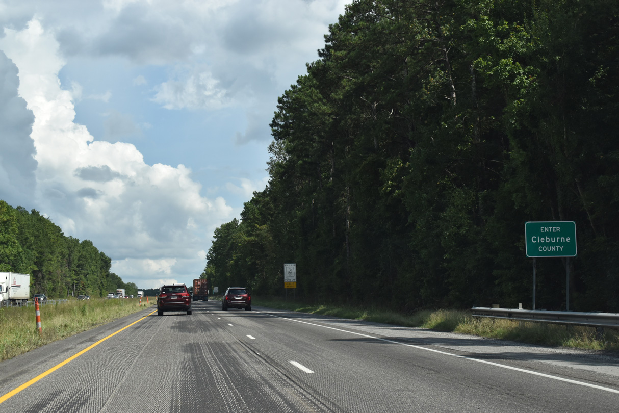
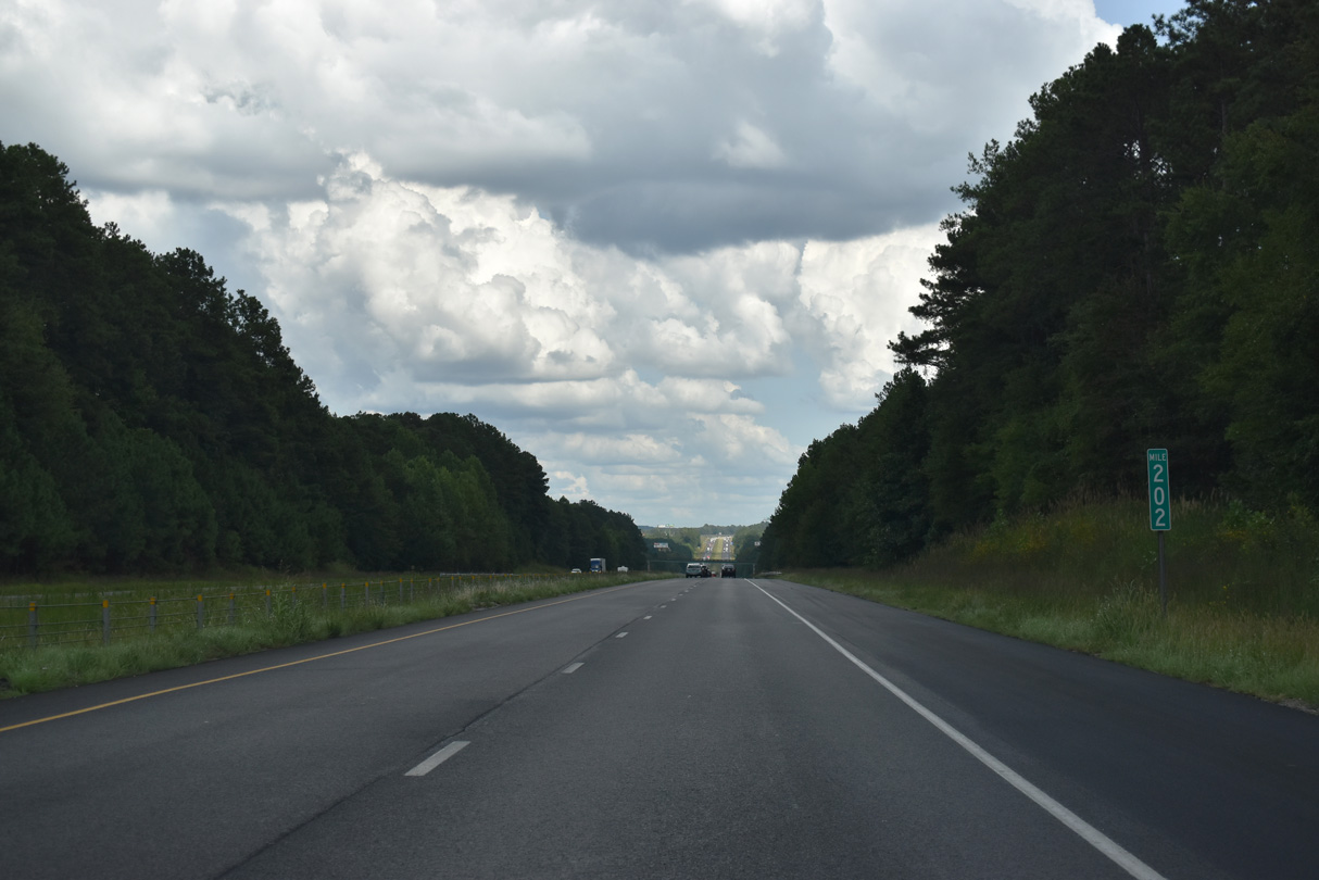
The final 20.96 miles of Interstate 20 in Alabama travel across Cleburne County.
09/11/20
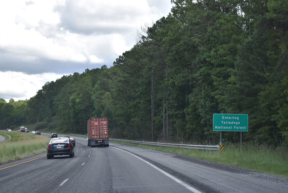
Interstate 20 traverses areas of Talladega National Forest east to Exit 199.
09/11/20
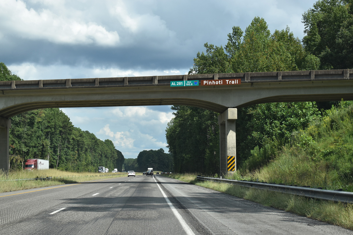
SR 281 (Talladega Scenic Drive / Pinhoti Trail) spans I-20 at mile post 195.8.
09/11/20
SR 281 (Talladega Scenic Drive) meanders northward across Horseblock Mountain to U.S. 78/SR 9 near Cleburne.
09/11/20
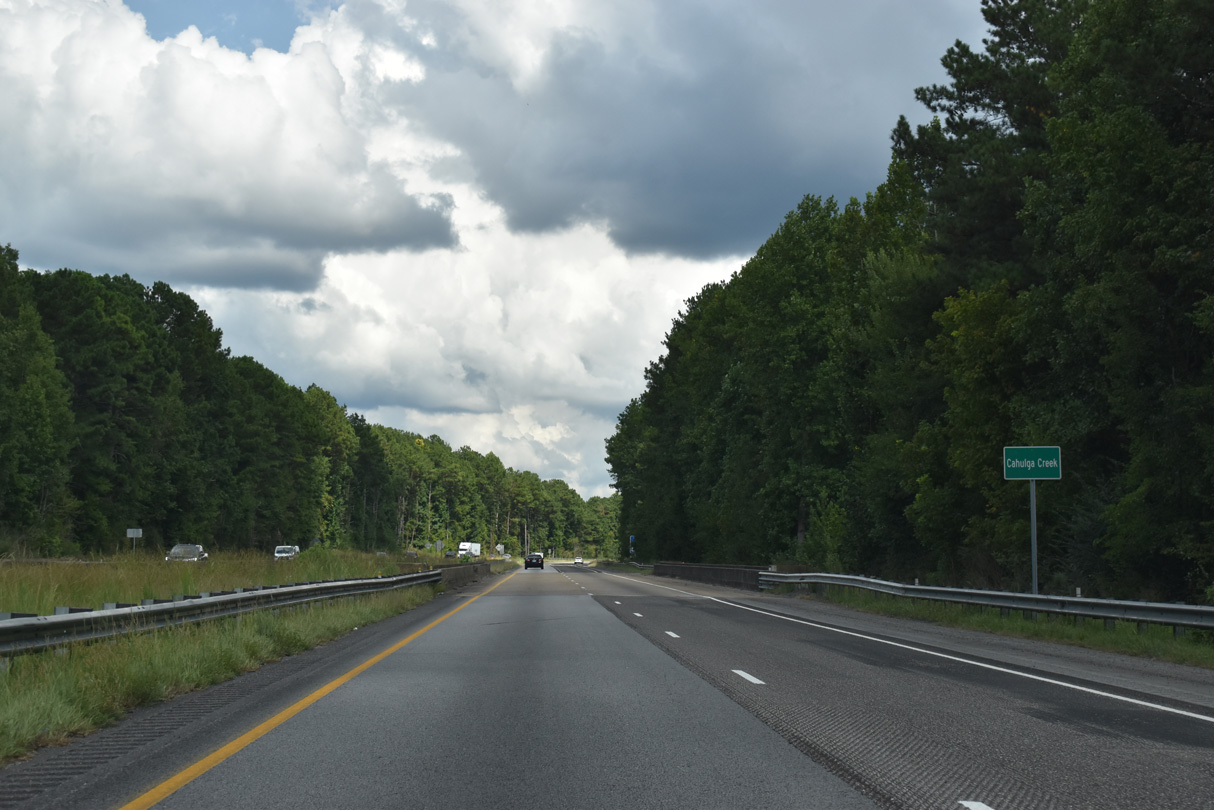
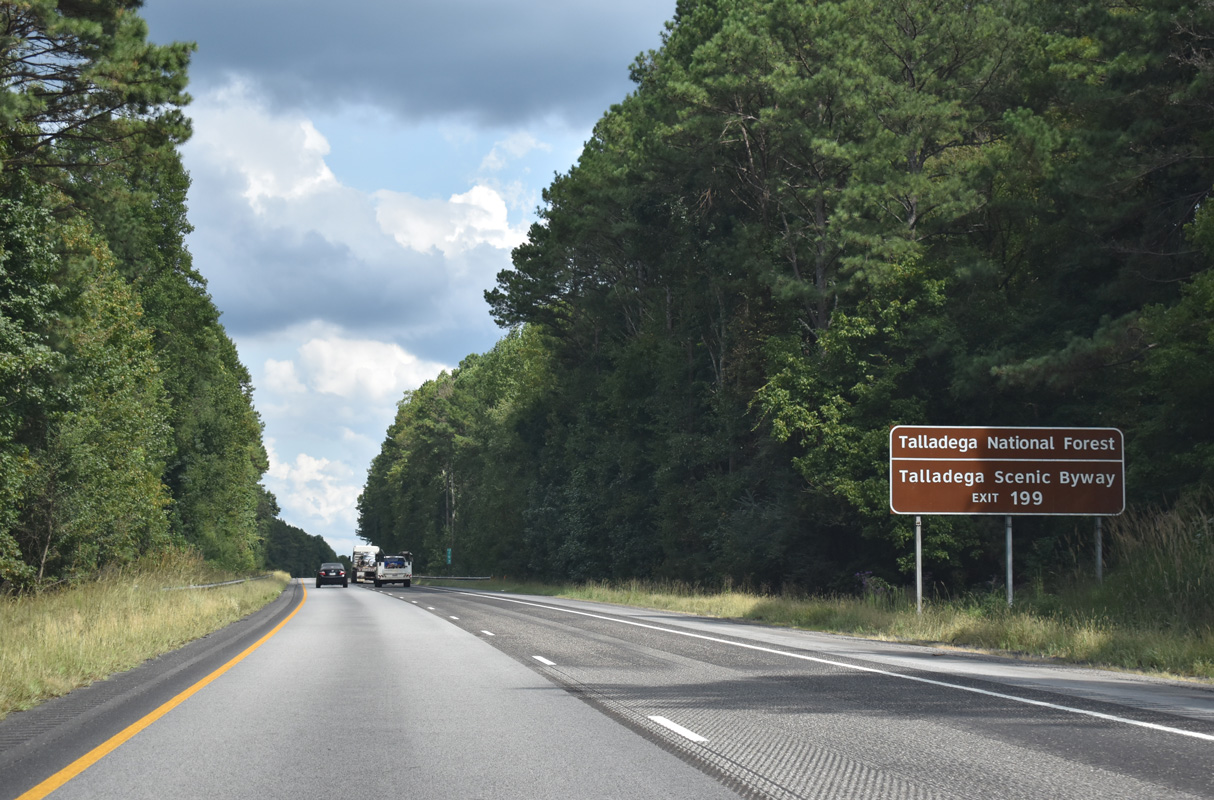
The diamond interchange (Exit 199) with SR 9 (Almon Street) near the Cleburne County seat of Heflin is 0.7 miles east of the I-20 bridge across Cahulga Creek.
09/11/20
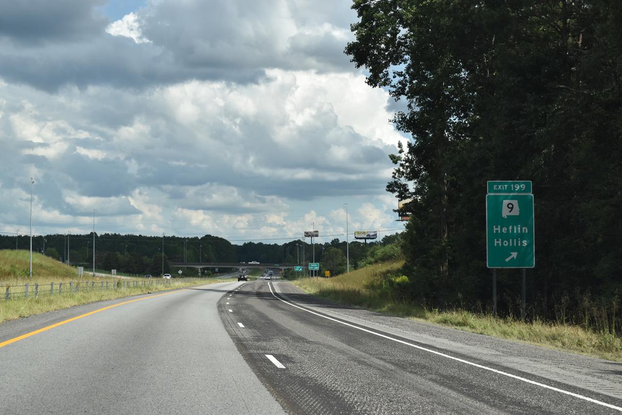
SR 9 heads 1.5 miles north to a 4.3 mile long overlap with U.S. 78 west between Old Davisville and Heflin. SR 9 continues north from U.S. 78, 21 miles to Piedmont and 38 miles to Centre. South from Exit 199, SR 9 travels nine miles to U.S. 431 at Hollis Crossroads and 25 miles to Lineville.
09/11/20
Interstate 20 straddles the south Heflin city limits east.
09/11/20
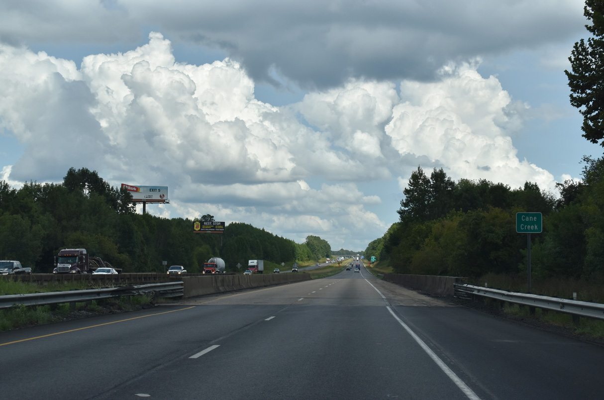
Interstate 20 crosses Cane Creek east of the CR 18 overpass.
09/11/20
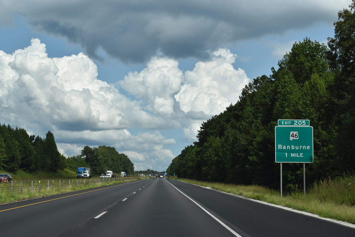
SR 46 extends 4.78 miles east from U.S. 78 (Ross Street) in Heflin to the diamond interchange at Exit 205.
09/11/20

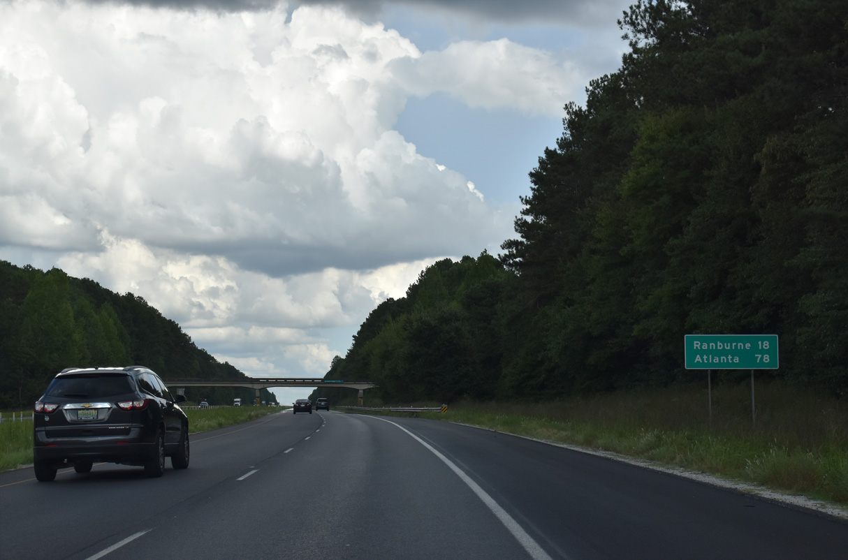
Southeast from Exit 205, SR 46 leads eight miles to Trickem and 14 miles to Ranburne. Alabama State Route 46 transitions into Georgia State Route 166 east ahead of Bowdon.
07/15/05

Another Progress20 project rebuilt and expanded 1.86 miles of I-20 between a point west of the Tallapoosa River to east of County Route 49 / Exit 210. Construction was underway between December 2011 and Fall 2013.
09/11/20
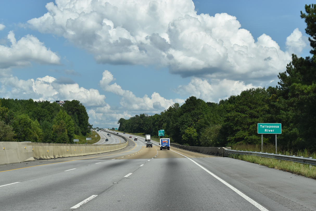
The Tallapoosa River flows south from Interstate 20 into Lake Wedowee.
09/11/20
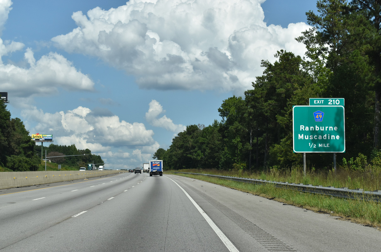
Cleburne County Route 49 meets I-20 at a diamond interchange (Exit 210) by the unincorporated community of Abernathy.
09/11/20
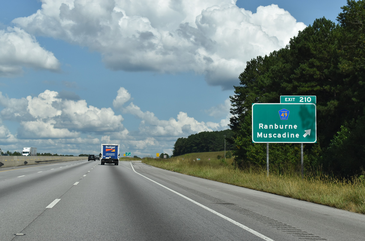
County Route 49 meanders south 11.5 miles through the settlements of New Hopewell and Macedonia to SR 46 at Ranburne. CR 49 continues 8.3 miles north through Lebanon and Muscadine to U.S. 78.
09/11/20
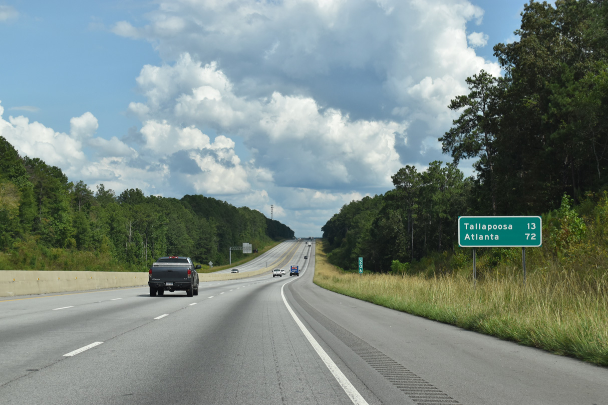
Interstate 20 east next meets Georgia State Route 100 at Exit 5, 4.7 miles south of U.S. 78/SR 8 in Tallapoosa.
09/11/20
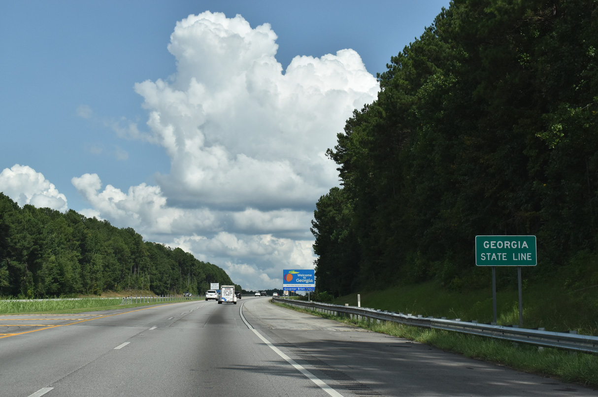
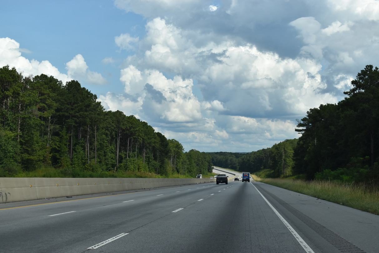
Interstate 20 crosses the Georgia state line east into Haralson County.
09/11/20

References:
Talladega Superspeedway. (n.d.) History. Retrieved October 11, 2012 from http://www.talladegasuperspeedway.com/This-Is-Talladega/History.aspx
Photo Credits:
- ABRoads: 10/07/12, 09/11/20
- Alex Nitzman: 07/15/05, 09/11/20
Connect with:
Page Updated Saturday February 28, 2026.