
Intertate 20 East - Atlanta to Conyers
 East
East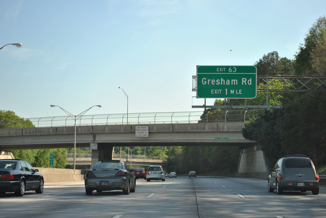
Interstate 20 turns back to the east from the confluence of Flat Shoals and Fayetteville Roads ahead of Exit 63 to Gresham Road.
04/13/12

A split diamond interchange connects I-20 with Gresham and Flat Shoals Roads in 0.75 miles. Forthcoming Columbia Drive is the last exit before Interstate 20 meets the Atlanta Beltway again.
04/13/12

Gresham Road stems south from Flat Shoals Road to cross I-20 en route to Clifton Church Road.
04/13/12
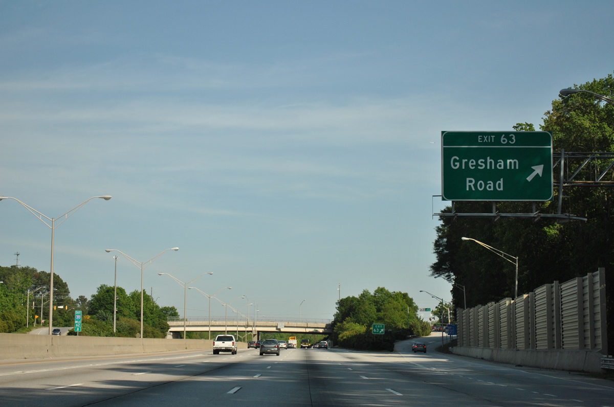
Exit 63 leaves I-20 east to Gresham Road. Retail lines the immediate vicinity of Gresham Road before the arterial winds southeast by several leafy subdivisions.
04/13/12
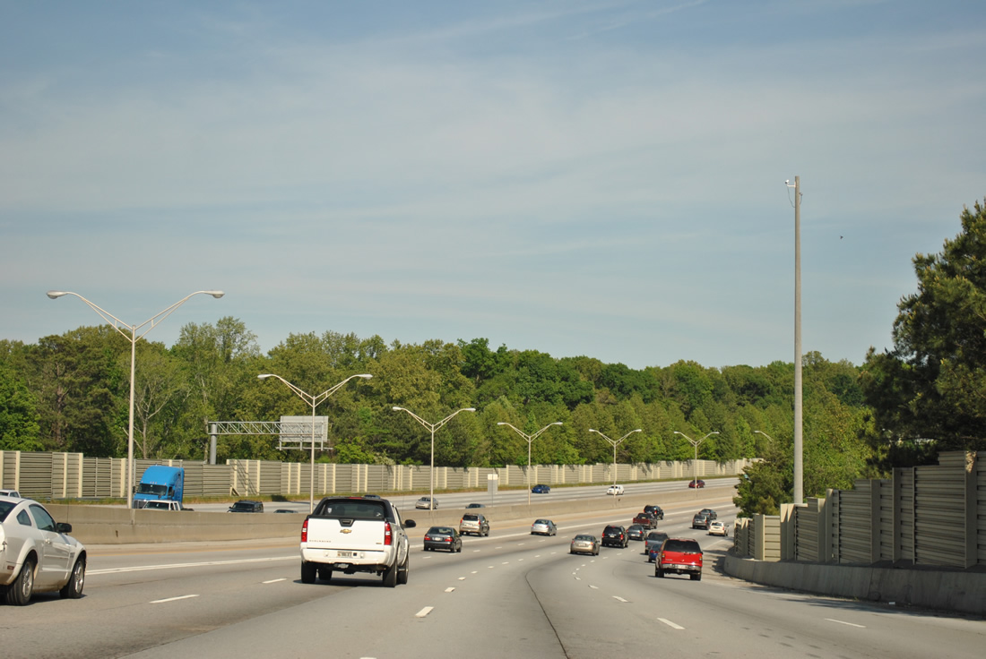
The ten lane freeway east of the Flat Shoals Road entrance ramp by Doolittle Creek. Sound walls were added along the east side of I-20 here after 2005.
04/13/12
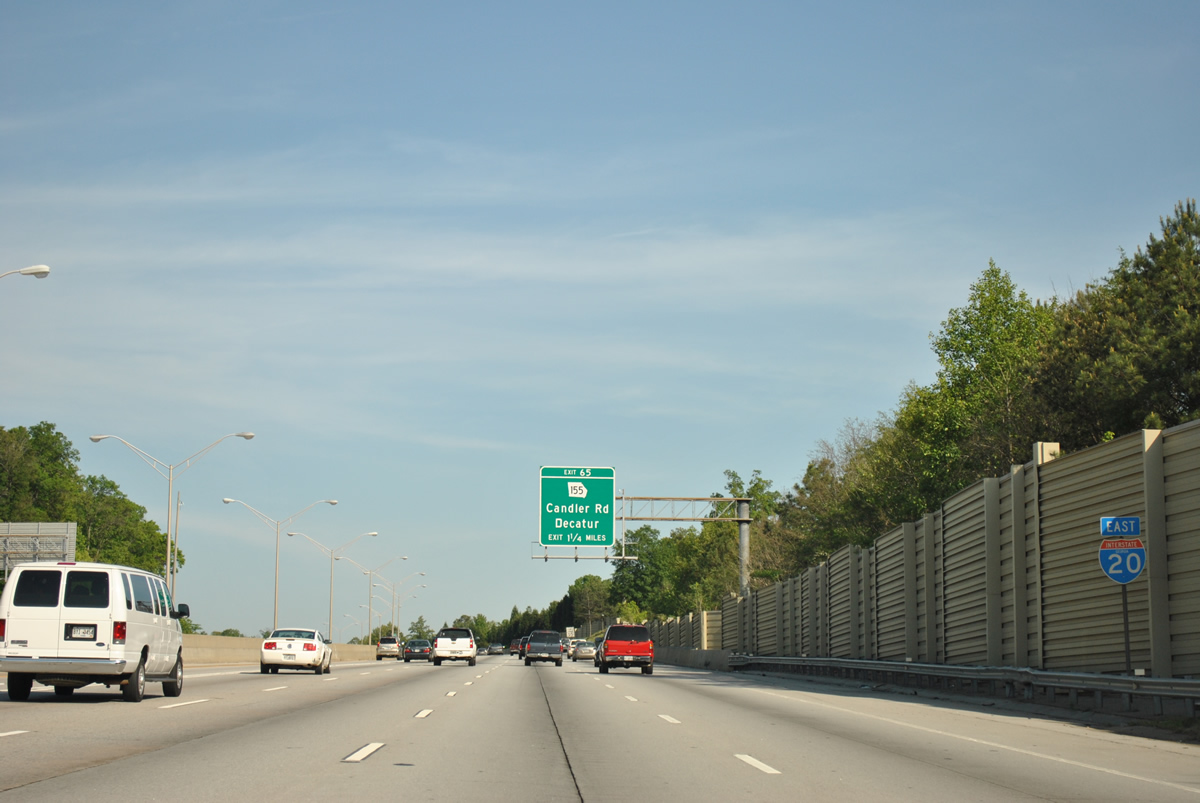
The first confirming marker for Interstate 20 posted east of I-285 precedes Exit 65.
04/13/12
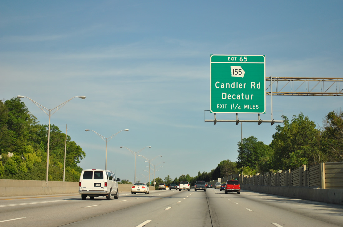
SR 155, a 57 mile long route from U.S. 19/41 in Griffin to U.S. 23/SR 13 near Chamblee, meets Interstate 20 at a diamond interchange (Exit 65) in 1.25 miles.
04/13/12
2.5 miles west of Interstate 285 (Perimeter Highway) along I-20 east. An interchange also joins SR 155 with the Atlanta Beltway just south of Panthersville.
04/13/12

SR 155 (Candler Street) leads 4.6 miles north from Exit 65 to Downtown Decatur.
04/13/12

A commercialized stretch anchored by South Dekalb Mall leads SR 155 south one mile to Interstate 285. SR 155 becomes Flat Shoals Road midway between the two freeways, and Flat Shoals Parkway eastward to Snapfinger.
04/13/12
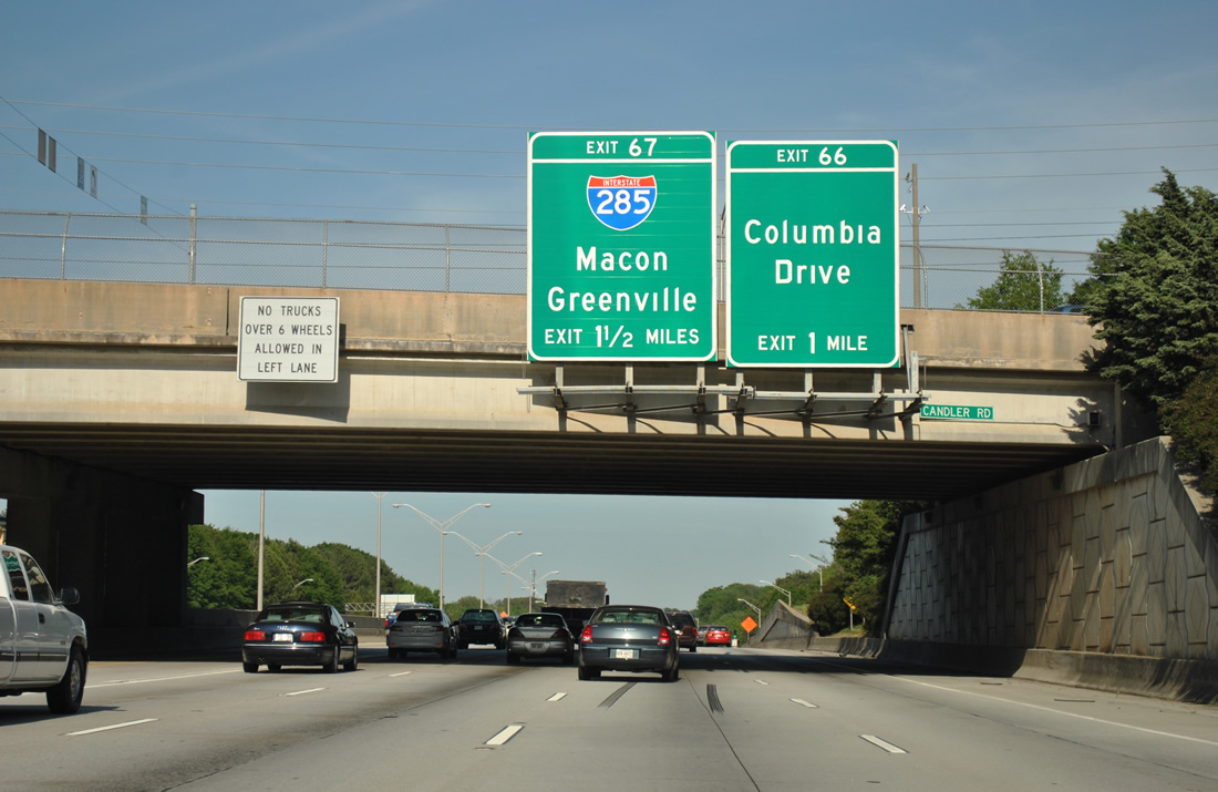
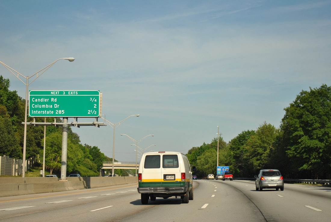
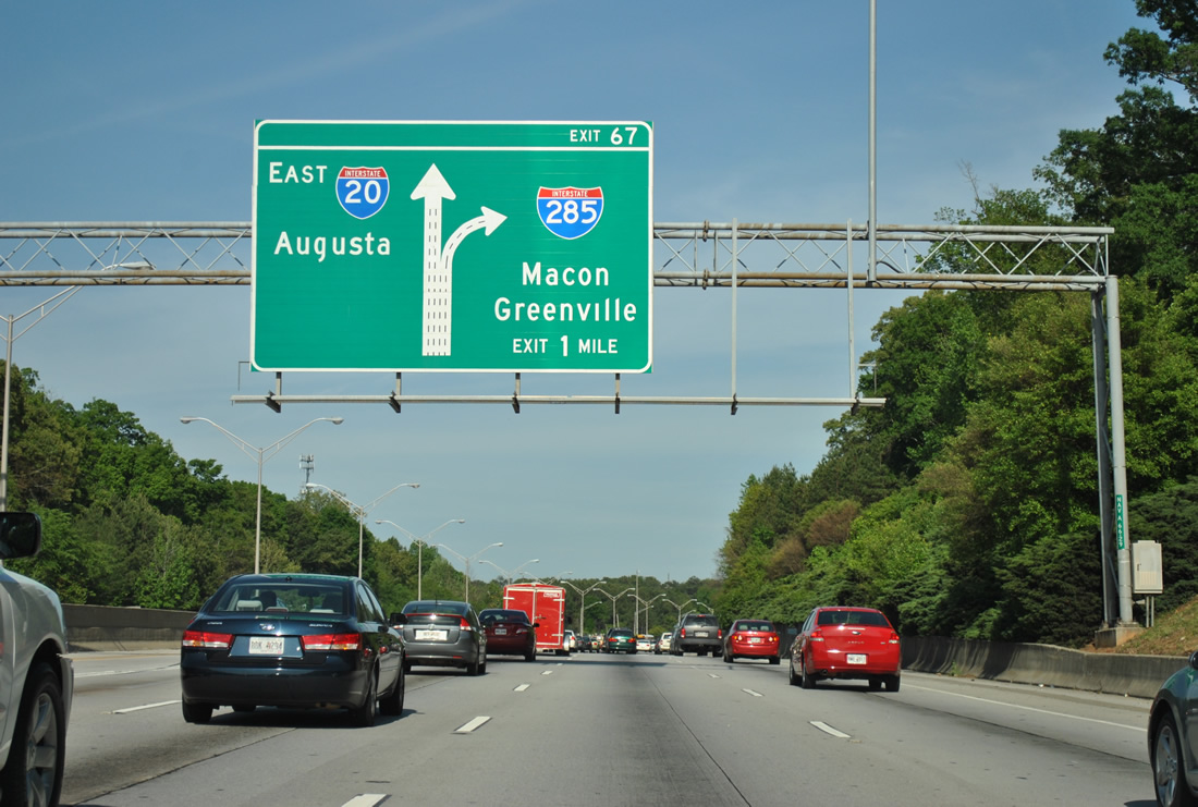
15 miles east of their previous exchange, I-20/285 come together again at a directional cloverleaf interchange (Exit 67) in 1.25 miles. A half diamond interchange (Exit 66) joins I-20 next with Columbia Drive.
04/13/12
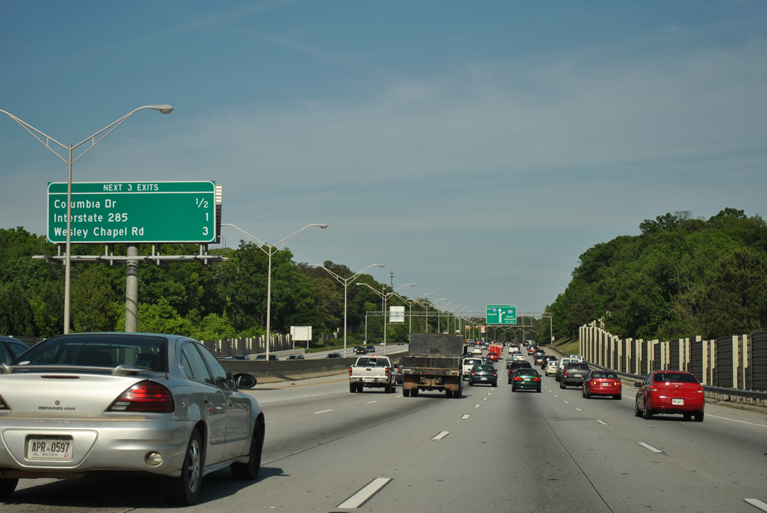
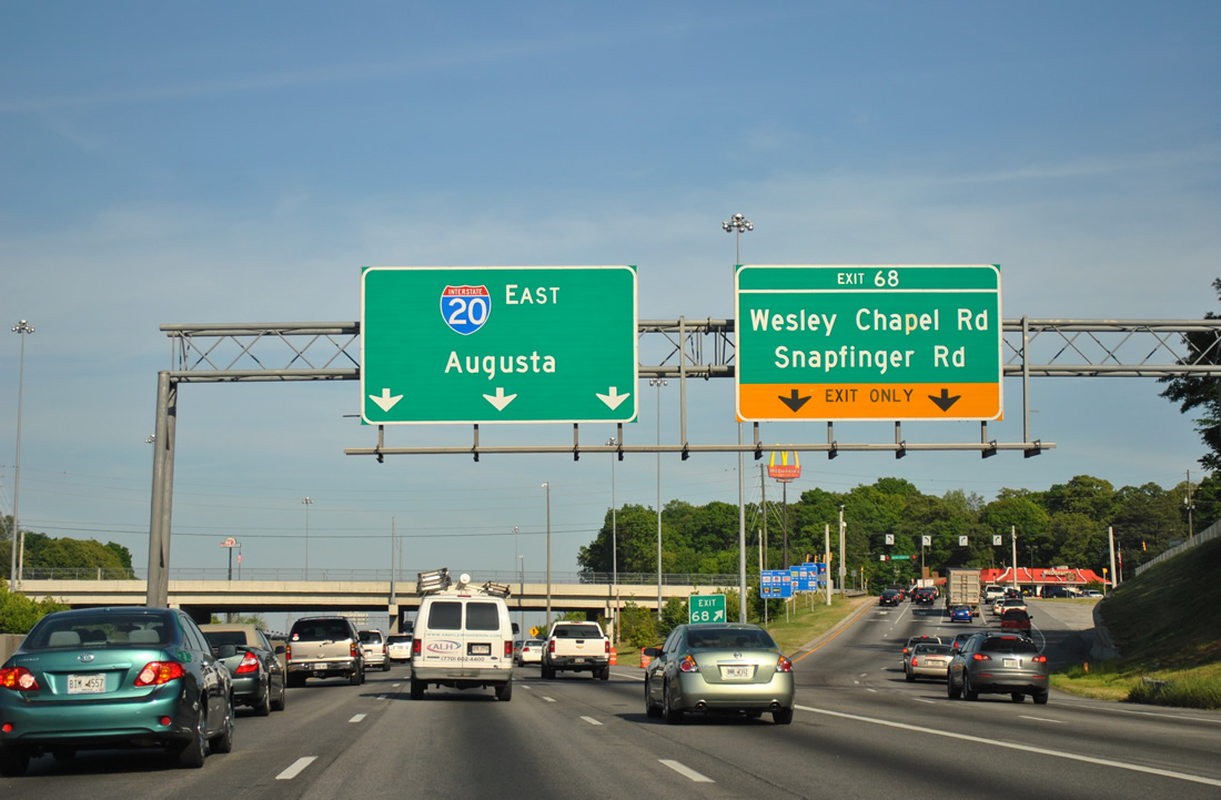
Often causing traffic delays, Interstate 20 east reduces from five to three overall lanes through the exchange with I-285. Exit 68 to Wesley Chapel Road follows the Beltway.
04/13/12
All traffic for I-285 departs in unison for the Perimeter Highway north to I-85 at Doraville and south to I-675 near Southeast Atlanta. Originally separate exits connected I-20 east with I-285, with a loop ramp joining the beltway north. The overall exchange was redesigned to eliminate left exit ramps by the late 1980s.
04/13/12
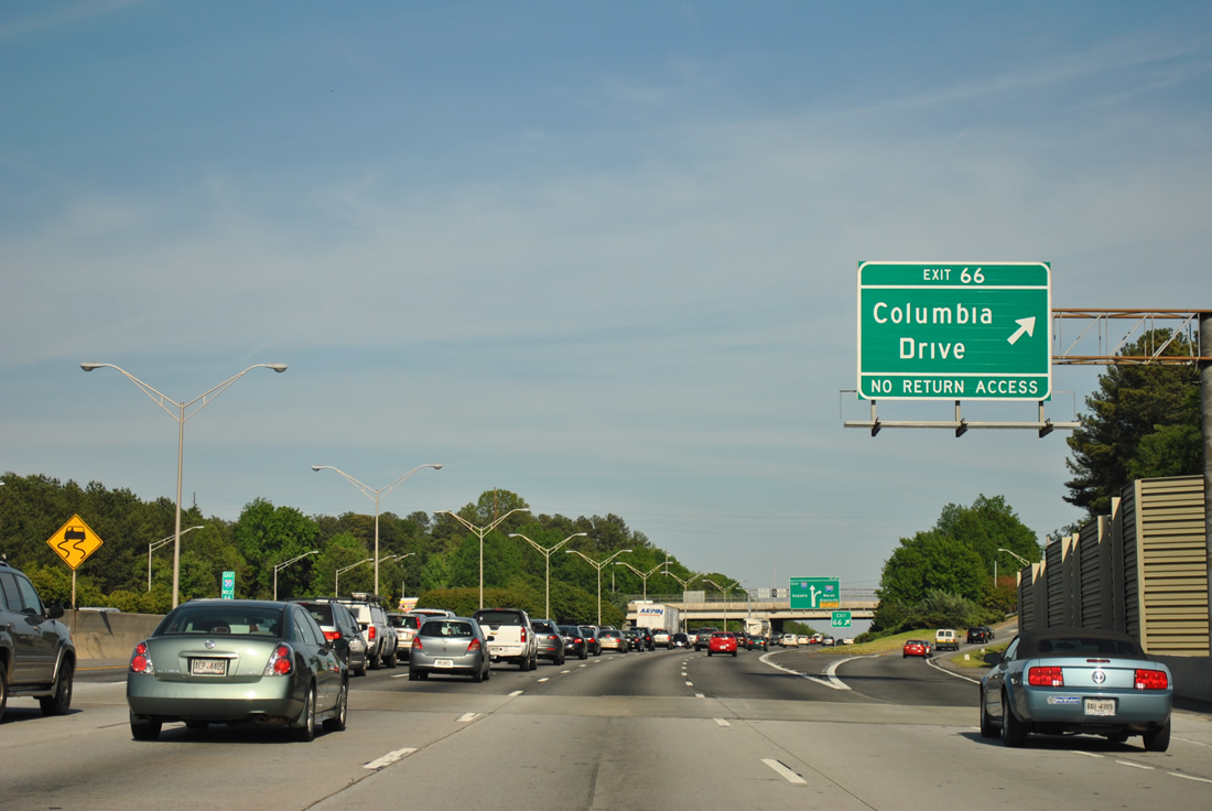
Columbia Drive arcs northwest from Exit 66 to Belvedere Park and the city of Decatur. Southward the suburban road curves to SR 155 (Flat Shoals Parkway) at Clifton Springs Road.
04/13/12
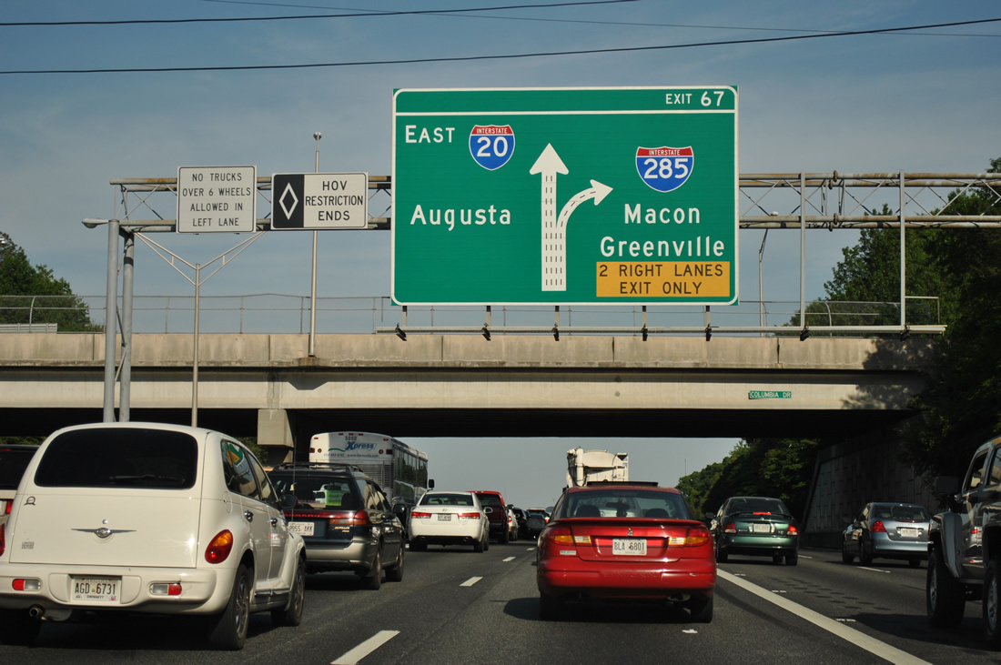
Two lanes drop from I-20 east at Exit 67 after the Columbia Drive overpass. Interstate 285, a 64 mile long beltway, utilizes control cities for the routes in which it connects.
04/13/12
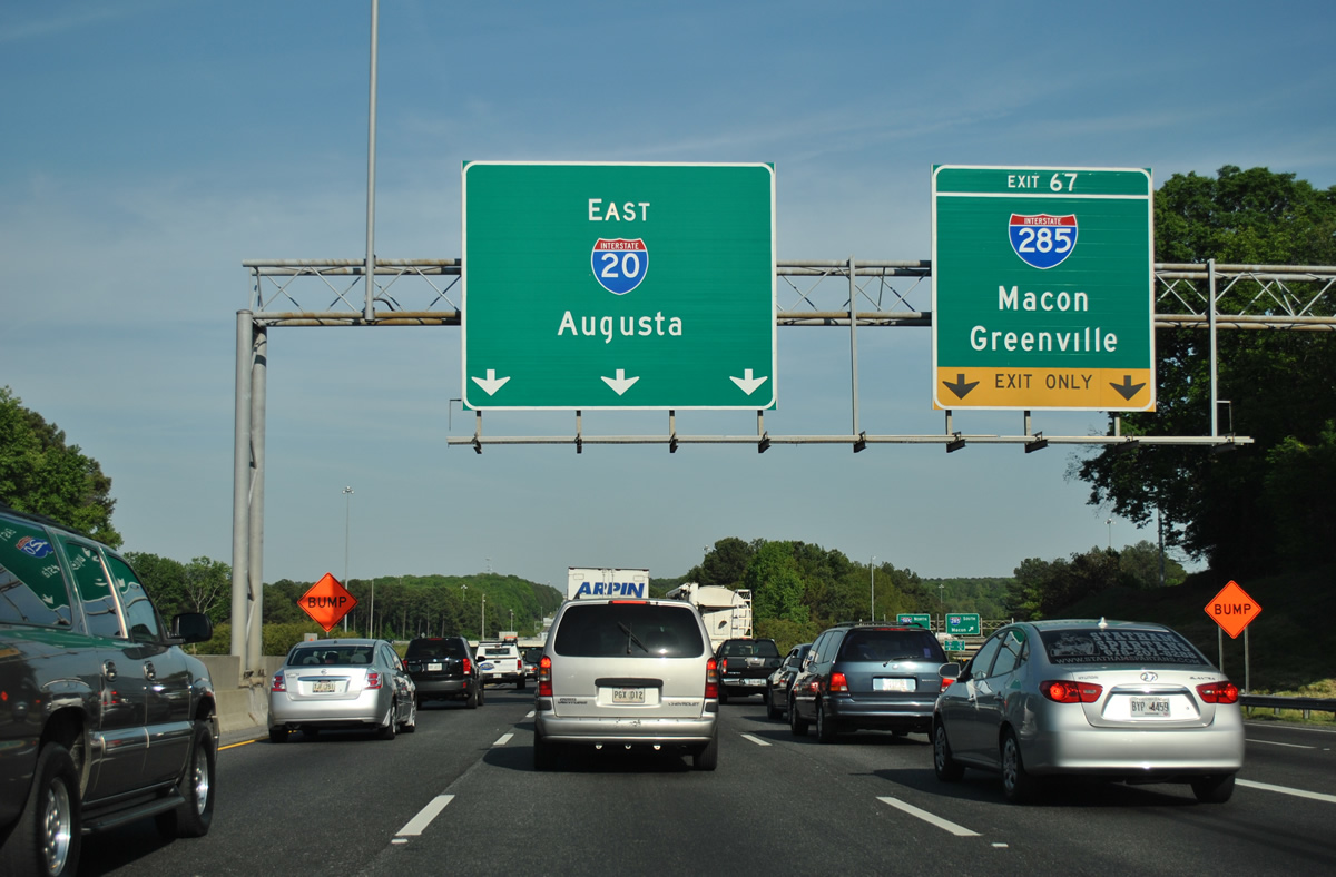
Greenville relates to Interstate 85 northeast from Duluth and Buford. Macon is derived from I-675 south to I-75 south from Stockbridge and McDonough.
04/13/12
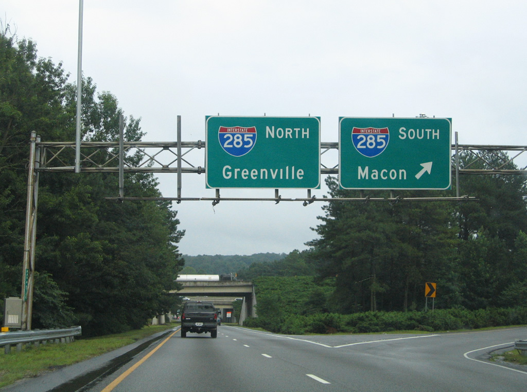
Two lanes of Exit 67 join I-285 north ahead of Decatur and Stone Mountain. Southbound Interstate 285 turns west from I-20 to Mountain View, Forest Park and ATL Airport.
07/15/05
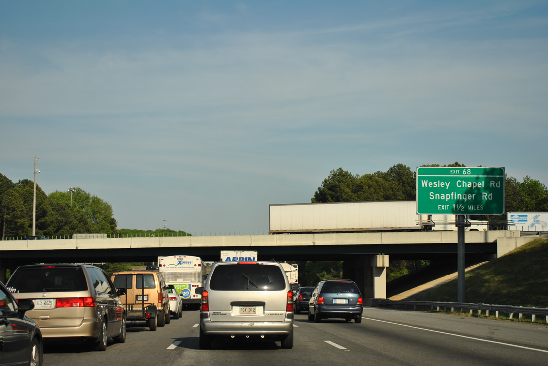
I-20 advances 1.5 miles east from I-285 to Exit 68 for Wesley Chapel and Snapfinger Roads. Redesign of the exchange with I-285 included a new southbound roadway for the Atlanta Beltway built adjacent to the northbound lanes. The previous southbound lanes were repurposed as a distributor roadway.
04/13/12
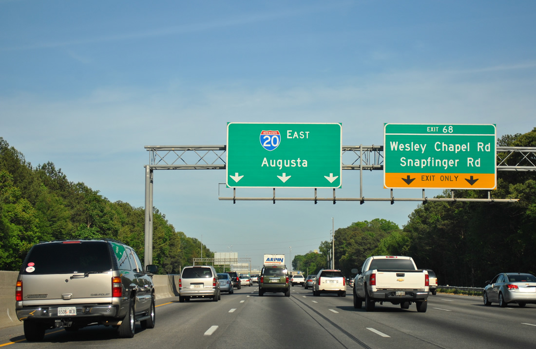
Two auxiliary lanes open east on I-20 to the diamond interchange (Exit 68) with Wesley Chapel Road. Construction of I-20 severed Snapfinger Road, which runs northwest to Columbia Drive. The northern portion is accessed via Snapfinger Woods Drive west from Chapel Hall Shopping Center. Southeast, Snapfinger Road leads to the community of Snapfinger and SR 155 (Flat Shoals Parkway).
04/13/12
Wesley Chapel Road leaves the commercialized exchange at Exit 68 for U.S. 278/SR 12 (Covington Highway) near Glen Haven and south to SR 155 at Flakes Mill Road.
04/13/12

A $30.9 million contract was awarded on February 7, 2012 to construct collector distributor lanes along I-20 between I-285 and Exit 71 to Panola Road. Completed in August 2013, the 4.7 mile long project added two eastbound lanes and sound barriers.1
04/13/12
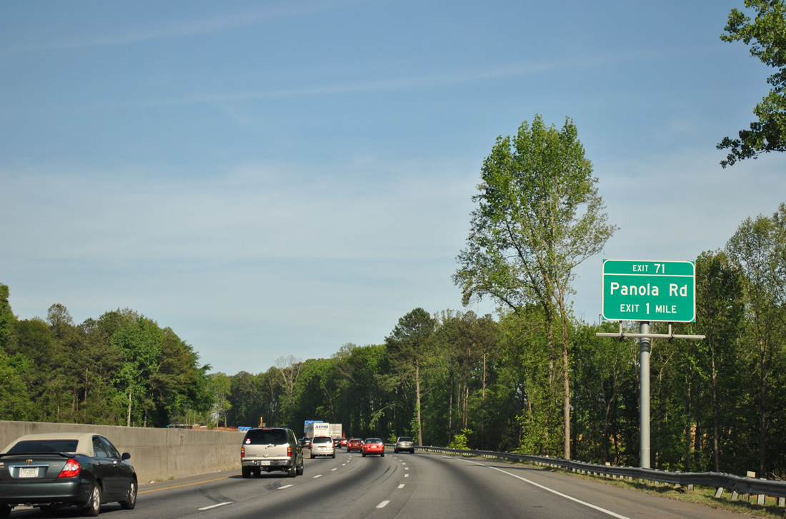
Snapfinger Creek flows under Interstate 20 ahead of Exit 71 to Panola Road.
04/13/12
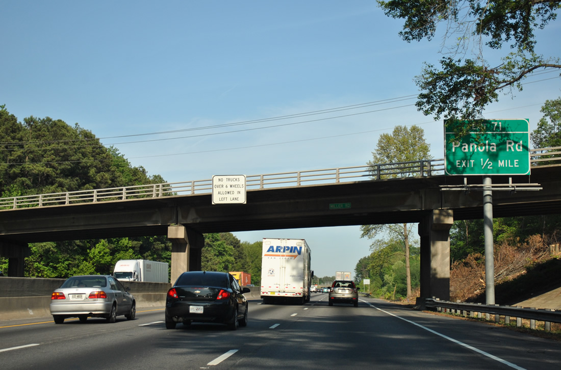
Miller Road spans I-20 a half mile west of the diamond interchange (Exit 71) with Panola Road. Panola Road runs between S Stone Mountain Lithonia Road and SR 155 (Snapfinger Road).
04/13/12
A second Interstate 20 shield posted on the stretch between Exits 68 and 71.
04/13/12
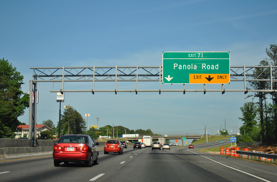
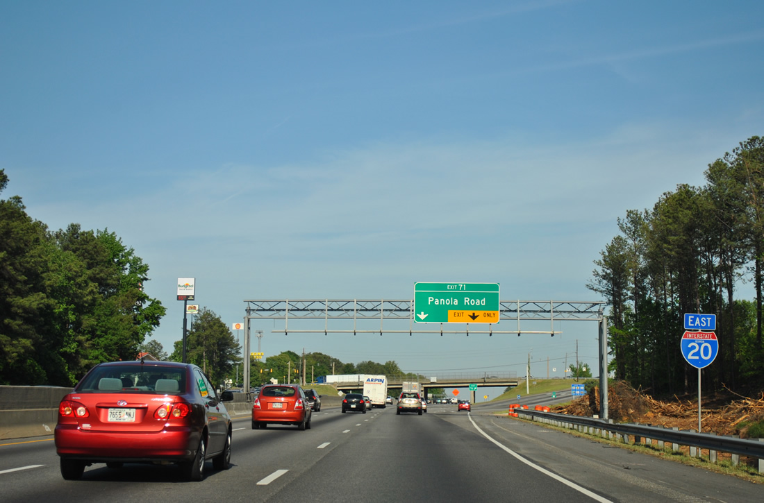
Commuters depart Interstate 20 east at the commercialized interchange with Panola Road. Sprawling Snapfinger Woods Industrial Park lines the west side of Panola Road north to U.S. 278 (Covington Highway) at Belmont.
04/13/12
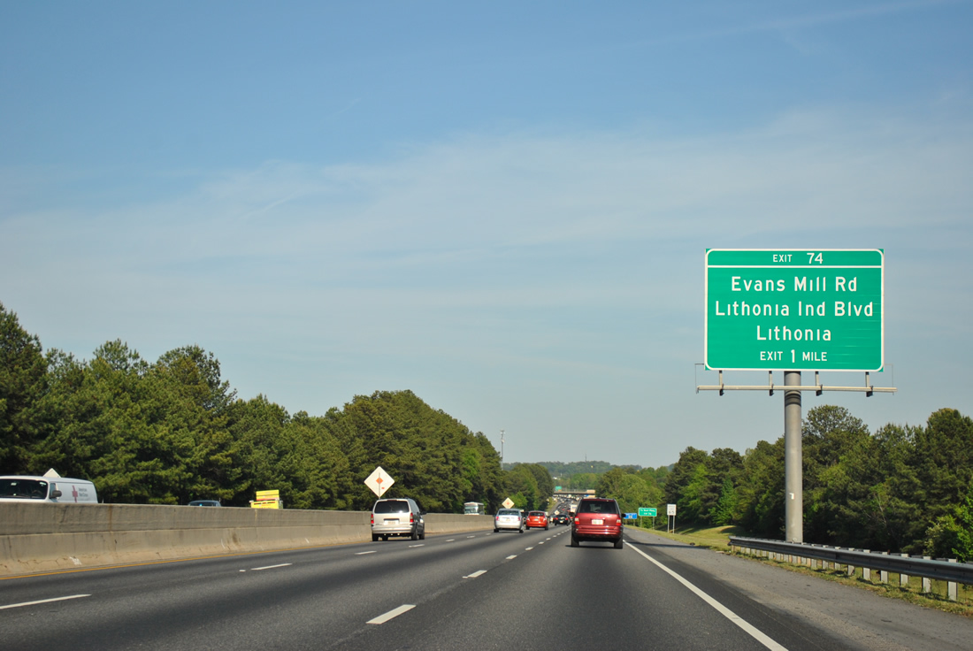
A split diamond interchange links I-20 east with Lithonia Industrial Boulevard and Evans Mill Road at Exit 74.
04/13/12
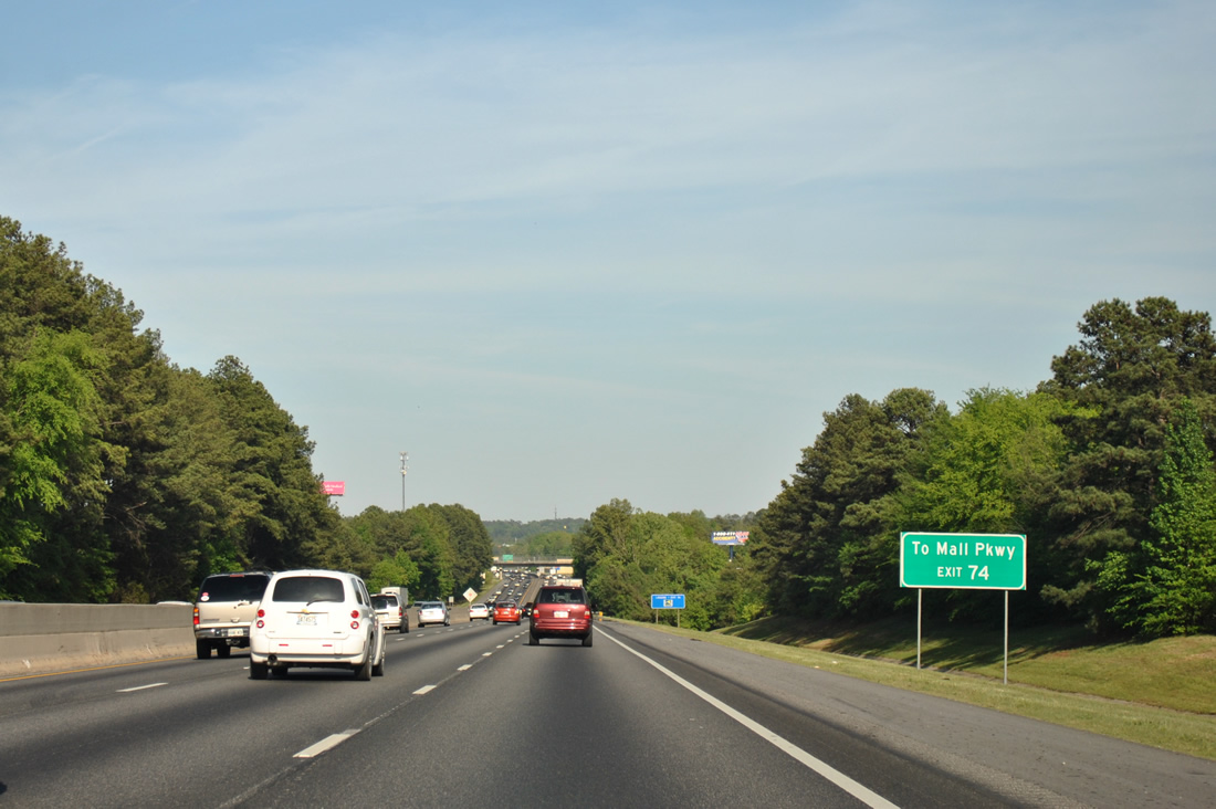
Exit 74 forms a south side frontage road to Lithonia Industrial Boulevard north and Evans Mill Road with connections to Mall Parkway east to The Mall at Stonecrest.
04/13/12
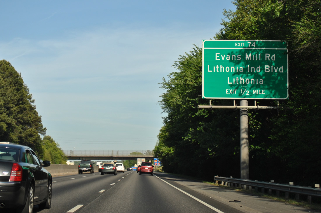
Fairington Road passes over I-20 to join Hillandale Drive to the north, one half mile ahead of Exit 74. Forthcoming Lithonia Industrial Boulevard leads northeast from Exit 74 around the city of Lithonia. An extension of the arterial links S Stone Mountain Lithonia Road with SR 124 (Rock Chapel Road).
04/13/12

Two lanes leave Interstate 20 east for Lithonia Industrial Boulevard and Evans Mill Road. Evans Mill Road enters Lithonia as Main Street to the northeast. The road winds southwest to SR 212 (Browns Mill Road.
04/13/12
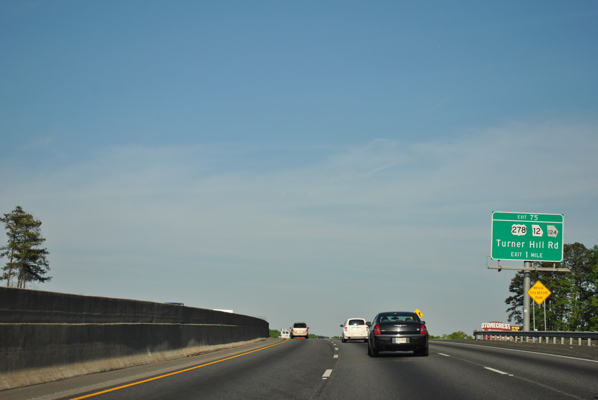
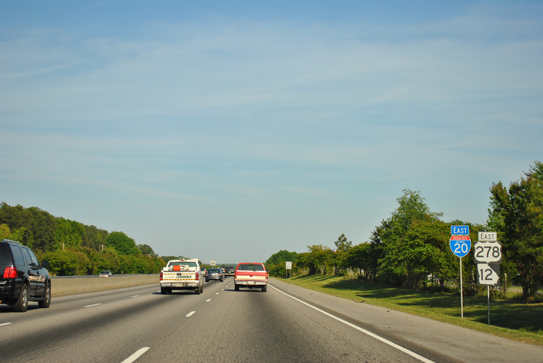
U.S. 278/SR 12 (Covington Highway) run southeast from Decatur and Glen Haven to meet Interstate 20 at Lithonia. The pair join Turner Hill Road (SR 124) to the diamond interchange at Exit 75.
04/13/12

The frontage road from Exit 74 adds a fourth eastbound lane to Turner Hill Road. Turner Hill Road carries SR 124 north from I-20 to Rock Chapel Road. Southward the road continues by The Mall at Stonecrest to Rockland Road west toward Arabia Mountain and Panola Mountain State Park.
04/13/12

Interstate 20 lines the northern periphery of the mall and the associated out parcels ahead of Exit 75 to SR 124 north and U.S. 278/SR 12 west.
04/13/12
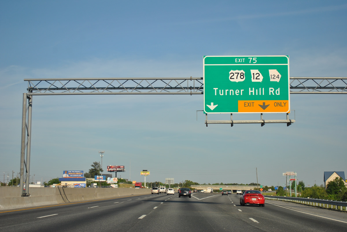
SR 124 travels nearly 51 miles from Lithonia northeast to Snellville, Lawrenceville and Braselton by Interstate 85. U.S. 278/SR 12 east join I-20 through Conyers to Covington and Exit 90.
04/13/12

 East
East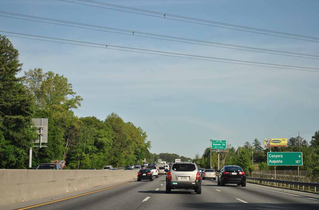
Conyers, the Rockdale County seat, is the next destination along Interstate 20 eastbound. Augusta is nearly two hours away.
04/13/12
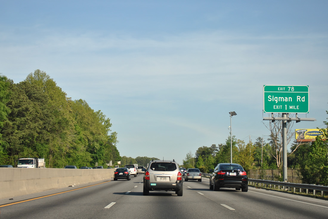
Mall Parkway winds east from Turner Hill Road to form a south side frontage road to the diamond interchange (Exit 78) with Sigman Road.
04/13/12
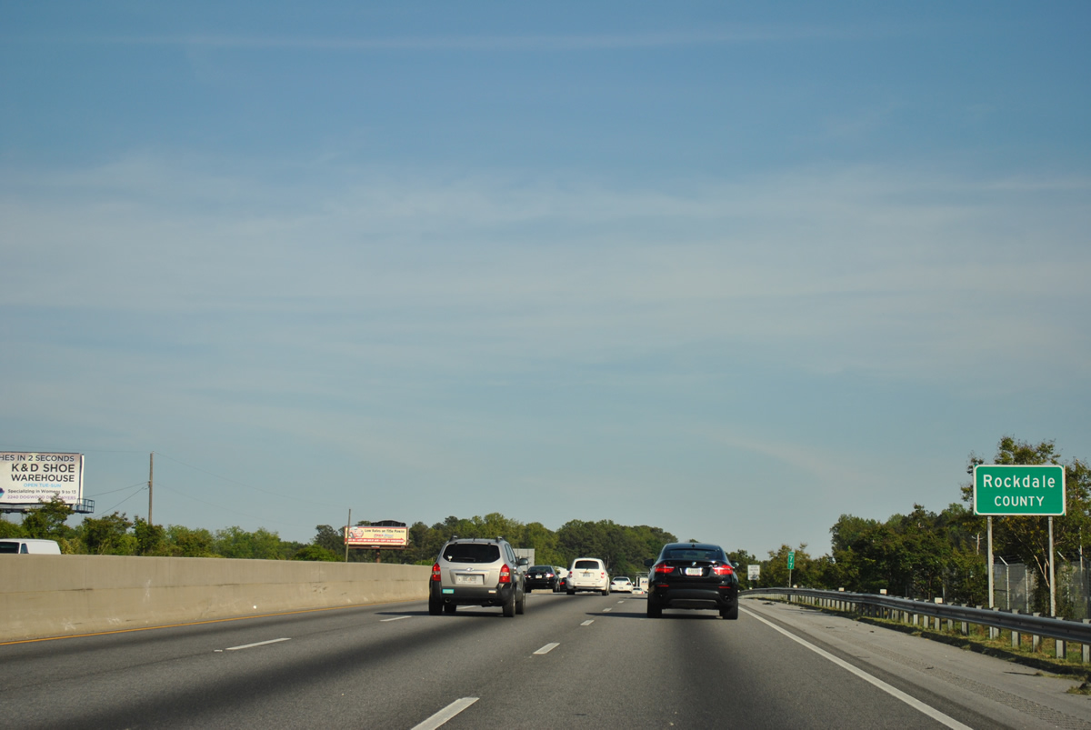
Entering Rockdale County along I-20-U.S. 278/SR 12 east. I-20 directly overlaid U.S. 278 when it was constructed through the county.
04/13/12
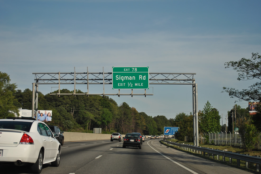
Sigman Road stems east from Abbott Road to cross Interstate 20 on the industrial west side of Conyers. The road encircles the north side of the city to SR 20.
04/13/12
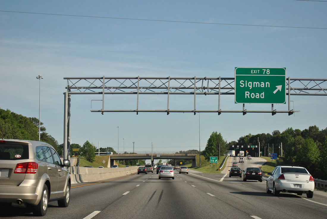
Sigman Road intersects Iris Drive, a south side frontage road, to the west of Exit 78 and Old Covington Highway (former U.S. 278) immediately to the east. Old U.S. 278 parallels the freeway to the north en route to Green Street in Conyers.
04/13/12
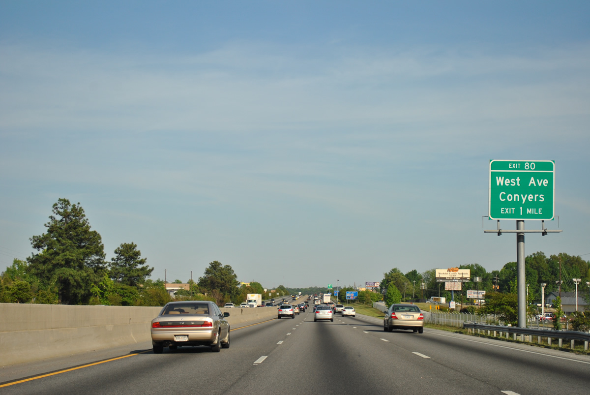
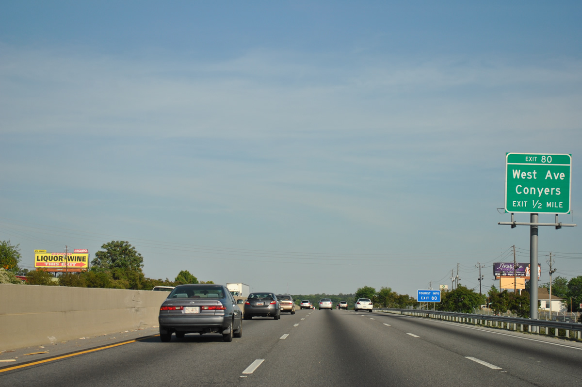
Exit 80 joins I-20-U.S. 278/SR 12 east with West Avenue at a diamond interchange in one mile.
04/13/12
West Avenue continues Klondike Road eastward into the city of Conyers at Green Street (former U.S. 278). Iris Drive runs directly beside I-20 east here.
04/13/12
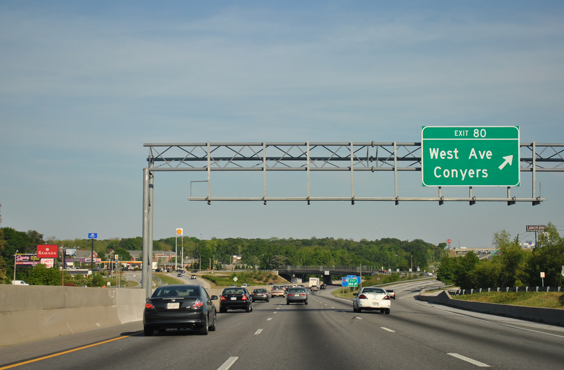
Exit 80 departs I-20/U.S. 278-SR 12 east for West Avenue in Conyers. Iris Drive remains alongside the six lane freeway to Exit 82 and again from east of Exit 82 to Exit 84. Dogwood Drive parallels the north side of I-20.
04/13/12
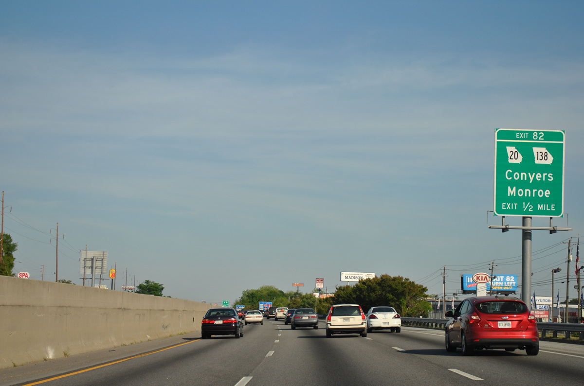
SR 20/138 (McDonough Road south / Walnut Grove Road north) meet I-20 at the second Conyers exit. SR 20/138 overlap for 2.5 miles between Stockbridge / McDonough Highways and Sigman Road.
04/13/12
SR 20 loops around Greater Atlanta as part of a 165 mile long course through McDonough, Conyers, Loganville, Lawrenceville, Buford, Cumming, Canton and Cartersville.
04/13/12
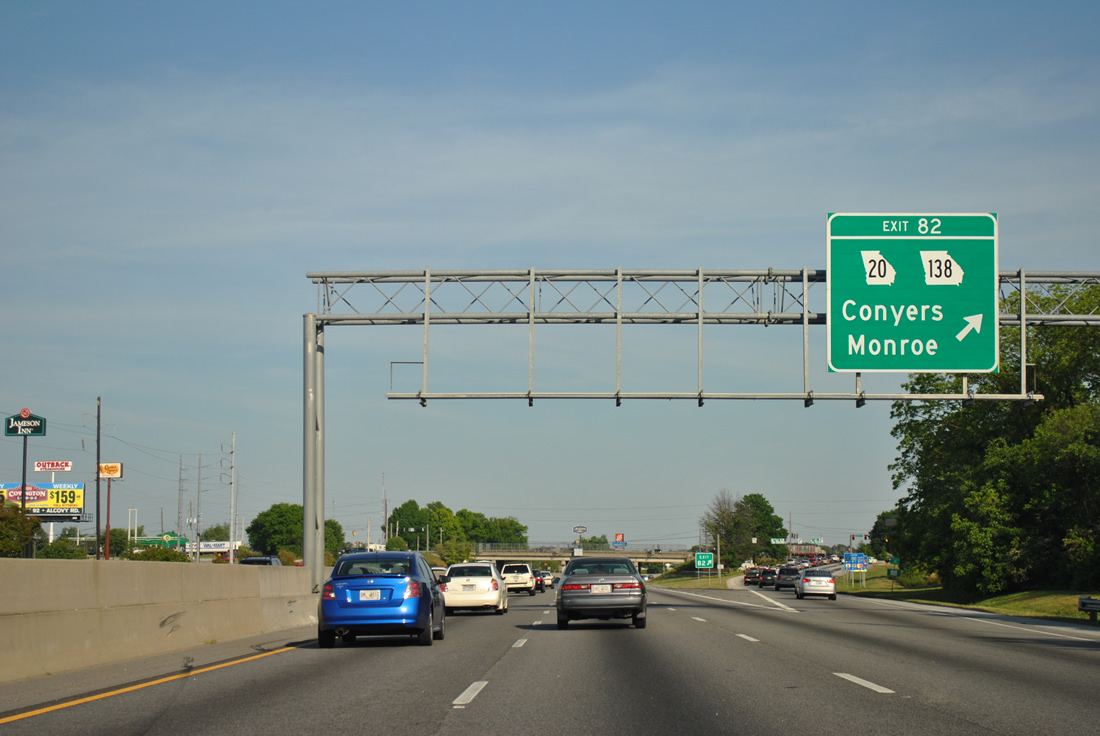
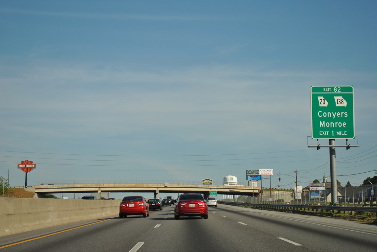
Exit 82 departs I-20/U.S. 278-SR 12 east for SR 20/138. 59 miles in length, SR 138 runs across the south Atlanta suburbs from SR 92 at Fairburn and Union City eastward to Jonesboro, Stockbridge and Conyers. SR 138 extends 21 miles northeast to U.S. 78 in the city of Monroe.
04/13/12

The first confirming markers for Interstate 20, U.S. 278 and SR 12 east.
04/13/12
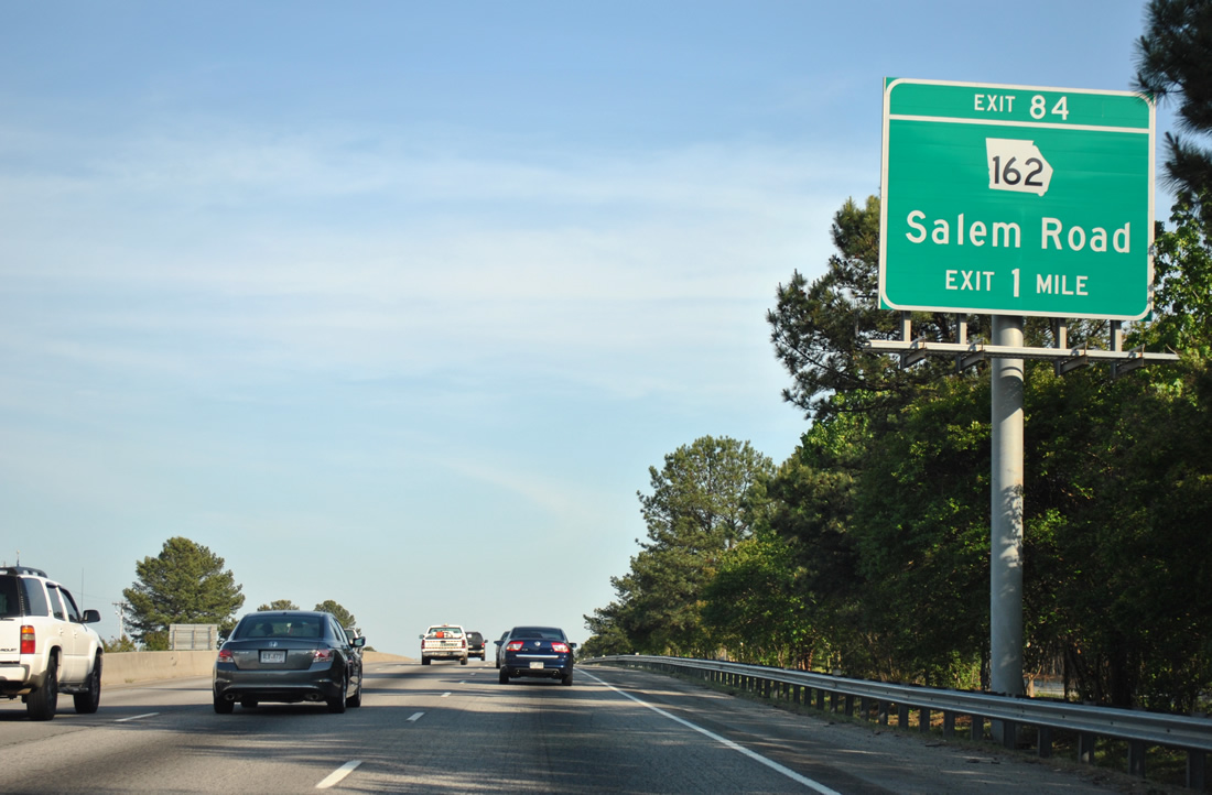
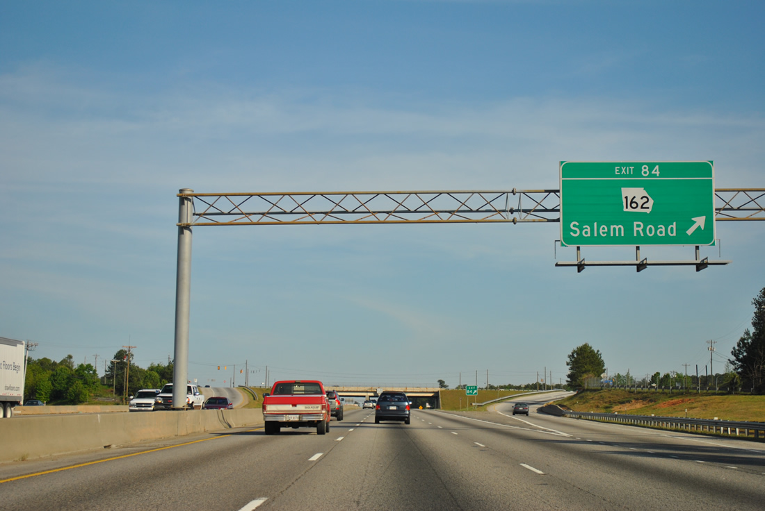
Interstate 20 continues east one mile to Exit 84 with Salem Road and the north end of SR 162..
04/13/12
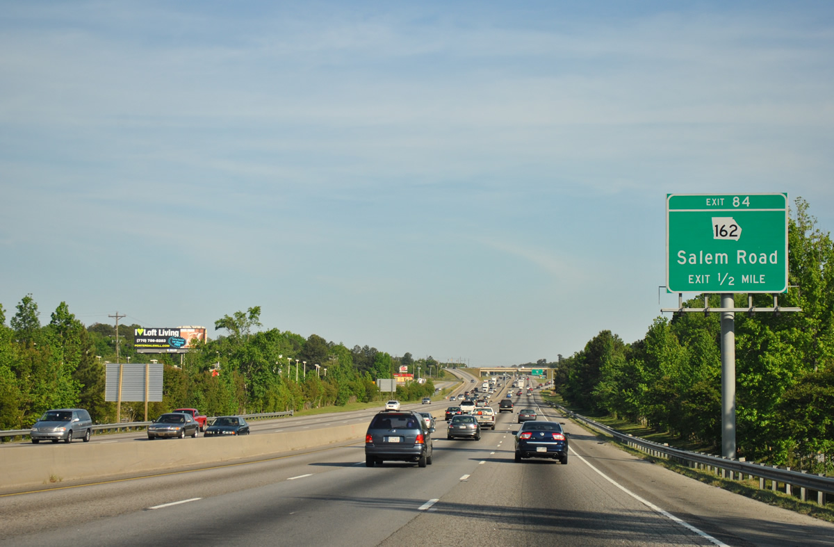
SR 162 (Salem Road) spurs 18.4 miles south from the diamond interchange at Exit 84 to Pace and Rocky Plains through southern Newton County to SR 36.
04/13/12
Northward from Exit 80, Salem Road becomes Sigman Road beyond the intersection with Old Covington Road (old U.S. 278).
04/13/12
East from Exit 84, I-20 overlaid the second alignment of U.S. 278, which remains as the frontage road system east to Almon Road. The first alignment follows Old Covington Road to the north between SR 20/138 and Almon Road.
04/13/12
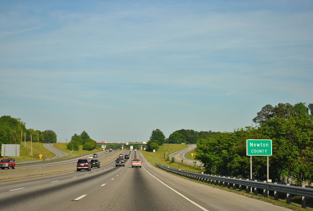
Crossing into Newton County, an overpass links the north and south side frontage roads as Almon Road (old U.S. 278) shifts northward to merge with Old Covington Road.
04/13/12
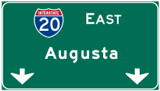

Photo Credits:
- ABRoads: 04/13/12
- Alex Nitzman: 07/15/05
Connect with:
Page Updated Wednesday June 09, 2021.