
Interstate 40 West - Amarillo
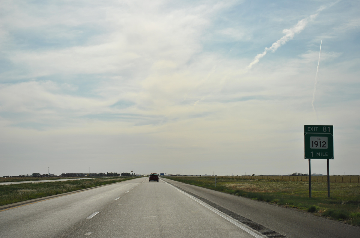
An L-shaped route, FM 1912 stems north from U.S. 287 to meet IH 40 at a diamond interchange (Exit 81) on the rural outskirts of Amarillo.
05/05/12
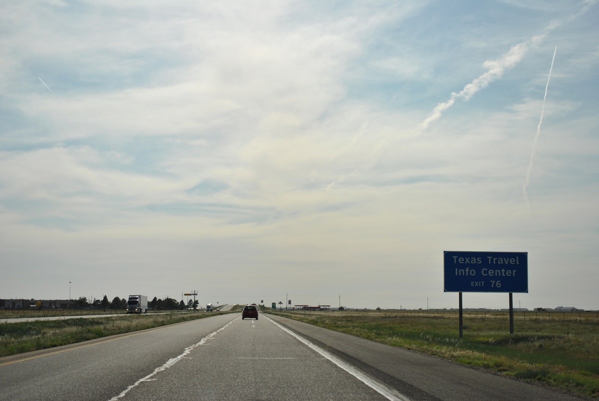
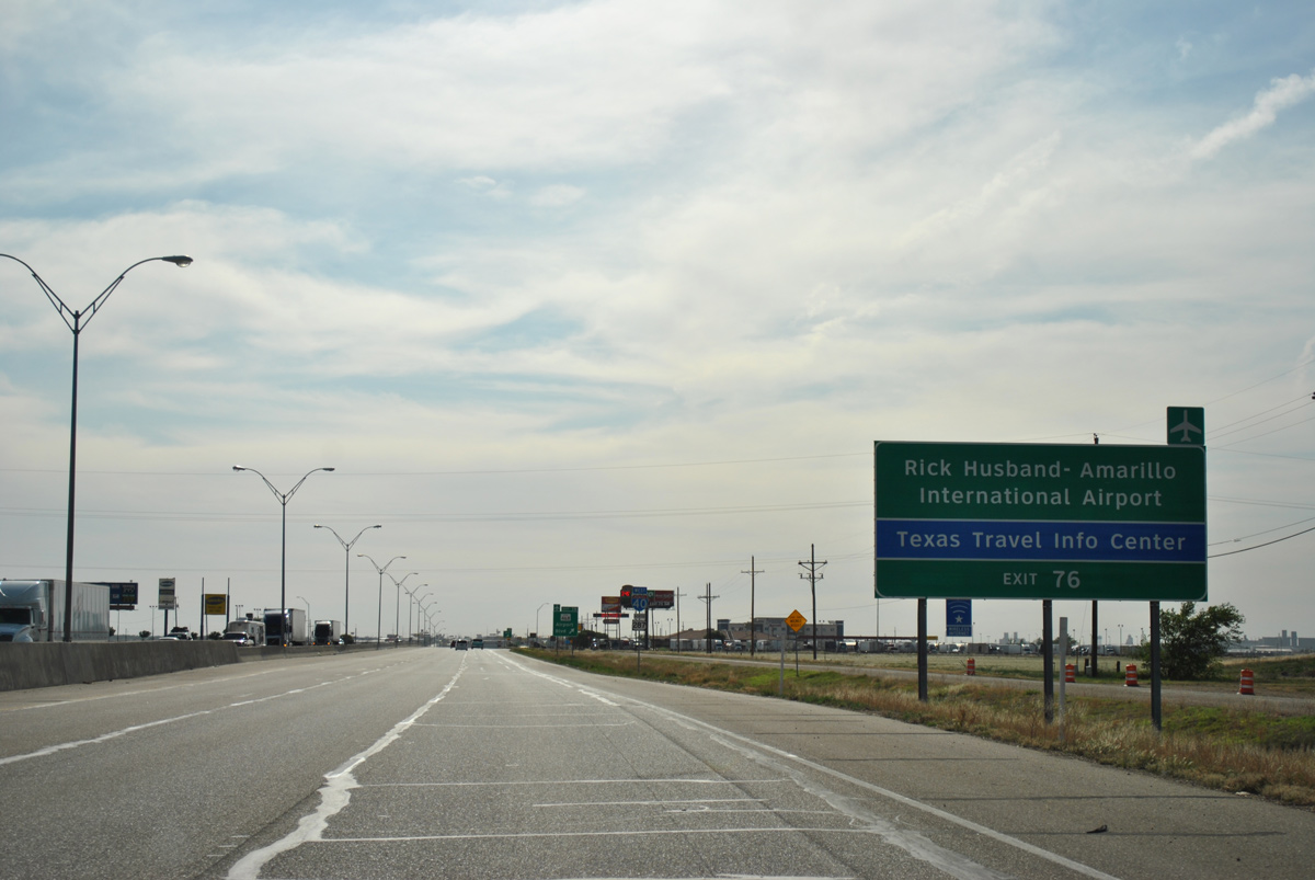
The long awaited Texas Travel Information Center, first referenced 100 miles to the east, is located five miles ahead at Exit 76 along Juett Attebury Road.
05/05/12
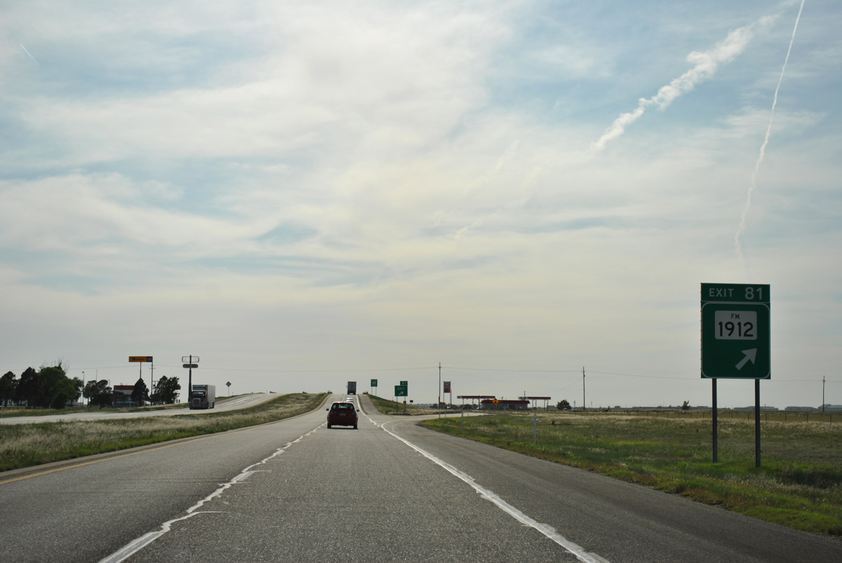
Exit 80 leaves Interstate 40 west for FM 1912 (Masterson Road). FM 1912 heads north along the Amarillo city line from the west end of FM 2575 (Historic U.S. 66) to U.S. 60 and Business Loop I-40. The west branch follows St. Francis Avenue to Loop 335.
05/05/12
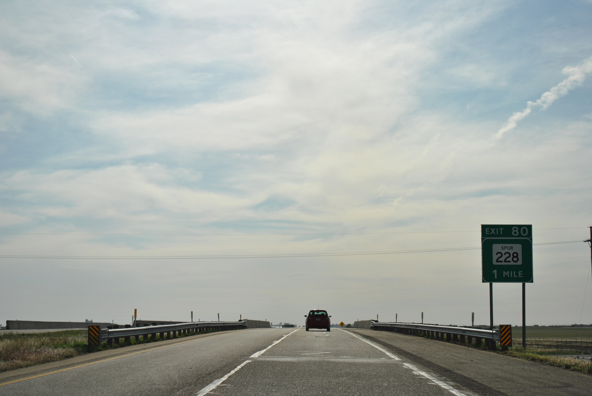
Interstate 40 bends southward alongside the abandoned Chicago, Rock Island and Pacific Railroad line to the diamond interchange (Exit 80) with Spur 228 (Jackrabbit Road).
05/05/12
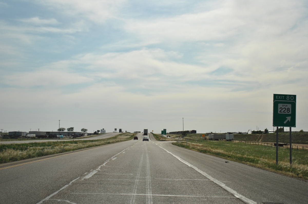
Spur 228 overlays 1.15 miles of Jackrabbit Road north from U.S. 287 to the Amarillo city line nearby. Jackrabbit Road becomes J Avenue north to the Highland Park Village community and the East Campus of Amarillo College.
05/05/12
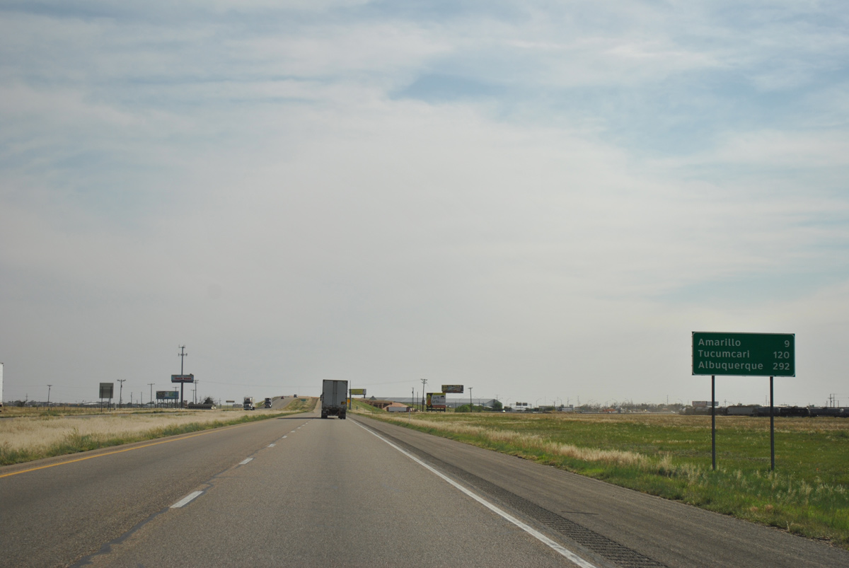
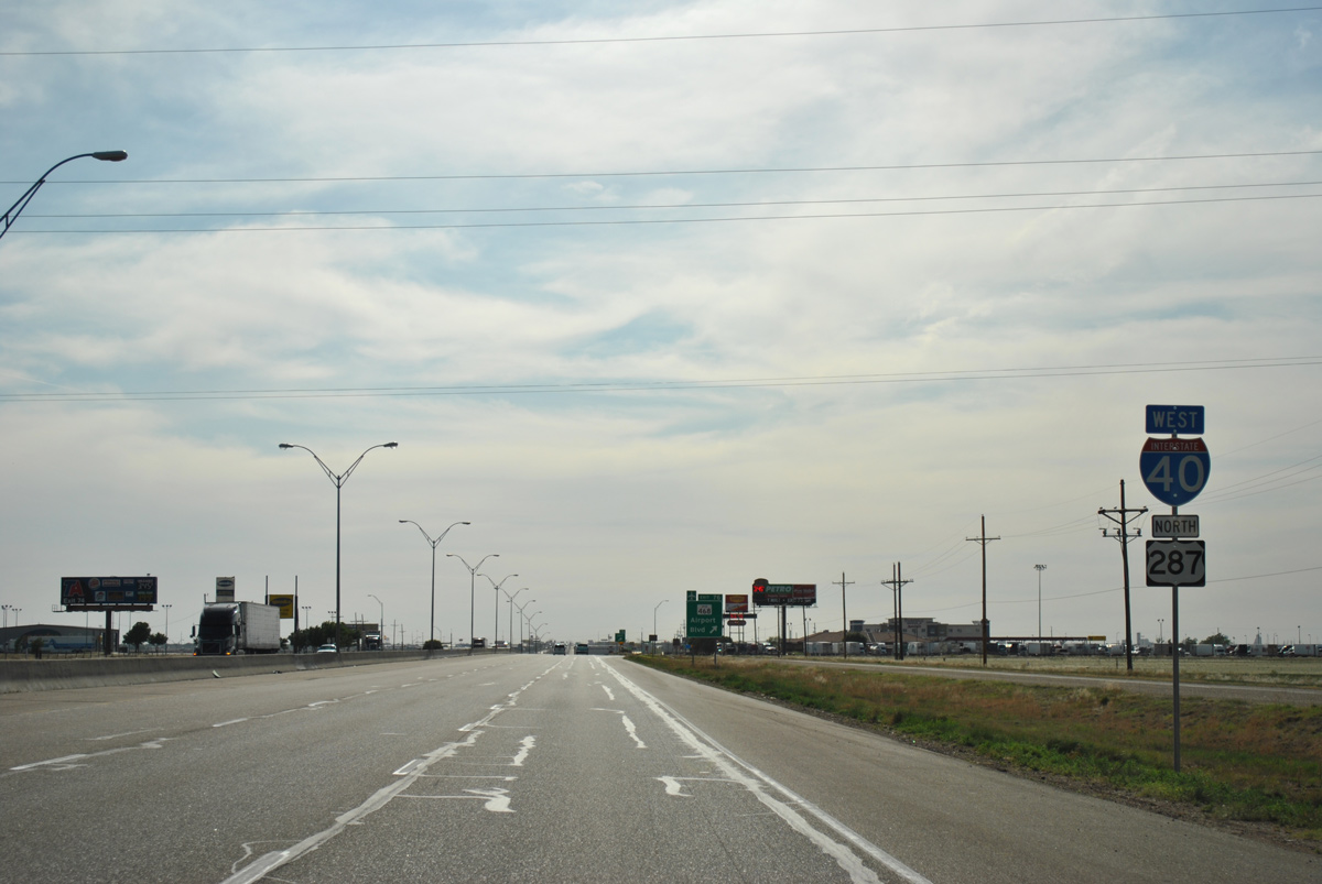
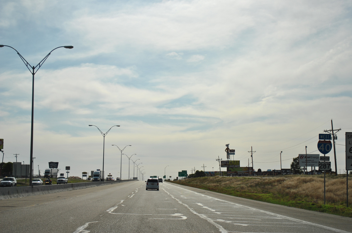
Angling southwest, IH 40 approaches the Amarillo city line at U.S. 287. Downtown lies another nine miles to the west. Albuquerque is another 283 miles further.
05/05/12
Interstate 40 becomes more urban with numerous interchanges through industrial and commercial areas to the south of Rick Husband Amarillo International Airport (AMA).
05/05/12
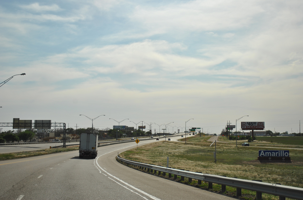
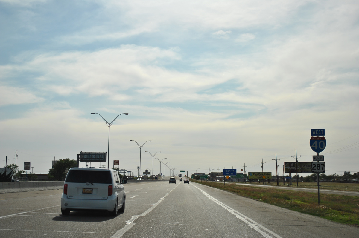
Traffic from U.S. 287 northbound joins IH 40 west at a wye interchange. An Amarillo welcome sign appears at the beginning of the 7.6 mile overlap between the two highways.
05/05/12
 North
North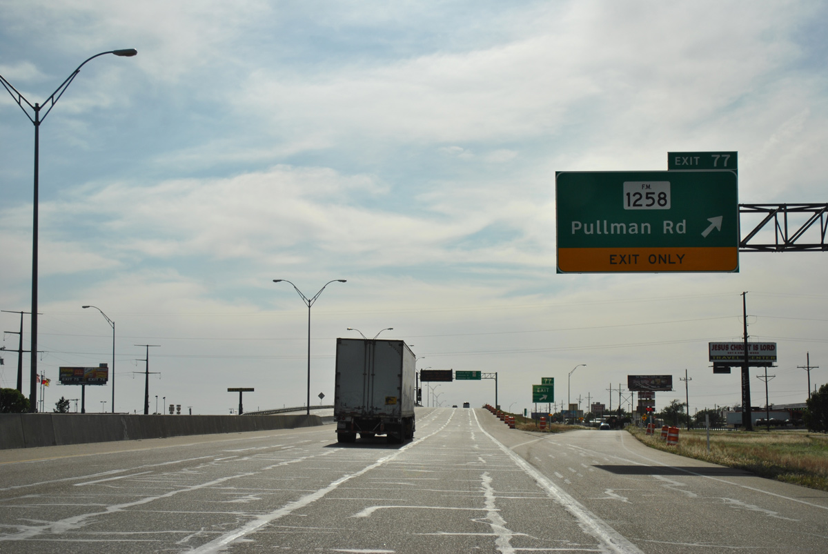
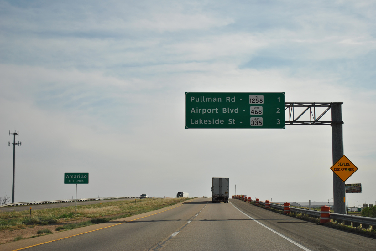
FM 1258 commences a 32.67 mile route from IH 40 & U.S. 287 at Exit 77 with Pullman Road. The rural highway leads south toward Palo Duro Canyon, where it takes a stair stepped course east into Armstrong County, ending at SH 207.
05/05/12
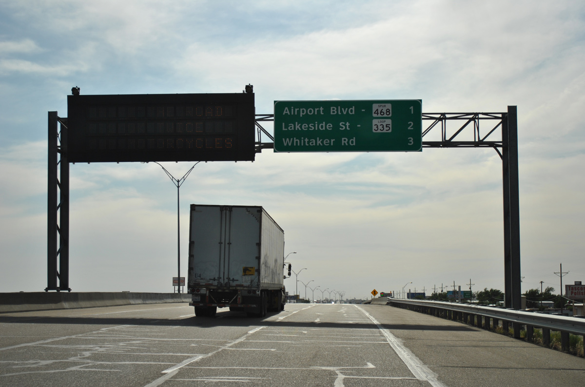
Interchange sequence sign posted one mile ahead of SS 468 (Airport Boulevard) north and two miles from SL 335 (Exit 75).
05/05/12
Spur 468 (Airport Road) extends north from Juett-Atterbury Road and IH 40 to the passenger terminal of Rick Husband Amarillo International Airport (AMA). Juett-Atterbury Road south passes by the travel information center to Farmers Avenue outside the Amarillo city limits.
05/05/12
The advent of traffic from U.S. 287 north increases the 2015 count from 20,772 vehicles per day (vpd) north of U.S. 287 to 33,684 vpd beyond Pullman Road. The freeway expands to six overall lanes across Amarillo.
05/05/12
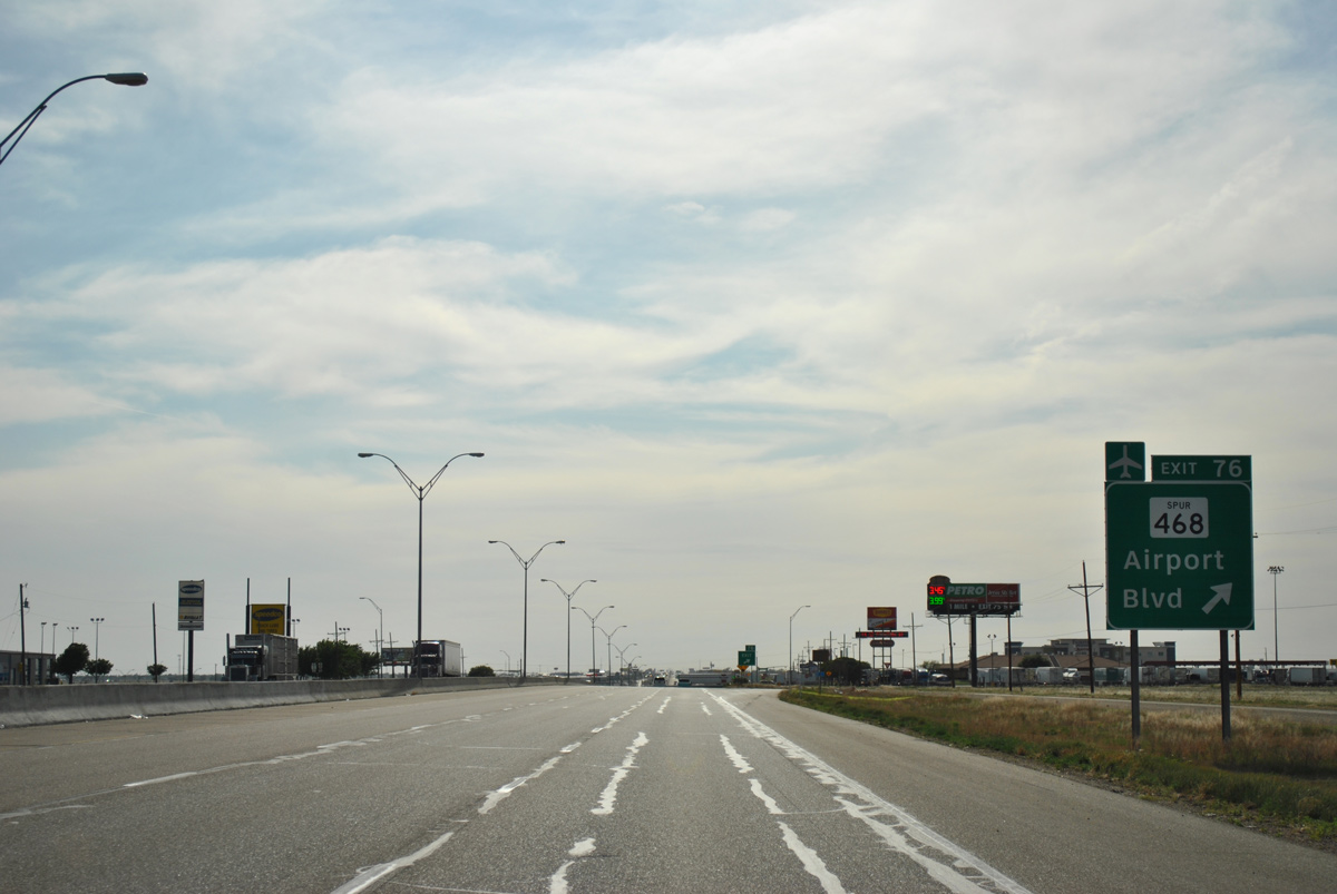
Spur 468 (Airport Road) curves 2.39 miles northeast from the diamond interchange (Exit 76) with IH 40 & U.S. 287 to end just beyond Fox Street at AMA Airport.
05/05/12
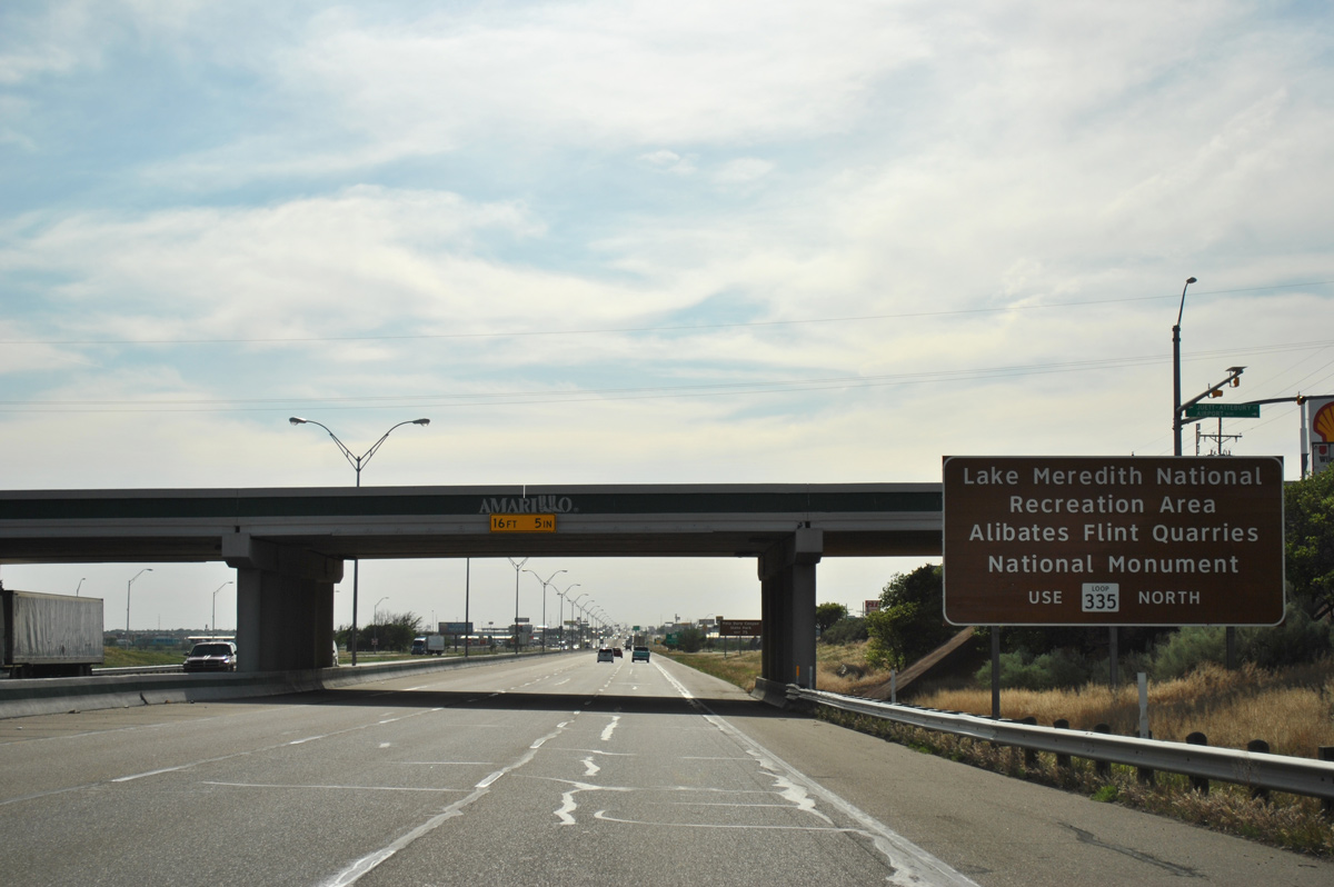
Upcoming Loop 335 (Lakeside Drive) provides a bypass of central Amarillo for travelers headed north along U.S. 87 & U.S. 287 or SH 136 to Lake Meredith National Recreation Area and the Alibates Flint Quarries National Monument.
05/05/12
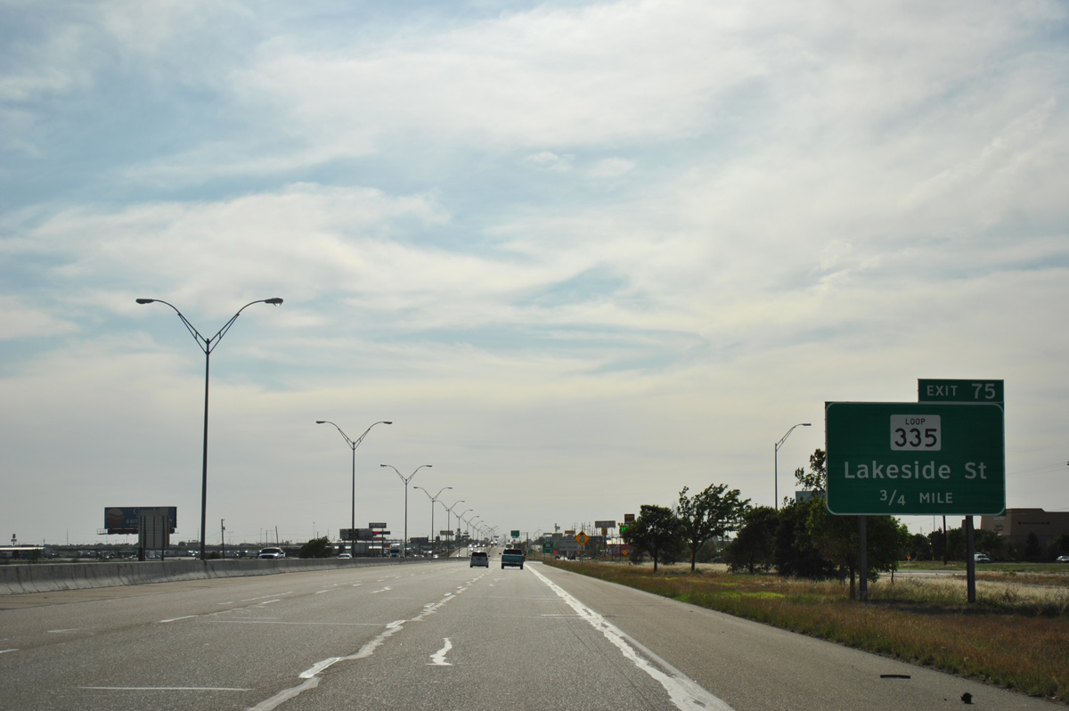
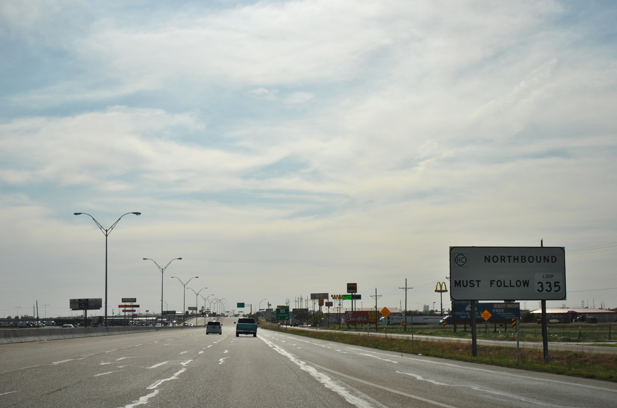
Commercialized frontage roads accompany IH 40 west & U.S. 287 north to the diamond interchange (Exit 75) with SL 335 (Lakeside Drive). Guide signs incorrectly reference the north-south leg of the state loop through east Amarillo as Lakeside Street.
05/05/12
All hazmat based cargo headed to the U.S. 87 and U.S. 287 corridors north from Amarillo must circumvent Downtown, where the two routes commingle with U.S. 60 along a pair of one way couplets.
05/05/12

Exit 75 departs for the adjacent frontage road to a signalized intersection with SL 335 (Lakeside Drive). The 40 mile loop encircling Amarillo travels mostly at-grade, with interchanges placed at many key junctions. Long range construction underway by 2016 upgrades portions of the loop into a full freeway.
05/05/12
A trio of diamond interchanges line the next three miles of Interstate 40 & U.S. 287 to Grand Street.
05/05/12
Commuters from Loop 335 swell 2015 traffic counts along IH 40 to 74,738 vpd at forthcoming Whitaker Road.
05/05/12
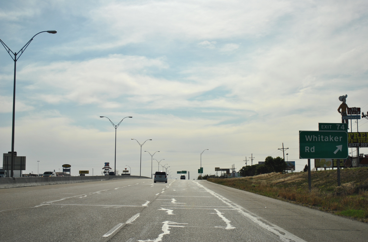
Whitaker Road stems south from IH 40 at Exit 74 to agricultural areas south of Amarillo to Loop 335. The landmark Big Texan Steak Ranch and Brewery is located just off Exit 74 on the north side frontage road.
05/05/12
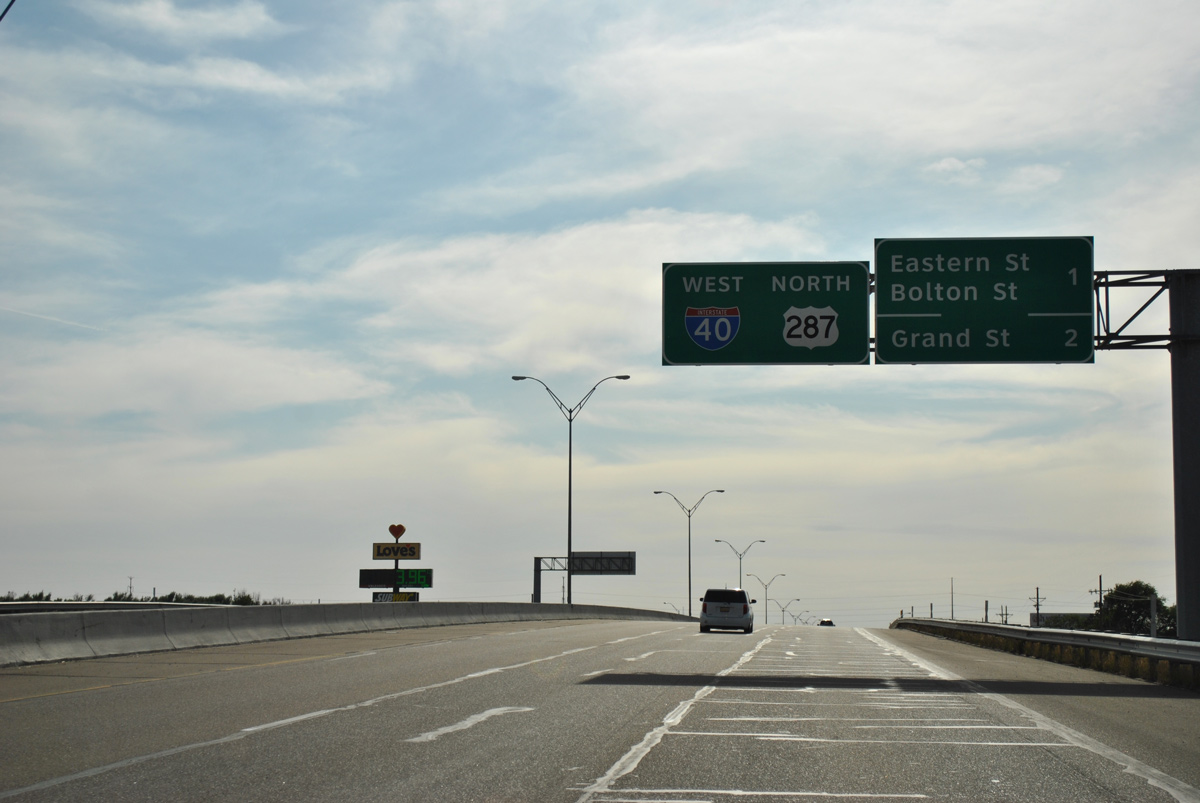
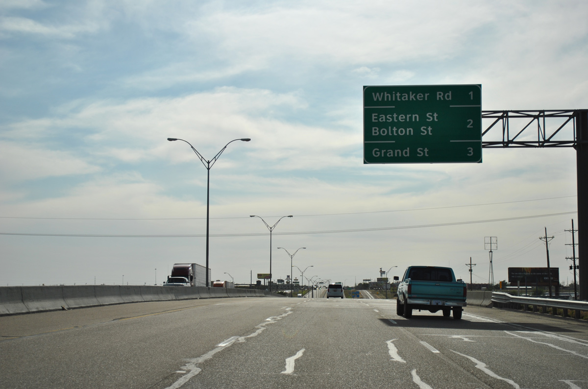
Exit 73 serves both Eastern Street and Bolton Street in one mile. Eastern Street travels north to Business Loop I-40 (Amarillo Boulevard) and south to the Oak Dale community and Loop 335, partially as an unpaved road.
05/05/12
The platted but unbuilt Bel-Aire residential area spreads to the south of Interstate 40 & U.S. 287 ahead of Exit 73. Amarillo Ranch RV Park and the Sunrise Park subdivision lie to the north.
05/05/12
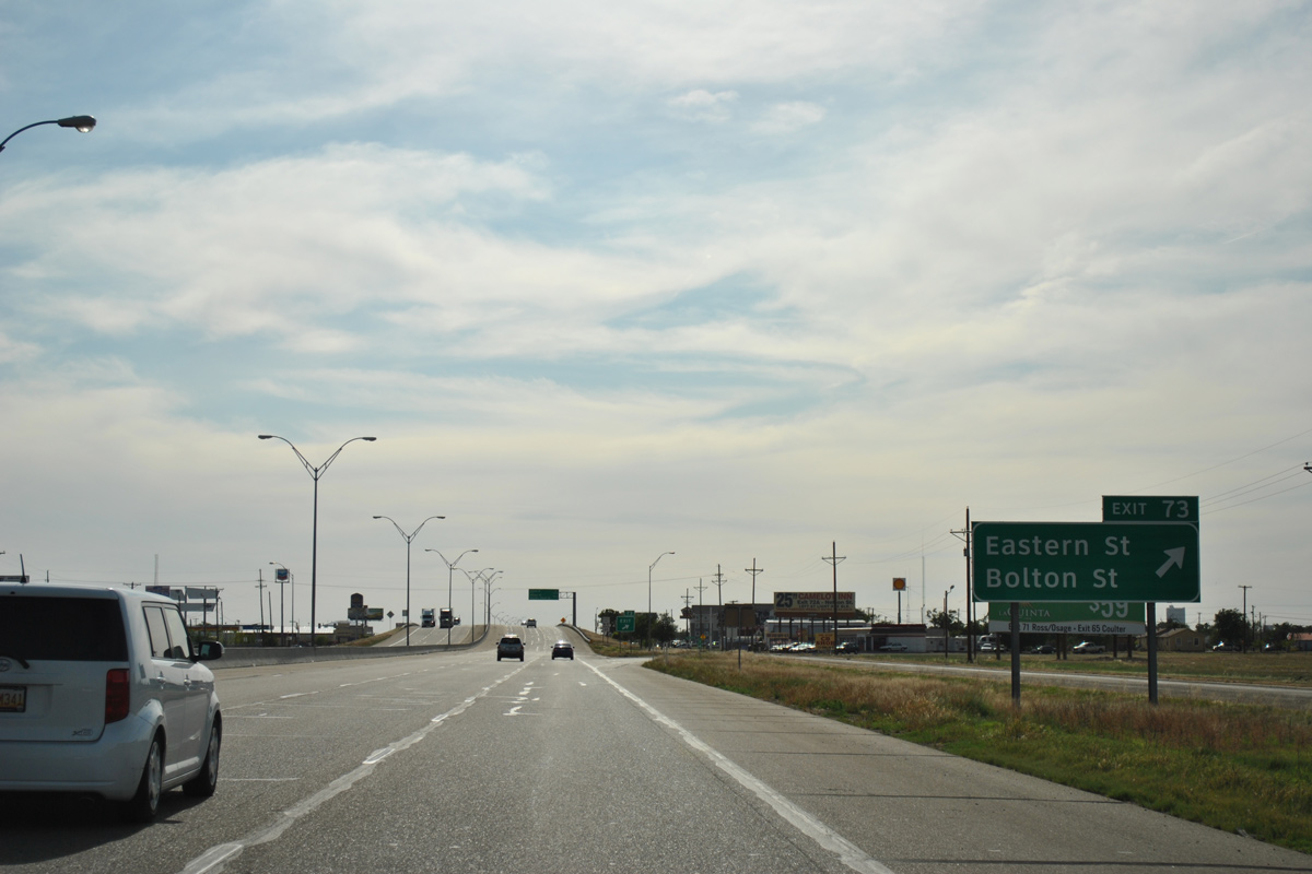
Westbound IH 40 at the off-ramp (Exit 73) for Eastern and Bolton Streets. Comprising a local through street, Bolton Street connects with the Sunrise, Humphreys Highland, and Mc Cartney communities to the north and the Oak Dale and Wing Song neighborhoods to the south.
05/05/12
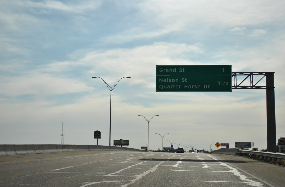
Exits 72B/A depart in quick succession over the next 1.5 miles for Grand Street and Tee Anchor Boulevard (Loop 395) west, and Quarter Horse Drive (Loop 362) north and Nelson Street south.
05/05/12
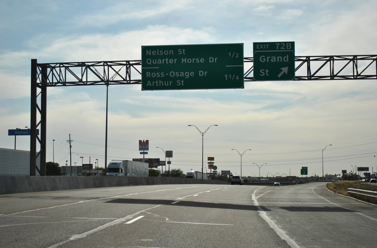
Grand Street forms a commercial arterial north from the Grandview neighborhood to big box retail at IH 40 and the Tri-State Fairgrounds. Tee Anchor Boulevard branches northwest from the IH 40 frontage road to Downtown Amarillo. Unmarked here, SL 395 overlays the boulevard 2.20 miles west to U.S. 60-87-287.
05/05/12
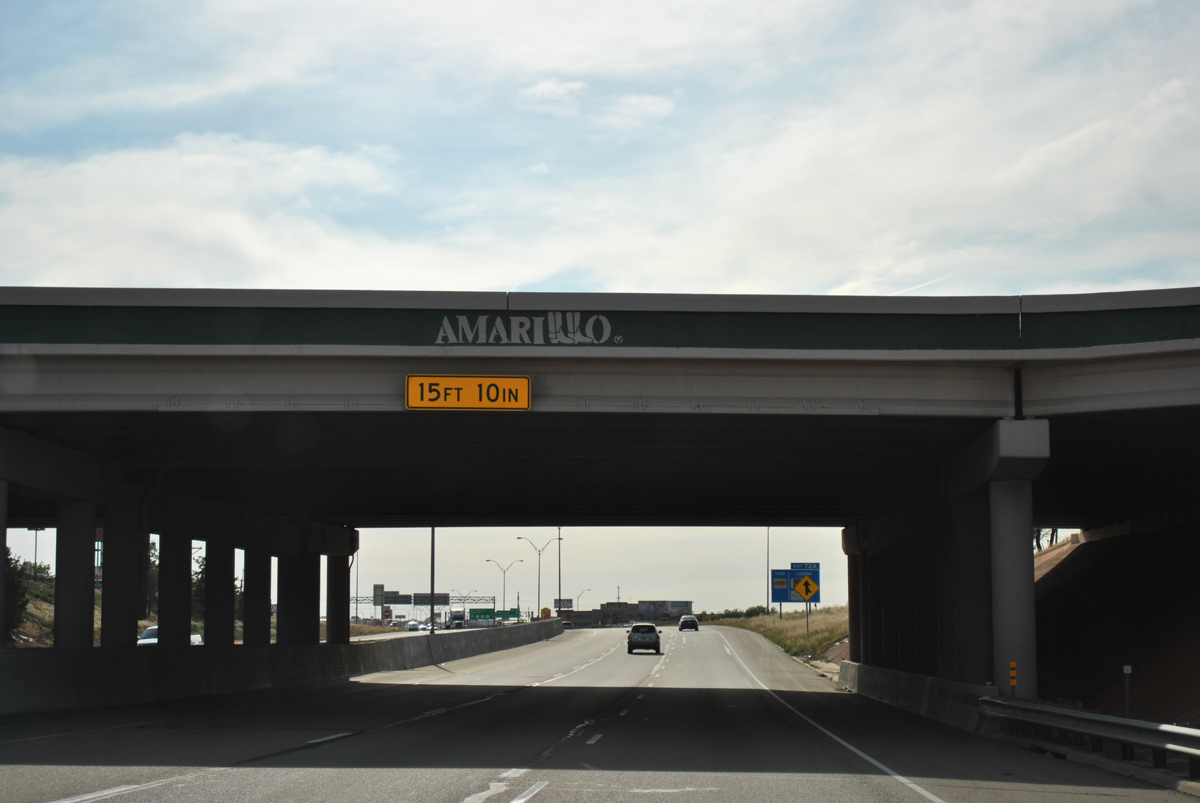
The Grand Street overpass includes U-turn ramps on each side for the respective frontage roads. The Amarillo logo, with the L's forming the city name, adorns all rebuilt overpasses for IH 27 and IH 40 across the city.1 The span here dates from 2000.
05/05/12
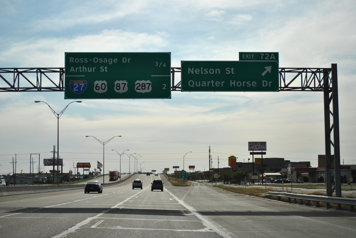
U.S. 287 partitions with IH 40 west in two miles at IH 27. A diamond interchange (Exit 72A) joins the freeway here with Quarter Horse Drive (SL 362), a 0.34 mile link to SL 395 (Tee Anchor Boulevard). Nelson Street extends south from SL 362 to 34th Avenue through the Lawndale and Grandview communities.
05/05/12
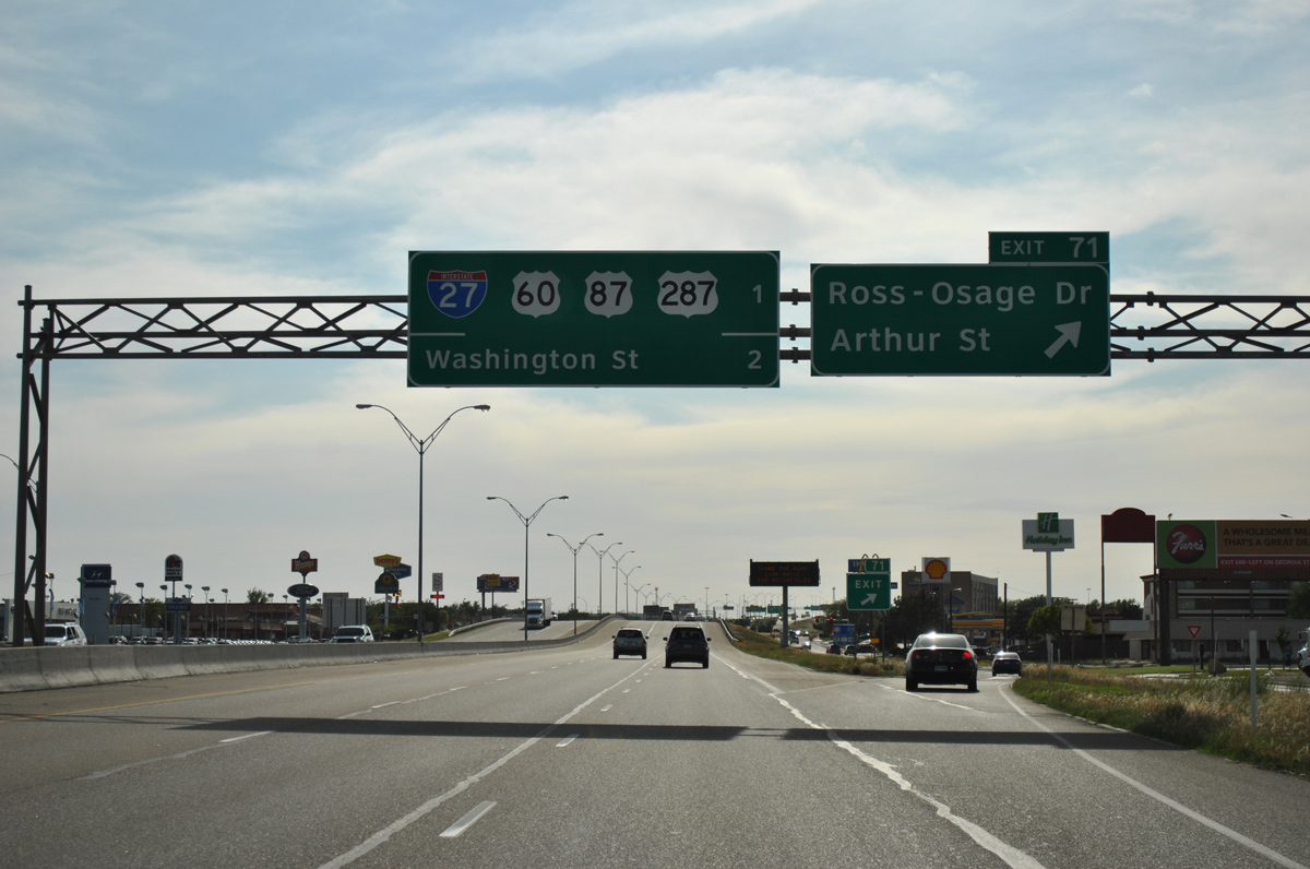
Advancing west to within one mile of IH 27, U.S. 60 and U.S. 87, IH 40 & U.S. 287 enter the diamond interchange (Exit 71) with the commercial corridor of Ross-Osage Drive south and Ross Street north. Frontage roads connect Exit 71 with Arthur Street to the Mirror's and Glenwood neighborhoods.
05/05/12
U.S. 287 accompanies U.S. 60 east on Buchanan Street while U.S. 87 parallels on adjacent Fillmore Street north through Downtown Amarillo. The dual couplets combine as a freeway for U.S. 87/287 north from 15th Avenue to Amarillo Zoo and Wonderland Amusement Park.
05/05/12
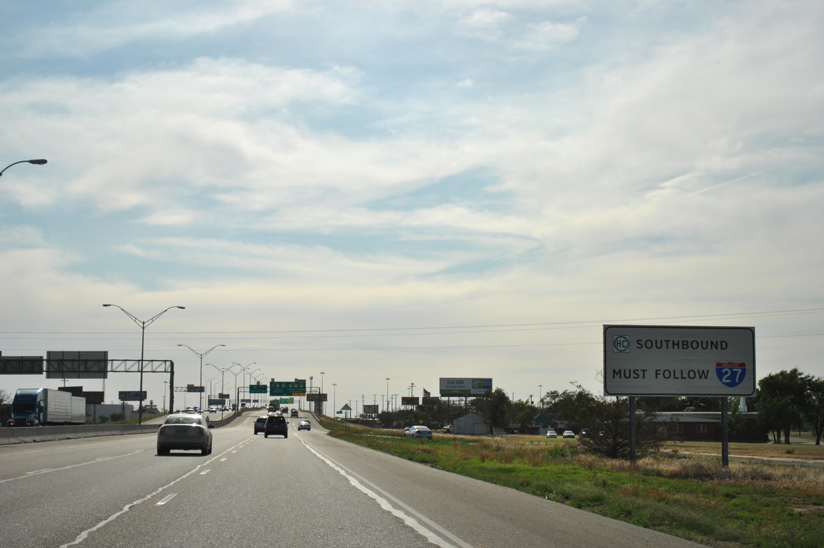
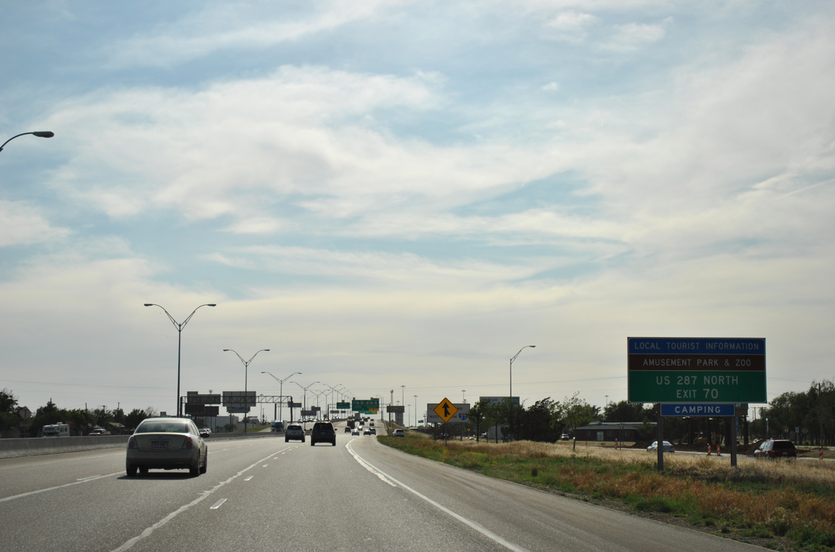
IH 27 south is the approved route for the transportation of Hazmat based cargo south from IH 40 and Amarillo.
05/05/12
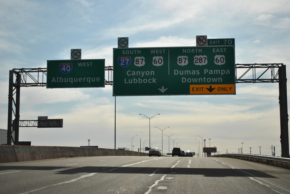
A two lane off-ramp (Exit 70) separates from IH 40 west next for the southbound beginning of IH 27 to Canyon and Lubbock and the continuation of U.S. 287 north through Downtown Amarillo.
05/05/12
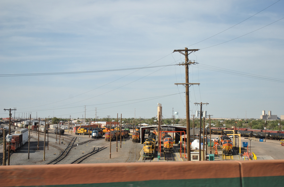
2015 traffic counts surpass 100,000 vpd as IH 40 & U.S. 287 span a BNSF Railroad yard.
05/05/12
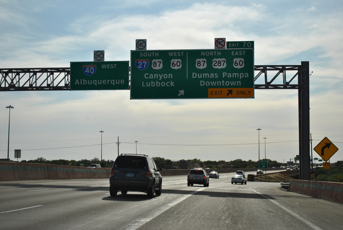
The turbine style interchange with Interstate 27 south and U.S. 60-87-287 north was reconfigured during a three year project completed in 2001. U.S. 60/87 overlap with IH 27 south to Canyon.
05/05/12
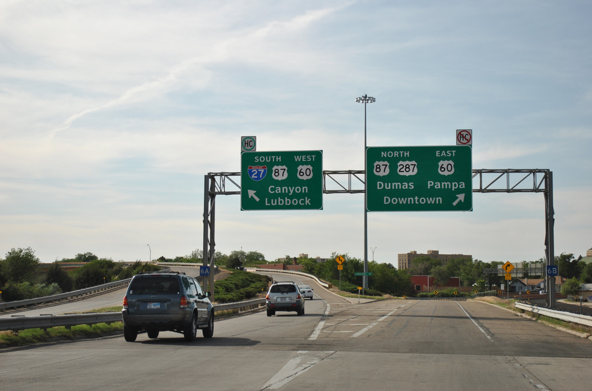
Interstate 27 travels 124 miles overall, from IH 40 south to the south end of Loop 289 in Lubbock. North from Exit 70, U.S. 60/287 run concurrently north through Downtown along Buchanan Street to Business Loop I-40 (Amarillo Boulevard). U.S. 87 uses Fillmore Street north.
05/05/12
References:
- "Editorial: Interstate 40-27 interchange gets a change for the better." Amarillo Globe-News (TX), April 24, 2004.
Photo Credits:
- ABRoads: 05/05/12
Connect with:
Page Updated Wednesday April 05, 2017.