
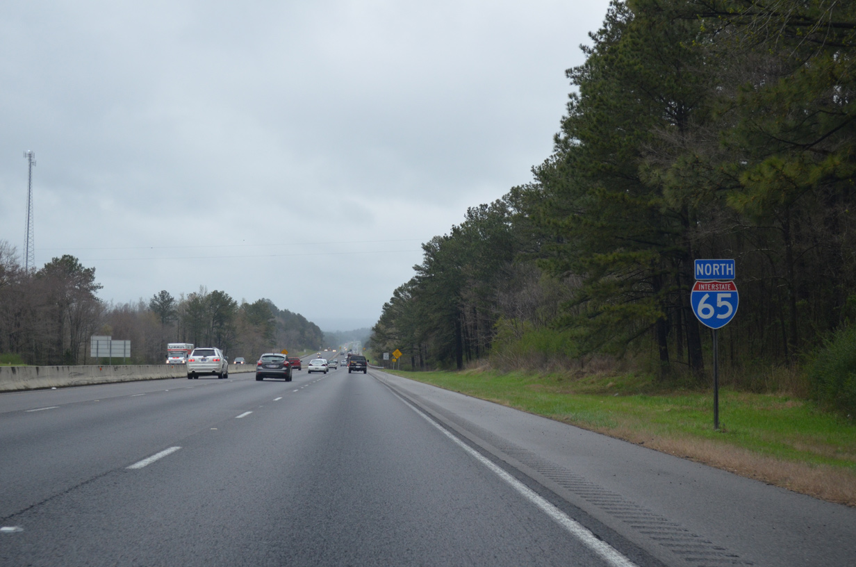
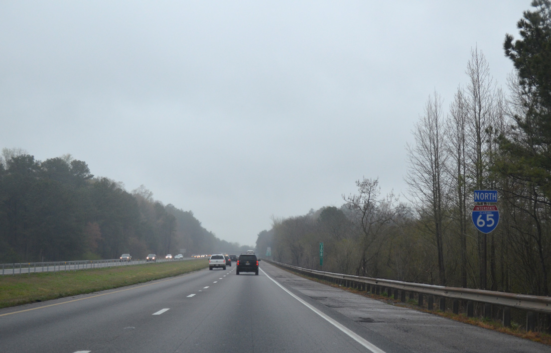
Interstate 65 North - Blount / Cullman Counties
 North
North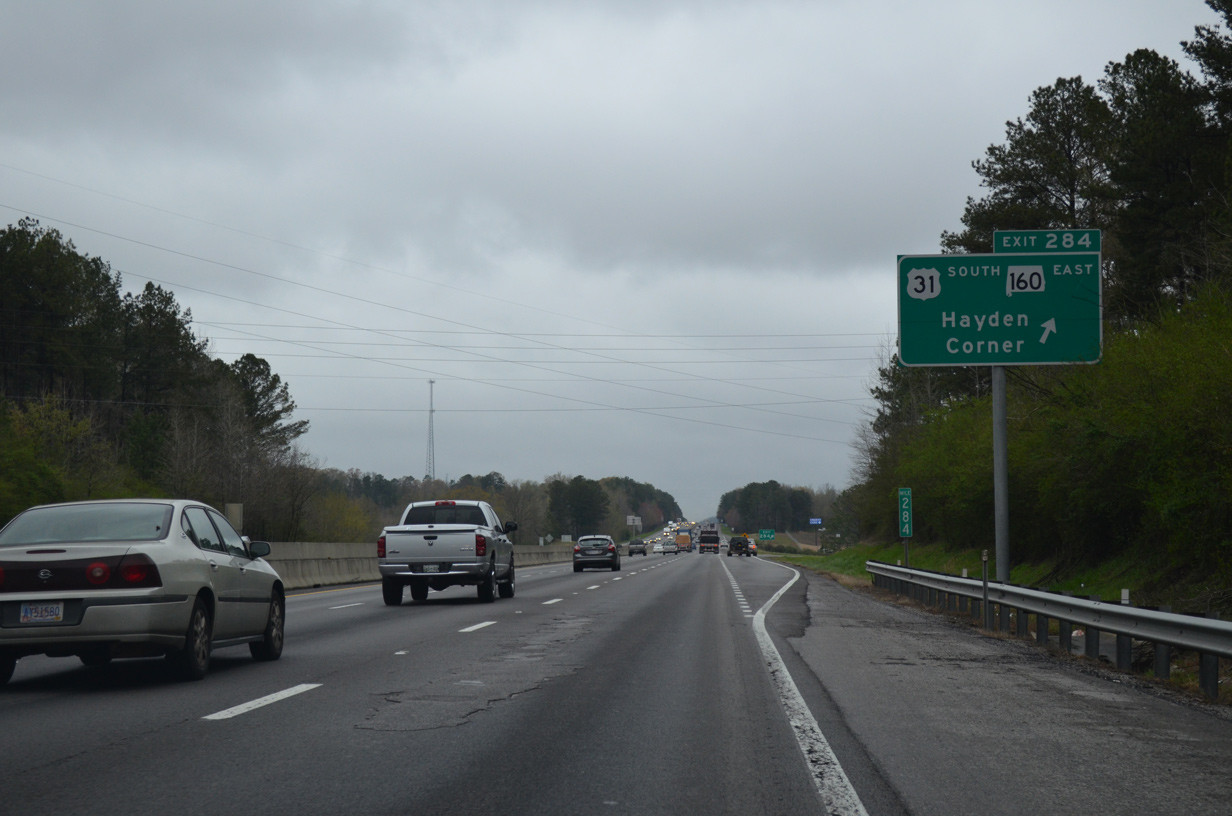
Exit 284 is the first of three Blount County exits from Interstate 65 north. U.S. 31 merges onto the freeway for a three mile overlap.
04/04/13
 North
North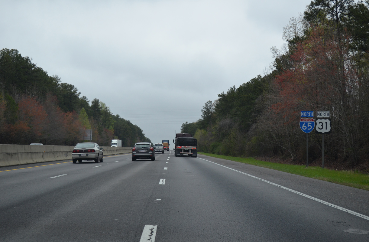
I-65/U.S. 31 parallel old U.S. 31 and Sibleyville Creek to the east side of Thomas Mountain. The original U.S. 31 alignment was made discontinuous because of freeway construction through Reid Gap.
04/04/13
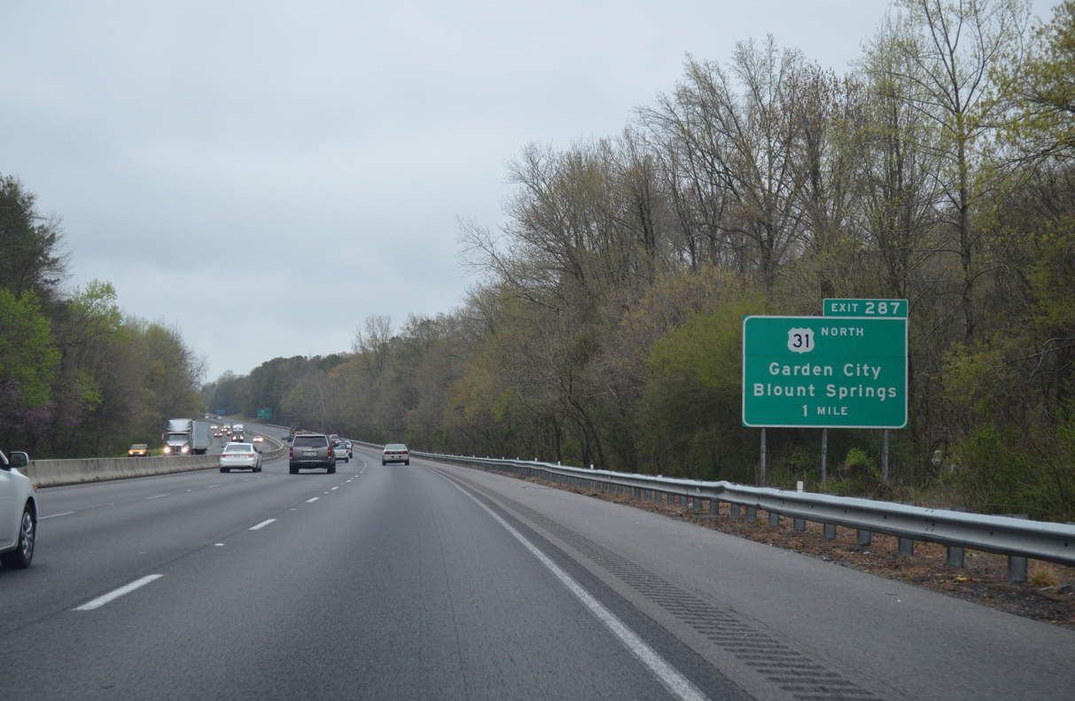
I-65/U.S. 31 north split beyond Reid Gap at Exit 287. Old U.S. 31 (Poplar Trail) ties in from Thomas Mountain to the southwest.
04/04/13

U.S. 31 (Bee Line Highway) curves northeast from Exit 287 and shoots the gap between Hamilton and Bryant Mountains to Blount Springs. Garden City in Cullman County, lies 12 miles northward along the US highway.
04/04/13
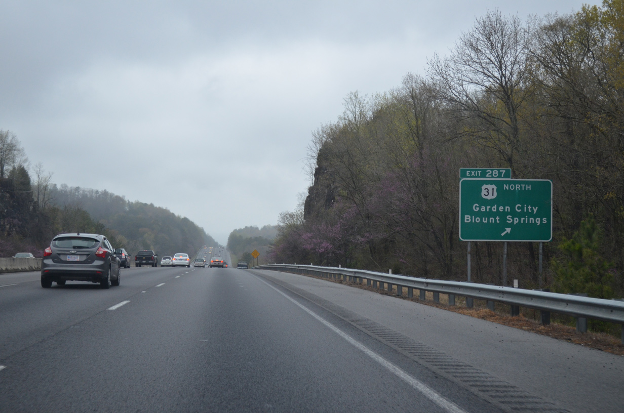
Northbound at the split with U.S. 31 (Exit 287) on Interstate 65. U.S. 31 stays east of the freeway to Exit 318.
04/04/13
North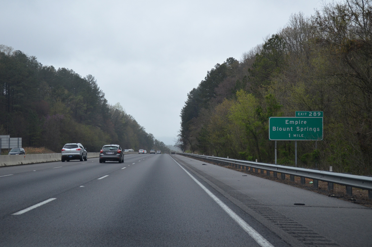
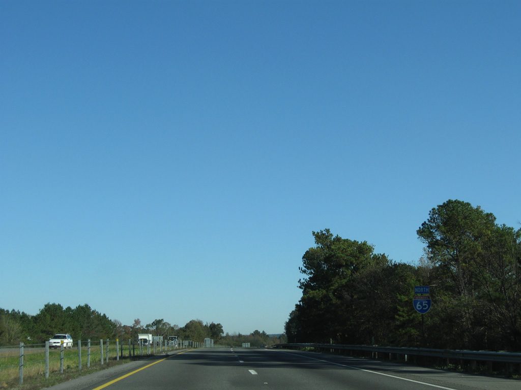
Blount County Route 5 provides a second exit to Blount Springs to the east of Interstate 65 via Exit 289.
04/04/13

Interstate 65 cuts through Hamilton Mountain and descends towards James Creek and the diamond interchange at Exit 289.
11/04/09
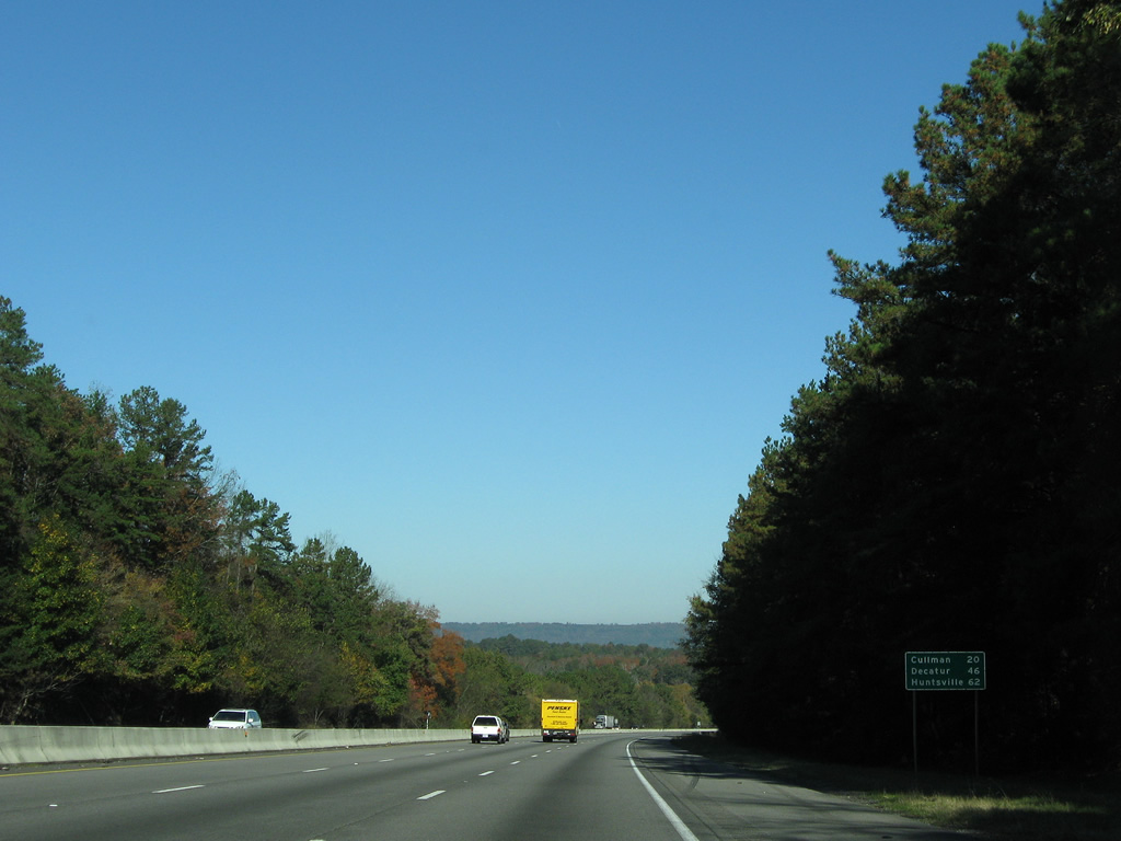
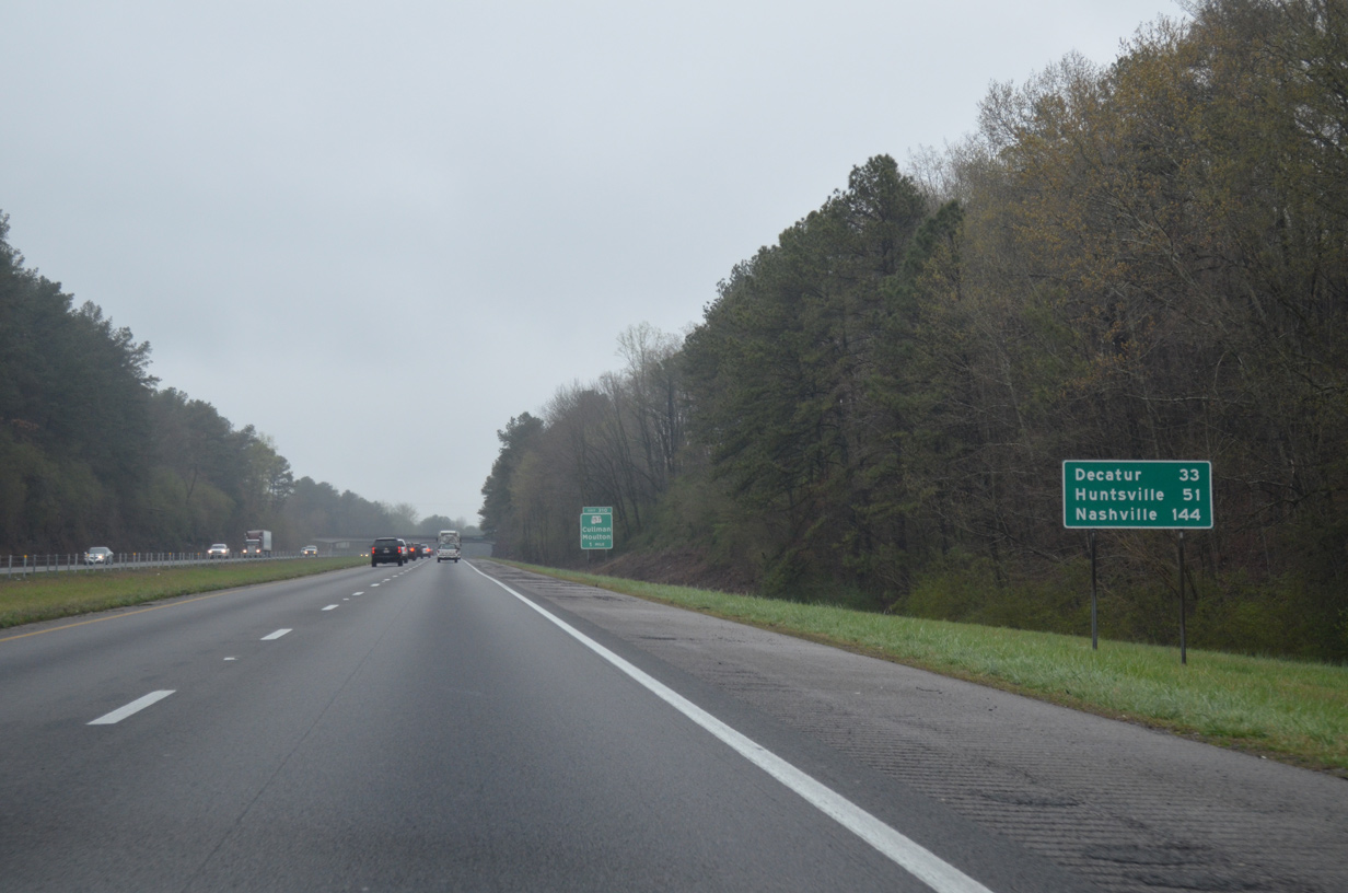
Cullman is the next city of importance along the Interstate 65 corridor. Decatur and Huntsville (via Interstate 565) follow. The mileage figure to Huntsville is nine miles to short, as the city center is still 71 miles away.
11/04/09

County Road 5 winds eastward from Exit 289 to end at U.S. 31 by Duffy Mountain and Blount Springs. Westward, the county highway ventures southwesterly to Sloan and Sumiton.
04/04/13
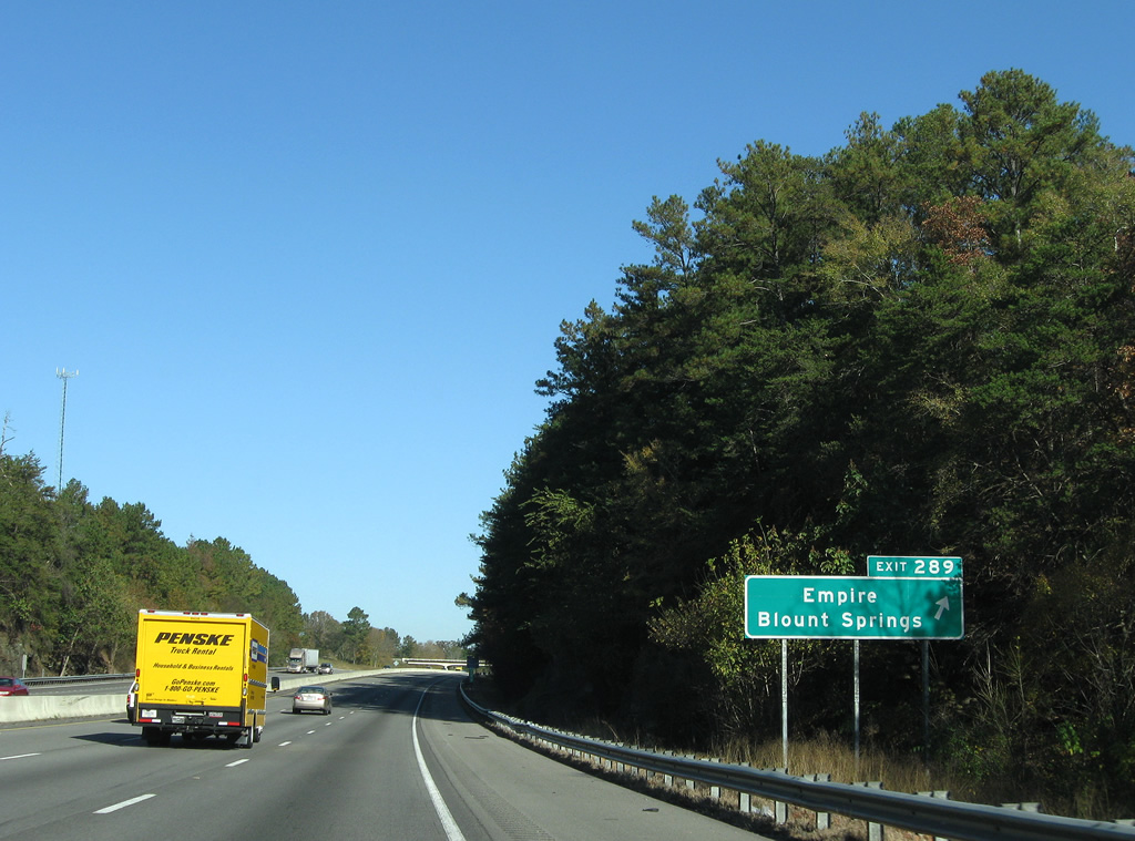
Exit 289 departs Interstate 65 north for CR 5. ocated in Walker County, Empire is accessible via CR 22 from Empire Road (CR 543), the continuation of CR 5.
11/04/09
Northbound reassurance shield posted for Interstate 65 between Exit 289 and the Cullman County line.
04/04/13
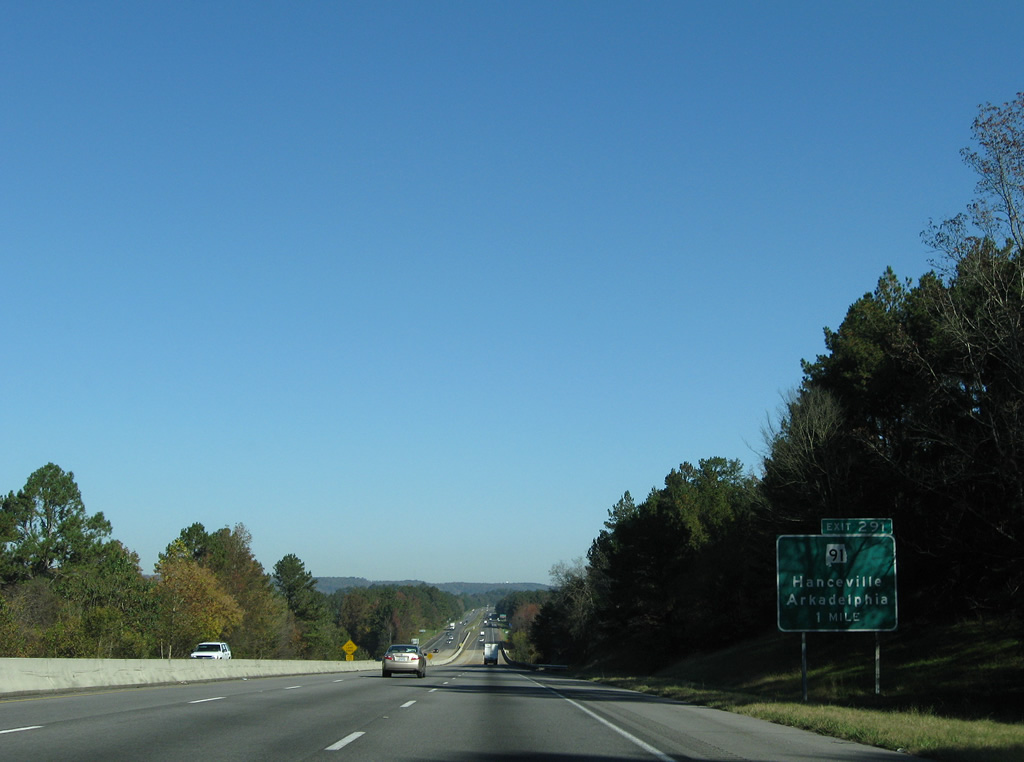
SR 91 crosses paths with Interstate 65 at the first of five Cullman County interchanges (Exit 291).
11/04/09
The Mulberry Fork of the Warrior River represents the Blount / Cullman County line. Interstate 65 spans the waterway and quickly reduces from six to four overall lanes.
11/04/09
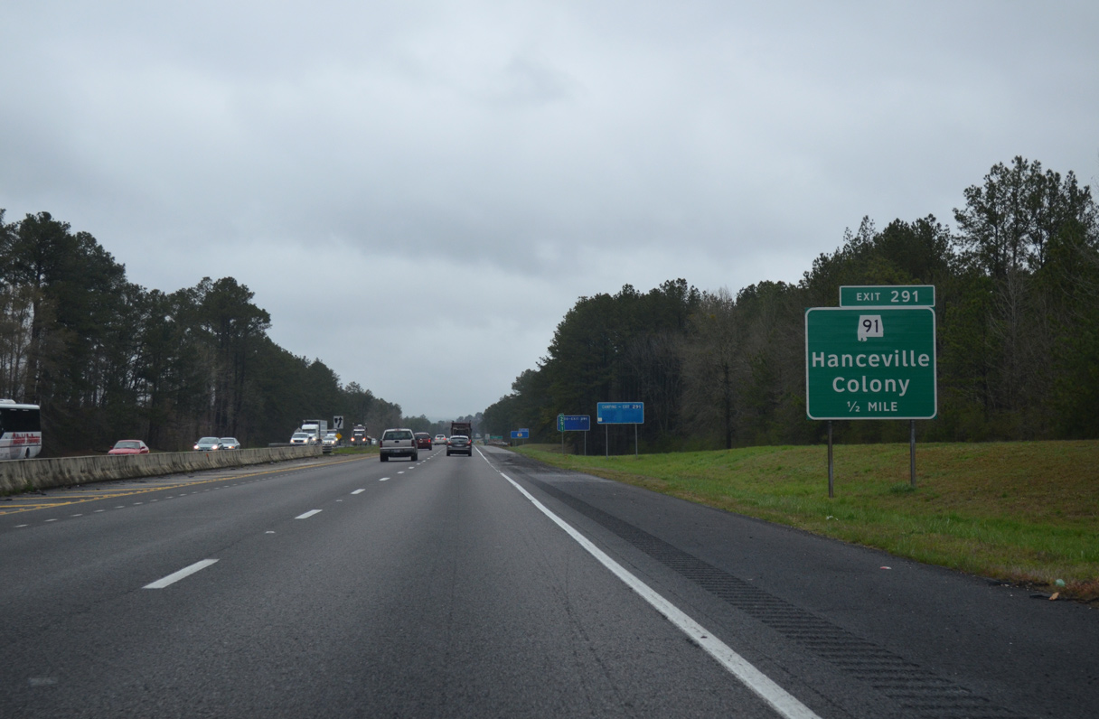
SR 91 leads west six miles from adjacent Colony to Arkadelphia and 14 miles to end at Wilburn (SR 69). East of I-65 and Black Bottom, the state route turns northward on the 11 mile drive to Hanceville (U.S. 31).
04/04/13

Interstate 65 enters the diamond interchange (Exit 291) with SR 91 by the town of Colony. SR 91 totals 38 miles from Wilburn to U.S. 278 at Holly Pond.
04/04/13
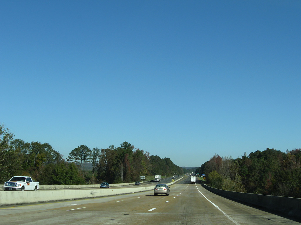
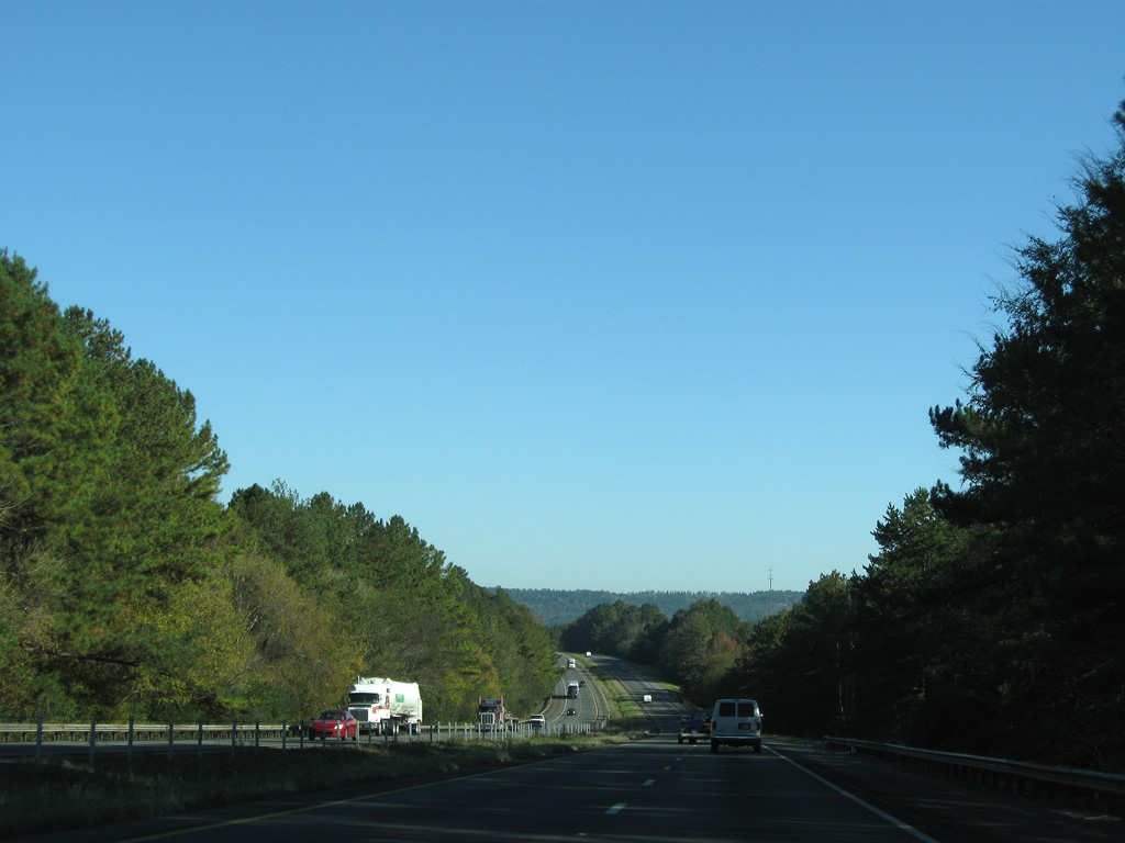
Interstate 65 stays east of Prospect Mountain through forest covered hills in south Cullman County. County Road 504 is the only crossing of the freeway on the nine mile stretch to Dodge City.
11/04/09
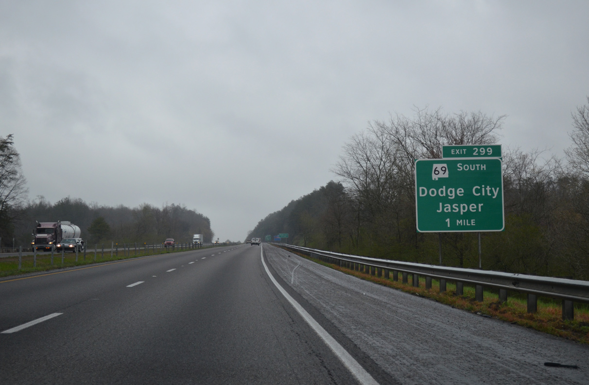
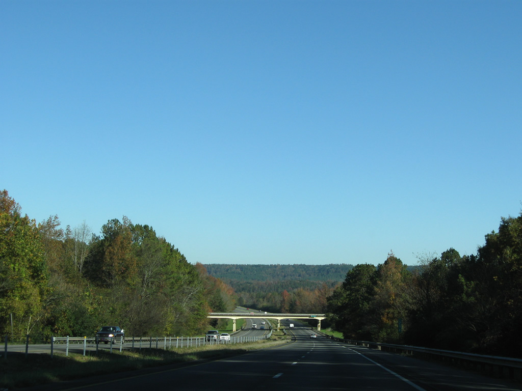
Interstate 65 rises from a valley by Marriot Creek to merge with SR 69 north at Exit 299 in Dodge City.
04/04/13
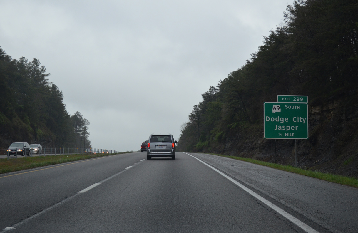
SR 69 stretches 280.60 miles from Jackson in lower Alabama to Guntersville ( U.S. 431). The state route provides a direct route from Cullman southwest to Jasper and Interstate 22.
04/04/13
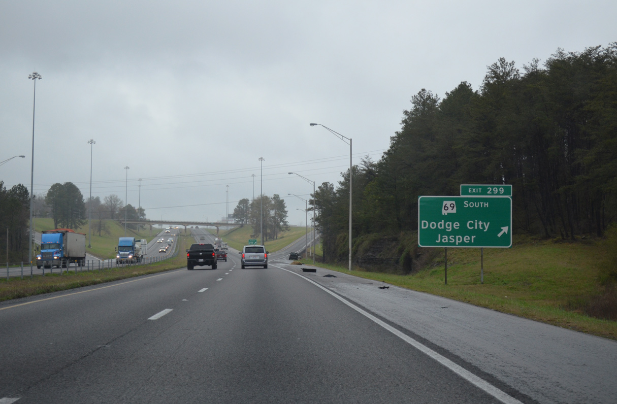
Entering the diamond interchange (Exit 299) with SR 69 south and Cullman County 490 east on I-65 north. CR 490 provides an alternate route to the city of Cullman to U.S. 31.
04/04/13
 North
North
The final northbound rest area in Alabama follows along the east side of I-65 in one mile
11/04/09
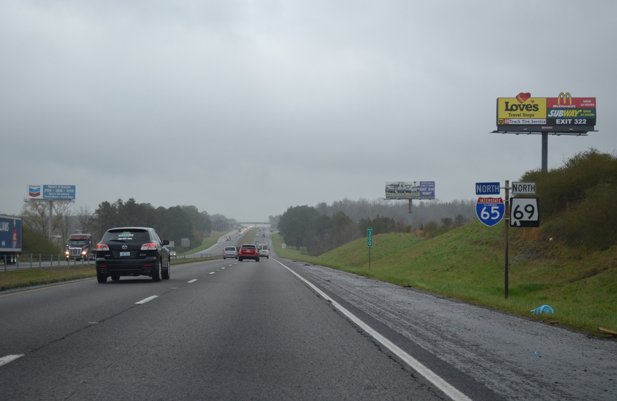
I-65/SR 69 overlap 4.0 miles north to Good Hope on the south side of Cullman.
04/04/13
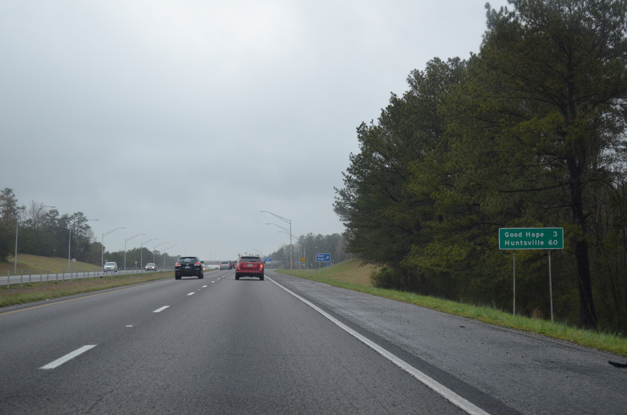
The Huntsville city center is now a 60 mile drive to the northeast via I-65 and I-565.
04/04/13
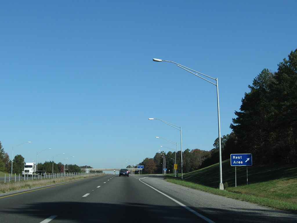
Travelers in both directions share the same rest area facility on the east side of Interstate 65 & SR 69.
11/04/09
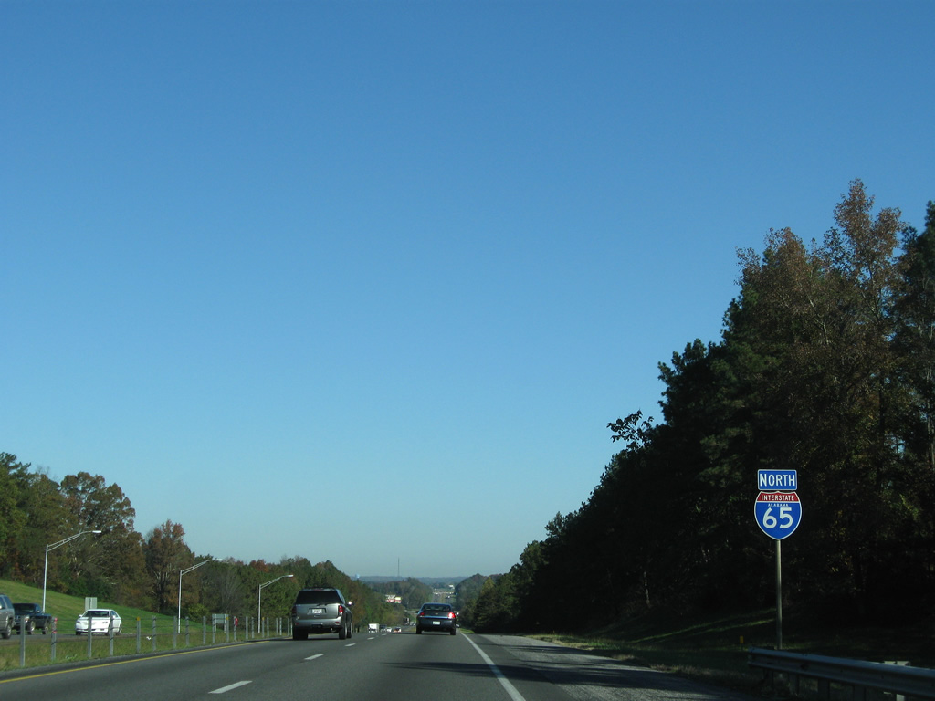
Continuing north from the rest area, drivers see a second reassurance assembly for Interstate 65.
11/04/09
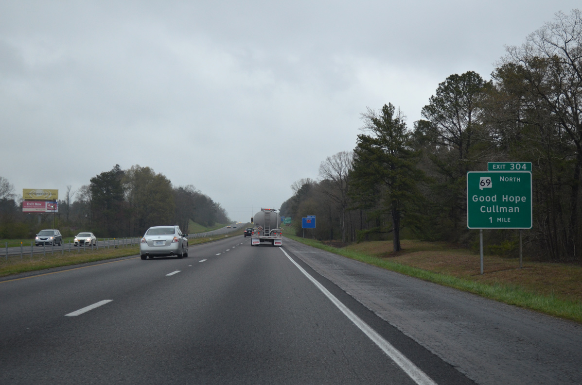
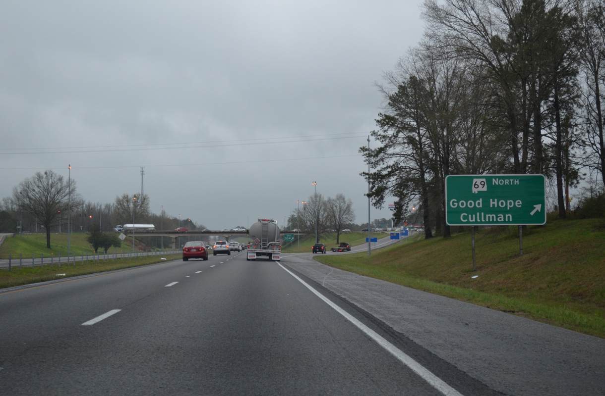
One mile south of the diamond interchange (Exit 304) with the departing SR 69 north and Cullman County 437 south at Good Hope on I-65.
04/04/13
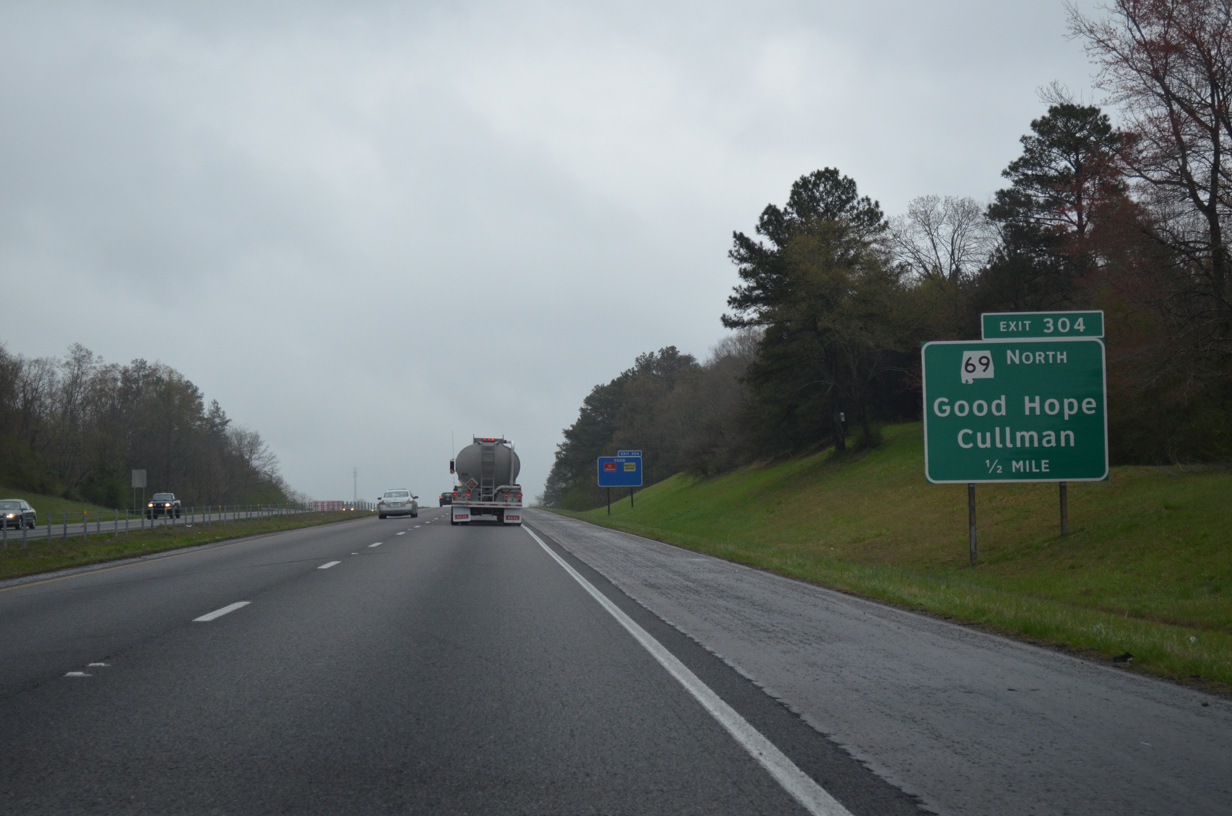
SR 69 provides the first of three exits to the Cullman County seat. The state route follows Cherokee Avenue north to its merge with U.S. 31 (2nd Avenue SW) north.
04/04/13
County Road 437 leads southwest from Interstate 65 and SR 69 at Exit 304 to Lewis Smith Lake and Trimble via County Road 438 west. County Road 437 represents the original SR 69 alignment north of the lake while County Road 110 does south of the lake.
04/04/13
North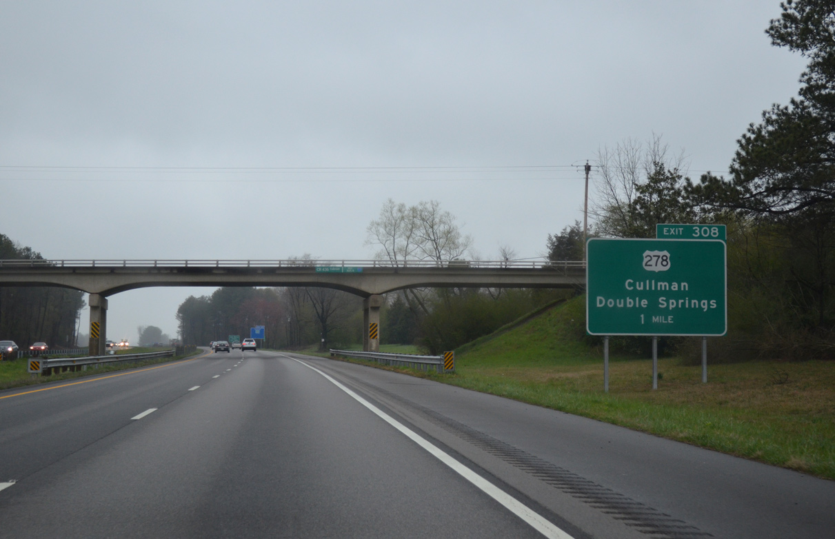
U.S. 278 joins Cullman with the Winston County seat of Double Springs, 37 miles west of Exit 308 with Interstate 65.
04/04/13
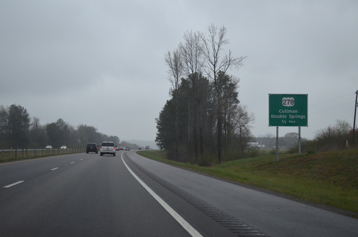
One half mile south of the diamond interchange (Exit 308) with U.S. 278 (4th Street SW). U.S. 278 merges with SR 69 north 1.8 miles to the east at Downtown Cullman and U.S. 31 (2nd Avenue SW).
A tornado tracked across Interstate 65 at this location on April 27, 2011. Rated EF4, the twister progressed eastward to Downtown Cullman, where it caused extensive damage.
04/04/13
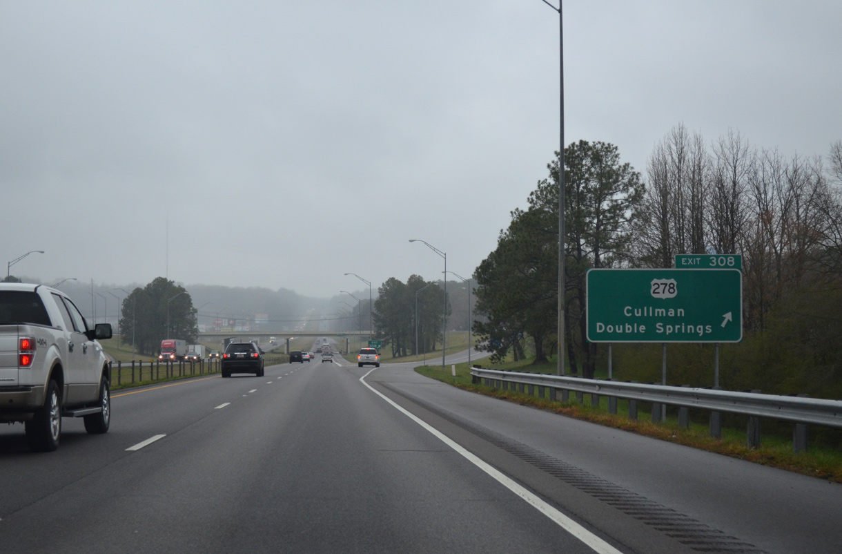
Northbound Interstate 65 at the ramp departure (Exit 308) to U.S. 278 (4th Street SW). U.S. 278 travels 12 miles west to Jones Chalep and 21 miles to Addison. Outside of Gadsden and Cullman, the 197 mile route across Alabama remains relatively rural.
04/04/13
Reassurance marker posted ahead of milepost 308 as I-65 climbs onto a ridge to the northwest of Cullman.
04/04/13
Nashville, Tennessee appears for the first time on a Interstate 65 distance sign outside Cullman.
04/04/13
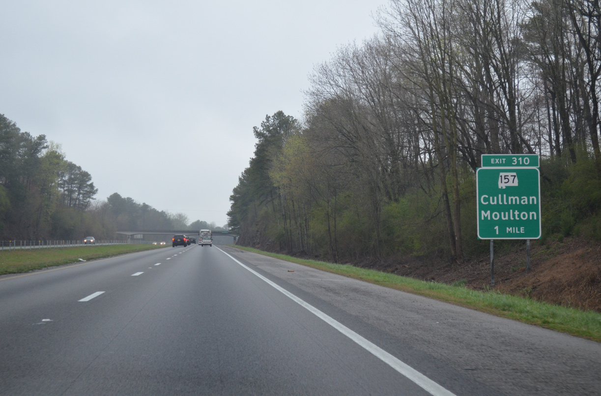
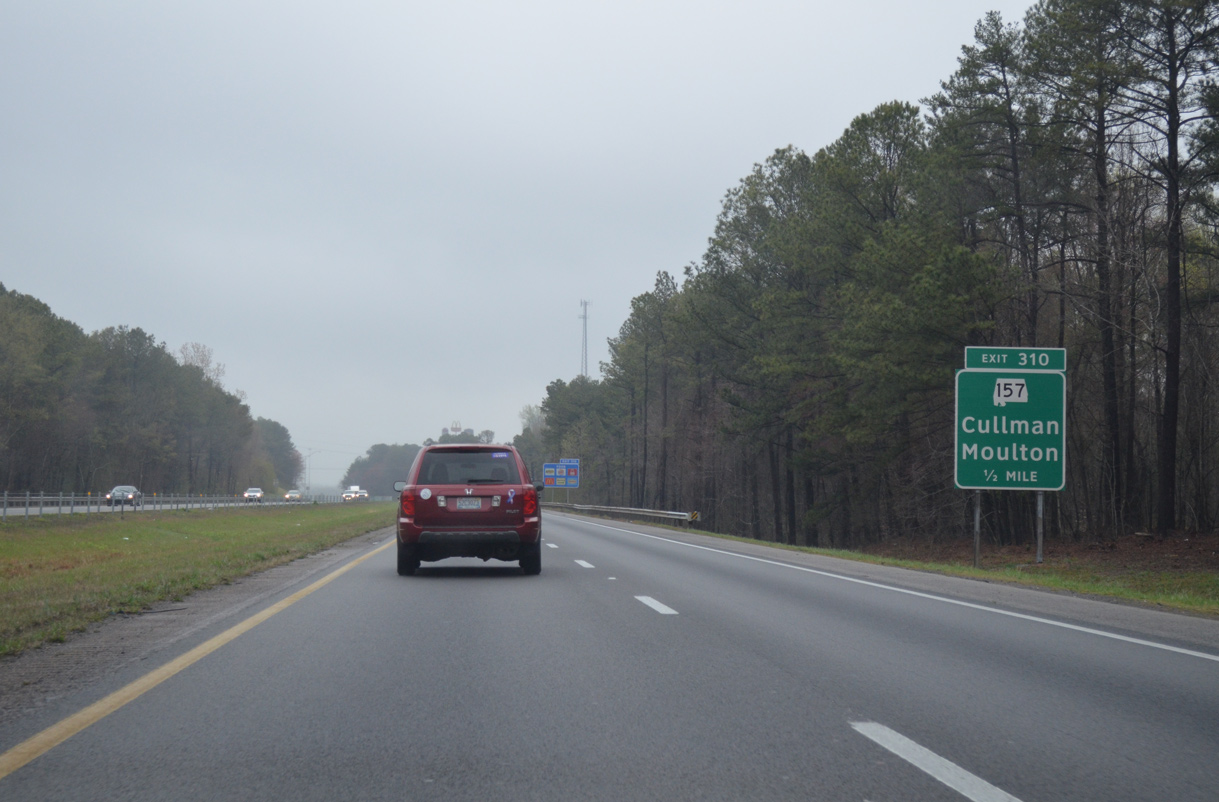
SR 157 (University of North Alabama Highway) meets Interstate 65 at a diamond interchange (Exit 310) northwest of Cullman.
04/04/13
SR 157 represents a major corridor from Cullman northwest to the Lawrence County seat of Moulton and Florence (with SR 20 west and U.S. 43 north). The entire route between Interstate 65 and SR 20 was four laned in the mid-2000s.
04/04/13
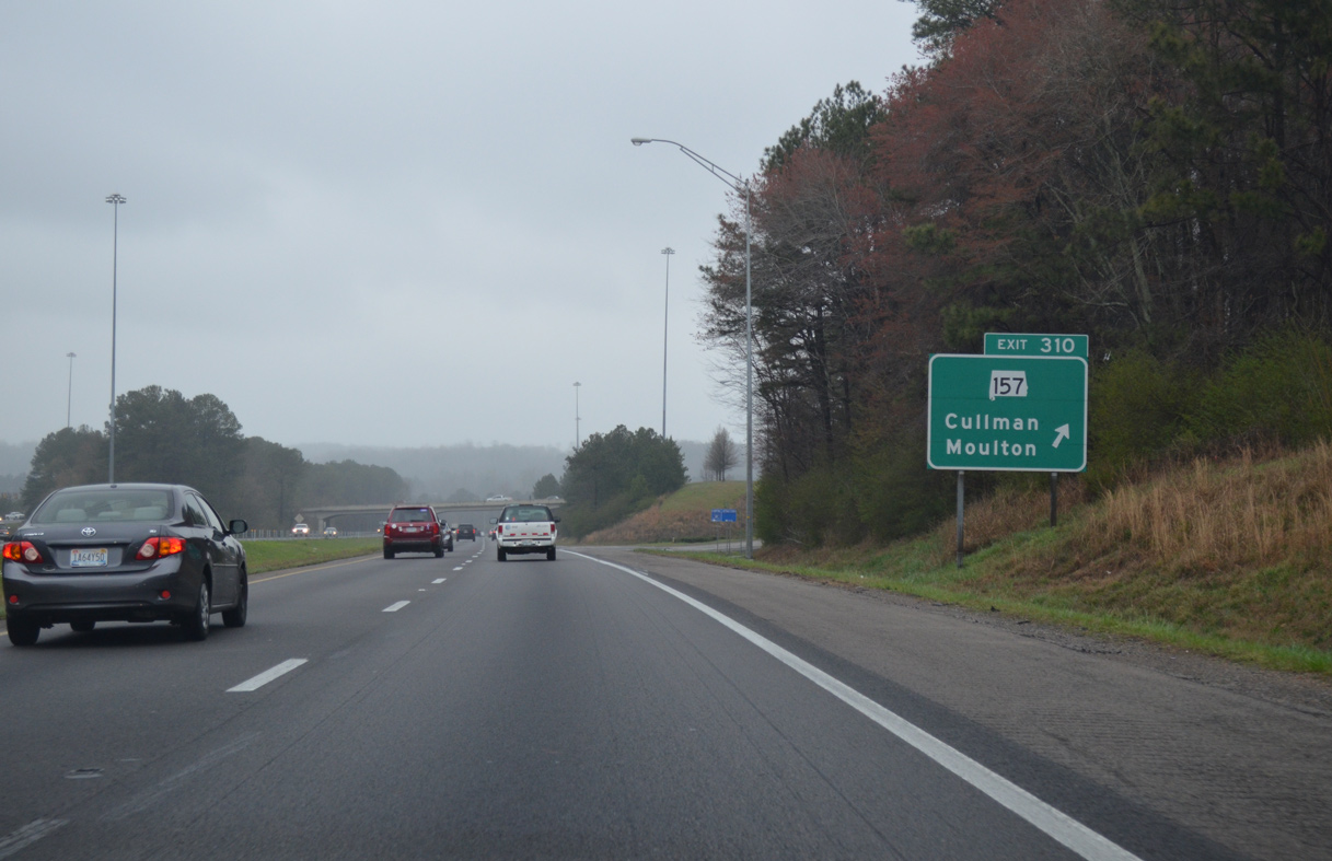
Exit 310 leaves Interstate 65 north for SR 157 north to West Point and east to SR 69 and U.S. 278. SR 157 totals 76 miles overall between U.S. 278 near East Point and the Tennessee state line north of Cloverdale.
04/04/13
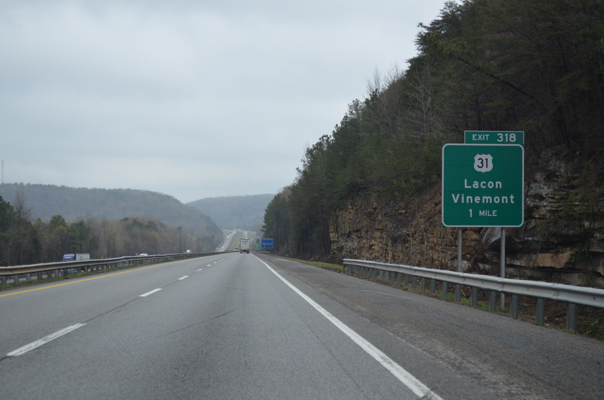
U.S. 31 and Interstate 65 converge north from Vinemont to Wilhite Cove and a modified diamond interchange at Exit 318.
04/04/13

U.S. 31 shifts to the west side of the freeway from forthcoming Exit 318 into nearby Lacon.
04/04/13
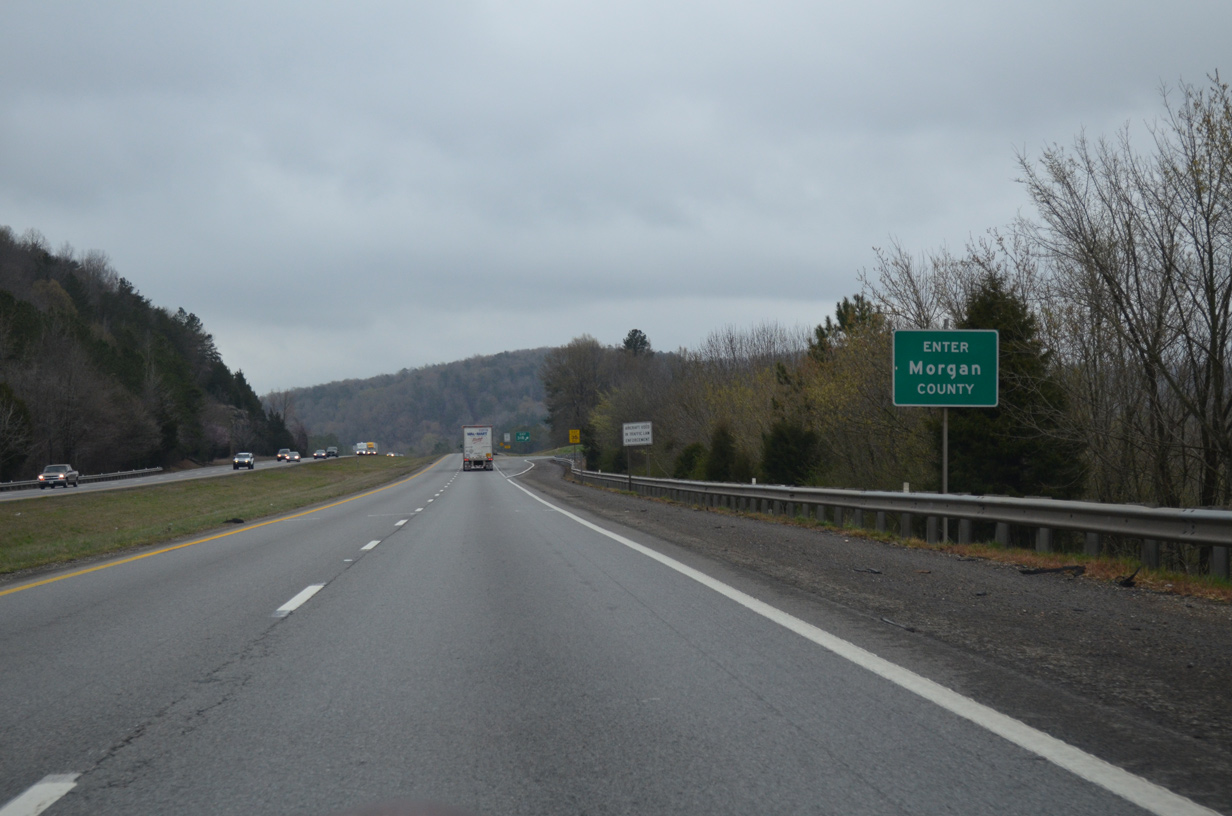
Just north of Indian Creek, drivers along Interstate 65 north enter Morgan County. This is the final county along the northbound drive to Tennessee.
04/04/13

Photo Credits:
- AARoads: 04/04/13
- ABRoads: 11/04/09
Page Updated Monday February 22, 2016.