
Interstate 65 North - Lake County
 North
North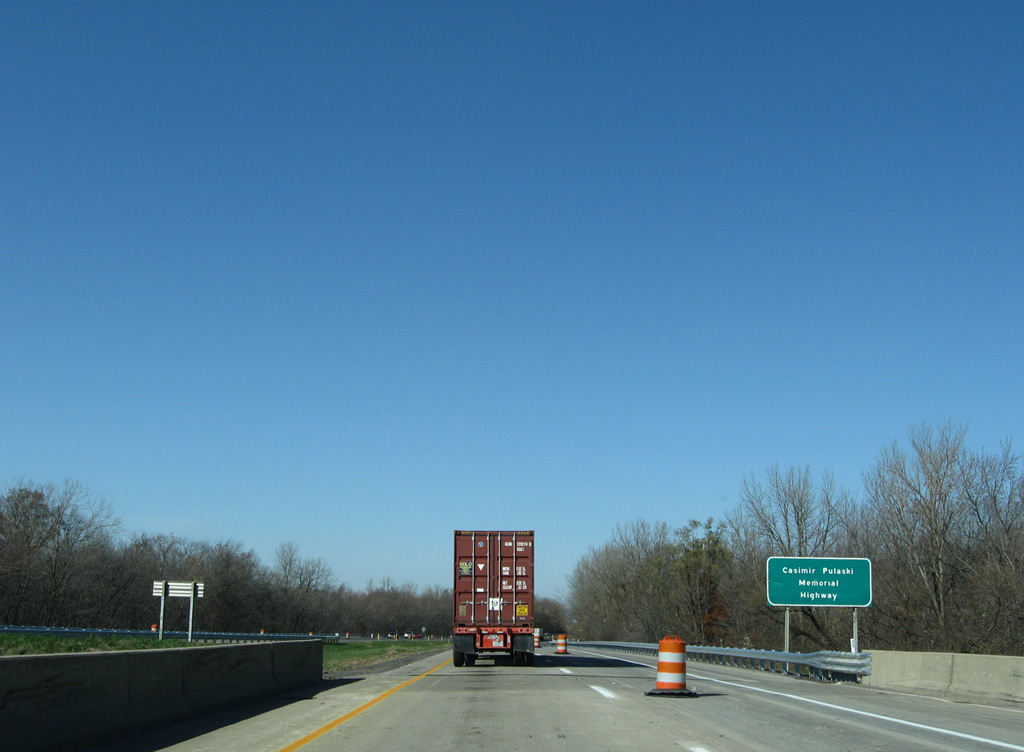
All of Interstate 65 within Lake County is designated the Casimir Pulaski Memorial Highway. Casimir Pulaski was a Polish military commander that emigrated to North America where he later served as a general in the Continental Army.
11/05/09
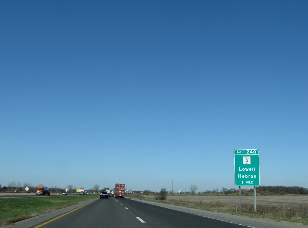
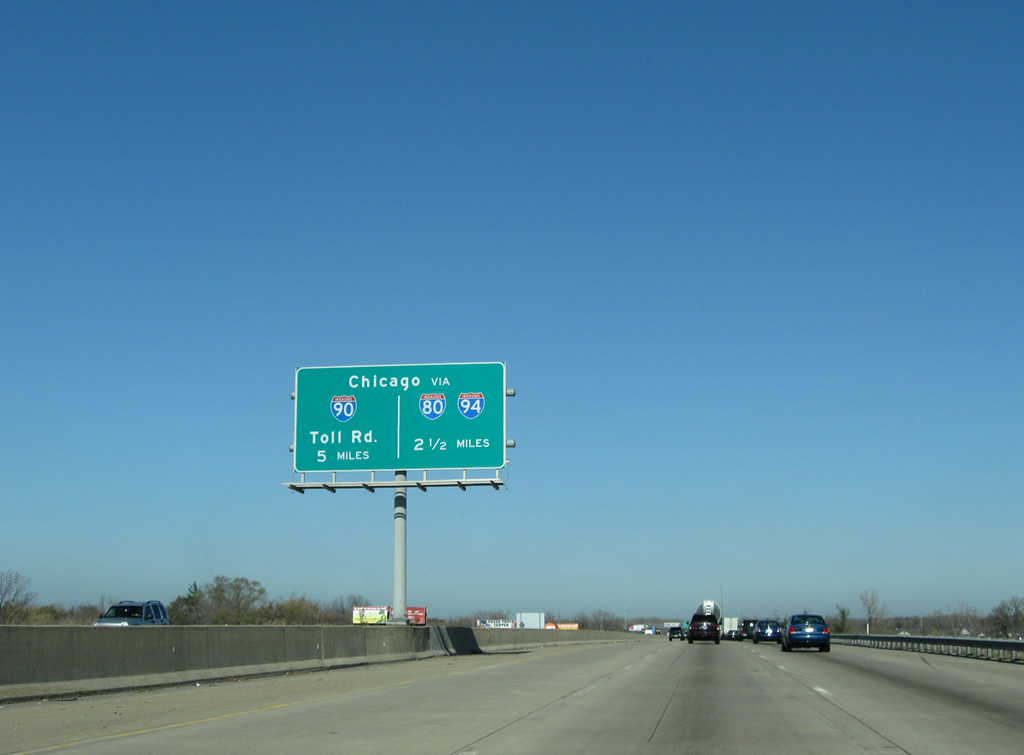
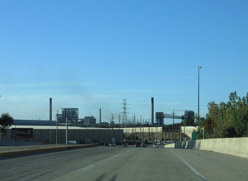
SR 2 and Interstate 65 come together at a diamond interchange (Exit 240) within the unincorporated community of Dinwiddie.
11/05/09
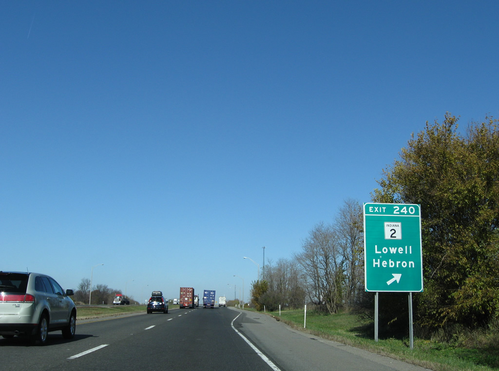
State Road 2 leads west from I-65 to Orchard Grove and Lowell and east to Hebron and Valparaiso.
11/05/09
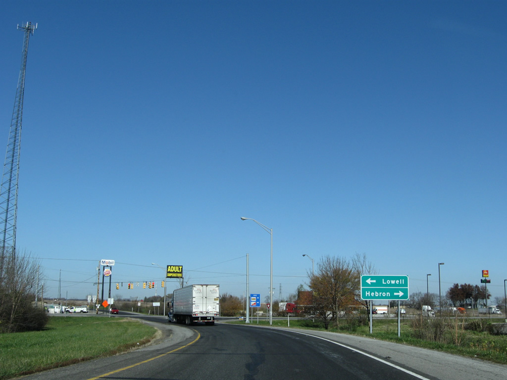
An assortment of traveler services line SR 2 at the exchange with I-65. SR 2 comprises a rural route to Lowell and Hebron. The state road runs 81 miles overall from the Illinois state line to U.S. 31 at South Bend.
11/05/09
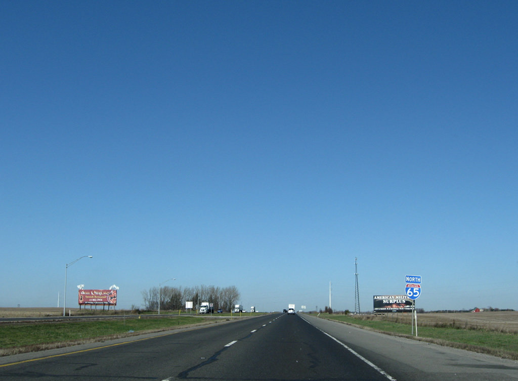
Interstate 65 remains rural through southeastern Lake County.
11/05/09
An abandoned northbound side weigh station lies one mile north of State Road 2. The southbound facility remains in operation.
11/05/09
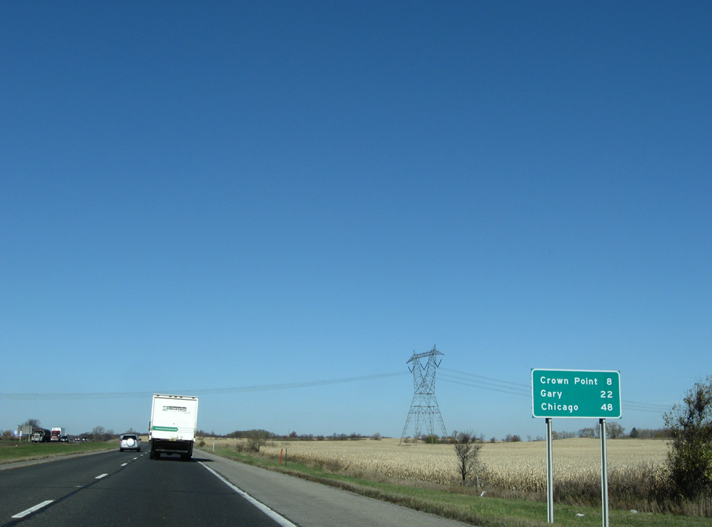
The next distance sign is not posted until after the old weigh station on-ramp. Crown Point lies eight miles ahead, followed by Gary at the northern terminus of Interstate 65.
11/05/09
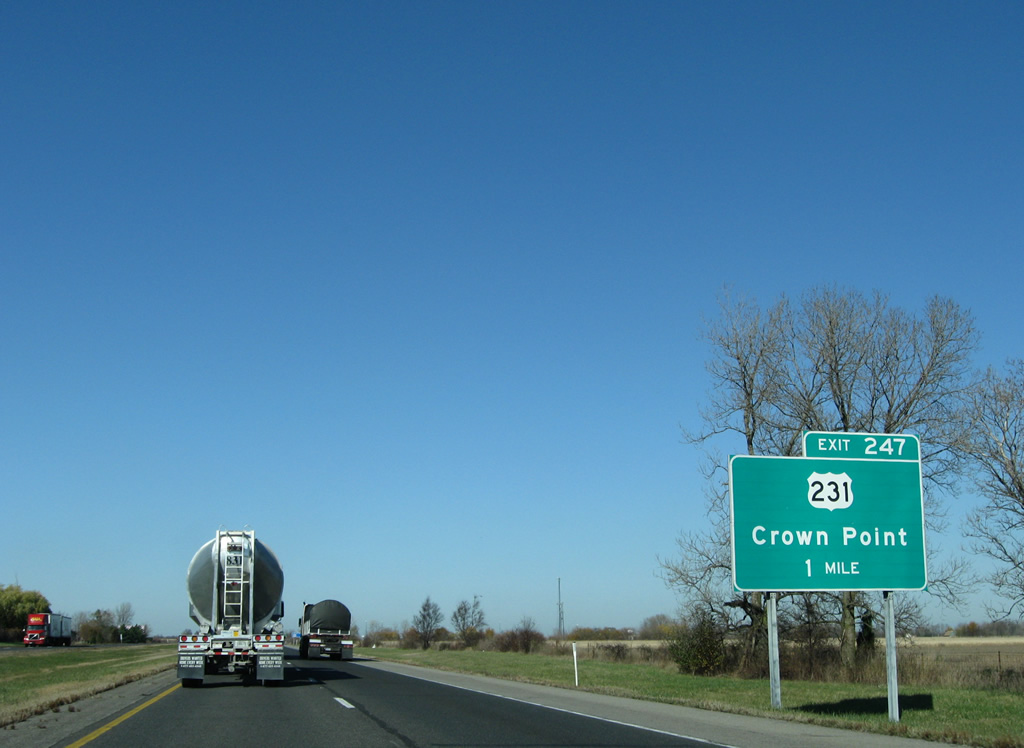
U.S. 231 returns to Interstate 65 by way of Hebron and Leroy to meet the freeway at a folded diamond interchange (Exit 247) in one mile.
11/05/09

Truck traffic remains thick through Northwestern Indiana as Interstate 65 enters the greater Chicago area and its assortment of ports and industrial facilities. Ramps to U.S. 231 connect with the US highway on the south side due to the original placement of a since removed railroad line.
11/05/09

U.S. 231 ventures 1.5 miles northwest to a short overlap with SR 55 along Joliet Street in Crown Point. SR 53 begins nearby and leads northward parallel to Interstate 65 to Gary and Interstate 90 (Indiana Toll Road). U.S. 231 otherwise ends 5.6 miles west of SR 55 at U.S. 41 near St. John.
11/05/09
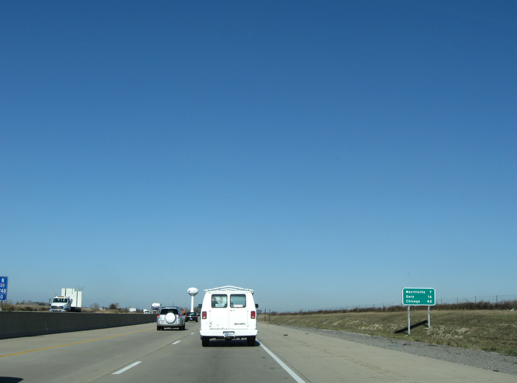
Merrillville is next along Interstate 65 in seven miles, followed by Gary in 16 miles. Chicago via Interstate 90 west, is 42 miles away.
11/05/09
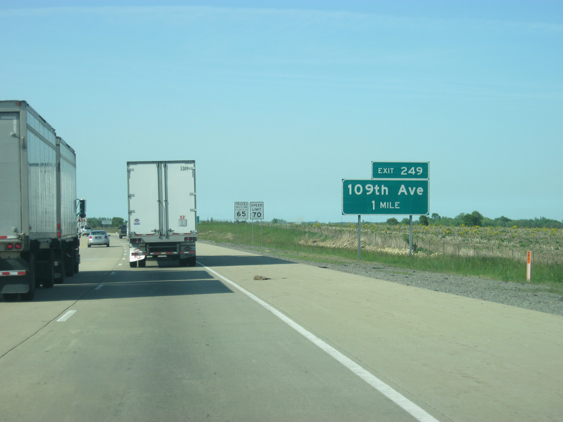
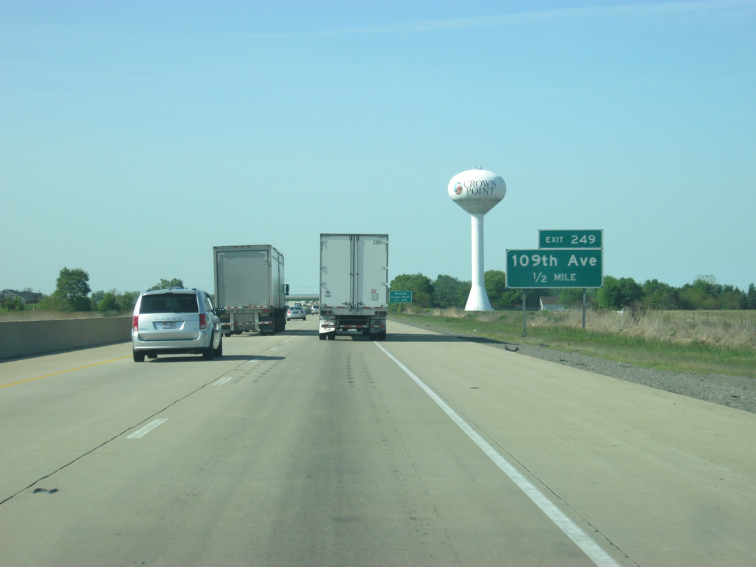
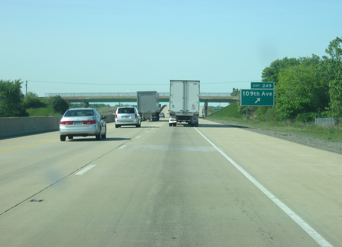
The diamond interchange (Exit 249) with E 109th Avenue was built between 2009 and 2010 to provide another route to Crown Point and a new route to Winfield from Interstate 65.
05/14/12
The city of Crown Point and town of Winfield are the controls for 109th Avenue and its interchange with Interstate 65, which broke up a five mile stretch between the exits at U.S. 30 and U.S. 231 in a fast-growing region of Lake County.
05/14/12
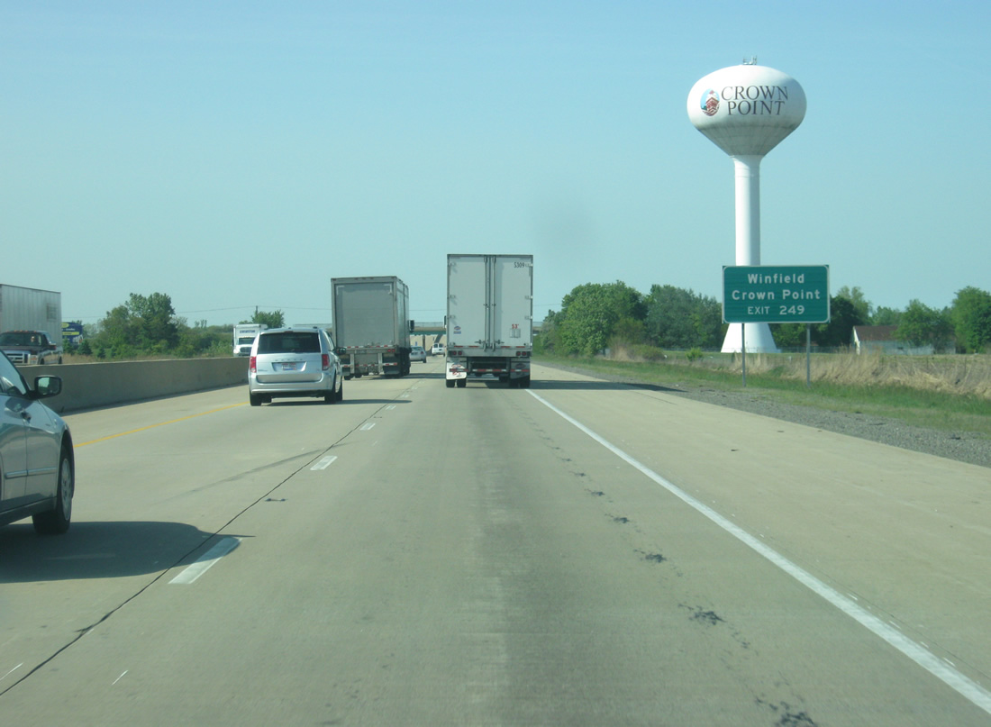
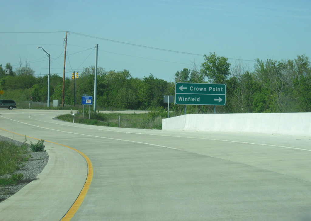
Exit 249 turns off of Interstate 65 south for 109th Avenue. 109th Street becomes North Street upon entering the Crown Point city limits to the west, providing a direct connection with Downtown Crown Point. Winfield and Lake Holiday lie to the east. Rural areas surrounding Exit 249 are expected to grow with the September 30, 2010 opened interchange.
11/05/09
05/14/12
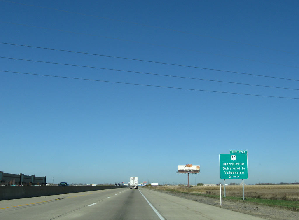
Interstate 65 enters Merrillville on the two mile approach to Exit 253 with U.S. 30 (81st Avenue).
11/05/09
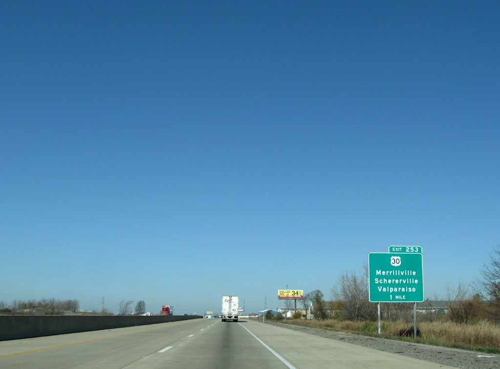
U.S. 30 joins the Northwest Indiana cities of Schererville, Merrillville and Valparaiso with Plymouth, Warsaw, Columbia City and Fort Wayne as a four lane corridor. Adjacent to Exit 253, the US Route consists of a commercial arterial with businesses lining both sides of the interchange, including Star Plaza Theatre and Westfield Southlake Mall nearby.
11/05/09
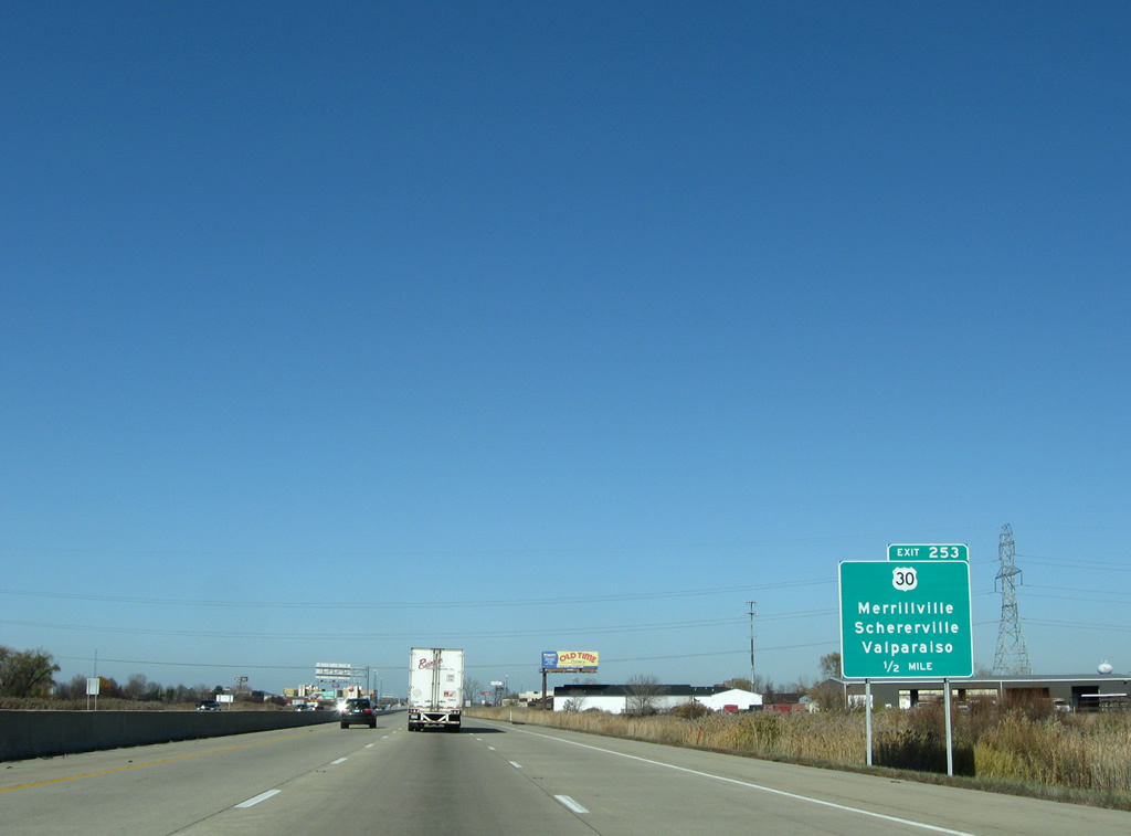
Originally a cloverleaf interchange, loop ramps from Interstate 65 to U.S. 30 were eliminated to remove weaving traffic concerns at Exit 253. U.S. 30> travels a busy route west from Merrillville to Schererville and Dyer, concluding the 151.8 mile cross state route near Ford Heights, Illinois.
11/05/09
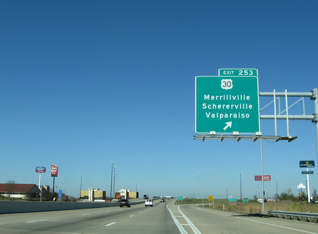
All traffic to U.S. 30 (81st Street) leaves Interstate 65 in unison as the freeway expands to six overall lanes. U.S. 30 ventures east 14 miles to Valparaiso, generally staying south of the city by Valparaiso University.
11/05/09
Continuing north through Merrillville along Interstate 65 near the 73rd Avenue overpass. 73rd Avenue represents the original alignment of U.S. 30, and later State Road 330, from Joliet Street in Schererville to Green Acres and Deep River by the Porter County line. SR 330 was posted between 1938 and 1947 after U.S. 30 shifted to its present alignment to the south.1
11/05/09
Upcoming exits are posted on the final run of Interstate 65 north between Merrillville and Gary. I-80/94 (Frank Borman Expressway) are first mentioned at the 73rd Avenue over crossing, 5.5 miles to the north.
11/05/09
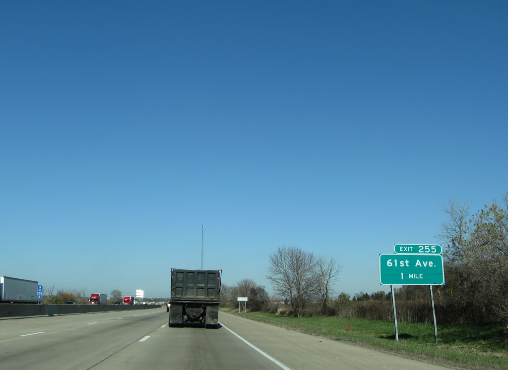
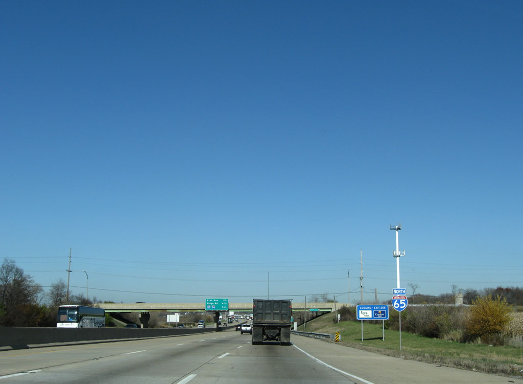
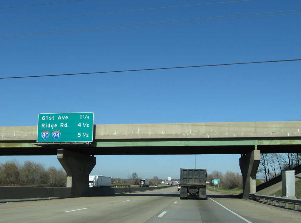
61st Avenue sees a six-ramp parclo interchange with Interstate 65 in northeast Merrillville. The Hobart city line resides just east of Exit 255.
11/05/09
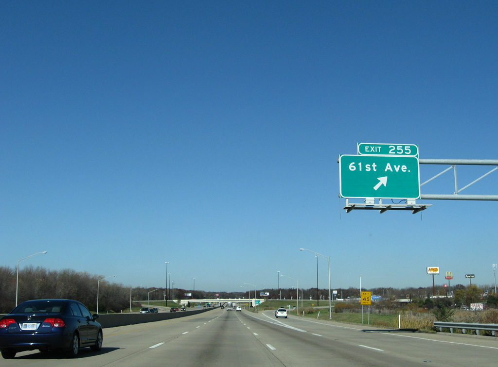
Heading west, 61st Avenue ends at SR 55 (Taft Street) in Merrillville. Eastward from Exit 255, 61st Avenue concludes at SR 51 (Lake Park Avenue) near Ainsworth.
11/05/09
Interstate 65 generally stays east of the Merrillville street grid by Robinson and Mac Joy Lakes to northwest Hobart.
11/05/09

A conventional distance sign simply lists the distance to the Gary central business district from Interstate 65 north near 53rd Avenue.
11/05/09
Interests to Chicago are directed from Interstate 65 via I-80/94 (Borman Expressway) west to the Bishop Ford Freeway north in 2.5 miles or the Indiana Toll Road west to the Chicago Skyway in five miles.
11/05/09
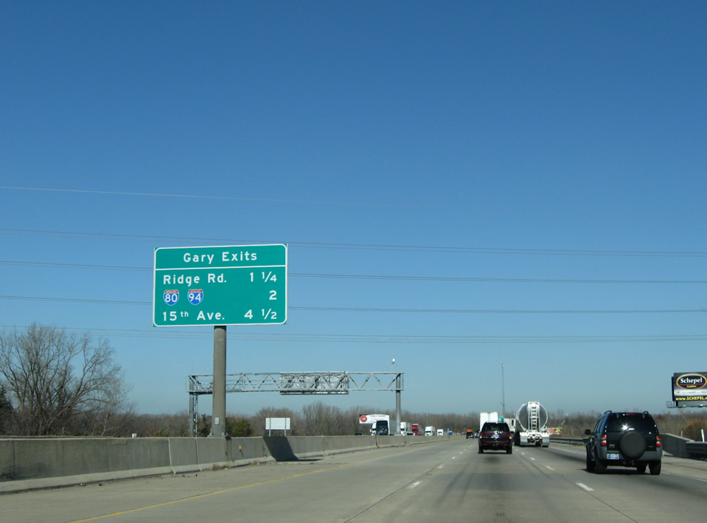
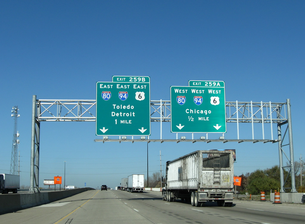
The final four exits of Interstate 65 all serve the city of Gary. Ridge Road (U.S. 6 Business) follows in 1.25 miles near the Liverpool and Glen Park communities. 15th Avenue and Dunes Highway (U.S. 12/20) connect with the Gary street grid between Interstates 80-94 and 90.
11/05/09
Ridge Road is the locally maintained business route for U.S. 6 west to Highland and U.S. 41 and east to New Chicago.
11/05/09
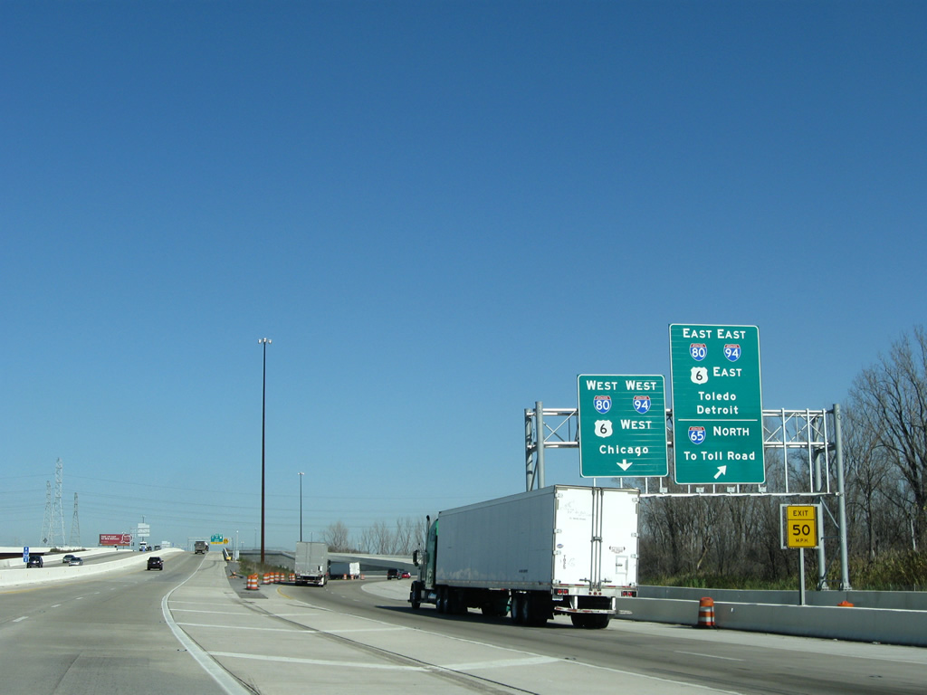
A wye interchange (Exit 259A) departs in 1.25 miles for the Northwest Connector, a short access road joining Interstate 65 north with I-80/94 (Frank Borman Expressway) west and the Borman east with I-65 south.
11/05/09
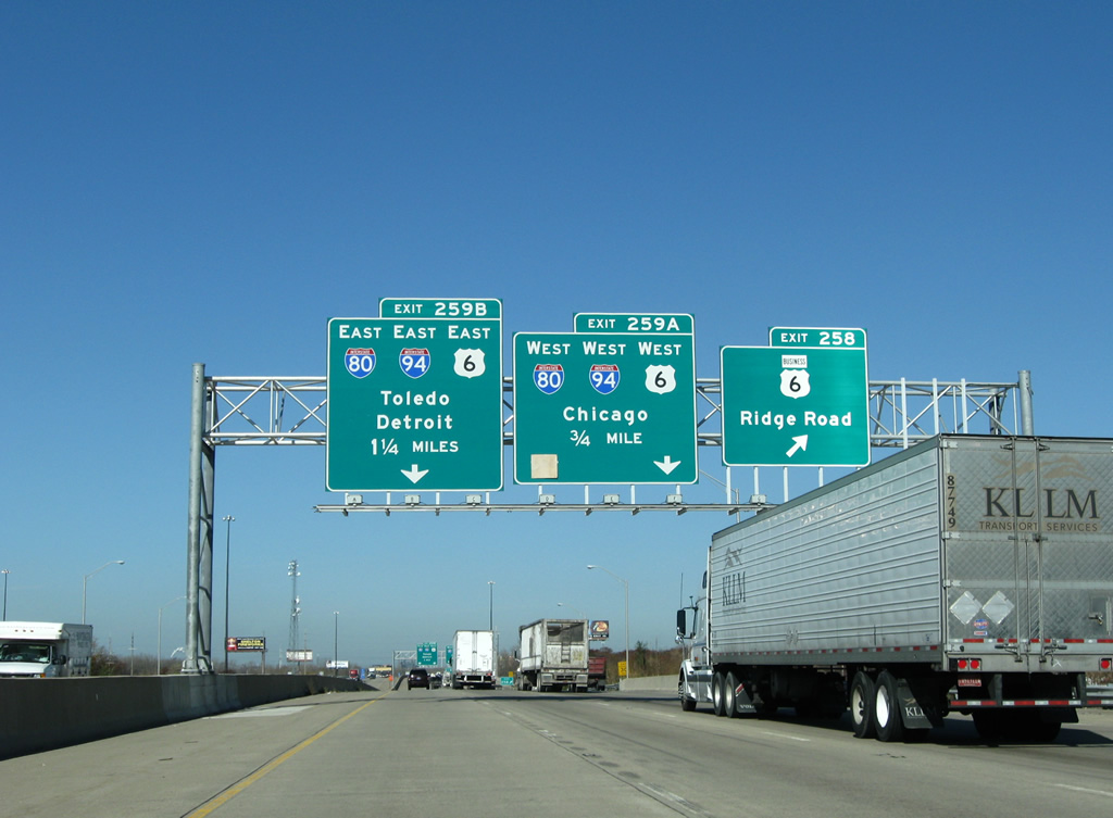
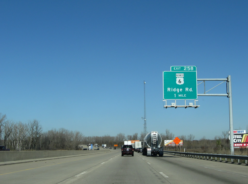
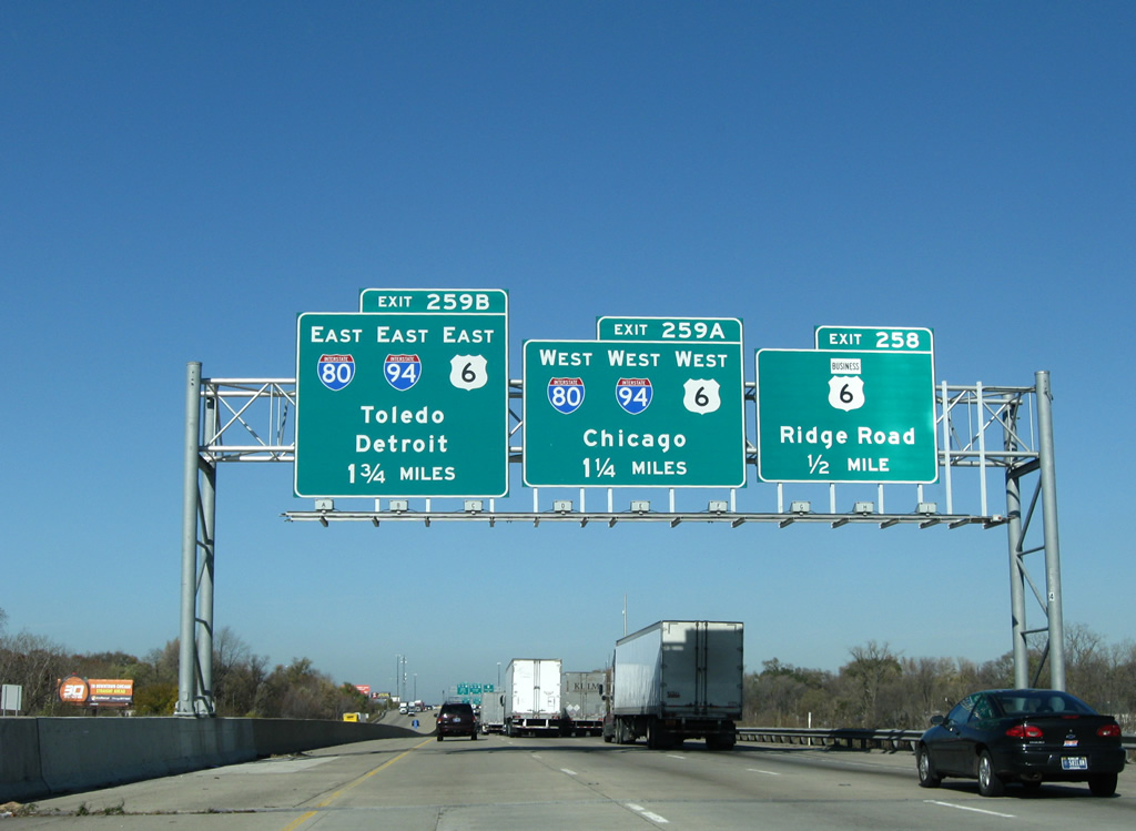
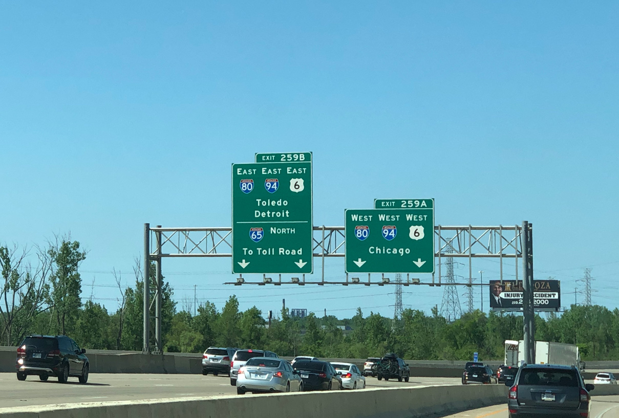
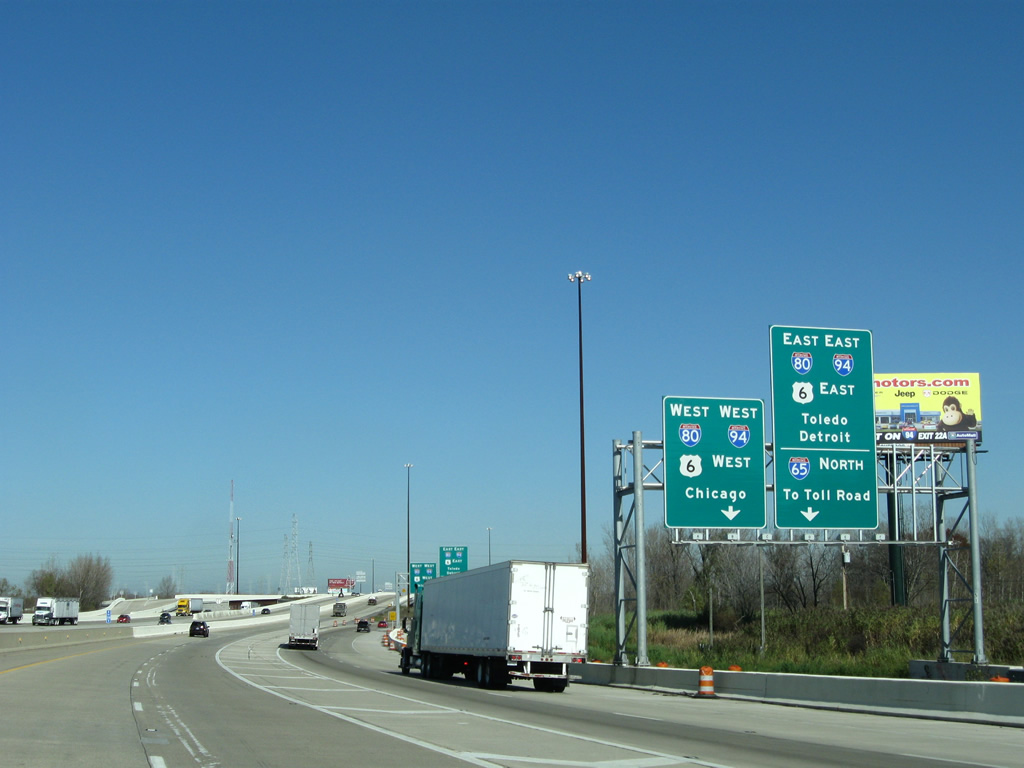
Exit 259 departs I-65 north for Ridge Road (U.S. 6 Business). U.S. 6 follows I-80/94 west to Lansing, Illinois and east to Lake Station. U.S. 6 east overtakes Ridge Road from SR 51 (Adam Benjamin Highway) toward Portage. Exit 259B follows for the Borman Expressway west to Chicagoland.
11/05/09
Changes made during 2009-11 construction add a second northbound lane over Ridge Road for I-65 to Gary. Frank Borman Expressway travels west from Northwest Connector (Exit 259A) through south Gary and Hammond toward Chicago, Illinois.
11/05/09
The entrance ramp from Ridge Road runs alongside I-65 to the Northwest Connector. I-80/94 overlap for 18.53 miles between Lake Station and the Tri-State Tollway (I-294) at Lansing, Illinois.
05/30/20
The entrance ramp from Ridge Road connects with the Northwest Connector and I-65 ahead of the directional cloverleaf interchange with I-80/94. Work completed in 2011 replaced a loop ramp from the Borman west to I-65 south with a flyover.
11/05/09
Two lanes branch away from Interstate 65 north for Chicago bound traffic as the Ridge Road on-ramp splits. I-80/94 part ways at Lansing, Illinois for the Quad Cities and Chicago respectively. I-294 follows the Tri-State Tollway north toward Milwaukee, Wisconsin.
11/05/09
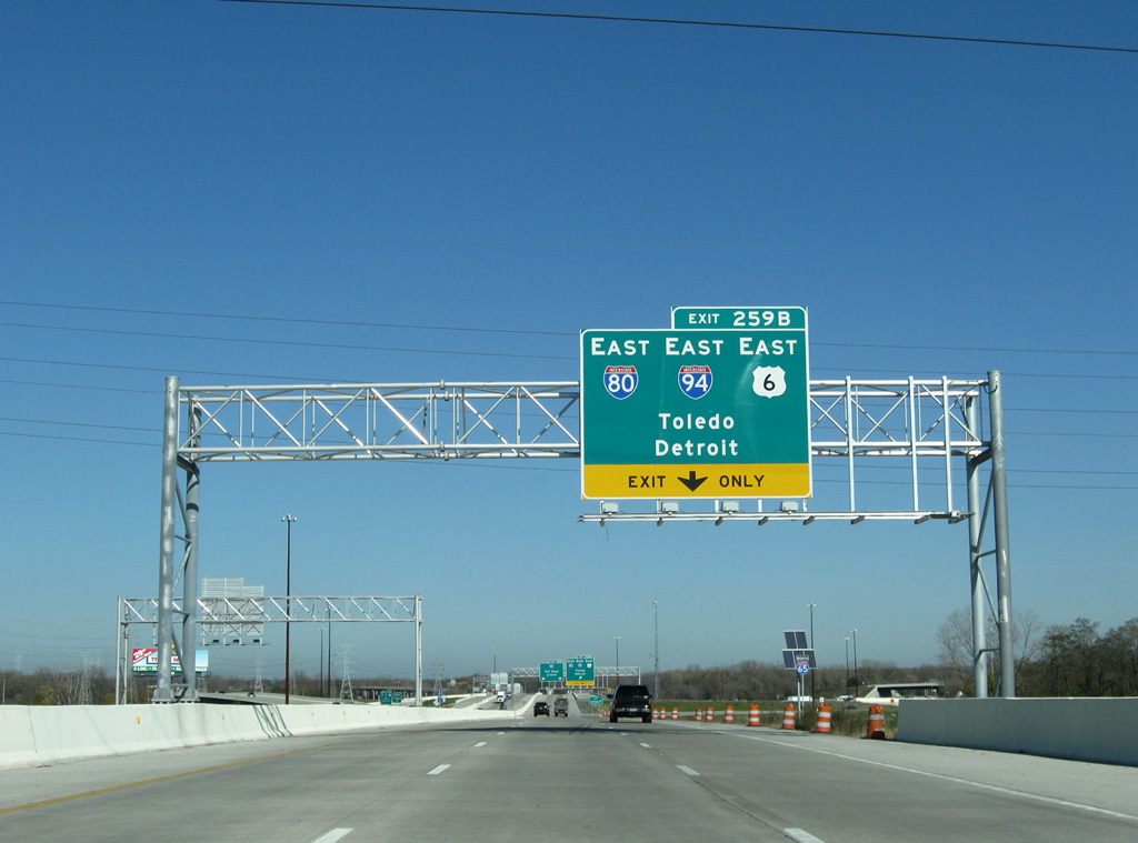
Interstate 65 passes over a Norfolk Southern Railroad ahead of Exit 259B to I-80/94-U.S. 6 east. I-80 shifts off the Borman Expressway onto the Indiana Toll Road in four miles, joining I-90 to Toledo and Elyria, Ohio. I-94 continues northeast to Portage, Chesteron and Michigan City.
11/05/09
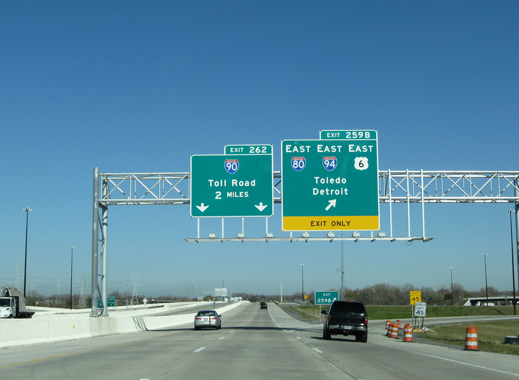
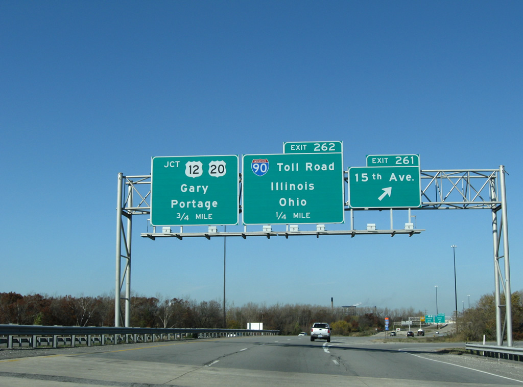
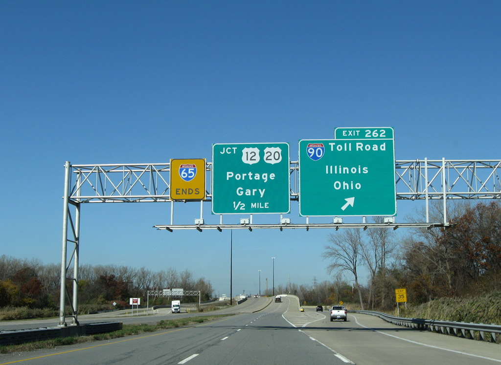
Exit 262, shown here to encompass the I-65 northbound mainline, follows Exit 259B in two miles for Interstate 90 (Indiana Toll Road). I-80 travels 151.6 miles across Indiana to join Gary and Portage with La Porte, South Bend, Mishawaka, Elkhart and Angola. I-94 arcs northeastward along Lake Michigan on a 46.1 mile course in Indiana to join Michigan City with St. Joseph, Michigan.
11/05/09
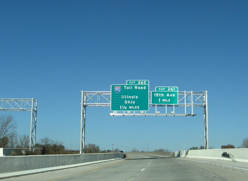
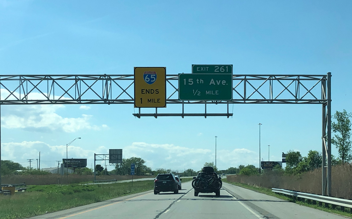
I-65 ascends onto a viaduct across Central Avenue and a Norfolk Southern Railroad line beyond the Borman Expressway. Departing next is a loop ramp (Exit 261) to E 15th Avenue and the wye interchange (Exit 262) for the Indiana Toll Road.
11/05/09
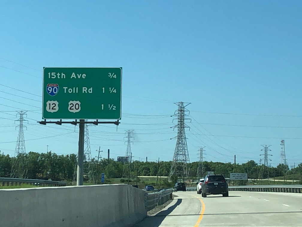
A parclo interchange (Exit 261) joins Interstate 65 with E 15th Avenue near the Aetna community in east Gary. 1.5 miles remain along the freeway northbound.
05/30/20
Interstate 65 concludes at a traffic light with U.S. 12/20 (E Dunes Highway) in one mile.
05/30/20
E 15th Avenue heads west from Exit 261 to Martin Luther King Drive and east to Clay Street and the Lake Station city line. Exit 262 provides a direct connection onto Interstate 90 west to East Chicago, Hammond and the Chicago Skyway.
11/05/09
Constructed in 2003-04, two wye interchanges join connecting ramps linking I-65 with the Indiana Toll Road. These ramps replace a previous signalized intersection that often caused congestion along the final half mile of freeway.
Interstate 90 continues east from Gary four miles to combine with I-80 at Lake Station and 55 miles to South Bend.
11/05/09
I-65 lowers from the exchange at Exit 262 to the intersection with U.S. 12/20 (E Dunes Highway) in Gary. The removal of an abandoned railroad line allowed for the construction of the ramps to Interstate 90.
09/03/05
With a left turn lane providing access to an adjacent warehouse facility, the freeway along I-65 ends just ahead of U.S. 12/20.
09/03/05
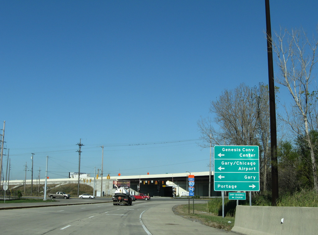
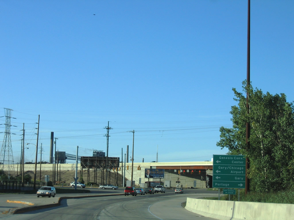
U.S. 12/20 overlap west to the couplet of 4th/5th Avenues into Downtown Gary. The routes serve the Genesis Convention Center, Gary's Baseball Stadium, and Gary/Chicago International Airport (GYY).
11/05/09

Taylor Road ties into the north end of I-65 from a nearby steel plant. U.S. 12/20 advance east along Dunes Highway to Aetna in east Gary and a split at Melton Road. Both routes continue into Portage.
05/30/20
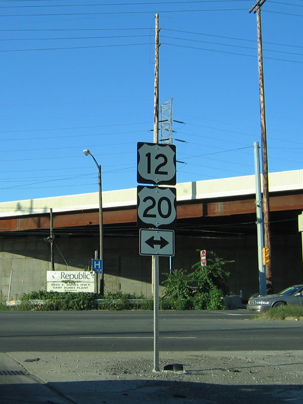
Hugging the Lake Michigan shore line from Michigan Shores east to the state line, U.S. 12 measures just 45.2 miles in Indiana. U.S. 20 follows a 153.5 mile course between Illinois at Hammond and the Ohio state line.
09/03/05
References:
- Indiana Highway Ends - SR 330.
http://www.highwayexplorer.com/EndsPage.php?id=1330
Photo Credits:
- ABRoads: 11/05/09
- Thomas Decker: 05/14/12
- Peter Johnson: 05/30/20
- AARoads: 09/03/05
Connect with:
Page Updated Monday October 26, 2020.