
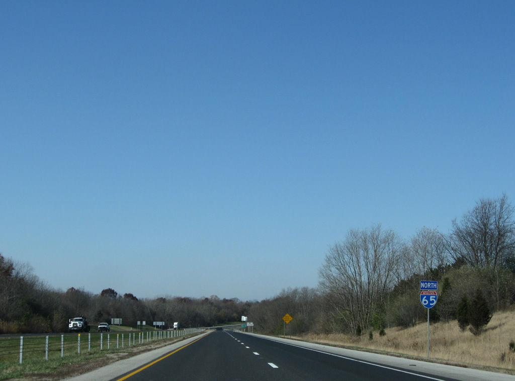
Interstate 65 North - Clinton / Tippecanoe Counties
 North
North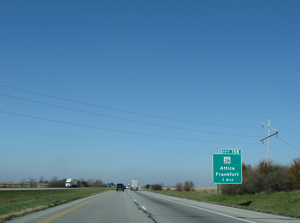
Southwestern Clinton County continues the agricultural landscape of Interstate 65 to Fickle and the diamond interchange with SR 28 (Exit 158).
11/05/09

SR 28 comprises a four lane divided highway leading east from Exit 158 nine miles to the Clinton County seat of Frankfort. Westward the state road travels 1.3 miles to Fickle and U.S. 52 near Clarks Hill.
11/05/09
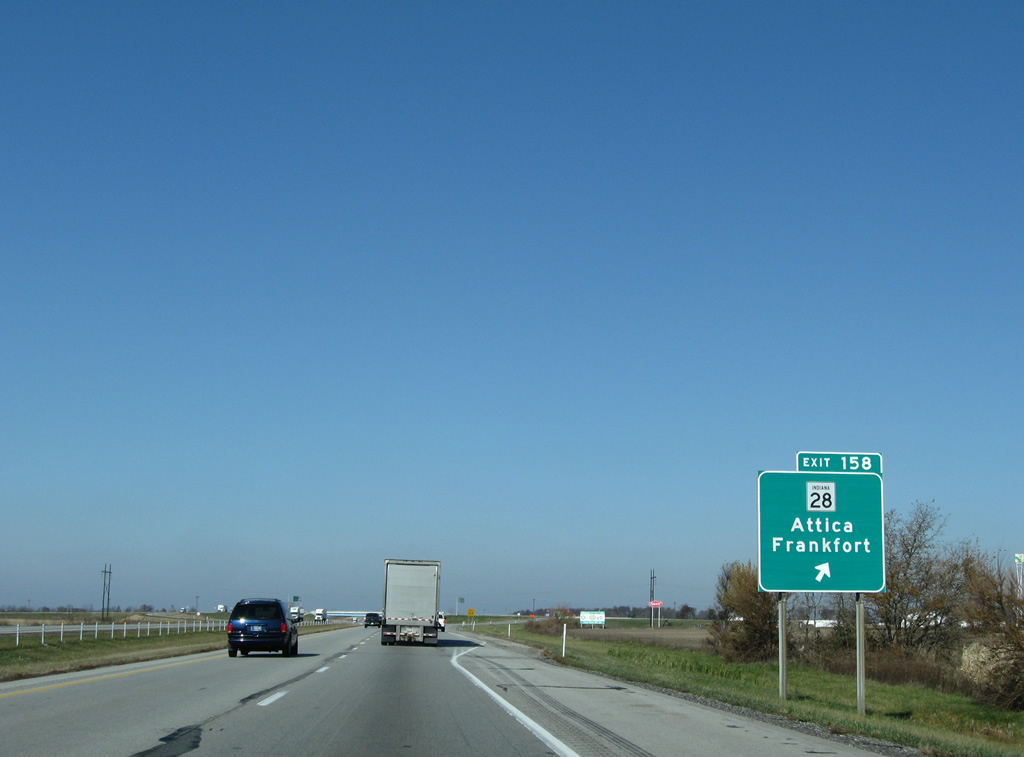
Exit 158 departs Interstate 65 north for SR 28. A 152.8 mile route, SR 28 travels across Indiana from the Illinois state line to Williamsport, Attica, Frankfort, Tipton, Elwood, Albany, Ridgeville and Union City.
11/05/09
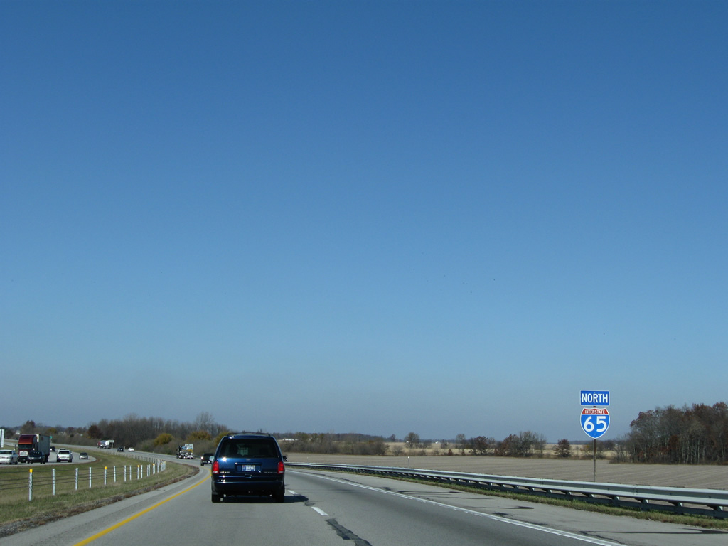
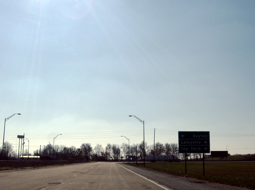
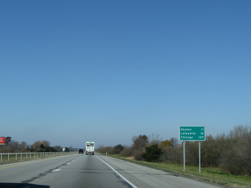
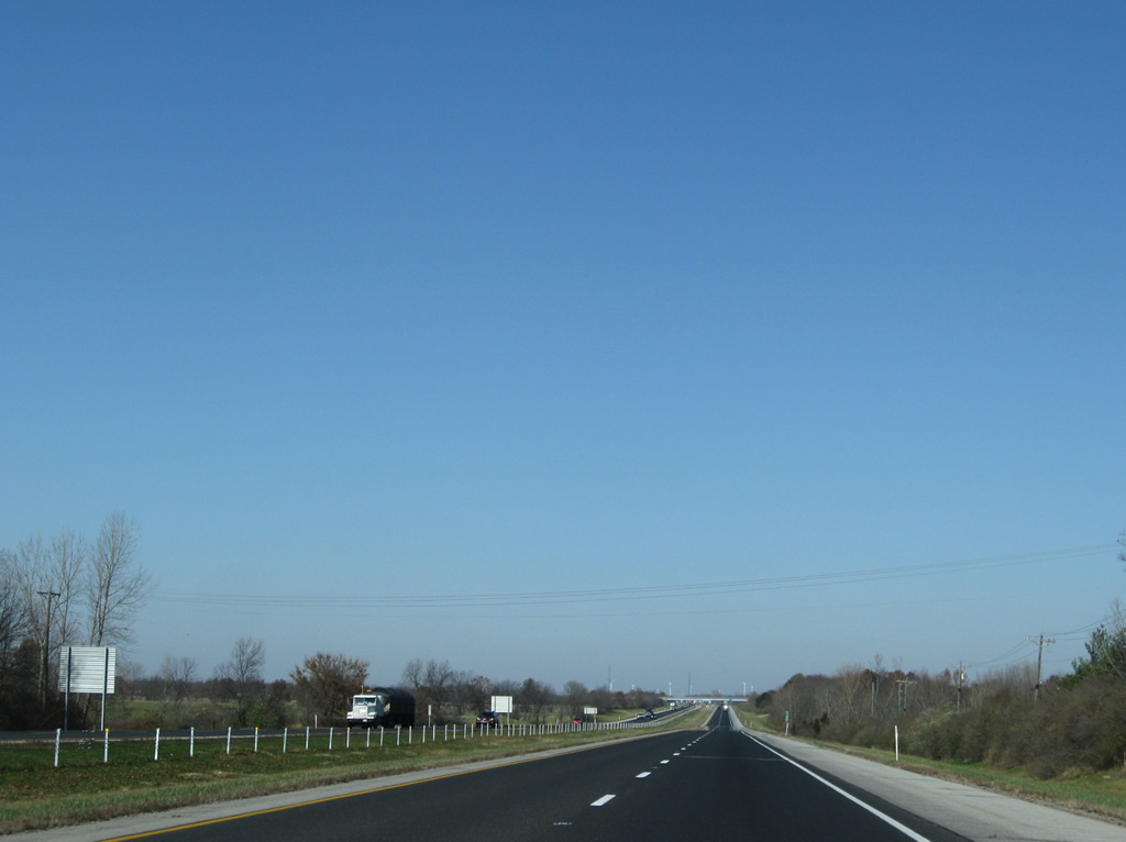
Interstate 65 continues 11 miles northwest to Dayton and 16 miles to the east side of Layette. Chicago is 137 miles.
11/05/09
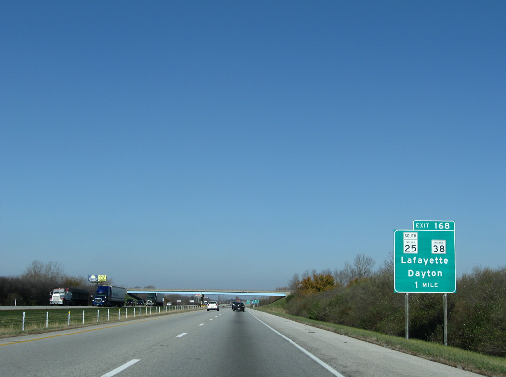
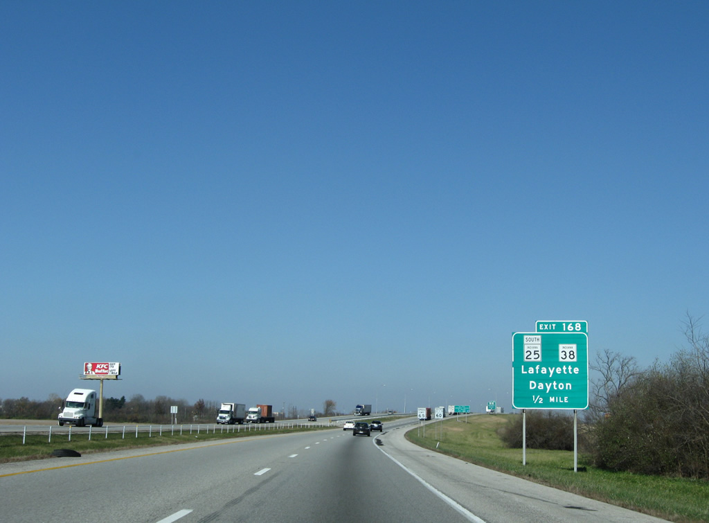
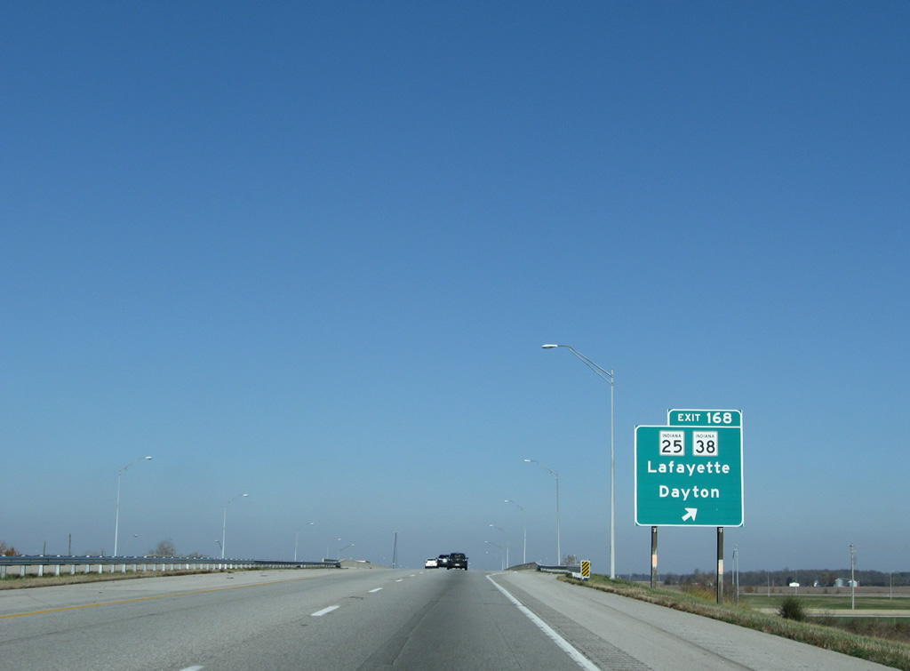
Now in Tippecanoe County, Interstate 65 is within one mile of a folded diamond interchange (Exit 168) with SR 25 south and SR 38 by the town of Dayton.
11/05/09
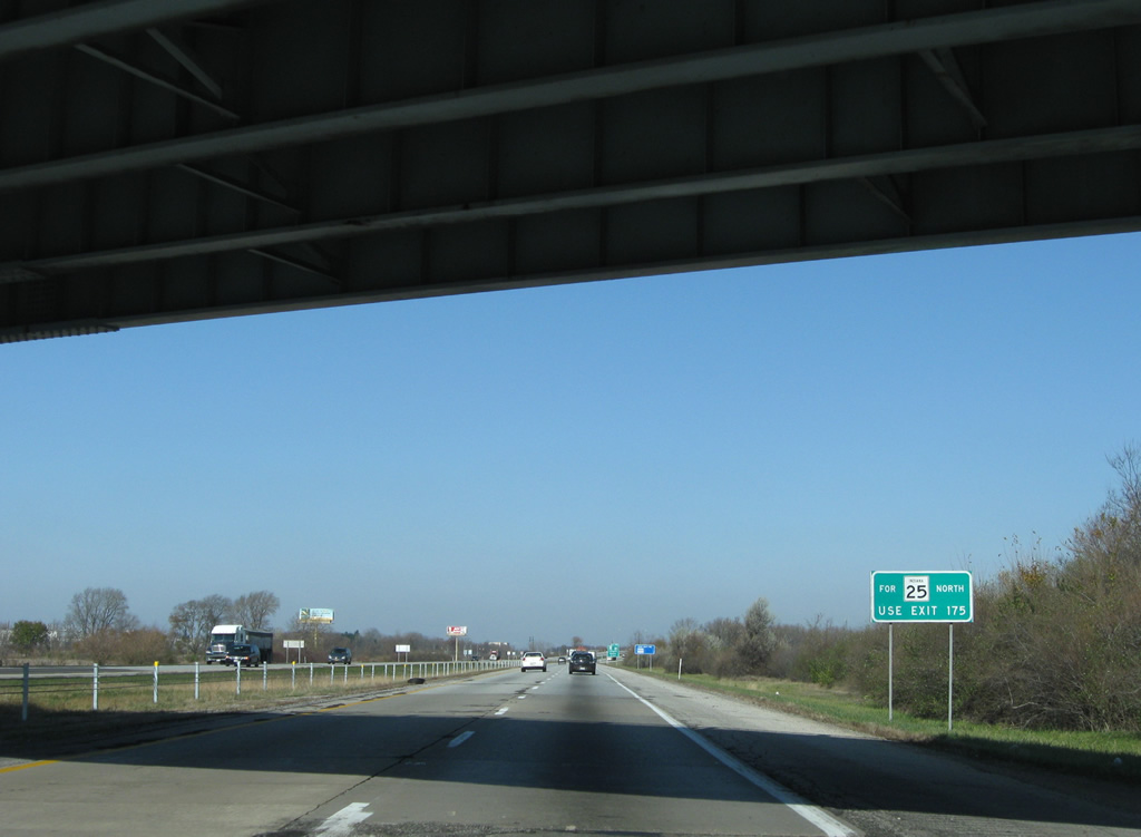
SR 25 used to run through Lafayette on a shared alignment with U.S. 52 (Sagamore Parkway) between Teal Road and Schuyler Avenue. The state road now follows SR 38 southeast from U.S. 52 to Exit 168 and Interstate 65 north to Exit 175.
11/05/09
SR 38 begins in Lafayette, from U.S. 52 and SR 25 near Tippecanoe Mall, and leads east to Dayton, Mulberry and U.S. 421 south to Frankfort. Overall the state road stretches 116.4 miles to Noblesville, Pendleton, New Castle and Richmond.
11/05/09
SR 25 west from U.S. 52 joins Lafayette with Ivy Tech Community College of Indiana and Shadeland ahead of a southerly turn to Wingate, Waynetown and SR 32 west of Crawfordsville.
11/05/09
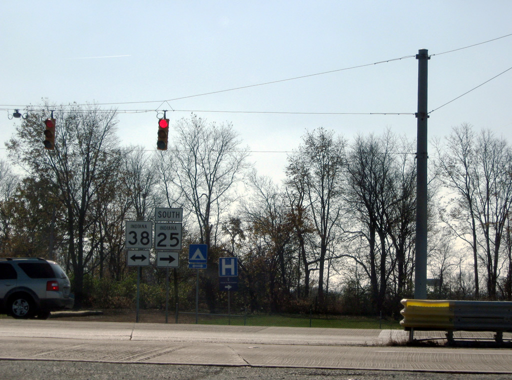
A loop ramp faces south for SR 25 south and SR 38 (Walnut Street) opposite a Norfolk Southern Railroad line. U.S. 52 and southeast Lafayette is a 5.3 mile drive via SR 25 & 38 west.
11/05/09
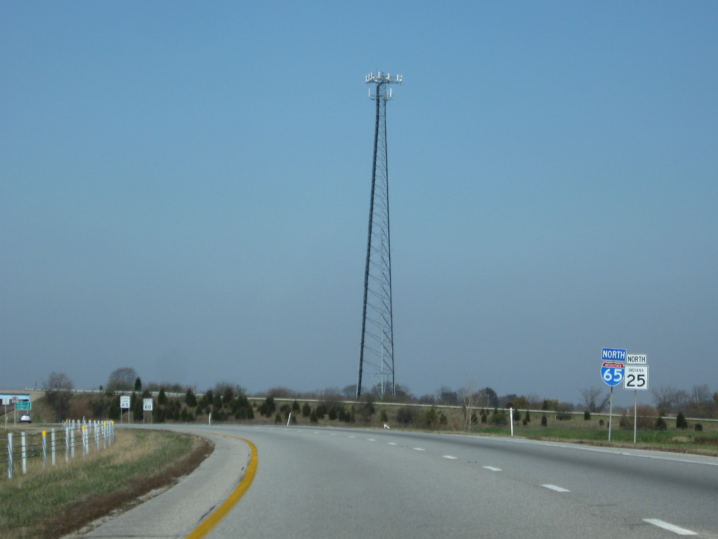
SR 25 uses Interstate 65 to bypass Lafayette on a seven mile overlap.
11/05/09
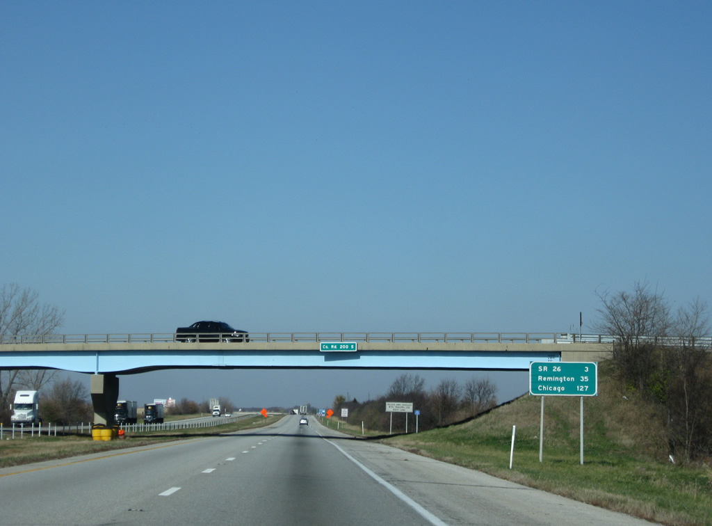
Remington in southern Jasper County is the next community highlighted on northbound distance signs beyond Lafayette. Chicago is 127 miles to the northwest.
11/05/09
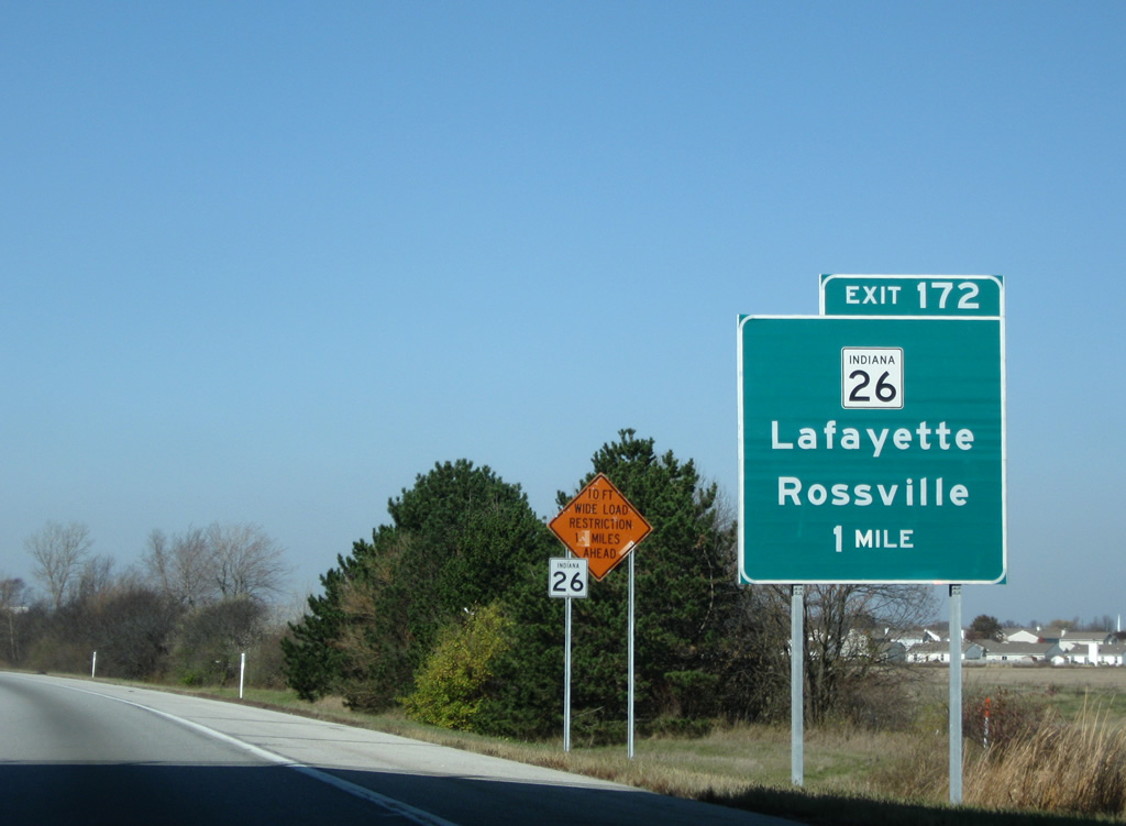
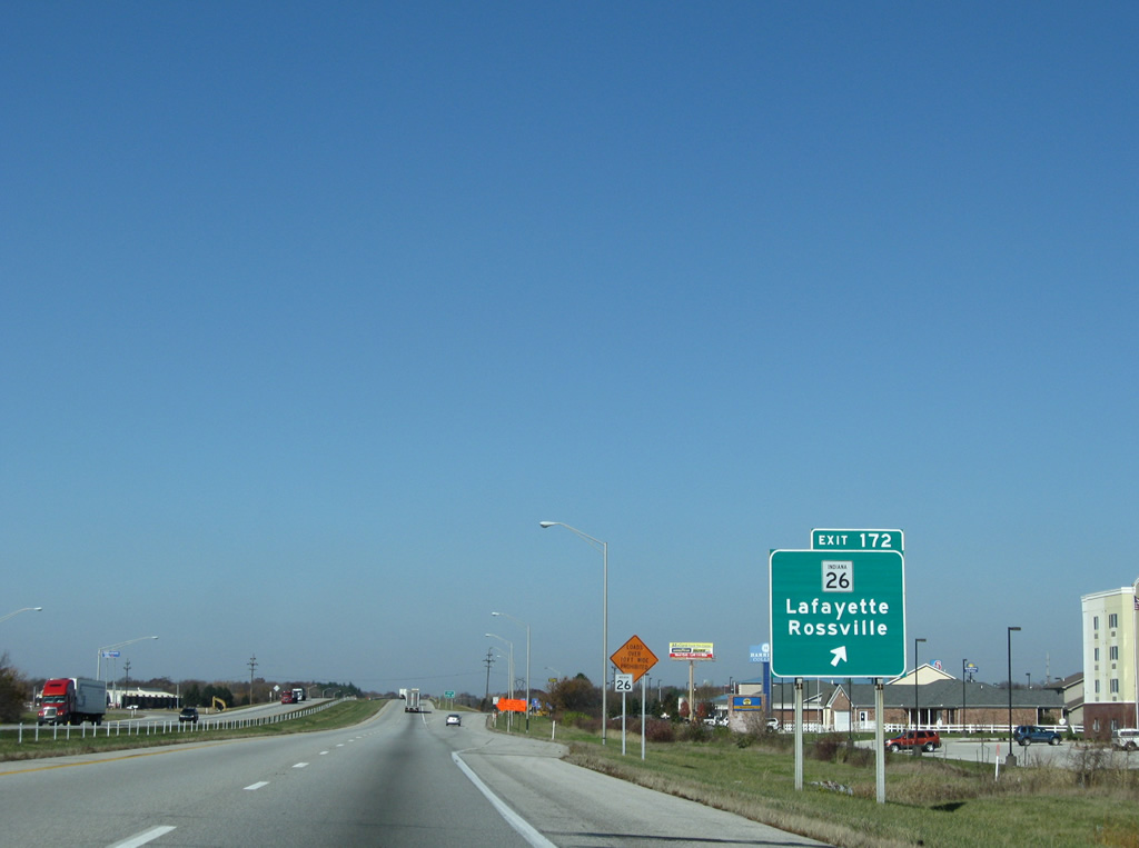
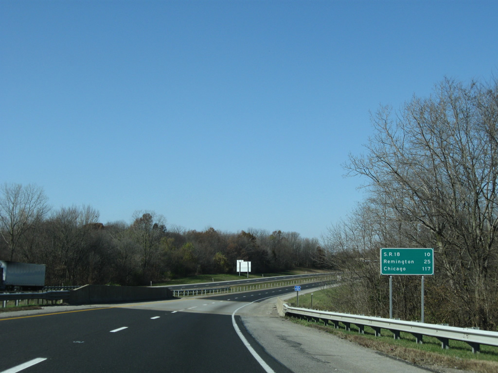
SR 26 constitutes a commercialized arterial leading west from Exit 172 of Interstate 65 to U.S. 52 (Sagamore Parkway) in Lafayette.
11/05/09
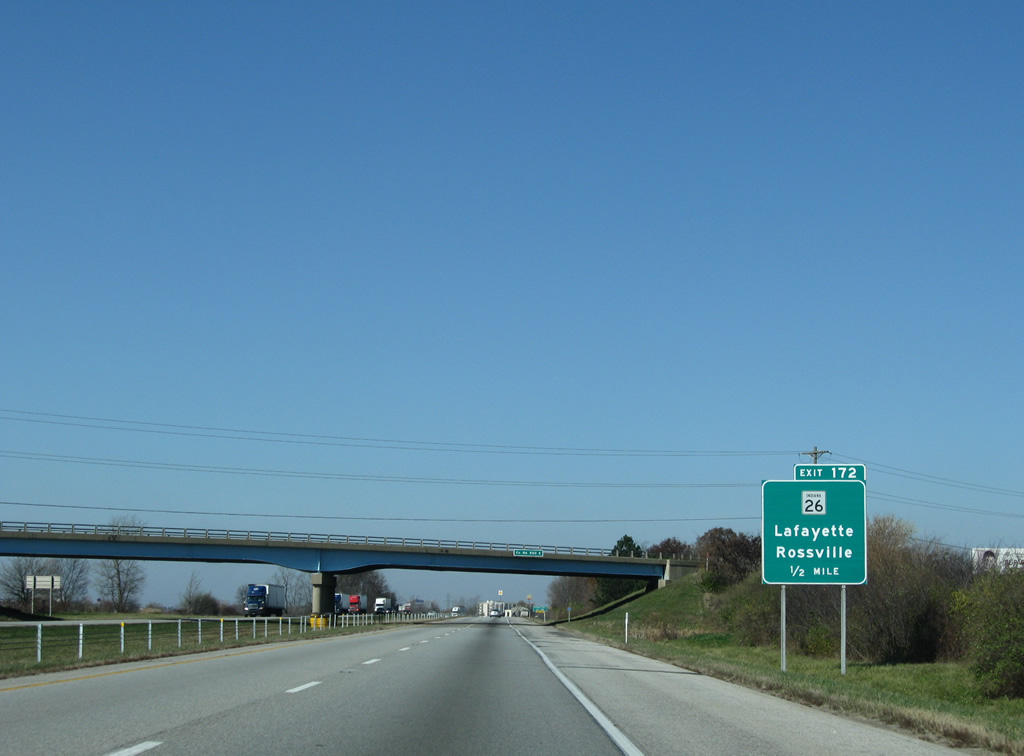
One half mile south of the diamond interchange (Exit 172) with SR 26. SR 26 joins Lafayette with Rossville and Kokomo to the east and suburbs to Monitor beside Interstate 65.
11/05/09
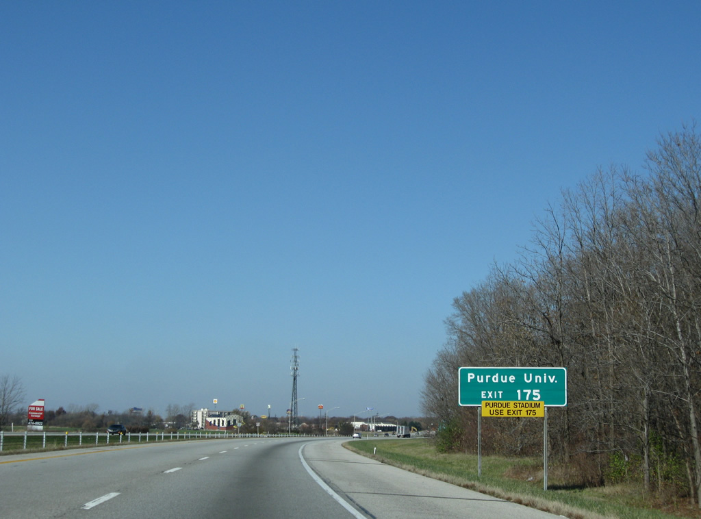
SR 26 provides the most direct route to Purdue University in West Lafayette. Ross-Ade Stadium traffic is advised to use Exit 175 via a route of Schuyler Avenue, U.S. 52 and Northwestern Avenue (currently U.S. 231). U.S. 231 is proposed to shift to a new bypass of West Lafayette.
11/05/09
SR 26 represents another cross-state route between the Illinois and Ohio State lines. The highway enters Indiana as Illinois 9 near Ambia and exits the state as SR 119 near Bellfountaine for a distance of 150.1 miles.
11/05/09
Interstate 65 & SR 25 straddle hilly areas of east Lafayette after the SR 26 on-ramp.
11/05/09
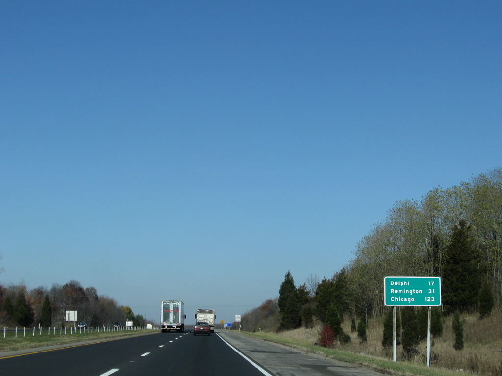
Delphi, the next community of interest along SR 25 north, is 17 miles. Remington follows along Interstate 65 north in 31 miles.
11/05/09
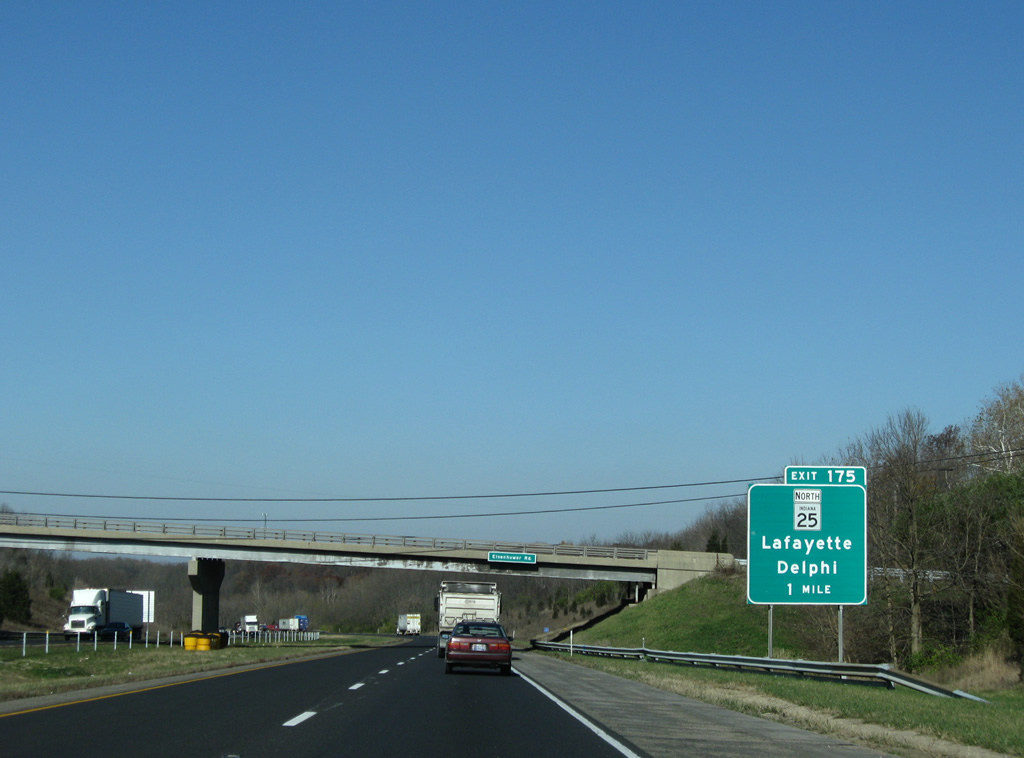
Eisenhower Road spans Interstate 65, one mile south of the Exit 175 diamond interchange with SR 25 north and Schuyler Avenue (former SR 25) south. INDOT is currently upgrading SR 25 from Lafayette to Logansport as part of the Hoosier Heartland Industrial Corridor .
11/05/09
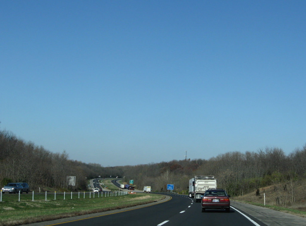
Interstate 65 & SR 25 wind toward a crossing of the Wildcat Creek. This stretch of freeway opened in 1969.
11/05/09
SR 25 travels 32 miles northeast from Lafayette to Logansport parallel to a Norfolk Southern Railroad line. The state road bypasses, or will bypass as part of the expressway upgrade project, several towns along the way including Americus, Delphi, Rockfield, Burrows, and Clymers. Photos and additional information of the SR 25 project can be found on the AARoads Forum.
11/05/09
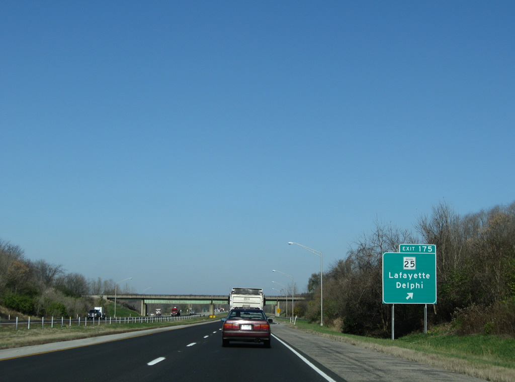
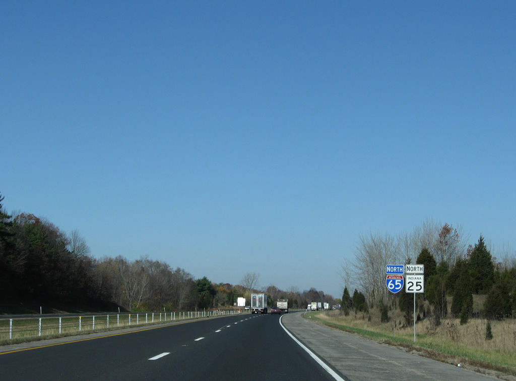
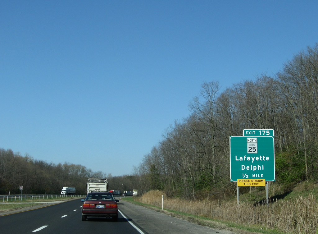
Exit 175 and SR 25 northbound part ways with Interstate 65 north. SR 25 continues north from Logansport to Rochester and a northern terminus at Warsaw. Schuyler Avenue (former SR 25 south) serves the industrial north side of Lafayette from Wildcat Creek to U.S. 52 (Sagamore Parkway).
11/05/09
North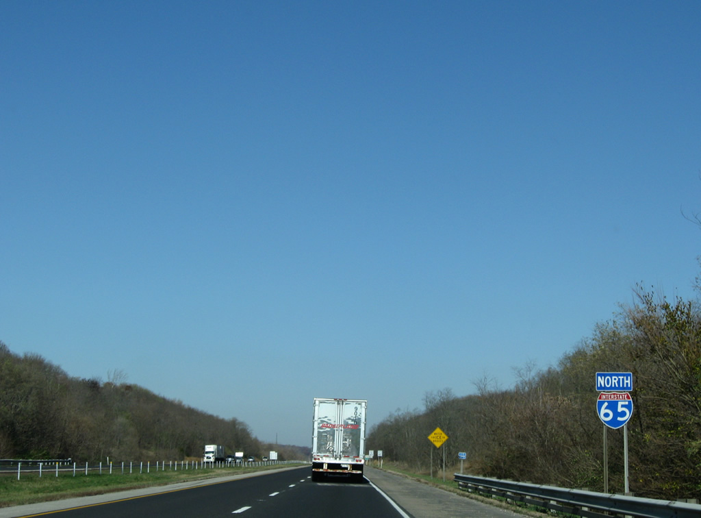
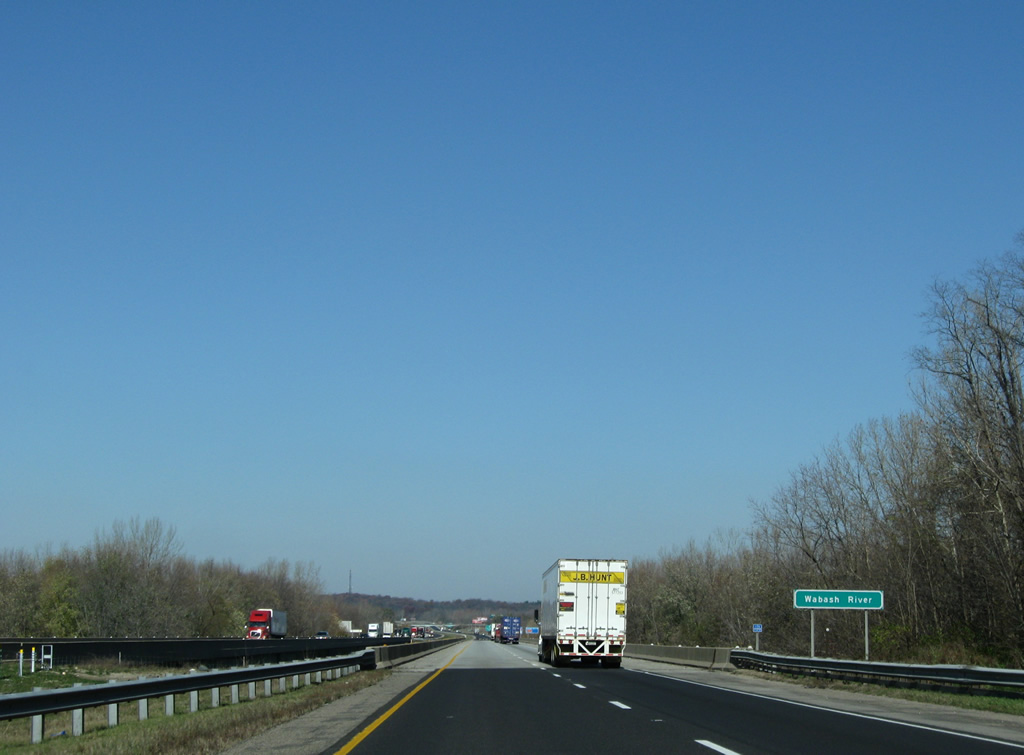
Interstate 65 leaves Lafayette and crosses the Wabash River en route to Battle Ground.
11/05/09
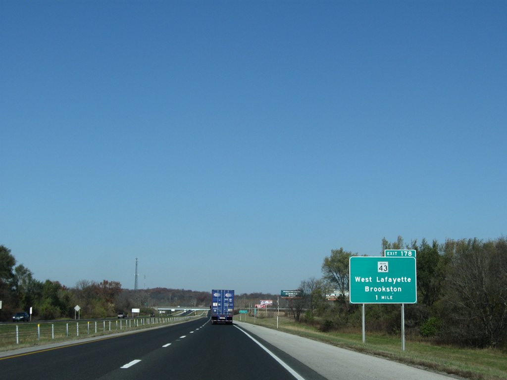
SR 43 crosses paths with Interstate 65 at Battle Ground via a parclo interchange (Exit 178). Another two-segment route, SR 43 travels from West Lafayette to Reynolds to the north and Cincinnati and Whitehall to the south.
11/05/09
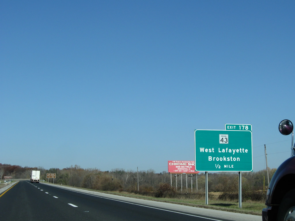
One half mile south of the Exit 178 off-ramp to SR 43. The state road joins Battle Ground and Interstate 65 with Brookston (SR 18) in adjacent White County.
11/05/09
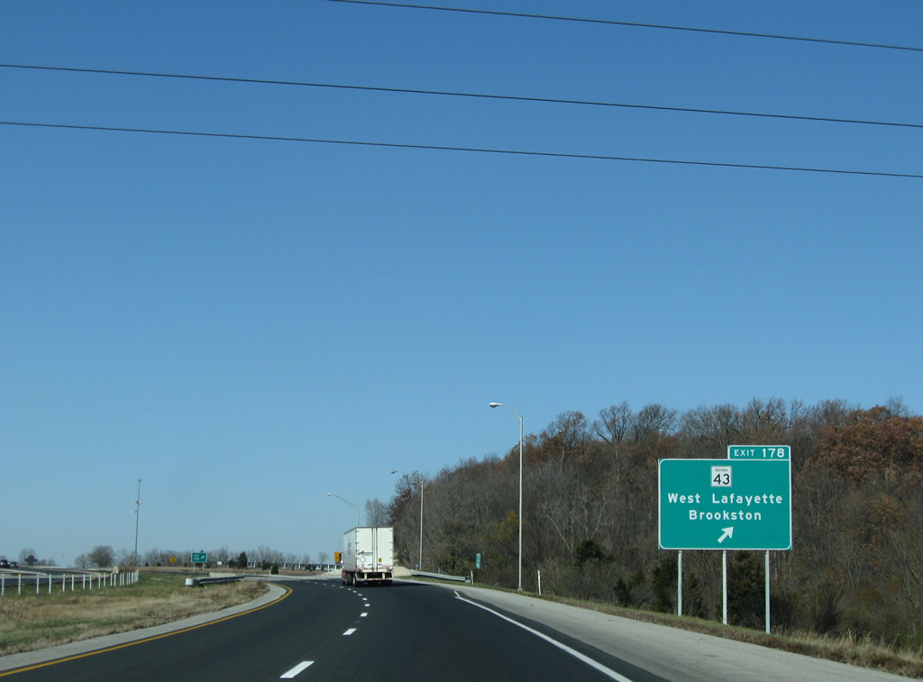
Exit 178 departs Interstate 65 north for SR 43. Battle Ground is home to Prophetstown State Park and Tippecanoe Battlefield State Memorial, both of which are accessible via SR 225 east from SR 43. SR 43 north also serves interests to Lakes Shafer and Freeman of the Tippecanoe River via connections with U.S. 421 at Reynolds.
11/05/09
Reassurance shield posted for Interstate 65 north as the freeway nears Burnett Creek near Battle Ground.
11/05/09
The next exit lies ten miles to the north with SR 18. Interstate 65 remains through agricultural areas until Remington (Exit 201).
11/05/09
Interstate 65 straightens out and approaches the County Road 725 North over crossing in northern Tippecanoe County.
11/05/09
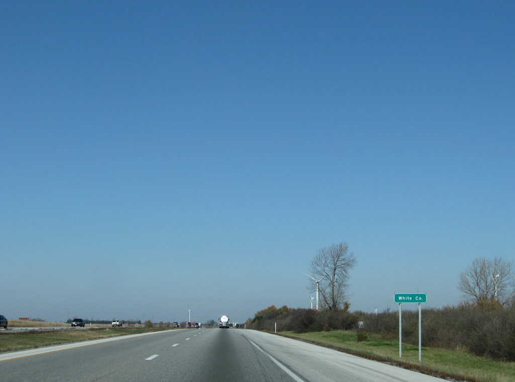
Entering White County along an uninterrupted stretch of Interstate 65 between Cairo and Badger Grove.
11/05/09
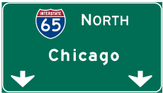
Photo Credits:
- ABRoads: 11/05/09
Page Updated Tuesday January 10, 2012.