
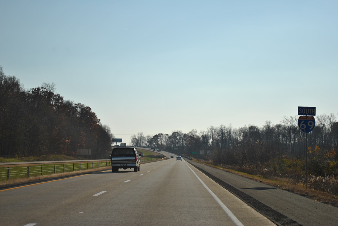
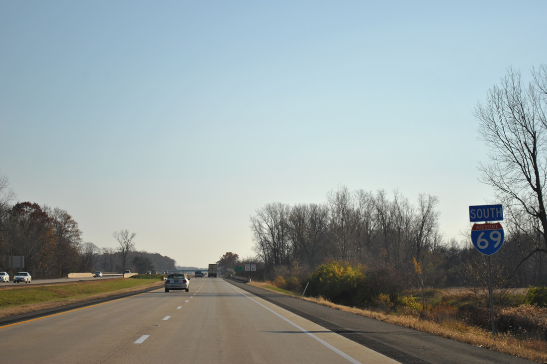
Interstate 69 South - Steuben / DeKalb Counties

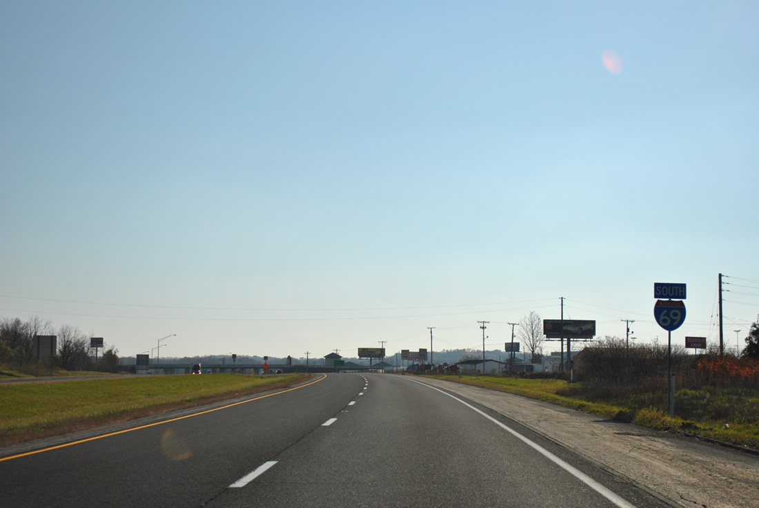
 South
South
One half mile ahead of the trumpet interchange (Exit 356) and access road to the Indiana Toll Road on I-69 south. I-80/90 travel across the northern tier of Indiana from the Ohio Turnpike west to Lake Station.
11/06/11
Old US 27 lines the west side of Interstate 69 by Exit 356 to become SR 127 at SR 120, south of the Toll Road.
11/06/11
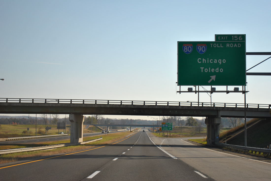
Exit 356 departs Interstate 69 south for I-80/90 west to South Bend, Gary and Chicago and east to Toledo, their split at Elyria and Cleveland, Ohio.
11/06/11
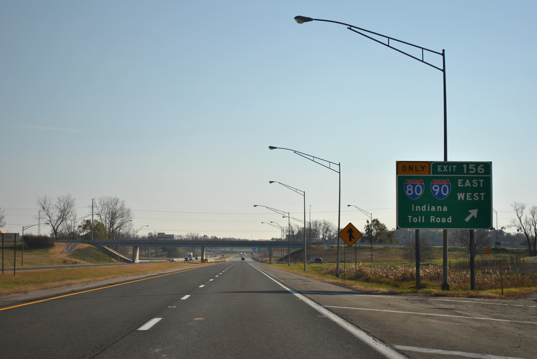
The Indiana Toll Road stretches 157 miles east from the Chicago Skyway to the Ohio Turnpike. The toll road is operated by the ITR Concession Company LLC (ITRCC) under a 75-year lease that commenced on June 29, 2006.
11/06/11
SR 127 accompanies the west side of Interstate 69 from SR 120 to the diamond interchange (Exit 354) at Failing Lake.
11/06/11
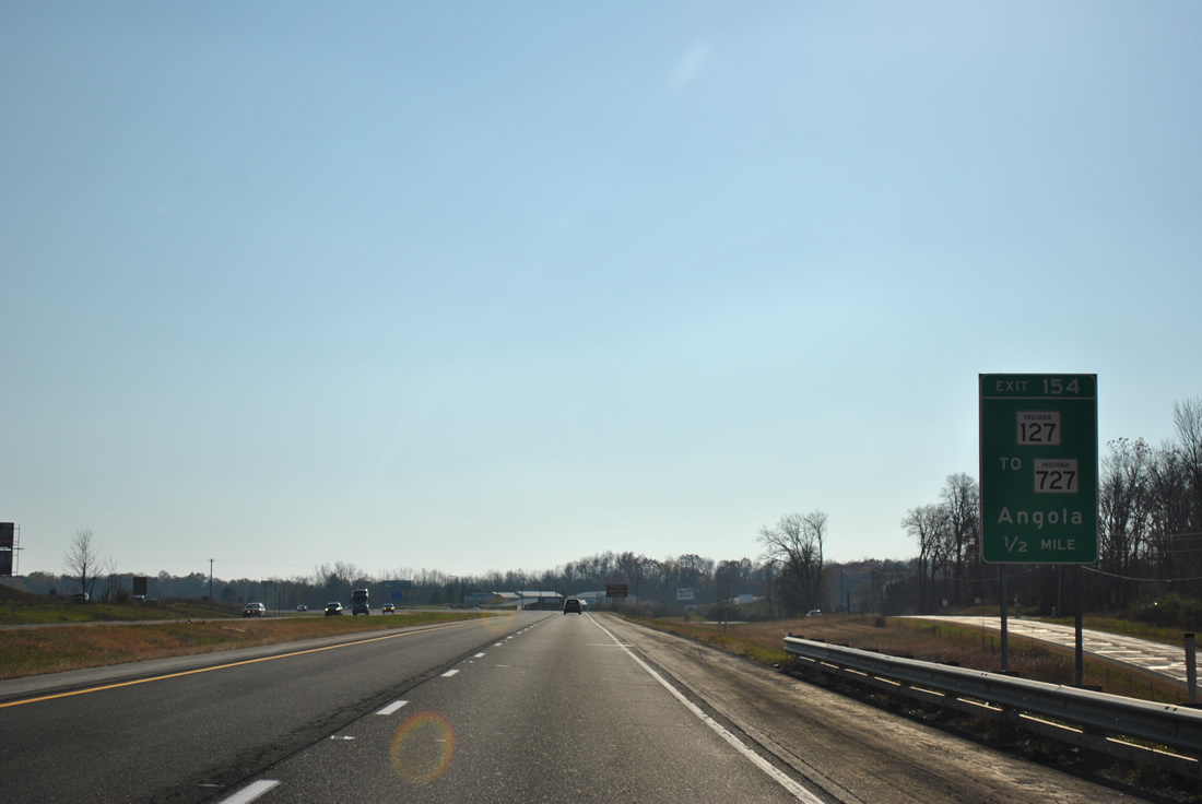
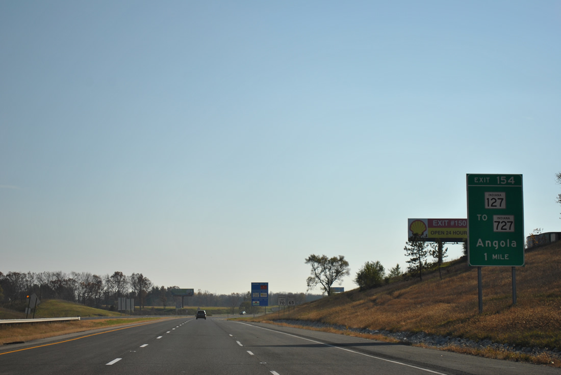
SR 127 shifts sides with I-69 at Exit 354, continuing along the original U.S. 27 alignment southward to Wayne Street in Angola. SR 727 begins at Exit 354 and spurs west 0.8 miles to Pokagon State Park on Lake James.
11/06/11
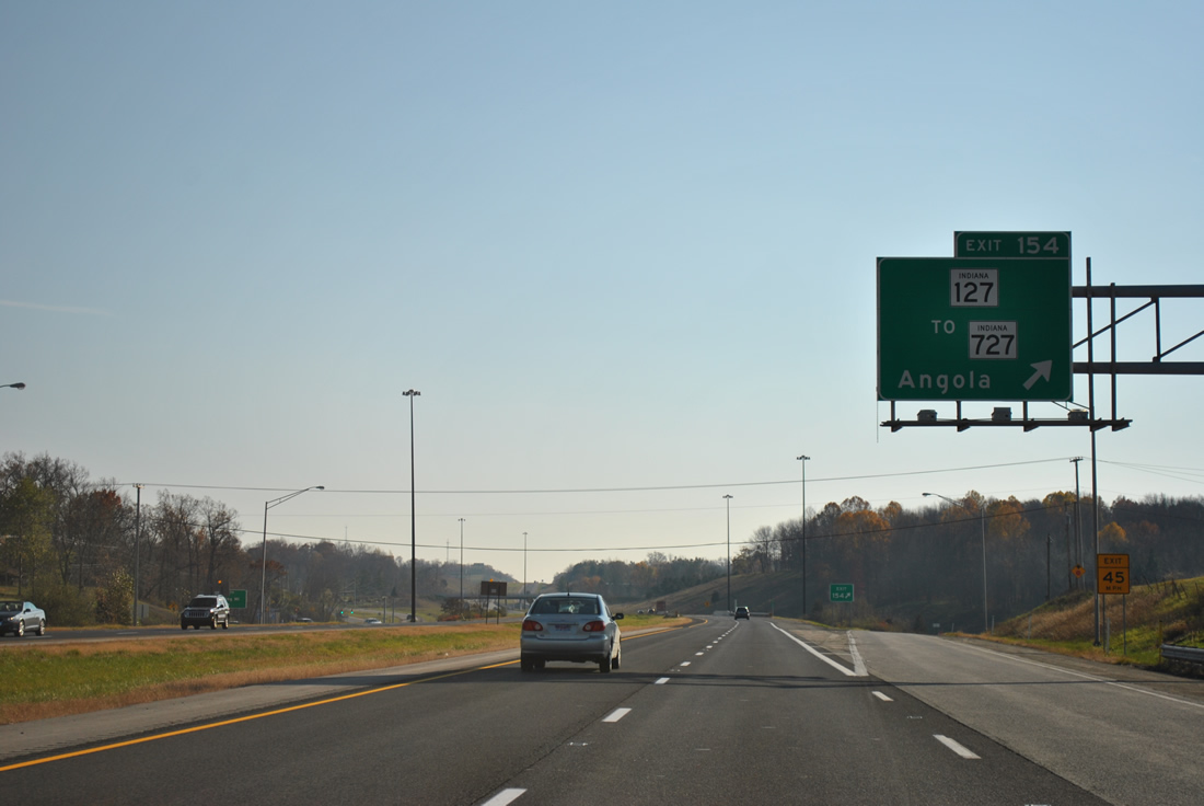
Southbound I-69 at Exit 354 for SR 127 to SR 727 west. SR 127 travels just 5.2 miles between SR 120 near Jamestown and U.S. 20 (Maumee Street) in Downtown Angola.
11/06/11
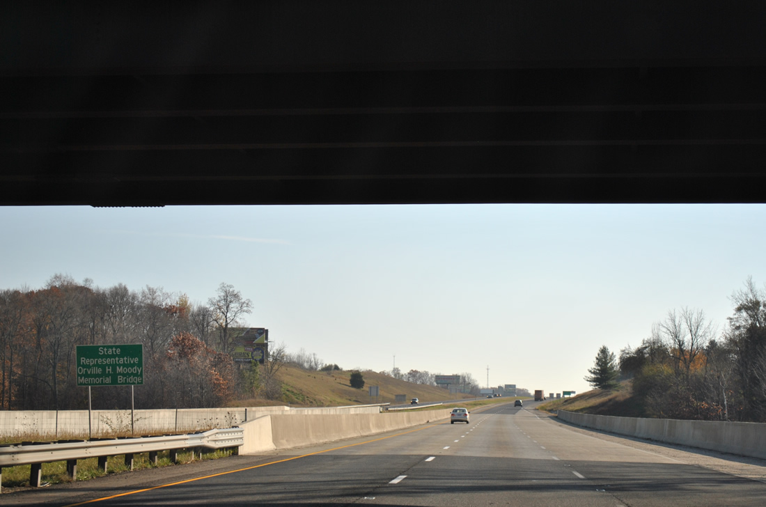
Interstate 69 crosses Lake Charles East from under the County Road 400 N overpass across the State Representative Orville H. Moody Memorial Bridge. This stretch of I-69 was constructed in 1966.
11/06/11
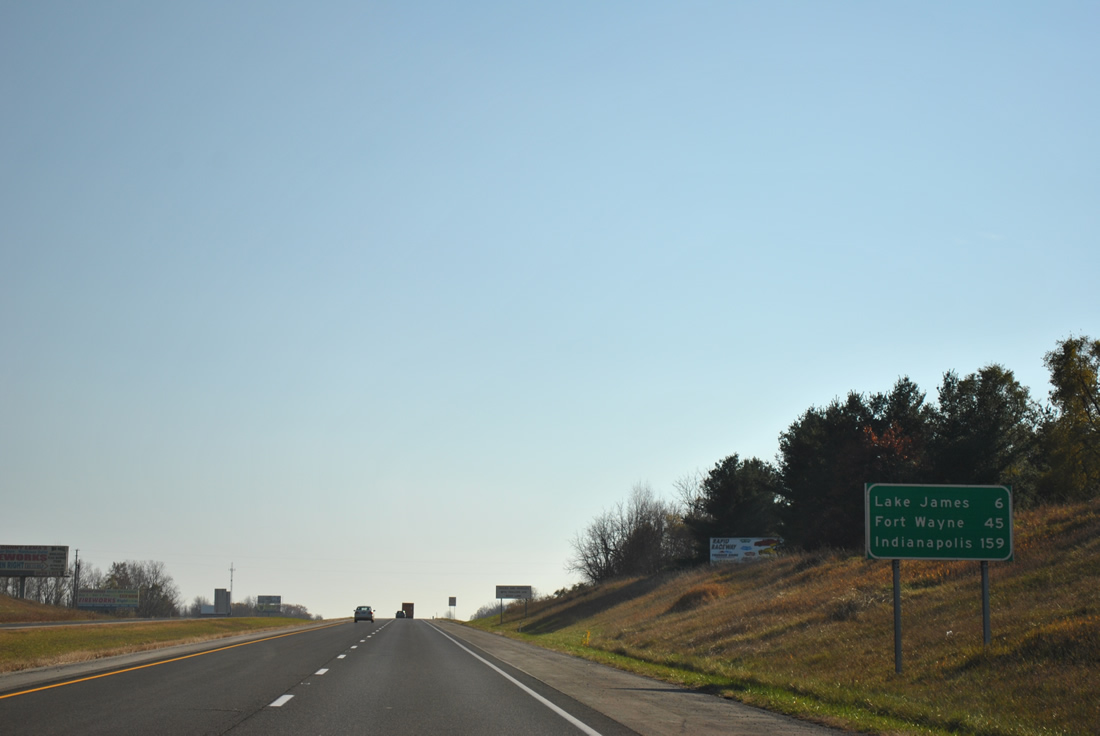
Distance sign posted ahead of the southwesterly curve of Interstate 69 by Lake James and Crooked Lake. Downtown Fort Wayne is a 45 mile drive; Indianapolis is 159 miles away.
11/06/11
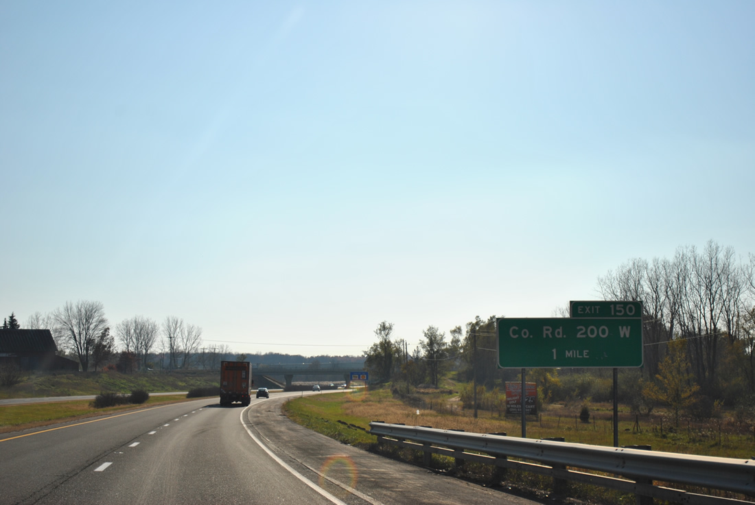
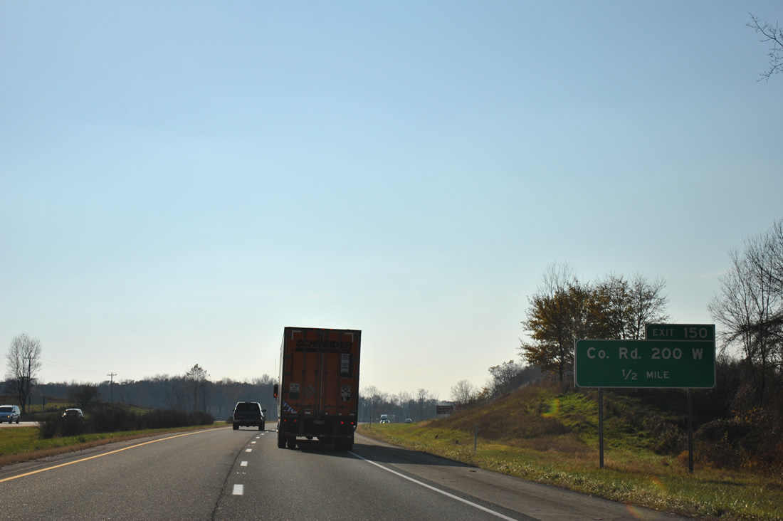
County Road 200 W meanders south from Bay View Road and Lake James to become a four lane highway ahead of Exit 350.
11/06/11
County Road 200 W enters the community of Crooked Lake just north of Interstate 69 and the diamond interchange at Exit 350.
11/06/11
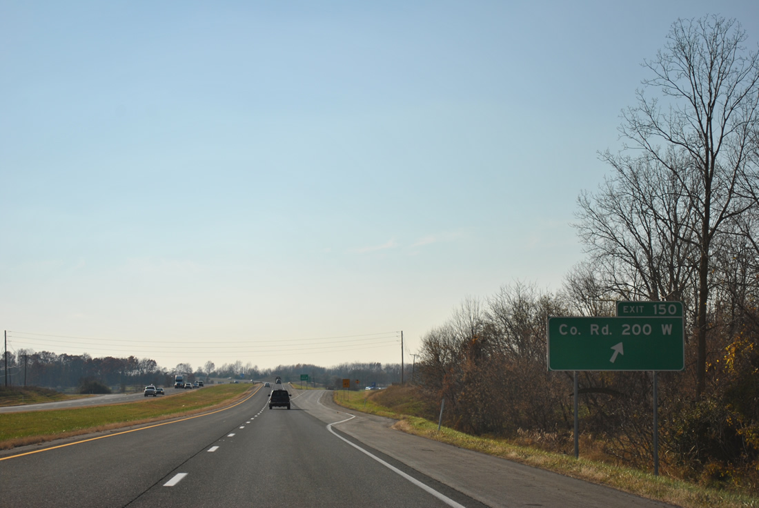
South from Exit 350, County Road 200 W continues to U.S. 20 near Fox Lake and Angola.
11/06/11
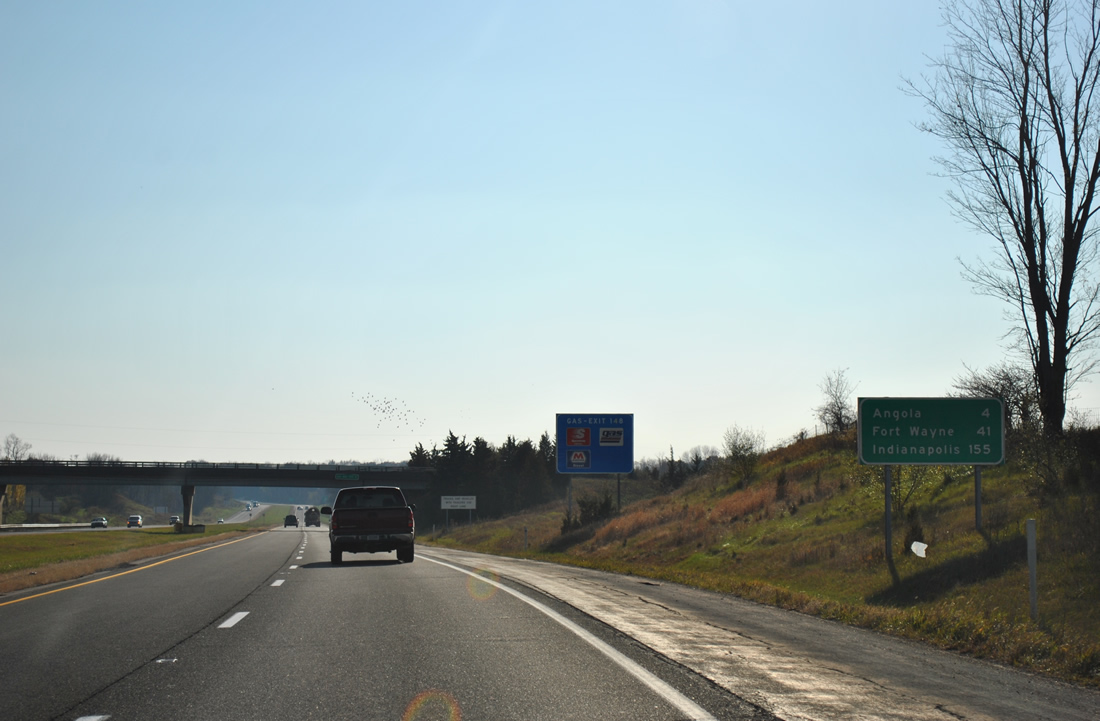
Continuing westward, Interstate 69 bypasses the Steuben County seat, which lies four miles to the east via U.S. 20. Fort Wayne is 41 miles to the south.
11/06/11
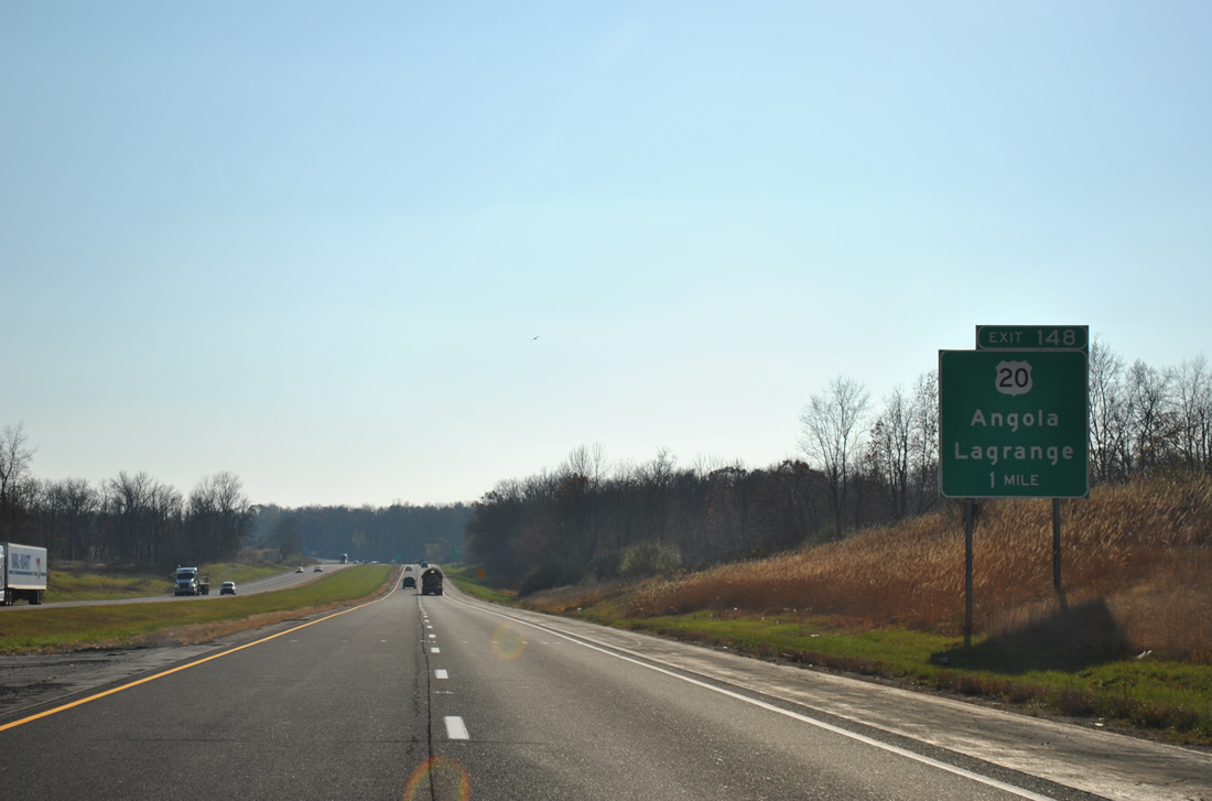
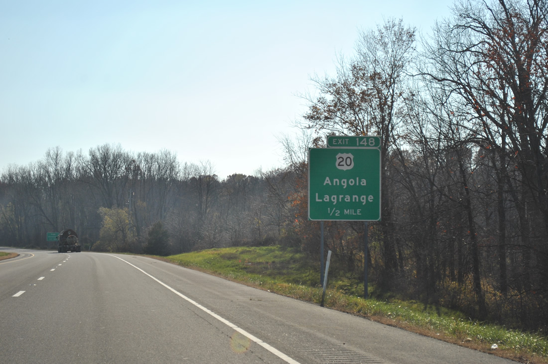
U.S. 20 constitutes the main route through Angola along Maumee Street. U.S. 20 runs 153.5 miles across northern Indiana between Columbia, Ohio and Chicago, Illinois.
11/06/11
The diamond interchange (Exit 348) with U.S. 20 lies south of Loon Lake.
11/06/11
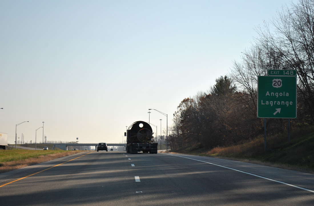
U.S. 20 connects Angola with the LaGrange county seat, 22 miles to the west. The rural route provides an alternative to the Indiana Toll Road for travelers destined for Elkhart and South Bend.
11/06/11
Golden Lake Road runs alongside Interstate 69 from U.S. 20 to West Fox Lake, where the road diverges westward to Bower and Golden Lakes.
11/06/11
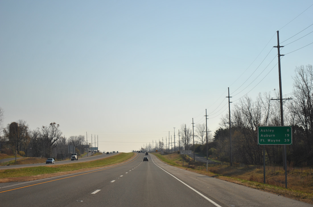
There are no additional exits in Steuben County along Interstate 69 southbound. Ashley lies along the DeKalb County line in eight miles, followed by the county seat of Auburn in 19 miles.
11/06/11
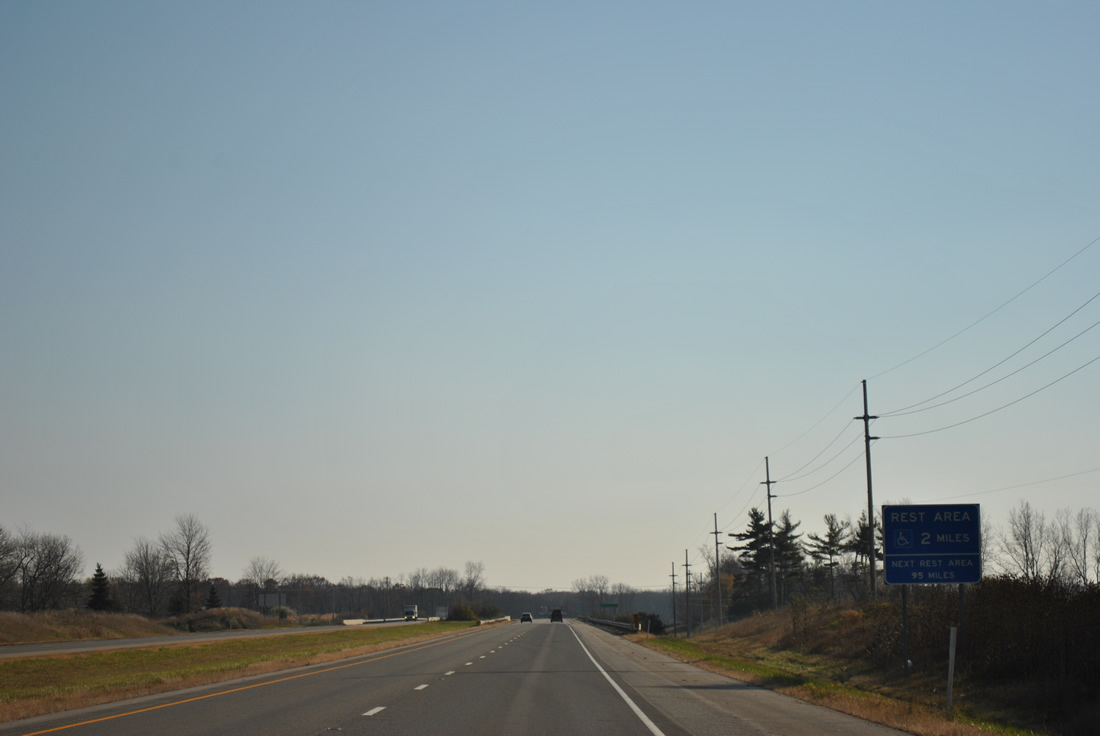
Approaching the bridge over Pigeon Creek, I-69 south is two miles from the first Indiana rest area.
11/06/11
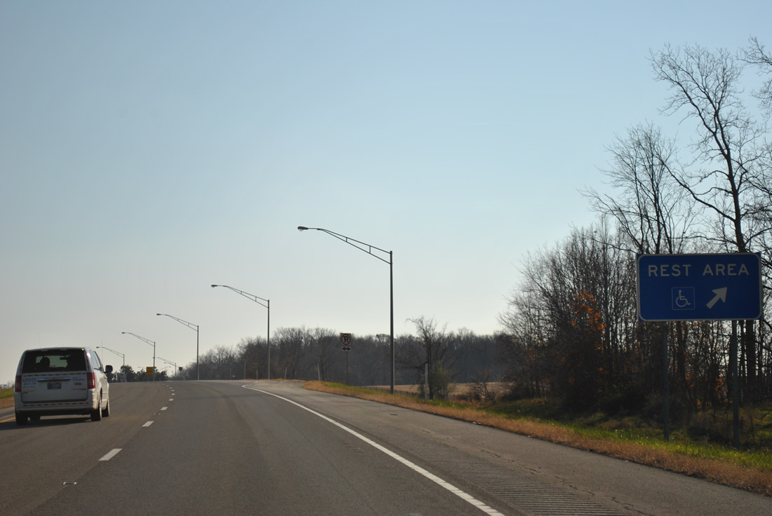
West of Pleasant Lake, Interstate 69 southbound reaches the rest area off-ramp. There are only two southbound facilities between Michigan and Indianapolis.
11/06/11
County Road 500 S leads west from Pleasant Lake and passes over Interstate 69 beyond this reassurance marker en route to Big Turkey Lake.
11/06/11
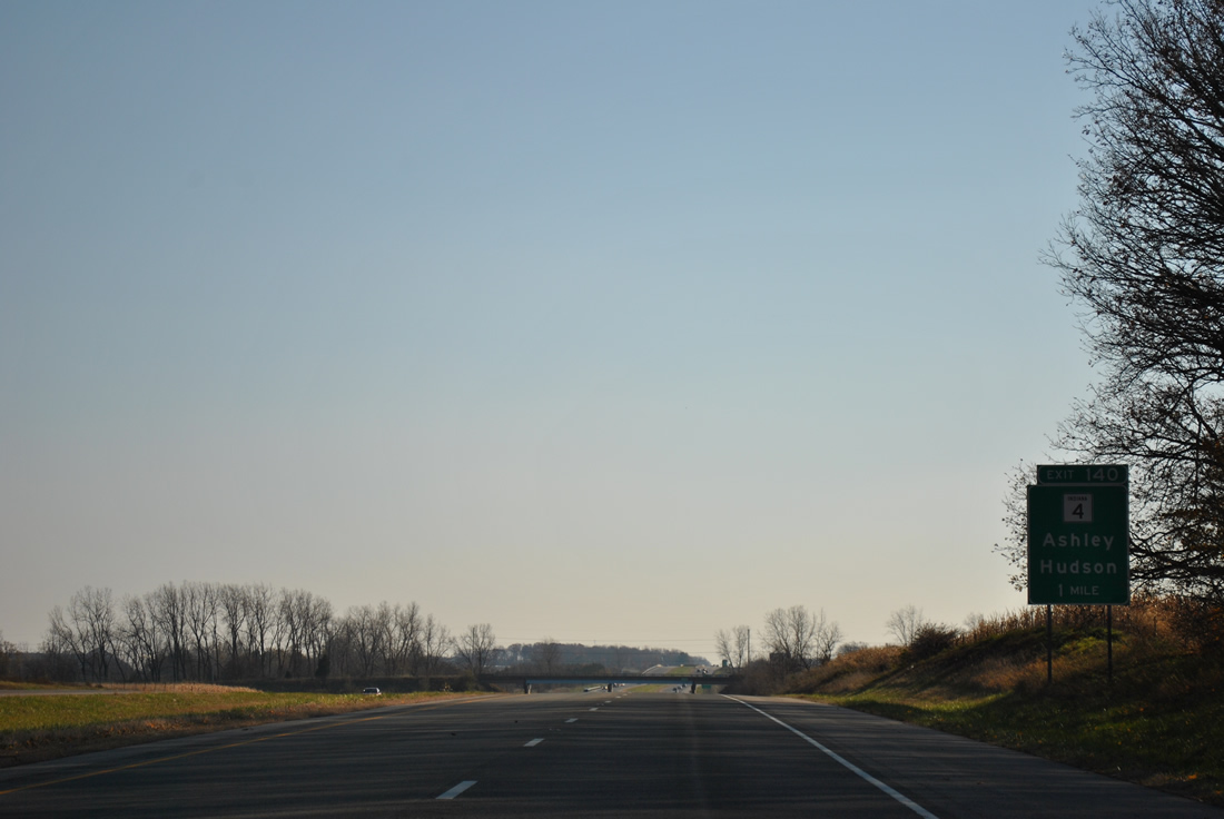
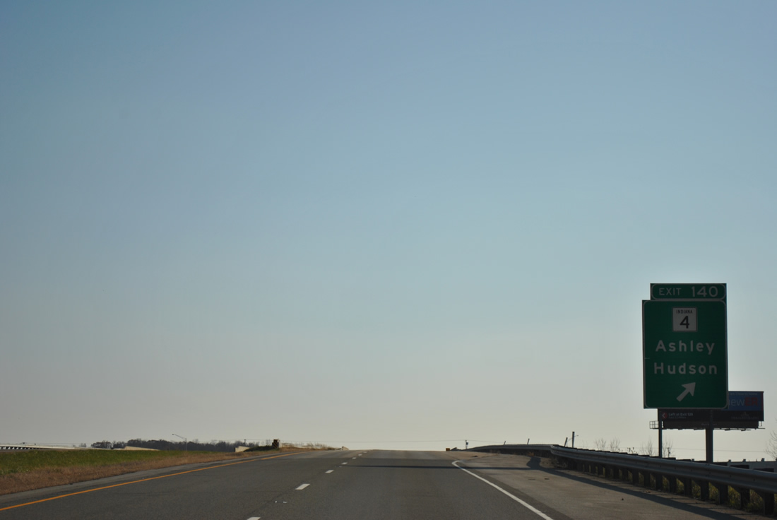
A diamond interchange (Exit 340) joins I-69 with SR 4 (State Street) west and County Road 800 N east in one mile.
11/06/11
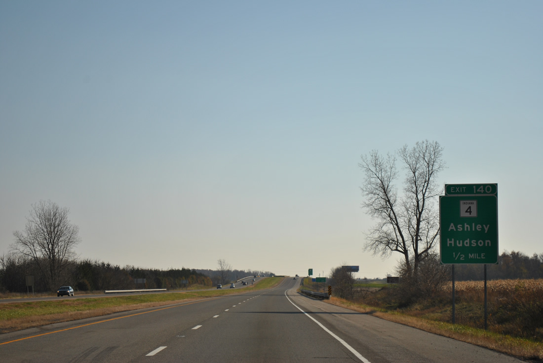
Ashley lies just west of Interstate 69 along SR 4. SR 4 exists in three segments with the easternmost portion going 5.4 miles from Exit 340 to SR 327 near Helmer. Other sections are routed south of Michiana.
11/06/11
Exit 340 parts ways with I-69 south beyond the Indiana Northeastern Railroad underpass. SR 4 west and Railroad Street connect Ashley with the Steuben County town of Hudson nearby. County Road 800 N follows the county line east to Steubenville and SR 427 in Hamilton.
11/06/11
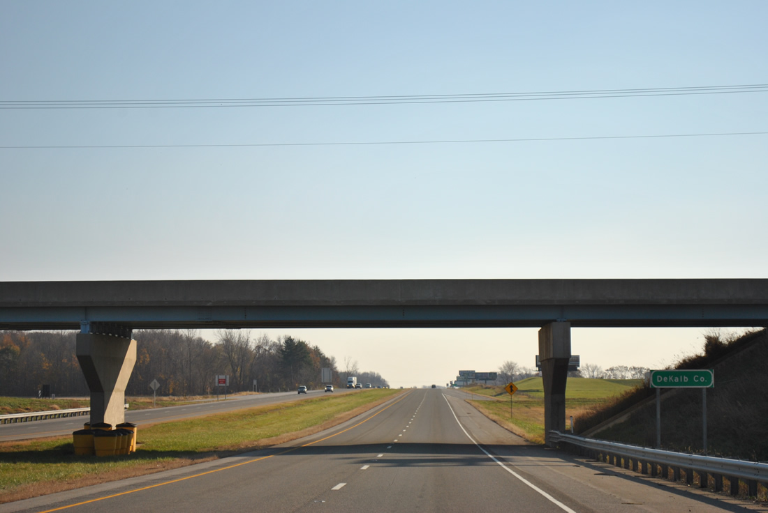
DeKalb County sign posted at the SR 4 / County Road 800 N overpass.
11/06/11
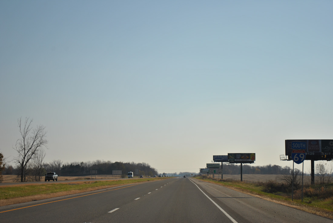
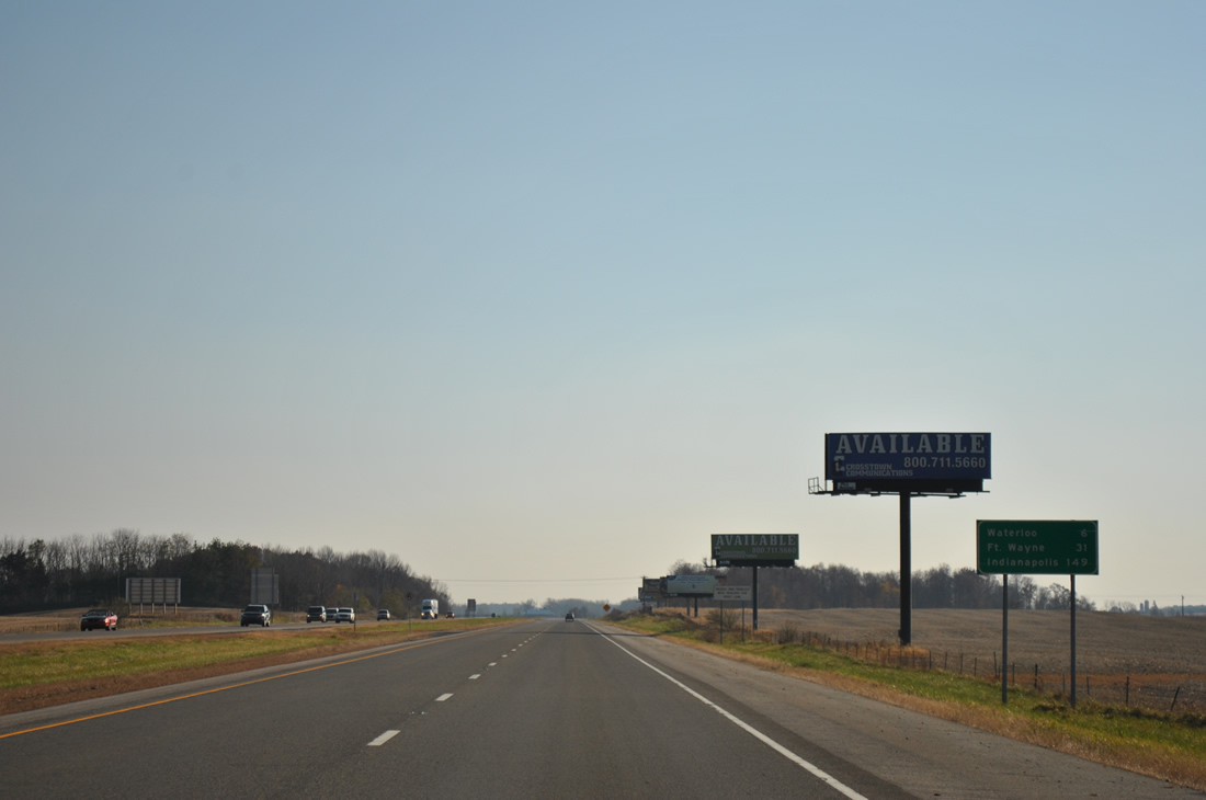
Interstate 69 continues south six miles to Waterloo and a half hour to Fort Wayne. Indianapolis is 149 miles out.
11/06/11
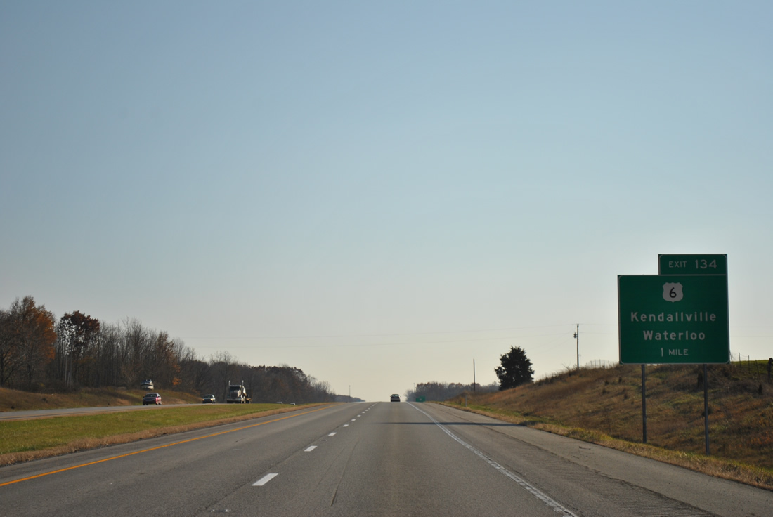
U.S. 6 meets the freeway at a diamond interchange (Exit 334) in one mile.
11/06/11
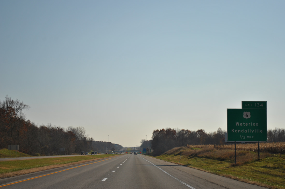
Heading east, U.S. 6 follows Cedar Creek from Interstate 69 into Waterloo. U.S. 6 continues 7.8 miles to Butler and 11.2 miles to the Ohio state line.
11/06/11
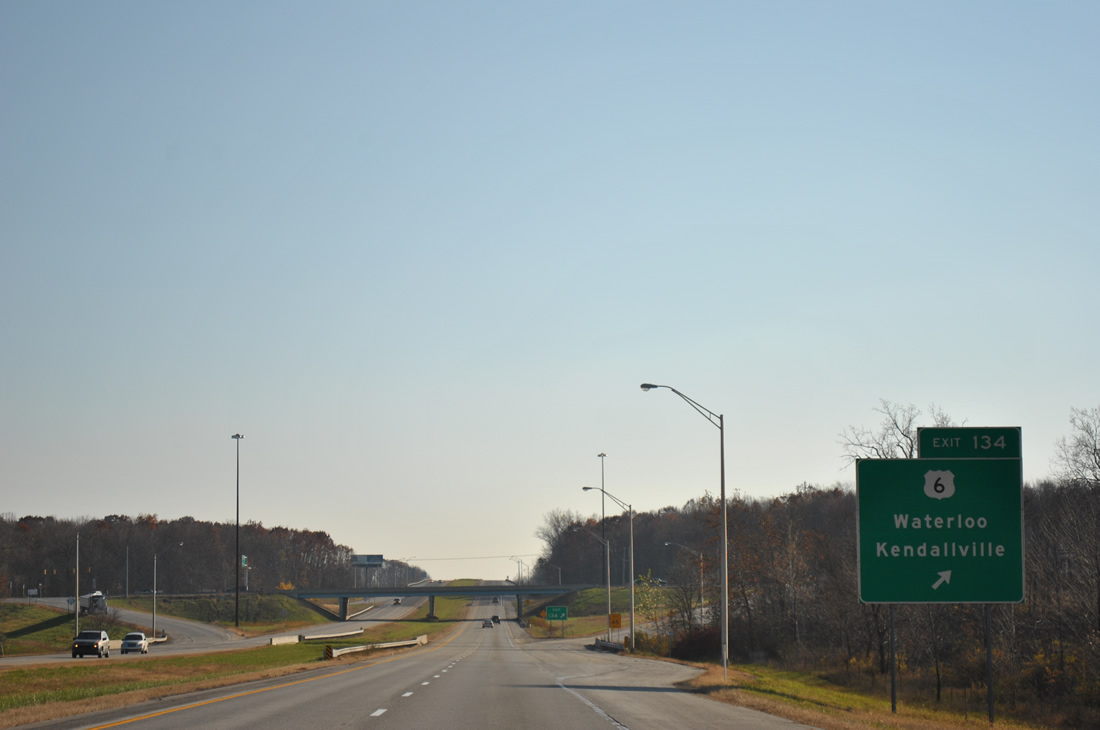
Kendallville lies ten miles to the west of Exit 334 along U.S. 6. U.S. 6 overall travels 149 miles across Indiana, connecting Nappanee, Bremen, Westville, Hobart and Hammond.
11/06/11
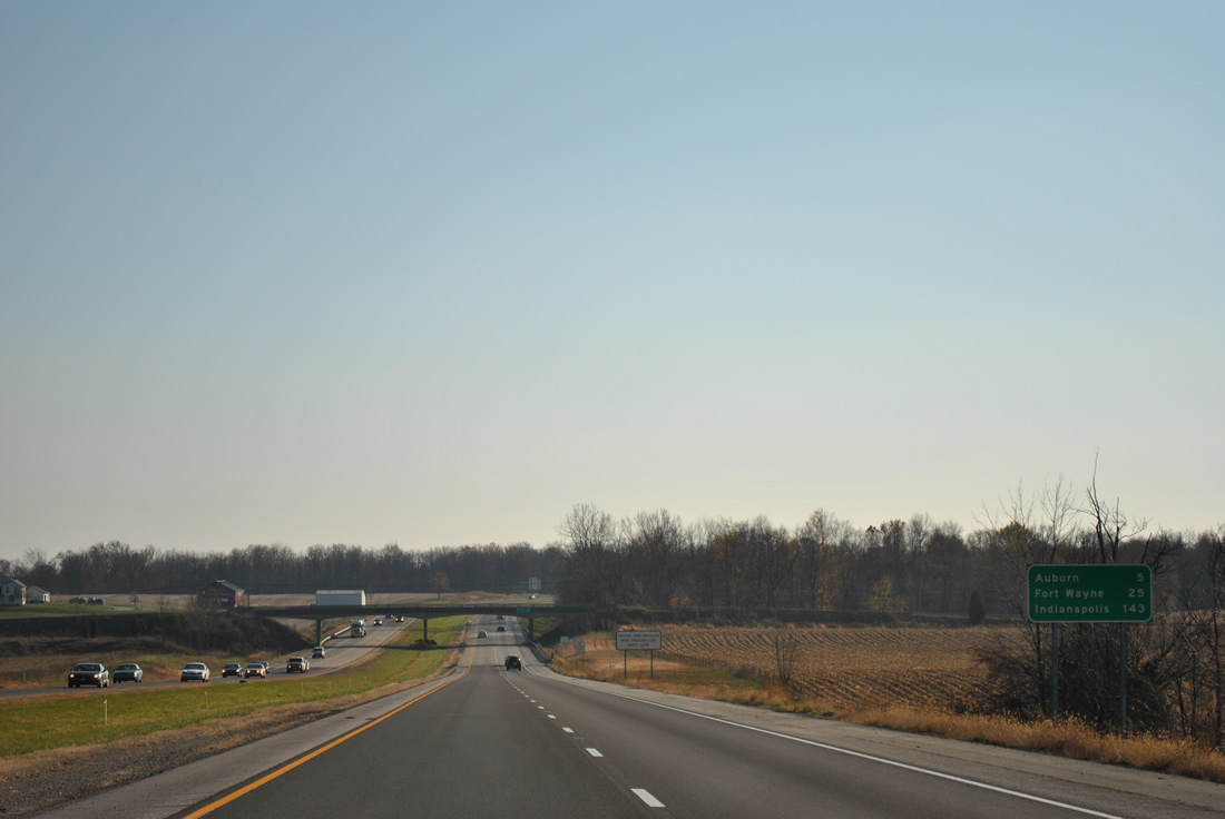
Bending westward again, Interstate 69 next meets Auburn in five miles. Fort Wayne and Indianapolis are 25 and 143 miles away respectively.
11/06/11
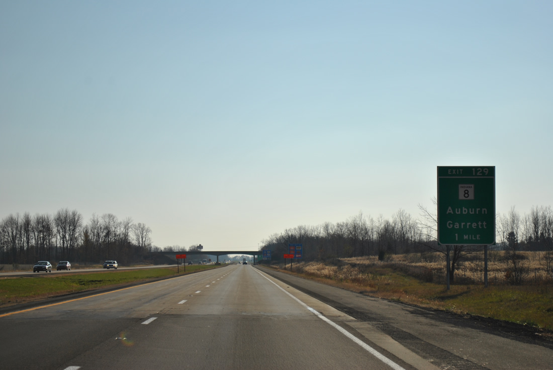
SR 8 (7th Street) provides the main route into Auburn from Interstate 69 via a diamond interchange at Exit 329.
11/06/11
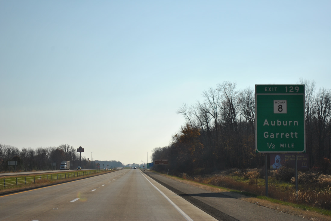
A split route, SR 8 travels 34 miles from Albion, in adjacent Noble County, to the Ohio state line near Newville. A western segment of SR 8 stretches 42 miles from Hebron to Marshall County.
11/06/11
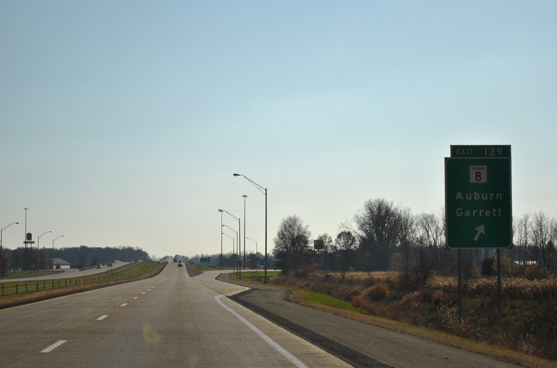
7th Street carries SR 8 east through a commercial strip ahead of the city center. Westward, SR 8 to SR 327 (Randolph Street) south connects I-69 with the city of Garrett.
11/06/11
Interstate 69 leaves SR 8 and crosses Peckhart Ditch and a CSX Railroad line beyond this reassurance shield.
11/06/11
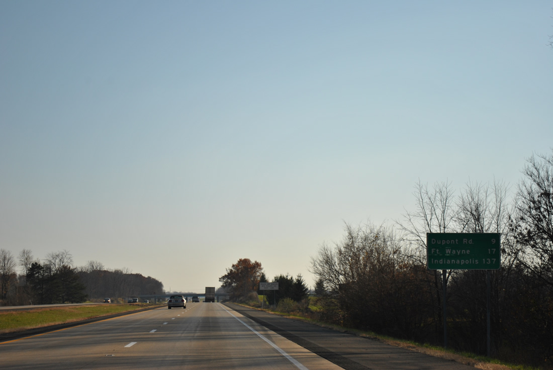
Southbound distance sign posted 20 miles north of Fort Wayne and 140 miles from the capital city.
11/06/11
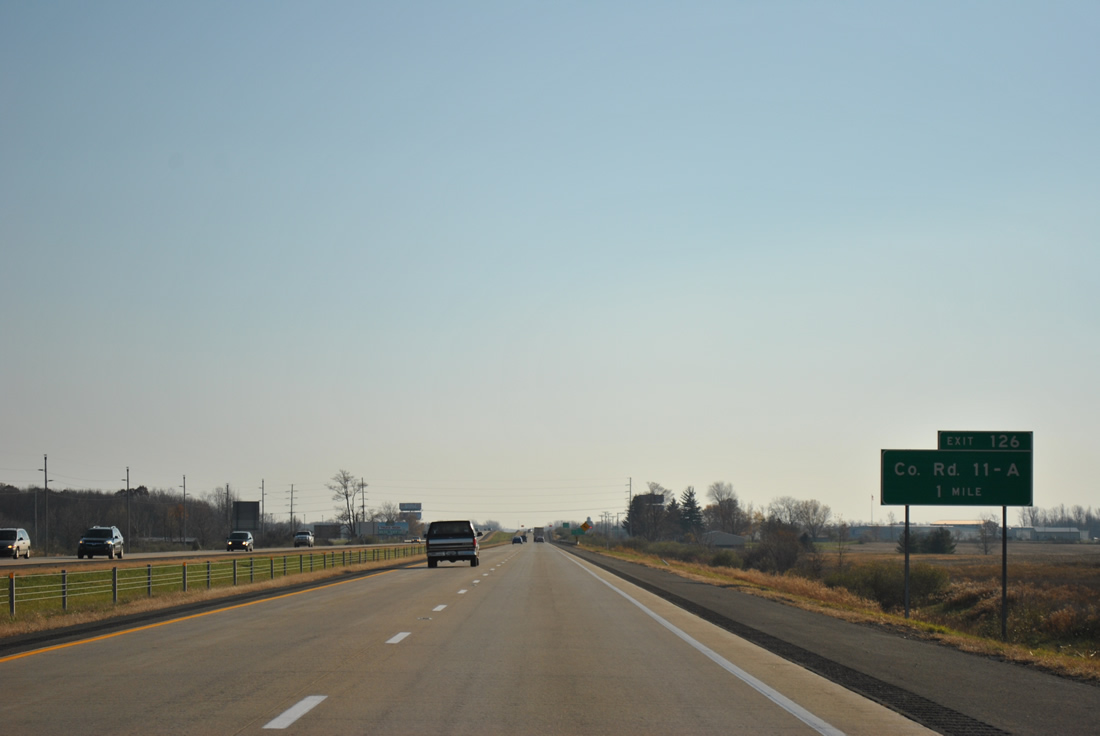
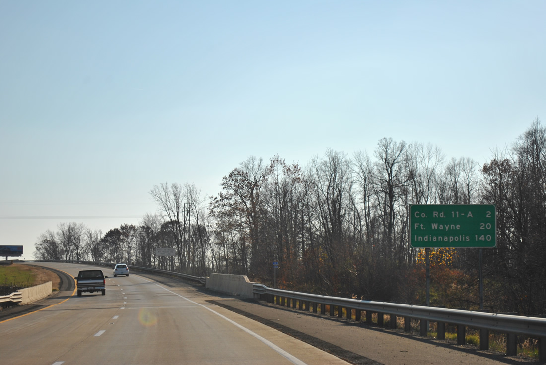
Farm land spreads to the west of Interstate 69 on the one mile approach to Exit 326 for County Road 11-A.
11/06/11
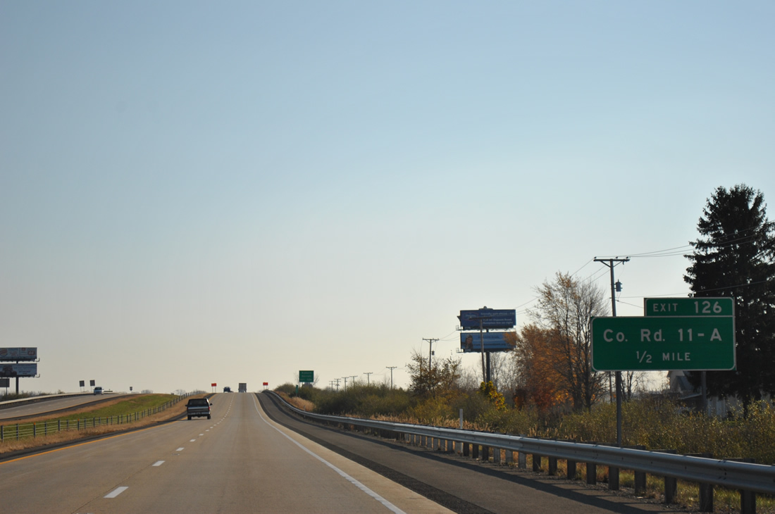
Interstate 69 passes over an abandoned railroad line ahead of the diamond interchange at Exit 326. County Road 11-A provides alternate routes to Auburn via CR 427 W (old U.S. 27) and CR 56 S to SR 327.
11/06/11
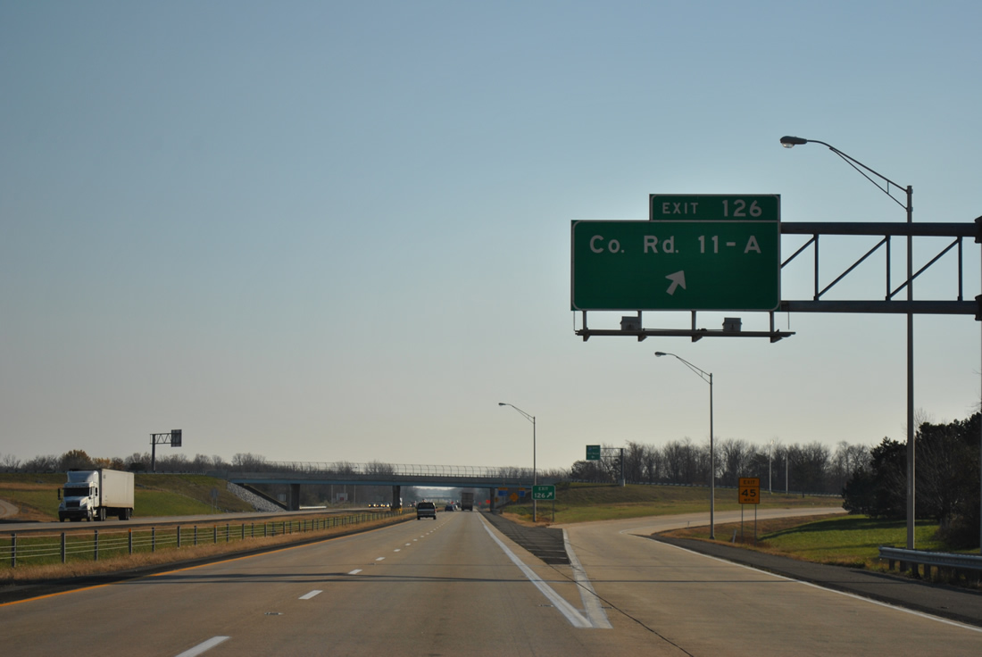
CR 11-A angles southwest from old U.S. 27 to New Era and CR 327 (former SR 327) at Holiday Lakes. CR 56 S to Butler Center links Exit 326 with the beginning of SR 205, a 32.2 mile route to Columbia City and South Whitley.
11/06/11
Interstate 69 south crosses Cedar Creek after this confirming marker.
11/06/11
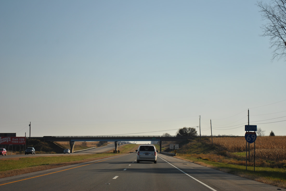
The succeeding southbound exit falls within Fort Wayne in nine miles. I-69 travels uninterrupted between Steuben and Allen Counties, with the exception of a set of abandoned rest areas two miles north of the county line.
11/06/11

Photo Credits:
- ABRoads: 11/06/11
Connect with:
Page Updated Friday January 27, 2012.